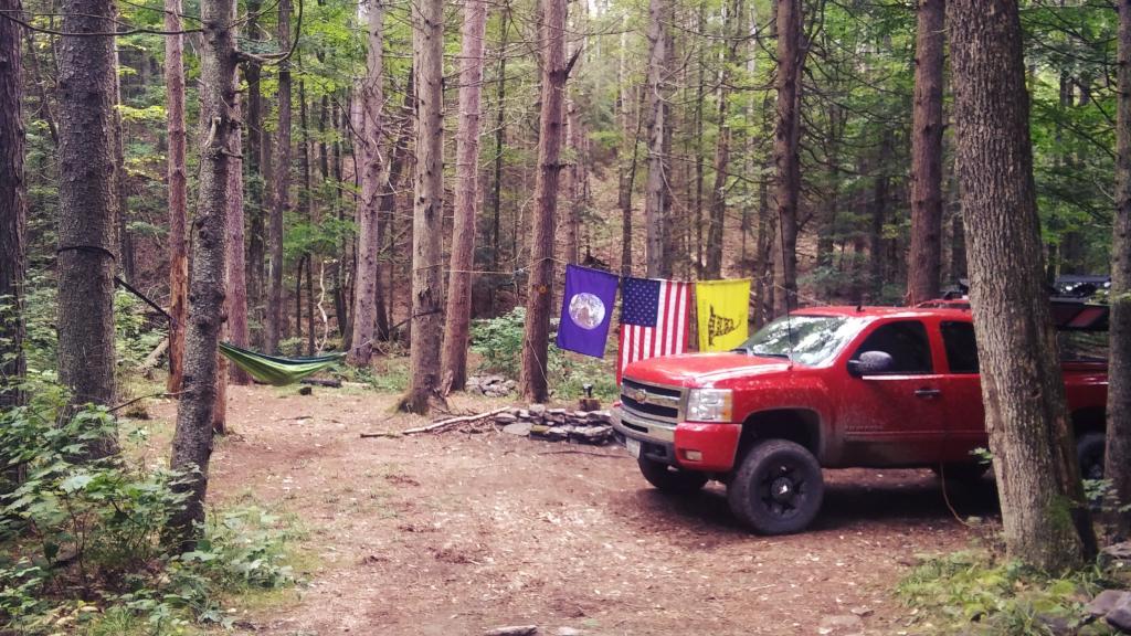
Search Results for: photo camp table

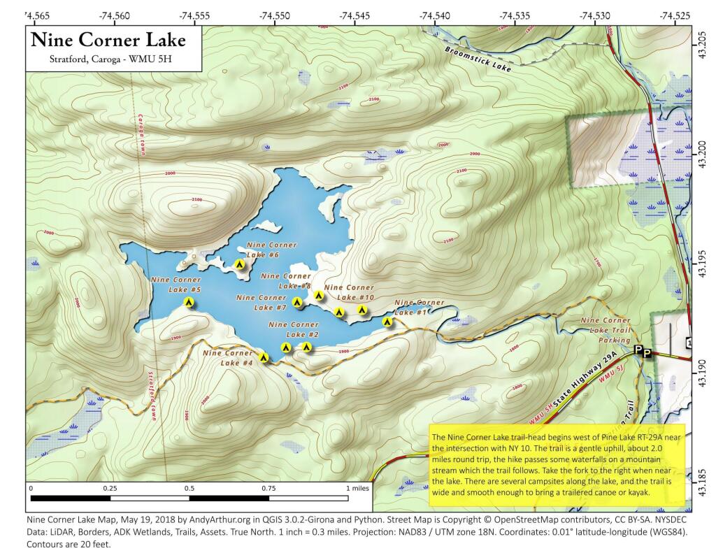
Nine Corner Lakes Campsites – Maps and Coordinates

Printable PDF Map

Here is a printable PDF map of Nine Corner Lakes.

 Nine Corner Lake

Nine Corner Lake

Coordinates

Here is a list of coordinates of the ten campsites on Nine Corner Lakes.

NameLatitudeLongitude
Campsite 143.1924389371481-74.5430762618629
Campsite 243.1913078793683-74.5481281244049
Campsite 343.1912867989861-74.5494095257902
Campsite 443.1908352130274-74.5508138254729
Campsite 543.1933896003805-74.5554635953599
Campsite 643.1951031544948-74.5522807361007
Campsite 743.1933585199337-74.5486993715471
Campsite 843.1936621808895-74.5473488389736
Campsite 943.1928875696147-74.5460840377464
Campsite 1043.1929919401202-74.5446495634989

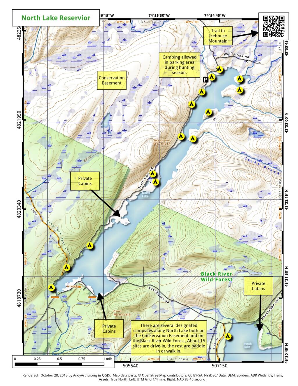
North Lake Reservoir Camping πŸ•

North Lake Reservoir Camping πŸ•

16 1/2 miles and 30 miles north of Forestport, the North Lake Reservoir serves as the headwaters to the Black River in a large reservoir maintained by the NYS Canal Authority for supplying a steady supply of water to Black River and Erie Canal via the former Black River Canal. Half of sites are on Black River Wild Forest, while most of the northernly sites are on a conservation easement. There is a sign-on booth for these campsites, permits are needed for stays over three nights. These are primitive campsites, though some of the sites along the eastern side, are accessible by a vehicle with a smaller camper on top. Boats with motors are allowed on this lake, so in summer months it may be not a quiet water. Most sites are on the water.

Interactive Map of North Lake Reservoir

Printable Map of North Lake Reservoir

 North Lake Reservior

Coordinates of North Lake Reservoir Campsites

Easement campsites are based on memory and were hand-drawn so they may be somewhat inaccurate.

Name Latitude Longitude
North Lake Designated Campsite #2 43.52293019 -74.94933889
North Lake Designated Campsite #3 43.52335381 -74.94934207
North Lake Designated Campsite #4 43.52506095 -74.94695943
North Lake Designated Campsite #6 43.52569387 -74.94579628
North Lake Designated Campsite #7 43.52600551 -74.94534407
North Lake Designated Campsite #8 43.52775406 -74.94410338
North Lake Designated Campsite #9 43.52800073 -74.94327684
North Lake Designated Campsite #10 43.52898888 -74.94247143
North Lake Designated Campsite #11 43.52977988 -74.9403576
Easement Campsite 43.61254681 -75.05263918
Easement Campsite 43.51529059 -74.90967
Easement Campsite 43.48088879 -75.01092893
Easement Campsite 43.54038222 -74.92580987
Easement Campsite 43.61805247 -75.03272826
Easement Campsite 43.61368033 -75.09087559
Easement Campsite 43.61053007 -75.02701572
Easement Campsite 43.58885404 -74.999126
Easement Campsite 43.59254977 -75.0887635
Easement Campsite 43.59171534 -75.00692959

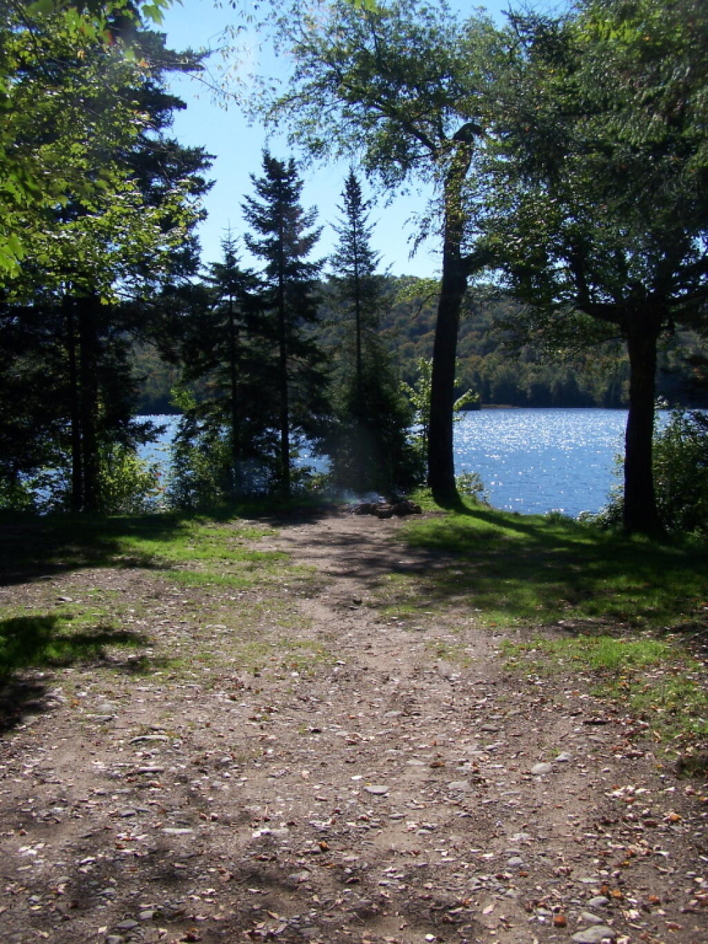
Campsite on Pensuila


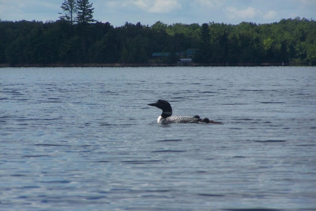
Loon with Chicks

Salmon River Reservoir Camping Opportunities – Maps and Coordinates

Salmon River Reservoir Camping Opportunities – Maps and Coordinates πŸ• πŸ›Ά

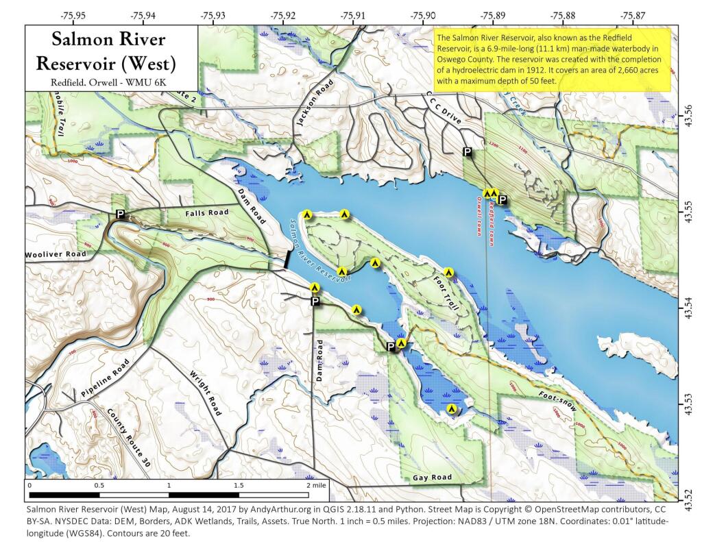
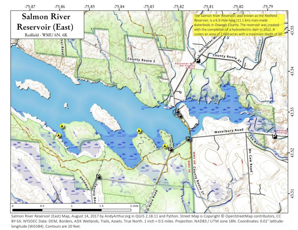
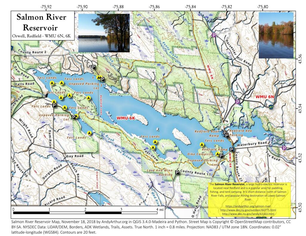
Here is a map and coordinates list for the Salmon River Reservoir Campsites. Scroll down for printable Adobe PDF maps.


Name
Latitude
Longitude
Campsite 1
43.5309742920692
-75.8286869256684
Campsite 2
43.5309992915826
-75.8297119265923
Campsite 3
43.5322302917437
-75.8326449252156
Campsite 4
43.551032398543
-75.8886238418359
Campsite 5
43.55177656419
-75.8896116338177
Campsite 6
43.5517061750734
-75.8905568903452
Campsite 7
43.541756677656
-75.9150815169557
Campsite 8
43.5394887698881
-75.9090654604258
Campsite 9
43.5360696244194
-75.902624135171
Campsite 10
43.5293055917744
-75.8953235118337
Campsite 11
43.5373862456009
-75.9012726107273
Campsite 12
43.5443809396893
-75.9064767993171
Campsite 13
43.5434303332432
-75.911225839972
Campsite 14
43.5493296300542
-75.9162896181872
Campsite 15
43.5493296300542
-75.9162896181872
Campsite 16
43.5494103882571
-75.9109502761858
Campsite 17
43.5451002917625
-75.8998779023845
Campsite 18
43.5434744124482
-75.8959544885348
Campsite 19
43.5237542467868
-75.859969258665
Campsite 20
43.5260120162344
-75.8588356278734
Campsite 21
43.5263250117288
-75.849574714577
Campsite 22
43.5250993776627
-75.8329156554249
Campsite 23
43.5213924995858
-75.8241771774025
Campsite 24
43.5246466269299
-75.8256976582404
Easement Site 1
43.5268720918897
-75.8437903809071
Easement Site 2
43.5301618787494
-75.8491361432998
Easement Site 3
43.535081215355
-75.8643611448784
Easement Site 4
43.5335274180135
-75.865935146283
Easement Site 5
43.5367460658778
-75.8714414686836

Printable PDF Maps of Salmon River Reservoir

 Salmon River Reservoir (West)


 Salmon River Reservoir (East)


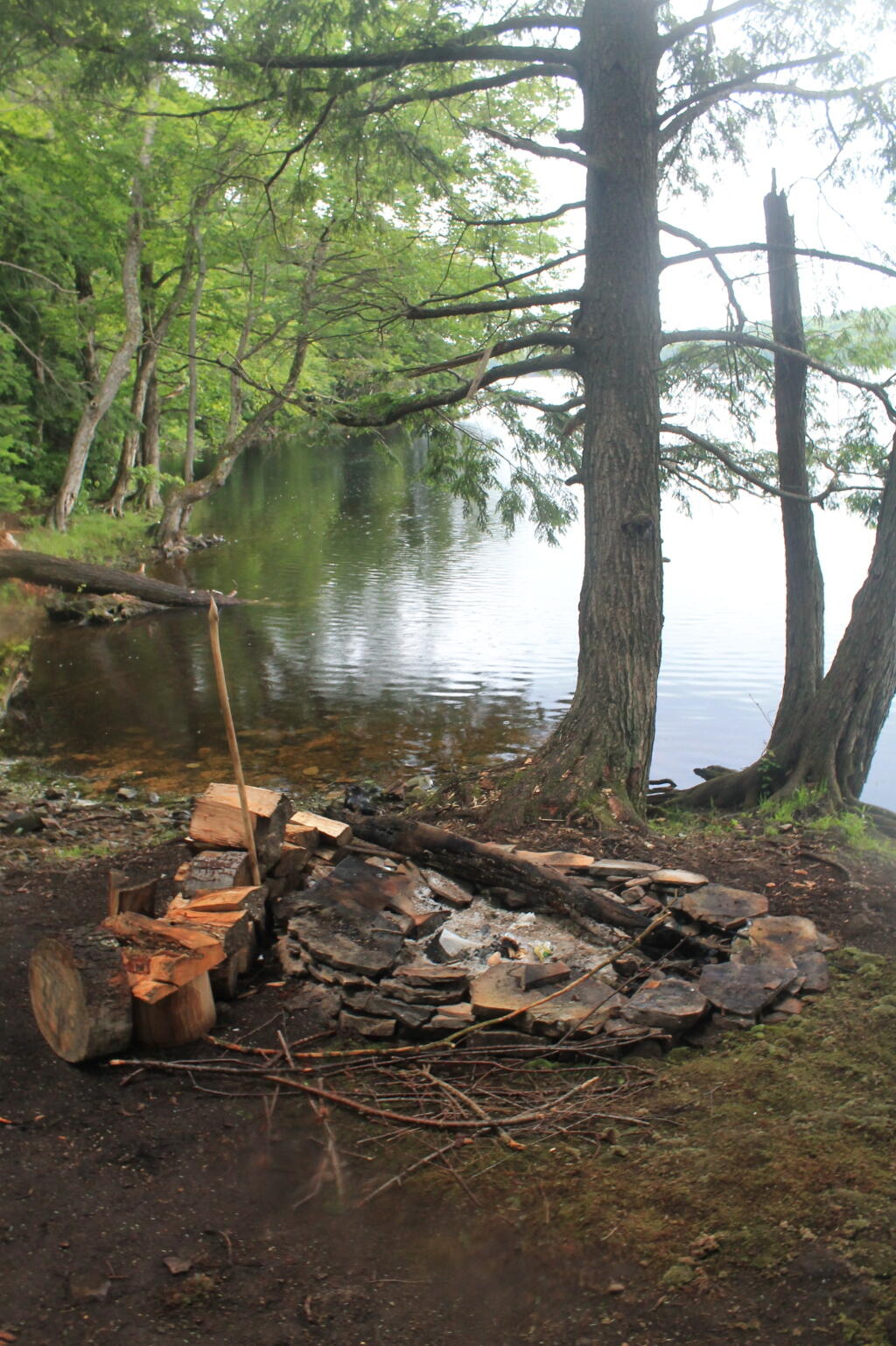
Campsite Along Reservior


 Salmon River Reservoir


Salmon River Reflects

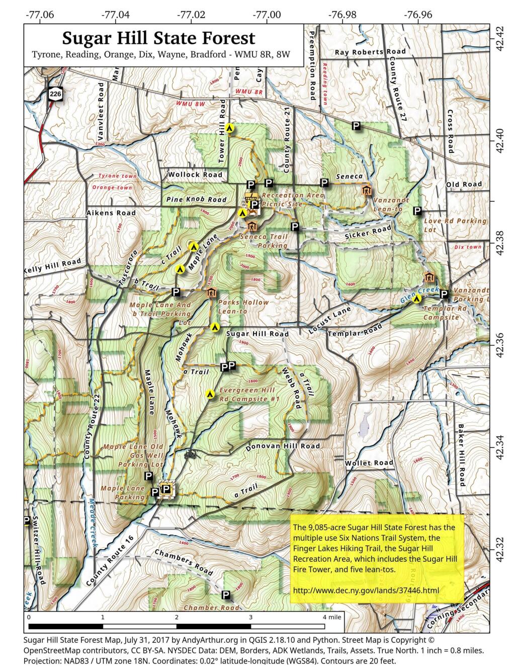
Sugar Hill State Forest Campsite Coordinates πŸ• 🐎

Explore this webpage for comprehensive maps and campsite listings within Sugar Hill State Forest, situated in the Finger Lakes region near Watkins Glen. Renowned for its equestrian trails and mountain biking possibilities, this forest also intersects with the Finger Lakes Trails.

Equipped with coordinates and interactive maps, this invaluable resource assists in pinpointing free camping sites within this area. Uncover more about the region to enhance your exploration, ensuring a memorable experience amid its natural beauty. From the allure of equestrian trails to the thrill of mountain biking routes and the Finger Lakes Trails, Sugar Hill State Forest offers a diverse range of outdoor activities for all to enjoy.

Free campsites are available for stays of up to 3 nights. Simply register on-site by signing the log book. For longer stays of 4 to 14 nights, contact the DEC Region 8 Bath Office during their operating hours (M-F, 8:30 AM – 4:30 PM) at (607) 622-8282 or region8@dec.ny.gov to request a free permit.

Here are the coordinates to the campsites.


NameDescriptionNotesLatitudeLongitude
1 Tower Area Campsite#1 42.3868508079723-77.0033564547783
2 Tower Area Campsite#2 42.3866442287727-77.0033822152506
3 Tower Area Campsite#3 42.3864639920396-77.0033635495228
4 Tower Area Campsite#4 42.3862833428498-77.0033685808509
6 Tower Area Campsite#6 42.386387348997-77.0029946864047
7 Tower Area Campsite#7Water Spigot42.3862370801033-77.0029985287376
8 Tower Area Campsite#8 42.3861734193137-77.003166784239
9 Tower Area Campsite#9 42.3865302803854-77.0027707543571
10 Tower Area Campsite#10 42.3861779212511-77.0028177471854
11 Tower Area Campsite#11 42.3864896808166-77.0025428626279
12 Tower Area Campsite#12 42.386122136377-77.0026163066674
13 Tower Area Campsite#13 42.3865438057378-77.0022831123144
14 Tower Area Campsite#14 42.386195258838-77.0023742768928
15 Tower Area Campsite#15 42.3860849947623-77.0021918714237
16 Tower Area Campsite#16 42.3860541128779-77.0019473250332
17 Tower Area Campsite#17 42.3860671182971-77.0017515936378
18 Tower Area Campsite#18Water Spigot42.386226464603-77.0016855292304
19 Tower Area Campsite#19Water Spigot42.3865569715304-77.0017003446791
20 Tower Area Campsite#20Water Spigot42.3866767087554-77.0017063052538
21 Tower Area Campsite#21Water Spigot42.3869433342594-77.0017190894415
22 Tower Area Campsite#22 42.3868316308635-77.0011615867452
23 Tower Area Campsite#23 42.3865865191587-77.001106379471
24 Tower Area Campsite#24 42.3863193084256-77.0012185947968
25 Tower Area Campsite#25 42.3861742601053-77.0012894260423
26 Tower Area Campsite#26 42.3860963967437-77.0015391367911
27 Tower Hill Cmpsite#27 42.3907655427657-76.9988721092714
28 Tower Hill Rd Campsite#28 42.3910797321534-76.9837920975243
29 Cr 23 Campsite#29 42.4023570878519-76.9758496629551
30 Tower Hill Rd Campsite#30 42.3902721886657-77.0028807356518
31 Tower Hill Rd Campsite#31 42.3904413584792-77.0036125118773
32 Seneca North Campsite#32 42.3847576397127-77.0052625526894
33 Maple Lane Campsite#33 42.3779066686613-77.0179033333715
34 Maple Lane Campsite#34 42.3734853366746-77.0214073314773
35 Maple Lane Campsite#35 42.3690875961503-77.0223501994882
36 Sugar Hill Road Campsite#36 42.3623013335723-77.0118293336207
37 Spencer Pond Campsite#37 42.4016911747852-77.0084235506782
38 Evergreen Hill Road Campsite#38 42.3547490565555-77.0073917279777
Cr 21 Campsite  42.3843480264464-76.9922894964248
Evergreen Hill Rd Campsite #1  42.3491716695934-77.0127316661659
Lower Evergreen Camping  42.3304466927625-77.0236097240433
Randall Road CampsiteLog Landing 42.3412383335045-77.0695449989935
Switzer Hill Road Campsite #2Log Landing 42.3406636026594-77.0649210396798
Templar Rd Campsite  42.3688377042101-76.9587191825894
Photo #21238
Photo #2241


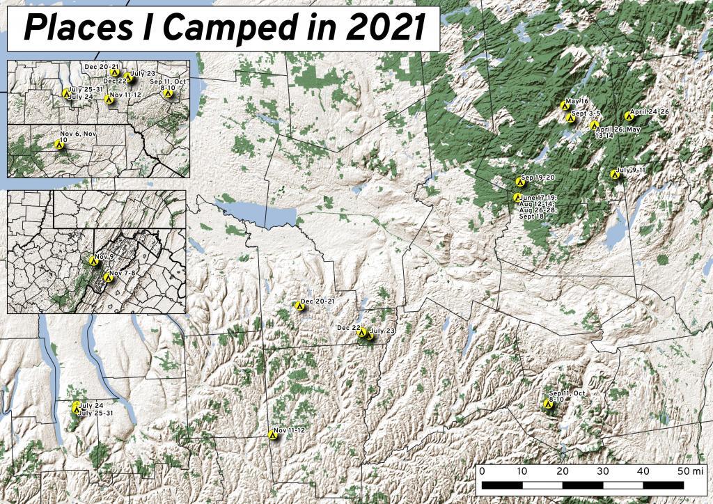
This past year I spent 37 nights camping in the wilderness πŸ•

This past year I spent 37 nights camping in the wilderness πŸ•

Places I Camped in 2021

While this was less then the 63 nights I did in 2020, with remote work winding down and more in-person meetings and events happening in Albany, I ended up not getting out as much as I did the previous year. Still 37 nights camping is still a lot of time in wilderness.

It was a lot rainier then some summers, so that also made it harder to get out of town for long weekends. When I did go camping, and I wasn’t remote working, I tried to make it a priority to find more-remote areas without cell service, so I could get solitude without the constant buzz of the phone. Plus I tended to stay in one campsite for two or three days, to avoid the hassles of taking down and setting up camp.

Saturday/Sunday April 24-25: Two Nights on East Branch

I started out my travels in late April on the East Branch Sacandaga River along NY 8, near Fox Lair. On Saturday, before arriving to camp, I hiked along Hope Falls Road and back to lower and upper Tenant Creek Falls. Sunday, I hiked around Fox Lair, sat down by the river for a while, did some fishing. Had a big ol’ fire. It was cold but also kind of spring-like.
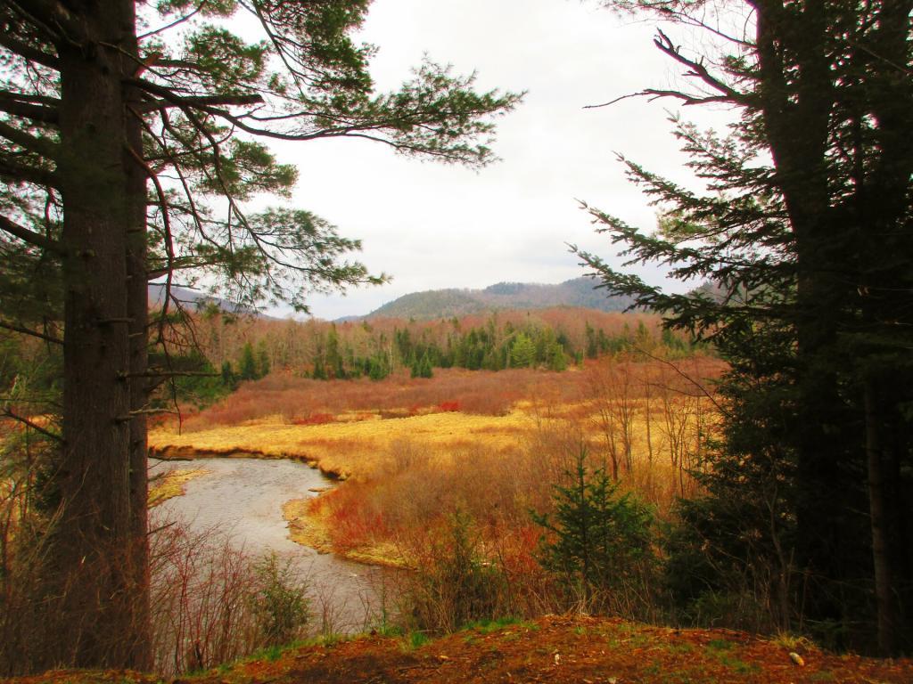
Sunday was kind of cloudy but not to wet

Monday April 26: One Night on Sacandaga River/Speculator Tree Farm

Monday I drove up to Speculator to do remote work at the library and the town park/beach with my laptop. I set up camp at Campsite 17 and in the evening after work, I hiked along Old NY Route 8B, spending some time along Austin Falls and heading back to camp before it got too dark. Tuesday I worked up in Speculator, before heading home. Things were still very brown and gray in the Adirondacks, although I ended up stopping along the Mohawk River in Rotterdam and hiking on the bike trail before dark, and it was much greener down there.

Thursday to Saturday May 13-15: Three Nights on Sacandaga River/Speculator Tree Farm

Thursday morning I got up early and drove up to Speculator before 9 AM to work remotely. I worked until lunch time in Spectulator when I drove down to Campsite 17 and set up camp and worked from there. Worked all day on Friday from camp, mostly sending emails from the hammock although I also edited a report I was working on with my laptop at the table, and grabbed some files a colleague needed off the server over the VPN. Knocked over the lantern, smashing the glass and breaking the the neck on it. On Saturday I hiked back along Robb Mill Road and some of the side trails in the Conservation Easement. Sunday, I drove up to Watch Hill on Indian Lake, hiked that, while there was a constant threat of thunderstorms, so I did it fairly quickly.
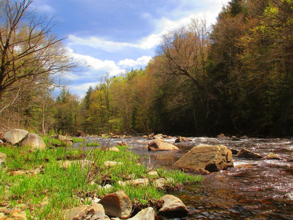
Sacandaga River below Austin Falls

Sunday May 16: One Night Camping Near Mason Lake

After hiking Watch Hill I ended up camping at Mason Lake. I also spent some time walking around the Indian Lake/Lewey Campground, just seeing what was there I was hoping being a Sunday I could get a campsite near Mason Lakke, but no such luck. Ended up camping at Campsite 5, a ways from the lake, although in the evening I did walk down to the lake. I did have cell service where I was camping, but it was spotty, so come Monday morning, I headed back to Speculator for work. The black flies were bad camping there, until well after dark I spent most of the afternoon hiding under the screen tent. In the morning, once the sun was up and the tent was down, I was booking out there because the black flies were intense.

Thursday, Friday, Saturday June 17-19: Three nights Camping at House Pond Campsite

Junteenth Weekend, a new state holiday. Piseco-Powley Road was rebuilt, and I spent a lot of time down at the swimming hole there. I was working remote on Thursday, but I left home after work and drove north before dusk. Spent a lot of time cooling off in East Branch by the campsite, laying in the hammock and relaxing. Saturday I spent kayaking at Lily Lake, but none of the lilies were out. Sunday I spent the balance of the day the potholers.
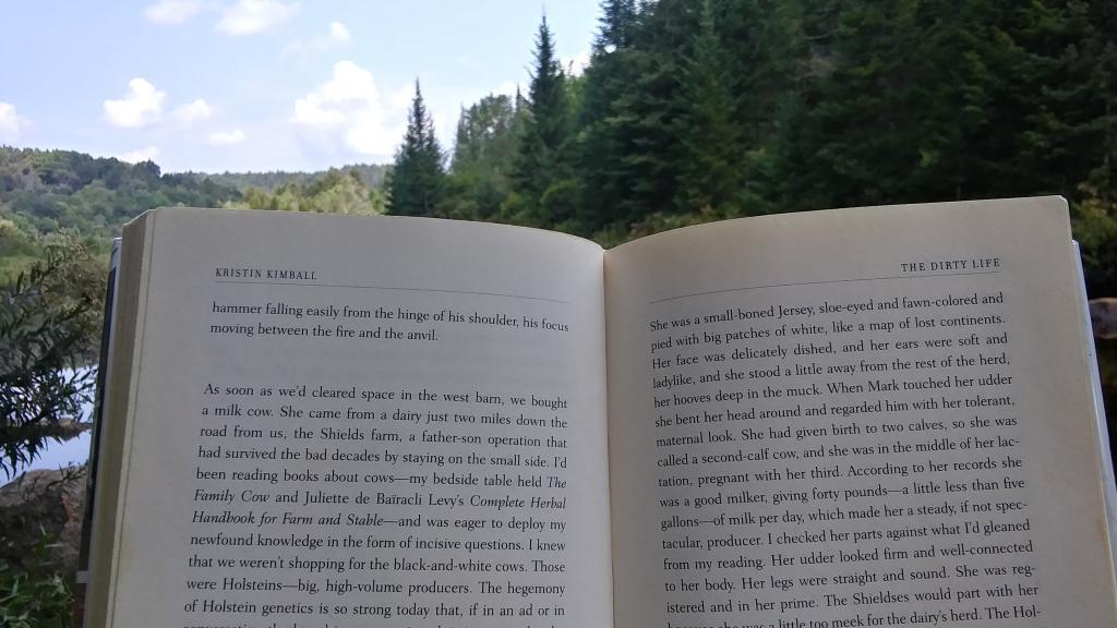
Reading ?

Friday, Saturday, Sunday July 8-10: Three nights camping on Hope Falls Road

After quite a run of rainy weather, we had part of weekend that wasn’t super wet. Also, many weeks in the summer, I preferred to just stay close to home, and catch the Nature Bus and spend Saturdays exploring Thacher Park for free. Friday was a personal day – I had a eye doctors appointment. Then I went north and set up camp at Hope Falls Road. Saturday, I hiked back to Ferris Lake and Tenant Creek Falls. Sunday, partially in the rain, I hiked back to both lower and upper Tenant Creek Falls. Sunday evening back at camp, it absolutely poured. I was originally planning to work remote on Monday and maybe Tuesday in Speculator but the weather was so wet, I decided against that.

Friday July 23: Overnight at Cherry Ridge

Heading out to the Finger Lakes, I overnighted at Cherry Ridge at Charles Baker State Forest in Madison County. It was a stop over after leaving home after work. Noticed how much sway there was in front end of the truck, and the tires were getting loud as they were warn and cupped, grew concerned that I might have issues later on. Eventually in December I replaced the tires, the worn rear shock bushing. and bad sway links. I was dealing with some real anxiety issues at that point. But I had a little fire, then retired early to bed and then took camp down early in the morning and headed west to Montezuma Wildlife Refuge and the state Audubon Preserve.

Saturday July 24: One night Tent Camping Along Backbone Horse Trail at Finger Lakes National Forest

I knew arriving at the Finger Lakes National Forest on a Saturday would mean many campsites would be taken, including the site I wanted. I ended up tent camping at one of the primitive sites off Potomac Road. It was a one night deal as I prefer camping in the truck shell and I saw the people in the campsite I wanted leave, so I quickly grabbed that campsite in the morning. Ended up breaking one of the elastic straps in one of the tent poles, I still need to repair it.

Sunday-Saturday July 25-31: Six Nights Truck Cap Camping Along Backbone Horse Trail at Finger Lakes National Forest

My summer vacation was the Finger Lakes National Forest. I decided to stick close to camp for much summer vacation, not rushing too much from place to place, spending a lot of afternoons at the Watkins Glen Pool, doing some paddling in Seneca Lake and Cayuta Lake, hiking in Texas Hollow and Sugar Hill State Forests. Did a lot of reading and laying back in the hammock. The campsite I stayed at didn’t have cell service, so it gave me a much needed to respite from the internet for a few days. Had some nice fires, drank some beer, and got away from it all.
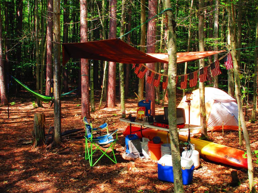
Summer Vacation Seems So Distant Now

Thursday, Friday, Saturday August 12-15: Three nights at House Pond Campsite with Clams and Sweet Corn

After summer vacation, I decided to take a long weekend — four days — up to Potholers, namely the House Pond campsite with lots of sweet corn, clams and beer. I can still taste the clams and beer, and I had plenty of them to eat over the weekend — they were breakfast, lunch and diner. But it was nice laying back in the hammock and swimming in the swimming hole by that campsite. I also hiked along old Edick Road and to Edick Road Campsite 1, which is way off from the main road, and then down to the ledge. Hiked back to House Pond, which was difficult as there was a lot of blow down from a storm earlier in the summer. Spent much of Sunday at the Potholers and then watched the sun set from the Kane Mountain Firetower. Didn’t bring the kayak this time.

Friday, Saturday, Sunday August 26-28: Three nights (again) at House Pond Campsite

With another warm week ahead, I decided to take off Friday and Monday off for one more week up at House Pond. This time I spent more time at Potholers, walking up there each afternoon, besides spending a lot of time at the swimming hole near this campsite. Did some fishing up House Pond, and a lot of drinking and reading from the hammock. Read yet another book about writing code in Python and Kristen Kimbell’s Dirty Life about farm life. I bought a large truck intertube for floating, but once I got to camp and started to setting up I realized I didn’t have an air pump with me, so I couldn’t use it while camping.
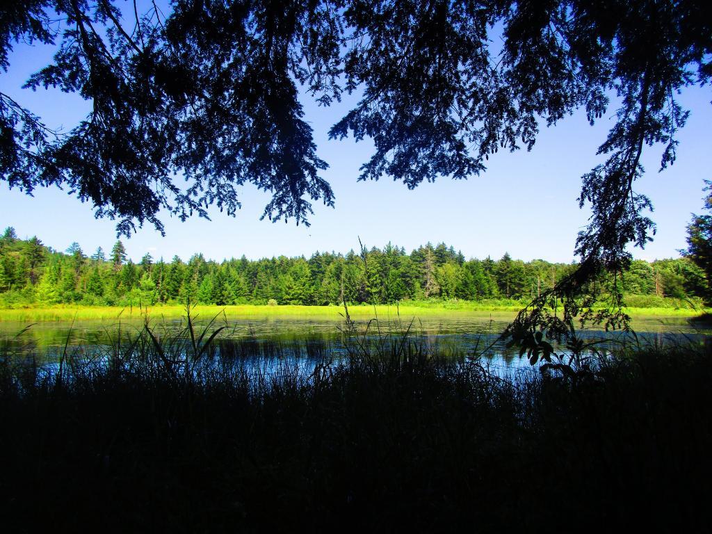
East Canada Creek Below Edick Road Ledge

Friday, Saturday, Sunday September 3-5: Three nights at Hardwood Hill at Perkins Clearing

Friday, September 3rd was the final day of remote work – Labor Day Weekend. I got up early, drove to Speculator before 9 AM. I started working from Speculator Library but with my phone having hotspot service and cell service, mid-day I drove up to Hardwood Hill. This time I made sure to inflate my intertube before heading up north, and I spent Saturday evening until well after dusk floating in the Jessup River off of Jessup River. Then I drove to Sled Harbor after dark, hoping to catch a glimpse the illuminated Wakely Hill Firetower, but I could not see it as it I couldn’t find the good views of the tower from the road after dark.

Saturday September 11: One night at Betty Brook

Decided to do a weekend trip out to Schoharie County to hike the Catskill Scenic Trail south of Grand Gorge through the deep notch where NY 30 runs. Hiked down to Hubbell’s Corners from Grand Gorge then went for a very cold swim at Mine Kill State Park. Mine Kill pool was open late this year due to opening late at the beginning of summer. Water temperature was 58 degrees. Sunday I also went for a quick swim at Mine Kill Pool again. Still very cold.
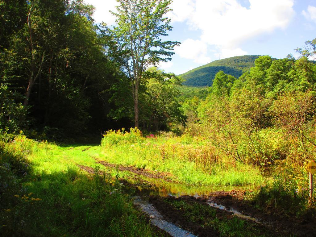
Into the Notch

Saturday September 18: One Night at House Pond

On September 18th, I drove up to Piseco-Powley Road to camp for three nights, four days. Spent one night at the House Pond Campsite, which I set up in the pouring rain, and spent time floating in the my new rubber intertube. It was a nice day once he rain stopped but the water was very cold. But it was nice laying back in the hammock that evening, although prior to dusk there was a lot of deer flies around and biting.

Sunday/Monday September 19 & 20: Two Nights at Powley Place

On Sunday afternoon I drove further up Piseco-Powley Road to Powley Place to do some camping and paddling on the East Canada Creek. Monday I hiked back to Goldstream Falls then carried my kayak down to the East Canada Creek and paddled down to the first rapids, portaged past that to the second main rapids. The beaver dams were relatively low this time, due to water levels being higher then other times when I’ve paddled the East Canada Creek. Laid back in the hammock, did some reading and looking out over the campsite on these mild, starry nights. Also did some floating down the East Canada Creek

Friday, Saturday, Sunday October 8-10: Three nights camping at Betty Brook

I took off the Friday before Columbus Day Weekend to hike Bear Pen Mountain in the Western Catskills. It was the start to a very colorful weekend. Betty Brook was nice, but it was good I got there relatively early — around 4 PM on Friday as the other campsites were quickly taken. On Saturday, I drove down to Stamford and hiked more of the Catskill Scenic Trail from Stamford for Bloomville then visited a friend in Summit. Sunday I hiked along Betty Brook Road to the snowmobile trail up Burnt Hill, then hiked over the dirt roads on Burnt and Rossman Hills, enjoying the leaves and wildlife. Hiked back  to camp and laid back into the hammock well into the evening, which was quite mild. Sunday I hiked from Grand Gorge to Stamford on the Catskill Scenic Trail.

Saturday, November 6: Camping at County Bridge Campground Pennsylvania

Originally I was planning to get new tires put on my truck prior to going to West Virginia,  trip that was postponed multiple times. Ultimately I decided it wouldn’t be a bad idea to just wear out the tires and go for the trip. I hadn’t decided on where I was going to go until I was on the road, and ended up going to Binghamton, then down to Pennsylvania for my first night camping. It was a cold first night — got down to 14 degrees.

Sunday/Monday November 7-8: Camp Run West Virginia

The first two nights I spent at Camp Run Primitive Campground at Miles, West Virginia which is located in a wash on the backside of Shenandoah Mountain. On Monday of that week I hiked up over Shenandoah Mountain, and watched the sun rise over Camp Run Lake. Tuesday morning I drove over through Judy Gap then up Spruce Mountain and hiked up that. In the afternoon I hiked up Seneca Rocks, something that had long been on my bucket list to do.
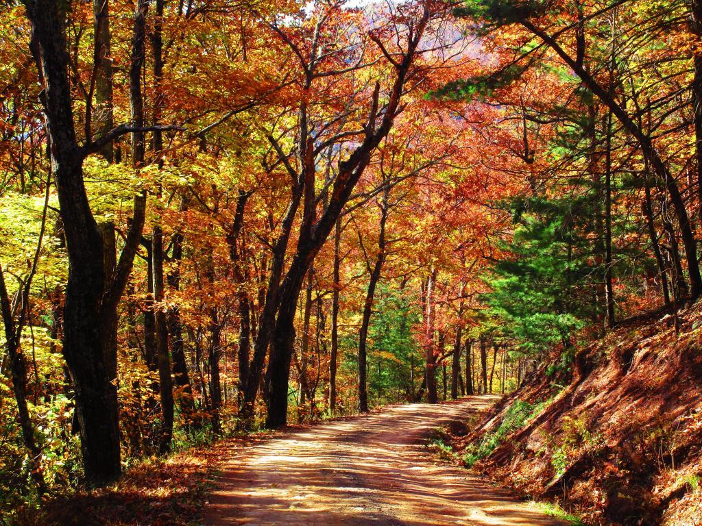
Quiet Walk Along Camp Run Road

Tuesday, November 9: Camping at Canaan Heights

On Tuesday night I camped up in Canaan Heights / Table Rock outside of Thomas WV. I was going to stay multiple days but hearing a lot of wheel bearing noise in my truck, I decided it best to head north on Wednesday and see if I could either make it home or get the truck fixed. The wheel bearing burned up by the time I got up to Lock Haven but was able to get it fixed that day and head north to County Bridge.

Wednesday, November 10: Camping at County Bridge Pennsylvania

The second time camping at County Bridge it wasn’t as cold.  I had a fire and retired to bed fairly early. But come the morning, neither the camp stove or the heater was working. I thought I might have have run out of propane. Then packed up in the morning on Veterans Day and headed north to Chenango Forks State Park, which I wanted to explore. I then stopped at Price Chopper, got some groceries and headed up to Long Pond State Forest for two kind of cold and chilly, damp nights.

Thursday/Friday, November 11-12: Camping at Long Pond State Forest

After spending the balance of Veterans Day, Thursday at Chenango Forks State Park, I camped for two nights at Long Pond State Forest. I was still having problems with my camp stove and heater, so it was kind of cold but I was able to find enough firewood to make do, and had some quiet evenings listening to the radio and just hanging out. Friday was pretty rainy, but I made due — beat having going back home. The fires were smokey but they were warm enough. And it beat being home.
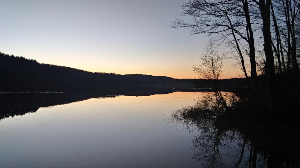
Dusk in November

Monday/Tuesday December 20-21: Camping at Stoney Pond State Forest

I thought about getting out of town after Thanksgiving but the weather did not cooperate. Then my truck’s repairs and tires got dragged out to mid-December. I decided to take he week off before Christmas to go camping. I was thinking about Central New York and then the Finger Lakes, but ultimately made it no farther then the Finger Lakes. Saturday was pouring rain, and then Sunday was bitterly cold. And my camp heater and stove were malfunctioning. But ultimately I was able to get it working, after much fiddling at camp. I camped two nights at Stoney Pond, spending Tuesday poking around Cazenovia. Tuesday was very gray, and Wednesday was snowy. Wednesday I drove to Hamilton and hiked part of the Chenango Canal Trail.

Wednesday, December 22: Camping at Moscow Hill Assembly Area

My final night camping in 2021 was the Moscow Hill Assembly Area at the Charles Baker State Forest. I decided to camp there as it was more sheltered from the wind and snow, and in case we got more snow, I figured I wouldn’t have to worry about the snow, as the county highway isn’t that far away. They were expecting high winds and low windchills, but it turned out not to be too bad. I thought about staying another night on Thursday, but the weather for Thursday looked sunny, and wanted to do some hiking, plus I wanted to be home for Christmas Eve for a family Christmas Party.
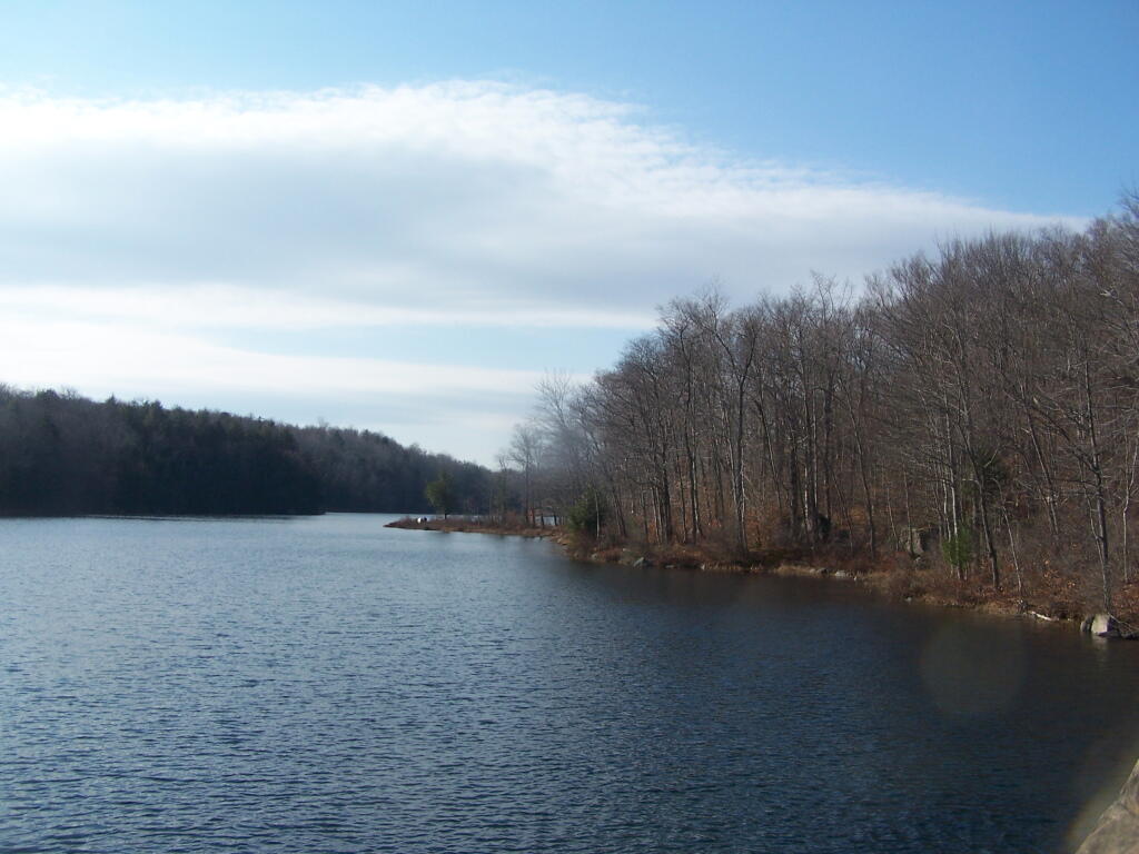
Indian Lake Campground / Lewey Lake Campground Coordinates and Map πŸ•

Indian Lake Campground / Lewey Lake Campground Coordinates and Map πŸ•

Here is a list of coordinates for the Indian Lake Islands Campground (Fee) and Lewey Lake Campground (Fee). More details from the DEC website.

CampgroundSiteDrivewayShadeLatitudeLongitude
Indian Lake Islands1(None)(Partial )43.7304748395054-74.2877932167853
Indian Lake Islands2(None)(Partial )43.7224530757475-74.2907624839568
Indian Lake Islands3(None)(Partial )43.7190491138668-74.2940872824686
Indian Lake Islands4(None)(Partial )43.7171199750046-74.2951363500399
Indian Lake Islands5(None)(Partial )43.7159390292911-74.296792430288
Indian Lake Islands6(None)(Partial )43.7137209154048-74.2992816338604
Indian Lake Islands7(None)(Partial )43.7086902361217-74.3044716184849
Indian Lake Islands8(None)(Partial )43.7066170967467-74.3063428212781
Indian Lake Islands9(None)(Partial )43.706484373826-74.309012568379
Indian Lake Islands10(None)(Partial )43.7041133917479-74.3108869570744
Indian Lake Islands11(None)(Partial )43.697346802679-74.3247139479059
Indian Lake Islands12(None)(Partial )43.6934233534827-74.315934250817
Indian Lake Islands13(None)(Partial )43.6938317599398-74.3095682765959
Indian Lake Islands14(None)(Partial )43.6913056913982-74.3104180397371
Indian Lake Islands15(None)(Partial )43.6877472510145-74.3207508140818
Indian Lake Islands16(None)(Partial )43.6879799999189-74.3198289615071
Indian Lake Islands17(None)(Partial )43.6872673095493-74.3201653062021
Indian Lake Islands18(None)(Partial )43.6868443760804-74.3211549484078
Indian Lake Islands19(None)(Partial )43.6800228460593-74.3197875603731
Indian Lake Islands20(None)(Partial )43.6793373937581-74.3247190213537
Indian Lake Islands21(None)(Partial )43.6810192238513-74.3271292597841
Indian Lake Islands22(None)(Partial )43.6805443385533-74.3273971705849
Indian Lake Islands23(None)(Partial )43.6800709967613-74.3279276612134
Indian Lake Islands24(None)(Partial )43.6775663157946-74.3314349429213
Indian Lake Islands25(None)(Partial )43.6771809454088-74.3307171030939
Indian Lake Islands26(None)(Partial )43.6600950542325-74.3339914761212
Indian Lake Islands27(None)(Partial )43.6623719767926-74.3322598972669
Indian Lake Islands28(None)(Partial )43.6575398626981-74.337038506508
Indian Lake Islands29(None)(Partial )43.6566182393285-74.3342267801279
Indian Lake Islands30(None)(Partial )43.6539829236887-74.3316966403176
Indian Lake Islands31(None)(Partial )43.6522937620085-74.3361775393021
Indian Lake Islands32(None)(Partial )43.6668538380581-74.341005433188
Indian Lake Islands33(None)(Partial )43.6641596734641-74.3447759888232
Indian Lake Islands34(None)(Partial )43.6744752460176-74.3406594587518
Indian Lake Islands35(None)(Partial )43.6763325751765-74.3405078298866
Indian Lake Islands36(None)(Partial )43.6751048173184-74.3424249794205
Indian Lake Islands37(None)(Partial )43.6726882040652-74.3447488483478
Indian Lake Islands38(None)(Partial )43.671219530231-74.3462089234796
Indian Lake Islands39(None)(Partial )43.6658110160362-74.3502713526553
Indian Lake Islands40(None)(Partial )43.6668806076464-74.3456652959817
Indian Lake Islands41(None)(Partial )43.6589425226124-74.3489672499976
Indian Lake Islands42(None)(Partial )43.6461754070921-74.3577661306475
Indian Lake Islands43(None)(Partial )43.6435487359423-74.3566787343966
Indian Lake Islands44(None)(Partial )43.6420329888729-74.3582695228578
Indian Lake Islands45(None)(Partial )43.6426696252334-74.3613463998048
Indian Lake Islands46(None)(Partial )43.6398608445525-74.36176979162
Indian Lake Islands47(None)(Partial )43.6383868178017-74.3623102353059
Indian Lake Islands48(None)(Partial )43.6343029677954-74.3647806409216
Indian Lake Islands49(None)(Partial )43.6243422964902-74.3729530691659
Indian Lake Islands50(None)(Partial )43.6190266118137-74.3767465989883
Indian Lake Islands51(None)(Partial )43.6138131801135-74.3818499714923
Indian Lake Islands52(None)(Partial )43.6562041049367-74.3704560068939
Indian Lake Islands53(None)(Partial )43.6494681775961-74.3846914479894
Indian Lake Islands54(None)(Partial )43.6514550856348-74.3831537190584
Indian Lake Islands55(None)(Partial )43.651176948613-74.3868066171873
Lewey Lake1(None)(Partial )43.6562024310996-74.3859352040697
Lewey Lake2(None)(Partial )43.6560080429272-74.386114371147
Lewey Lake3(None)(Partial )43.6555994338734-74.3863285289305
Lewey Lake4(None)(Partial )43.6553409492017-74.3869939588461
Lewey Lake5(Back-In )(Partial )43.6549944505377-74.3872402889378
Lewey Lake6(None)(Partial )43.6547358088616-74.3875232167508
Lewey Lake7(None)(Partial )43.6555627626506-74.3883763623652
Lewey Lake8(None)(Partial )43.6553264387608-74.3887331268337
Lewey Lake9(None)(Partial )43.6551699020518-74.3884978054947
Lewey Lake10(Back-In )(Partial )43.6554939292582-74.3888692371441
Lewey Lake11(Back-In )(Partial )43.6556169965957-74.3887170551251
Lewey Lake12(Back-In )(Partial )43.6545401285823-74.3878158251703
Lewey Lake13(Back-In )(Partial )43.6543208717219-74.3879588081455
Lewey Lake14(Back-In )(Partial )43.6541063200042-74.3882028588317
Lewey Lake16(Back-In )(Partial )43.6533270463703-74.3890618274419
Lewey Lake17(Back-In )(Partial )43.6536643355513-74.3888746674892
Lewey Lake18(Back-In )(Partial )43.6538492339655-74.3887021752128
Lewey Lake19(Back-In )(Partial )43.653681673951-74.388552945847
Lewey Lake20(Back-In )(Partial )43.653456870117-74.3883911731743
Lewey Lake21(Back-In )(Partial )43.653222432248-74.388209813196
Lewey Lake23(Back-In )(Partial )43.6531357242574-74.388033516963
Lewey Lake24(Back-In )(Partial )43.6528033447699-74.3887803769451
Lewey Lake25(Back-In )(Partial )43.6532196336188-74.388577320074
Lewey Lake27(Back-In )(Partial )43.6529120186575-74.3889676038093
Lewey Lake29(Back-In )(Partial )43.6527997073202-74.3893493421477
Lewey Lake30(Back-In )(Partial )43.6525419392994-74.3892600860596
Lewey Lake31(Back-In )(Partial )43.6523132664271-74.3902070762933
Lewey Lake33(Back-In )(Partial )43.6525673731442-74.3895616820917
Lewey Lake34(Back-In )(Partial )43.6492545820769-74.3893065206245
Lewey Lake35(Back-In )(Partial )43.6508892227624-74.3893752618756
Lewey Lake36(Back-In )(Partial )43.6507135666242-74.3886027442071
Lewey Lake37(Back-In )(Partial )43.6509786873957-74.388285084342
Lewey Lake38(Back-In )(Partial )43.6507288662767-74.3879004711796
Lewey Lake39(Back-In )(Partial )43.6508545527112-74.3873479998761
Lewey Lake40(Back-In )(Partial )43.6505376052044-74.3868853324626
Lewey Lake41(Back-In )(Partial )43.6505965848651-74.3863335387737
Lewey Lake42(Back-In )(Partial )43.6503928785904-74.3865521520601
Lewey Lake43(Back-In )(Partial )43.6509805975001-74.3859752872169
Lewey Lake44(Back-In )(Partial )43.6507507080316-74.3857545266411
Lewey Lake45(Back-In )(Partial )43.6502700695766-74.3858644139635
Lewey Lake46(Back-In )(Partial )43.6502911704183-74.3862447827049
Lewey Lake47(Back-In )(Partial )43.6499932410208-74.385775369415
Lewey Lake48(Back-In )(Partial )43.6501671207898-74.3862132375143
Lewey Lake49(Back-In )(Partial )43.649549553744-74.3856683424932
Lewey Lake50(Back-In )(Partial )43.649966522813-74.386123415084
Lewey Lake51(Back-In )(Partial )43.64926880754-74.385736821138
Lewey Lake52(Back-In )(Partial )43.6495131664191-74.3859902369415
Lewey Lake53(Back-In )(Partial )43.6490594925732-74.3857980091705
Lewey Lake54(Back-In )(Partial )43.6492327723884-74.3861243275344
Lewey Lake55(Back-In )(Partial )43.648899195221-74.3861146008927
Lewey Lake56(Back-In )(Partial )43.6487871388043-74.3865422481799
Lewey Lake57(Back-In )(Partial )43.6490827420732-74.3865786094433
Lewey Lake58(Back-In )(Partial )43.6487509249503-74.3868969451581
Lewey Lake59(Back-In )(Partial )43.6489757309761-74.3870586997987
Lewey Lake60(Back-In )(Partial )43.648661597741-74.3871209487514
Lewey Lake61(Back-In )(Partial )43.6487070089981-74.3875929241082
Lewey Lake62(Back-In )(Partial )43.6484255936806-74.3875367291766
Lewey Lake63(Back-In )(Partial )43.6484749247307-74.3878511839453
Lewey Lake64(Back-In )(Partial )43.6482309213949-74.387663376046
Lewey Lake65(Back-In )(Partial )43.6479052355313-74.3882375383448
Lewey Lake67(Back-In )(Partial )43.6480674354201-74.3882752613386
Lewey Lake68(Back-In )(Partial )43.6482636181653-74.3884307490016
Lewey Lake69(Back-In )(Partial )43.6483329508238-74.3889221631754
Lewey Lake70(Back-In )(Partial )43.6484214744842-74.3885472557372
Lewey Lake71(Back-In )(Partial )43.6485923320595-74.3893132305463
Lewey Lake72(Back-In )(Partial )43.6486609923734-74.3887876057122
Lewey Lake73(Back-In )(Partial )43.6488249806771-74.3891599552364
Lewey Lake74(Back-In )(Partial )43.6489020524226-74.3893166545299
Lewey Lake75(Back-In )(Partial )43.6488364719736-74.3895272905218
Lewey Lake76(Back-In )(Partial )43.6487225473048-74.3896071849629
Lewey Lake77(Back-In )(Partial )43.6484114953114-74.389354432209
Lewey Lake78(Back-In )(Partial )43.6486135264653-74.3897132737756
Lewey Lake79(Back-In )(Partial )43.6484114953114-74.389354432209
Lewey Lake80(Back-In )(Partial )43.6484316600153-74.3897837495296
Lewey Lake81(Back-In )(Partial )43.6482493658706-74.3893298280977
Lewey Lake82(Back-In )(Partial )43.6483274184154-74.3896702405063
Lewey Lake83(Back-In )(Partial )43.6480393118859-74.3892532177941
Lewey Lake84(Back-In )(Partial )43.6481460210081-74.3896064613976
Lewey Lake85(Back-In )(Partial )43.6478770421904-74.3892023702674
Lewey Lake86(Back-In )(Partial )43.6479599999346-74.3895689760199
Lewey Lake87(Back-In )(Partial )43.6478547627806-74.3894913035924
Lewey Lake88(Back-In )(Partial )43.6476653559151-74.3894694543108
Lewey Lake89(Back-In )(Partial )43.6465796420994-74.3878830951514
Lewey Lake90(Back-In )(Partial )43.6464166547287-74.3886220941953
Lewey Lake91(Back-In )(Partial )43.6461264370569-74.3879362333827
Lewey Lake92(Back-In )(Partial )43.6460700944218-74.3886830317875
Lewey Lake93(Back-In )(Partial )43.6457783052293-74.3887307535881
Lewey Lake94(Back-In )(Partial )43.6457941322989-74.3881887576526
Lewey Lake95(Back-In )(Partial )43.6453738976443-74.3887716912407
Lewey Lake96(Back-In )(Partial )43.6451383323739-74.3885836944366
Lewey Lake97(Back-In )(Partial )43.6450937957173-74.3890731028571
Lewey Lake98(Back-In )(Partial )43.6447522634829-74.3888885258902
Lewey Lake99(Back-In )(Partial )43.6448758257383-74.3892983928306
Lewey Lake100(Back-In )(Partial )43.6444766060049-74.3891889997801
Lewey Lake101(Back-In )(Partial )43.6447155884519-74.3896280744818
Lewey Lake102(Back-In )(Partial )43.6443911413052-74.3894648954895
Lewey Lake103(Back-In )(Partial )43.644640969072-74.3899306453455
Lewey Lake104(Back-In )(Partial )43.6443100466916-74.3896792682778
Lewey Lake105(Back-In )(Partial )43.6445450573364-74.3903673156228
Lewey Lake106(Back-In )(Partial )43.6442218430019-74.3899611305922
Lewey Lake107(Back-In )(Partial )43.6442819553248-74.3905116582544
Lewey Lake108(Back-In )(Partial )43.6440041511869-74.3902389008548
Lewey Lake109(Back-In )(Partial )43.6440072993199-74.3908293690613
Lewey Lake110(Back-In )(Partial )43.6436722524392-74.3905440671692
Lewey Lake111(Back-In )(Partial )43.6436941772484-74.391081853163
Lewey Lake112(Back-In )(Partial )43.6435213310838-74.3908342797345
Lewey Lake113(Back-In )(Partial )43.643533725148-74.3913721607107
Lewey Lake114(Back-In )(Partial )43.6433223445442-74.3910462427773
Lewey Lake115(Back-In )(Partial )43.643411177599-74.391622718015
Lewey Lake116(Back-In )(Partial )43.6431418564056-74.3911530423907
Lewey Lake117(Back-In )(Partial )43.6430981942098-74.3919014384763
Lewey Lake118(Back-In )(Partial )43.6429436385439-74.3915093385338
Lewey Lake119(Back-In )(Partial )43.6425954007563-74.3923264121497
Lewey Lake120(Back-In )(Partial )43.642753691304-74.3916293530442
Lewey Lake121(Back-In )(Partial )43.6423561343236-74.3921319950852
Lewey Lake122(Back-In )(Partial )43.6426687003843-74.3917745520774
Lewey Lake123(Back-In )(Partial )43.6424692234731-74.3918946613195
Lewey Lake124(Back-In )(Partial )43.6525381902482-74.3903428596814
Lewey Lake125(Back-In )(Partial )43.6527107575593-74.3905379765597
Lewey Lake126(Back-In )(Partial )43.6525936063472-74.3909066359603
Lewey Lake128(Back-In )(Partial )43.652435146533-74.3915710018658
Lewey Lake130(Back-In )(Partial )43.6522428085308-74.3921372760075
Lewey Lake131(Back-In )(Partial )43.65262218037-74.3917987856947
Lewey Lake132(Back-In )(Partial )43.6519884616328-74.3926910478604
Lewey Lake133(Back-In )(Partial )43.6524064144964-74.3923537012364
Lewey Lake134(Back-In )(Partial )43.6516698395068-74.3928058122598
Lewey Lake135(Back-In )(Partial )43.6522611334302-74.3927183145996
Lewey Lake136(Back-In )(Partial )43.6515362971243-74.3927809096067
Lewey Lake137(Back-In )(Partial )43.6520427514414-74.3930448485546
Lewey Lake138(Back-In )(Partial )43.6513837326685-74.3927627610359
Lewey Lake139(Back-In )(Partial )43.651771321095-74.393073830334
Lewey Lake140(Back-In )(Partial )43.6512450072755-74.3926591681817
Lewey Lake141(Back-In )(Partial )43.6514806578101-74.3930701951291
Lewey Lake142(Back-In )(Partial )43.6511588649176-74.3925878560293
Lewey Lake143(Back-In )(Partial )43.6512942546345-74.3929605193171
Lewey Lake144(Back-In )(Partial )43.651034885811-74.3925694199481
Lewey Lake145(Back-In )(Partial )43.6511985134041-74.3928761800213
Lewey Lake146(Back-In )(Partial )43.6509110819315-74.3925837910083
Lewey Lake147(Back-In )(Partial )43.6510744306825-74.3928380575372
Lewey Lake148(Back-In )(Partial )43.6507249563543-74.3925266103811
Lewey Lake149(Back-In )(Partial )43.6510075196288-74.3927993604525
Lewey Lake150(Back-In )(Partial )43.6505764581427-74.3923771846
Lewey Lake151(Back-In )(Partial )43.6508931396266-74.3927939517889
Lewey Lake152(Back-In )(Partial )43.6501539712455-74.3928139724822
Lewey Lake153(Back-In )(Partial )43.6506453217752-74.3927833240434
Lewey Lake154(Back-In )(Partial )43.6504826701999-74.392660288079
Lewey Lake155(Back-In )(Partial )43.6503944701246-74.3922018509199
Lewey Lake156(Back-In )(Partial )43.6502670517585-74.3924327989789
Lewey Lake157(Back-In )(Partial )43.6502171749186-74.3920133465799
Lewey Lake158(Back-In )(Partial )43.6500655524662-74.3921723595017
Lewey Lake159(Back-In )(Partial )43.65010220154-74.3918963946763
Lewey Lake160(Back-In )(Partial )43.6498801593201-74.3922529700147
Lewey Lake161(Back-In )(Partial )43.6499783628321-74.3919042063052
Lewey Lake162(Back-In )(Partial )43.6498642959964-74.3919578506314
Lewey Lake163(Back-In )(Partial )43.6497365301035-74.3921231830361
Lewey Lake164(Back-In )(Partial )43.6496799855084-74.3922418642017
Lewey Lake165(Back-In )(Partial )43.6496332482681-74.3924129407801
Lewey Lake166(Back-In )(Partial )43.6497576807574-74.3925166743979
Lewey Lake167(Back-In )(Partial )43.6495349395156-74.3927420176198
Lewey Lake168(Back-In )(Partial )43.649783733219-74.3929363627442
Lewey Lake169(Back-In )(Partial )43.6495607821443-74.3931223364114
Lewey Lake170(Back-In )(Partial )43.6499420039304-74.3931316221761
Lewey Lake171(Back-In )(Partial )43.6496759293245-74.3932720972688
Lewey Lake172(Back-In )(Partial )43.6501760859221-74.3932473770535
Lewey Lake173(Back-In )(Partial )43.649848004272-74.3933753532189
Lewey Lake174(Back-In )(Partial )43.6504723139811-74.3934018781128
Lewey Lake175(Back-In )(Partial )43.6500105506526-74.3934787044013
Lewey Lake176(Pull-Through )(Partial )43.6506729402757-74.393498286223
Lewey Lake177(Pull-Through )(Partial )43.6503306000313-74.393632967762
Lewey Lake178(Pull-Through )(Partial )43.6508973193824-74.3935813326933
Lewey Lake179(Pull-Through )(Partial )43.6509749070501-74.3938364644253
Lewey Lake180(Pull-Through )(Partial )43.6511403385758-74.3935854497481
Lewey Lake182(Back-In )(Partial )43.651440355387-74.3935561829589
Lewey Lake183(Back-In )(Partial )43.6516291202832-74.3932130628545
Lewey Lake184(Back-In )(Partial )43.6501834954987-74.3937459974257
Lewey Lake185(Back-In )(Partial )43.6504412950105-74.3938418312205
Lewey Lake186(Back-In )(Partial )43.6505096309504-74.3941495496478
Lewey Lake187(Back-In )(Partial )43.6505108131118-74.3943726395853
Lewey Lake188(Back-In )(Partial )43.6502945381307-74.3940204765682
Lewey Lake189(Back-In )(Partial )43.6504361127886-74.3946621101528
Lewey Lake190(Back-In )(Partial )43.6503160298583-74.3944795858391
Lewey Lake191(Back-In )(Partial )43.6504046722823-74.395023325048
Lewey Lake192(Back-In )(Partial )43.650237709888-74.3949856303055
Lewey Lake193(Back-In )(Partial )43.6503107727246-74.3952867393724
Lewey Lake194(Back-In )(Partial )43.6505389086426-74.3951794622762
Lewey Lake195(Back-In )(Partial )43.6504598223622-74.3955411553674
Lewey Lake196(Back-In )(Partial )43.650711537203-74.3953877079922
Lewey Lake197(Back-In )(Partial )43.6506604477948-74.3956375705903
Lewey Lake198(Back-In )(Partial )43.6508644839223-74.3954780403089
Lewey Lake199(Back-In )(Partial )43.6511071204696-74.3954099874409
Lewey Lake200(Back-In )(Partial )43.6509038476415-74.39571387204
Lewey Lake201(Back-In )(Partial )43.6512421888644-74.3957236030087
Lewey Lake202(Back-In )(Partial )43.6510374934892-74.3957584655006
Lewey Lake203(Back-In )(Partial )43.6512159603347-74.3961700748559
Lewey Lake204(Back-In )(Partial )43.6514019455146-74.396201021807
Lewey Lake205(Back-In )(Partial )43.6513460550165-74.3964443723559
Lewey Lake206(Back-In )(Partial )43.6515135356203-74.3965804953413
Lewey Lake207(Back-In )(Partial )43.6509386316873-74.395083584175
Lewey Lake208(Back-In )(Partial )43.6511057320134-74.3951475261183
Lewey Lake209(Back-In )(Partial )43.6509513619453-74.3947881729673
Lewey Lake210(Back-In )(Partial )43.6511135597002-74.3948259154299
Lewey Lake211(Back-In )(Partial )43.6509965733823-74.3943283871773
Lewey Lake212(Back-In )(Partial )43.6511304274238-74.3944123467805
Lewey Lake213(Back-In )(Partial )43.6507444735048-74.3938370645823
Lewey Lake214(Back-In )(Partial )43.6511862101655-74.3941493106687
Lewey Lake215(Back-In )(Partial )43.6512797582196-74.3938202749566

Lewey Lake

Primitive Campsites and Lean-Tos in Schoharie County πŸ•

Exploring the lesser-traveled back roads and backcountry of Schoharie County reveals a host of hidden camping gems, perfect for those seeking a tranquil woods experience. This guide assists in pinpointing these sites, most of which are accessible by vehicle, suitable for tents or smaller camper units. While some roads can be rugged and seasonally accessible, a pre-trip exploration is recommended to ensure a smooth and enjoyable extended stay amidst the natural surroundings.

Facility

Name

Asset

Lat

Lng

Street

City

Burnt-Rossman Hills State Forest

Betty Brook Campsite

Roadside Campsite

42.5282069949748

-74.5141411051093

267 Miller Rd

Summit

Burnt-Rossman Hills State Forest

Cole Hollow Stream Campsite

Tent Campsite

42.5173809830791

-74.4783362503377

739 Cole Hollow Rd

West Fulton

Burnt-Rossman Hills State Forest

Duck Pond Campsite

Roadside Campsite

42.5101650935711

-74.483569788123

116 Duck Pond Rd

West Fulton

Burnt-Rossman Hills State Forest

Eminence Lean-To

Lean-To

42.5433037239374

-74.488594594497

1478 Burnt Hill Rd

West Fulton

Burnt-Rossman Hills State Forest

Panther Creek Campsite

Tent Campsite

42.5707997358218

-74.5222079737636

822 Sawyer Hollow Rd

Richmondville

Burnt-Rossman Hills State Forest

Westkill Camp Site

Tent Campsite

42.4891982222204

-74.5093675822639

1223 Westkill Rd

Jefferson

Clapper Hollow State Forest

Clapper Hollow Lean-To

Lean-To

42.5282012275126

-74.6420043552481

460 Meade Rd

Jefferson

Dutch Settlement State Forest

Lean-To

Lean-To

42.6294376035285

-74.2675434310789

334 Treadlemire Rd

Berne

Huntersfield State Forest

Lean-To

Lean-To

42.3550413795618

-74.3460668476724

371 Huntersfield Rd

Prattsville

Keyserkill State Forest

Keyserkill Campsite

Tent Campsite

42.4892248356724

-74.3594496582389

578 Keyserkill Rd

Middleburgh

Keyserkill State Forest

Pond Campsite

Tent Campsite

42.5026457018464

-74.3614634029007

198 Coons Den Rd

Middleburgh

Lutheranville State Forest

Sisson Rd Campsite

Roadside Campsite

42.6110826168082

-74.6399766310532

833 County Route 353

Middleburgh

Mallet Pond State Forest

Mallet Pond Campsite (Undesignated)

Tent Campsite

42.5878422010516

-74.5223274563456

634 Rossman Fly Rd

Richmondville

Mallet Pond State Forest

Rossman Pond Campsite (Undesignated)

Roadside Campsite

42.5941596281094

-74.5290358970195

634 Rossman Fly Rd

Richmondville

Rensselaerville State Forest

Campsite 2

Roadside Campsite

42.4994499144647

-74.1948355550861

856 Cheese Hill Rd

Preston Hollow

Rensselaerville State Forest

Campsite 4

Roadside Campsite

42.501426797599

-74.2175233050623

833 County Route 353

Middleburgh

Camping at Betty Brook a Few Weeks Back