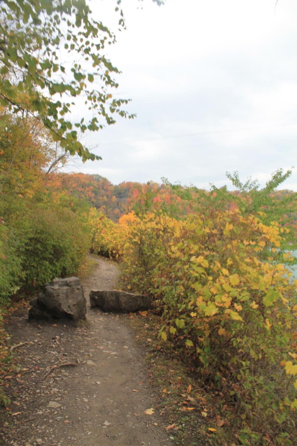
Fallen Rocks on the Trail
These aren't ATV barriers.
Taken on Sunday October 14, 2012 at Niagara Falls.
These aren't ATV barriers.
Taken on Sunday October 14, 2012 at Niagara Falls.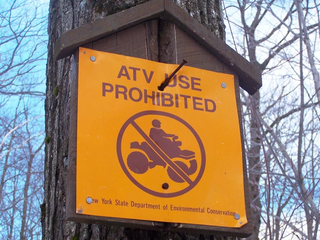
Yet, that still does not make it clear if this truck trail is open to motor vehicles in the summer.
Taken on Saturday April 2, 2011 at Harvey Mountain State Forest.
The Cliff of Middleburgh is not totally flat, but instead ascends several times as you go along it. The Long Path follows an ATV trail along this privately owned parcel.
Taken on Sunday March 21, 2010 at Middleburgh Cliff.One of my fears is that I will get stuck in the process of buying land and building a cabin on it. In many ways, it’s a much more complicated and drawn out process then simply looking at a house, going through a well established path of real estate agents, title searches, house inspection, and traditional mortgage but it also turns out not to be an impossible project without many construction skills or equipment.
In some ways buying raw or minimally developed land (such as an old trailer site or badly damaged home with some infrastructure), especially with cash is a much harder road to hoe. While I haven’t totally written off getting a mortgage — there are tax benefits, namely you can reduce your total income by the amount you pay in mortgage interest — the cost of money these days makes it seem like a waste. And I worry about getting ripped off, and regulatory issues more generally as all of this world is very new and complicated to me. I’ve always preferred to pay with cash, it’s generally cheaper though it will involve cashing out stocks and paying a shit ton of Capital Gains taxes.
Right now I am at the stage at studying parcels that are currently on the market and giving it some thought. What is out there without a home? What are the prices? How far from work? How close to neighbors or potential neighbors who could complain about things to the town? Since drafting my first draft of the homestead and cabin on Saturday, I think I have a better idea — the priority being having the right redneck kind of neighbors, general distance from neighbors, ability to homestead with livestock and have bonfires, ride an ATV around the property, heat with wood, compost, garden and use on-site solar to avoid being tied to growing expense of the dirty power of the electrical grid. Buy and build what I actually want, even if that’s somewhat more expensive then I’d like to spend and not what other people want from the property.
I’m teaching myself LibreCAD so I can draw my vision for the home and the property that I want in a way that is presentable to potential sellers or their real estate agents, town building officials, and architects. I am not a very good hand drawer, and knowing at least some CAD and floor plan design drawing techniques will be good to illustrate my vision to the appropriate people. While I am sure not all of my ideas can be implemented due to regulatory and cost reasons, being able to have a clear idea of what I want on paper, in an easily readable form will make it much easier to obtain what I want.
Maybe the best way to judge my progress is to have a rough time table :
Up bright and early as often is the case in the morning. Coffee and eggs just enjoying the quiet over the land as the sun rises. In the distance is the roar of an ATV as I sit warming my hands over the propane heater.
Good morning! Happy Columbus Day. ⛵🍂Mostly clear and 43 degrees in Delmar, NY. There is a south breeze at 5 mph. 🍃.
Five o’clock I rose as always 🛏 and it was dark in the woods. I don’t mind, I like an early start and a good breakfast. 🍳 Annoyed I left the sweet corn 🌽 and onions 🧅 home but I had plenty of other good things to use in my eggs – I packed the jalapeño I had plus canned 🥫 olives and chopped tomatoes. Kind of getting past the farm fresh tomato 🍅 time of year.
Columbus Day will be mostly sunny 🌞, with a high of 60 degrees at 3pm. Four degrees below normal, which is similar to a typical day around October 19th. Southwest wind 5 to 10 mph. A year ago, we had partly cloudy skies in the morning, remaining cloudy in the afternoon. The high last year was 63 degrees. The record high of 83 was set in 1949. There was a dusting of snow in 2000.❄
Cold this morning with the breeze 🌬️ but should get nicer as the day progreses. Going to ride Blackie 🚵 around Rennselearville State Forest on some roads and trails, have lunch 🍲 and then head over to Partridge Run WMA for biking along the Switzkill and other gravel rides for the balance of the day. Hopefully it will warm up. Yesterday was kind of cool and wet at times, I retired to bed at nine o’clock as it started to rain as I sat by the fire 🔥. At least my only time limitation today is getting home by dusk.
Solar noon 🌞 is at 12:43 pm with sun having an altitude of 41.2° from the due south horizon (-29.6° vs. 6/21). A six foot person will cast a 6.9 foot shadow today compared to 2.2 feet on the first day of summer. The golden hour 🏅 starts at 5:47 pm with the sun in the west-southwest (256°). 📸 The sunset is in the west (262°) with the sun dropping below the horizon at 6:25 pm after setting for 2 minutes and 55 seconds with dusk around 6:51 pm, which is one minute and 42 seconds earlier than yesterday. 🌇 The best time to look at the stars is after 7:26 pm. At sunset, look for partly clear skies 🌄 and temperatures around 55 degrees. There will be a southwest breeze at 7 mph. Tomorrow will have 11 hours and 22 minutes of daytime, a decrease of 2 minutes and 48 seconds over today.
Today is the big blog renewal day. 📄 I’m going to bite the bullet and get it done. I like blogging and telling my story. Plus the ad revenue has been pretty good, looking forward to that first check come November. And in a few months time I should be mostly made whole, when I don’t count my time. ⌚ But it’s something I like doing. Kind of like my vacation next week.
Tonight will be partly cloudy 🌃, with a low of 39 degrees at 4am. Four degrees below normal, which is similar to a typical night around October 21st. South wind around 6 mph. In 2022, we had cloudy skies in the evening, which became mostly clear by the early hours of the morning. It got down to 40 degrees. The record low of 25 occurred back in 1980.
That new bicycle lights are awesome. 🔦 Super bright for riding at night, no worries about hitting potholes or missing something on the road or trail riding after dark. I was so impressed doing a little bit of night riding on CCC Road last night. 🛒 While it might be dusk 🌆 riding home from the grocery store tonight I should be good with that nice bright light. Plus I’ll have plenty of good fruits and vegetables to eat for the week to come. Still will need to visit Walmart probably on Tuesday for socks 🧦 and other supplies.
Yesterday I totally fell off the health wagon 🍻 having a few beers, eating too many carbs 🍞 and even maybe sneaking in a dart or two 🚬 around the campfire. 🔥 Big portion of couscous, chicken, celery and spices for dinner. I don’t smoke or drink except by the fire sometimes. 🍏 Way too many apples and Greek yogurt. So bad! Got to have some fun, tonight it will be back to rice and lentils I think. 🤔 I need to get to the supermarket 🛒 and get more fresh produce tonight as I will have finished off the carrots 🥕 and celery along with apples 🍏 and bananas 🍌 by the end of the day and I need them to eat at work tomorrow.
Rainy weekend on tap to start the October Vacation. 🌧️ Saturday, rain likely. Cloudy, with a high near 55. Chance of precipitation is 60%. Sunday, rain likely. Cloudy, with a high near 55. Chance of precipitation is 60%. Typical average high for the weekend is 62 degrees.
What a bummer. 😔 I’m really watching next weekend to see how my October vacation is going to go. I really don’t want to postpone it due to rapidly dropping daylight, leaves and temperature. I can live with a rainy weekend as I drive south to West Virginia 🗻 but not a week of rain and high temperatures in the mid 40s. I might have to reconsider my trip – cancel it, postpone it or choose another location closer to home. I don’t know, going to watch the forecast for Thomas WV as it draws closer, the 8-14 day outlook suggests cool but dry which I’m good with if not too windy. 🤷♂️
Looking ahead, there are 5 weeks until Average Night Below Freezing 🌌 when the sun will be setting at 4:36 pm with dusk at 5:05 pm (Standard Time). On that day in 2022, we had partly cloudy and temperatures between 49 and 36 degrees. Typically, the high temperature is 50 degrees. We hit a record high of 69 back in 1964. Those days are coming much too quickly and I’ll eventually need to turn back on the heat and plug air leaks in my apartment.
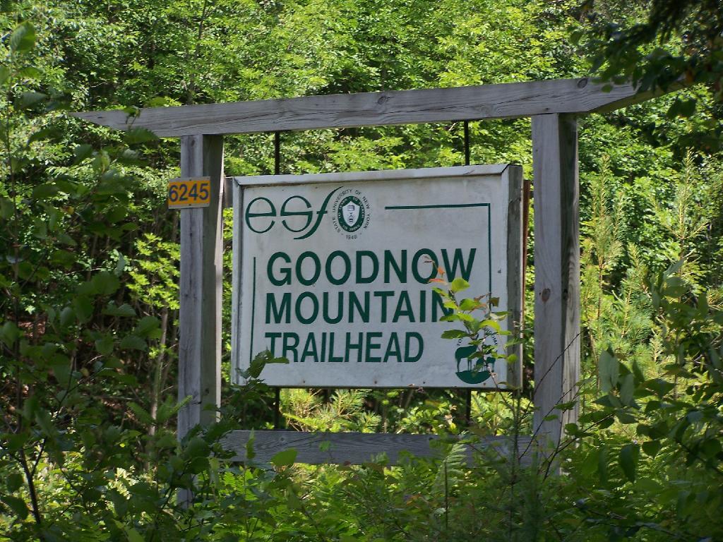
A couple of weeks ago I hiked up Goodnow Mountain, on a beautiful clear afternoon, that by the time I reached the mountain it started to cloud up and the humidity started to increase. I had previously in the morning attempted to hike up Giant Mountain in the High Peaks, and wanted to do something easier for the afternoon.
Goodnow Mountain is located at the SUNY ESF (Environmental Science-Forestry) College, just south of the Adirondack High Peaks on NY 28, just to the west of Newcomb. It’s a bit of a drive from the Adirondack Northway from the east or even a little ways from Long Lake to the west, but well worth it for the views.
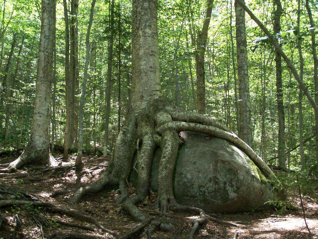
About a quarter mile up the trail you pass an interesting tree grown over a rock. This is not as uncommon as you might think in the Adirondacks where the soils are poor and the ground is rocky, and trees seek to put down more roots to pick up nuetrants.
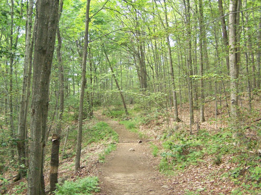
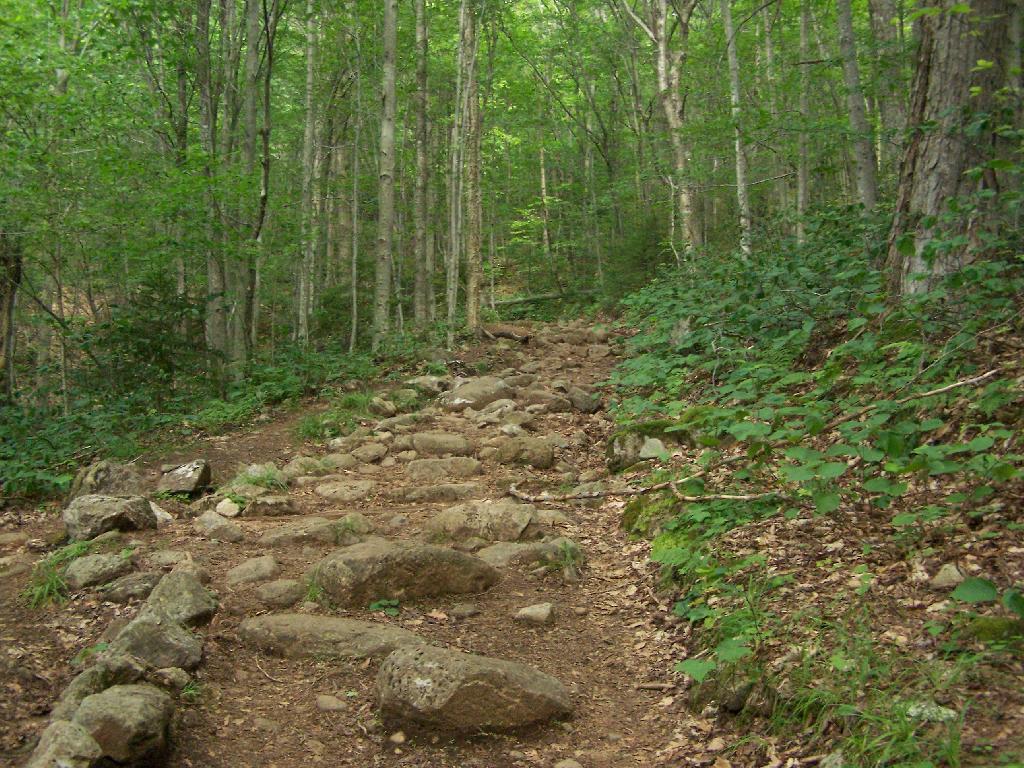
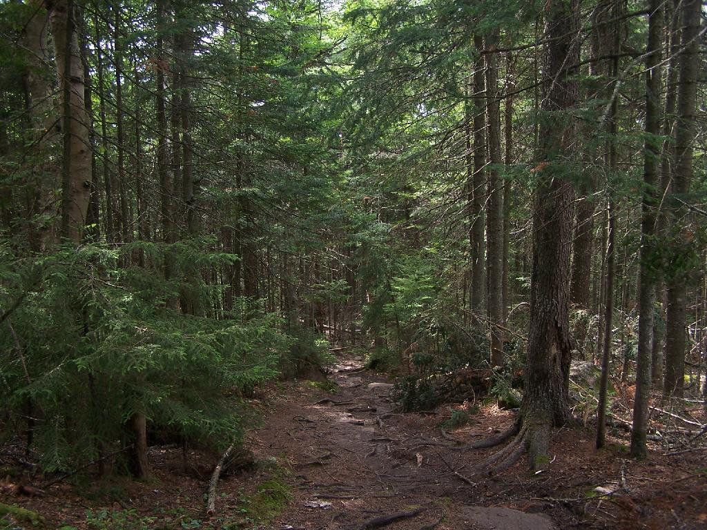
At about 1/2 mile you reach the old woods road that at one time, decades ago, provide vehicular access to the tower for forest rangers. Part of the trail is flat, but then it keeps steeper and erosion is noticable on the old road bed, no longer passable by anything then ATV in an emergency.
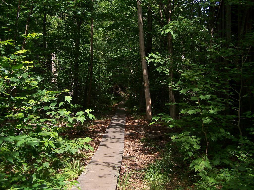
Further up the mountain, the trail follows a series of boardwalks that keeps most of the trail out of the mud and the muck.
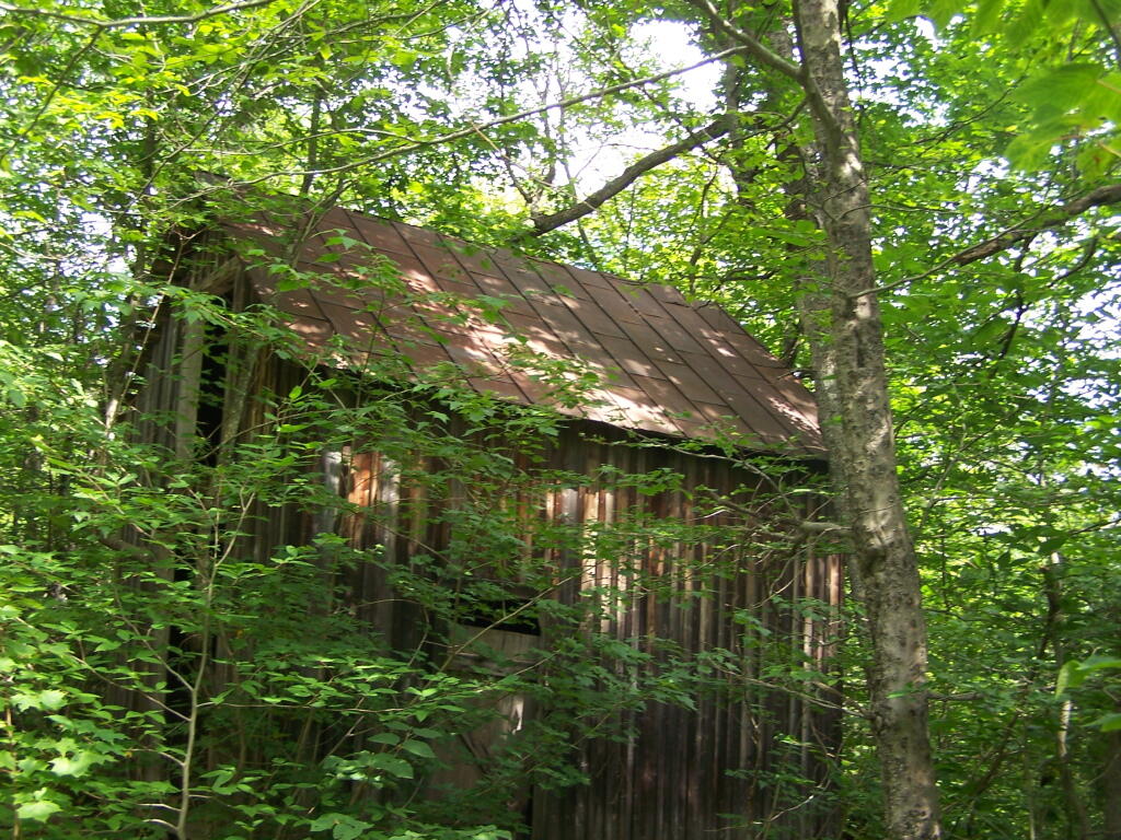
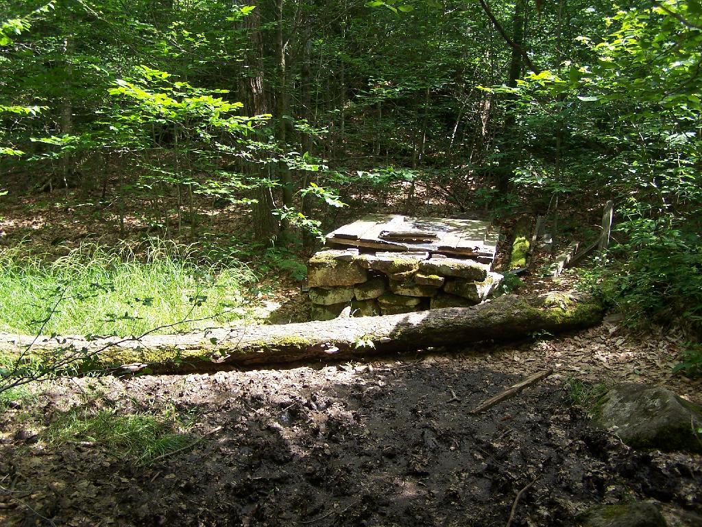
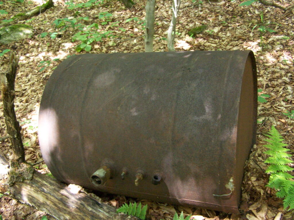
Then you reach an old abandoned barn, a well, and some interesting old debris like what appears to be a tank from a hot water heater storage unit.
You ascend a ledge, with some limited views to the south.
Then their is a thick planation of White Pines along the trail as you make one relatively short ascent to the firetower.
Eventually at the last possible moment, you break through the White Pines to see the Goodnow Firetower, and almost instantly want to start climbing it for the views, unless your suffering from heat exhaustion, then you might want to look for the relatively limited shaded but open sections on the mountain.
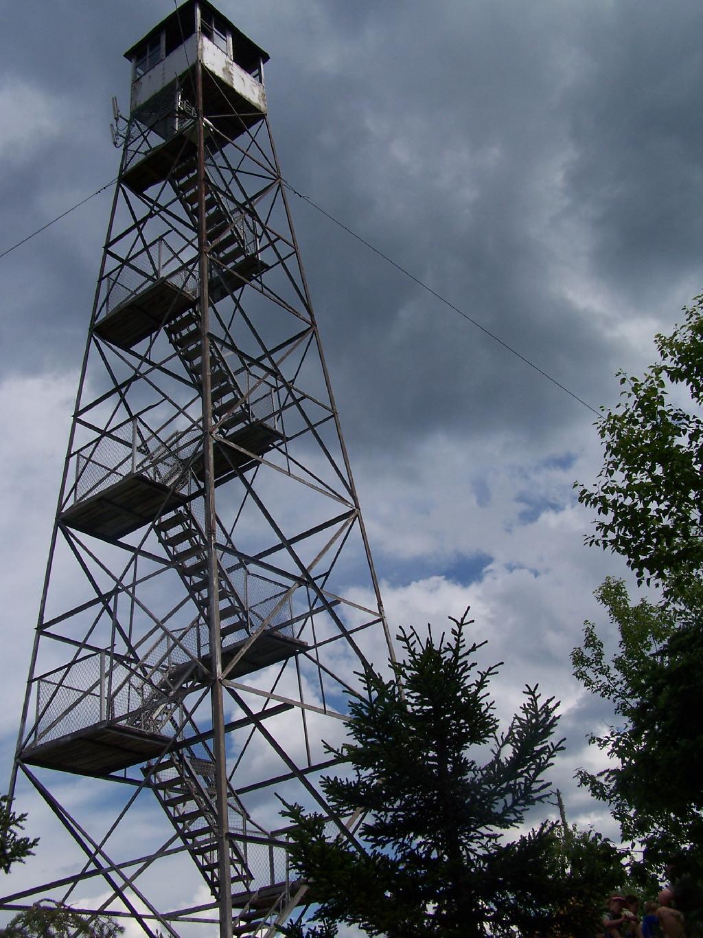
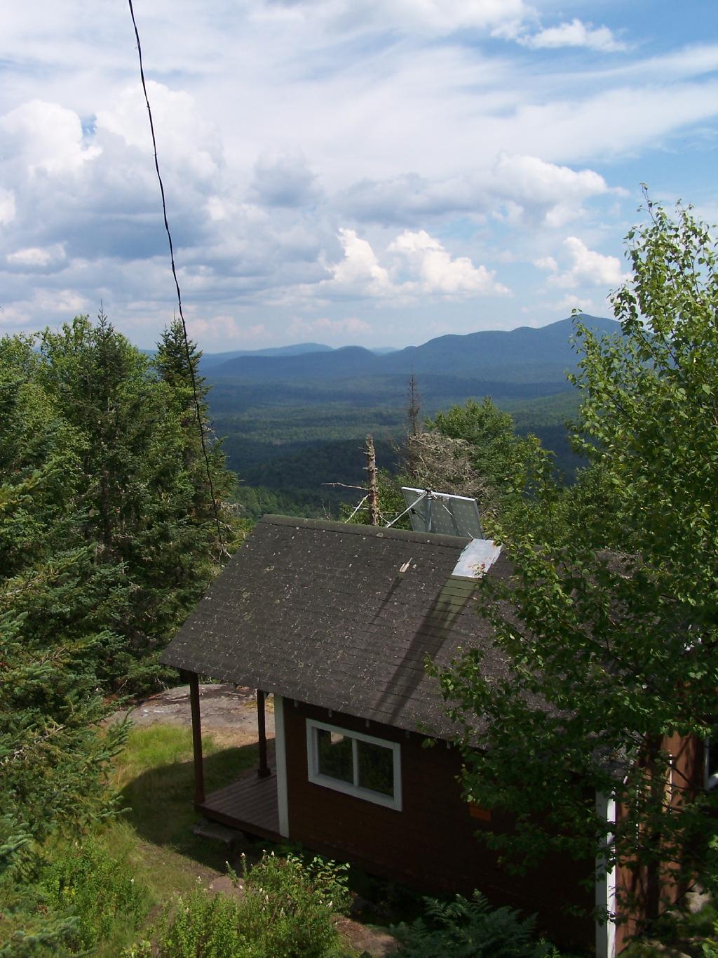
SUNY ESF has restored to the Ranger’s cabin, and the porch is a farely popular place to sit, enjoy the view, beat the heat for a few moments.
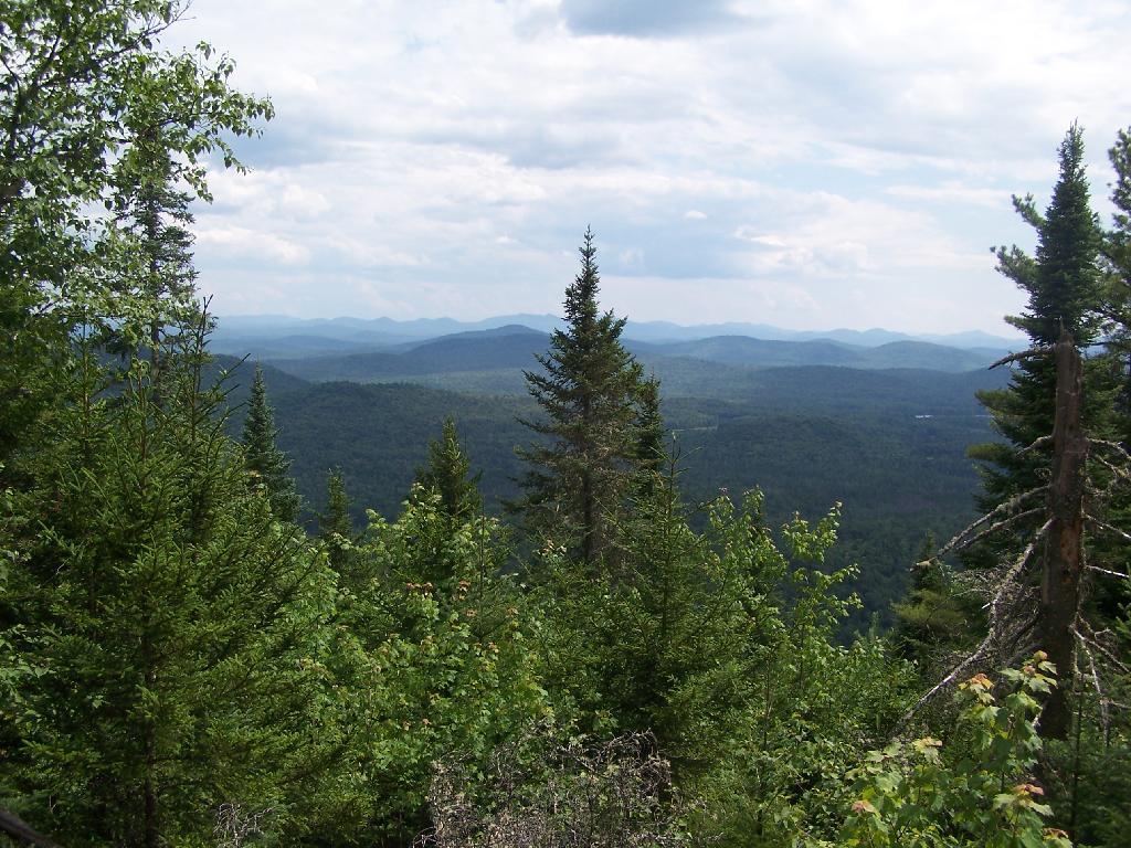
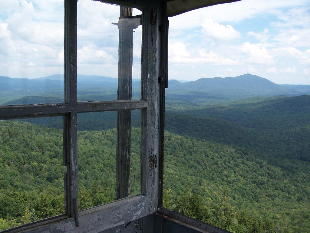
There are many interesting views from the firetower. Here are the High Peaks looking North, the Vanderwhacker Wild Forest to the east, Kempshall Mountain / Long Lake to the west, and Blue Mountain / Blue Ridge to the South.
Here is a map of the hike.
Please see also information on dispersed, roadside and back-country camping in New York State, Vermont and West Virginia.
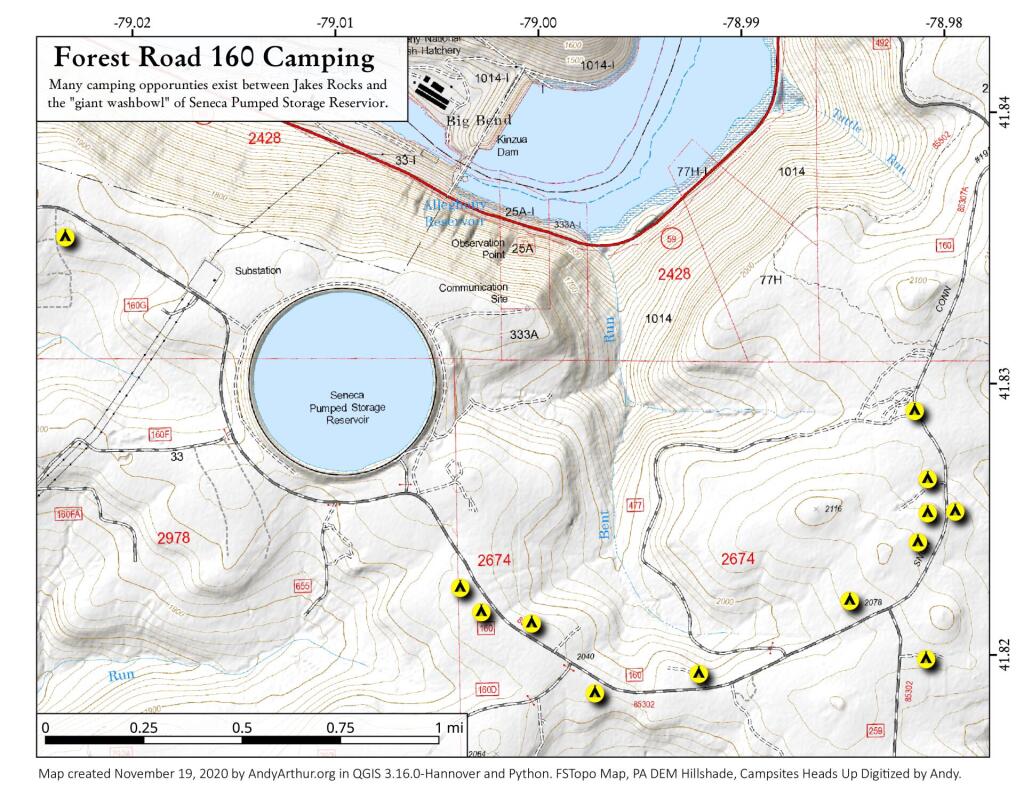
Allegheny National Forest Dispersed Campsites (shown on this map with a round Yellow Camp logo) are free-to-use with a 14-day stay limit in any 30 day period. Many of these campsites are informal areas used for camping, others like along Forest Road 160 and 259 near Jake’s Rocks and along Lolita Grade have enhanced gravel pads/parking areas. Unlike New York State, they do not have formal markings at the sites. More detailed map.
PA DCNR Motor Vehicle Campsites (shown on this map with a Blue Camp logo) are free to stay at with a permit which can now be obtained online, 3 days in advance.
In the Allegheny National Forest there are a variety of back country roads, offering primitive roadside camping.
Forest Road 160/259 is the most popular dispersed camping area near Jakes Rocks and the Allegheny Reservior. Above are some campsites in this area. Many of these campsites have gravel parking areas and hardend campsites.
There are several campsites along Loleta Grade, south of Lamonaville (FR 131). This is on the backside of Buzzard Swamp Wildlife Refuge, and is a much more wilderness experience. Many of these campsites have gravel parking areas and hardened campsites. Some of the campsites along the Gurgling Run can be buggy during the summer month, but get much less use then the Jakes Rocks area. Be aware that Forest Road 131 from Loleta Recreation Area to Forest Road 288 is permanently closed due to damage after Superstorm Sandy.
There is a handful of campsites along Fire Road FR 137 along the Dry Run and Whitney Creek near the Willow Creek ATV Area.
There are a handful of campsites along the East Tionesta Creek south of Kane/Shefield.
There are many other roads that have camping but these are some of my favorite locations.
On Pennsylvania State Forests there are a variety of back country roads, offering primitive roadside camping.
I have not done a lot of DCNR Motor Vehicle Camping, but above is a picture from 2012 when I spent half a week truck camping at Painter Run in the Tioga State Forest near the Pennsylvania Grand Canyon. There are many other opportunities as can be seen above, if you plan ahead and get your permit.
Also, see the DCNR Interactive Map if you are interested in fee campgrounds. They have several “rustic” campgrounds which are inexpensive at $10 night, and do not require reservation. These are traditional campgrounds with hand pump water, pit privies and no electricity but often are well maintained and quiet — although the campsites aren’t spread out like back country camping. Many of these campsites are lightly used off-season and are often a good place to spend a night when traveling.
Allegheny National Forest Dispersed Campsites are free-to-use with a 14-day stay limit in any 30 day period. Many of these campsites are informal areas used for camping, others like along Forest Road 160 and 259 near Jake's Rocks and along Lolita Grade have enhanced gravel pads/parking areas. Unlike New York State, they do not have formal markings at the sites. More detailed map.
PA DCNR Motor Vehicle Campsites are free to stay at with a permit which can be obtained from the local DCNR Forestry office (click on the black dot) during ordinary business hours or by emailing/calling their office with your license plate and contact information.