Search Results for: photo time to take down that campsite

The Second Day

I Honestly I Didn’t Have a lot of Hope for the Rest of the Week. The first day didn’t go real well. I thought I could replace the lawn chair and maybe the bad battery, although I really wanted to spend time researching deep-cycle batteries before I made the leap and just bought another cheap Wal-Mart Marine battery.

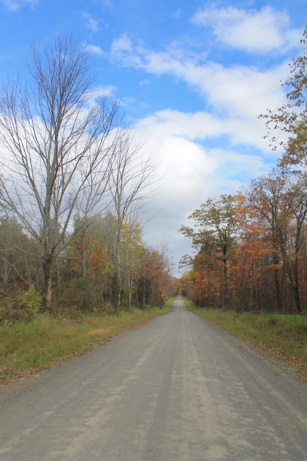
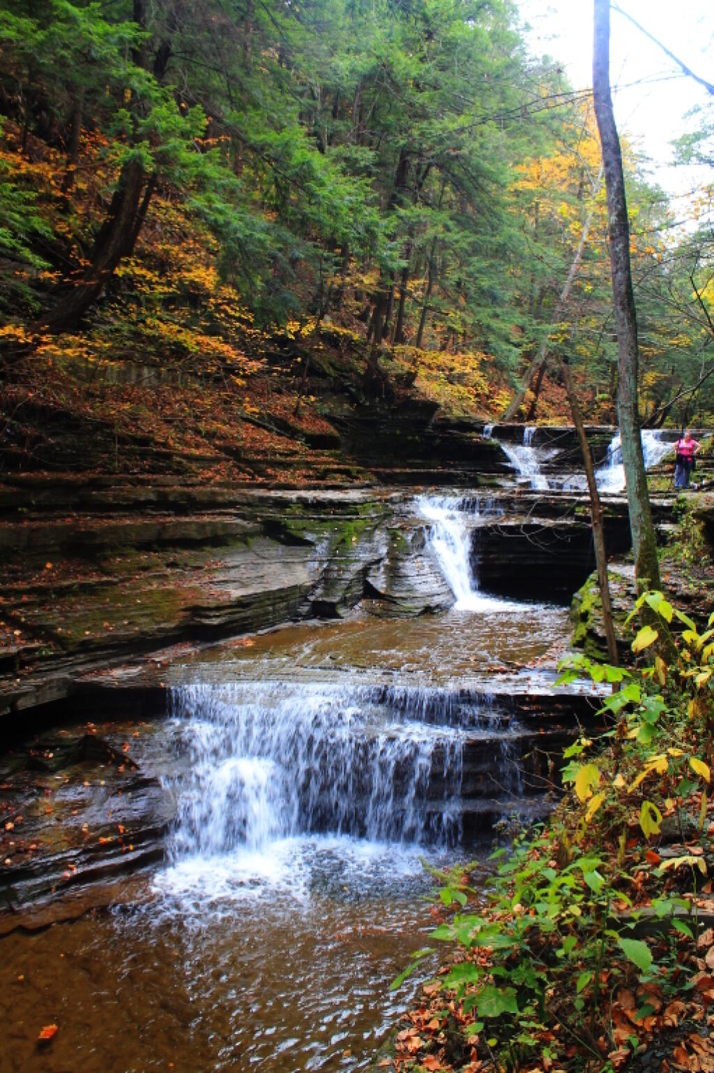
But then the Beauty of November in the Woods Hit Me. This month is not only reserved for the sportsmen in the woods. It is remarkably beautifully especially when the clouds break and its not super cold out.

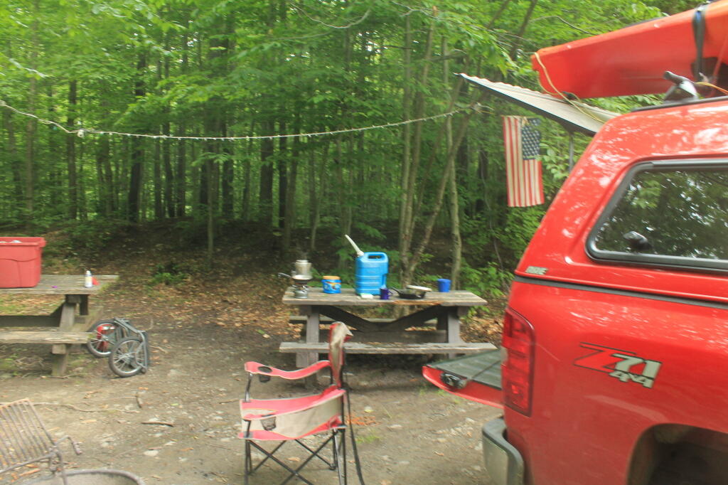
Made Breakfast up and Got Started on the Day. There was a nice shooting lane in the woods from the campsite,  so I set up a political lawn sign, put on my shooting glasses and ear plugs and started blasting away at. I couldn’t believe how fast the shot shells disappeared at 5 rounds at a time in my pump action Renmington 870.

Had My Traditional Camp Breakfast. I am a big fan of scrambled eggs with cheese and sausages for breakfast.  I often load it up with veggies although this time I didn’t. Took down camp after having this delicious breakfast.

Decided to Head Down to Pennsylvania. I had originally planned to spend two nights in the Western Catskills small game hunting,  hiking and plinking but I wanted to give the deep-cycle a good charge in hopes I could recover it so I would have a decent amount of light the next night without constantly having to crank the truck to keep the lights on.

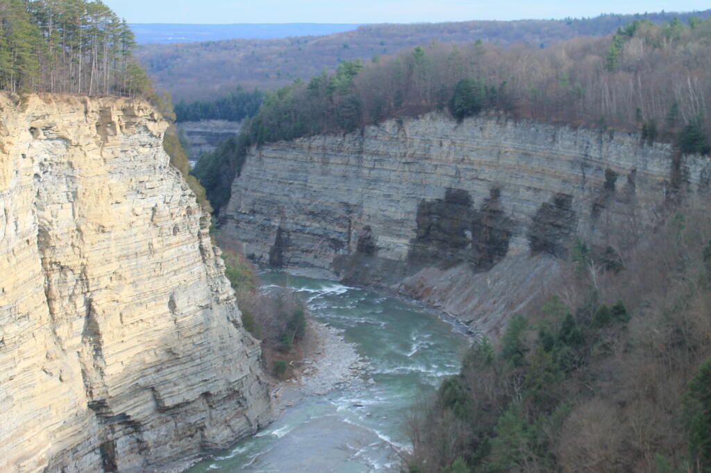
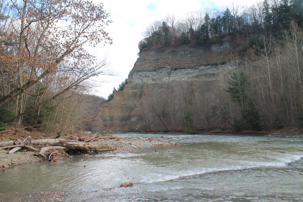
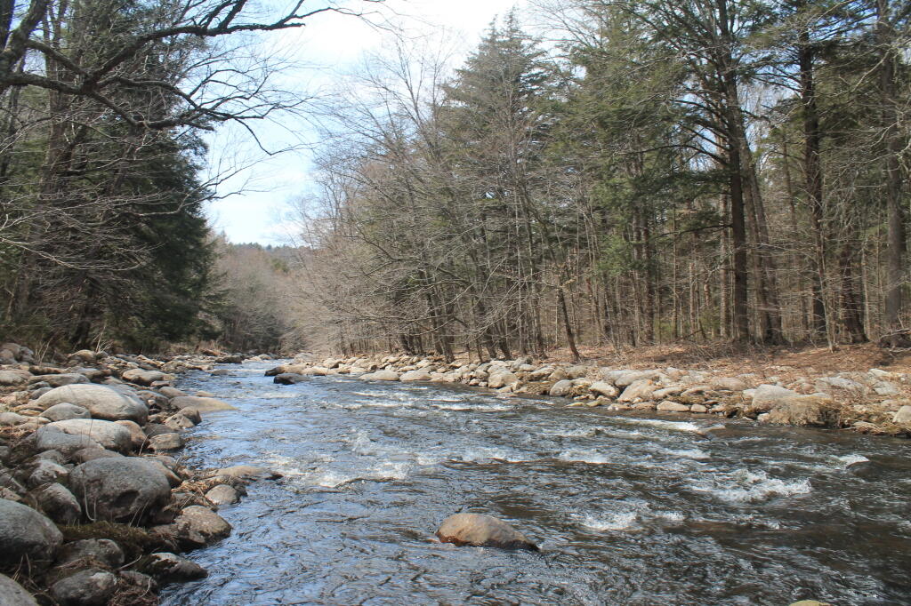
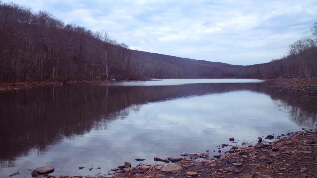
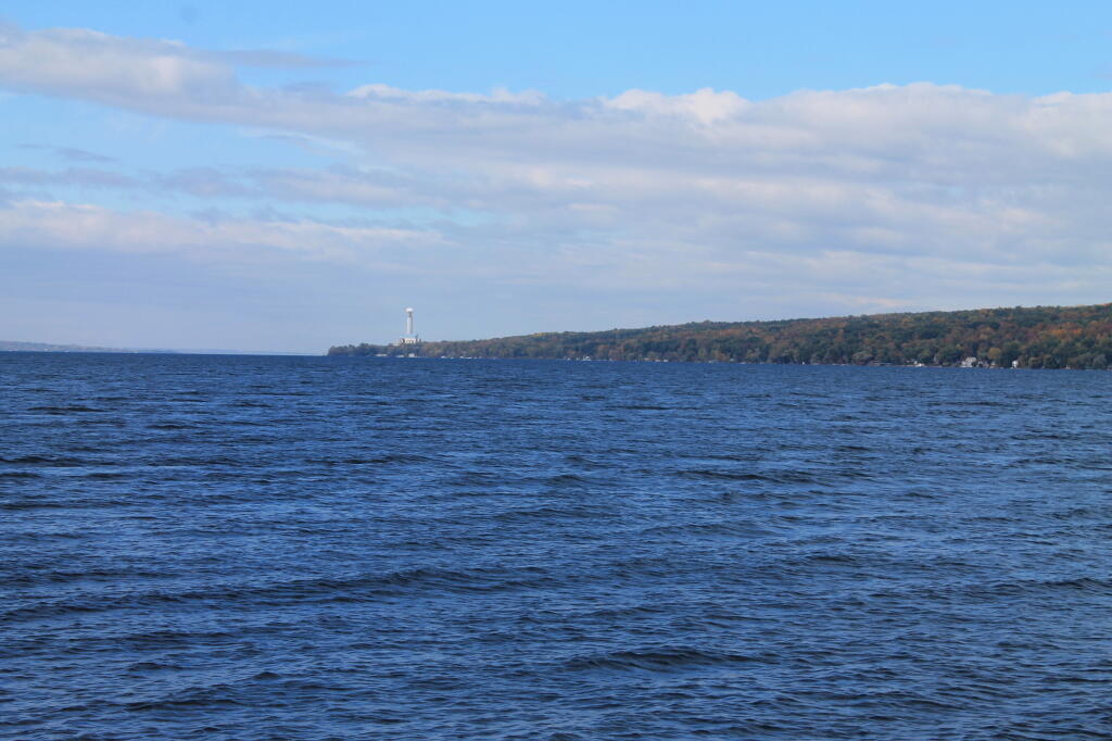
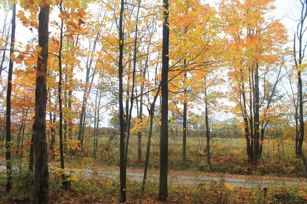
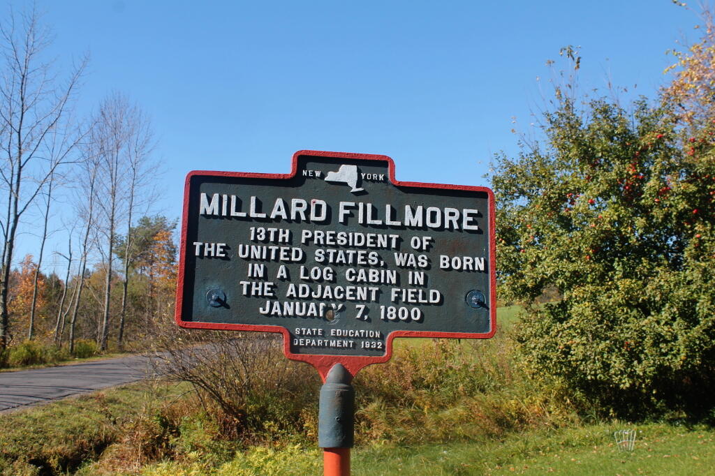
Roscoe NY is Famous for Trout Fishing but it could also be noted for it’s true scenic beauty. Now I phone in love with the beauty of the Appalachian mountains, how they tower over the land, but I tell you the area around Roscoe really pretty.

These mountains may not be the size of the Adirondacks, but their rounded tops surround the hollows so beautifully.

Stopped at the famous Roscoe dinner for a bit, got some coffee  and hopped on the Quickway for Hancock and ultimately Pennsylvania. Stopped at the Rest Stop/Text Stop where there was good 3G service and checked much email and social media.

Thought About Heading Down to Scranton to a sporting goods store to pick up a replacement camp chair and more ammo.  Figured ammo would be cheaper in Pennsylvania and a sporting goods store eould have more choices in 20 gauge shot then a Wal-Mart.

Checked out the GPS but saw there was no big sporting goods stores nearby. Decided to f-it and head to Wellsboro PA figuring I could just stop at Mansfield Wal-Mart along the way, get a camp chair and hopefully some ammunition.

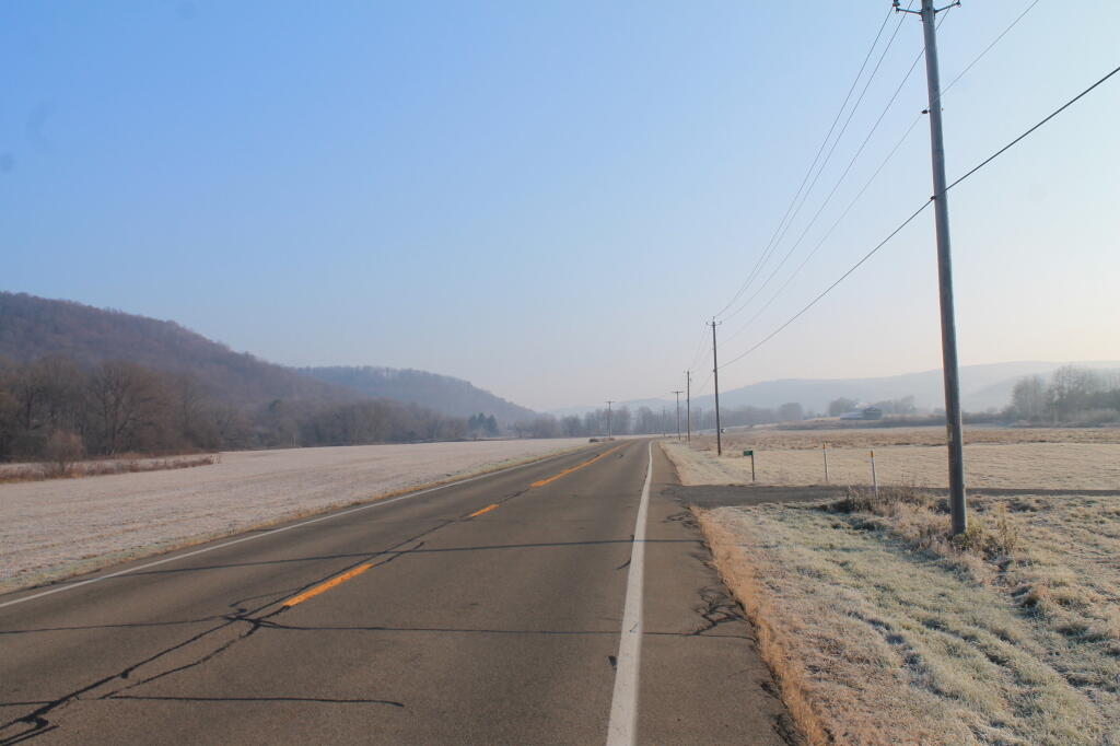
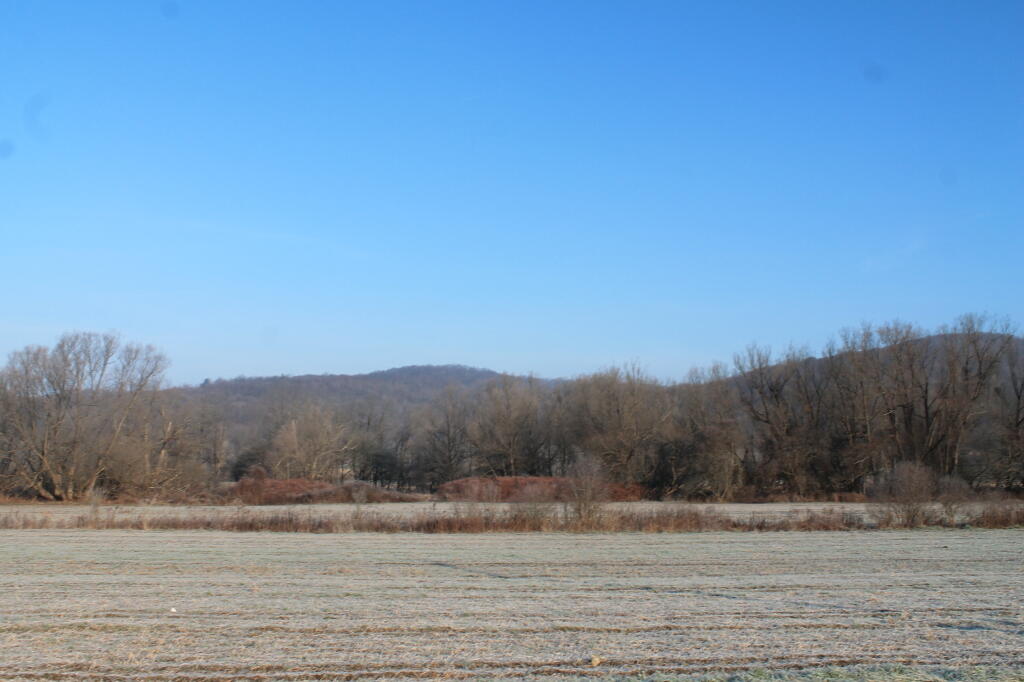
Typed into Google Maps to take me to Wellsboro avoiding highways. Took me through some real wild country — not a lot of big farms — a lot of cabins, camps and rundown houses.

Before crossing into Pennsylvania I took County Route Old 17 and enjoyed some scenic vistas, stopping for a while to Instagram. Crossed over to PA and ended up on some real backroads, some twister and slower then I would like.

People Burn Everything in Pennsyltucky. I would not hestitate to say at least 90% of households in rural PA have trash burning barrels and most folks burn their garbage, plastic and all.

Funny to think that when burning barrels have been illegal in New York for 5 years and relatively uncommon and disfavored for 10 years except in the most rural parts of the state.

People in Pennsyltucky also heat with wood and outdoor wood boilers have big piles of brush and generally smoky in the hollows this time of year. For a firebug like me, this seems so liberating compared to the up-tight open burning laws in New York.

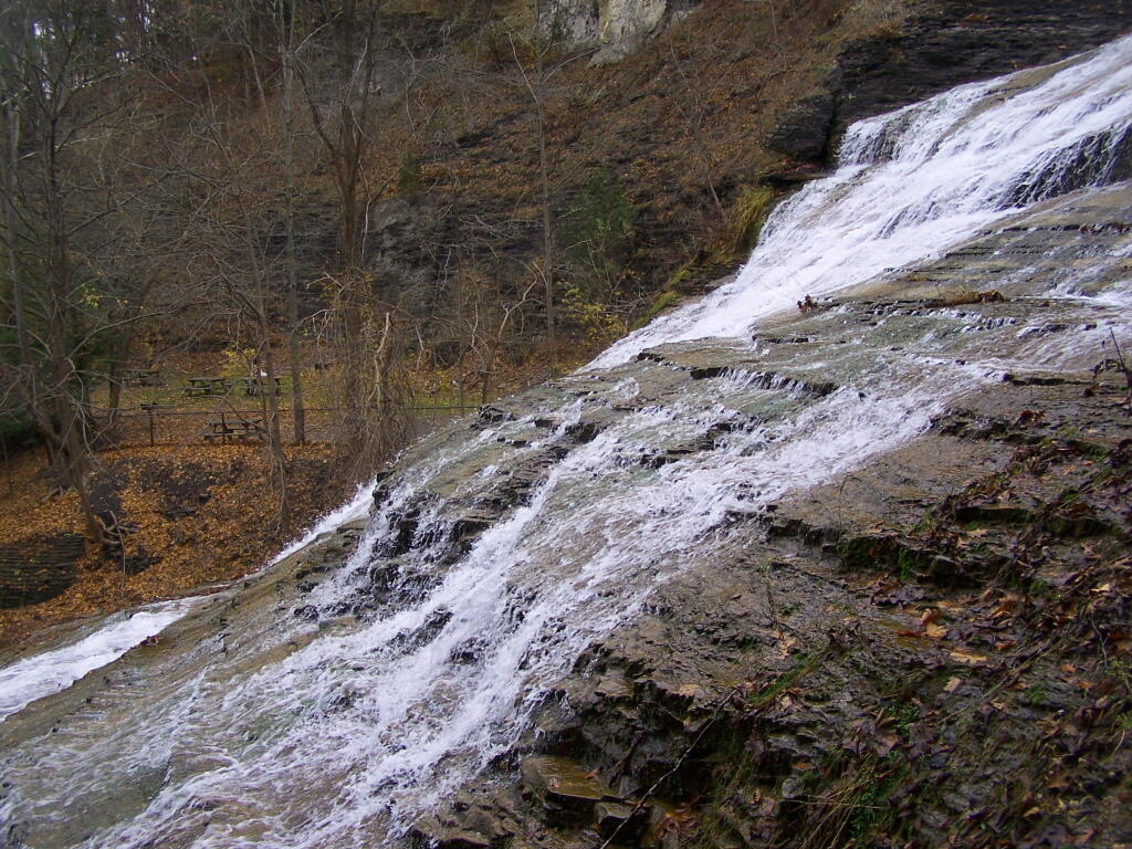
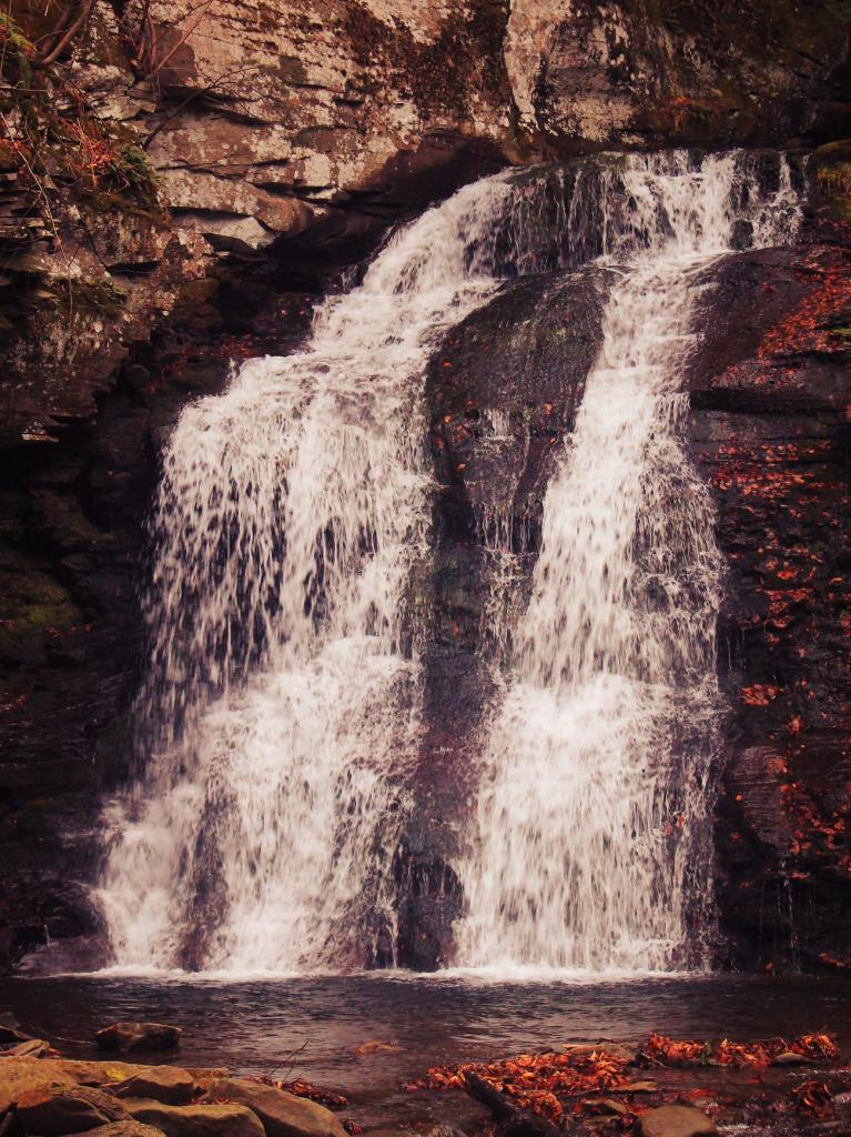
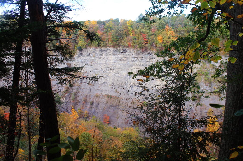
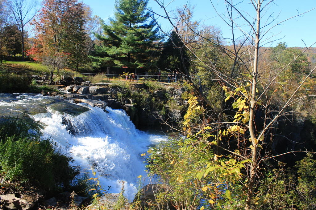
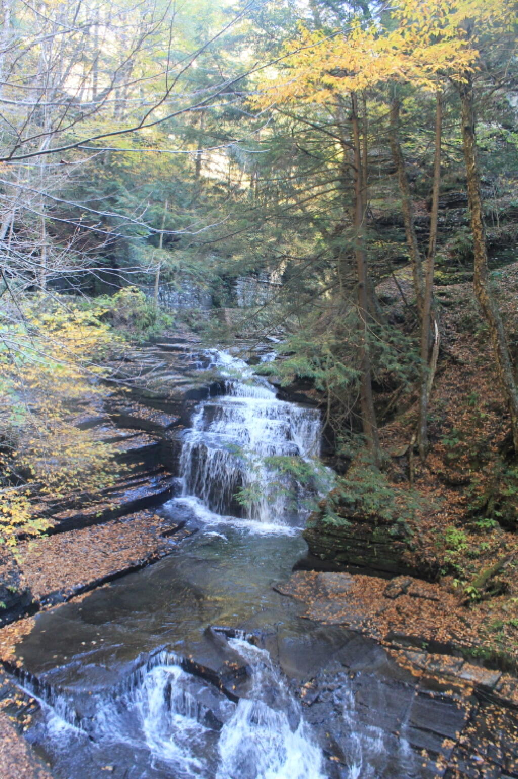
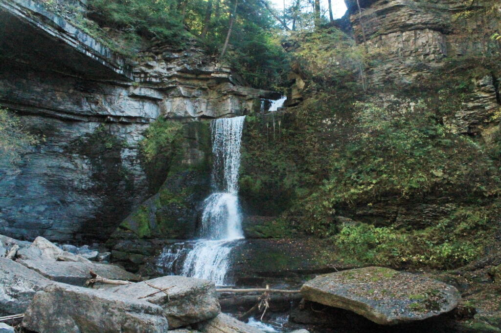
Stopped at the Saint Marie Overlook. It was pretty as usual.  Took some more Instagram photos.

The More Digits in a Pennsylvania Highway the narrower and twister the road is. The main line one digit roads are as good as any in New York. Most 2 digit roads aren’t bad but when you get on the three digits, the roads are little more then blacktopped cow paths.

The shoulders are non-existent with guard rails extending right up to shoulders. To make things worst, PA uses rumble strips extensively so as you hit them if you try to stay away from the guard rails when driving.

Four digit roads are supposed to be analogous to county roads but as far as I can tell their maintained like town roads in New York.

Fracking Towns seem to have slowed down a lot since the initial craziness when the fracking boom was well underway.

Montrose was still dusty and Main Street was under heavy construction when I drove by. Saw a convoy of trucks hauling water and sand to a fracking site, but certainly not bumper to bumper.

Tonawanda, the city where they send reporters to cover fracking still had the new motels and the oil and gas businesses but it was still quiet compared to 2010. Some signs of oil wealth in the form of big jacked-up diesel pickups but thats not shocking for rural America but for the most part you didn’t see tons of oil wealth.

Ended Up Going to the Mansfield Wal-Mart to get a new camp chair and ammunition. A fairly big Wal-Mart, it had something unknown to a New Yorkers — lots of guns. Wal-Mart in more rural parts of New York will have a small revolving case of long guns plus air guns on the shelf.

But at least in rural Mansfield, they not only have several large cabinets with rifles and shotguns, they prominently feature modern sporting rifles aka AR-15s or as anti-gun politicians like to call them, assault rifles. They have a $500, $750, and $1000 models with things like fancier scopes.

They also sell handguns at Wal-Mart after a PA  resident passes the standard instant NICS check like any gun, which seems so strange to New York where you have to go through the whole Sullivan Act pistol permit system. Handguns aren’t super accurate or dangerous compared to long-guns but New York treats them special as they are concealable. Still its great Pennsylvania residents have this freedom to keep and bear arms.

Left with a lawn chair and a 100 round brick of 20 gauge #7 birdshot for $24.50. Still need nore #6 for rabbit and squirrel hunting but the birdshot is cheap for plinking with the shotgun.

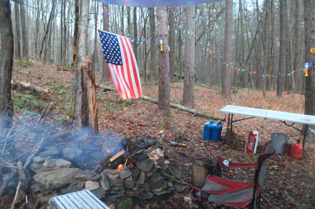
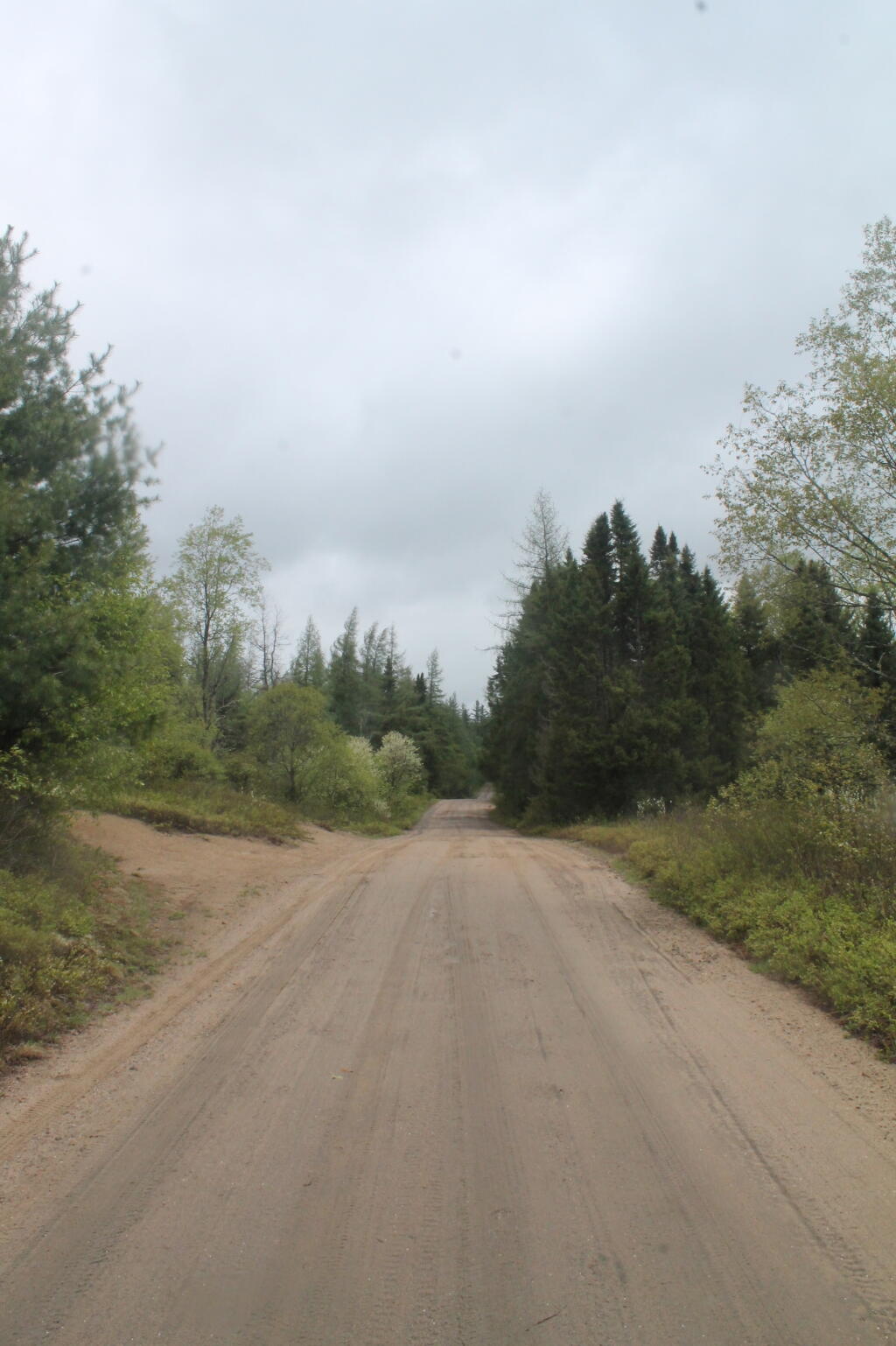
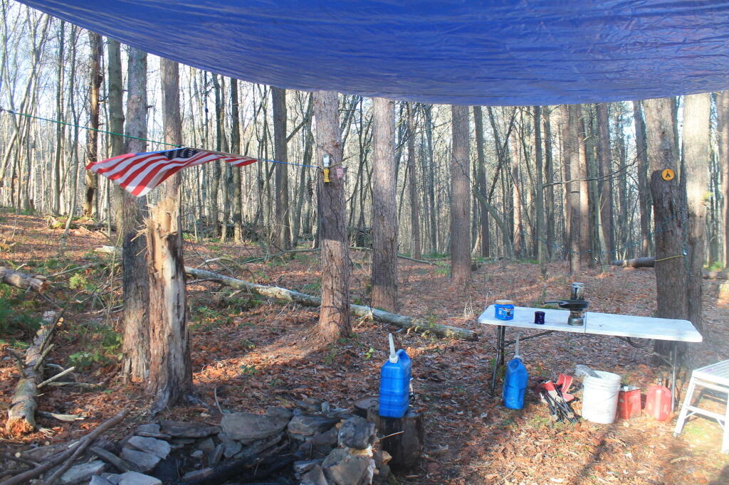
Camped at Asaph Run Camping Area in Asaph. Driving through the hamlet, saw a place selling firewood, so I picked up some wood for $5. The Asaph Run primative campsite is $10 night but it gives you a fire ring, picnic table and a pit privy. I had the

Lights Seemed to Work Bettet but still problematic like the previous night.  Due to the chilly wind and trouble keeping the lights and radio on, I retired to bed by 8 pm, listening to podcasts into the night.

Spring 2014 Camping Plans

Typically the first spring weekend is the earliest time in shoulder season for roadside camping in this part of the country. Often by that weekend, many of the back-roads are relatively free of snow that in drier locations, roadside camping is possible.

Shoulder-season camping can be somewhat tricky as snow and mud stays a long time in the back woods of the mountains, and it’s usually still fairly cold and the days are still relatively short, however it can be done if due care is well planned.

Downstream

Early April – Wilcox Lake Wild Forest

My first camping trip of the year will probably be a weekend trip up to Wilcox Lake Wild Forest. Depending on the snow and mud conditions, I may camp off of NY Route 8 or possibly Hope Falls Road. I’d rather do Hope Falls road and maybe hike along Stony Creek, but I am not sure if it’s possible that early in the year. NY 8 is nice except for all the noise pollution from traffic.

Might do some hiking back to one of the lakes or trails in the region that I haven’t done lately. Might try some trout fishing up in the East Branch of the Sacandaga River.

Falls

Late April – Finger Lakes National Forest

The first big trip I plan to take is the Finger Lakes National Forest. I am thinking of taking off a Thursday and Friday, and doing a three night trip out there. It’s a bit of  a drive out there, but the Finger Lakes are pretty, and by late April should be greening up. I enjoy seeing the open and wild farm country out there. Probably visit some of the state parks out there. I don’t have an Empire Pass this year, but I suspect most state parks won’t be charging on a Thursday or Friday in April. I might dip down to Pennsylvania for a bit on the return trip.

Very Soggy Riding

Early May – Vanderwhacker Wild Forest

Assuming the snow is gone relatively early and the ground is relatively dry, I may go up to Vanderwhacker Wild Forest and camp along Moose Club Way or North Club Road. Those roads can be soft in the spring time, but a lot depends on the weather. There always is the campsites along NY 28N as another option.

 Cold Afternoon on Mary Smith Hill

Mid-May – Mary Jane Hill and Western Catskills

I want to spend more time in Western Catskills this year. While it’s a bit of a drive, now that I know about a few of the roadside campsites up that way, I have a place to base my camp out. I only have a preliminary idea of what is back there from the two nights I spent out there on Veterans Day Weekend. There looks to be a lot of interesting and unexplored land out there.

It’s a bit of drive down there, but mileage wise, it isn’t awful. It might be a relatively quick drive if I take the Thruway to NY 28 then go straight across to NY 30. I also want to check out Tomannex State Forest in Hancock  I heard a rumor on the Internet that there is some nice roadside camping along the East Branch of the Delaware River down there, not to mention good fishing opportunities.

A Break in the Rain?

Memorial Day Weekend – Moose River Plains

Memorial Day Weekend I always like do something fun where I am way back in the woods. Maybe Moose River Plains. That said this year, I will not be going up there if most of the weekend is for cold pouring rain or snow. I did that last year, and it was miserable. I may have told myself repeatably that camping out in the rain was more fun then being stuck back in the city, but I was pretty much lying to myself.

Bingo Brook Road

Early June – Southern Green Mountains

The Southern Green Mountains are always nice to visit. The Deerfield River is pretty and there are some nice truck trails and hikes up in the area. Maybe hike Mount Greylock then drive north and camp on one of the forest roads not too far back from VT 9. Always fun to visit Vermont and spend time in other states.

Hanging Out at Camp

Mid-June – Brookfield, Central NY

I am usually on-call for several weeks in June, so I need to be somewhere where I have cellphone service. I have good cellphone service at Charles Baker State Forest. Maybe do some paddling and fishing on one of the creeks or ponds around there. The Rogers Environmental Education Center is always delightful in the early spring.

A list of trip ideas I have for the months of April, May, and June as we move from shoulder season to spring to summer. Also known as the first 1,500 miles.

Lift Kits and Being White Trash

Friday I took off from work as a Personal Day. I have never taken an actual personal day for personal reasons from work in the 6-years I’ve worked for my company, despite them offering the time. I have taken personal time in the past, but usually it’s just another day for a long-weekend road trip to somewheres exotic – and not a bona-fide personal reason.

I had a list of things of things I wanted to get done that day, like a hair cut, getting my camera repaired, and grocery shopping. But it mostly ended up being a day when I slept in and didn’t do much besides go and talk to a couple of shops about getting my truck jacked up.

 What I’m Leaning Towards

After thinking about it for a quite a bit, I am leaning towards going with 35s, a BDS-six inch lift, and 4.88 gearing. The shop said it would probably come out to between $5-6k, but I am not sure if that includes the re-gearing. A lot of money, but so be it – I’ve been saving my money, and my truck is my toy.


white_silverado

My top priorities for the lift kit is getting a truck that looks quite nice, has better ground-clearance especially in the snow, doesn’t break-down way out in the woods, doesn’t drink dramatically more fuel, and is economical to maintain. Those might be a tough combination with a lift-kit, but if I stay at 6-inches with the lift kit, get a good brand kit with necessary accessories, re-gear to avoid straining the transmission, and only put 35s on it, I should be okay. I’d rather spend the money now, rather get broke down somewheres in the boondocks and spending a lot of money for front-end repairs.

In my ideal world, I would love to do 37s and 6 inch lift plus a 3” body lift. But alas, money is no object, and indeed, I am afraid of the damage I would do the front end and the drive-shafts, putting so much weight and load on them. I’ve researched doing that on the interwebs, but and it might be a fun project if the truck was retired to be a mud-toy around the farm, but not when it’s something I’m taking on long-trips in the back country. Instead, I’d rather spend money a quality lift-kit that doesn’t put CV boots at a bad angle by replacing proper components, which I would have take somewhere to get fixed.

4.88 gearing with the 35s is a bit lower then a stock gears, but it will give me more power on the hills, and make crawling easier. I’ve always though the factory gearing was a bit high. From what I’ve read, it also won’t hurt gas mileage much compared to a higher gearing, e.g. 4.56s. It also leaves open the possibility of going to 37s when the 35s wear out and need to be replaced eventually, without regearing, if I am willing to sacrifice some power (e.g. 4.88s on 37s are about the factory gear ratio).

At any rate, the local shop seemed to think I could do that. I think it would make my truck look a lot more muscular, and give me a lot more ground-clearance in the snow and getting in and out of campsites, and on rough roads. It will be fun in April, once my truck jacked up, and I’m on my first road trip again with the higher vantage points and better views. If I want to go higher, I will think about the body lift later on.

muller_white_1500-004

Now the White Trash Part

So after I was looking at jacking up my truck, I had to swing by the Salvation Army to look for a new sports-coat. I was disappointed that I couldn’t find one, because the one I currently wear that after 7 years is wearing out. I only wear a sportscoat to work about 100 days a year, and a such, they tend to last. I really didn’t want to spend a fortunate, but I wanted to look good. I guess I will be stuck going to JC Penny or another large chain store to get a new sportscoat.

It really felt kind of guilty shopping at the thrift shop, looking for clothes for work, after looking at those expensive lift kits. But heck, it’s helping charity, and whatever – if it looks nice – who cares if I spent $30 or $70 on the jacket. But it sure seemed trashy going there, after drooling over off-road equipment at the off-road stores.

Then I had stop by the Freihofer’s Outlet store in Schenetady to stock up on bake goods and cookies. They tasted pretty awesome too. But it just seemed so trashy and tacky to be going to a discount bake goods place, after spending so much time looking at lift kits.

Note: Sample pictures used in this article are from OK 4WD’s Online Garage, which shows the quality work they do in Northwestern New Jersey. I didn’t ask permission to use the photos, and if they really object, please email me. They look like they do nice work, and I lived near them, would definately talk to their shop.

An afternoon spent visiting a 4x4 shop, then buying cheap pastries and shopping at a thrift store. It's called priorities.

Weekend at Bear Springs Mountain, Delaware Wild Forest, Warren Highlands

Based on the forecast for the long weekend, I decided to head down to the Western Catskills rather then Moose River Plains. It certainly was a bit sunnier, drier, and less snowy then it looks like they got up at Moose Plains. I simply did not another Memorial Day Weekend at Moose Plains, sitting in rain and snow showers.

I ended up heading down to the Western Catskills. Didn’t leave home until after 10 AM, because I was putzing around. So be it. I also had to stop at Walmart to buy another blaze orange hat, for hiking, because I lost mine. I knew it would be hunting season down there, and figured better safe then sorry. The previous night, they didn’t have one at Glenmont Walmart, so had to visit the Decided to head out the Warren Anderson Expressway (I-88) down to NY 10, and take that all the way south to Walton.

Fire Tower

Driving down NY 10, as soon as I reached Summit, you could see a dusting of snow on the summits around. Stopped in Stamford, drove up to Mount Utsaythana. There was a dusting of snow there too, in parts it looked like a winter wonderland. Then it was down to Walton, following NY 10 and the East Branch of Delaware River. Drove through Delhi, a small rural college town. I had been through Delhi years ago, meandering around Stamford, but not in years. Then I went down to Walton, climbed an enormous hill in the truck, and was at the Bear Spring Mountain Wildlife Management Area (aka Public Hunting Grounds).

At Bear Spring Mountain WMA there is a state DEC campground known as Bear Spring Mountain Campground. It consists of two parts, a fully developed campground with hot showers that is open during the summer months near Launt Pond, and the Spring Brook area with stud pends and a pit privy, similar to Charles Baker State Forest. Both areas are a $18 a night in summer, but from October to the end of hunting season, the lower area is free, but the water is shut-off down there. The designated campsites there are crunched together, and there is no privacy, so I can’t imagine it’s much fun camping there, especially with the smell of horses on a hot summer’s afternoon.

By the time I got down there, it was fairly early, so decided to explore a bit. Drove up to Corbett, explored the Corbett Suspension Bridge, and an old chimney from the “acid factory”, which made an acid from tree bark for smokelesss gunpowder. Decided to head back and explore Bear Spring Mountain WMA a bit more, and drove up West Trout Brook Road, past several hunters. There are some limited views from end of East Trout Brook Road, namely at the summit Bear Spring Mountain. There are better views from NY 206, climbing up from Walton, but with few view points. Also explored Beers Brook Road, which had some limited but nice views into the valley below, and Russ Gray Pond.

Bridge Tower

Bear Spring WMA, being a federally-funded public hunting grounds, does not allow camping. The only camping there is those tiny, smashed together developed campgrounds known as the Bear Spring State Campground, operated by the DEC. I decided it was getting late, and I would camp there tonight, especially because it looked like one of campers had packed up, and the only other person around, was a female bow hunter, on far end of the campground. I wasn’t thrilled, as it meant I would have to keep the music down, but at least the campground was deep in the valley, protected from the wind.

It wasn’t a bad night though. The pit privies were kind of gross, but probably not worst then most of the outhouses in the woods. There was surprisingly a lot of wood in woods near the campground. The truck worked well with keeping the lights on, since switching the truck’s radio back to the starting battery and evenly discharging both batteries. The radio shuts off automatically when the starting battery is starting to get a bit low, and Big Red’s DIC says “Battery Low: Start Engine Low”. Previously, with the starting battery at full charge, hooked up to the discharged auxiliary battery, the alternator wouldn’t kick up to full charge, so the auxiliary battery would fail to get fully charged. Now, with the starting battery slightly discharged – but with enough charge to crank the engine, things kept working well all night long. There was a little bit of sleet in the evening, but nothing major.

Russ Grey Pond

The next morning, I got a slow start. It was drizzling, and I kind of slept in. I didn’t have a tarp set up, which didn’t help. I probably didn’t break camp until 10:30 AM..I was thinking of hiking the NYC DEP trail that overlooks the Pepacton Reservoir, but I ended up turning off onto Holiday Brook Road, and deciding to check out Huggins Lake. Hugging Lake was a nice hike back, following an old woods road back there. There is a campsite down by the lake. Apparently on the ridge above Huggins Lake, there is an old growth forest, but I never got back there.

Then it was off to Mary Smith Road. On Campground Road, one of the cut-over roads, I got to a cover bridge, which had a clearance of 6’6”, which is about an inch too low for my pickup truck with the cap and racks on. So I had to turn around, and back track for about 5 miles. That sucked. Stopped and grabed a few pictures. When I got on Mary Smith Road, and back in forest preserve, I was pleasantly surprised to find three roadside campsites on it. I ended up camping at the most used of the sites – as witnessed by vegetation – along the Finger Lakes Trail/Mary Smith Trail/Middle Mountain Trail. It was a pretty nice roadside campsite.

About as soon as I scoped out the campsite, I realized it would be a pretty night up there. Despite the mountains on both sides, the north wind was whipping along the col. But I liked the campsite, and there was plenty of trees to hang a tarp up. I starting setting up camp at 2:30 PM – which was kind of early – but I figured it was too late to hike Mary Smith Hill (which wasn’t true), but it did start to rain/sleet a bit. Got the tarp up, then the lights strung up and flag up. A heavy sleet squall pounded the col, for a while bad enough I hid out in the cab of the truck. Then I went out, built a fire, and spent sometime listening to a podcast and reading a book about the 1964 World Fair in New York.

The new 60-watt equivalent LED bulb I bought worked real well in the cold, which got down below freezing that night.. But with the bulb focused on the book, it was easy reading and plenty bright. In the cold, the 60-watt equivalent LED bulb was actually brighter then the 100-watt florescent bulb I had at camp, even after fully warming up, because the cold wind made it impossible for the florescent tube to get warm enough to fully atomize the mercury in the fixture.

At times the wind picked up, and it was pretty darn cold, to say the least. I end up putting the fire out cold before bed, to reduce the risk of the fire spreading, and because the tarp partially covered the fire pit, I was afraid it could fall into the fire, and possibly set the truck on fire or cause dripping plastic to fall on it. The fire was out cold, and I went to bed around 10:30 PM. No nightmares.

Mary Smith Hill Roadside Campsite 1

After bedding down, the wind started to whip around. It literally was howling, and the tarp was snapping up and down, making quite a bit of noise. Morning came, and it was beautiful blue skies, but very cold. That was when I first saw car actually pass by on Mary Smith Hill Road – despite being a through-road, and not a super remote road at that. Had another slow breakfast, and built a small fire to burn up some camp garbage. Usually I don’t start fires in the morning, but I was chilly, and knowing that it may be a while until I got out camping again, I wanted to have a fire.

Once I finally got going, I hiked up Mary Smith Hill to the overlook. It really was a lot less further then I expected, and ha+d some interesting views to the north. Nothing totally breathtaking, but still an interesting short hike of maybe 20 minutes each way. Then I drove over to Russell Brook Falls, making a wrong turn and ending up going through Livingston Manor and the world famous fly fishing town, Roscoe. My impression of Roscoe, was it was a very a long and pokey 30 MPH zone, but with more stores then one would expect in such a rural, small town. I probably should have stopped, but I was burning daylight.

Finally made it to Morton Hill Road, and passed a Game Warden in a unmarked green suburbanite-style Jeep. The only reason I know that, was I saw him outside of the car talking to somebody in full uniform. Morton Hill Road climbs a lot from Roscoe out to where it hits Russell Brook Road. There are three campsites along Russell Brook Road, although in all of them there is a boulder barrier between the campsite and fire pit. One might still be able to use them for a pickup with a camper on them, I guess.

Russell Brook Falls 2

I hiked back to Russell Brook Falls – a beautiful but relatively unknown set of falls – at least to non-regulars to that part of state. They are less then quarter mile from the Russell Brook Falls parking area. I stopped and grabbed some pictures. Then, it’s easy hike back to back to Trout Pond, following a gated road 9/10th of a mile from the parking area. There is a slight incline on the road, but nothing to make one break a sweat, even a fat out of shape dude like me, who spends too much time sipping cold buds in the woods. The road is a designated route for people with disabilities – somebody very strong with a wheel chair could theoretically get back there, or maybe with a CP-4 disabled with an ATV permit.

Back at Trout Pond, there is a campsite on the easterly end, and the gated road continues to the west end of lake. On the west end of the lake, there are two other campsites, spaced a ¼ mile apart, along with two lean-tos. All are designed for those with disabilities. There is also a trout spawning shelter on one of the creeks leading into lake. One of the lean-tos was well equipped – somebody left behind some nice pots and pans, all cleaned up, and a selection of perfectly good adult beverages and soda along the back wall of the lean-to. Talk about paying it forward to the next person who will use that lean-to – most certainly a hunter this time of year.

It’s small game hunting season, heard several small game bullets ring out, while hiking back there. No hunters nearby, as far as I could see, but I did wear plenty of blaze orange. I am sure next week, there will be a lot more hunters back there. Wish them luck. Hiked back to my truck and explored Campbell Mountain Road and Campbell Brook Road, looking for additional roadside campsites, preferably the kind you can back a pickup all the way back to. No such luck. Oh, well.

Trout Pond

Then I drove down NY 30, through the hamlet of Harvard, then East Branch. Took Old Route 17 to Hancock, then poked around the Poconos and the Warren Highlands in Pennsyltucky, before eventually ending up in Susquehanna and Great Bend. The area around Hancock is very mountainous and beautiful. The Warren Highlands were rough, mostly hunting and rural landscape country, with a relatively small amount of farming going on. Lots of open burning going on too – I love Pennsylvania..

I love that wild country, and everything Pennsylvania. Fueled up, picked up certain Pennsylvania products not legal in New York and/or cheaper then New York, then hopped on I-88/Warren Anderson Expressway, and made a bee-line back to Delmar, stopping only momentarily at the rest stop on I-88. That place was creepy as all hell after dark, and not well lit either. I seriously thought of just taking a piss in some farm

I made it back to Delmar around 7 PM. It was a good adventure. Burned through more gasoline, then I had planned, although on the trip back along I-88, I average 19.9 mpg in my Big Red Silverado pickup, so not complaining.

A long-weekend trip in early November to explore the the Western Catskills.

Gorging on Gorges, An Adventure, Day 2

I awoke for Day 2 of Gorging on Gorges, and it was a fairly warm morning, at least for the day before Columbus Day, in the back country of the Finger Lakes National Forest. I decided I wanted a full breakfast this morning, so I got some sausage frying up, the coffee peculator doing its thing, then scrambled some eggs with mushrooms and sweet peppers. It was a good breakfast. Packed up my gear, folded the flag, headed out on Potamac Road, and stopped grab a few pictures of the pastures along the road.

Potamac Road 2

Driving along all these back-country roads, I was amazed during most of my trip in New York State, on how many anti-SAFE Act signs there were in front of houses and farms along the way. If there ever was an issue that galvinized the backwoods of Upstate NY, it has to be that stupid gun law. I would reminded of the opposition to the SAFE Act all week, until I finally crossed into Pennsylvania state-line – the last SAFE Act sign ended a ¼ mile before I left the state. I bet you that poor dairy farmer, was awful pissed to live on the wrong side of an imaginary line, so they had to be subjected to stupid laws, high taxes, and anti-farm regulations.

Across the Gorge

Drove down to Trumansburg and then to Taughannock Falls State Park’s Gorge Overlook. The main overlook, next to the parking lot was a complete tourist trap, with dozens of tourists, many obviously traveling a long ways to get there, crowded around the overlook deck, as everyone – myself included – scrambled to get that one trademark photo of the falls. I was glad to get away from that overlook.

Started along the North Rim trail along the gorge. I was looking for secret places to find isolated, beautiful views of fall, and the hike did not disappoint. I found one perfectly shrouded in colorful fall leaves, but with a view of falls. I snapped a picture. I continued along, and found some good views in the gorge, showing the depth and width it below the falls. Then I ran into Robin Smith and his wife – Twitter and Facebook friend. Chatted for five minutes, then I proceeded on.

A Secret Spot for Observing the Falls

In part, I was in a bit of a rush, trying to find a place to take a piss. All that coffee plus maybe an eye-opener drink wasn’t great for the bladder. There also were a few to many people around to do it right on trail, especially being so close to the road most of way. But eventually I did it, and was on my way.

The North Rim trail runs into the Black Diamond Trail, which crosses an old railroad bridge, converted to a hiking trail via some concrete slaps and fence placed on it. The high, old railroad trestle provides views of a smaller, upper waterfalls and the little known, but quite impressive upper gorge. The upper gorge, above the falls, is a deep, narrow, but beautiful gorge where the Taughannock Creek runs, cutting deep into the valley. For the best views, you have to take the South Rim trail, which is what I took next.

Upper Gorge

The South Rim trail is impressive. There is the big parking lot from the Gorge Overlook on Taughannock Road, or you can alternatively take Gorge Road, and halfway down it, park in the smallish pull-off. Don’t miss it though. If you follow the South Rim Trail, there are some views of the gorge below the falls, and one view of the gorge, extending out to Seneca Lake.

I hiked back to my pickup truck, and then drove down to the main part of Taughannock Falls State Park. I parked in main portion of the park, rather then the always crowded and tight to park in lot next to the trail to Gorge Trail, which runs inside the gorge to below the falls. Not wanting my truck damaged by an overly excited tourist, I figured it’s always safer to park in an empty lot. Walked down to Seneca Lake, and noticed how green the trees were still on the lake shore. This contrasts to sections of US 20, the previous day, where the colors were burnt out to say the least. I was also surprised to see the AES Cayuga in Lansing, across the lake, burning coal today. They must keep in standby for when the line frequency drops to low locally. Stopped in the bathrooms at Taughannock Falls State Park, which were just very gross – clean, but rusty and in old shape – like so many state facilities.

AES Cayuga Coal Plant in Lansing

Then I hiked along the gorge trail to the fall, taking several moments to stop and take photos, and explore the river bed. I had previously been here, in mid-July, but it certainly was different now that fall was in full swing. The trail was popular, and in some places, downright crowded, but the riverbed, at least as far as one could hike, wasn’t nearly as crowded. The gorge walls were pretty with the fall leaves, although by the time I got the falls, the sun was right over the top of the waterfalls, so most of the pictures of the falls came out pretty poorly.

The Falls From Below

Headed back to the truck, then drove down to Ithaca. The traffic was as awful as always in that city. I had stop at the pharmacy, then it was off to Buttermilk Falls State Park. I was surprised they were still charging – the last day must be Columbus Day. By now, it was too late to keep Robert Treman State Park on my list; that will have to wait until tomorrow. This time, I intentionally hiked up the North Rim trail, up to West King Road, then down into the gorge. Last November, I hiked up the gorge, so I figured it would be interesting to go the other way this time.

North Rim Trail

Hiking down Buttermilk Falls was scenic, but not as a scenic as I remember it. Maybe after all this time hiking in gorges and exploring the gorges, they also start to look a bit alike – and we are only day two. It’s more scenic then most of other glens, besides Enfield Glen and Watkins Glen, but it’s still a step below them. The gorge swimming pool at the bottom of the gorge it was nice.

 An Autumn Afternoon at the Falls

It was a good hike, until descending the slippery stairs, I slipped, and dropped my camera, and it fell like 20 feet, hitting a dozen of the stone stairs before coming to a rest. The fall did some serious damage to the camera, as one might expect. The protective UV filter was shattered, the case was cracked up the lens. I was not pleased, to say the least. There may have been a few cuss words. But so be it. The camera was under a drop warranty that I bought when I got it, but I was more worried that the fall would damage the camera, so I would be out of luck for taking more pictures for the rest of the trip.

I might have been pissed at myself for my careless handling and missteps, for a little while, cussed myself out. I was less pissed when I discovered the lens wasn’t destroyed, only the $5 UV filter. The camera seemed to continue to work well, although the flash doesn’t always pop up – a feature I almost never use at any rate. The camera seemed to work okay, and I picked up a second UV filter at Walmart later in the evening. Later in the week, I noticed the automatic focus was sticking – fortunately I have a drop warranty on the lens too. One of these days, I will get around to sending the camera back to the factory for warranty repairs or replacement.

Nice Little Falls

Once I got over the shock, anger, and amusement of smashing up my camera, and got the shattered UV filter off the camera – it took a little fiddling, as the impact of the fall bent the ring – I enjoyed the remaining hike and vistas of falls. Snapped several other quite nice pictures. Went to Walmart to pick up a few supplies, then back to Finger Lakes National Forest, for another evening at camp.

When I drove up to the campsites on Chicken Coop Road, I was pleasantly surprised to find out the campsite I like was vacant. Whoever was the night before packed up, and there was no mess left over. Hung the flag up, set up the table, hung lights up, and gathered wood. Started a campfire, cracked open a beer, had soup and sandwitches for dinner. The colors in the woods were about peak here. Around 6:15 PM, walked across the road, to take a closer look at the cows grazing in the pasture.

Pasture View from Campsite

I stayed up until 8:15 PM, when it started to sprinkle, and quickly turned to a heavier rain, and decided it was time to seek shelter under the truck cap. Again a bit annoyed about the rain, and my stupidity about not setting up a tarp earlier in the evening. I listened to the radio for a bit, played on my cellphone, and retired for the night. The good news was that by morning, the rain would have passed, although the skies would be cloudy, damp, and the temperature only around 47 degrees.

Gorging on Gorges, An Adventure, Day 1

About a month ago, I took a trip I gave the name “Gorging on Gorges”. As the name would suggest, most of the trip involved visiting various gorges, taking photographs of them, and otherwise exploring them. About half of them I had previously been to, while the rest were new. I also visited several other state parks, state forests, and national forests – and did something I haven’t done in a long time – camped one night in a developed campground.

Towards the Park

I started out my trip from Albany, taking US Route 20 West from I-88. I really wanted to avoid expressways for the bulk of my trip, is my general view is that expressways are the best way to get across America without really seeing anything. It’s more then a philosophical argument for me – what’s the purpose of a vacation if your rushing from point “A” to point “B”.

The first part of the trip, I drove to Chittenango Falls State Park via Nelson and beautiful farm country so high above. I walked down into the gorge, and up and around the falls. The color was somewhat muted, but it still was quite pretty. Then I headed off, taking some side roads as recommended by my GPS’s most direct route, and ended up passing a few miles from Labrador Hollow and the beautiful Labrador Pond, and said, heck, I got to stop on by there.

I drove down to Labrador Pond parking area, and hiked down to the pond. The colors were still not fully-turned on Jones Hill, but on Labrador Mountain were well past peak. Despite the crowds of fall foliage peepers from Syracuse, crowding the area, there were adequate opportunities for solitude. I walked down to the lake, snapped a few photos, then hiked the nature trail/boardwalk. It was nice. It also was great to see the boardwalk being used by a disabled man – he could get out and enjoy nature, despite his difficulties he had walking. One of the large dairies in the area was spreading something on fields nearby, and it sure stunk – it seemed nastier then fermented grain, although that’s probably what it was. Didn’t stick around too long, as I had places to go.

Somewhat Faded Colors

Drove down through Prebles, another deep, rich agricultural valley, dotted by large dairies that take advantage of the area’s rich soils for producing many bushels of corn on each acre. Got held up for about 5 minutes during a paving job, where they had the road restricted to one lane, for what had to been a half mile or so. Noticed how most of remaining trash burning barrels had disappeared from the landscape, that might have only been there 3 or 4 years ago.

Then it was off to Homer, where I passed a moose, made out of welded scrap metal along the road. It was kind of a neat roadside attraction, and I really should have stopped and got a picture, but I had a tight schedule and was burning daylight. I would come to later regret not getting that picture, but heck, I figure I can probably find a picture of it on the Internet using Google Images or Flickr. If not, it will certainly be there, the next time I find myself going through this roadside wilderness.

Millard Fillmore Historic Marker

I got lost on my way to Moravia. Not really lost, because I was following the GPS, but because I had programmed the “most direct route” rather then “fastest route”, the GPS.decided to take me up a rough dirt road through Hewitt State Forest. I declined, and eventually the GPS found a new route, that happened to take me past Milton Fillmore’s birthplace. There is now a picnic pavilion and a some landscaping in that location. I turned around, snapped a few pictures, and explored it briefly. I wanted to a get a picture for dad for his historical markers collection.

Then it was off to Fillmore Glen. I was running a bit late at this point, but it’s a pleasant drive down to Filmore. The landscape is pretty rural until you drop, rather quickly into Moravia. Moravia is a pretty, small rural town; the glen is located at far southernly end of the town. There was a bridge being replaced in town, and you had to wait, for what seemed like an eternity for the light to green on the on-one lane bridge.

Finally, I got to the park entrance. The older guy there, grumbled when I said I had an Empire Pass. He was like “where is it – I can’t see it”. The rear window on my truck where the Empire Pass is tinted, but not that dark. I was slightly annoyed that the park entrance guy wasn’t friendly, and I forgot to ask for a map. I was kind of rushing. Got parked, and there was a big wedding going on, complete with horse drawn carriage. Crossed the “Dry Creek” and started up the trail, first to the Cow Shed falls, then decided to take the Northern Rim Trail. It wasn’t apparent at first that it was the rim trail, but I didn’t have a map. I actually printed up a map, and had it my truck, but I of course forgot it.

Small Waterfall in Gorge

The Northern Rim climbs a fair bit, then runs along the rim, with very limited and occasional views. It crosses a pretty little creek that tumbles down the gorge, and eventually leads to a path down to the gorge trail, three-quarters the way up the gorge. I decided to hike down to the gorge trail, and then head back down the gorge towards the parking area. I missed a bit of the gorge trail, and the overlook, but so be it, time was tight.

The Gorge trail was scenic, but certainly not the most scenic of gorges. There were several small waterfalls, and some stairs and bridges, although most of the trail was gravel along the edge. The “Dry Creek” had plenty of water, but in general, the gorges was smaller then other Finger Lake gorges. There were several glens of interest, but the most beautiful portion of the glen was the Cow Sheds in the button of the gorge. Cow Sheds falls, are the wider portion of the gorge, where at one time, historically, cows would gather for shelter in severe or cold weather.

Cow Sheds Falls

Snapped a few more pictures of Fillmore Glen, and it was off to Ithaca. I made pretty good time to Ithaca, although I admit I certainly wasn’t poking along. I really should have stopped more places, but I wanted to get to the Finger Lakes National Forest relatively early so I could set up camp and/or make alternative plans should my desired campsite on Chicken Coop Road be unavailable. Passed a giant bull statue on a farm, along NY 38, a few miles south of Moravia. I really should have stopped for a picture, but I was burning daylight, and the Finger Lakes National Forest, was over an hour away. I think this is the one, that the farmer paid like $10,000 to haul from an abandoned Steakhouse in Binghamton to the farm. I am sure the bull will be there for a long time – in case anybody forgot what is raised on farms.

Then it was down to Freeville.. The only thing real remarkable about that town, was the pine barrens and swamps, consisting of heading into it. When you think of the Finger Lakes, you tend to think open landscapes and farms, at least until you get mostly south of them of them, or in the highest points to the west. But not here. The Finger Lakes Trust owns some land, on the north side, where it the land is mostly the backwaters of the Oswaco Inlet.

Finally made it to Ithaca by 4:45 PM. I was lucky at this hour that traffic wasn’t too much of a slog by Ithaca standards, then I was off heading up Trumansberg Road. It seemed like an endless drive. Finally made it to Perry City, and then to the Finger Lakes National Forest. There was no sign of the government closure when I got there, but a bit disappointed, my favorite campsite on Chicken Coop Road was already taken. It was off to campsite on Potamac Road, just past the hunting camp.

I wasn’t thrilled by campsite, a big field campsite, but it had some trees along one edge for hanging the flag and lights. It was pretty good site for observing the stars, although there was a hunting camp down the road a little ways, so I had to keep the music down. I really don’t want to piss off the hunters. I gathered up some firewood from the woods, and got a fire started. The sun was fading fast, but so be it. I wired up my lights, some Christmas lights, and got the spot light on the flag.

It got dark, and I tuned into the Ithaca Progressive Radio Station, and gazed on the stars for a couple of hours. Nibbled on some snacks, cracked open a beer or two. Tossed some more wood on fire, and was happy to finally be on vacation.

Untitled [Expires August 10 2024]

It was a good first day… more adventures to come.

Finger Lakes, Southern Tier, Western NY Trip to Offer New and Old Experiences

Next week, Columbus Day Weekend and the days following it, I will be taking a trip out to the Finger Lakes, then out to Western NY and the Southern Tier, then to Chautauqua County, then dip down into Pennsylvania, and come back along US 6. Many of these destinations I’ve been to before, but also there are many other destinations I want to explore, anew.

IMG 2663

I will probably start the first part of the week at the Finger Lakes National Forest and/or Sugar Hill State Forest. I would like to check out many of the gorge parks in fall, especially Robert Treman State Park. I also am interested in seeing Fillmore Glen, possibly on the way out there, as that is the only gorge I have not been to in the various Finger Lakes State Parks.

Untitled [Expires October 10 2024]

Later on the week, I want to visit  Harriet Hollister Spencer Recreation Area, then Letchworth State Park. Possibly stay over night at the campground, depending on the weather. Then at some point, I want to check out the Allegheny County State Forests, and I may be able to camp at Bully Hill State Forest. The Bully Hill website says that hunters are allowed to camp at the various gravel pull offs at that state forest. It is after all, small game hunting season.

Flowing North

Then I hope to visit the ever so special Zoar Valley gorge. I bet you that gorge is filled with color this time of year. It certainly was spectacular, last November, at least when it wasn’t dropping wet snow.

Great Valley

From there, probably visit Little Rock City, then progress west through Chautauqua County to the Chautauqua Gorge. There are campsites there, and I might spend a night there, until heading south to Allegheny National Forest for a day or two. Visit Kinzua Bridge State Park – which surprisingly I have never been to.

South Branch as It Enters the Main Branch

From there, probably take a southernly route, e.g. State College and Jersey Shore, before eventually coming across the Pennsylvania wilds into Endless Mountain Country, and ultimately returning back to New York.

McCarty Hill from Great Valley

At least that’s the tentative plans. Things don’t always work out the way they first appear, and it’s possible that for the Allegheny leg, in particular, that some of the roads and overlooks will be gated off for the government shutdown, assuming it’s not resolved in the next few days.