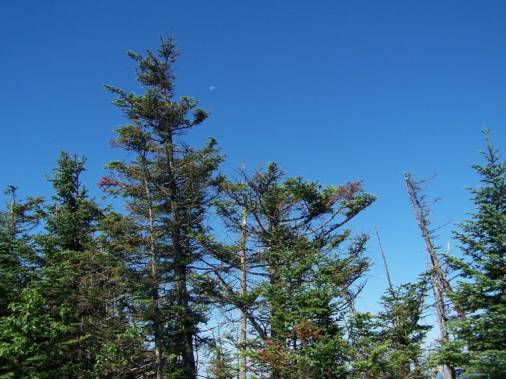
Half Moon in Morning
Good morning! Monday’s come back around again. Three weeks to Mutts Day. Partly sunny and 76 degrees in Albany. There is a south-southwest breeze at 8 mph. The dew point is 59 degrees.
Looks like a beautiful summer morning. Today should be a nice day but more rain is expected for Tuesday. I guess everyday can’t be perfect. Now the weekend is sliding down hill but that’s still a long ways away and is subject to change.
Tonight will have a slight chance of showers, then a chance of showers and thunderstorms after 2am. Mostly cloudy, with a low of 70 degrees at 3am. Nine degrees above normal. Maximum dew point of 66 at 4am. South wind around 9 mph. Chance of precipitation is 30%. New rainfall amounts of less than a tenth of an inch, except higher amounts possible in thunderstorms. In 2016, we had cloudy skies. It got down to 59 degrees. The record low of 48 occurred back in 1986.
On this day in 1890, Wyoming is admitted to the United States as the 44th US State. Many liberals regard that as a mistake, although it has some beautiful country out in Yellowstone and lots of oil and coal. And in 1962, Telstar, the world’s first communication satellite is launched.
It was pretty last night once the moon started to rise. Lots of moonlight all over the land. Sun came up pretty early and I awoke around 5:30, got up, took a piss and went back to bed for a while.
Truck smelled a little like gasoline while I was camping last night, as I spilled some gasoline over the bed of the truck, as I didn’t have the gas can properly sealed. It was my fault, I didn’t put the cap on right after filling my camp stove at Moose River Plains. Fixed that, and things are still ventalating out, but I had plenty of gas fumes to breathe last night.
I am hoping to get my new phone this evening from the FedEx store. I also ordered a protective case so hopefully I won’t drop it so much and if I do it will be more protected. I also look forward to doing more Instagram photos once again because they are fast and easy and are shared both on social media and the blog.
The more I think about it, the more I’m leaning towards camping at White House. Then I could swim at Wells or Speculator Beach and paddle the flat water of Sacandaga River. Although I wouldn’t mind going back to Pisceo Powley Road again. I do like the trip up there and being farther back in the back country. Assuming that the weather is decent next weekend I have options. Otherwise it’s just another quiet weekend at home before summer vacation in the Finger Lakes.
Thinking about this year bringing my kayak on summer vacation. I usually don’t because I don’t like hauling the kayak all over but in the heat of summer it might be fun to paddle and fish on the various Finger Lakes. What I’m thinking is that once I set up camp I could lock my kayak to a tree so I’m not driving around with it all week. I could do the same thing when I’m at the Allegheny National Forest and are going out to Presque Isle State Park. That way I wouldn’t have to drag the kayak around everywhere.
Today will be mostly sunny, with a high of 85 degrees at 3pm. Three degrees above normal. Maximum dew point of 63 at 6pm. Southwest wind 8 to 11 mph. A year ago, we had cloudy skies. The high last year was 79 degrees. The record high of 100 was set in 1936.
The sun will set at 8:33 pm with dusk around 9:07 pm, which is 29 seconds earlier than yesterday. At sunset, look for partly cloudy conditions and 78 degrees. The dew point will be 64 degrees. There will be a south breeze at 9 mph. Today will have 15 hours and 6 minutes of daytime, an increase of one minute and 14 seconds over yesterday.
As previously noted, there are 3 weeks until Mutts Day when the sun will be setting at 8:15 pm with dusk at 8:47 pm. On that day in 2016, we had rain, drizzle, fog, mist, cloudy skies and temperatures between 71 and 63 degrees. Typically, the high temperature is 82 degrees. We hit a record high of 98 back in 1917.
Good evening! Partly clear and 79 degrees in Delmar, NY. There is a west breeze at 7 mph. The dew point is 62 degrees. Pretty warm evening after a hot day but it could be a lot worse. We only tied the record for today and the dew point was only in the muggy, not the oppressive range.
After getting back from my evening walk, I’m sitting out back in a lawn chair with the fan in my truck cap blowing air on me making it feel a little better cooler. With the breeze from the fan and the relatively low dew point its pretty reasonable but when I was in my apartment earlier getting changed, it’s still pretty oppressive. I’m quite impressed by this little oscillating fan. It pushes around a lot of air for being an inexpensive 12 volt fan. I have the truck cap lights doing the slow cycle through their colors.
Tonight will be partly cloudy, with a low of 73 degrees at 4am. 16 degrees above normal. Maximum dew point of 66 at 5am. As the night progresses, it will get stickier. West wind 5 to 7 mph becoming southwest after midnight. In 2016, it got down to 52 degrees with rain and mostly cloudy skies. The record low of 38 occurred back in 1974.
Waning Gibbous Moon tonight with 77% illuminated. The moon will rise around 9:58 pm. The Last Quarter Moon is on Saturday night with chance of t-storms expected. The Full “Buck” Moon is on Sunday, July 9th. The sun will rise at 5:16 am with the first light at 4:42 am, which is 4 seconds earlier than yesterday. Tonight will have 8 hours and 42 minutes of darkness, a decrease of 31 seconds over last night.
Nice summer evening, the air smells a little like fresh hay from the farm chopping it down the road. The stars are decent tonight, although it’s not totally dark yet. Some fire flies around, although I think I walked a bit too early to see the bat. I’m sure he’s around although I don’t think they are common as they once were. That’s kind of bad, because we need more bats after such a buggy spring. I heard more rain the second half of the week into the weekend.
Today was the work picnic at Martell’s at the Albany Golf Course. Wasn’t a half bad evening but it was hot. I made the mistake of walking back to my truck parked up by SUNY which made me into a sweaty pig. I didn’t mind abstaining from drinking because the one glass of Coors Light I had made the diet soda taste good in constrast. Food, while basic picnic food was pretty good and by evening it had cooled down a bit. Nice way to close out another session year. I think I had the biggest truck in the lot but then again they’re aren’t a lot of people in government who drive pickup trucks, at least to work.
Tomorrow will have a slight chance of showers and thunderstorms. Partly sunny, with a high of 85 degrees at 2pm. Nine degrees above normal. Maximum dew point of 69 at 11am. The mercury won’t be as high tomorrow as today but it will feel a lot more muggy. Northwest wind 6 to 9 mph. Chance of precipitation is 20%. Some relief expected Thursday when it becomes less humid. A year ago, we had rain, mostly cloudy skies and a high of 66 degrees. The record high of 94 was set in 1892.
Not a particularly nice weekend on tap. Saturday, mostly cloudy, with a high near 78. Maximum dew point of 66 at 4pm. Sunday, a chance of showers and thunderstorms. Mostly cloudy, with a high near 83. Chance of precipitation is 50%. Maximum dew point of 71 at 4pm. That’s going to be pretty oppressive. Typical average high for the weekend is 79 degrees. Summer like temperatures but not a lot of sun expected this weekend for sure.
In four weeks on July 10 the sun will be setting at 8:33 pm, which is 9 seconds earlier then tonight. In 2016 on that day, we had rain, drizzle, patches of fog, mist, mostly cloudy skies and temperatures between 79 and 63 degrees. Typically, you have temperatures between 82 and 61 degrees. The record high of 100 degrees was set back in 1936.
Finally got the photos and videos uploaded from the last weekend. It was a good weekend if it was fairly ordinary on Pisceo Powley Road. I keep playing with video. My only complaint is that I wish the weekend was a bit longer and the weather a bit sunnier and warmer on Saturday. It was almost perfect on Sunday though, until it was time to go home. Bugs were bad though.
Been having some problems with my dashboard camera locking in the mountains due to a GPS bug. I noticed that they have a firmware update that may address this issue. I like how the dash cam manufacturer keeps putting out meaningful upgrades and how all you have to do to upgrade is save the file on the root of the flash card then put it back in the dash cam and turn it on. Doesn’t require Windows or any specific PC program to update the firmware.
Next weekend I’m heading to the Gas Up. It looks like Saturday will have the best weather. I want to get the homemade ice cream there, made by the antique Blackstone engine or whatever that is called. I want to poke around the exhibits more and make some more videos. Probably no to camping this weekend but it depends on the weather.
Then the following weekend I might go swimming at Mine Kill State Park, camp at Burnt Rossman, fish the Schoharie Creek and maybe visit the farm markets in Fulton for fresh fruit. And maybe hike the Cliffs of Middleburg. So many fun things to do in Schoharie County. Probably just one night as I expect to be tired after a busy week at work.
Using the headphone speaker wire to tie my wallet to my belt seems to work fine, although I guess to the paranoid it looks like I’m wearing a wire for spying. But especially with the suit on it looks essentially invisible and if it does fall out of my pocket I’ll feel the wire tug on my belt. The insulated headphone wire is quite durable and because I break ear buds with some regularity, i should have plenty of wire to replace it when it wears out and breaks again.
Looking ahead, Mutts Day is in 7 weeks, Strugeon Moon is in 8 weeks, Last Sunset After 8 PM is in 2 months, Labor Day is in 12 weeks, September 11th is in 13 weeks, More Night Then Day in Albany is in 15 weeks, Columbus Day is in 17 weeks, Christmas is in 28 weeks, January 1, 2018 is in 29 weeks and 35th Birthday is in 33 weeks.
With that sun coming up so early and the mercury now dropping a bit, I probably should retire to bed.
| Location | Region | Facility | Name | Notes |
|---|---|---|---|---|
| 40.8977396062, -72.6606151038 |
1 | David A. Sarnoff Pine Barrens Preserve | Interior Lean- To | |
| 42.039846675, -74.593646931 |
3 | Balsam Lake Mountain Wild Forest | Balsam Lake Mountain Lean-To | |
| 42.0821851976, -74.5866114487 |
3 | Balsam Lake Mountain Wild Forest | Dry Brook Ridge Lean-To | |
| 42.0669125899, -74.6546347244 |
3 | Balsam Lake Mountain Wild Forest | Kelly Hollow Lean-To | |
| 42.0673682324, -74.5869876883 |
3 | Balsam Lake Mountain Wild Forest | Mill Brook Lean-To | |
| 42.0490509759, -74.644686588 |
3 | Balsam Lake Mountain Wild Forest | Mill Brook Ridge Lean-To | |
| 42.1150311581, -74.4907498238 |
3 | Belleayre Mtn Ski Center | East Ski Lean-To | |
| 42.1177186512, -74.5031992126 |
3 | Belleayre Mtn Ski Center | West Ski Lean-To | |
| 42.009105151, -74.4838519037 |
3 | Big Indian Wildernes Area | Biscuit Brook Lean-To | |
| 41.9980754336, -74.5603918334 |
3 | Big Indian Wildernes Area | Fall Brook Lean-To | |
| 42.0753394054, -74.4858565042 |
3 | Big Indian Wildernes Area | Mckinly Hollow Lean-To | |
| 42.0920121203, -74.50571316 |
3 | Big Indian Wildernes Area | Rider Hollow Lean-To | |
| 42.0502743293, -74.5106001667 |
3 | Big Indian Wildernes Area | Shandaken Brook Lean-To | |
| 42.0697505965, -74.2874492999 |
3 | Phoenicia – Mt. Tobias Wild Forest | Tremper Mountain Lean-To 1 | |
| 42.0719347774, -74.280350018 |
3 | Phoenicia – Mt. Tobias Wild Forest | Tremper Mountain Lean-To 2 | |
| 42.1388242073, -74.4544191301 |
3 | Shandaken Wild Forest | Rochester Hollow Lean-To | |
| 42.1027865494, -74.3948255307 |
3 | Slide Mountain Wilderness | Fox Hollow Lean-To | |
| 41.9591817103, -74.4068771821 |
3 | Slide Mountain Wilderness | Table Mountain Lean-To | |
| 42.0273156785, -74.3356447251 |
3 | Slide Mountain Wilderness | Terrace Mountain Lean-To | |
| 41.9400595492, -74.6320548238 |
3 | Willowemoc Wild Forest | Long Pond Lean-To | |
| 42.1584913515, -75.3620266032 |
4 | Arctic China State Forest | A-40 Lean-To | |
| 42.1528069973, -75.3102096425 |
4 | Barbour Brook State Forest | A-41 Lean To | |
| 42.2276166115, -75.3902198332 |
4 | Beals Pond State Forest | ||
| 42.3354251044, -73.4841812463 |
4 | Beebe Hill State Forest | Beebe Hill Lean-To | |
| 42.543303724, -74.4885945942 |
4 | Burnt-Rossman Hills State Forest | Eminence Lean-To | |
| 42.5282012278, -74.6420043552 |
4 | Clapper Hollow State Forest | Clapper Hollow Lean-To | |
| 42.0491041533, -74.9281738602 |
4 | Delaware Wild Forest | Cat Hollow Lean-To | |
| 42.0118726464, -74.9483763817 |
4 | Delaware Wild Forest | Mud Pond Trail Lean-To | |
| 42.0058597072, -74.8682131934 |
4 | Delaware Wild Forest | Pelnor Hollow Lean-To | |
| 42.0124988931, -74.9472696156 |
4 | Delaware Wild Forest | Trout Pond Trail Lean-To | Built For ADA |
| 42.6294376039, -74.2675434311 |
4 | Dutch Settlement State Forest | Lean-To | |
| 42.2197534864, -74.4391024687 |
4 | Halcott Mountain Wild Forest | Halcott Lean-To | |
| 42.313988005, -73.4414954693 |
4 | Harvey Mountain State Forest | Harvey Mountain Lean-To | |
| 42.1660752671, -74.2304343401 |
4 | Hunter-West Kill Wilderness | Devil’s Acre Lean-To | Good Condition |
| 42.1692897833, -74.2576582937 |
4 | Hunter-West Kill Wilderness | Diamond Notch Lean-To | |
| 42.3550413796, -74.3460668476 |
4 | Huntersfield State Forest | Lean-To | |
| 42.1196391066, -74.0873843029 |
4 | Indian Head Wilderness | Devils Kitchen Lean-To | |
| 42.0985881282, -74.0915994051 |
4 | Indian Head Wilderness | Echo Lake Lean-To | |
| 42.1357750354, -74.1634997793 |
4 | Indian Head Wilderness | Mink Hollow Lean-To | |
| 42.1894936316, -74.239507302 |
4 | Rusk Mountain Wild Forest | John Robb Lean-To | |
| 42.2789596573, -74.1033902943 |
4 | Windham Blackhead Range Wilderness | Batavia Kill Lean-To | |
| 42.3062546068, -74.1744107284 |
4 | Windham Blackhead Range Wilderness | Elm Ridge Lean-To | |
| 43.8755968409, -74.366426237 |
5 | Blue Mountain Wild Forest | O’neill Flow Lean-To | |
| 43.8873444776, -74.3788006261 |
5 | Blue Mountain Wild Forest | Tirrel Pond North Lean-To | |
| 43.829937473, -74.4366163022 |
5 | Blue Ridge Wilderness | Cascade Pond Lean-To | Fair |
| 43.8186736685, -74.4205248717 |
5 | Blue Ridge Wilderness | Stephens Pond Lean-To | Good |
| 43.8201917816, -74.4686803224 |
5 | Blue Ridge Wilderness | Wilson Pond Lean-To | Fair |
| 44.5989256982, -74.2285921246 |
5 | Debar Mtn. Wild Forest | Debar Mountian Lean-To | Debar Mtn Leanto |
| 44.4918501724, -74.2523227309 |
5 | Debar Mtn. Wild Forest | Grass Pond Lean-To | |
| 44.5192586399, -74.2710522386 |
5 | Debar Mtn. Wild Forest | Sheep Meadow Lean-To #1 | |
| 44.5193465505, -74.2711670085 |
5 | Debar Mtn. Wild Forest | Sheep Meadow Lean-To #2 | |
| 44.108205472, -73.7738312581 |
5 | Dix Mountain Wilderness | Bouquet Lean-To | |
| 44.0601596209, -73.8078167801 |
5 | Dix Mountain Wilderness | Lilian Brook Lean-To | |
| 44.044126198, -73.8058583966 |
5 | Dix Mountain Wilderness | Slide Brook Lean-To | |
| 44.1759172265, -73.7215350426 |
5 | Giant Mountain Wilderness | Giant Mtn. Lean-To | |
| 43.8863219437, -73.5641701351 |
5 | Hammond Pond Wild Forest | Eagle Lake Lean-To | |
| 43.9655912049, -73.6440374623 |
5 | Hammond Pond Wild Forest | Moose Mt Pond Lean-To | |
| 44.1447454969, -73.9547665307 |
5 | High Peaks Wilderness | Avalanche | |
| 44.1809734501, -73.8284043214 |
5 | High Peaks Wilderness | Bear Brook Lean-To | |
| 44.121015479, -73.9821264349 |
5 | High Peaks Wilderness | Beaver Point #1 | |
| 44.1207874446, -73.9817139904 |
5 | High Peaks Wilderness | Beaver Point #2 | |
| 44.1825279757, -74.1805220238 |
5 | High Peaks Wilderness | Blueberry Lean-To | |
| 44.1449655863, -73.8833895452 |
5 | High Peaks Wilderness | Bushnell Falls #1 Lean-To | |
| 44.1444007481, -73.8834828976 |
5 | High Peaks Wilderness | Bushnell Falls #2 Lean-To | |
| 44.1129718174, -73.9928913122 |
5 | High Peaks Wilderness | Calamity #1 Lean-To | |
| 44.1448580137, -74.2751710479 |
5 | High Peaks Wilderness | Calkin’s Brook Lean-To | |
| 44.1058294131, -74.3120366857 |
5 | High Peaks Wilderness | Calkin’s Creek Lean-To | |
| 43.9980126927, -74.3927845611 |
5 | High Peaks Wilderness | Catlin Bay #1 Lean-To | |
| 43.9972143811, -74.3959393656 |
5 | High Peaks Wilderness | Catlin Bay #2 Lean-To | |
| 44.1425166432, -74.1303582429 |
5 | High Peaks Wilderness | Cold River #2 Lean-To | |
| 44.091459278, -74.2576417508 |
5 | High Peaks Wilderness | Cold River #3 Lean-To | |
| 44.0913902533, -74.2557348025 |
5 | High Peaks Wilderness | Cold River #4 Lean-To | |
| 44.1427273763, -74.1298402107 |
5 | High Peaks Wilderness | Cold River Lean-To #1 Lean-To | |
| 44.1778467491, -73.833854921 |
5 | High Peaks Wilderness | Deer Brook Lean-To | |
| 44.141626874, -74.1069373468 |
5 | High Peaks Wilderness | Duck Hole #1 Lean-To | |
| 44.1416768647, -74.1065435467 |
5 | High Peaks Wilderness | Duck Hole #2 Lean-To | |
| 44.1142099053, -73.9556152329 |
5 | High Peaks Wilderness | Feldspar Lean-To | |
| 44.1186643668, -73.9840090128 |
5 | High Peaks Wilderness | Flowed Lands #2 Lean-To | |
| 44.1077341951, -73.9912056361 |
5 | High Peaks Wilderness | Griffin Lean-To | |
| 44.1773165403, -74.3218077012 |
5 | High Peaks Wilderness | Hemlock Hill Lean-To | |
| 44.1041784421, -74.0669132937 |
5 | High Peaks Wilderness | Henderson Lake Lean-To | |
| 44.1117549601, -74.0592189223 |
5 | High Peaks Wilderness | Henderson Lean-To | |
| 44.1178828905, -73.9873641274 |
5 | High Peaks Wilderness | Herbert Brook Lean-To | |
| 44.0026552882, -74.3864802633 |
5 | High Peaks Wilderness | Hidden Cove Lean-To | |
| 44.0760291647, -74.3235341651 |
5 | High Peaks Wilderness | Island House Lean-To | |
| 44.1494011459, -73.9557902347 |
5 | High Peaks Wilderness | Kagel Lean-To | |
| 44.0288002362, -74.367307986 |
5 | High Peaks Wilderness | Kelly Point #1 Lean-To | |
| 44.0287025672, -74.3671303487 |
5 | High Peaks Wilderness | Kelly Point #2 Lean-To | |
| 44.1706807759, -73.9050776091 |
5 | High Peaks Wilderness | Klondike Lean-To | |
| 44.1130126221, -73.9888393806 |
5 | High Peaks Wilderness | Livingston Point Lean-To | |
| 44.1469386475, -73.9552287453 |
5 | High Peaks Wilderness | Marcy Brook Lean-To | |
| 44.1579156535, -73.953395811 |
5 | High Peaks Wilderness | Marcy Dam #1 Lean-To | |
| 44.1573119259, -73.9533863686 |
5 | High Peaks Wilderness | Marcy Dam #2 Lean-To | |
| 44.1573817221, -73.9512823564 |
5 | High Peaks Wilderness | Marcy Dam #3 Lean-To | |
| 44.158399029, -73.9510719571 |
5 | High Peaks Wilderness | Marcy Dam #4 Lean-To | |
| 44.1586913289, -73.9524288871 |
5 | High Peaks Wilderness | Marcy Dam #5 Lean-To | |
| 44.1828433824, -74.0736410238 |
5 | High Peaks Wilderness | Moose Pond Lean-To | |
| 44.079589789, -74.2389368367 |
5 | High Peaks Wilderness | Moose Pond Stream Lean-To | |
| 44.0795538786, -74.2391509433 |
5 | High Peaks Wilderness | Moose Pond Stream Lean-To #2 | |
| 44.1992083493, -73.9059885406 |
5 | High Peaks Wilderness | Mr. Van Lean-To | |
| 44.0158171441, -74.1523218843 |
5 | High Peaks Wilderness | Newcomb Lake Lean-To #1 | |
| 44.0205306743, -74.1522782707 |
5 | High Peaks Wilderness | Newcomb Lake Lean-To #2 | |
| 44.1733720177, -74.1571389816 |
5 | High Peaks Wilderness | Number Four #1 Lean-To | |
| 44.1733860424, -74.1561240274 |
5 | High Peaks Wilderness | Number Four #2 Lean-To | |
| 44.1110695692, -73.9924324205 |
5 | High Peaks Wilderness | Opalescent Lean-To | |
| 44.1466502842, -73.8622440861 |
5 | High Peaks Wilderness | Ore Bed Brook Lean-To | |
| 44.1202212816, -74.1874471739 |
5 | High Peaks Wilderness | Ouluska Pass Brook Lean-To | |
| 44.0996351514, -73.9133647612 |
5 | High Peaks Wilderness | Panther Gorge Lean-To | |
| 44.0654422644, -74.3285192442 |
5 | High Peaks Wilderness | Plumley Point #1 Lean-To | |
| 44.0655989161, -74.3276122455 |
5 | High Peaks Wilderness | Plumley Point #2 Lean-To | |
| 44.1472355081, -74.318105399 |
5 | High Peaks Wilderness | Raquette Falls #1 Lean-To | |
| 44.1568302695, -74.3133083456 |
5 | High Peaks Wilderness | Raquette Falls #2 Lean-To | |
| 44.1710800022, -73.9974911766 |
5 | High Peaks Wilderness | Rocky Falls Lean-To | |
| 44.0414093849, -74.3501490964 |
5 | High Peaks Wilderness | Rodney Point #1 Lean-To | |
| 44.0429767454, -74.3493346475 |
5 | High Peaks Wilderness | Rodney Point #2 Lean-To | |
| 44.099413657, -74.1052871721 |
5 | High Peaks Wilderness | Santanoni Lean-To | |
| 44.159177638, -74.013876769 |
5 | High Peaks Wilderness | Scott Clearing Lean-To | |
| 44.1062441377, -74.2091536428 |
5 | High Peaks Wilderness | Seward Lean-To | |
| 44.1247329647, -73.9010796778 |
5 | High Peaks Wilderness | Slant Rock Lean-To | |
| 44.1988046777, -74.3183103111 |
5 | High Peaks Wilderness | Stony Creek Lean-To | |
| 44.1093110139, -73.961729679 |
5 | High Peaks Wilderness | Uphill Lean-To | |
| 44.1191510722, -73.9841831313 |
5 | High Peaks Wilderness | Walker Brook Lean-To | |
| 44.1221483174, -74.0532242803 |
5 | High Peaks Wilderness | Wallface Lean-To | |
| 44.1784419747, -74.1736369919 |
5 | High Peaks Wilderness | Ward Brook Lean-To | |
| 44.161824666, -73.8555947195 |
5 | High Peaks Wilderness | Wm. G. Howard Lean-To | |
| 44.1538919753, -73.8510077515 |
5 | High Peaks Wilderness | Wolf Jaw Lean-To | |
| 44.2530195934, -73.7180348153 |
5 | Hurricane Mountain Primitive Area | Gulf Brook Lean-To | Fair |
| 44.2607301476, -73.7100106669 |
5 | Hurricane Mountain Primitive Area | Lost Pond/Biesemeyer Lean-To | Fair |
| 43.5996600139, -73.5330643346 |
5 | Lake George Wild Forest | Black Mountain Ponds Lean-To | Lean-To With Privy And Fire Ring Black Mtn Pond Trail |
| 43.6193129088, -73.5841121844 |
5 | Lake George Wild Forest | Fifth Peak Lean-To | Lean-To W/ Privy And Fire Ring Tongue Mtn Range Trail |
| 43.5760391953, -73.5361031163 |
5 | Lake George Wild Forest | Fishbrook Pond North Lean-To | Leanto With Privy, Picnic Table And Fire Ring Fishbrook Pd-Lk Grg Shore Trl |
| 43.5738720148, -73.5384766731 |
5 | Lake George Wild Forest | Fishbrook Pond South Lean-To | Leanto With Privy, Picnic Table And Fire Ring Fishbrook Pd E Shore Trl |
| 43.6473357817, -73.5745337831 |
5 | Lake George Wild Forest | Five Mile Mountain Lean-To | Lean-To W/ Privy And Fire Ring Tongue Mtn Range Trail |
| 43.5778037953, -73.5168397538 |
5 | Lake George Wild Forest | Greenland Pond Lean-To | Leanto With Privy, Picnic Table And Fire Ring Greenland Pd Shelter Spur |
| 43.5958213341, -73.5179510245 |
5 | Lake George Wild Forest | Lapland Pond Lean-To | Campsite With Lean-To 13-27 Lapland Pond Lean-To Conector |
| 43.5871682823, -73.5277594231 |
5 | Lake George Wild Forest | Millman Pond Lean-To | Campsite With Lean-To 5-10 Old Farm To Millman Pond Trl |
| 44.3214560457, -74.0307860439 |
5 | Mckenzie Mtn. Wilderness | Placid Lean-To | |
| 44.3442169075, -73.9286469378 |
5 | Mckenzie Mtn. Wilderness | White Face Brook Lean-To | |
| 43.7790246336, -74.7044289121 |
5 | Moose River Plains Wild Forest | 8th Lake Island Lean-To | |
| 43.7801152974, -74.7044390115 |
5 | Moose River Plains Wild Forest | 8th Lake North Shore | |
| 43.7897826664, -74.6985922707 |
5 | Moose River Plains Wild Forest | 8thlake East Shore Lean-To | |
| 43.8316711731, -74.6617561796 |
5 | Moose River Plains Wild Forest | Beaver Bay Lean-To 1 | |
| 43.8316049364, -74.6615109228 |
5 | Moose River Plains Wild Forest | Beaver Bay Lean-To 2 | |
| 43.8314336654, -74.6609019165 |
5 | Moose River Plains Wild Forest | Beaver Bay Lean-To 3 | |
| 43.7478050188, -74.7441985068 |
5 | Moose River Plains Wild Forest | Seventh Lake Lean-To 1 | |
| 43.7507665118, -74.7346427944 |
5 | Moose River Plains Wild Forest | Seventh Lake Lean-To 2 | |
| 43.7563901134, -74.7178174969 |
5 | Moose River Plains Wild Forest | Seventh Lake Lean-To 3 | |
| 43.8145480145, -73.5808194792 |
5 | Pharaoh Lake Wilderness | Berrymill Pond Lean-To | Digitized From National Geographic Map |
| 43.8384100119, -73.5916749102 |
5 | Pharaoh Lake Wilderness | Clear Pond Lean-To | Digitized From National Geographic Map |
| 43.8412911595, -73.6316882519 |
5 | Pharaoh Lake Wilderness | Crab Pond Lean-To | Digitized From National Geographic Map |
| 43.8223693677, -73.5906397879 |
5 | Pharaoh Lake Wilderness | Grizzle Ocean Lean-To | Digitized From National Geographic Map |
| 43.8492027141, -73.6180024108 |
5 | Pharaoh Lake Wilderness | Lillypad Pond Lean-To | Digitized From National Geographic Map |
| 43.8500028762, -73.5895397847 |
5 | Pharaoh Lake Wilderness | Little Rock Pond Lean-To | Digitized From National Geographic Map |
| 43.8405296779, -73.6501782303 |
5 | Pharaoh Lake Wilderness | Oxshoe Pond Lean-To | Digitized From National Geographic Map |
| 43.7945783128, -73.6458567831 |
5 | Pharaoh Lake Wilderness | Pharaoh Lake #1 Lean-To | Digitized From National Geographic Map |
| 43.7966550547, -73.6403349616 |
5 | Pharaoh Lake Wilderness | Pharaoh Lake #2 Lean-To | Digitized From National Geographic Map |
| 43.8049450672, -73.6240085371 |
5 | Pharaoh Lake Wilderness | Pharaoh Lake #3 Lean-To | Digitized From National Geographic Map |
| 43.8049450672, -73.6240085371 |
5 | Pharaoh Lake Wilderness | Pharaoh Lake #3 Lean-To | Digitized From National Geographic Map |
| 43.8121074537, -73.6282851829 |
5 | Pharaoh Lake Wilderness | Pharaoh Lake #4 Lean-To | Digitized From National Geographic Map |
| 43.8021964679, -73.6391689125 |
5 | Pharaoh Lake Wilderness | Pharaoh Lake #5 Lean-To | Digitized From National Geographic Map |
| 43.8505590671, -73.5922949091 |
5 | Pharaoh Lake Wilderness | Rock Pond Lean-To | Digitized From National Geographic Map |
| 43.8581713271, -73.626483712 |
5 | Pharaoh Lake Wilderness | Tubmill Marsh Lean-To | Digitized From National Geographic Map |
| 44.3961331068, -74.3704212658 |
5 | Saint Regis Canoe Area | Fish Pond Site 2 Lean-To | Saint Regis Mountain |
| 44.3913013571, -74.3658071555 |
5 | Saint Regis Canoe Area | Fish Pond Site 5 Lean-To | New Lean-To Built Sept. 2010,Relocated Further From Water |
| 44.3808655111, -74.3200340382 |
5 | Saint Regis Canoe Area | St. Regis Pond Site 3 Lean-To | Lean-To Too Close To Water, Need To Move Back When Major Work Is Needed |
| 44.3250945507, -74.3498966646 |
5 | Saranac Lakes Wild Forest | Follensby Clear Lean-To | |
| 44.2866574735, -74.1626018103 |
5 | Saranac Lakes Wild Forest | Kiwasa Lake Site 3 Lean-To | |
| 44.3322955804, -73.9566258523 |
5 | Saranac Lakes Wild Forest | Lake Placid Site 2 Lean-To | Lake Placid |
| 44.3325954268, -73.9566801194 |
5 | Saranac Lakes Wild Forest | Lake Placid Site 3 Lean-To | Lake Placid |
| 44.2253525405, -74.3803783852 |
5 | Saranac Lakes Wild Forest | Raquette Lean-To | Built In 2013 Relocated From Trombley Landing Site |
| 44.3092299998, -74.1801499997 |
5 | Saranac Lakes Wild Forest | Saranac Islands Site 2 Lean-To | |
| 44.2890999998, -74.2172199999 |
5 | Saranac Lakes Wild Forest | Saranac Islands Site 45 Lean-To | |
| 44.2666999994, -74.2447999995 |
5 | Saranac Lakes Wild Forest | Saranac Islands Site 63 Lean-To | |
| 44.2729500004, -74.27398 |
5 | Saranac Lakes Wild Forest | Saranac Islands Site 81 Lean-To | |
| 44.2878799998, -74.2885399997 |
5 | Saranac Lakes Wild Forest | Saranac Islands Site 87 Lean-To | |
| 44.2287716477, -74.3755334312 |
5 | Saranac Lakes Wild Forest | Trombley Landing Lean-To | |
| 44.3028866826, -74.3026336593 |
5 | Saranac Lakes Wild Forest | Upper Saranac Lake Lean-To | |
| 43.8161997506, -74.6446678086 |
5 | Sargent Ponds Wild Forest | Big Island Lean-To 1 | |
| 43.8170896757, -74.6432509546 |
5 | Sargent Ponds Wild Forest | Big Island Lean-To 2 | |
| 43.8171339137, -74.6437800321 |
5 | Sargent Ponds Wild Forest | Big Island Lean-To 3 | |
| 43.8707715776, -74.6285067054 |
5 | Sargent Ponds Wild Forest | Boucher Point Lean-To #1 | |
| 43.8710064606, -74.6281079204 |
5 | Sargent Ponds Wild Forest | Boucher Point Lean-To #2 | |
| 43.8707202965, -74.629171869 |
5 | Sargent Ponds Wild Forest | Boucher Point Lean-To #3 | |
| 44.1027442039, -74.321862706 |
5 | Sargent Ponds Wild Forest | Deep Hole Lean-To | |
| 43.9262175397, -74.4753958672 |
5 | Sargent Ponds Wild Forest | Deerland Carry # 2 Lean-To | Fair Condition |
| 43.9257807189, -74.4758457554 |
5 | Sargent Ponds Wild Forest | Deerland Carry #1 Lean-To | Fair Condition |
| 43.9028470717, -74.5480629364 |
5 | Sargent Ponds Wild Forest | Forked Lake Lean-To | |
| 44.0814068183, -74.3358291461 |
5 | Sargent Ponds Wild Forest | Long Lake Nw Lean-To #1 | |
| 44.0825043385, -74.3339145725 |
5 | Sargent Ponds Wild Forest | Long Lake Nw Lean-To #2 | |
| 43.8593314968, -74.5626945075 |
5 | Sargent Ponds Wild Forest | Lower Sargents Pond Lean-To | Fair Condition |
| 43.8794136061, -74.6060523536 |
5 | Sargent Ponds Wild Forest | Outlet Bay Lean-To | Hit By Tree, 2011 |
| 43.9066458928, -74.5025901551 |
5 | Sargent Ponds Wild Forest | Pinebrook Lean-To | Fair Condition |
| 43.8368984989, -74.5352656022 |
5 | Sargent Ponds Wild Forest | Utowana Lake Lean-To | |
| 44.3317122951, -73.8997103538 |
5 | Sentinel Range Wilderness | Copperas Pond Lean-To | |
| 43.2171873383, -74.3641178087 |
5 | Shaker Mountain Wild Forest | Chase Lake Lean-To | |
| 43.1885867657, -74.4310218123 |
5 | Shaker Mountain Wild Forest | Holmes Lake Lean-To | |
| 43.6161332228, -74.1506253912 |
5 | Siamese Ponds Wilderness | E. Sacandaga River Lean-To | |
| 43.7007731961, -74.1581732825 |
5 | Siamese Ponds Wilderness | Hour Pond Lean-To | |
| 43.7278247362, -74.2012685562 |
5 | Siamese Ponds Wilderness | John Pond Lean-To | |
| 43.6775543215, -74.1916025718 |
5 | Siamese Ponds Wilderness | Puffer Pond #1 Lean-To | |
| 43.6765395437, -74.1997399401 |
5 | Siamese Ponds Wilderness | Puffer Pond #2 Lean-To | |
| 43.3974135952, -74.45529759 |
5 | Silver Lake Wilderness | Hamilton Lake Stream #1 Lean-To | |
| 43.3426710732, -74.4562907856 |
5 | Silver Lake Wilderness | Mud Lake Lean-To | |
| 43.2919354568, -74.4237351677 |
5 | Silver Lake Wilderness | Silver Lake Lean-To | |
| 44.4897002134, -73.8614267379 |
5 | Taylor Pond Wild Forest | North Shore Taylor Pond Lean-To | Managed By Operations |
| 44.4776887718, -73.881283087 |
5 | Taylor Pond Wild Forest | Northwest Shore Taylor Pond Lean-To | Managed By Operations |
| 44.3997973549, -73.5145569962 |
5 | Taylor Pond Wild Forest | Poke-O-Moonshine Summit Lean-To | |
| 44.4828880086, -73.8537772441 |
5 | Taylor Pond Wild Forest | South East Taylor Pond Lean-To | Managed By Operations |
| 43.9326741166, -73.9690844017 |
5 | Vanderwhacker Mountain Wild Forest | Cheney Pond Lean-To | |
| 43.8387348153, -73.9856219154 |
5 | Vanderwhacker Mountain Wild Forest | Stony Pond Lean-To | |
| 43.6259693968, -74.5492715037 |
5 | West Canada Lake Wilderness | Beaver Pond (AKA Cedar Lakes Lean-To #2) | |
| 43.6787448835, -74.4954982188 |
5 | West Canada Lake Wilderness | Carry Lean-To | |
| 43.628125665, -74.5404732399 |
5 | West Canada Lake Wilderness | Cedar Lakes #1 Lean-To | |
| 43.6084635843, -74.559724172 |
5 | West Canada Lake Wilderness | Cedar Lakes #3 Lean-To | |
| 43.6524139144, -74.4903803529 |
5 | West Canada Lake Wilderness | Colvin Brook Lean-To | |
| 43.5968984709, -74.5316653645 |
5 | West Canada Lake Wilderness | Pillsbury Lake Lean-To | |
| 43.5807608964, -74.576533363 |
5 | West Canada Lake Wilderness | Sampson Lake Lean-To | |
| 43.5872448097, -74.6215788384 |
5 | West Canada Lake Wilderness | South Lake Lean-To | |
| 43.5272841126, -74.6099246975 |
5 | West Canada Lake Wilderness | Spruce Lake #1 Lean-To | |
| 43.5346306298, -74.6080858031 |
5 | West Canada Lake Wilderness | Spruce Lake #2 Lean-To | |
| 43.5371297279, -74.608209628 |
5 | West Canada Lake Wilderness | Spruce Lake #3 Lean-To | |
| 43.4527175892, -74.5822815394 |
5 | West Canada Lake Wilderness | T Lake Lean-To | |
| 43.586987614, -74.613997971 |
5 | West Canada Lake Wilderness | West Canada Creek Lean-To | |
| 43.5931622288, -74.6268866843 |
5 | West Canada Lake Wilderness | West Lake #1 Lean-To | |
| 43.5970642572, -74.6231056496 |
5 | West Canada Lake Wilderness | West Lake #2 Lean-To | |
| 43.5102617091, -74.0492883971 |
5 | Wilcox Lake Wild Forest | Lizard Pond Lean-To | Digitized From National Geographic Map |
| 43.3363734227, -74.2173211966 |
5 | Wilcox Lake Wild Forest | Murphy Lake Lean-To | Digitized From National Geographic Map |
| 43.396075559, -74.1532214824 |
5 | Wilcox Lake Wild Forest | Wilcox Lake #1 Lean-To | Digitized From National Geographic Map |
| 43.39859675, -74.1554639493 |
5 | Wilcox Lake Wild Forest | Wilcox Lake #2 Lean-To | Digitized From National Geographic Map |
| 44.0021452737, -74.7756817712 |
5 | William C. Whitney Wilderness | Lake Lila # 7 Lean-To | |
| 44.4244015852, -73.8486868866 |
5 | Wilmington Wild Forest | Cooper Kill Lean-To | Too Close To Water, Need To Replocate, Do Not Repair |
| 44.1070894301, -75.0674448544 |
6 | Aldrich Pond Wild Forest | Streeter Lake Lean-To | Wood |
| 43.7434886212, -74.8776068003 |
6 | Alger Island Campground | Campsite # 01 | |
| 43.7443528827, -74.8771318496 |
6 | Alger Island Campground | Campsite # 02 | |
| 43.7456011181, -74.8768832894 |
6 | Alger Island Campground | Campsite # 03 | |
| 43.7466942129, -74.8745145576 |
6 | Alger Island Campground | Campsite # 04 | |
| 43.746535972, -74.8735980503 |
6 | Alger Island Campground | Campsite # 05 | |
| 43.7467703384, -74.8722666576 |
6 | Alger Island Campground | Campsite # 06 | |
| 43.7465482669, -74.8718037808 |
6 | Alger Island Campground | Campsite # 07 | |
| 43.7458848539, -74.8729191925 |
6 | Alger Island Campground | Campsite # 08 | |
| 43.7454701717, -74.8727721949 |
6 | Alger Island Campground | Campsite # 09 | |
| 43.7450840439, -74.8725955649 |
6 | Alger Island Campground | Campsite # 10 | |
| 43.744783668, -74.8724088972 |
6 | Alger Island Campground | Campsite # 11 | |
| 43.7441622435, -74.8727256743 |
6 | Alger Island Campground | Campsite # 12 | |
| 43.7440135576, -74.8739878218 |
6 | Alger Island Campground | Campsite # 13 | |
| 43.7431429387, -74.875172598 |
6 | Alger Island Campground | Campsite # 14 | |
| 43.7428736074, -74.8760835968 |
6 | Alger Island Campground | Campsite # 15 | |
| 43.6000735406, -75.0530032053 |
6 | Black River Wild Forest | Bear Lake Lean-To | |
| 43.5245079024, -75.0409215605 |
6 | Black River Wild Forest | Chub Pond #1 Lean-To | Rehabbed In 2008 |
| 43.5298225654, -75.0424937056 |
6 | Black River Wild Forest | Chub Pond #2 Lean-To | Built By Lean-To Permit 1963, Taken Care Of By Plumley Family |
| 43.5537469236, -75.059377614 |
6 | Black River Wild Forest | Gull Lake Lean-To | |
| 43.5341150034, -74.9280935302 |
6 | Black River Wild Forest | Lean-To | |
| 43.6299248982, -75.0362877527 |
6 | Black River Wild Forest | Remsen Falls Lean-To | Rehabbed In 2008 |
| 43.5589136946, -75.0030576033 |
6 | Black River Wild Forest | Sand Lake Falls Lean-To | Rehabbed In 2008 |
| 43.5998849075, -75.0203817469 |
6 | Black River Wild Forest | Woodhull Lake Lean-To | Rehabbed In 2008, Double Sized Lean-To |
| 43.6520754244, -75.0592470923 |
6 | Black River Wildforest | Nelson Lake Trail Lean-To | |
| 43.3445446485, -75.6722203255 |
6 | Cobb Brook State Forest | Leanto | |
| 44.1990987752, -74.8148790735 |
6 | Cranberry Lake Wild Forest | Bear Mountain Lean-To | |
| 44.2105729246, -74.7181527787 |
6 | Cranberry Lake Wild Forest | Burntbridge Pond Lean-To | |
| 44.1533999108, -74.8840290725 |
6 | Cranberry Lake Wild Forest | Ranger School Lean-To | Campsite 41 Aka Inlet Flow Lean-To |
| 44.0529214425, -74.9471939334 |
6 | Five Ponds Wilderness | Big Shallow Lean-To | Cs 30 |
| 44.0528916324, -75.0090580588 |
6 | Five Ponds Wilderness | Cage Lake Lean-To | |
| 44.0931113064, -74.8498397365 |
6 | Five Ponds Wilderness | Cowhorn Pond Lean-To | |
| 44.1123581654, -74.8914922468 |
6 | Five Ponds Wilderness | Janacks Landing Lean-To | With Full Sized Privy |
| 44.0474525004, -74.9526919257 |
6 | Five Ponds Wilderness | Little Shallow Lean-To | Cs 30 |
| 44.1198328093, -74.8454890242 |
6 | Five Ponds Wilderness | Olmstead Pond Lean-To | With Full Sized Privy |
| 44.0689970407, -74.9112845696 |
6 | Five Ponds Wilderness | Oswegatchie River Site 13 Lean-To | Cs 13 Lt |
| 44.0688665373, -74.9093532798 |
6 | Five Ponds Wilderness | Oswegatchie River Site 15 Lean-To | Cs 15 Lt |
| 44.0746275016, -74.9613775006 |
6 | Five Ponds Wilderness | Oswegatchie River Site 34 Lean-To | Cs 34 Lt |
| 44.0843538607, -74.9687312803 |
6 | Five Ponds Wilderness | Oswegatchie River Site 38 Lean-To | Cs 38 Lt |
| 44.0154640897, -75.0054753701 |
6 | Five Ponds Wilderness | Sand Lake Lean-To | Cs 30 |
| 43.9284894776, -74.9448704212 |
6 | Five Ponds Wilderness | Trout Pond Lean-To | |
| 43.9284894776, -74.9448704212 |
6 | Five Ponds Wilderness | Trout Pond Lean-To | |
| 44.0299676783, -74.9801386129 |
6 | Five Ponds Wilderness | Wolf Lake Lean-To | Cs 30 |
| 43.7029255425, -75.0960024266 |
6 | Haderondah | Middle Branch Lake Lean-To | |
| 43.6859486954, -75.0986138399 |
6 | Haderondah | Middle Settlement Lake Lean-To | |
| 44.1511613292, -74.5657606156 |
6 | Horseshoe Lake Wild Forest | Black Bay Lean-To | Checked 11/2015 |
| 44.196860294, -74.5121752893 |
6 | Horseshoe Lake Wild Forest | Eagle Landing Lean-To | Tupper Lake Site #5 |
| 43.8235350455, -75.1693122081 |
6 | Independence River Wild Forest | Panther Pond Lean-To | |
| 43.7083935125, -75.14645298 |
6 | Independence River Wild Forest | Pine Lake Lean-To | |
| 43.8089062032, -75.474955964 |
6 | Lowville Demonstration Area | Lowville Forestry Demonstration Area | |
| 43.8558345419, -74.804220953 |
6 | Pigeon Lake Wilderness | Andes Creek Lean-To | |
| 43.8575116443, -74.8252446695 |
6 | Pigeon Lake Wilderness | Gull Lake Lean-To | |
| 43.8764050748, -74.7655286668 |
6 | Pigeon Lake Wilderness | Lower Sister Lake Lean-To | |
| 43.8421644493, -74.8055993839 |
6 | Pigeon Lake Wilderness | Russian Lake Lean-To | |
| 43.8139160683, -74.7983685471 |
6 | Pigeon Lake Wilderness Area | Queer Lake Lean-To | Campsite With Lean-To |
| 43.8348742486, -75.8607286637 |
6 | Tug Hill State Forest | Electric Loop Lean-Too | Wooden Lean-Too Built In 1982, By Steve Wood Troop 7 |
| 44.3578220602, -75.3160008277 |
6 | Wolf Lake State Forest | Beaver Flow Lean-To | Beaver Flow Leanto |
| 44.3242717044, -75.3337383742 |
6 | Wolf Lake State Forest | Huckleberry Lake Lean-To | Huckleberry Lake Leanto |
| 44.3322757137, -75.3211717792 |
6 | Wolf Lake State Forest | Moon Pond Lean-To | Moon Lake Leanto |
| 44.3322757137, -75.3211717792 |
6 | Wolf Lake State Forest | Moon Pond Lean-To | Moon Lake Leanto |
| 44.3322757137, -75.3211717792 |
6 | Wolf Lake State Forest | Moon Pond Lean-To | Moon Lake Leanto |
| 44.3322757137, -75.3211717792 |
6 | Wolf Lake State Forest | Moon Pond Lean-To | Moon Lake Leanto |
| 44.3363136709, -75.313863327 |
6 | Wolf Lake State Forest | Wolf Lake Lean-To | Wolf Lake Leanto |
| 42.746653083, -75.3797255193 |
7 | Charles E. Baker State Forest | Trail 17 Lean-To | Primitive Campsite With Fire Pit |
| 42.7627233838, -75.379619514 |
7 | Charles E. Baker State Forest | Woodland Pond Lean-To | Primitive Campsite With Hore Tie Rail And Fire Pit |
| 42.3270424066, -76.4900608723 |
7 | Danby State Forest | Chestnut Lean-To | |
| 42.3176423354, -76.4225442513 |
7 | Danby State Forest | Tamarack Lean-To | |
| 42.8201846305, -75.8591052772 |
7 | Deruyter State Forest | Deruyter Lean-To | |
| 42.4228873052, -75.7674346807 |
7 | Genegantslet State Forest | Top Ten Lean-To | 20′ X 20′ Log Cabin |
| 42.4728525684, -76.1787322193 |
7 | Kennedy State Forest | Foxfire Lean-To | |
| 42.4458019158, -75.7015069607 |
7 | Ludlow Creek State Forest | Ludlow Creek Lean-To | 8′ X 10′ Constructed 2002 |
| 42.723126977, -75.8709545002 |
7 | Mariposa State Forest | Mariposa Finger Lakes Lean-To | |
| 42.7672022335, -76.0112561891 |
7 | Morgan Hill State Forest | Morgan Hill Lean-To | |
| 42.6423073773, -75.7437663179 |
7 | Perkins Pond State Forest | Flt Lean-To Lean-To | |
| 42.3905962266, -76.2718006242 |
7 | Robinson Hollow State Forest | Kimme Lean-To | |
| 42.3276442724, -76.3290355678 |
7 | Shindagin Hollow State Forest | Shindagin Lean-T0 | Scheduled For Replacement In 2004 |
| 42.5122011517, -76.1208238604 |
7 | Tuller Hill State Forest | Woodchuck Hollow Lean-To | Rebuilt In 2002 From Local State Forest Red Pine, Built By Volunteers From Suny Cortland |
| 42.6060629372, -75.4671141039 |
7 | Whaupaunaucau State | Leanto | |
| 42.3132130609, -77.5663734584 |
8 | Burt Hill State Forest | On Finger Lake Trail Lean-To | |
| 42.625051213, -77.3586638233 |
8 | High Tor Wma | High Tor North Lean-To | Campsite With Stone Firepit And Privy Updated By Emily Bonk Forest Tech |
| 42.6146971076, -77.3661109424 |
8 | High Tor Wma | High Tor South Lean-To | Campsite With Firepit And Privy Updated By Emily Bonk Forest Tech |
| 42.0965007548, -77.1964378403 |
8 | Mccarthy Hill State Forest | Mccarthy Hill Leanto | Built By Fltc 2012 |
| 42.2891155929, -77.1188809327 |
8 | South Bradford State Forest | Moss Hill Lean-To | |
| 42.3730816642, -76.9554800047 |
8 | Sugar Hill State Forest | Buck Settlement Lean-To | Built 2006 By Fltc |
| 42.369515888, -77.0127591279 |
8 | Sugar Hill State Forest | Parks Hollow Lean-To | |
| 42.3690917205, -77.0130036276 |
8 | Sugar Hill State Forest | Parks Hollow Lean-To | Log Built 2011 |
| 42.3822533326, -77.0026799995 |
8 | Sugar Hill State Forest | The Twin Lean-To’s | 2 Lean-To At This Location |
| 42.3898077706, -76.9725898373 |
8 | Sugar Hill State Forest | Vanzandt Lean-To | |
| 42.3340314562, -78.532889311 |
9 | Boyce Hill State Forest | Flt Lean To | Log Lean To Built In 2012 By Flt Club |
| 42.53472215, -73.9623319605 |
Cabins | |||
| 42.3492343019, -77.8075299409 |
Flt |

This lists out the 331 lean-tos with coordinates in the DEC's April 2017 release of Points of Interest Shapefile, that can be obtained from here: http://gis.ny.gov/gisdata/inventories/member.cfm?OrganizationID=529
Good evening! Mostly cloudy and 60 degrees on Bennett Hill in Clarksville. There is a northeast breeze at 6 mph. The dew point is 47 degrees. The skies will clear Sunday around 6 am.
The sun will set at 7:44 pm with dusk around 8:14 pm, which is one minute and 8 seconds later than yesterday. At sunset, look for mostly cloudy conditions and 56 degrees. There will be a northeast breeze at 6 mph.
The views from the recently cleared overlooks from Bennett Hill are amazing. They cleared out a much larger view over Clarksville so on a relatively clear day like today you can see the Adirondacks and Green Mountains along with the interesting hills around the Vly Creek Reservoir. Also a new view of Wolf Hill and the Heldebergs. I like how you can really study the terrain. Reminds you that you are in the mountains. Green is starting to pop pit everywhere. Birds are chirping, cows are enjoying the first spring grasses.
Did some vacuuming and cleaning around the apartment, and finally vacuumed out my truck before I take it up to the Adirondacks and track more mud into it. It really needed a good vacuum though. I also made up some more maps and fixed a minor bug in the code for my map making software.
Tonight will be scattered showers and thunderstorms, then showers and possibly a thunderstorm after midnight. Some of the storms could produce heavy rain. Low of 50 degrees at 5am. 10 degrees above normal. Northeast wind 6 to 16 mph becoming southeast after midnight. Chance of precipitation is 90%. New rainfall amounts between a quarter and half of an inch possible. In 2016, it got down to 32 degrees with periods of rain. The record low of 20 occurred back in 1875.
Waning Crescent Moon tonight with 37% illuminated. The moon will rise around 1:22 am. The New Moon is on Wednesday night with mostly cloudy skies expected. The Full “Flower” Moon is in 3 weeks. The sun will rise at 6:04 am with the first light at 5:34 am, which is one minute and 32 seconds earlier than yesterday. Tonight will have 10 hours and 18 minutes of darkness, a decrease of 2 minutes and 40 seconds over last night.
Tomorrow will have showers and thunderstorms before noon, then scattered showers. High of 56 degrees at 2pm. Two degrees below normal. Maximum dew point of 49 at 2pm. South wind 9 to 13 mph. Chance of precipitation is 80%. New precipitation amounts between a quarter and half of an inch possible. A year ago, we had rain and a high of 76 degrees. The record high of 89 was set in 1923. 0.6 inches of snow fell back in 1947.
A decent weekend ahead. Saturday, partly sunny, with a high near 54. Northwest wind 8 to 10 mph. Sunday, partly sunny, with a high near 60. A bit cool and not perfect sunshine. But okay for camping. I will live with it. I probably could have went up to the North Country based on the weather we’ve had so far but I expect tonight to be very wet.Typical average high for the weekend is 61 degrees.
When I get home tonight, I’m going to have a quick dinner then go down to the library. Pick up a few books to read at camp then update the blog. I have a bunch of photos and maps to upload. Then I will start pulling the remaining camping gear out of the attic. If the rain really lingers or forecast changes, I guess I could still change my mind.
In four weeks on May 18 the sun will be setting at 8:14 pm, which is 30 minutes and 40 seconds later then today. In 2016 on that day, we had partly cloudy skies and temperatures between 69 and 38 degrees. Typically, you have temperatures between 70 and 48 degrees. The record high of 94 degrees was set back in 1962.
Looking ahead, Start of June is in 6 weeks and Inaugeration Day 2021 is in 44 months.
“If you ask me my opinion, I’m thoroughly disappointed with the snowstorm. It’s been very whimpy storm, and while we might ultimately end up with a close to a foot, the snow hasn’t come down that hard. But it was still good for cross country skiing around town.”
Good evening! Continuing to snow and 30 degrees in Delmar, NY. There is a south-southeast breeze at 7 mph. The skies will clear tomorrow around 3 pm. One month from now the clocks will have sprung ahead an hour.
Tonight will snow, mainly before 1am. Areas of blowing snow after 4am. Low of 29 degrees at 6am. Mild, relatively speaking, 12 degrees above normal. Blustery, with a southwest wind 5 to 10 mph becoming northwest 15 to 20 mph after midnight. Winds could gust as high as 33 mph. Chance of precipitation is 90%. Total nighttime snow accumulation of 2 to 4 inches possible. In 2016, it got down to -9 degrees with periods of snow. The record low of -18 occurred back in 1875.
Waning Gibbous Moon tonight with 86% illuminated. The moon will . The Last Quarter Moon is next Saturday with partly cloudy skies expected. The Full “Worm” Moon is in 4 weeks. The sun will rise at 6:54 am with the first light at 6:25 am, which is 1 minutes and 21 seconds earlier then yesterday. Tonight will have 13 hours and 28 minutes of darkness, a decrease of 2 minutes and 40 seconds over last night.
Tomorrow will have a chance of snow, mainly before 10am, then a slight chance of snow showers after 11am. Areas of blowing snow. Mostly cloudy, with a high of 32 degrees at 12pm. Two degrees below normal. Windy, with a northwest wind 24 to 28 mph, with gusts as high as 46 mph. Chance of precipitation is 50%. New snow accumulation of less than one inch possible. A year ago, we had snow and a high of 20 degrees. The record high of 58 was set in 1900. 9 inches of snow fell back in 1893.
In four weeks on March 12 the sun will be setting at 6:59 pm (Daylight Savings Time), which is 1 hour and 34 minutes later then tonight. In 2016 on that day, we had partly cloudy skies and temperatures between 62 and 25 degrees. Typically, you have temperatures between 43 and 24 degrees. The record high of 69 degrees was set back in 2012.
Finished putting together the Save the Pine Bush presentation for Wednesday night. Wrote a short little JQuery script that will show the slides. Most of it is old photos from the 30th anniversary dinner, although I added some new slides that I took. It should be a good presentation.
Went out Cross Country skiing around town, first stopping at the library to return library books, then down to the four corners then along the rail trail heading westerly to a point out by Font Grove Road. It was nice skiing, the sidewalks had just about a perfect amount of snow on them and the rail trail had packed ski trails but the snow seemed a bit sticky. It’s fairly mild, it was a warm snow. Probably out skiing for about three hours, but I didn’t hurry that much and with the insulated coveralls I find it slows me up skiing quite a bit.
Honestly for all the hype, I didn’t think the roads were that bad. They were slippery but the plows have kept up well with the snow all day. It snowed for most of the day but for the most part it was never a really heavy snow.
Tomorrow it’s back to work. I don’t care that much because I’ll just wear my big boots and just walk to the bus stop. When you live in the city with off street parking and have the bus to get around, winter is hardly an inconvenience. I’ll dig out Big Red next Saturday. Hopefully it will warm up and melt most of the snow by then. I hate having to brush the snow off my big jacked up truck.
Looking ahead, Daylight Savings Time is a month away, Palm Sunday is in 8 weeks, Easter is in 9 weeks, Mother’s Day is in 13 weeks and Father’s Day is in 18 weeks.
“With apologizes to Donovan, when the sunshine stated pouring through my window today, I decided to get off my velvet throne and go out to Partridge Run WMA and go cross country skiing for about two hours and then drove down through Huntersland.”
“And no, I don’t really own a velvet throne. My desk chair is my an old paint bench I use camping with a chair top that I broke the legs off. But hell it’s durable. I like it. ”
On that note, Good evening! Partly clear and 23 degrees in Delmar, NY. There is a south-southwest breeze at 5 mph. Kind of a chilly evening but it’s still early February. No, I’m not camping. Maybe soon if we get some decent weather. I’d love to have a good fire under the stars.
Tonight will be mostly cloudy, with a low of 19 degrees at 6am. Three degrees above normal. Not that cold for early February. South wind 5 to 7 mph. In 2016, it got down to 24 degrees under mostly cloudy skies. The record low of -15 occurred back in 1918.
Waxing Gibbous Moon tonight with 58% illuminated. Look up, it’s easy to see tonight if you’re out in the cold. The moon will set around 3:00 am. The Full “Snow” Moon is next Saturday. The sun will rise at 7:04 am with the first light at 6:35 am, which is 1 minutes and 9 seconds earlier then yesterday. Tonight will have 13 hours and 49 minutes of darkness, a decrease of 2 minutes and 30 seconds over last night.
Tomorrow will have a slight chance of snow between 11am and 1pm, then a chance of rain and snow. Cloudy, with a high of 36 degrees at 3pm. Four degrees above normal. South wind 10 to 13 mph. Chance of precipitation is 30%. Little or no snow accumulation expected. A year ago, we had mostly cloudy skies and a high of 41 degrees. The record high of 59 was set in 1890. 10.4 inches of snow fell back in 2014.
In four weeks on March 4 the sun will be setting at 5:49 pm, which is 35 minutes later then tonight. In 2016 on that day, we had snow and temperatures between 38 and 18 degrees. Typically, you have temperatures between 40 and 22 degrees. That’s getting closer to camping weather. The record high of 59 degrees was set back in 1919.
Looking ahead, Average High of 40 is a month away, April Fools Day is in 8 weeks and Independence Day is in 5 months.
I have many new maps, photos and stories for next week. Things were a bit quiet on the blog today but I did enjoy my time out in the wilderness.