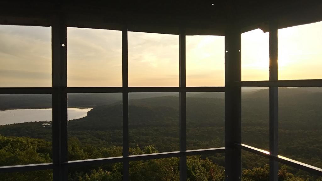
The Adirondack Park’s 6 million acres of pristine waters, mountain peaks and forestlands were not always the main attraction for all vacationers.
Some came for the dumps.
In the 1960s and ’70s, nearly every town in the Adirondack Park had its own dump or landfill. With lax regulations, black bears would descend on these open-air pits and feast on garbage. Tourists and residents descended, too. They lugged cameras, set up lawn chairs and took the family out for a night of wildlife viewing—some of the bears close enough to touch.
“It was a big attraction on a Saturday morning,” said Kevin Hajos, superintendent of public works for Warren County. Hajos used to go with his grandparents to watch the bears at the North Creek landfill.
That was before Gov. George Pataki and his administration decided in the 1990s that the Adirondack Park was not the place for trash.
For the last couple of decades, New Yorkers have spent millions of dollars keeping dumps out of the public-private park. Annual subsidies have helped the two counties that are wholly within the Adirondacks to truck their garbage elsewhere. But those subsidies are now in doubt, and some observers question the practicality of continuing to haul out all of the garbage that tens of thousands of residents and millions of visitors generate each year. The uncertainty could dump a financial load on park residents as local officials figure out how to tackle garbage in the future.
University of Michigan researchers and their partners are forecasting that western Lake Erie will experience a smaller-than-average harmful algal bloom this summer.
A relatively dry spring is expected to lead to a repeat of last year’s mild bloom, marking the first time in more than a dozen years that mild Lake Erie blooms have occurred in consecutive summers.
This year’s bloom is expected to measure 3—the same size as last year’s bloom—with a potential range of 2-4.5 out of 10 on the severity index, according to the annual Lake Erie forecast released today by the National Oceanic and Atmospheric Administration, which funds the research. The 2021 bloom is expected to be among the smaller blooms since 2011.
The Adirondack Explorer repeatedly sent questions to the state Department of Environmental Conservation from the ruling’s release on May 4 through May 24. Questions included what would come of the 19 or so miles of snowmobile trails already built; how the decision would affect other trail work; how the DEC was interpreting what constituted a constitutionally protected tree; whether the DEC would pursue a constitutional amendment specifically to authorize the snowmobile trail; and what guidance the department was providing to trail crews heading into their summer season.
A spokesperson wrote back on May 25 to say that “DEC remains committed to thoughtful stewardship of the Forest Preserve for the use and enjoyment of the public and protection of this resource. DEC is carefully and thoroughly analyzing the Court’s decision and determining the implications for DEC’s varied and complex work.”
The Adirondack Park Agency also did not respond to a similar list of questions, except to say that the state attorney general’s office was reviewing the decision.
Ben Brosseau, director of communications for the Adirondack Mountain Club, said last year’s DEC guidance held that trail crews were not allowed to cut trees on the forest preserve while the case was pending. By the Explorer’s press deadline, ADK had not received any updated guidance, but Brosseau said “we expect new guidance for hiking trail work to come out by mid to late summer.” josh willson of BETABETA Executive Director Josh Wilson skis in the Saranac Lake Wild Forest, where a trail project for mountain biking and skiing has been delayed by the tree-cutting lawsuit.
I think the solution is to repeal the forest preserve language in the constitution and move the Adirondack Park either into the state's reforestation program or the state nature and historic preserve, but I'm a right wing reactionary like Governor Franklin D. Roosevelt.