Places
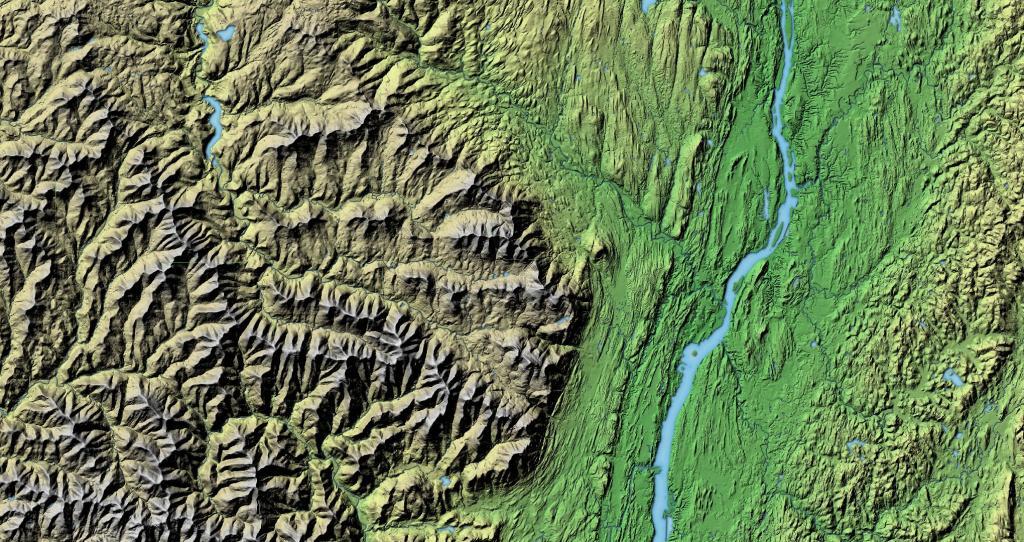
Eastern Catskill Mountains
Continuing my exploration of terrain using digital elevation models, today we look at the Catskill Escarpment and the Hudson River.
NY Route 12
New York State Route 12 is a state highway extending for 222.27 miles through central and northern New York in the United States. The southern terminus of the route is at U.S. Route 11 in the town of Chenango in the Southern Tier. The northern terminus is at NY 37 near the village of Morristown in the North Country.
New York Route 8
From wandering through the south-central Adirondacks through a great tour through Central NY, there is much to see along this 207 mile state-designated touring route.
How Much to Spend on Housing | JohnnyFD.com – Follow the Journey of a Location Independent Entrepreneur
My buddies’ $150k house he bought in Summit 🏘 🐷 🤠
It’s super nice, with a view of the mountains and nine acres of land. I am jealous because the parcel I grew up on was only 4.9 acres and the neighbors were a lot closer it seems. It also makes me kind of happy to think things like this still exist in the world, because $150,000 isn’t a lot of money in these inflationary times, and I could if I decided to sell of some stock go out and buy something similar, if I so wanted today.
To be sure it’s more of a large hunting cabin then a house, and it’s electrically heated and not far from the road. But it shows what kind of deals once can get if you out there and looking — he apparently snapped it up from the man that was selling the first day it went on the market. Plus Schoharie County has been bleeding population ever since Summit Shock Correctional closed — nearly one out ten people have left the county since then. But it’s a reminder of what’s out there if you are looking.
It really gives me hope that there is a tomorrow, and some day I will be able to afford my own land, preferably with cash and no borrowing costs. And that the only choice need not be suburbia with neighbors right next door, looking down on your redneckery. Seems like there is a bright future ahead, and if I want to leave way out in the sticks, there are eventually very affordable options out there if you know what your looking for. And if you keep it simple, and it’s paid with cash, rural living can be affordable and possible.
Long Path Intersections with Roads
One of the challenges is to find places where the Long Path leaves the public roads. Using OpenStreetMap data I created a line intersection of the Long Path against public roads, then with some hand editing made sure only to include off-road trail sections when they meet public roads. Then I ran it against the state's reverse geocoding service to add street addresses so you can use it with your phone or car GPS.
