Places
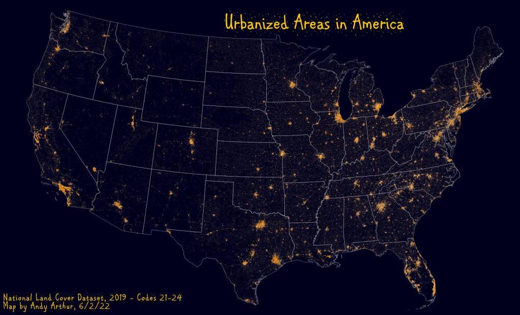
Urban Areas in America
Cars are becoming data harvesting nightmares
Cars are becoming data harvesting nightmares
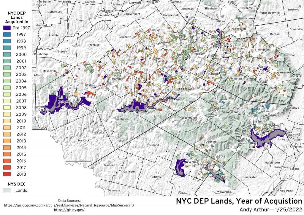
NYC DEP Lands – Year of Acquistion
Catskill Weather was asking if I could make up a map of lands that the NYC Department of Environmental Protection - Water Division had acquired in the Catskill Mountains over the past twenty years. I had my doubts, but then I found out that Greene County had hosted on their county REST/services a copy of the NYC DEP map. It's a few years out of date but still an interesting visualization.
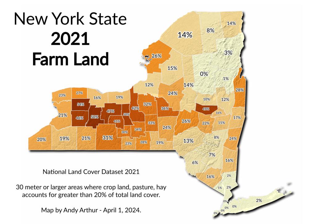
Farm Land by New York State County in 2021
Montgomery County is a classic example of an MAUP ... it's almost drawn to capture all of the agricultural areas along the Mohawk Valley without the hills and poorer soils of surrounding counties. Probably this was done historically not by accident.
![Untitled [Expires June 24 2024]](https://andyarthur.org//data/photo_014141_large.jpg)


