Warren County is a county in the U.S. state of New York. It is part of the Glens Falls, New York, Metropolitan Statistical Area. As of the 2010 census, the population was 65,707. It is named in honor of General Joseph Warren, an American Revolutionary War hero of the Battle of Bunker Hill.The county seat is Queensbury.
According to the U.S. Census Bureau, the county has a total area of 932 square miles (2,410 km2), of which 869 square miles (2,250 km2) consists of land and 62 square miles (160 km2) (6.69%) consists of water. Warren County is situated in the eastern portion of New York state; the eastern border is Washington County. Being located in the Adirondack Mountains, it is not uncommon for mountain peaks to surpass 2,000 feet (610 m). The highest peak in the county is Gore Mountain at an elevation of 3,198 feet (975 m).
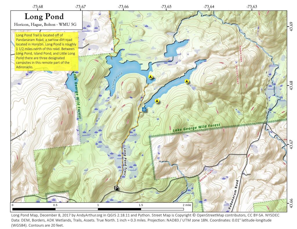
From Padnaram Road in the Town of Bolton, one can follow an old snowmobile trail back to the wilderness lakes of Long Pond and Island Pond. There are three designated campsites along Long Pond and a boat launch. See more on the ADK Forum: http://www.adkforum.com/showthread.php?t=19202
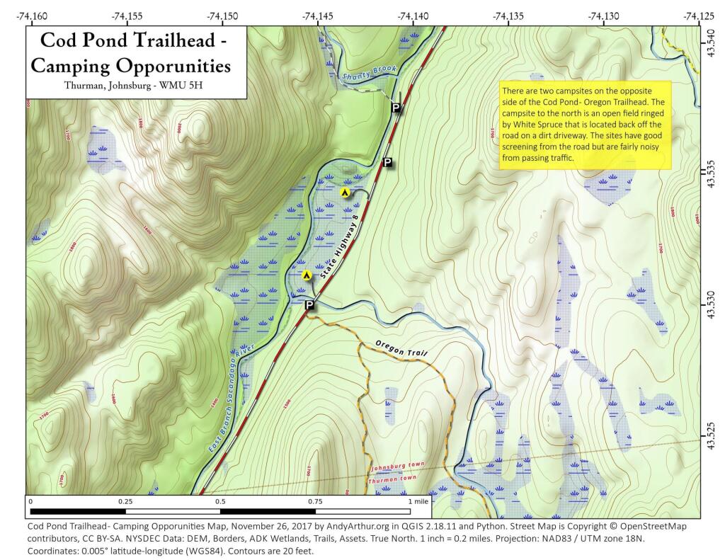
This past weekend I camped at the upper of these two campsites. It was a nice open field surrounded by white spruce. I hadn't ever been back to this campsite, but being sheltered from the wind with great views oft he stars, it is clearly now one of my favorite sites along NY 8. I have not explored the lower site but I confirmed it existed -- or at least the driveway exists to it -- when I was up that way this past weekend.
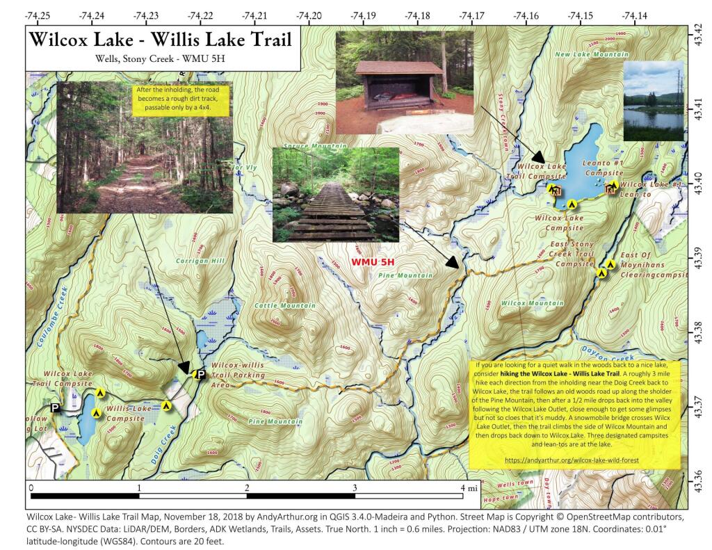
The Willis-Wilcox Lake Trail is a 3 mile walk back from Pumpkin Hollow Road outside of Wells. A quiet trail, it's relatively flat with some up and down over the col of Cattle Mountain and then over part of Wilcox Mountain. Part of the trail follows an old woods road, other sections follow the Wilcox Outlet Stream.
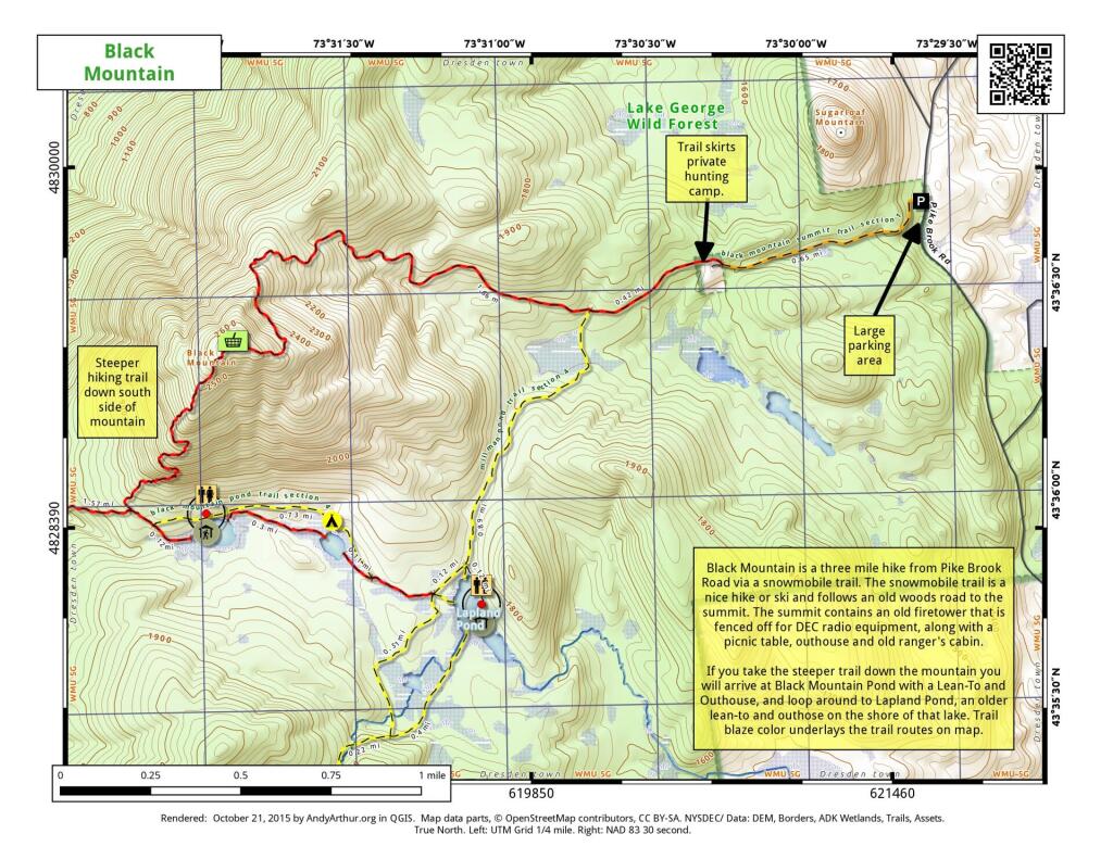
Black Mountain is a three mile hike from Pike Brook Road via a snowmobile trail. The snowmobile trail is a nice hike or ski and follows an old woods road to the summit. The summit contains an old firetower this is fenced off for DEC radio equipment, along with a picnic table, outhouse, and old ranger's cabin.
If you take the steeper trail down the mountain you will arrive at Black Mountain Pond with a Lean-To and Outhouse, and loop around to Lapland Pond, an older lean-to and outhouse on the shore of the lake. Trail blaze color underlays the trail routes on the map.
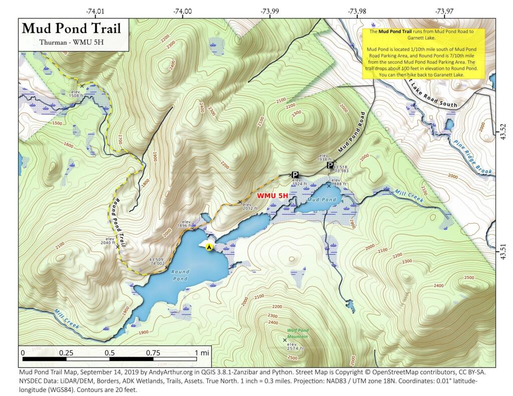
The Mud Pond Trail runs from Mud Pond Road to Garnett Lake.
Mud Pond is located 1/10th mile south of Mud Pond Road Parking Area, and Round Pond is 7/10th mile from the second Mud Pond Road Parking Area. The trail drops about 100 feet in elevation to Round Pond. You can then hike back to Garnett Lake.