Essex County
Pharaoh Lake Wilderness Campsites and Lean-Tos
Interactive Map
You can download the campsites and lean-tos on this map.
Map
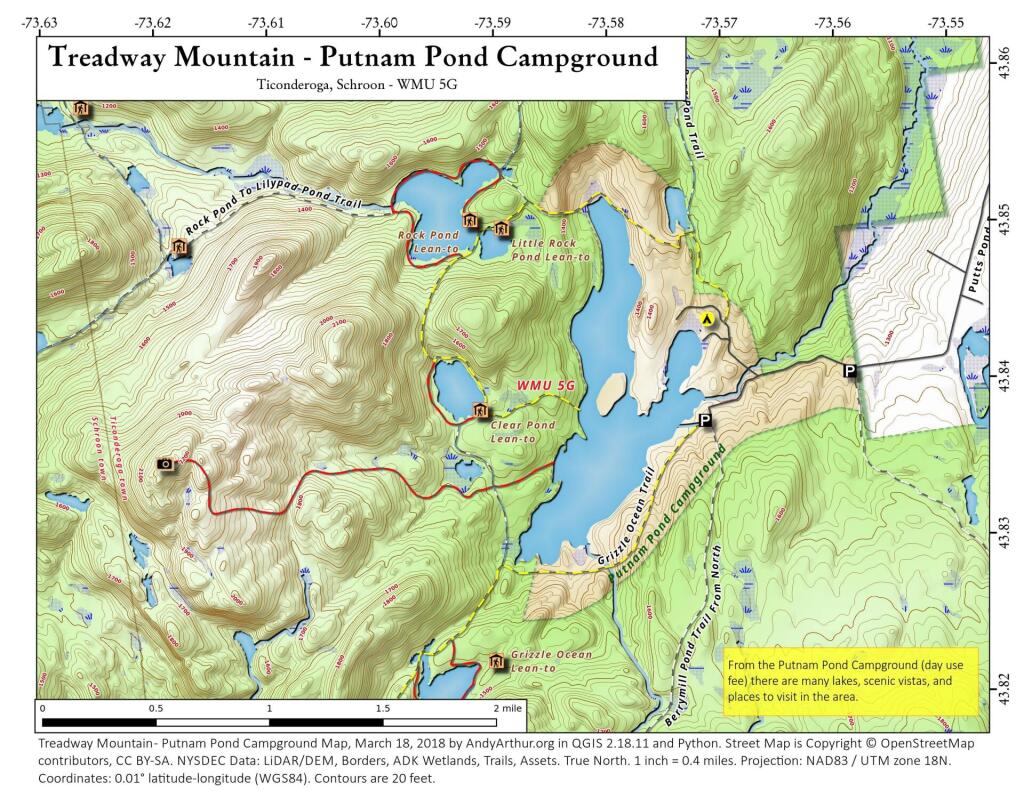
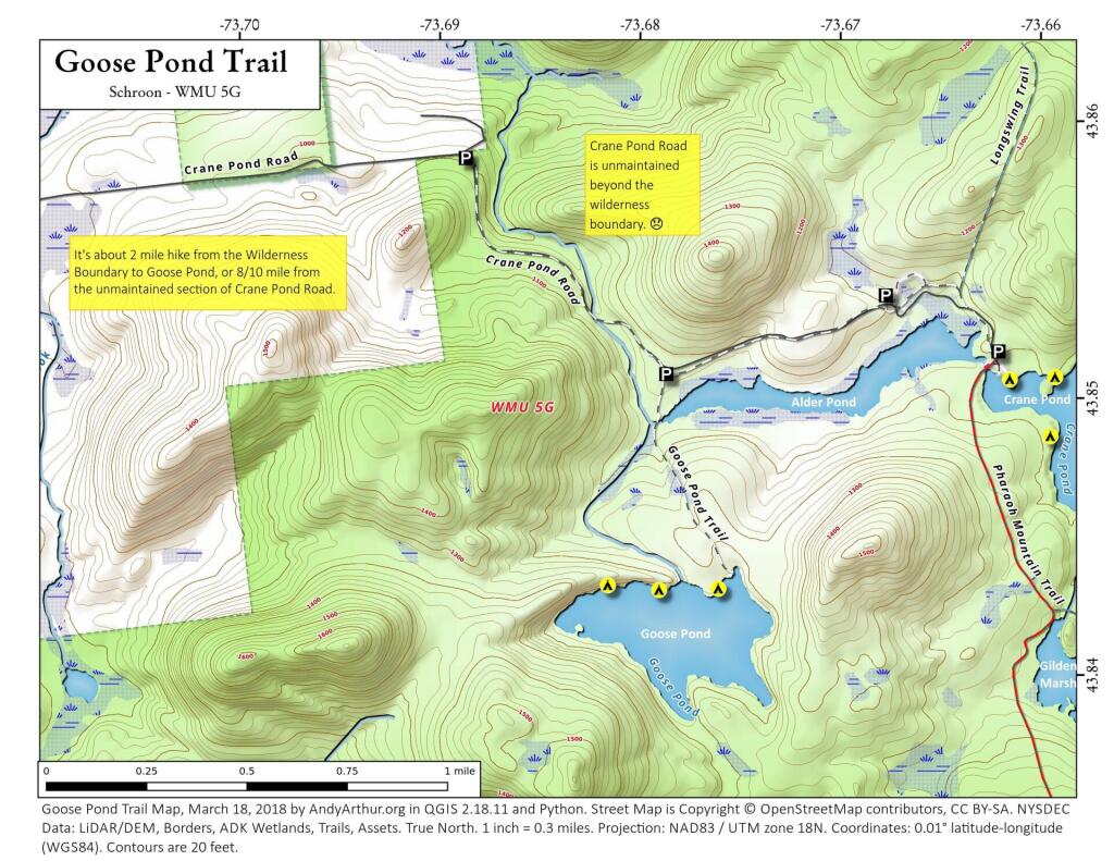
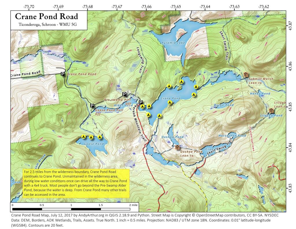
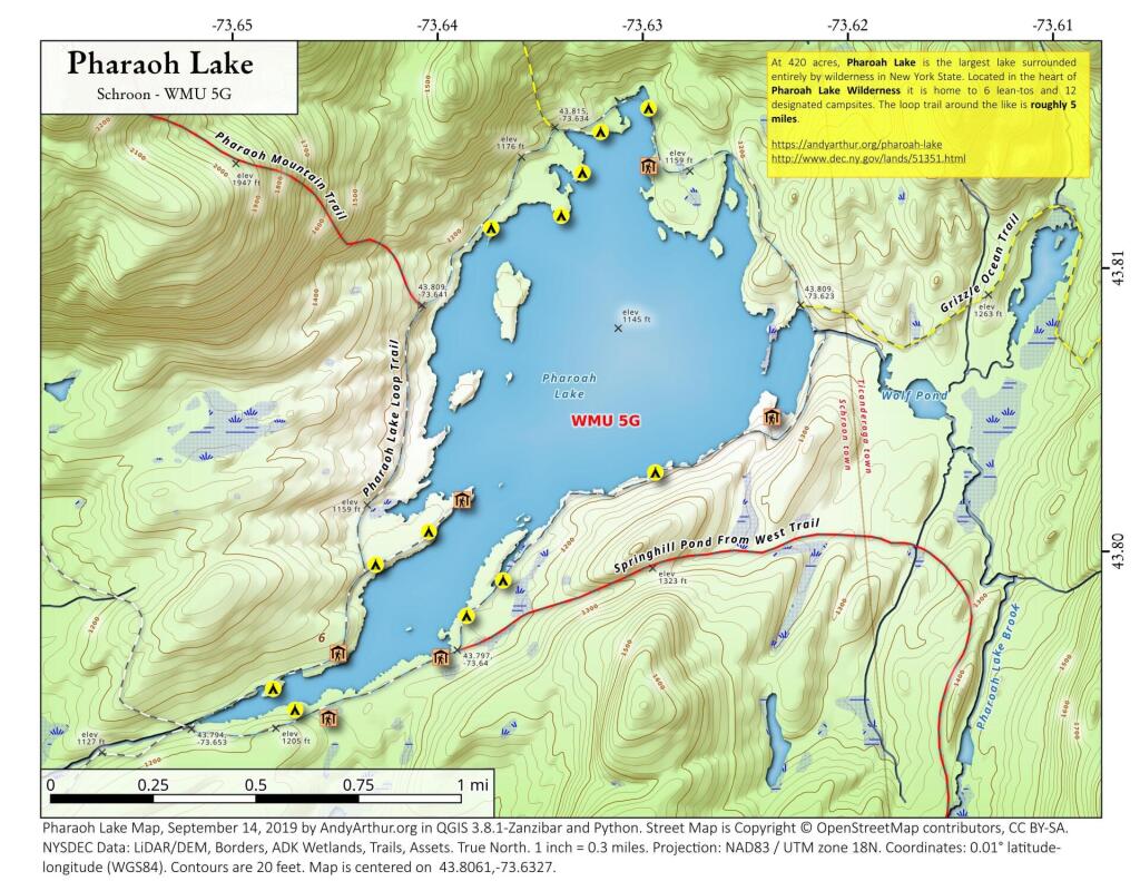
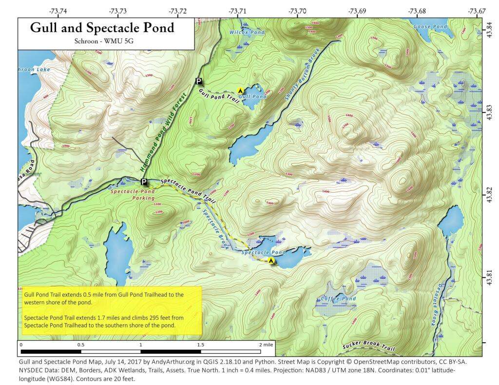
A series of maps you may find useful exploring the Pharaoh Lake Wilderness.
Coordinates in Pharaoh Lake Wilderness
Here is a list of the designated campsites, lean-tos, trailheads and other notable locations in the Pharaoh Lake Wilderness. Also available as a downloadable Google Sheet.
| Location | Latitude | Longitude |
| Berrymill Pond Lean-To | 43.81454801 | -73.58081948 |
| Berrymill Pond Trailhead at Putman Pond Campground | 43.83509151 | -73.57026107 |
| Berrymill Trail At New Hague Road | 43.78023127 | -73.55329092 |
| Clear Pond Lean-To | 43.83841001 | -73.59167491 |
| Crab Pond Campsite | 43.77472843 | -73.65890527 |
| Crab Pond Spur (Red) – Crab Pond – Short Swing Trail Intersection | 43.83775208 | -73.64057710 |
| Crane Pond Campsite | 43.84864335 | -73.65985638 |
| Crane Pond Campsite | 43.85071940 | -73.66183786 |
| Crane Pond Campsite | 43.85560839 | -73.65264543 |
| Crane Pond Campsite | 43.85535605 | -73.64349342 |
| Crane Pond Campsite | 43.85160920 | -73.65251154 |
| Crane Pond Campsite | 43.84835649 | -73.65613048 |
| Crane Pond Campsite | 43.85077388 | -73.65957227 |
| Crane Pond Campsite | 43.85666013 | -73.64841229 |
| Crane Pond Parking | 43.85141342 | -73.66104306 |
| Crane Pond Road – Wilderness Boundary – Adirondack Homeland Rock | 43.85936898 | -73.68870525 |
| Flooded Area Of Crane Pond Road | 43.85323847 | -73.66807111 |
| Glidden Marsh | 43.84240546 | -73.65970659 |
| Glidden Marsh – Short Swing Trail Intersection | 43.83893960 | -73.65592982 |
| Goose Pond Campsite | 43.84351480 | -73.68206730 |
| Goose Pond Campsite | 43.84331698 | -73.67951317 |
| Goose Pond Campsite | 43.84333086 | -73.67655565 |
| Goose Pond Trailhead | 43.85121333 | -73.67911657 |
| Grizzle Ocean – Eastern Intersection of Loop | 43.82374108 | -73.59452777 |
| Grizzle Ocean – Western Intersection of Loop | 43.82208142 | -73.59755325 |
| Grizzle Ocean Lean-To | 43.82236937 | -73.59063979 |
| Grizzle Ocean Trail – Pharaoh Lake Loop Intersection | 43.80886888 | -73.62245840 |
| Gull Pond Campsite | 43.83310214 | -73.70973235 |
| Gull Pond Trailhead | 43.83425890 | -73.71730737 |
| Lillypad Pond Lean-To | 43.84920271 | -73.61800241 |
| Little Rock Pond Lean-To | 43.85000288 | -73.58953978 |
| Lost Pond Campsite | 43.82660035 | -73.54556752 |
| Lost Pond Campsite | 43.82722045 | -73.54368500 |
| Lost Pond Campsite | 43.82252686 | -73.54176973 |
| Lost Pond Trailhead | 43.84084139 | -73.55904777 |
| Mill Brook Site #1 | 43.77416116 | -73.68800138 |
| Mill Brook Site #2 | 43.77317457 | -73.68730677 |
| Oxshoe Pond Lean-To | 43.84052968 | -73.65017823 |
| Pharaoh Lake #1 Lean-To | 43.79457831 | -73.64585678 |
| Pharaoh Lake #2 Lean-To | 43.79665505 | -73.64033496 |
| Pharaoh Lake #3 Lean-To | 43.80494507 | -73.62400854 |
| Pharaoh Lake #4 Lean-To | 43.81387816 | -73.62981963 |
| Pharaoh Lake #5 Lean-To | 43.80219647 | -73.63916891 |
| Pharaoh Lake #6 Lean-To | 43.79686458 | -73.64533930 |
| Pharaoh Lake Campsite | 43.80109528 | -73.64083096 |
| Pharaoh Lake Campsite | 43.81177053 | -73.63754264 |
| Pharaoh Lake Campsite | 43.85342094 | -73.64430870 |
| Pharaoh Lake Campsite | 43.81510616 | -73.63212963 |
| Pharaoh Lake Campsite | 43.81217079 | -73.63411431 |
| Pharaoh Lake Campsite | 43.81367066 | -73.63304811 |
| Pharaoh Lake Campsite | 43.80305162 | -73.62973486 |
| Pharaoh Lake Campsite | 43.79564039 | -73.64853700 |
| Pharaoh Lake Campsite | 43.81590916 | -73.62977563 |
| Pharaoh Lake Loop – Pharaoh Mountain Intersection | 43.80907659 | -73.64105356 |
| Pharaoh Lake Trail – Pharaoh Loop Intersection | 43.79438761 | -73.65306303 |
| Pharaoh Lake Trail Parking Area | 43.75978733 | -73.68943074 |
| Pharaoh Mountain Summit | 43.81822928 | -73.65791845 |
| Pharaoh Mountain Summit Campsite | 43.81933550 | -73.65747805 |
| Primitive Campsite | 43.79488366 | -73.64748837 |
| Primitive Campsite | 43.79996483 | -73.64344224 |
| Primitive Campsite | 43.79810280 | -73.63904961 |
| Primitive Campsite | 43.79933265 | -73.63724240 |
| Rock Pond Lean-To | 43.85055907 | -73.59229491 |
| Spectacle Pond Campsite | 43.81247996 | -73.70505246 |
| Spectacle Pond Trailhead | 43.82256426 | -73.72683295 |
| Springhill Ponds Campsite | 43.78857544 | -73.59368259 |
| Springhill Ponds Campsite | 43.78851542 | -73.59810362 |
| Sucker Brook Parking Area | 43.77104809 | -73.74263703 |
| Treadway Mountain | 43.83509861 | -73.61995041 |
| Treadway Mountain Trail – Clear Pond Trail South Intersection | 43.83346060 | -73.59055781 |
| Tubmill Marsh Lean-To | 43.85817133 | -73.62648371 |
Northwood Club Road
Interactive map showing camping opporunites along this road outside of Minerva.
