![Untitled [Expires October 30 2024]](https://andyarthur.org//data/photo_014834_large.jpg)
Search Results for: "Map:" Mountain Pond
Crane Mountain Pond
Mountain Pond
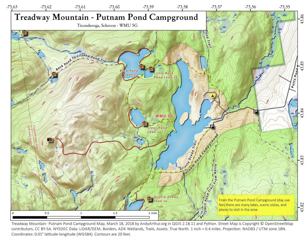
Treadway Mountain from Putnam Pond Campground
Moose Mountain Pond
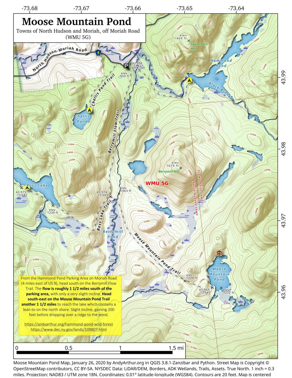
From the Hammond Pond Parking Area on Moriah Road (4 miles east of US 9), head south on the Berrymill Flow Trail. The flow is roughly 1 1/2 miles south of the parking area, with only a very slight incline. Head south-east on the Mouse Mountain Pond Trail another 1 1/2 miles to reach the lake which contains a lean-to on the north shore. Slight incline, gaining 200 feet before dropping over a ridge to the pond.
https://andyarthur.org/hammond-pond
https://www.dec.ny.gov/lands/109807.html
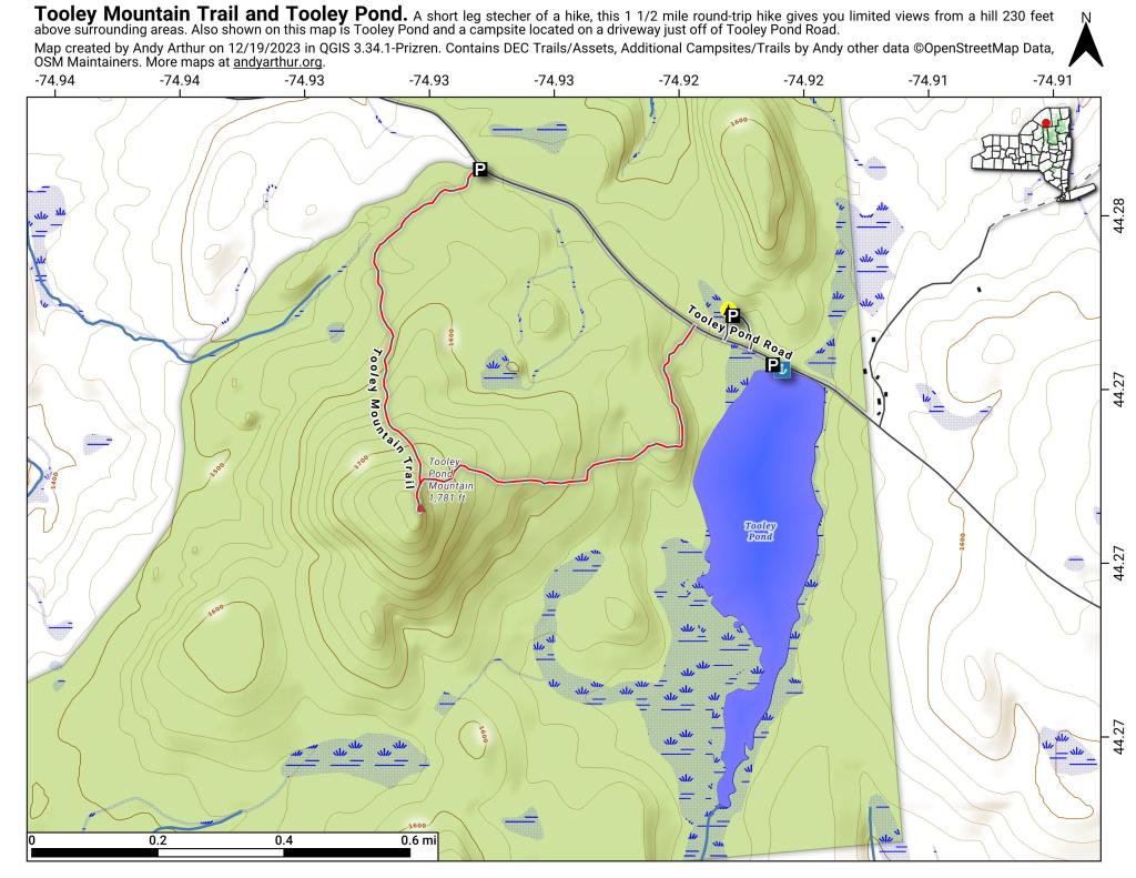
Tooley Mountain Trail and Tooley Pond
Sucker Pond
In the Green Mountain National Forest, a few miles north of the VT-Mass border.