Search Results for: "Map:" Moose Pond
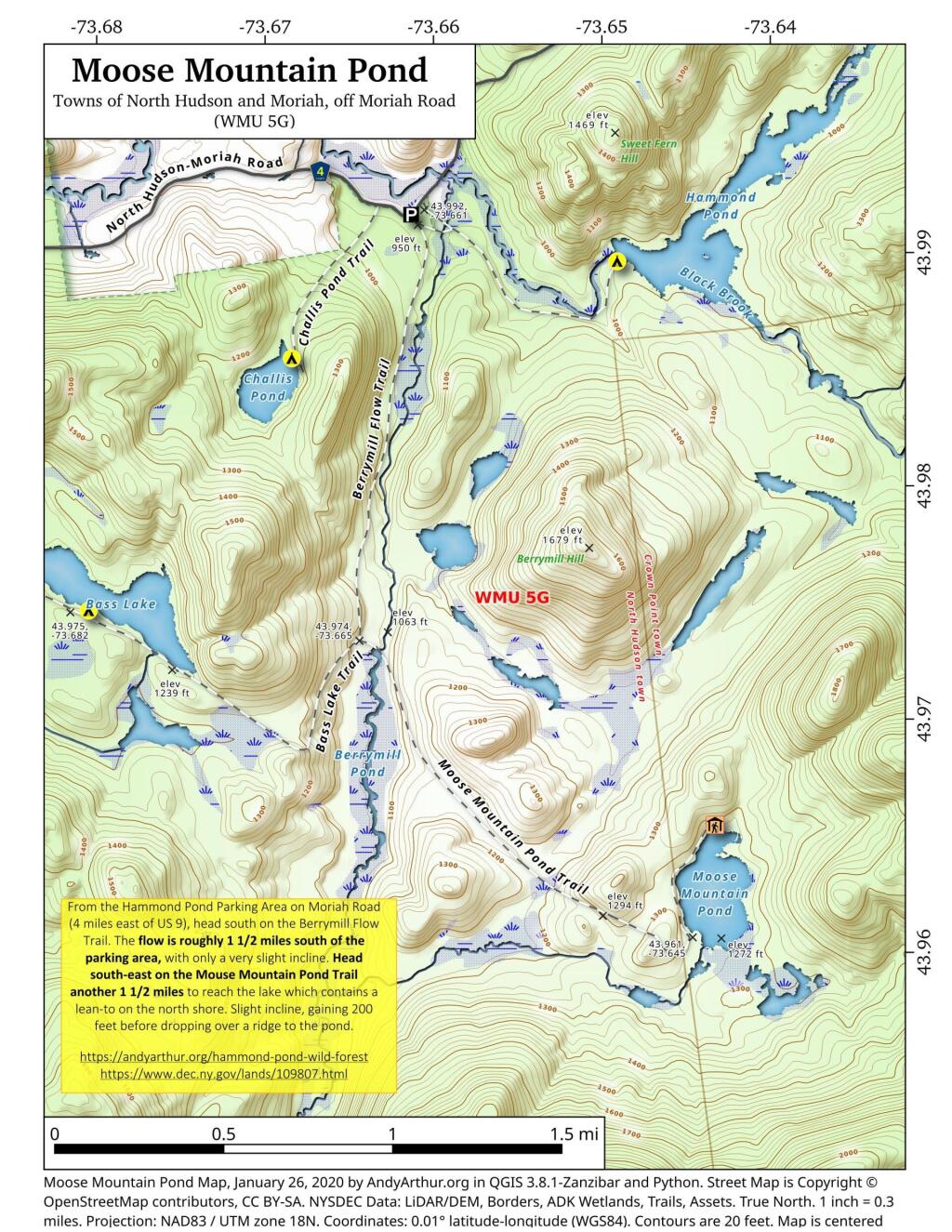
Moose Mountain Pond
From the Hammond Pond Parking Area on Moriah Road (4 miles east of US 9), head south on the Berrymill Flow Trail. The flow is roughly 1 1/2 miles south of the parking area, with only a very slight incline. Head south-east on the Mouse Mountain Pond Trail another 1 1/2 miles to reach the lake which contains a lean-to on the north shore. Slight incline, gaining 200 feet before dropping over a ridge to the pond.
https://andyarthur.org/hammond-pond
https://www.dec.ny.gov/lands/109807.html
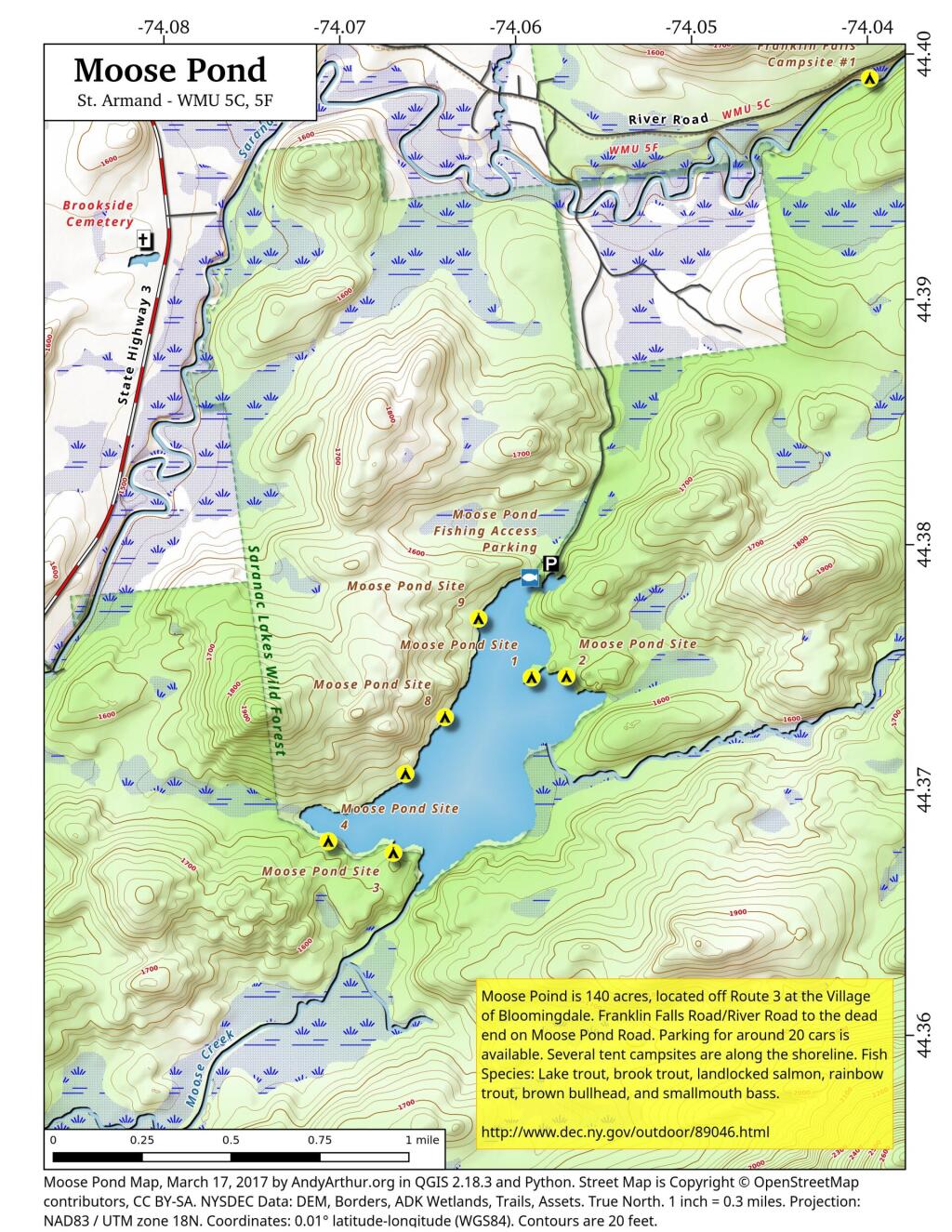
Moose Pond Campsites
Moose Pond
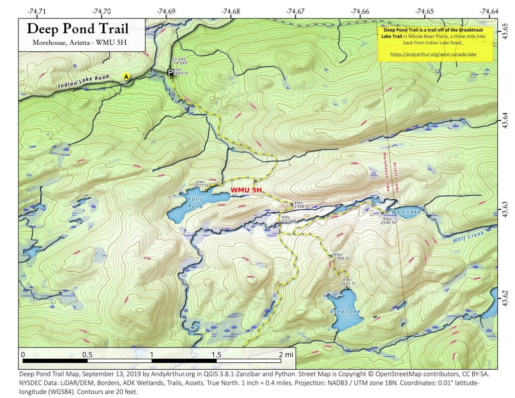
Deep Pond Trail
Deep Pond Trail is located off of the Brooktrout Lake Trail in Moose River Plainss (technically West Canada Lake Wilderness), and is a three mile hike back from Idnain Lake Road.
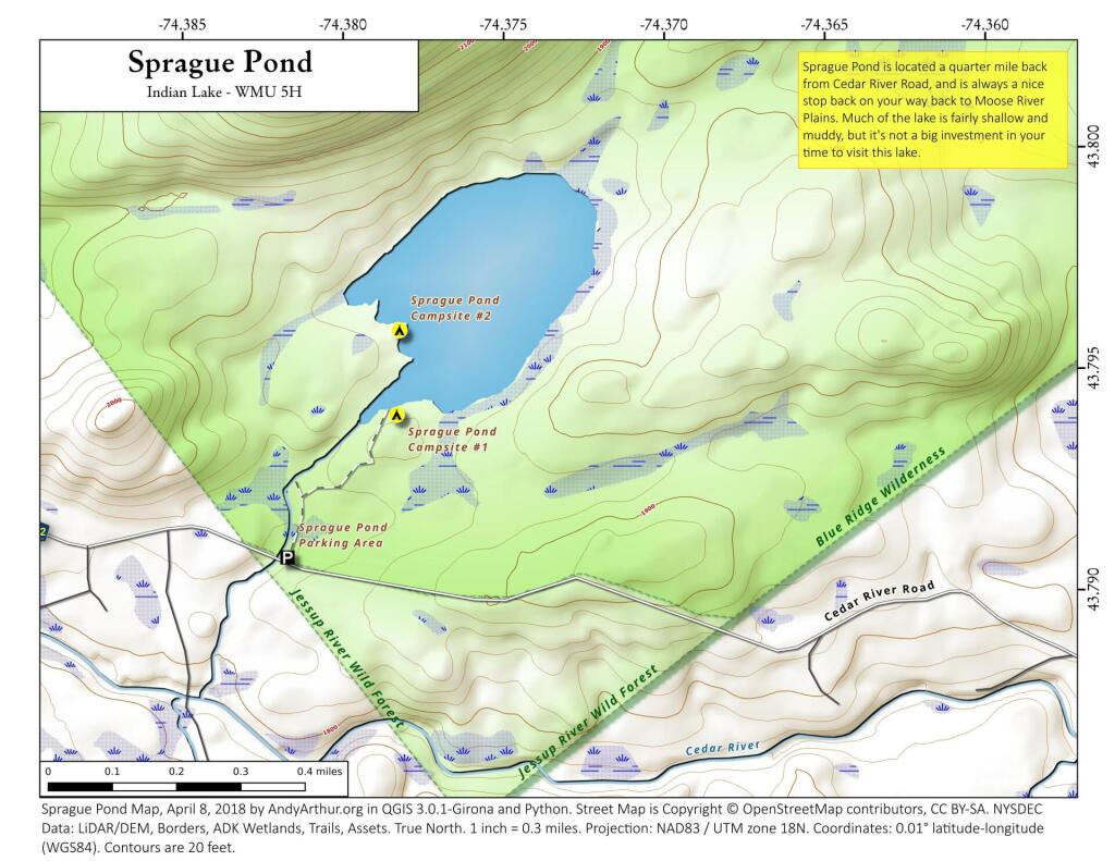
Sprague Pond
Located a quarter mile north of Cedar River Road, about half way to Cedar River Flow at Moose River Plains, is the trail head for Sprague Pond. It's a short hike a quarter mile north of the road, along it's outlet creek to a modestly sized, swampy pond. Campsites along the pond are very informal, and lightly used.


