Indian Lake Trail
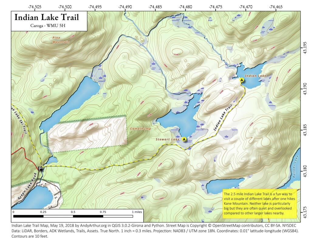
The 2.5 mile Indian Lake Trail from the Kane Mountain Parking Area takes you past Stewart Lake to Indian Lake. A nice quiet trail often done in combination with hiking up the Kane Mountain Firetower.
The 2.5 mile Indian Lake Trail from the Kane Mountain Parking Area takes you past Stewart Lake to Indian Lake. A nice quiet trail often done in combination with hiking up the Kane Mountain Firetower.
This map shows from the public tax records who has wells and who uses the public water supply in the hamlet area of Indian Lake.
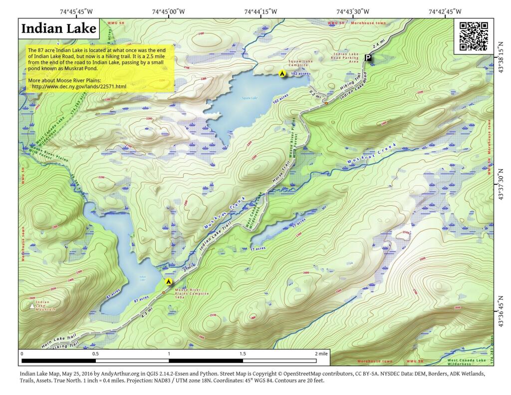
This map shows the Indian Lake Trail from Squaw Lake, past Muskrat Lake to Indian Lake at Moose River Plains. The old Indian Lake Road terminates about a 1/4 mile before Squaw Lake pursuant to a compromised implemented under the demands of the wilderness activists.
44.22080561052468,-74.30630484336764
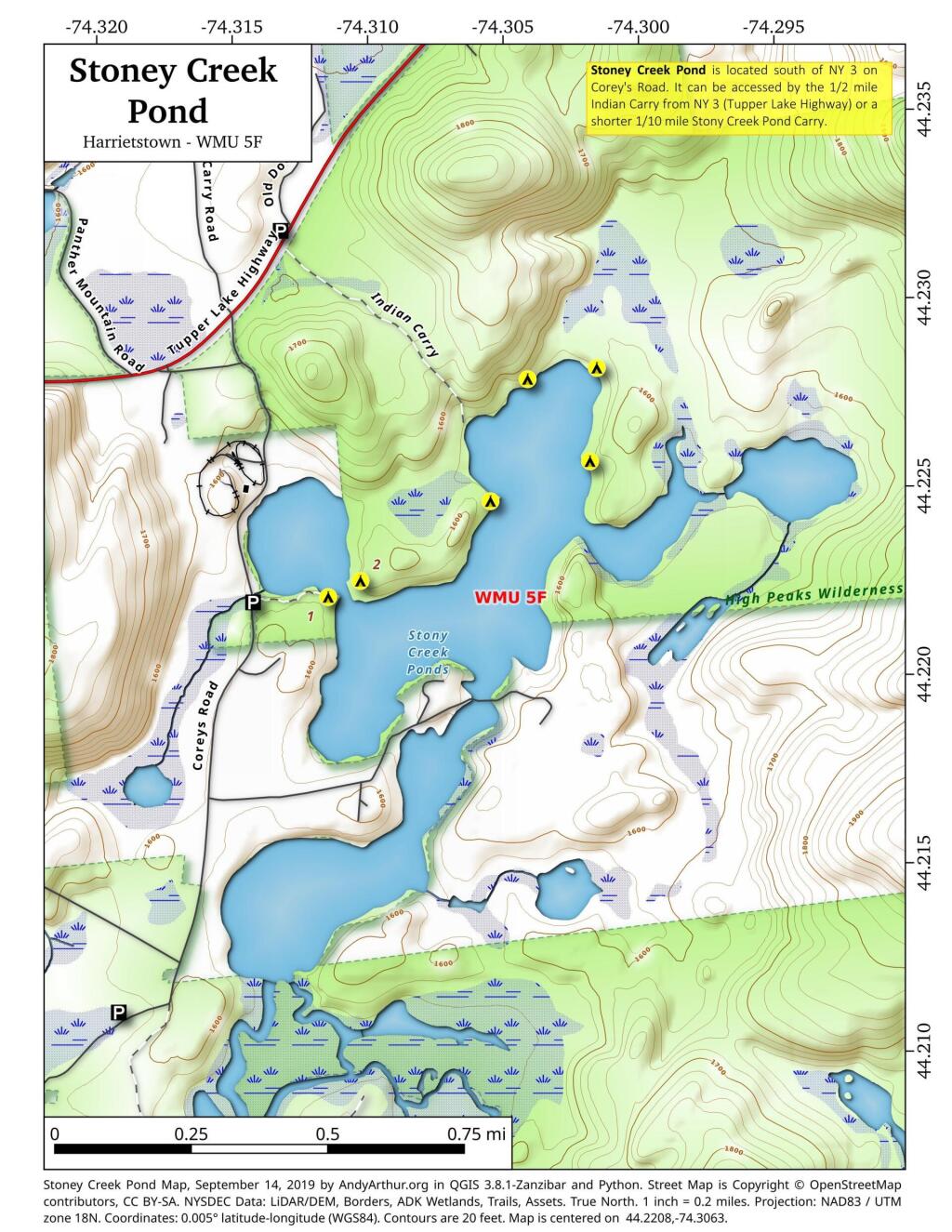
Stoney Creek Pond is located south of NY 3 on Corey's Road. It can be accessed by the 1/2 mile Indian Carry from NY 3 (Tupper Lake Highway) or a shorter 1/10 mile Stony Creek Pond Carry.