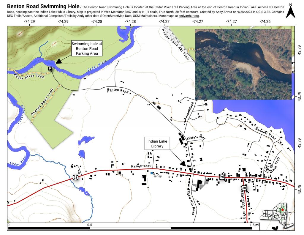
The Benton Road Swimming Hole is located at the Cedar River Trail Parking Area at the end of Benton Road in Indian Lake. Access via Benton Road, heading past the Indian Lake Public Library. Find a video of the swimming hole here on Facebook: https://www.facebook.com/watch/?v=517656672638409
Old Forge, West Canada Lakes and Indian Lakes USGS Topographic maps from circa 1900. Colored dashes represent contemporary DEC Roads and Trails for comparison sake. Underlay is contemporary USGS topographic map.
The Charles C. Deam Wilderness Area is located close to the city of Heltonville and Bloomington, Indiana. Lake Monroe, Indiana's largest reservoir, forms the northern boundary. It was established as wilderness in 1982 and is managed by the Hoosier National Forest. It covers 12,472 acres. https://www.fs.usda.gov/recarea/hoosier/recarea/?recid=41554
At the turn of the century, before NY 30, the Schenectady and Ogdensburg Railroad went past Hope through Wells before heading along what is now Fly Creek Road to along the edge of Indian Lake to the village.
https://mapwarper.net/maps/54787