Branch Pond Road
Branch Pond Road in Kelley Stand is a popular place to camp and hike back to Branch Pond, Bourne Pond and Stratton Pond in the Lye Brook Wilderness.
Branch Pond Road in Kelley Stand is a popular place to camp and hike back to Branch Pond, Bourne Pond and Stratton Pond in the Lye Brook Wilderness.
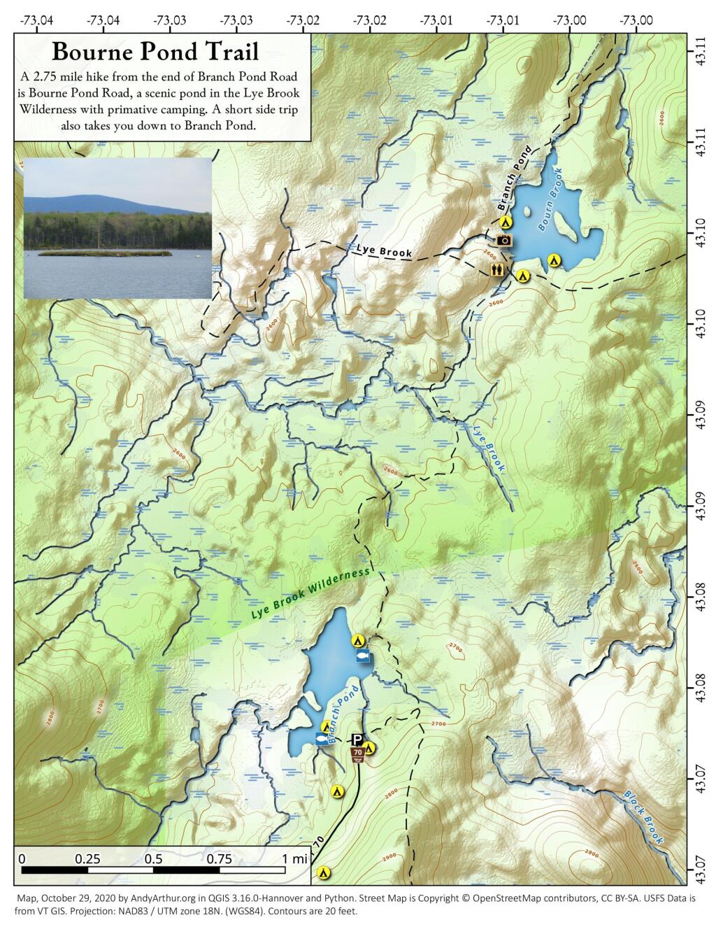
Bourne Pond is a 2.75 mile hike from the end of Branch Pond Road, a scenic pond in the Lye Brook Wilderness with primative camping and an outhouse. A short side trip takes you down to Branch Pond.
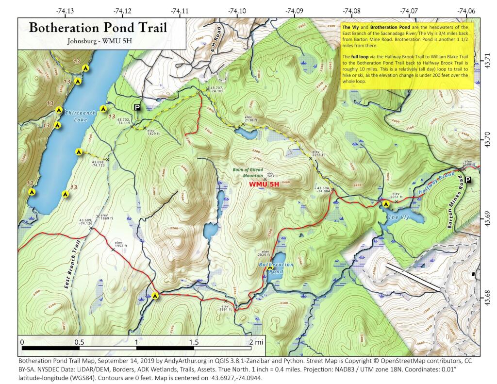
The Vly and Brotheration Pond are the headwaters of the East Branch of the Sacanadaga River. The Vly is 3/4 miles back from Barton Mine Road. Brotheration Pond is another 1 1/2 miles from there.
The full loop via the Halfway Brook Trail to William Blake Trail to the Botheration Pond Trail back to Halfway Brook Trail is roughly 10 miles. This is a relatively (all day) loop to trail to hike or ski, as the elevation change is under 200 feet over the whole loop.
A map of the various dispersed campsites along Branch Pond Road in the Green Mountain National Forest.
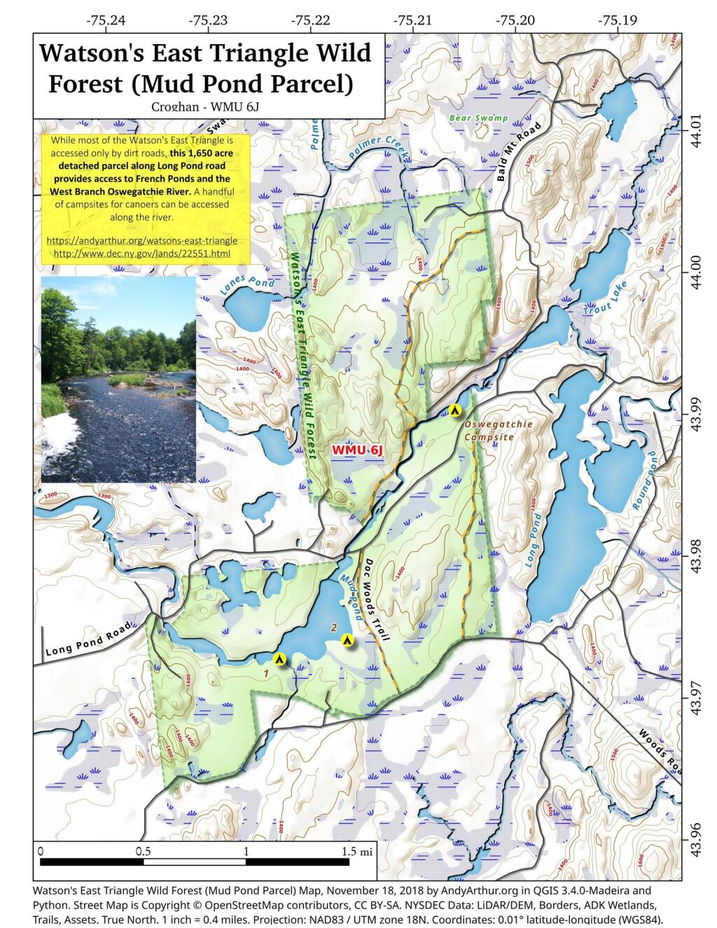
While most of Watson's East Triangle is accessed only by seasonal dirt roads, this 1,650 acre detached parcel along Long Pond road provides access to Franch Ponds and the West Branch Oswegathie River. A handful of campsites can be accessed along the river.
The Bourn Pond Trail skirts the western edge of Branch Pond and then enters the Lye Brook Wilderness. The trail travels along an old railroad grade and reaches south end of Borun Pond. Sections of this trail can be very muddy and may not be suitable for hiking during wet weather.