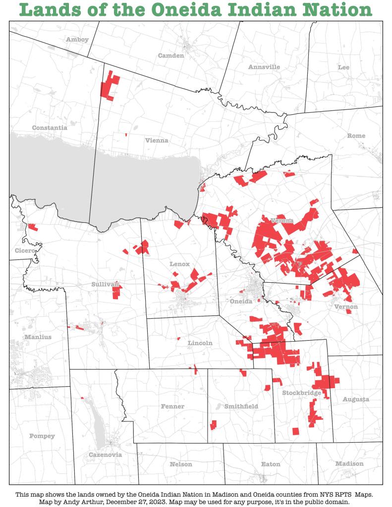
Thematic Map: Lands of the Oneida Indian Nation
Download a High Resolution JPEG Image of the Lands of the Oneida Indian Nation or an Adobe Acrobat Printable PDF of the Thematic Lands of the Oneida Indian Nation.
About Lands of the Oneida Indian Nation ....
I was curious about the contemporary lands of the Oneida Indian Nation while I was out in Madison County during the Christmas holiday. I thought it would be an interesting map, querying it from the state tax maps.
More about Oneida, New York...
Oneida is a city in Madison County located west of Oneida Castle (in Oneida County) and east of Canastota, New York, United States. The population was 11,390 at the 2010 census. The city, like both Oneida County and the nearby silver and china maker, was named for the Oneida tribe, which had a large territory here around Oneida Lake during the colonial period. The city developed especially in the period following construction of the Erie Canal and railroads across the state.
http://en.wikipedia.org/wiki/Oneida,_New_York
Maps and Interactives
Utica – House Style
Oneida Lake – Land Use
Oneida Flats – 1996, 2003, 2013, 2017, 2022
Oneida 1895
Lands of the Oneida Indian Nation
... photos, maps and other content from from Oneida, New York.
