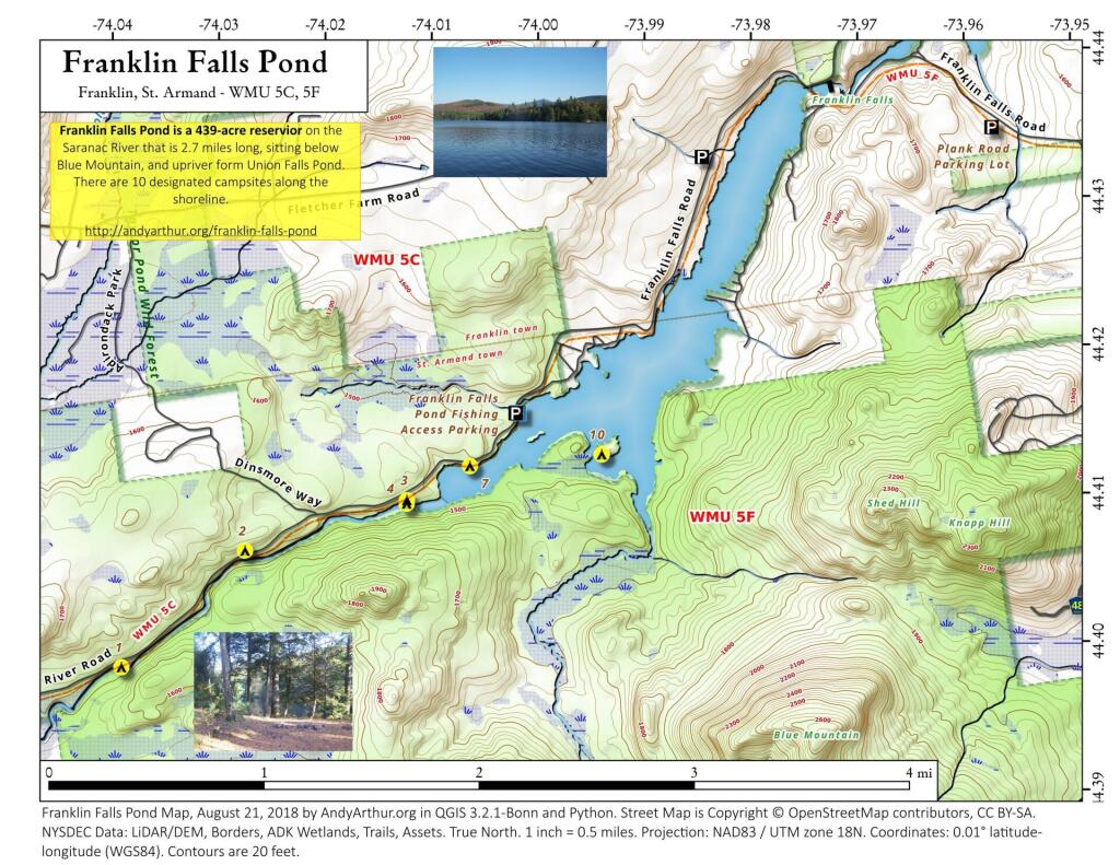
Map: Franklin Falls Pond
Download a High Resolution JPEG Image of the Franklin Falls Pond or an Adobe Acrobat Printable PDF of the Franklin Falls Pond.

Bookmark my free Interactive GPS Map for your phone:
https://andyarthur.org/ny
... shows your location as a blue dot in relationship to campsites, trails, state land. This online map requires cell service, won't work in remote country, so also bring a paper map.
Free Download of New & Historical USGS 1:24k Topograpic Maps
Interactive maps with backcountry and roadside camping: New York, Pennsylvania, West Virginia & Vermont. List of NYS DEC Lean-Tos and Firetowers.
Google Spreadsheet with Roadside, Primitive and Pay Campsites
More about Franklin Falls Pond...
Franklin Falls Pond is a 439-acre (178 ha), 2.7-mile (4.3 km) long pond created by damming the Saranac River three miles (5 km) northeast of Saranac Lake in the Adirondack Mountains of northern New York State, USA.
http://en.wikipedia.org/wiki/Franklin_Falls_Pond
Maps and Interactives
Franklin Falls Reservior
Franklin Falls Pond – Saranac River Campsites
Franklin Falls Pond
... photos, maps and other content from from Franklin Falls Pond.

2 Comments
Would you happen to know the name of the boat livery that was on Franklin in 1950? It was down a steep, deeply ruttted road.
In the 1950s, one notable boat livery in the area around Franklin Falls was Hickok’s Boat Livery. It was located on the north side of Fish Creek on the Upper Saranac Lake side of New York Route 301. This livery was owned by Robert E. Hickok and Gaylord Wray, and operated by Minnie Wray Hickok. It dates back to at least the 1930’s.