Search Results for: "Map:"
Stillwater Reservior
Stillwater Mountain
Indian Pipe State Forest
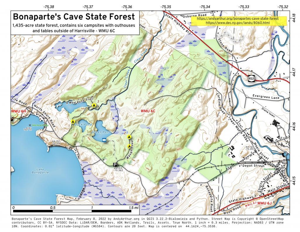
Bonaparte’s Cave State Forest
Lowville
I do find the hillshade to make even most boring map a little more attractive. Not all of New York has the LiDAR data in the 3D Elevation Program, like with Albany County, but a lot of places do, and it's far nicer then the traditional digital elevation models.
Confusion Flats
Confusion Flats is located in the Independence River Wild Forest and Otter Creek State Forests, and it's a series of sand trails and roads that are popular with horseback riders and off-roaders.