Search Results for: photo out on canada lake

Locations and Maps of Lean-Tos in NYS

Interactive Map of Lean-Tos

You can get a downloadable, more detailed map with campsites, lean-tos, scenic vistas and trails.

Note: This list is sorted from North to South, and West to East in New York, therefore the farthest North Lean-To in NY State is in the Debar Mountain Wild Forest, and the farthest south one is in David A. Sarnoff Pine Barrens Preserve in Long Island. Location links take you to aerial photos of the Lean-Tos on the free ACME Mapper.

Download or View this Chart on Google Sheets

State Forest LandNameTypeDescriptionLocation
Debar Mtn. Wild ForestDebar Mountian Lean-ToLean-To 44.598926, -74.228592
Debar Mtn. Wild ForestGrass Pond Lean-ToLean-To 44.493389, -74.251194
Taylor Pond Wild ForestNorth Shore Taylor Pond Lean-ToLean-ToManaged By Operations44.4897, -73.861427
Taylor Pond Wild ForestSouth East Taylor Pond Lean-ToLean-ToManaged By Operations44.482888, -73.853777
Taylor Pond Wild ForestNorthwest Shore Taylor Pond Lean-ToLean-ToManaged By Operations44.477689, -73.881283
Taylor Pond Wild ForestPoke-O-Moonshine Summit Lean-ToLean-To 44.399797, -73.514557
Saint Regis Canoe AreaFish Pond Campsite 2Lean-To 44.396133, -74.370421
Saint Regis Canoe AreaFish Pond Campsite 5Lean-To 44.391301, -74.365807
Saint Regis Canoe AreaSt. Regis Pond South Shore Lean-ToLean-ToWithin The Adopt A Lean-To System44.380642, -74.320299
Saint Regis Canoe AreaSt. Regis Pond Campsite 19Lean-To 44.380626, -74.320423
Wolf Lake State ForestBeaver Flow Lean-ToLean-To 44.357822, -75.316001
Mckenzie Mtn. WildernessLoch Bonnie Lean-ToLean-To 44.347347, -73.995669
Mckenzie Mtn. WildernessWhite Face Brook Lean-ToLean-To 44.344217, -73.928647
Wolf Lake State ForestWolf Lake Lean-ToLean-To 44.336323, -75.313886
Saranac Lakes Wild ForestLake Placid Campsite 3Lean-To 44.332595, -73.95668
Saranac Lakes Wild ForestLake Placid Campsite 2Lean-To 44.332296, -73.956626
Wolf Lake State ForestMoon Pond Lean-ToLean-To 44.332276, -75.321172
Saranac Lakes Wild ForestFollensby ClearLean-To 44.325095, -74.349897
Wolf Lake State ForestHuckleberry Lake Lean-ToLean-To 44.324272, -75.333738
Mckenzie Mtn. WildernessPlacid Lean-ToLean-To 44.321456, -74.030786
Saranac Lakes Wild Forest Lean-To 44.309124, -74.18053
Saranac Lakes Wild Forest Lean-To 44.302887, -74.302634
Saranac Lakes Wild Forest Lean-To 44.289835, -74.216869
Saranac Lakes Wild Forest Lean-To 44.286942, -74.289775
Saranac Lakes Wild Forest Lean-To 44.286657, -74.162602
Saranac Lakes Wild Forest Lean-To 44.271712, -74.273283
Saranac Lakes Wild Forest Lean-To 44.265599, -74.24293
Hurricane Mountain Primitive AreaLost Pond/BiesemeyerLean-To 44.26073, -73.710011
Hurricane Mountain Primitive AreaGulf Brook Lean-ToLean-To 44.253097, -73.71796
Saranac Lakes Wild Forest Lean-To 44.228772, -74.375533
High Peaks Wilderness Lean-To 44.198805, -74.31831
Horseshoe Lake Wild ForestEagle Landing Lean-ToLean-To 44.19683, -74.512309
High Peaks Wilderness Lean-To 44.177317, -74.321808
Giant Mountain WildernessGiant Mtn. Lean-ToLean-To 44.175641, -73.722171
Horseshoe Lake Wild Forest Lean-To 44.158907, -74.560725
High Peaks Wilderness Lean-To 44.15683, -74.313308
Cranberry Lake Wild Forest Lean-To 44.1534, -74.884029
High Peaks Wilderness Lean-To 44.147236, -74.318105
Dix Mountain WildernessBouquet Lean-ToLean-To 44.110904, -73.774043
High Peaks Wilderness Lean-To 44.105829, -74.312037
Sargent Ponds Wild Forest Lean-To 44.102744, -74.321863
Sargent Ponds Wild Forest Lean-To 44.082504, -74.333915
Sargent Ponds Wild Forest Lean-To 44.081407, -74.335829
High Peaks Wilderness Lean-To 44.065927, -74.326697
Dix Mountain WildernessLilian Brook Lean-ToLean-To 44.058989, -73.806533
Dix Mountain WildernessSlide Brook Lean-ToLean-To 44.044126, -73.805858
High Peaks Wilderness Lean-To 44.042977, -74.349335
High Peaks Wilderness Lean-To 44.041409, -74.350149
High Peaks Wilderness Lean-To 44.02862, -74.366763
High Peaks Wilderness Lean-To 44.002655, -74.38648
William C. Whitney WildernessLake Lila # 7Lean-To 44.002145, -74.775682
High Peaks Wilderness Lean-To 43.998164, -74.392741
Independence River Wild ForestTrout Pond Lean ToLean-To 43.928489, -74.94487
Sargent Ponds Wild ForestDeerland Carry Lean-To 2Lean-ToFair Condition43.926218, -74.475396
Sargent Ponds Wild ForestDeerland Carry Lean-To 1Lean-ToFair Condition43.925781, -74.475846
Sargent Ponds Wild ForestPinebrook Lean-ToLean-ToFair Condition43.906646, -74.50259
Sargent Ponds Wild Forest Lean-To 43.902847, -74.548063
Blue Mountain Wild ForestNorth End Tirrel Pond Lean-ToLean-To 43.887378, -74.377739
Sargent Ponds Wild Forest Lean-To 43.879414, -74.606052
Blue Mountain Wild ForestO’neil Lean-ToLean-To 43.875096, -74.367316
Sargent Ponds Wild Forest Lean-To 43.871006, -74.628108
Sargent Ponds Wild Forest Lean-To 43.870772, -74.628507
Sargent Ponds Wild Forest Lean-To 43.87072, -74.629172
Sargent Ponds Wild ForestLower Sargents Pond Lean-ToLean-ToFair Condition43.859331, -74.562695
Blue Ridge WildernessBoulderLean-To 43.841564, -74.472689
Sargent Ponds Wild Forest Lean-To 43.836898, -74.535266
Moose River Plains Wild Forest Lean-To 43.831671, -74.661756
Moose River Plains Wild Forest Lean-To 43.831605, -74.661511
Moose River Plains Wild Forest Lean-To 43.831434, -74.660902
Blue Ridge WildernessCascade Pond Lean-ToLean-To 43.829744, -74.436618
Independence River Wild ForestPanther Pond Lean-ToLean-To 43.823535, -75.169312
Blue Ridge WildernessWilson PondLean-To 43.820192, -74.46868
Blue Ridge WildernessStephens PondLean-To 43.818674, -74.420524
Blue Ridge WildernessStephens PondLean-To 43.818674, -74.420525
Sargent Ponds Wild Forest Lean-To 43.817134, -74.64378
Sargent Ponds Wild Forest Lean-To 43.81709, -74.643251
Sargent Ponds Wild Forest Lean-To 43.8162, -74.644668
Blue Ridge WildernessBlue Ridge Lean-ToLean-To 43.80014, -74.610139
Moose River Plains Wild Forest8thlake East Shore Lean-ToLean-To 43.789783, -74.698592
Moose River Plains Wild Forest8th Lake North Shore Lean-ToLean-To 43.780115, -74.704439
Moose River Plains Wild Forest8th Lake Island Lean-ToLean-To 43.779025, -74.704429
Moose River Plains Wild Forest Lean-To 43.75639, -74.717817
Moose River Plains Wild Forest Lean-To 43.750767, -74.734643
Moose River Plains Wild Forest Lean-To 43.747805, -74.744199
Independence River Wild ForestPine Lake Lean-ToLean-To 43.708394, -75.146453
HaderondahMiddle Branch LakeLean-To 43.702926, -75.096002
Siamese Ponds WildernessHour Pond Lean-ToLean-To 43.70112, -74.158221
HaderondahCedar Pond Lean ToLean-To 43.69597, -75.082602
HaderondahMiddle Settlement LakeLean-To 43.685949, -75.098614
West Canada Lakes WildernessColvin Brook Lean-ToLean-To 43.652414, -74.49038
Lake George Wild ForestFive Mile Mountain Lean-ToLean-ToLean-To W/ Privy And Firering43.647336, -73.574534
Black River Wild ForestRemsen Falls Lean-ToLean-To 43.629925, -75.036288
Lake George Wild ForestFifth Peak Lean-ToLean-ToLean-To W/ Privy And Firering43.619313, -73.584112
Black River Wild ForestWoodhull Lake Lean-ToLean-To 43.599885, -75.020382
Lake George Wild ForestBlack Mountain Ponds Lean-ToLean-ToLean-To With Privy And Firering43.59966, -73.533064
West Canada Lakes WildernessPillsbury Lake Lean-ToLean-To 43.596898, -74.531665
Lake George Wild Forest Lean-ToCampsite With Lean-To 13-2743.595821, -73.517951
Lake George Wild Forest Lean-ToCampsite With Lean-To 5-1043.587168, -73.527759
Lake George Wild ForestGreenland Pond LeantoLean-ToLeanto With Privy, Picnic Table And Fire Ring43.577804, -73.51684
Lake George Wild ForestFishbrook Pond North LeantoLean-ToLeanto With Privy, Picnic Table And Fire Ring43.576039, -73.536103
Lake George Wild ForestFishbrook Pond South LeantoLean-ToLeanto With Privy, Picnic Table And Fire Ring43.573872, -73.538477
Black River Wild ForestSand Lake Falls Lean-ToLean-To 43.558914, -75.003058
Black River Wild ForestGull Lake Lean-ToLean-To 43.553747, -75.059378
Black River Wild ForestChub Pond Lean-To #2Lean-To 43.529823, -75.042494
Black River Wild ForestChub Pond Lean-To #1Lean-To 43.524598, -75.043801
West Canada Lakes WildernessT Lake Leant-ToLean-To 43.452718, -74.582282
Silver Lake WildernessHamilton Lake Stream Lean-To 1Lean-To 43.39716, -74.455046
Silver Lake WildernessHamilton Lake Stream Lean-To 2Lean-To 43.397156, -74.455065
Cobb Brook State ForestLeantoLean-To 43.344545, -75.67222
Silver Lake WildernessMud Lake Lean-ToLean-To 43.342671, -74.456291
Deruyter State ForestDeruyter Lean-ToLean-To 42.820185, -75.859105
Morgan Hill State ForestMorgan Hill Lean-ToLean-To 42.767202, -76.011256
Perkins Pond State ForestFlt Lean-ToLean-To 42.642307, -75.743766
Dutch Settlement State ForestLean-ToLean-To 42.629438, -74.267543
Whaupaunaucau StateLeantoLean-To 42.606063, -75.467114
Burnt-Rossman Hills State ForestEminence Lean-ToLean-To 42.543304, -74.488595
Clapper Hollow State ForestClapper Hollow Lean-ToLean-To 42.528201, -74.642004
Tuller Hill State ForestTuller Hill Lean-T0Lean-ToRebuilt In 2002 From Local State Forest Red Pine, Built By Volunteers From Suny Cortland42.512201, -76.120824
Kennedy State ForestFoxfire LeantoLean-To 42.472853, -76.178732
Ludlow Creek State ForestLudlow Creek Lean-ToLean-To8′ X 10′42.445802, -75.701507
Genegantslet State ForestTop Ten Lean-ToLean-To20′ X 20′42.422887, -75.767435
Robinson Hollow State ForestKimme Lean-ToLean-To 42.390596, -76.271801
Sugar Hill State ForestVanzandt Lean-ToLean-To 42.389935, -76.972601
Sugar Hill State ForestThe Twin Lean-To’sLean-ToTwo Lean-To At This Location42.382253, -77.00268
Sugar Hill State ForestTemplar Rd Lean-ToLean-To 42.373082, -76.95548
Sugar Hill State ForestParks Hollow Lean-ToLean-To 42.369463, -77.012608
Huntersfield State ForestLean-ToLean-To 42.355041, -74.346067
Beebe Hill State ForestBeebe Hill Lean-ToLean-To 42.335425, -73.484181
Shindagin Hollow State ForestShindagin Lean-T0Lean-ToScheduled For Replacement In 200442.327644, -76.329036
Danby State ForestBald Hill Lean-ToLean-To 42.327042, -76.490061
Danby State ForestTravor Rd Lean-ToLean-To 42.317642, -76.422544
Harvey Mountain State ForestHarvey Mountain Lean-ToLean-To 42.313988, -73.441495
Burt Hill State ForestOn Finger Lake Trail Lean-ToLean-To 42.313213, -77.566373
Elm Ridge Wild ForestOn Elm Ridge Trail Lean-ToLean-To 42.306134, -74.173598
South Bradford State ForestMoss Hill Lean-ToLean-To 42.289116, -77.118881
Windham Blackhead Range WildernessBatavia Kill Lean-ToLean-To 42.278839, -74.102579
Rusk Mountain Wild ForestJohn Robb Leanto Lean-ToLean-To 42.189374, -74.238696
Rusk Mountain Wild ForestDiamond Notch Lean-ToLean-To 42.16917, -74.256848
Hunter-West Kill Mountain WildernessDevil’s Acre Lean-ToLean-ToGood Condition42.165955, -74.229624
Arctic China State ForestA-40 Lean-ToLean-To 42.158491, -75.362027
Barbour Brook State ForestA-41 Lean ToLean-To 42.152807, -75.31021
  Lean-To 42.135655, -74.16269
Dry Brook Ridge Wild ForestGerman Hollow Road Lean-ToLean-To 42.134527, -74.616198
  Lean-To 42.119518, -74.086575
  Lean-To 42.117719, -74.503199
  Lean-To 42.115031, -74.49075
  Lean-To 42.102787, -74.394826
  Lean-To 42.098467, -74.09079
Big Indian Wildernes AreaRider Hollow Lean-ToLean-To 42.092012, -74.505713
  Lean-To 42.082185, -74.586611
Big Indian Wildernes AreaMckinly Hollow Lean-ToLean-To 42.075339, -74.485857
  Lean-To 42.071935, -74.28035
  Lean-To 42.069751, -74.287449
  Lean-To 42.067368, -74.586988
  Lean-To 42.066913, -74.654635
Big Indian Wildernes AreaShandaken Brook Lean-ToLean-To 42.050274, -74.5106
Delaware Wild ForestCampbell Mountain Trail Lean-ToLean-To 42.048989, -74.927363
  Lean-To 42.048641, -74.645056
  Lean-To 42.039437, -74.594017
  Lean-To 42.027316, -74.335645
Delaware Wild ForestTrout Pond Trail North Lean-ToLean-ToBuilt For Ada42.012942, -74.946392
Delaware Wild ForestTrout Pond Trail South Lean-ToLean-ToBuilt For Ada42.011758, -74.947566
Big Indian Wildernes AreaBiscuit Brook Lean-ToLean-To 42.009105, -74.483852
Delaware Wild ForestPelnor Hollow Trail Lean-ToLean-To 42.005744, -74.867403
Big Indian Wildernes AreaFall Brook Lean-ToLean-To 41.998075, -74.560392
  Lean-To 41.959182, -74.406877
  Lean-To 41.94006, -74.632055
David A. Sarnoff Pine Barrens PreserveInterior Lean- ToLean-To 40.89774, -72.660615

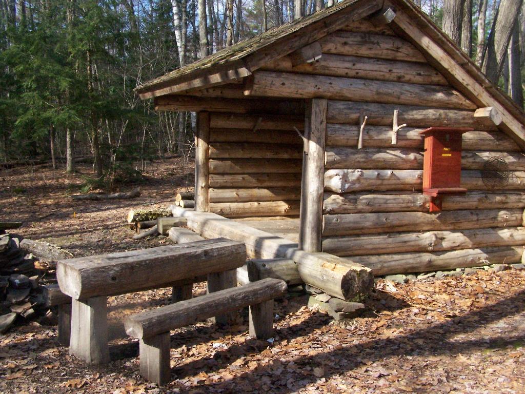
Lean-To Side

State Truck Trails and Forest Preserve Roads Over A Half Mile

Looking for state land to wheel on? This list shows all of the conservation department-maintained DEC truck trails and public access roads that are more then a 1/2 mile long. This roads are varied, but most of them are dirt roads that take you through the back country. Town maintained roads through state forests are generally not shown on in this listing.

State Land Road Miles
Albert J. Woodford Memorial State Forest Truck Trail 0.7
Albert J. Woodford Memorial State Forest Janis Road 1.1
Aldrich Pond Wild Forest Powell Road 0.5
Aldrich Pond Wild Forest Mullins Flow Road 0.6
Aldrich Pond Wild Forest Little River Road 0.7
Aldrich Pond Wild Forest Silver Dawn Road 0.7
Aldrich Pond Wild Forest Jackworks Trail 1.1
Aldrich Pond Wild Forest South Creek Lake Road 1.6
Aldrich Pond Wild Forest Tyler Road 3.7
Aldrich Pond Wild Forest Streeter Lake Road 4.8
Allen Lake State Forest George Forest Road 1.5
Ambler State Forest Truck Trail 1.8
Ampersand Primitive Area Ampersand Park Road 3.2
Andersen Hill State Forest Big Pine Public Forest Acess Road 1.5
Arctic China State Forest China Public Forest Access Road 1.1
Arctic China State Forest Shears Public Forest Access Road 2
Arctic China State Forest Dunbar Public Forest Access Road 2.1
Armlin Hill State Forest Truck Trail 1.1
Arnold Lake State Forest Public Forest Access Road 0.9
Arnold Lake State Forest Hartwick Forest Access Road 1
Ashland Pinnacle State Forest Ashland Pinnacle Access Road #2 0.5
Ashland Pinnacle State Forest Haul Road #1/Long Path Hiking Trail 1.4
Avon Regional Office Goodlake Year Entrance Road 0.7
Baker School House State Forest Baker School House Public Forest Acess Road 1.8
Bald Mountain State Forest Howe Forest Road 2.4
Balsam Creek State Forest Briar Hill Road 1.5
Barbour Brook State Forest Barbour Brook Public Forest Access Road 2
Basswood State Forest Burlington Public Forest Access Road 0.5
Basswood State Forest Basswood Pond Public Forest Access Road 1
Basswood State Forest Dr. Crouch Truck Trail 1.3
Bates State Forest Pucker Street 1
Bates State Forest Bates Forest Road 2.6
Battle Hill State Forest Unnamed 1.3
Bear Pond Primitive Area Bear Pond Road 0.8
Bear Swamp State Forest Karsch Haul Road 0.5
Bear Swamp State Forest Joe Chamberlin Public Forest Access Road 1.6
Bear Swamp State Forest Roseboom Public Facility Truck Trail 1.8
Bear Swamp State Forest Snowmobile Trail 8.3
Bearpen Mountain State Forest Ski Run Road 2.1
Beartown State Forest Town Road 0.7
Beartown State Forest Cotton Road 0.8
Beartown State Forest Steam Mill Road 0.8
Beartown State Forest Aspen Hollow Road 2.4
Beaver Creek State Forest Public Forest Access Road 2, Madison 11 0.5
Beaver Creek State Forest Truck Trail -2-12 0.7
Beaver Creek State Forest Public Forest Access Road 1, Madison 11 1.3
Beaver Creek State Forest Truck Trail -1-12 3.6
Beaver Dam State Forest Sears Public Forest Acess Road 1.4
Beaver Meadow State Forest Weir Dam Truck Trail 0.5
Beebe Hill State Forest Barrett Pond Road 1.4
Beebe Hill State Forest Loop Road 2.3
Big Brook State Forest County Line Road Spur 0.6
Big Brook State Forest Walasek Mulcoy Road 0.8
Big Brook State Forest Hanifin Road 0.9
Big Brook State Forest County Line Road 1.4
Birdseye Hollow State Forest Sanford Lake Access Road 0.5
Black Creek State Forest Stanley Road 1.1
Black River Wild Forest Remsen Falls Trail 0.5
Black River Wild Forest Woods Lake Road 0.5
Black River Wild Forest Gull Lake Road 0.6
Black River Wild Forest Flansburg Road 0.7
Black River Wild Forest Party Road 0.7
Black River Wild Forest Black Creek Road 0.8
Black River Wild Forest Cohen Road 1.7
Black River Wild Forest Flansberg Road 2.6
Black River Wild Forest Black Creek Lake Road 3
Black River Wild Forest Haskell Road 3
Black River Wild Forest Mill Creek Road 3.4
Black River Wild Forest Nicks Lake Campground Roads 3.5
Black River Wild Forest Wolf Lake Landing Road 4.8
Black River Wild Forest West Creek Road 6.3
Blenheim Hill State Forest Ward Allen Road 1.1
Blenheim Hill State Forest Quarry Road 1.2
Blue Mountain Wild Forest Deer Pond Road 1.1
Blue Mountain Wild Forest Chain Lakes Road North 1.3
Blue Mountain Wild Forest Polaris Road 1.3
Bombay State Forest Cross Haul Road 0.7
Bombay State Forest Railroad Bed Public Forest Acess Road 1.2
Bombay State Forest Pike Brook Haul Road 3.1
Bonaparte’s Cave State Forest Corbine Road 0.8
Bonaparte’s Cave State Forest Mud Pond Road 0.8
Boutwell Hill State Forest Arab Hill Forest Road, Cha 1 Section 0.8
Boutwell Hill State Forest Arab Hill Forest Road, Cha 7 Section 2.1
Boyce Hill State Forest Jackson Forest Road 0.6
Brasher State Forest Route 53 Haul Road 0.5
Brasher State Forest Beaver Pond Trail 0.6
Brasher State Forest Kennehan Haul Road 0.8
Brasher State Forest Bush Road 1.1
Brasher State Forest Buckley Haul Road 1.2
Brasher State Forest Cc Dam Public Forest Access Road 1.2
Brasher State Forest Mccarthy Public Forest Access Road 1.6
Brasher State Forest Liberty Public Forest Access Road 1.7
Brasher State Forest Hastings Falls Haul Road 2.1
Brasher State Forest Wilson Public Forest Access Road 2.1
Brasher State Forest Camp / Larue Public Forest Access Road 2.2
Brasher State Forest Pascal Haul Road 2.4
Brasher State Forest Bush Public Forest Access Road 2.9
Brasher State Forest Railroad Bed Public Forest Access Road 3.6
Brokenstraw State Forest Brokenstraw Forest Road 1.7
Bryant Hill State Forest Hawk Forest Road 1.4
Buck Hill State Forest Hertz Road 0.7
Buck Hill State Forest Truck Trail 1.5
Buck Hill State Forest Buck Hill Road 3.1
Bucks Brook State Forest Access Trail 0.6
Buckton State Forest Buckton Haul Road 0.8
Bucktooth State Forest Baily Hollow Forest Road 0.6
Bucktooth State Forest Manley Hill Forest Road 1
Bully Hill State Forest Dixon Forest Road 1
Bully Hill State Forest Connection Forest Road 1.6
Bully Hill State Forest Stearns Forest Road 2.1
Burnt-Rossman Hills State Forest Koenig Road 0.5
Burnt-Rossman Hills State Forest Betty Brook Haul Road 0.6
Burnt-Rossman Hills State Forest Eminence Dead End Truck Trail 0.7
Burnt-Rossman Hills State Forest Duck Pond Road 1.2
Burnt-Rossman Hills State Forest Monkey Run Truck Trail East 1.3
Burnt-Rossman Hills State Forest Yankee Street Truck Trail 1.3
Burnt-Rossman Hills State Forest Betty Brook Road 1.4
Burnt-Rossman Hills State Forest Betty Brook Truck Trail 1.5
Burnt-Rossman Hills State Forest Duck Pond Truck Trail 1.5
Burnt-Rossman Hills State Forest Morey Road Truck Trail 1.7
Burnt-Rossman Hills State Forest Eminence Road Truck Trail 2.6
Burnt-Rossman Hills State Forest Burnt Hill Road 2.9
Bush Hill State Forest Fox Cross Forest Road 2
California Hill State Forest Wayawanda Road 0.7
Canacadea State Forest Macduff Road 2.3
Canadaway Creek Wma Dibble Hill Forest Road 2
Canaseraga State Forest Ringelberg Truck Trail 0.5
Canaseraga State Forest Right Fork Truck Trail 1
Canaseraga State Forest Stanley Road 1.1
Canaseraga State Forest Left Fork Truck Trail 1.4
Caroga Lake Campground Campground Road 2
Catherineville State Forest Santamont Access Trail 1.1
Catherineville State Forest Circle Public Forest Access Road 1.8
Charles E. Baker State Forest Truck Trail 5 0.6
Charles E. Baker State Forest Truck Trail 2 0.9
Charles E. Baker State Forest Truck Trail 6 0.9
Charles E. Baker State Forest Truck Trail 4 1.4
Charles E. Baker State Forest Truck Trail 12 1.5
Charles E. Baker State Forest Truck Trail 8 1.9
Charles E. Baker State Forest Truck Trail 7 2.1
Charles E. Baker State Forest Truck Trail 1 3
Charles E. Baker State Forest Truck Trail 13 3.2
Chazy Highlands State Forest Spring Road 0.6
Cherry Valley State Forest Kniskern Public Access Road 1.2
Cherry Valley State Forest Mosse Public Forest Access Road 1.9
Cinnamon Lake State Forest Hornby Road Haul Road 0.7
Clapper Hollow State Forest Clapper Hollow Truck Trail 1
Clark Hill State Forest Abandoned Town Road 0.8
Clark Hill State Forest Truck Trail 0.9
Clark Hill State Forest Access Road North Of Buck Hill Road 0.9
Clark Hill State Forest Class A Truck Trail 1.2
Clark Hill State Forest Haul Road 1.3
Cliffside State Forest Railroad Haul Road 1.3
Cobb Brook State Forest Unnamed Truck Trail 0.6
Cold Creek State Forest Headwaters Forest Road 1.4
Cold Spring Brook State Forest Cold Spring Brook Public Forest Access Road 1.9
Cole Hill State Forest Cr 2 Access Road 0.8
Coyle Hill State Forest Warner Spur Forest Road 0.5
Coyle Hill State Forest Slawson Forest Road 0.8
Coyle Hill State Forest Warner Forest Road 1.8
Cranberry Lake Campground Campground Road 2.5
Cranberry Lake Wild Forest Grass River Railroad 6.1
Cuyler Hill State Forest Jipson Hill Public Forest Acess Road 1.3
Cuyler Hill State Forest Cuyler Hill Public Forest Acess Road 5.1
David A. Sarnoff Preserve Field Access Road 0.8
Debar Mountain Wild Forest Debar Game Refuge Road 0.5
Debar Mountain Wild Forest Debar Meadow Road 0.6
Debar Mountain Wild Forest Vanderwalker Road 0.9
Debar Mountain Wild Forest 4 Mile Road Riffle Season Access Corridor 1.1
Debar Mountain Wild Forest Ny Centrail Railroad Bed 2.2
Deer River State Forest Ccc Road 0.6
Deer River State Forest Hogsback Road 0.6
Deer River State Forest Willow Road 0.6
Deer River State Forest Glaze Road 0.7
Deer River State Forest Avery Lot Road 0.9
Deer River State Forest Esseltine Hill Road 0.9
Deer River State Forest Ricky’s Number Trail 1
Deer River State Forest Horse Barn Road 1.2
Deer River State Forest Laramie Road 1.3
Deer River State Forest Beanville Road 1.4
Deer River State Forest Spruce Road 1.6
Deer River State Forest Loope Road 2
Deer River State Forest Firewood Road 2.6
Degrasse State Forest Burns Flats Road 0.5
Degrasse State Forest Loop Road 1.2
Deruyter State Forest Tromp Road 1.5
Dobbins Memorial State Forest Snowmobile Trail 3.5
Dog Hollow State Forest Brewer Public Forest Acess Road 0.9
Downerville State Forest River Public Forest Access Road 1
Dry Run State Forest Wildcat Hollow 0.8
Dunkin’s Reserve State Forest Access Road 3.5
Dutch Settlement State Forest Haul Road #1 0.6
Dutton Ridge State Forest Dutton Ridge Access Road 1.5
Earlville State Forest Mad 2 Forest Access Road 1.5
East Osceola State Forest Malloy Brook Road 1.1
East Otto State Forest Kriedeman Forest Road 1.7
Edgewood Oak Brush Plains Preserve Edgewood Oak Brush Plains Preserve 0.5
Edgewood Oak Brush Plains Preserve Unpaved Forest Road 0.5
Edgewood Oak Brush Plains Preserve Old Commack Road 1.6
English Hill State Forest Ricketts Forest Road 0.9
Exeter State Forest Exeter Public Forest Access Road 1.3
Fairfield State Forest Jenksville Hill Public Forest Acess Road 2
Fall Brook State Forest Gossner Road 0.6
Fall Brook State Forest Haul Road To B-45 Wetland 0.9
Fall Brook State Forest Access Road From Co. Rt 67A 1
Fall Brook State Forest Forest Access Roaad 1.2
Ferris Lake Wild Forest Meco Lake Trail 0.9
Ferris Lake Wild Forest Sheriff Lake Trail 0.9
Ferris Lake Wild Forest Mud Lake Road 5.5
Fish Creek State Forest Forward Road 0.5
Fish Creek State Forest Trestle Road 0.6
Fish Creek Wma State Highway 184 Access Road 0.9
Five Rivers Education Center Goose Lane 0.5
Flat Rock State Forest Pedobo Road 0.8
Flat Rock State Forest Karsch Haul Road 0.9
Flat Rock State Forest Ampersand Park Road 1.9
Florence Hill State Forest Florence Hill Road 1.9
Fort Jackson State Forest Sheldon Public Forest Access Road 0.5
Frank E. Jadwin Memorial State Forest Keesler Road 0.6
Frank E. Jadwin Memorial State Forest Old Croghan Road 0.7
Frank E. Jadwin Memorial State Forest Henry Road 0.8
Frank E. Jadwin Memorial State Forest Nelson Road 0.8
Frank E. Jadwin Memorial State Forest Wahalula Road 0.8
Frank E. Jadwin Memorial State Forest Q- Road 1.5
Frank E. Jadwin Memorial State Forest Patchin Road 1.7
Frank E. Jadwin Memorial State Forest Blanchard Creek Road 2.7
Frank E. Jadwin Memorial State Forest Wisner Road 2.7
Frank E. Jadwin Memorial State Forest Judy Cole Road 2.8
Frank E. Jadwin Memorial State Forest Loop Road 3.2
Fulton Chain Wild Forest Cary Lake Road 1.8
Furnace Creek State Forest Miller Road East 0.7
Furnace Creek State Forest Powerline Row 0.7
Furnace Creek State Forest Sheehan Road 1.2
Furnace Creek State Forest B-29 Road 1.4
Gates Hill State Forest Coons Den Truck Trail 0.6
Gates Hill State Forest Eviann Road 1.2
Genegantslet State Forest South Loomis Road 0.7
Gillies Hill State Forest Abbey Forest Road 0.9
Gillies Hill State Forest Pettit Forest Road 1.4
Golden Hill State Forest Firelane Forest Road 1.6
Goundry Hill State Forest Guiren Road 1
Goundry Hill State Forest Corbett Hollow Access Road 1.1
Grant Powell State Forest Huck Berry Road 2.1
Grass River Wild Forest Spruce Mountain Road 0.8
Grass River Wild Forest Hollywood Road 2.5
Grass River Wild Forest Railroad Grade Road 2.9
Greenwood Creek State Forest Grass Pond Public Forest Access Road 0.9
Grigg’s Gulf State Forest Grigg’s Gulf Public Forest Acess Road 1.5
Gulf Unique Area Gulf R.O.W. Road 0.5
Gulf Unique Area Old Skid Road 1.1
Hall Island State Forest Unnamed Public Forest Acess Road 0.7
Hammond Hill State Forest Redman Run Public Forest Acess Road 1.1
Hammond Hill State Forest Cannan Public Forest Acess Road 1.3
Hammond Pond Wild Forest Paynes Way 0.7
Harris Hill State Forest Sprague Forest Road 0.8
Harvey Mountain State Forest Harvey Mt Access Road 0.9
Harvey Mountain State Forest East Hill Access Road 2.4
Hatch Creek State Forest Hodge Forest Road 0.6
Hatch Creek State Forest North Forest Road 0.8
Hatch Creek State Forest South Forest Road 0.9
Hemlock-Canadice State Forest South Hemlock Access Road 0.7
Henderson Shores Unique Area Radar Road 0.8
Hewitt State Forest Hewitt Rd 1.1
Hickok Brook Multiple Use Area Spur Road 0.7
Hickok Brook Multiple Use Area Main Road 1.1
High Flats State Forest Chapel Hill Access Trail 0.5
High Flats State Forest Crowley Access Trail 0.5
High Flats State Forest Close Pond Access Trail 0.7
High Flats State Forest Donovan Public Forest Access Road 1.1
High Knob State Forest Shale Pit Road 1.9
High Peaks Wilderness Northville-Placid Trail-Northern Terminus 1.1
Hill Higher State Forest Hill Higher Forest Road 1.1
Hinckley State Forest Elm Flats Road 0.5
Hinckley State Forest Roberts Road 0.5
Hinckley State Forest Lanning Road 0.8
Hinckley State Forest Access Road 1.6
Hinckley State Forest Black Creek Road 2
Hogsback State Forest Forest Access Road 3
Honey Hill State Forest Edwards Public Forest Access Road 1.4
Hooker Mountain State Forest Norton Public Forest Access Road 0.8
Horseshoe Lake Wild Forest Cut Off Road 0.6
Horseshoe Lake Wild Forest Lower Dam Road 0.7
Horseshoe Lake Wild Forest Otter Brook Trail 0.9
Horseshoe Lake Wild Forest Grass River Railroad 1.7
Horseshoe Lake Wild Forest Otter Brook Road 2.2
Hoxie Gorge State Forest Russel Hill Public Forest Acess Road 2.5
Huntersfield State Forest Huntersfield Access Road #2 0.7
Huntersfield State Forest Huntersfield Access Road #1 1.9
Hunts Pond State Forest Truck Trail 1.7
Independence River State Forest Assembly Road 1
Independence River Wild Forest Blue Jog Road 0.5
Independence River Wild Forest Sunday Lake Road 0.5
Independence River Wild Forest Evies Pond Road 0.7
Independence River Wild Forest Burnt Creek Road 0.7
Independence River Wild Forest Elbow Rd 0.7
Independence River Wild Forest Shortcut Road 0.8
Independence River Wild Forest Fish Pond Road 1
Independence River Wild Forest Halfmoon Lake Rd 1
Independence River Wild Forest Little Otter Creek Road 1
Independence River Wild Forest Long Pond Spur 1
Independence River Wild Forest East Loop Road 1.1
Independence River Wild Forest Copper Lake Road 1.2
Independence River Wild Forest Necessary Dam Road 1.2
Independence River Wild Forest Pitcher Pond Road 1.3
Independence River Wild Forest Hinchings Pond Road 1.8
Independence River Wild Forest Basket Factory Road 2.1
Independence River Wild Forest Catspaw Lake Road 2.4
Independence River Wild Forest Confusion Flats Road 2.6
Independence River Wild Forest Big Otter Lake Road 3.1
Independence River Wild Forest Stony Lake Road 3.1
Independence River Wild Forest Florence Pond Road 3.1
Independence River Wild Forest Steam Mill Road 3.5
Independence River Wild Forest Smith Road 3.7
Indian Pipe State Forest Dunes Road 0.7
Indian River Wma Red Lake Road 2
Jackson Hill State Forest Forest Access Road 2.1
Jersey Hill State Forest Scholes Forest Road 1.6
Jessup River Wild Forest Lake Colby Camp Road 0.7
Karr Valley Creek State Forest Frungillo Forest Road 0.8
Karr Valley Creek State Forest Norton Forest Road 1.3
Karr Valley Creek State Forest Davison Forest Road 1.4
Keeney Swamp State Forest Fitch Hill Spur Forest Road 0.7
Keeney Swamp State Forest C3D 0.8
Keeney Swamp State Forest Fitch Hill Forest Road 1.2
Keeney Swamp State Forest Gordon Forest Road 1.4
Kennedy State Forest Courtney Hill Public Forest Acess Road 0.7
Kennedy State Forest Cotton-Hanlon Public Forest Acess Road 1
Kennedy State Forest Kennedy Public Forest Acess Road 2.5
Kenneth Wilson Campground Campground Road 9.7
Ketchumville State Forest Ketchumville Public Forest Acess Road 1
Keyserkill State Forest Guinea Road Truck Trail 1
Keyserkill State Forest Keyserkill Truck Trail #1 1.3
Klipnocky State Forest Emery Forest Road 1.2
Klipnocky State Forest Marble Forest Road 1.6
Klondike State Forest Klondike Public Forest Acess Road 1.7
Lafayetteville Multiple Use Area Wilbur Flats Road 0.9
Lake Durant Campground Scott Public Forest Acess Road 0.9
Lake George Wild Forest Jabe Pond Road 1
Lake George Wild Forest Dacy Clearing Road 1.6
Lake George Wild Forest Lily Pond Road 2.1
Lake George Wild Forest Gay Pond Road 4
Lake Harris Campground Campground Road 0.9
Lakeview Marsh Wma Skinner Road 0.7
Leonard Hill State Forest Leonard Hill Access Road #1 0.7
Leonard Hill State Forest Leonard Hill Access Road #3 1.2
Leonard Hill State Forest Leonard Hill Access Road #2 1.6
Lesser Wilderness State Forest Gomer Hill Road 0.5
Lesser Wilderness State Forest Toole Road 0.6
Lesser Wilderness State Forest Alguire Road 0.7
Lesser Wilderness State Forest Smith Road 0.8
Lesser Wilderness State Forest Nob Road 0.9
Lesser Wilderness State Forest Seelman Road 1.3
Lesser Wilderness State Forest Mcgoldrick Road 3
Lesser Wilderness State Forest #9 Road 4.7
Limekiln Lake Campground Lime Kiln Lake Campground Trails 3.9
Linda Gronlund Memorial At Barcelona Neck Trustee Road West 1
Linda Gronlund Memorial At Barcelona Neck Trustee Road East 1.7
Lonesome Bay State Forest Alamogin Public Forest Access Road 2.2
Long Pond State Forest Access Road 0.5
Long Pond State Forest Truck Trail 0.7
Long Pond State Forest Long Pond Snowmobile Trail 0.8
Lookout State Forest Ball Road 0.6
Lost Nation State Forest Brookdale Road / Jenkins Corners Rd / Red Barn Rd 2.5
Lost Valley State Forest Lost Valley Haul Road 1.2
Lowville Demonstration Area Dadville Road 0.6
Ludlow Creek State Forest Trail Road 1.3
Lutheranville State Forest Access Road #1 0.5
Lutheranville State Forest Access Road #2 1.2
Lyon Brook State Forest Lyon Brook Truck Trail 1.2
Mad River State Forest Thompson Corners Florence Road 0.5
Mad River State Forest Bartlett Road 0.6
Mad River State Forest Rehm Road 0.6
Mad River State Forest Phalen Road South 1.9
Mad River State Forest Mcspirit Road 2.1
Madawaska Flow – Quebec Brook Primitive Area Benz Pond Road 2.2
Mallet Pond State Forest Cemetery Road Truck Trail 2
Maxon Creek State Forest Pease Hill Public Forest Acess Road 1
Mccarthy Hill State Forest Main Access Road 0.5
Mccarty Hill State Forest Ccc Forest Road 1.5
Mccarty Hill State Forest Mccarty Hill East Forest Road 2
Mcdonough State Forest Ccc Trail 1
Mcdonough State Forest Truck Trail 4 1.1
Mcdonough State Forest Finger Lakes Trail 1.8
Mcdonough State Forest Truck Trail 3 2
Melondy Hill State Forest Public Forest Access Road 2.5
Montrose Point State Forest Through Trail 0.6
Moose River Plains Wild Forest Loop Road 1.2
Moose River Plains Wild Forest Indian Lake Road 3.4
Moose River Plains Wild Forest Otter Brook Road 3.4
Moose River Plains Wild Forest Rock Dam Road 4.2
Moose River Plains Wild Forest Lime Kiln Lake – Cedar River Road 16.9
Morgan Hill State Forest Herlihy Haul Road 0.6
Morgan Hill State Forest Keith Gutchess Haul Road 0.7
Morrow Mountain State Forest Mollie Road 2.8
Mount Hunger State Forest Whalen Road 0.6
Mount Pisgah State Forest Mt Pisgah Access Road #1 1.3
Mount Pleasant State Forest Beck Forest Road 0.6
Mount Pleasant State Forest Brumagin Forest Road 0.7
Mount Pleasant State Forest Spruce Forest Road 0.8
Mount Tom State Forest Notch Lane Access Road 1.4
Mount Tom State Forest Shaker Hollow Access Trail 1.4
Muller Hill State Forest Davenport Road 1.4
Muller Hill State Forest Bliss Road 1.5
New Forge State Forest New Forge Access Road #2 0.5
New Forge State Forest New Forge Access Road #3 0.6
New Forge State Forest New Forge Access Road 1.5
Newfield State Forest Irish Hill Haul Road 0.8
Nicks Lake Campground Nicks Lake Campground Roads 0.6
Nimham Mountain Multiple Use Area Coles Mills Road 0.7
Nimham Mountain Multiple Use Area Tower Road 0.7
Nine Mile Creek State Forest North Nine Mile Town Road 0.5
Nine Mile Creek State Forest Phearsdorf Forest Road 0.5
Nine Mile Creek State Forest North Nine Mile Forest Road 2.2
North Harmony State Forest Snake Forest Road 0.9
North South Lake Campground South Lake Road 1.3
North South Lake Campground North Lake Campground Road 1.8
Northhampton Beach Campground Campground Road 5.5
Oakley Corners State Forest Oakley Corners North Public Forest Acess Road 1.6
Ohissa State Forest Cramers Corner Road 0.8
Onjebonge State Forest Lime Quarry Road 1.3
Onjebonge State Forest Alice Coffey Road 2.5
Orebed Creek State Forest Ritz Road 1.3
Ossian State Forest Back Road To Rattlesnake 0.7
Ossian State Forest Scoville Access Road 1
Ossian State Forest Linzy Road Truck Trail 1.8
Otselic State Forest Truck Trail 3.1
Otsquago State Forest Wagner Hill Road 0.8
Otter Creek State Forest Eatonville Road 0.6
Otter Creek State Forest Mikes Road 1.2
Otter Creek State Forest Otter Creek Road 1.5
Palmer’s Pond State Forest Geitner Forest Road 0.7
Palmer’s Pond State Forest Palmer’s Pond Forest Road 1.5
Palmer’s Pond State Forest 6 2.4
Partridge Run Wma Boys Camp Road Ext 2
Patria State Forest Pleasant Valley Road 0.6
Patria State Forest Barkman Road Access 0.6
Patria State Forest Hardscrabble Road Access 0.8
Peck Hill State Forest Swamp Road 0.5
Peck Hill State Forest West Boundary Trail 0.6
Peck Hill State Forest Beaver Vly 0.7
Peck Hill State Forest Dam Road 0.7
Penn Mountain State Forest Star Hill Road 1
Penn Mountain State Forest West Gate Road 2.6
Penn Mountain State Forest South Gate Road 3.6
Penn Mountain State Forest East Gate Road 3.8
Perch River Wma Perch Lake Road 0.5
Perch River Wma Buckminster Road 0.9
Perch River Wma Cook Road 1.4
Perch River Wma Allen Road 2.1
Perch River Wma State Route 12 2.6
Perch River Wma Vaadi Road 3
Perch River Wma Dog Hill Road 4
Pharsalia Woods State Forest Nine Mile Truck Trail Snowmobile Trail 1.6
Piermont Marsh Tidal Wetland Piermont Pier Access Road 0.9
Pine Hill State Forest Bundy Hollow Public Forest Access Road 1
Pittstown State Forest State Fire Lane 2.2
Plainfield State Forest Hughes Public Forest Access Road 1.3
Plattekill State Forest Mountain Brook Road 1
Plumbottom State Forest Reddy Forest Road 3
Point Peninsula Wma Pine Woods Road 1.5
Point Peninsula Wma Beach Road 2.1
Point Peninsula Wma Shore Road 8
Point Rock State Forest Egger Brrok Raod 1.3
Popple Pond State Forest Smith Road 0.7
Popple Pond State Forest Haul Road Shared By Oneida 6 And County Forest 1.6
Popple Pond State Forest Truck Trail 3
Potato Hill State Forest Blackman Hill Rd 1.1
Potato Hill State Forest Level Green Rd 1.2
Pulpit Rock State Forest Watson Road 0.6
Punkeyville State Forest Irish Settlement Road 0.7
Punkeyville State Forest River Road 0.9
R Milton Hick Memorial State Forest Lafleuer Road 1.2
Relay State Forest Relay Public Forest Access Road 1.2
Rensselaerville State Forest Kenyon Road Access 2.4
Ridge Conservation Area And Maintenance Center Mid-Island Access Road 0.5
Rock City State Forest Salamanca Forest Road 0.8
Rock City State Forest Eckert Forest Road 0.9
Rock City State Forest Little Rock City Forest Road 2
Rock Creek State Forest Admin Access Road 1.3
Rockwood State Forest Spring Road 0.5
Rockwood State Forest B Road 0.6
Rocky Point Pine Barrens State Forest Accessible 0.5
Rocky Point Pine Barrens State Forest Firestone Road 1.7
Rural Grove State Forest Rural Grove Access Road (Shibley Road) 3.1
Rush Creek State Forest C2-C 1.2
Rush Creek State Forest Russell Forest Road 3
Sacandaga Campground Sacandaga Campground 1.4
Salmon River State Forest Harpers Ferry Public Forest Acess Road 0.9
Sand Flats State Forest Bucks Corners Road 0.9
Sand Flats State Forest Obrian Road 0.9
Sand Flats State Forest Water Hole Road 1
Sand Flats State Forest Y Road 1.5
Sand Flats State Forest Powell Road 1.7
Sand Flats State Forest Fall Brook Road 2.2
Saranac Lakes Wild Forest Horseshoe Pond Trail 0.5
Saranac Lakes Wild Forest Little Clear Pond Road 0.5
Saranac Lakes Wild Forest Connery Pond Road 0.6
Saranac Lakes Wild Forest Little Green Pond Road 0.6
Saranac Lakes Wild Forest Rollins Pond Access Road 0.8
Saranac Lakes Wild Forest Medow Pond Truck Trail 0.9
Saranac Lakes Wild Forest Bartlett Carry Road 1.2
Saranac Lakes Wild Forest Floodwood Mountain Road 1.2
Saranac Lakes Wild Forest Rat Pond Road 1.5
Saranac Lakes Wild Forest Sunday Pond Road 1.6
Scott Patent State Forest Scott Patent Access Road 1.4
Shawangunk Ridge State Forest Woods Road 1
Shindagin Hollow State Forest Ekroos Public Forest Acess Road 1.4
Skyline Drive State Forest Skyline Drive Public Forest Acess Road 2.2
Slader Creek State Forest Oberdorf Forest Road 2.1
Sonyea State Forest Shaker Access Road 1.9
South Bradford State Forest Ccc Road 1.6
South Hill State Forest South Hill Truck Trail 0.5
South Hill State Forest Public Forest Access Road Extension 0.9
South Hill State Forest South Hill Public Forest Access Road 0.9
South Hill State Forest Kotary Road Extension 1
South Hill State Forest Powerline Road 1
South Mountain State Forest Ashland Pinnacle Access Road #2 0.5
South Mountain State Forest South Mountain Access Road 0.9
South Mountain State Forest Bluebird Road 1.1
South Valley State Forest Phillips Brook Fr First Section 0.7
South Valley State Forest Phillips Brook Forest Road 1.2
St. Regis River State Forest Old Railroad Bed 1.6
Stammer Creek State Forest Sugar Bush Haul Road 1.1
Steam Mill State Forest Zion Public Forest Access Road #2 0.5
Steam Mill State Forest Glass House Hill Road 1
Steam Mill State Forest Assembly Road 1.1
Steam Mill State Forest Steammill Rd 1.4
Steam Mill State Forest Carroll Hill Public Forest Access Road #2 1.9
Steam Mill State Forest Zion Public Forest Access Road #1 2
Steam Mill State Forest Carroll Hill Public Forest Access Road #3 2.5
Stewart State Forest Great Swamp Road 0.5
Stewart State Forest Drakes Ln 0.6
Stewart State Forest Orlando Dr 0.6
Stewart State Forest Ridge Road South 0.6
Stewart State Forest Scofield Lane 0.7
Stewart State Forest Armstrong Lane Trail 0.9
Stewart State Forest Giles Road 0.9
Stewart State Forest Pittman Robertson Pond Road 0.9
Stewart State Forest Weed Road 1.2
Stewart State Forest Beaver Pond Road 1.3
Stewart State Forest Barron Road 1.8
Stewart State Forest Barron Road South 208 1.8
Stewart State Forest Ridge Road 2.8
Stewart State Forest Maple Ave 3.1
Stewart State Forest New Road 3.4
Stockton State Forest Blackman Forest Road 1.4
Stone Store State Forest Fawn Ridge Road 2.7
Sugar Hill State Forest Firetower Access Road 0.5
Sugar Hill State Forest Old Westerfield Road 0.5
Sugar Hill State Forest A Trail 1
Sugar Hill State Forest Pine Knob Road 1
Sugar Hill State Forest Maple Lane 2.1
Summer Hill State Forest Snowmobile Trail 5
Sundown Wild Forest South Mountain Extension 1
Swancott Hill State Forest Tower Road 2.3
Swancott Mill State Forest Swancott Mill Road 0.9
Taconic Hereford Multiple Use Area Pirate Crrek 0.5
Taconic Hereford Multiple Use Area Whatchamacallit 0.5
Taconic Hereford Multiple Use Area Camp 0.6
Taconic Hereford Multiple Use Area Mercury 0.6
Taconic Hereford Multiple Use Area Border Trail 0.8
Taconic Hereford Multiple Use Area Mustang 0.8
Taconic Hereford Multiple Use Area Outer Gut 0.8
Taconic Hereford Multiple Use Area Brockway Road 0.9
Taconic Hereford Multiple Use Area Green Acres 1.2
Taconic Hereford Multiple Use Area Tsp Road 1.2
Taconic Hereford Multiple Use Area Pond Gut Road 1.3
Taconic Hereford Multiple Use Area Timbuktu 1.3
Taconic Hereford Multiple Use Area Fong’s Way 1.4
Taconic Hereford Multiple Use Area Getaway 1.9
Taconic Hereford Multiple Use Area Upper Snowmobile Trail 1.9
Taconic Ridge State Forest Rounds Mountain Rd. 0.8
Taconic Ridge State Forest Robinson’s Hollow Road 0.9
Taconic Ridge State Forest Green Hollow Access Road 1.1
Taylor Creek State Forest T Road Public Forest Access Road 1
Taylor Valley State Forest Seacord Hill Spur Public Forest Acess Road 0.9
Taylor Valley State Forest Seacord Hill Public Forest Acess Road 2.1
Taylor Valley State Forest Mount Roderick Public Forest Acess Road 4.3
Terry Mountain State Forest Lynch Mt Road Trail 1
Terry Mountain State Forest Red Road 1.7
Terry Mountain State Forest Mud Pond Road Trail 2
Terry Mountain State Forest Tower Road 2
Texas Hill State Forest M8 Access Trail 0.6
Texas Hill State Forest Texas Hill Truck Trail 0.7
Texas School House State Forest New Lisbon Public Forest Access Road 1.2
Three Springs State Forest Three Springs Access Road 1.6
Tied Lake Primitive Area Tied Lake Road 1.2
Titusville Mountain State Forest Lee Road 2
Tomannex State Forest Tomannex Public Forest Access Road 1
Tomannex State Forest Haul Road #1 4.7
Toothaker Creek State Forest Garrison Access Trail 1.1
Tri-County State Forest Flanagan Road 0.5
Trout Lake State Forest Cedar Lake Public Forest Access Road 0.5
Tug Hill State Forest Home Run Road 0.6
Tug Hill State Forest Babbit Road 0.8
Tug Hill State Forest Gruntley Road 1.3
Tug Hill State Forest Mile Strip Road 2.5
Tug Hill State Forest Denning (West) Road 2.8
Tug Hill State Forest Willams Road 2.9
Tug Hill State Forest Horace Forward Road 3.3
Tug Hill Wma Alphabet Lane Road 0.8
Tug Hill Wma Runing George Road 1.3
Tug Hill Wma Beech Street Road 1.7
Tug Hill Wma Running George Road 3.8
Tuller Hill State Forest Snyder Hill Public Forest Acess Road 1.6
Tuller Hill State Forest Pipeline Public Forest Acess Road 1.6
Tuller Hill State Forest Vinnedge Public Forest Acess Road 1.7
Turkey Hill State Forest Turkey Hill Public Forest Acess Road 1.3
Turkey Ridge State Forest Turkey Road 0.7
Turnpike State Forest Turnpike Forest Road 2.2
Turnpike State Forest Stewart Forest Road 3.1
Upper And Lower Lakes Wma Canton Access Road 0.5
Upper And Lower Lakes Wma Logging Access Road 0.5
Upper And Lower Lakes Wma Corning Access Road 1
Upper And Lower Lakes Wma Middle Access Road 1.2
Vandermark State Forest Allen Forest Road 1.1
Vandermark State Forest Bird Forest Road 1.5
Vanderwhacker Mountain Wild Forest Cheney Pond Road 0.5
Vanderwhacker Mountain Wild Forest Thilo Road 1.7
Vanderwhacker Mountain Wild Forest Vanderwhacker Road 2.6
Watson’s East Triangle Wild Forest Wolf Creek Road West 0.5
Watson’s East Triangle Wild Forest Deep Cuts Road 0.6
Watson’s East Triangle Wild Forest Tunnel Road 0.7
Watson’s East Triangle Wild Forest Number 1 Road 2.1
Watson’s East Triangle Wild Forest Bear Pond Road 8.4
Webster Hill State Forest Webster Hill Forest Access Road 0.8
West Canada Lake Wilderness Northville-Placid Trail 2.2
West Parishville State Forest Scotch Pine Access Trail 0.5
West Parishville State Forest Red Pine Access Trail 0.7
West Parishville State Forest Kidney Killer Access Trail 0.9
Whalen Memorial State Forest Whalen Forest Road 1.6
Whaupaunaucau State Forest Haul Road #4 0.5
Whaupaunaucau State Forest Alguire Road 1
Whaupaunaucau State Forest C8 – B15 Road 1.3
Whippoorwill Corners State Forest Loop Access Road 1.3
Whiskey Flats State Forest Capell Access Road 0.5
Whiskey Flats State Forest Sochia Pond Public Forest Access Road 0.5
Whiskey Flats State Forest Sandy Public Forest Access Road 0.7
White Pond Multiple Use Area Farmers Mills Road 0.9
White Pond Multiple Use Area White Pond Road 1
Wilcox Lake Wild Forest Dorr Road 0.5
Wilcox Lake Wild Forest Lizard Pond Road 0.6
Wilcox Lake Wild Forest Mud Pond Road 0.7
Wilcox Lake Wild Forest Fish Ponds Road 0.8
Wilcox Lake Wild Forest Harrisburg Lake Road 1.5
Wilcox Lake Wild Forest Pumpkin Hollow Road 1.5
Wilcox Lake Wild Forest Oregon Road 1.7
Wilcox Lake Wild Forest West Stony Creek Road 5.4
Wiley Brook State Forest Finger Lakes Trail 0.7
William C. Whitney Wilderness Lake Lila Road 5.8
Wilson Hill Wma Sand Road 0.6
Wilson Hill Wma Northern Access Road 1.9
Winona State Forest Blood Road 0.7
Winona State Forest Hessel Road 0.9
Winona State Forest Remington 1.1
Winona State Forest Hawley Road 1.5
Winona State Forest Tucker Road 2.6
Winona State Forest Bargy (Main) Road 3.2
Wolf Lake State Forest Orbegezo Row 1.4
Woodland Valley Campground Woodland Valley Road 0.5
Woodland Valley Campground Camping Trail Road 0.8
Yatesville Falls State Forest Yatesville Falls Access Road 1.2

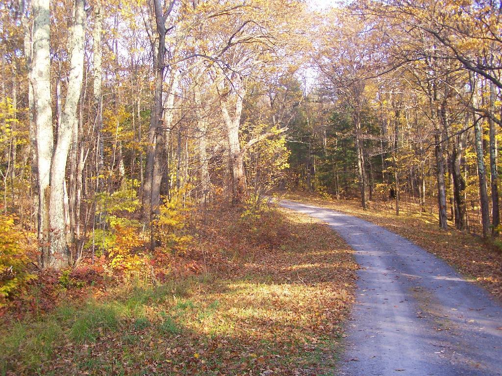
Along Pheasant Truck Trail

Looking for state land to wheel on? This list shows all of the conservation department-maintained DEC truck trails and public access roads that are more then a 1/2 mile long. This roads are varied, but most of them are dirt roads that take you through the back country. Town maintained roads through state forests are generally not shown on in this listing.

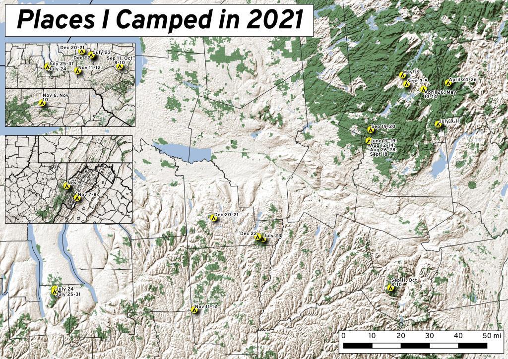
This past year I spent 37 nights camping in the wilderness ๐Ÿ•

This past year I spent 37 nights camping in the wilderness ๐Ÿ•

Places I Camped in 2021

While this was less then the 63 nights I did in 2020, with remote work winding down and more in-person meetings and events happening in Albany, I ended up not getting out as much as I did the previous year. Still 37 nights camping is still a lot of time in wilderness.

It was a lot rainier then some summers, so that also made it harder to get out of town for long weekends. When I did go camping, and I wasnโ€™t remote working, I tried to make it a priority to find more-remote areas without cell service, so I could get solitude without the constant buzz of the phone. Plus I tended to stay in one campsite for two or three days, to avoid the hassles of taking down and setting up camp.

Saturday/Sunday April 24-25: Two Nights on East Branch

I started out my travels in late April on the East Branch Sacandaga River along NY 8, near Fox Lair. On Saturday, before arriving to camp, I hiked along Hope Falls Road and back to lower and upper Tenant Creek Falls. Sunday, I hiked around Fox Lair, sat down by the river for a while, did some fishing. Had a big olโ€™ fire. It was cold but also kind of spring-like.

Sunday was kind of cloudy but not to wet

Monday April 26: One Night on Sacandaga River/Speculator Tree Farm

Monday I drove up to Speculator to do remote work at the library and the town park/beach with my laptop. I set up camp at Campsite 17 and in the evening after work, I hiked along Old NY Route 8B, spending some time along Austin Falls and heading back to camp before it got too dark. Tuesday I worked up in Speculator, before heading home. Things were still very brown and gray in the Adirondacks, although I ended up stopping along the Mohawk River in Rotterdam and hiking on the bike trail before dark, and it was much greener down there.

Thursday to Saturday May 13-15: Three Nights on Sacandaga River/Speculator Tree Farm

Thursday morning I got up early and drove up to Speculator before 9 AM to work remotely. I worked until lunch time in Spectulator when I drove down to Campsite 17 and set up camp and worked from there. Worked all day on Friday from camp, mostly sending emails from the hammock although I also edited a report I was working on with my laptop at the table, and grabbed some files a colleague needed off the server over the VPN. Knocked over the lantern, smashing the glass and breaking the the neck on it. On Saturday I hiked back along Robb Mill Road and some of the side trails in the Conservation Easement. Sunday, I drove up to Watch Hill on Indian Lake, hiked that, while there was a constant threat of thunderstorms, so I did it fairly quickly.

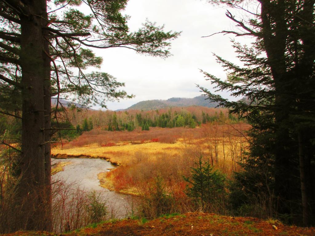
Sacandaga River below Austin Falls

Sunday May 16: One Night Camping Near Mason Lake

After hiking Watch Hill I ended up camping at Mason Lake. I also spent some time walking around the Indian Lake/Lewey Campground, just seeing what was there I was hoping being a Sunday I could get a campsite near Mason Lakke, but no such luck. Ended up camping at Campsite 5, a ways from the lake, although in the evening I did walk down to the lake. I did have cell service where I was camping, but it was spotty, so come Monday morning, I headed back to Speculator for work. The black flies were bad camping there, until well after dark I spent most of the afternoon hiding under the screen tent. In the morning, once the sun was up and the tent was down, I was booking out there because the black flies were intense.

Thursday, Friday, Saturday June 17-19: Three nights Camping at House Pond Campsite

Junteenth Weekend, a new state holiday. Piseco-Powley Road was rebuilt, and I spent a lot of time down at the swimming hole there. I was working remote on Thursday, but I left home after work and drove north before dusk. Spent a lot of time cooling off in East Branch by the campsite, laying in the hammock and relaxing. Saturday I spent kayaking at Lily Lake, but none of the lilies were out. Sunday I spent the balance of the day the potholers.

Reading ?

Friday, Saturday, Sunday July 8-10: Three nights camping on Hope Falls Road

After quite a run of rainy weather, we had part of weekend that wasnโ€™t super wet. Also, many weeks in the summer, I preferred to just stay close to home, and catch the Nature Bus and spend Saturdays exploring Thacher Park for free. Friday was a personal day โ€“ I had a eye doctors appointment. Then I went north and set up camp at Hope Falls Road. Saturday, I hiked back to Ferris Lake and Tenant Creek Falls. Sunday, partially in the rain, I hiked back to both lower and upper Tenant Creek Falls. Sunday evening back at camp, it absolutely poured. I was originally planning to work remote on Monday and maybe Tuesday in Speculator but the weather was so wet, I decided against that.

Friday July 23: Overnight at Cherry Ridge

Heading out to the Finger Lakes, I overnighted at Cherry Ridge at Charles Baker State Forest in Madison County. It was a stop over after leaving home after work. Noticed how much sway there was in front end of the truck, and the tires were getting loud as they were warn and cupped, grew concerned that I might have issues later on. Eventually in December I replaced the tires, the worn rear shock bushing. and bad sway links. I was dealing with some real anxiety issues at that point. But I had a little fire, then retired early to bed and then took camp down early in the morning and headed west to Montezuma Wildlife Refuge and the state Audubon Preserve.

Saturday July 24: One night Tent Camping Along Backbone Horse Trail at Finger Lakes National Forest

I knew arriving at the Finger Lakes National Forest on a Saturday would mean many campsites would be taken, including the site I wanted. I ended up tent camping at one of the primitive sites off Potomac Road. It was a one night deal as I prefer camping in the truck shell and I saw the people in the campsite I wanted leave, so I quickly grabbed that campsite in the morning. Ended up breaking one of the elastic straps in one of the tent poles, I still need to repair it.

Sunday-Saturday July 25-31: Six Nights Truck Cap Camping Along Backbone Horse Trail at Finger Lakes National Forest

My summer vacation was the Finger Lakes National Forest. I decided to stick close to camp for much summer vacation, not rushing too much from place to place, spending a lot of afternoons at the Watkins Glen Pool, doing some paddling in Seneca Lake and Cayuta Lake, hiking in Texas Hollow and Sugar Hill State Forests. Did a lot of reading and laying back in the hammock. The campsite I stayed at didn’t have cell service, so it gave me a much needed to respite from the internet for a few days. Had some nice fires, drank some beer, and got away from it all.

Summer Vacation Seems So Distant Now

Thursday, Friday, Saturday August 12-15: Three nights at House Pond Campsite with Clams and Sweet Corn

After summer vacation, I decided to take a long weekend — four days — up to Potholers, namely the House Pond campsite with lots of sweet corn, clams and beer. I can still taste the clams and beer, and I had plenty of them to eat over the weekend — they were breakfast, lunch and diner. But it was nice laying back in the hammock and swimming in the swimming hole by that campsite. I also hiked along old Edick Road and to Edick Road Campsite 1, which is way off from the main road, and then down to the ledge. Hiked back to House Pond, which was difficult as there was a lot of blow down from a storm earlier in the summer. Spent much of Sunday at the Potholers and then watched the sun set from the Kane Mountain Firetower. Didn’t bring the kayak this time.

Friday, Saturday, Sunday August 26-28: Three nights (again) at House Pond Campsite

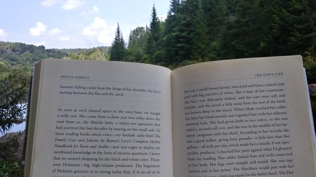
With another warm week ahead, I decided to take off Friday and Monday off for one more week up at House Pond. This time I spent more time at Potholers, walking up there each afternoon, besides spending a lot of time at the swimming hole near this campsite. Did some fishing up House Pond, and a lot of drinking and reading from the hammock. Read yet another book about writing code in Python and Kristen Kimbell’s Dirty Life about farm life. I bought a large truck intertube for floating, but once I got to camp and started to setting up I realized I didn’t have an air pump with me, so I couldn’t use it while camping.

East Canada Creek Below Edick Road Ledge

Friday, Saturday, Sunday September 3-5: Three nights at Hardwood Hill at Perkins Clearing

Friday, September 3rd was the final day of remote work โ€“ Labor Day Weekend. I got up early, drove to Speculator before 9 AM. I started working from Speculator Library but with my phone having hotspot service and cell service, mid-day I drove up to Hardwood Hill. This time I made sure to inflate my intertube before heading up north, and I spent Saturday evening until well after dusk floating in the Jessup River off of Jessup River. Then I drove to Sled Harbor after dark, hoping to catch a glimpse the illuminated Wakely Hill Firetower, but I could not see it as it I couldn’t find the good views of the tower from the road after dark.

Saturday September 11: One night at Betty Brook

Decided to do a weekend trip out to Schoharie County to hike the Catskill Scenic Trail south of Grand Gorge through the deep notch where NY 30 runs. Hiked down to Hubbellโ€™s Corners from Grand Gorge then went for a very cold swim at Mine Kill State Park. Mine Kill pool was open late this year due to opening late at the beginning of summer. Water temperature was 58 degrees. Sunday I also went for a quick swim at Mine Kill Pool again. Still very cold.

Into the Notch

Saturday September 18: One Night at House Pond

On September 18th, I drove up to Piseco-Powley Road to camp for three nights, four days. Spent one night at the House Pond Campsite, which I set up in the pouring rain, and spent time floating in the my new rubber intertube. It was a nice day once he rain stopped but the water was very cold. But it was nice laying back in the hammock that evening, although prior to dusk there was a lot of deer flies around and biting.

Sunday/Monday September 19 & 20: Two Nights at Powley Place

On Sunday afternoon I drove further up Piseco-Powley Road to Powley Place to do some camping and paddling on the East Canada Creek. Monday I hiked back to Goldstream Falls then carried my kayak down to the East Canada Creek and paddled down to the first rapids, portaged past that to the second main rapids. The beaver dams were relatively low this time, due to water levels being higher then other times when I’ve paddled the East Canada Creek. Laid back in the hammock, did some reading and looking out over the campsite on these mild, starry nights. Also did some floating down the East Canada Creek

Friday, Saturday, Sunday October 8-10: Three nights camping at Betty Brook

I took off the Friday before Columbus Day Weekend to hike Bear Pen Mountain in the Western Catskills. It was the start to a very colorful weekend. Betty Brook was nice, but it was good I got there relatively early — around 4 PM on Friday as the other campsites were quickly taken. On Saturday, I drove down to Stamford and hiked more of the Catskill Scenic Trail from Stamford for Bloomville then visited a friend in Summit. Sunday I hiked along Betty Brook Road to the snowmobile trail up Burnt Hill, then hiked over the dirt roads on Burnt and Rossman Hills, enjoying the leaves and wildlife. Hiked back  to camp and laid back into the hammock well into the evening, which was quite mild. Sunday I hiked from Grand Gorge to Stamford on the Catskill Scenic Trail.

Saturday, November 6: Camping at County Bridge Campground Pennsylvania

Originally I was planning to get new tires put on my truck prior to going to West Virginia,  trip that was postponed multiple times. Ultimately I decided it wouldn’t be a bad idea to just wear out the tires and go for the trip. I hadn’t decided on where I was going to go until I was on the road, and ended up going to Binghamton, then down to Pennsylvania for my first night camping. It was a cold first night — got down to 14 degrees.

Sunday/Monday November 7-8: Camp Run West Virginia

The first two nights I spent at Camp Run Primitive Campground at Miles, West Virginia which is located in a wash on the backside of Shenandoah Mountain. On Monday of that week I hiked up over Shenandoah Mountain, and watched the sun rise over Camp Run Lake. Tuesday morning I drove over through Judy Gap then up Spruce Mountain and hiked up that. In the afternoon I hiked up Seneca Rocks, something that had long been on my bucket list to do.

Quiet Walk Along Camp Run Road

Tuesday, November 9: Camping at Canaan Heights

On Tuesday night I camped up in Canaan Heights / Table Rock outside of Thomas WV. I was going to stay multiple days but hearing a lot of wheel bearing noise in my truck, I decided it best to head north on Wednesday and see if I could either make it home or get the truck fixed. The wheel bearing burned up by the time I got up to Lock Haven but was able to get it fixed that day and head north to County Bridge.

Wednesday, November 10: Camping at County Bridge Pennsylvania

The second time camping at County Bridge it wasn’t as cold.  I had a fire and retired to bed fairly early. But come the morning, neither the camp stove or the heater was working. I thought I might have have run out of propane. Then packed up in the morning on Veterans Day and headed north to Chenango Forks State Park, which I wanted to explore. I then stopped at Price Chopper, got some groceries and headed up to Long Pond State Forest for two kind of cold and chilly, damp nights.

Thursday/Friday, November 11-12: Camping at Long Pond State Forest

After spending the balance of Veterans Day, Thursday at Chenango Forks State Park, I camped for two nights at Long Pond State Forest. I was still having problems with my camp stove and heater, so it was kind of cold but I was able to find enough firewood to make do, and had some quiet evenings listening to the radio and just hanging out. Friday was pretty rainy, but I made due — beat having going back home. The fires were smokey but they were warm enough. And it beat being home.

Dusk in November

Monday/Tuesday December 20-21: Camping at Stoney Pond State Forest

I thought about getting out of town after Thanksgiving but the weather did not cooperate. Then my truck’s repairs and tires got dragged out to mid-December. I decided to take he week off before Christmas to go camping. I was thinking about Central New York and then the Finger Lakes, but ultimately made it no farther then the Finger Lakes. Saturday was pouring rain, and then Sunday was bitterly cold. And my camp heater and stove were malfunctioning. But ultimately I was able to get it working, after much fiddling at camp. I camped two nights at Stoney Pond, spending Tuesday poking around Cazenovia. Tuesday was very gray, and Wednesday was snowy. Wednesday I drove to Hamilton and hiked part of the Chenango Canal Trail.

Wednesday, December 22: Camping at Moscow Hill Assembly Area

My final night camping in 2021 was the Moscow Hill Assembly Area at the Charles Baker State Forest. I decided to camp there as it was more sheltered from the wind and snow, and in case we got more snow, I figured I wouldn’t have to worry about the snow, as the county highway isn’t that far away. They were expecting high winds and low windchills, but it turned out not to be too bad. I thought about staying another night on Thursday, but the weather for Thursday looked sunny, and wanted to do some hiking, plus I wanted to be home for Christmas Eve for a family Christmas Party.

Good Evening – August 15, 2021

Good evening! Sitting on the Kane Firetower waiting for the sun to set ๐Ÿ—ผ

Partly clear and 69 degrees at the Kane Mountain Firetower. Light breeze. The dew point is 51 degrees. A very clear evening ๐ŸŒƒ for sure, good for watching the sunset. With the low dew point I can easily see the other side of the Mohawk Valley including some of the silos on the Schoharie side. Also the wind turbines on the ridge outside of the Adirondack Park.

It’s been a nice weekend up north, โ˜บ with way too many beer boiled clams, sausage and sweet corn ๐Ÿฆช๐Ÿป๐ŸŒฝ and swimming ๐ŸŠ๐Ÿป‍โ™‚๏ธ holes and about 25 miles of hiking – well over 15 miles was today alone. Camped at the House Pond Campsite 2 again. Today I hiked from Seeley Road in Knapville to Dexter Lake and then to Spectacle Lake and then to Waters Mill Pond. Then about two hours in the evening cooling off in the Potholers, followed by a sunset hike up Kane Mountain. Now to drive home by 10 pm.

Yesterday, I hiked back to House Pond which had a lot of blow down over parts of the trail. ๐ŸŽ‹ There was a bad thunderstorm โ›ˆ in July that I remember seeing on the news ๐Ÿ“ฐ that caused some big trees to come down, but at least it didn’t wash out the road much or if it did Stratford had already fixed it. Looks like they had to saw and remove multiple trees off Piseco-Powley Road that had came down it and I could hear them cutting downed trees at the hunting camp down the road and I saw them leaving with several pickup trucks full of wood.

Also yesterday I hiked along the Edick Road Snowmobile Trail and then back to Edick Road Campsite #1 out along the ledge overlooking the East Canada Creek, spotting a photographing a doe up close. ๐ŸฆŒ I climbed down the gorge wall and watched the various birds ๐Ÿฆ in the grass lands along that grassy part of the river. Then more clams, corn and sausage. And back to Potholers.

Friday was even more lazy — it was fairly hot. Many hours reading and learning more about Python, ๐Ÿ and then I hiked to Potholers. ๐ŸŠ‍โ™€๏ธ Then after I got back to camp, I swam at the swimming hole across the road from House Pond Campsite 2 until dusk, listening to a podcast, started a fire ๐Ÿ”ฅ had more clams, ๐Ÿ•น laid back in hammock until it started to pour ๐ŸŒง and then hung out under the tarp as it rained some more listening to podcasts until 11 PM.

Thursday, was a rather late start because it was so humid and I was on vacation and was lazy. I screwed up and didn’t get my turn signal on time for Sandell Farm’s to get sweet corn, and ended up going to Rogers Orchard to get sweet corn and blueberries. ๐ŸŽ Then I ended up running to Wally World and forgetting the main reason I wanted to go there — to get coffee. โ˜• I like the large coffee containers they have there not just because they are inexpensive on a per pound basis, they make great containers for making ice in for camping. Or “donating” to the state to put toilet paper in the outhouses, to keep the racoons from shredding it. ๐Ÿšฝ I was hoping to check out Willie Marsh ๐Ÿธ but I got on the wrong road, so I didn’t go by there. I finally got camp around 12:30, set things up, made my first batch of clams, ๐Ÿ•น and they were good. Swam in the swimming hole across the way from House Pond Campsite, ๐ŸŠ‍โ™€๏ธ which might not be the potholers, but it’s right next door. Sat back in the hammock for a while listening to some music ๐ŸŽผ and the news ๐Ÿ“ป, then had a fire. ๐Ÿ”ฅ The wood sure was wet that first night, and it was a bit smokey until I got it going well.

June 20, 2021 Evening

Good evening! Partly clear and 82 degrees in Delmar, NY. There is a south breeze at 8 mph. ๐Ÿƒ. The dew point is 62 degrees. Back home again, as John Denver once sung. ๐ŸŽถ Remarkably hot, especially now that I am back home after having a nice Sunday dinner at the folks house. ๐Ÿ‘• Slowly unpacking my gear from camping, taking steps to drink and cool down.

Well, happy summer folks. โ˜บ The next ten weeks through Labor Day Weekend are considered real summer when the state parks pools are open and the days are relatively long. ๐Ÿ– Nice hot summer days to spend at the pool or swimming hole. ๐ŸŠ๐Ÿป‍โ™‚๏ธ Do some fishing ๐ŸŽฃ late into the night.

It was a beautiful trip back across the Mohawk Valley and through the Schoharie Valley. Everything was very green and lush.  It was a nice weekend up north, although Friday night was very wet. โ˜” It drizzled for a while and then when I went for a good walk up to the Potholers it poured and I got completely soaked. ๐Ÿ’ฆ It was decent all three days up north although I have to say that today was the best of the week. That said, much too short. ๐Ÿ‡ Time flies, especially when it’s rare that I am not out of town for four or more nights, in the era of remote work. But I decided I should come home tonight, because I need to at minimum move to a new campsite.

It was three nights up in the wilderness, ๐Ÿ• camping up at House Pond, spending much of Friday during the day drinking, ๐Ÿบ reading, ๐Ÿ“• writing, โœ and hanging down at the Swimming Hole by the House Pond Campsite. ๐ŸŠ‍โ™€๏ธ It was nice but the water was a bit cold to say the least. ๐Ÿ›ถ Saturday, was kayaking from Stewart Landing up to Lily Lake. I didn’t go much into West Lake because I wanted to be close to back to Stewart Landing by 2 pm as they were threatening severe storms by afternoon, which never materialized. Instead, I spent the evening reading, and then down at the same swimming hole on the East Canada Creek. ๐ŸŠ‍โ™€๏ธ Most of Sunday was spent slowly taking down camp after a nice breakfast ๐Ÿฅž then the majority of the day the Potholers. I forgot how much nicer the Potholers are with the flowing water and potholes compared to any ordinary swimming hole on a nice summer day. It’s good to be back there!

Tonight will be mostly cloudy ๐ŸŒฅ, with a low of 69 degrees at 5am. 10 degrees above normal. Maximum dew point of 66 at 3am. South wind around 8 mph. Probably need the fan on all evening. In 2020, we had mostly clear skies. It was somewhat humid. It got down to 69 degrees. The record low of 41 occurred back in 1970.

I thought about staying over the folks house, ๐Ÿ‘ช but I was tired and wanted to get home. It has been a nice weekend, but alas I should get ready for the work week and get my camping gear put away. I also want to get the volt meter out before dark, and try to figure out why the relay isn’t closing between the starting and accessory batteries when the engine is on or the solar is outputting enough to top off both batteries. ๐Ÿ”‹ That was annoying that wasn’t working this weekend.

Tonight will have a Waxing Gibbous ๐ŸŒ” Moon with 81% illuminated. At 7 PM, the moon was in the southeast (139°) at an altitude of 26° from the horizon, some 226,818 miles away from where you are looking up from the earth. ๐Ÿš€ At the state speed limit of 55 mph, you’ll make it there by December 9th. Buckle up for safety! ๐Ÿ’บ The Strawberry ๐Ÿ“ Moon is on Thursday, June 24. The darkest hour is at 12:58 am, followed by dawn at 4:43 am, and sun starting to rise at 5:18 am in the east-northeast (57°) and last for 3 minutes and 28 seconds. Sunrise is 11 seconds later than yesterday. ๐ŸŒ„ The golden hour ends at 6:01 am with sun in the east-northeast (64°). Tonight will have 8 hours and 41 minutes of darkness, a decrease of 2 seconds over last night.

Tomorrow will have a chance of showers and thunderstorms, mainly after 4pm. Some of the storms could produce small hail, gusty winds, and heavy rain. Mostly sunny ๐ŸŒž, with a high of 89 degrees at 3pm. Eight degrees above normal. Maximum dew point of 71 at 11am. South wind 10 to 17 mph, with gusts as high as 29 mph. Chance of precipitation is 30%. New rainfall amounts of less than a tenth of an inch, except higher amounts possible in thunderstorms. A year ago, we had partly cloudy skies in the morning with some clearing in the afternoon. It was somewhat humid. The high last year was 92 degrees. The record high of 97 was set in 1938.

Friday turned out to be a very late start heading north. ๐Ÿš I decided not to drive downtown as I’m out of practice with parallel parking and I hate dealing with rush hour traffic. ๐Ÿš™ So I took the bus home and packed the coolers but ended up having to run to the grocery store to get all the things I didn’t previously pack. But at least the nights are long, and I had plenty of time to get set up, gather some firewood ๐Ÿ”ฅ and get things going.

The relay that connects the alternator – starting battery ๐Ÿ”‹ to the accessory batteries quit working on the way up to camp. Not sure if it’s the exciter wire that broke or the relay is seized. It was fine, I had lots of sun โ˜€ for the solar so all was good. I stopped on Friday to try to get figure out the issue but nothing obvious. I’ll test this evening or tomorrow with the volt meter. โšก It’s possible that the big old can relay failed from the occasional clatter of the relay when clouds appear on a sunny day, although I think I have mostly arrested that by adjusting settings on the voltage control. I am betting the wire is just broken.

In four weeks on July 18 the sun will be setting in the west-northwest (300°) at 8:29 pm,๐ŸŒ„ which is 7 minutes and 24 seconds earlier then today. In 2020 on that day, we had hot and sunny weather with shallow fog in the morning and temperatures between 87 and 59 degrees. Typically, you have temperatures between 84 and 63 degrees. The record high of 100 degrees was set back in 1953.

By then, I hope to be on my summer vacation. ๐Ÿ˜Ž I am thinking the Finger Lakes National Forest and the state parks circuit I normally do, finding new places to hike or explore. I kind of like that campsite I stayed at last year without cell service, because I find do a lot more reading and thinking if I’m camping somewhere without cell service, ๐Ÿคซ the quiet with no Facebook quite nice. ๐Ÿ“ฑ I admit I am a bit of social media addict, even if my own postings to social media are a bit more asinine as I hate all the creepy commercial advertising that follows you around the internet, especially the green schemes.

Looking ahead, Independence Day ๐Ÿ‡บ๐Ÿ‡ธ is Next Sunday, World Population Day ๐Ÿ‘ฉ‍๐Ÿ‘ฉ‍๐Ÿ‘ง‍๐Ÿ‘ง is in 3 weeks, Ugly Truck Day ๐Ÿšš is a month away, August ๐ŸŒป is in 6 weeks, Buck Moon ๐ŸŒ• is in 9 weeks, Halloween ๐ŸŽƒ is in 19 weeks, Average High is 50 ๐Ÿ‚ is in 21 weeks, Regular Deer Season in Southern Zone ๐ŸฆŒ is in 5 months, Repeal of Prohibition Day ๐Ÿบ is in 24 weeks, Cold Moon ๐ŸŒ• is in 26 weeks and Boxing Day ๐ŸฅŠ is in 27 weeks.

 Yesterday On Lake Pleasant

April 19, 2021 Morning

Good morning! Monday’s come back around again. It’s Earth Week, a day where they celebrate spring tillage ๐Ÿšœ and that earthy smell of freshly tiled earth, diesel smoke and cow manure. ๐Ÿ’ฉ And rolling coal, ๐Ÿ›ป along with politicians lying about how they plan to save the earth ๐ŸŒŽ by allowing polluters to pollute more and covering the earth with cadmium-infused glass. ๐Ÿญ Four weeks to Average High is 70 ๐Ÿฎ. June is dairy month, although we reach the 70s by mid-May, although the cows like that. Partly sunny and 43 degrees in Delmar, NY. Calm wind. ๐Ÿ˜Ž Temperatures will drop below freezing at Thursday around 3 am. โ˜ƒ๏ธ

Cold start to the morning ๐ŸŒ… although that’s kind of my fault as I like sleeping with the windows open, so it feels more like January in my apartment then late April. But that’s fine, I’m enjoying my morning walk before work. ๐ŸšถI just sleep so much better with the windows open ๐Ÿ”ณ breathing in the fresh air and diesel smoke. Lol. I remember when I had that neighbor with that big throaty diesel that would rumble each morning before he left for his construction ๐Ÿšง worker ๐Ÿ‘ท job. Basically truck porn ๐Ÿ›ป. I did sleep like a baby so no complaints there. ๐Ÿ‘ถ Probably because I whine so much there days on the blog.

Today will be scattered showers and thunderstorms, mainly after 5pm. Partly sunny ๐ŸŒž, with a high of 63 degrees at 4pm. Three degrees above normal, which is similar to a typical day around April 25th. Calm wind becoming southwest around 6 mph in the afternoon. Chance of precipitation is 30%. New rainfall amounts of less than a tenth of an inch, except higher amounts possible in thunderstorms. A year ago, we had mostly sunny skies in the morning, remaining cloudy in the afternoon. The high last year was 67 degrees. The record high of 92 was set in 1976. 8.8 inches of snow fell back in 1983.โ„

Such a nice morning โ˜€ that I really should work down at library today ๐Ÿ–ฅ but I don’t think the nice weather is expected to last much longer into the afternoon with rain โ˜” showers pushing in. I have fair amount of bandwidth to use up by Friday so it’s not really necessary. At least wherever I work — at least for the morning, I can enjoy the fresh air and sunlight.

I keep watching for changes to bus schedules ๐Ÿš as an early indicator when to when work will be returning to downtown. ๐ŸšI feel like they will be restoring commuter service about the time they reopen the state buildings downtown ๐Ÿข. Still the park and ride sits abandoned but maintained in pristine condition 13 months into the pandemic. At this point, like so many people I have very mixed emotions about returning back to the downtown office. ๐Ÿ™ After all we’ve built such a remote work ๐Ÿ’ป infrastructure. ๐Ÿ’‰ Come a week from Wednesday, it will be two weeks since my last COVID-19 shot so I am pretty unlikely to pick up COVID, at least not severe COVID-19, although I’m sure it will be many more months of mask wearing ๐Ÿ˜ท at least on public transit and in places where people can’t keep 6 feet apart.

Solar noon ๐ŸŒž is at 12:55 pm with sun having an altitude of 58.7ยฐ from the due south horizon (-12.1ยฐ vs. 6/21). A six foot person will cast a 3.7 foot shadow today compared to 2.2 feet on the first day of summer. The golden hour ๐Ÿ… starts at 7:04 pm with the sun in the west (280ยฐ). ๐Ÿ“ธ The sunset is in the west-northwest (286ยฐ) with the sun dropping below the horizon at 7:42 pm after setting for 3 minutes and 1 seconds with dusk around 8:11 pm, which is one minute and 9 seconds later than yesterday. ๐ŸŒ‡ At dusk you’ll see the First Quarter ๐ŸŒ“ Moon in the southwest (221ยฐ) at an altitude of 68ยฐ from the horizon, 242,820 miles away. ๐Ÿš€ The best time to look at the stars is after 8:48 pm. At sunset, look for partly clear skies ๐ŸŒ„ and temperatures around 58 degrees. There will be a south-southwest breeze at 5 mph. Today will have 13 hours and 35 minutes of daytime, an increase of 2 minutes and 43 seconds over yesterday.

Cut my hair ๐Ÿ’‡๐Ÿปโ€โ™‚๏ธ and sideburns yesterday, as I wanted to be cooler and cleaner with summer coming around. I have that hair trimmer which works pretty good job. The hat fits better ๐Ÿงข and the hair won’t get so matted with mud and sweat up at camp. โ›บ

Been continuing to monitor my bank accounts ๐Ÿ’ณ to watch for any fraudulent activity but I don’t see any but I’m hoping that those attempted $1 charges drop off it and the problem is over. I don’t want to have to order yet another card from the bank. I really can’t figure out what happened, as I’ve not done any Internet or phone purchases, and everything else has been dip-style purchases with the secure chip that doesn’t pass your credit card number through the machine. Maybe I have to tape something over card number from watching cameras, or I guess something could have read the strip even on the dip machine. ๐Ÿคช PARANOIA! I just hate dealing with coins ๐Ÿ’ต and exact change, after all these years of swipes.

Tonight will be partly cloudy ๐ŸŒƒ, with a low of 42 degrees at 3am. Three degrees above normal, which is similar to a typical night around April 28th. Should be a decent evening once the rain showers pass this afternoon. South wind around 5 mph. In 2020, we had light drizzle in the evening, which became mostly clear by the early hours of the morning. It got down to 36 degrees. The record low of 19 occurred back in 1875.

Weekend forecast looks pretty decent for late April. โ˜บ Saturday, mostly sunny, with a high near 64. Maximum dew point of 38 at 8pm. Sunday, a chance of showers. Partly sunny, with a high near 57. Chance of precipitation is 50%. Typical average high for the weekend is 62 degrees.

I really think this will be the weekend I make it to the Adirondacks. ๐Ÿ• It certainly might be a nice weekend up north. I might then head out to Central New York in the following weeks, just because there isn’t as likely to have black flies every where. Depending on the status of remote work come May, I might go out there for a week. I think working down by Seneca Lake with my laptop could be quiet pleasant, doing some camping up in the National Forest. ๐ŸŒฒ I know, just wishful thinking. But I spent a lot of time last summer working from shore of Lake Pleasant and that dock on Sacanadaga Riverwalk. ๐Ÿ“ฑ Still undecided if I will drive up on Friday or Saturday. I noticed they’ve raised the price on pre-treated safe and legal firewood at Stewarts, but maybe I can find a pallet in town I can chop up and burn, and use my magnet to pick out any nails from the fire pit. ๐Ÿ”ฅ ๐Ÿงฒ

Looking ahead, there are 4 weeks until Pack Rat Day ๐Ÿ€ when the sun will be setting at 8:13 pm with dusk at 8:45 pm. By then the greenies’ burn ban will be over, so when you do your clean outs in country, make sure to pile enough pallets and try not to burn too much noxious rubber or PVC products. ๐Ÿ”ฅ How much a different world it could have been had not that redneck been burning garbage upwind of a former Governor and high-price John’s country home in Columbia County. ๐Ÿ›ข On that day in 2020, we had mostly cloudy, rain showers and temperatures between 74 and 54 degrees. Typically, the high temperature is 70 degrees. We hit a record high of 92 back in 2017.

Mountains Fade Away

October 3, 2020 Night

Good evening! Clear and 47 degrees in Delmar, NY. Calm wind. ๐ŸŒ• Still close to the full moon and lots of moonlight out there tonight. Nice evening for a walk under the moonlight but I decided to come inside and take out my contacts ๐Ÿ‘€ as my eyes were itching and retire to bed ๐Ÿ›.

While today was kind of a stay home day, ๐Ÿก I did walk out to Five Rivers this afternoon for a while and it was nice after the crowds thinned out. ๐Ÿธ Lots of Blue Jays ๐Ÿฆ around and some does ๐ŸฆŒ and a bit of color – you saw the pictures ๐Ÿ–ผ I posted earlier but if not, scroll ๐Ÿ“œ down.

Tonight will have patchy fog after 5am. Patchy frost after 5am. Otherwise, mostly clear ๐ŸŒƒ, with a low of 37 degrees at 6am. Seven degrees below normal, which is similar to a typical night around October 23rd. Light and variable wind. Yeah, I should close the windows but I’ll burrow under the covers and it’s not like it’s cold enough to freeze the pipes. โ„ I like the fresh air. In 2019, we had light rain in the evening, which became mostly clear by the early hours of the morning. It got down to 41 degrees. The record low of 26 occurred back in 1948.

Tonight will have a Waining Gibbous ๐ŸŒ– Moon with 95% illuminated. At 10 PM, the moon was in the east (100ยฐ) at an altitude of 25ยฐ from the horizon, some 252,136 miles away from where you are looking up from the earth. ๐Ÿš€ At the state speed limit of 55 mph, you’ll make it there by April 13th. Buckle up for safety! ๐Ÿ’บ The New Moon is on Monday, October 19. The darkest hour is at 12:45 am, followed by dawn at 6:28 am, and sun starting to rise at 6:56 am in the east (95ยฐ) and last for 2 minutes and 55 seconds. Sunrise is one minute and 7 seconds later than yesterday. ๐ŸŒ„ The golden hour ends at 7:33 am with sun in the east-southeast (101ยฐ). Tonight will have 12 hours and 23 minutes of darkness, an increase of 2 minutes and 52 seconds over last night.

Tomorrow will have patchy fog before 8am. Patchy frost before 9am. Otherwise, mostly sunny ๐ŸŒž, with a high of 63 degrees at 2pm. Two degrees below normal, which is similar to a typical day around October 7th. Calm wind becoming south around 6 mph in the afternoon. A year ago, we had cloudy skies in the morning, which became light rain by afternoon. The high last year was 59 degrees. The record high of 86 was set in 1891. 6.5 inches of snow fell back in 1987.โ„

Tomorrow I want to get up fairly early and go for a hike at Partridge Run. ๐Ÿšถ๐Ÿป I think I have a nice autumn hike planned and I’ll bring my camera ๐Ÿ“ธ for more nice autumn pictures. ๐Ÿ‚ Then it’s out to the folks house for Sunday dinner. ๐ŸฒI didn’t get to see them last week as I was tardy getting back from the Adirondacks as I ended up hiking farther than I had originally planned in the West Canada Lakes Wilderness. ๐Ÿ Next weekend I’m thinking ๐Ÿ’ญ about hiking one day at Beebe Hill and Harvey Mountain.

Ran out of space for more podcasts on my phone ๐ŸŽง so I couldn’t download any more so I deleted the old ones I had on my phone and resync so I have more to listen to ๐Ÿ‘‚๐Ÿป over the next few days. I’ll get even more when I go to the library on Monday for my Zoom Meeting. โฌ‡๏ธ I also need to upgrade my laptop to the latest version of stable Ubuntu as 18.04 is finally reaching its end of life. ๐Ÿž I only run the stable version of Ubuntu and I usually wait for a few minor bug patches to come out before upgrading the distribution.

I was annoyed that they left a phone book ๐Ÿ“™ on my door step now that they’ve ended free paper recycling โ™ป. I’ll shred the book and I might end up burning it ๐Ÿ”ฅ but it’s still obnoxious. I think I might just have to plan more frequent trips to the transfer station. ๐Ÿ›ข I can’t wait until I eventually move out to the country.

In four weeks on October 31 the sun will be setting in the west-southwest (251ยฐ) at 5:49 pm,๐ŸŒ„ which is 43 minutes and 40 seconds earlier then tonight. In 2019 on that day, we had rain and temperatures between 75 and 60 degrees. Typically, you have temperatures between 54 and 35 degrees. The record high of 75 degrees was set back in 2019.

Looking ahead, Northern Zone Regular Season ๐ŸฆŒ is in 2 weeks, Halloween ๐Ÿฆ‡ and the Blue Moon ๐ŸŒ• is in 4 weeks, Election Day 2019 ๐Ÿ—ณ๏ธ is a month away, Small Business Saturday ๐Ÿ›๏ธ is in 8 weeks, Repeal of Prohibition Day ๐Ÿบ is in 9 weeks, Boxing Day ๐ŸฅŠ is in 12 weeks, Latest Sunrise of the Winter ๐ŸŒ„๏ธ is in 3 months, Static Electric Shock Day ๐Ÿงผ is in 14 weeks, National Cheese Lovers Day ๐Ÿง€ is in 16 weeks, Save the Pine Bush Turns 43 ๐Ÿฆ‹ is in 18 weeks, 5:30 PM Sunset ๐ŸŒ† is in 20 weeks, and Snow Moon ๐ŸŒ• is in 21 weeks.

 Between The Hills