Search Results for: photo mini falls 2

Site Map

🌲🌲 Our Public Lands 🌳🌲

Interactive maps with backcountry and roadside camping: New York, Pennsylvania, West Virginia & Vermont.
List of NYS DEC Lean-Tos with map coordinates. List of NYS DEC Firetowers with map coordinates and more information.
Google Spreadsheet with Roadside, Primitive and Pay Campsites

Explore the Finger Lakes Trail, Long Path, Northville-Placid Trail and Long Trail/Appalachian in Vermont.
Catskill Park Mountain Peaks, Hudson Valley & Long Island Peaks, Peaks Over 3000 ft Elevation, Highest Peaks in Adirondacks, Interactive Map of All Named Summits in NYS, Blaze Colors in Catskill Park, Trailhead Parking Coordinates and Addresses in the Catskills.

Browse USGS Topo Quads as PDF πŸ†• by State Lands or County. You can Bulk Download New & Old USGS Topograpic Maps.

Links to various NY State Land Websites πŸ†•. Get latest GIS Data from state Web Services.

β›ΊπŸŒ² Camp πŸŒ²πŸ•

Moose River PlainsCampsite Listing, Maps and photos of state’s largest free camping area.
Piseco-Powley RoadCampsite Listing, Maps and photos of 15 mile dirt road with camping.
Catskill Park Primitive CampsitesAn overview of free camping locations in Catskill Park.
Burnt-Rossman Forest, Cattaraugus County, East Branch Sacandaga River, Finger Lakes National Forest, Madison County, Pennsylvania, Vermont and West Virigina.

Campsite Coordinates for Bog River Flow / Lows Lake, Hudson River SMA (Buttermilk Falls), Lake Lila, Oswegathie River, Nine-Corner Lake, Pharaoh Lake Wilderness, Saranac River Campsites, Stillwater Lake, Schoharie County, and Sugar Hill State Forest.

Overview of Camping Areas in the Catskills, Green Mountains, Southern Adirondacks, Central Adirondacks, Northern Adirondacks, Allegheny National Forest and Penna. DCNR Motorized Campsites and the Monongahela National Forest West Virginia.

Free Campsite Overview Maps: Adirondack – North Country, Catskills, Central NY, Finger Lakes, Western NY. Interactive Map.

Places I camped in 2023, 2022, 2021 and 2020.

🏞 πŸ›Ή Bicycle Trails and “Blackie” My Mountain Bike 🚲 🚢

Finally bought a mountain bike, after chewing over a mountain vs commuter bike. Really enjoying riding my bike to work and when it rains there is always a bike rack to safely take it back home. One way to get to adventures at Thacher Park is the Nature Bus.

Empire Trail – KMZ and Interactive Map. Parking along it.

More Trailways with KMZ files including the Albany County Rail Trail, Black Diamond Trail, Catharine Valley Trail, Catskill Scenic Trail, Fonda, Johnstown & Gloversville Rail Trail, Genesee Valley Trail, Link Trail.

🦌🌲 Hunt πŸ¦ƒπŸΏ

Wildlife Management Units (Deer)KMZ Map shows the WMU boundaries.

Summer 2019 Aerial Photographs of WMUs

KMZ Maps of Deer Harvest Density by Town: 2019, 2018, 2017, 2016. By WMU 2017, 2016, 2015.

KMZ Maps of Buck Harvest Density by Town: 2019, 2018, 2017, 2016. By WMU 2017, 2016

2016 -2019 Deer and Buck Harvest by TownKMZ Spreadsheet with FIPS codes for making your own calculations.

🎣🐑 Fish 🐟🐠

Parking and Access to Trout StreamsAn interactive, downloadable KMZ Map.
Lakes with DEC Contour MapsA KMZ Map links to Contour Maps for Fishing.

πŸŒ¨πŸ” Sled & Wheel πŸš™β„

State Truck Trails Over A Half MileDirt roads to explore in the backcountry.
NYS Statewide Snowmobile Trail SystemState trails on public and private lands.

πŸ“‰πŸ“Š Learn πŸ’΅πŸ“ˆ

Interactive Maps of NY CensusExplore and download KML files.
Charts and Interactive DiagramsFrom population to pollution control.
Andy Arthur GitHubGit my R and Python scripts used to make maps and diagrams.
Use ArcPullR to Get Geospatial DataSuper easy way to connect to get GIS data in R from government servers.
GDAL Opens E00 FilesMost open source programs nowadays can open common geospatial formats.
NY Building FootprintsWhere to find on the internet for making maps.
WMS and ArcMap ServicesDownloadable CSV file listing services used on the blog.
2022 US Census Population EstimatesRed states, south continue to gain population.
2020 Cartogram of State Population

πŸ’³ πŸ› Property Taxes πŸ πŸ’Έ

Properties in Albany Pine Bush Study Area, Excel Files: Various Tax Rolls, Find coordinates and political districts, Look Up State Tax Records and a Script for Processing RPTL 1520 PDFs. Match NY SWIS Codes to FIPS Codes and GEOID. How to Find MapServer Data and Load Into QGIS.

πŸš—πŸš— Big Red πŸš—πŸš—

Big RedPhotos and Videos of my lifted truck with its camper shell. Big Red’s Dual Battery Setup for Camp Power, Video Tour and Diagram. Big Red is getting old. What is next? I’ve thought about going carless for a while to save money and reduce pollution. Or maybe going bigger? Or smaller? Five dollar gas sucks.

πŸ”₯🌲 Off-Grid Living 🏠🀠

I am seriously thinking about building an off-grid house. I have a first draft. I need to learn CAD! I have a road map towards buying land and building. I concede might have to live with long commute and give up traveling and camping. I need to be strong.

Why off grid? Well, I’m not into contemporary society. I want to own land, but not be called a landowner, and a cabin, not hooked to electrical grid, farm, raise pigs for food and burn my own trash. I’m saving for a better tomorrow, hoping to make the leap to another freer state. Having acreage is important. Cornfields aren’t bad neighbors. Maybe though my vision has grown smaller and more local. More on off-grid living.

I am 16 years into my career and have made some significant progress in my life. I love my job. But I do wonder on all the things I’m missing out but saving sure makes me high. Maybe it will be different when I own my own land — the end of goal of all this saving.

2020 into 2021 during the pandemic was a year of remote work. It was a struggle not having internet at home, worked a lot out of my truck. But I worked remotely from Horseshoe Lake which was super cool.

Generally I like the idea of owning land in a red state, particularly Idaho, Iowa, Pennsylvania, West Virginia, Wisconsin — and Midwest more generally. But I may settle for New York – it’s all about the f-ing money!

πŸ’»πŸ‘¨β€πŸ’» Open Source πŸ—ΊοΈπŸ“

I use open source software and public sources of data for the blog. Quantum GIS (QGIS), GDAL/ogr2ogr, PyQGIS, GeoPANDAS, R Studio and Leaflet for map making, Arduino and ESP32 microprocessors, Ubuntu Linux and XFCE Window Manager. I’ve recently gotten interested in machine learning.

I avoid using commercial software like Microsoft Windows and do not have home internet or television. If you don’t use commercial software and use your brain, fears of computer viruses are overblown. I deleted most of my social media accounts.

Creating Digital Surface Models using LiDAR Point Clouds.

πŸ“ŠπŸ—Ί R Statistical Programming πŸ“œπŸ‘¨β€πŸ«

The R programming language and RStudio are powerful tools for statistical analysis, making maps and charts. Many of the blog posts and analysis I do are in R, ggplot not only makes great charts but also maps using tidycensus. Generally, R is better then Python for geospatial work.

Use IDW Interpolation to fill in missing Census data, Zonal Histograms for land cover, load WMS Aerial Photography in R, find mountain peaks, save Census shapefiles using tigris quickly, pull NY Election Night Results using Selenium. Fast reverse Geocoding in PostGIS. Working with PDFs in R. Fix a common error starting rselenium/wdman. Make data-filled calendars. R is wonderful and weird, learn it!

πŸΌπŸ”’ Python and Pandas πŸ’»πŸ

Querying state property database, political enrollments, PL 94-171 Census files, calculating population statistics, what address is a district in, converting old districts to new districts, Shapefiles missing Projection information in QGIS.

Learn to code for free modern HTML, Javascript, Python and SQL at freeCodeCamp and web development at the Odin Project.

🐴 🐘 Politics 🦁 🐍

Crunched Election Results with Turnout for Albany County: November 2023, 2022, 2021, 2020, 2019 and Primaries June 2019, Pres/June 2020, June 2021, June 2022, Aug 2022, June 2023.

Albany County Races converted to the new 2023 EDs using Super EDs and Code: 2022, 2021, 2020, 2019 and Primaries June 2019, Pres/June 2020, June 2021, June 2022, Aug 2022.

Above Election Results as zipped Excel files.

Albany County Legislature Districts 2024 Maps

Maps Comparing 2017 and 2023 Albany County Election Districts and a Crosswalk Table Showing the Proposition of Voting Age Population in New and Old EDs

Maps of 2022 NYC Assembly Races, NYS Assembly Races, NY Senate Races, Governor’s Race in Erie County and Statewide. Partisan shift in governor race between 2010 and 2018.

A comparison of Democratic Performance 2022 Assembly Districts to those proposed in 2023 by the IRC. Here is latest 4/20/23 IRC Maps, showing ADP and how they change from existing Assembly districts. Most towns upstate, outside of cities, are quite red. Using LATFOR data with R to calculate Average Democratic Performance.

You can scrape employee salary data from SeeThroughNY using R. Other useful investigative resources.

I often think politics is for losers. I’m into the politics of statistical analysis and reading history books.

I believe strongly in the first amendment, second amendment, oppose gun restrictions and I support de-funding the police in favor of lower-cost technology and civilian employees. Maybe use red flag laws for voting to stop dangerous voters? And the media should stop promoting mass-shootings, even if it’s super profitable for all involved. They should tax the media when it promotes violence. I think some people are much too paranoid in politics. How elections are rigged under law to benefit incumbents. But vote, it’s the best option and inexpensive.

Yeah for the third parties! I voted for Larry Sharpe for Governor and Jo Jergenson for President but my views are complicated and often vote for Democrats, after voting Jill Stein Green Party in 2016.

Generally, I think Biden has been a good change over DJT and glad the Trump era is over and are glad prosecutors and grand jurors are holding him responsible by indicting him for many serious felonies. I don’t think Trump can win in 2024, as nothing has changed politically from 2020.

I think rural people should be left alone and not worship government workers or have parades for them. I am no fan of Donald Trump, his speeches are bad, I don’t like Trump’s embrace of radical environmentalists, but do admire the homemade roadside monuments to DJT.

I don’t toke. But whatever. There are too many transit authorities.

🌲🌳The Earth 🌎 🐸

Why I oppose wilderness areas and parks. It’s trendy to be green these days, but is eco-marketing good for the planet? I visited the Mount Storm Coal Plant and Corridor H.

I worry about a lot about overly-aggressive Climate Change Action, and Undermining Environment Laws for Climate Action. I think we should all admit we are Addicted to Fossil Fuels. These days, urban recycling has become a joke, when it’s still an option at all. It’s better to just buy less shit and avoid the alure of Costcos. I really don’t like how aging radicals have become industrial solar salespeople.

Big bucks are coming to state-designated disadvantaged communities under the CLCP. Which counties and political districts are in line for the the most pork? Interactive map.

I’m a big of farmers who are essentially Living Off the Earth and think Rednecks are Noble Savages. Dairy Farming are key to our rural landscape. I’d trust a farmer or a hunter in a pile of guts he’s butchered over any ivory-tower scientist.

πŸŒŽπŸ”† Industrial Solar 🌞 🏭

Hundreds of multi-acre industrial solar farms are being built in our state. How bad is solar for the environment? We should ask tough questions. Interactive of recently built solar farms, proposed facilities. List of proposed industrial solar facilities. See how the Greenville Solar Farm changed the landscape.

πŸ’³ πŸ’ΈSaving Money πŸ’° πŸ’·

I am not a fan of ESG Investing as it’s not well diversified. I prefer index-funds and other tax-advantaged ways of saving. Why I am concerned about saving enough for retirement, even though I’m in my late 30s. We as a nation should save more, consume less. I like the idea of carbon tax to replace capital gains taxes to discourage consumption.

πŸ₯¦ 🍎Mission Fifty & Being Healthier 🏠🧠

I am now officially in my 40s! I am building to a better life in my 50s, which means getting up early, walking a lot, saying no to cake and yes to more fruit. In many ways, the forties are an awesome time to be alive.

And eating healthy for less without losing sleep over arsenic. And I don’t think we should subsidize unhealthy habits. How I got started in eating healther. Meals are too focused on meat and carbs due to how we describe them, maybe I eat too many bananas in the office, what to eat while camping, worry more about salt then GMOs, eat more beans. Do spend extra for farmers market peaches, especially doughnut peaches and plums. Consider ethnic supermarkets. Thinking about how to make a healthier macaroni and cheese, spinach-mackeral-pasta salad, quick-cook biscuits and whole-wheat bread. That said, too many recipes are junk food crap. Okay in moderation is not okay. The fact that I’m thinner is not a sign I’m dying.

A few years back I decided to explore my mental illness with therapy, thinking about why I have so much anxiety and how many of my values are rational or just thinking too much rednecks’ burn barrels and how much of a throwaway society we live in. Do I want to change?

I’ve learned to care less about the world, and focus more on myself. Maybe I am happier as I am now, saving and investing a lot towards owning my own land, where I don’t have to deal with all the bullshit of modern life.

Mission Fifty: Getting to the point where I own my own land. 🚜
Healthy Eating 🍎 / Growing My Wealth πŸ’°
Healthy Thoughts πŸ’­ / Enjoying Life πŸ˜ƒ

Questions, comments? Feel free to email me at andy@andyarthur.org.

You do your thing, I’ll do mine.

I use GNU open source software.
Plus I like buck goats,
because they’re real macho men
spraying their beards with goat urine.

Finally things have greened up and nights are long. Now if only the rain would stop.” – Andy Arthur

Return to the Top

Laugh a bit and learn how your data is used on this blog: Privacy Policy

This blog is Β© Copyright 1997-2023 Andy Arthur.org, please share using the Creative Commons Attribution 3.0 License.

Categories:

Trump’s Walls

Trump is right, America needs more walls.

Of course, Trump is proposing the walls in the exactly the wrong location – not in places where is going to do much good. We need more walls and levies along our river banks and streams to protect our cities, villages, towns and farmlands from increased storm surge and flooding from increasingly severe storms that are all but certain in future years.

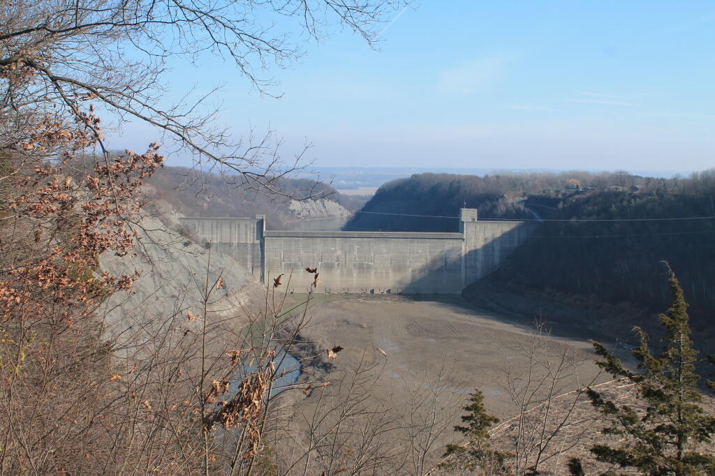
The fact is the climate is changing, and we are having more flooding. Appalachia, with it’s steep slopes and deep river valleys has always been prone to flooding. Past storm control projects – like Mount Morris Dam at Letchworth State Park has protected the Geneseo Valley and Rochester from flooding after Hurricane Agnes, as have many smaller storm control projects across our country.

All the evidence points to the need for more levies and storm control dams needed in the future. We need, bigger, better sewage control plants to deal with increased water flows. Weather records are showing increasing rain falls across most of the eastern half of country, water that has to be carefully moved into streams in ways that minimize damage to infrastructure and our lands.

Mount Morris Flood Control Dam

We need to prepare, because climate change is not only something in the distant future, it’s something that is impacting our communities with increased flooding risks now.

Saving for tomorrow and distant tomorrow

One of the things I often think about is how best to manage my money — is it better to invest more towards short term, mid-term, or long-term goals like retirement? I try to have a balanced plan.

I’ve made it a priority to retire relatively young, or at least be in a place where I can live outside of a small town, where I can own land and an off-grid cabin, heat with wood, hunt and trap my own land, own more guns, have nice 4×4 truck, tractor and implements, a four-wheeler, burn my trash, hunt and hobby farm my land. Where I don’t have be stuck living the Albany, New York-life forever. I want to live where I can have my freedom to be my own person, protected from the evils of modern society.

All those things take a big chunk of cash, especially if I’m uninterested in getting a bank loan and want enough land that I can burn or shoot whatever I want without pissing off the neighbors. Land and being in the back woods is important to my future. I don’t mind working, but I don’t want to be tied to the big city for the rest of my life.

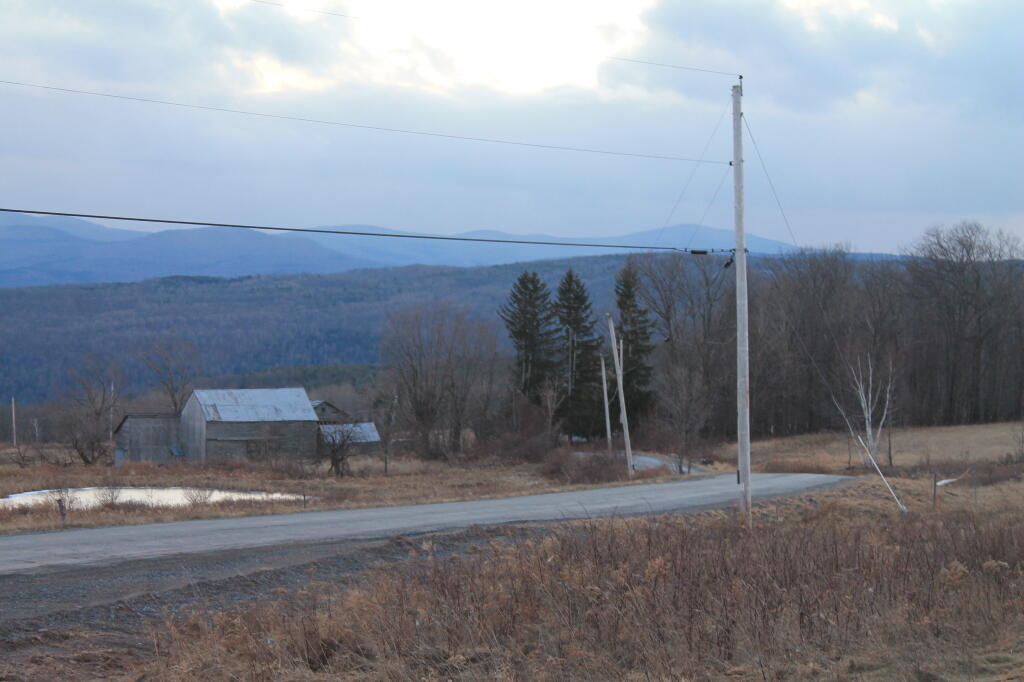
Farm on Jersey Street

Short-Term: High-Interest Savings and Certificates of Deposit

For the short-term, I save each paycheck in various FDIC-insured accounts, in case of job loss, sickness, or injury — and more immediate needs not covered by the ordinary budget. I don’t ordinary touch this money, but sometimes there is something big I might want to get like a new toy, that’s not in my budget. But I’ve cut back a lot on expensive toys now, as I’m pretty happy with what I have now.

I realize within 5 years I will probably have to think about replacing Big Red, as it starts to wear out. I don’t drive the truck that much, but it is getting older at this point, and it’s tough with our salty climate.️ I’m also not sure how good the engine is — for a while it burned oil. I want to make sure I have a reliable vehicle, though I admit I will probably will go for something cheaper next like a 3/4 ton 4×4 regular-cab, long-bed work-truck. I probably would not lift my truck or get any kind of fancy features, although I’d probably get a cap with a rack to mount the solar panel. Or I might get a lower-cost sedan and do more tent camping. I don’t know, car prices have grown enormously over the past decade. So that’s going to take a pretty big hit on cash.

This money is taxed when I first earned it, and the interest earned is taxed on a yearly-basis like ordinary income, essentially increasing my income as far as the tax man is concerned.

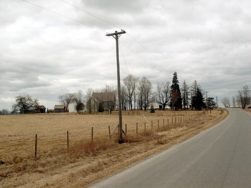
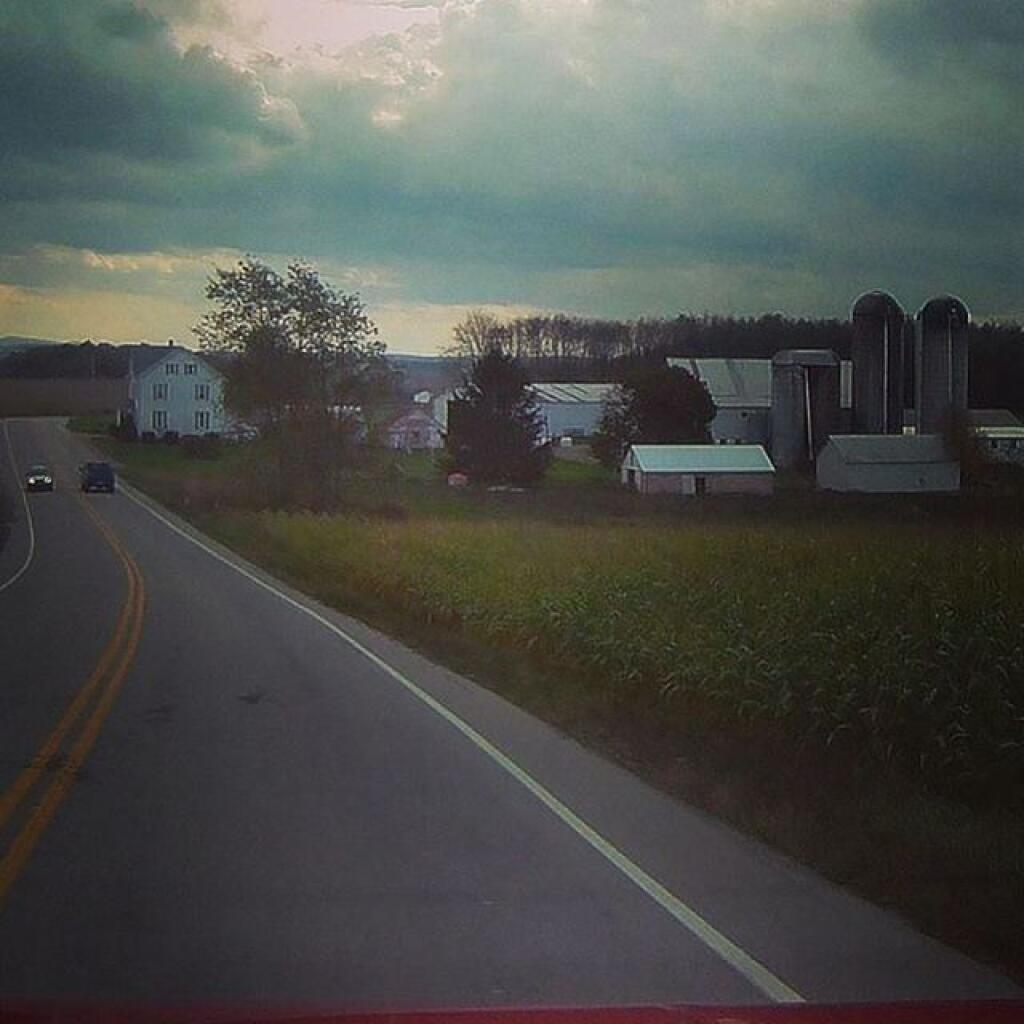
Farmland a Little Ways Beyond Somerset

Mid-Term: Low Cost Index Funds and Sector Funds

Each pay period I also make a payment to a nationally-known online brokerage firm to buy low-cost, low-free index funds and some sector funds. While the biggest chunk of money there is in total-market US and international funds, I also have some bond funds, some small and mid-caps high-growth/high-risk, and some energy industry sector funds which provide some protection against high energy prices.

I don’t plan to touch that money for another 10-20 years, which is between 2028-2038, as I want that money to continue to grow, and it’s heavily invested in things that gain value quickly but also have substantial downside risk, at least in the short-run. Another deep recession, like we had in 2008 could definitely set me back a few years on those investments, although in the past few years have seen substantial growth, so I’m not really worried even if we have a great depression the size of 90 years ago.

I don’t really need this money today or tomorrow, but I will want it when it comes to buying land and the off-grid cabin, and other related improvements. So I am more then willing to take short-term risk, which is somewhat mitigated by the fact that I practice cost-averaging by buying a little more each paycheck. Even if I buy high one year, and the market falls the next year, the next year it’s offset by the fact I am getting more shares at a lower price.

This money is taxed when I first earn it, and the tax man considers the dividends I reinvest into buying more shares, income each year. So I pay the tax man each year for the privilege of my total number of shares as they grow each year. Once I cash out these index funds to buy land and the cabin, I will have to pay long-term capital gain tax on the gains over the years. While paying long-term capital gain tax sucks, it’s less then if it was taxed as ordinary income. New York State taxes capital gains as ordinary income, so that’s yet another reason to leave New York when I’m at that point in my life.

The unfortunate truth, is when I need this money to buy land and the off-grid cabin, it will probably hit with a fairly big federal tax bill on the capital gains. In the point when I touch this money, my hope is already establish a residency in a state without no or at least low state capital gains tax. I probably would rent for at least a year in that future state, to avoid state taxes and give myself more time to look at properties I would ultimately want to buy.

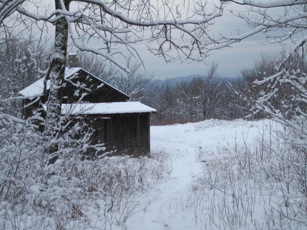
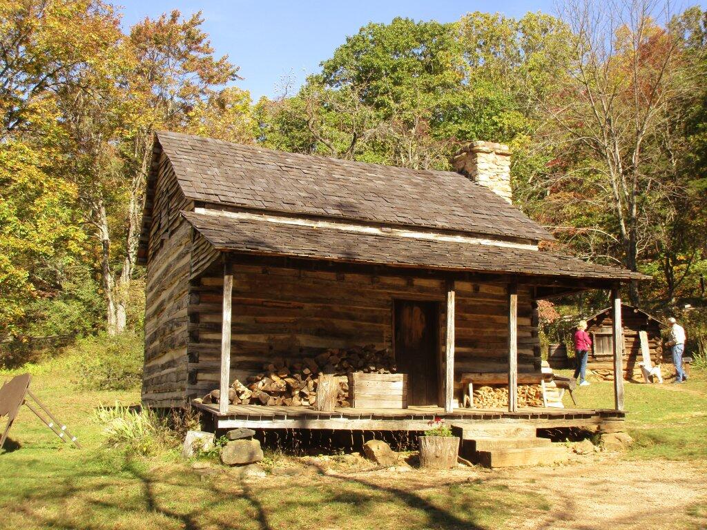
Former Rangers Cabin

Early Retirement: Deferred Compensation and Pension

I am hoping to retire around age 55 or so. A lot will depend on the affordability of healthcare and what options are available in the area where I buy my land. That would bring me to around year 2038, which sounds like a long-time away but it’s only 19 years. Assuming I get enough credit in with the state government, I will have 30 years in by age 55, and I will be able to sell part of my sick time for health insurance. I also am a vested member of state pension system, so there will hopefully be some money in that state constitutionally-protected benefit when I retire. Like social security, a pension is the part of the three-legged stool, but I don’t necessarily expect them to be all that strong in come years — although I have hope that our political leaders will make wise choices and strengthen both of these systems to ensure promised benefits are still part of our society by my retirement.

In support of this goal, I’ve been doing a pre-tax deferred compensation 457 plan, which allows me to reduce my gross income each year for tax purposes like with an ordinary IRA but at an amount up to $19,000 a year. Yeah, I don’t reach that number at this point. This is a good thing, especially for somebody like me who doesn’t have student loans or mortgage interest or local property tax deduction to use to reduce my total income. The catch if with the program you can only contribute a percentage of income earned by state or local government employment, it doesn’t count from other employers or sources. I have a second job, that is not covered by deferred compensation.

When you withdraw this amount you have to pay tax on the total amount it like it was ordinary income — you don’t get a break on capital gains like you do with other kinds of long-term capital gains. If I move out of New York State to a low-tax state without taxation on retirement savings, I will never pay any state income tax on this state income.

With 457 plans like deferred compensation, there is no age restrictions on when you can start taking money from it, although you are required to take a certain percentage of it starting by age 70.

Farm on Cheese Hill Road

Later in Retirement: Roth IRA

Early in my career, before I started in state service, I started contributing to a Roth IRA, over the years worked it up to maximum yearly contribution, which is now $6,000 a year. Money for Roth IRA is put in after tax-income, so you use money after payroll taxes to fund them. While limited, they have some definite advantages — namely they are very flexible in what you can put in them, tied to no one funding source like the 457 plans, and with the Roth IRA are tax-free to withdraw from after age 59, as long as you take a minimum distribution before age 70.

Another thing I like about the Roth IRA, is the contribution limit is relatively low at $6,000 so it’s a goal that can be fairly easily met each year by biweekly contributions. It is funded automatically, no matter if I am making money from my state work or private sector work. It just feels like an accomplishment to hit that number each year, and watch as it grows. I typically use target-based retirement funds, which are a low-cost mixture of index and bond funds.

I don’t plan to live a fancy life in my later years, but I will have to repair and replace equipment, and still have money for groceries, fuel and supplies. Even if I don’t have an expensive electricity or cable bill, my truck and toys will still need work. I will need groceries and supplies.

Cabin

Savings and Investing is A Ways and Means

There is a lot of glamor on television about being rich. I doubt I will ever be too rich to chop my own wood, burn my own trash, or compost my own waste. I like doing things myself, and while there are some things I lack the skills to do, I’ve not one for living a life of luxury or excess. But I am working to save and invest, as a way and mean to a better future. Money buys essential land, property and services; it’s required for a better tomorrow. A dollar saved to today, is put away to grow towards a bigger dollar tomorrow. A buck might not seem like a lot today, but when you add a buck here and buck there, it adds up over a sufficient period of time. What seems like a distant future, it really only a matter of time until a better life tomorrow.

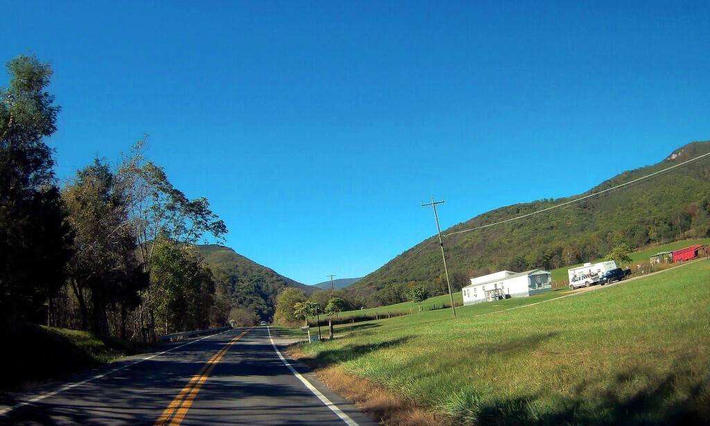
 Outside Of Cabins, WV

For the love of styrofoam when camping in the boonies

I am a big fan of using styrofoam plates, bowls, and plastic folks when I’m camping in the woods. Not so much paper plates, because styrofoam burns better in a hot fire, especially when wet and contaminated with food. It’s also cheap. Regular plates are fine for at home, but when your water supply is limited, using disposable, and burnable plates makes a lot of sense – plus then you don’t have to deal with dish water contaminated with food waste, attracting bears or other wildlife.

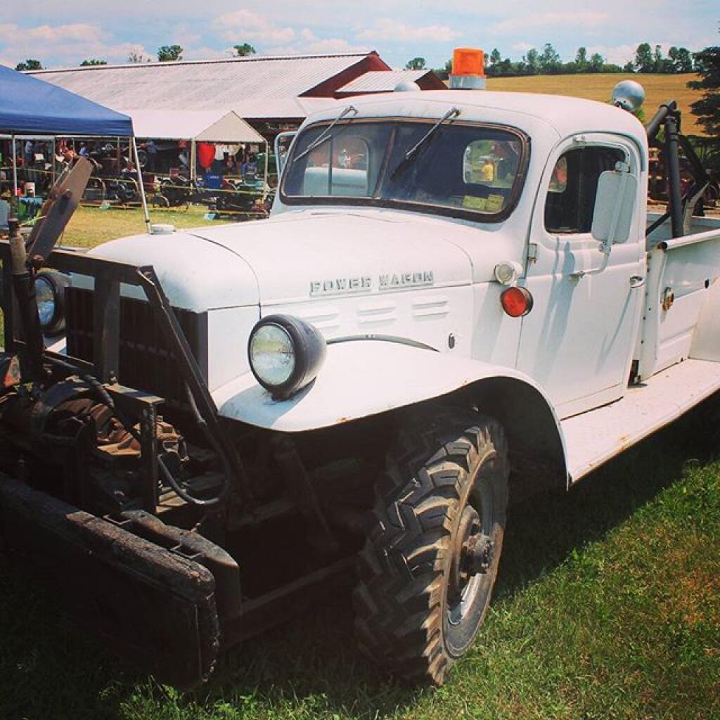
Power Wagon #gasup2016

That said, I am well aware of the environmental downsides to using styrofoam.

Styrofoam is made out of styrene which is non-biodegradable, and as a petrochemical is a hazardous material. Breathing in styrene gases in an enclosed space, according to the government can make one nauseous and is a probable carcinogen. If you just take a match to a styrofoam plate and don’t burn it in a hot fire it certainly burns with a black smoke and bright yellow from the polyaromic hydrocarbons, and smells fairly nasty.

Styrofoam, as litter, quickly falls apart and become small enough to be digested by fish and other animals, leaving the toxic styrene to be eaten by the fish. One shouldn’t litter, and I certainly do not litter. Anything that isn’t fully burned, I pack out. While most garbage minimally biodegradable in a landfill, styrofoam is completely un-biodegradable, and only may leach out the styrene compounds into the lechate system or groundwater.

The mass-urban use of styrofoam isn’t a good thing. Restaurants shouldn’t use styrofoam, indeed I have argued that it should be banned for take-out containers in favor of paper containers. But in the back-country,Β  where pollution levels are low, and general use of land is low, I don’t see the big deal about using styrofoam.

Burning the Morning's Garbage Up

It’s cheap, burns well, and beats washing dishes with a limited water supply.

It’s cheap, it burns well in a hot fire, and beats doing dishes when you have a limited water supply.

Laws and Case Law

Highway Law Section 115-A:
Abandonment of County Highways.

Whenever a county road or part thereof constructed as part of the county road system deviates from the line of an existing town highway, or from the line of a former town highway within the limits of an incorporated village, as shown on the map of the county road system, the board of supervisors by resolution duly adopted upon the recommendation of the county superintendent of highways, and pursuant to a written agreement with the town board or village board of trustees, or in the event such an agreement cannot be reached with the approval of the commissioner of transportation, may abandon to the town or the incorporated village as the case may be for future maintenance, that part of the town highway or former town highway within the limits of an incorporated village not improved and modify the map of the county road system accordingly. The portion of any town highway or former town highway within the limits of an incorporated village excluded from the county road system shall be maintained by the town or village in which it is located.

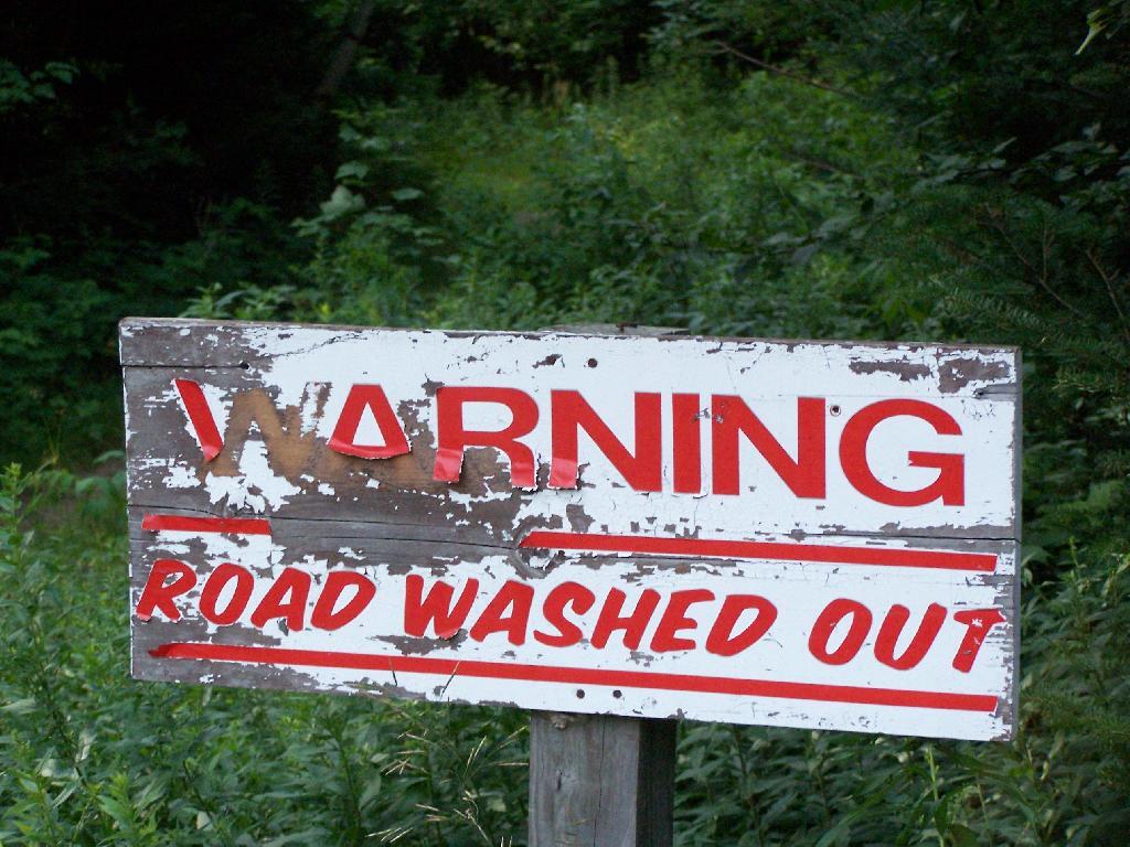
Warning! Road Washed Out

Highway Law Section 205:
Highways Abandoned By Local Governments.

1. Every highway that shall not have been opened and worked within six years from the time it shall have been dedicated to the use of the public, or laid out, shall cease to be a highway; but the period during which any action or proceeding shall have been, or shall be pending in regard to any such highway, shall form no part of such six years; and every highway that shall not have been traveled or used as a highway for six years, shall cease to be a highway, and every public right of way that shall not have been used for said period shall be deemed abandoned as a right-of-way. The town superintendent with the written consent of a majority of the town board shall file, and cause to be recorded in the town clerk’s office of the town a written description, signed by him, and by said town board of each highway and public right-of-way so abandoned, and the same shall thereupon be discontinued.

2. There may also be a qualified abandonment of a highway under the following conditions and for the following purposes, to wit: Where it appears to the town superintendent and said town board, at any time, that a highway has not become wholly disused as aforesaid, but that it has not for two years next previous thereto, been usually traveled along the greater part thereof, by more than two vehicles daily, in addition to pedestrians and persons on horseback, and it shall also appear to the superintendent of highways of the county in which such town is situate that a qualified abandonment of such highway is proper and will not cause injustice or hardship to the owner or occupant of any lands adjoining such highway after such superintendent shall have held a public hearing thereon upon giving at least twenty days’ written notice to such owners and occupants of such lands of the time and place of such hearing, they shall file and cause to be recorded in the town clerk’s office a certificate containing a description of that portion of the highway partly disused as aforesaid and declaring a qualified abandonment thereof. The effect of such qualified abandonment, with respect to the portion of said highway described in the certificate, shall be as follows: It shall no longer be worked at the public expense; it shall not cease to be a highway for purposes of the public easement, by reason of such suspension of work thereon; no persons shall impair its use as a highway nor obstruct it, except as hereinafter provided, but no persons shall be required to keep any part of it in repair; wherever an owner or lessee of adjoining lands has the right to possession of other lands wholly or partly on the directly opposite side of the highway therefrom, he may construct and maintain across said highway a fence at each end of the area of highway which adjoins both of said opposite pieces of land, provided that each said cross fence must have a gate in the middle thereof at least ten feet in length, which gate must at all times be kept unlocked and supplied with a sufficient hasp or latch for keeping the same closed; all persons owning or using opposite lands, connected by such gates and fences, may use the portion of highway thus enclosed for pasturage; any traveler or other person who intentionally, or by wilful neglect, leaves such gate unlatched, shall be guilty of a misdemeanor, and the fact of leaving it unlatched shall be prima facie evidence of such intent or wilful neglect. Excepting as herein abrogated, all other general laws relating to highways shall apply to such partially abandoned highway. This section shall not apply to highways less than two rods in width unless it shall appear to the town superintendent at any time that such a highway has not, during the months of June to September inclusive of the two years next previous thereto, been usually traveled along the greater part thereof by more than ten pedestrians daily.

Any action or proceeding involving the abandonment or qualified abandonment of a highway made pursuant to this section must, in the case of abandonment, be commenced within one year from the date of filing by the town superintendent as provided in subdivision one of this section.

Old NY 30 Signs

Matter of Smigel v. Town of Rennselaer.

As seen on Google Scholar.

MATTER OF SMIGEL v. TOWN OF RENSSELAERVILLE

283 A.D.2d 863 (2001)

725 N.Y.S.2d 138

In the Matter of HENRIETTA SMIGEL, Respondent, v.
TOWN OF RENSSELAERVILLE et al., Appellants.

Appellate Division of the Supreme Court of the State of New York, Third Department.

Decided May 24, 2001.

Mercure, J. P., Peters, Spain and Carpinello, JJ., concur. Lahtinen, J.

Petitioner is the owner of land bordering the Camp Winsocki Road (hereinafter the road) located in respondent Town of Rensselaerville in Albany County, having acquired title to the property in 1986. In December 1995, petitioner requested that respondents abandon a portion of the road which she had barricaded at both ends in 1986, and which respondent Town Supervisor admitted had not been maintained by respondents for at least 20 years. Her request was continued for further study by the Town Board of the Town of Rensselaerville. In October 1999, petitioner and another petitioned respondents “to abandon a portion of its present easement to [the road].” In January 2000, after a public hearing, respondents refused to abandon the road and passed a resolution finding that the road had not been abandoned through disuse, ordering petitioner to remove all of her barricades, and making the road a seasonal road to be maintained from April 1 to December 1.

In January 2000, petitioner commenced this combined CPLR article 78 proceeding and action for declaratory judgment seeking a judgment clearing her title “as to the portion of her property previously subjected to an easement for the highway,” injunctive relief prohibiting respondents from removing her barriers on the road and trespassing on her property and an order directing respondents to file a certification of abandonment. Respondents answered, asserting that the petition/ complaint failed to state a cause of action.

The parties submitted numerous affidavits and documentary evidence in support of their respective positions and, in April 2000, Supreme Court determined that because no photographs had been submitted by either party, the matter could not be summarily decided, and it therefore set a hearing date to determine whether recreational travel “follows the `lines of the ancient street.'” When the parties appeared on the scheduled hearing date, they were informed that the hearing had been canceled and were directed to leave any photographs that they had with the court for review. Both parties submitted photographs depicting the present condition of the road.* On May 26, 2000, Supreme Court granted the petition/complaint and declared the road to be abandoned. Respondents appeal and we reverse.

Highway Law § 205 (1) provides, in relevant part, that “every highway that shall not have been traveled or used as a highway for six years, shall cease to be a highway.” Once a highway exists, it is presumed to continue until the contrary is demonstrated and the presumption is in favor of continuance (see, City of Cohoes v Delaware & Hudson Canal Co., 134 N.Y. 397, 407; Matter of Van Aken v Town of Roxbury,211 A.D.2d 863, 865, lv denied 85 N.Y.2d 812). The burden of establishing abandonment is on the party claiming that the highway has been abandoned (see, Matter of Faigle v Macumber,169 A.D.2d 914, 915). In that regard, a municipality’s intention regarding a road is irrelevant (see, Daetsch v Taber,149 A.D.2d 864, 865) and its failure to maintain a road does not mean that the road ceases to be a highway (see, O’Leary v Town of Trenton,172 Misc.2d 447, 450). A determination of abandonment of a road by nonuse is a factual determination (see, e.g., Coleman v Village of Head of Harbor,163 A.D.2d 456, 458, lv denied76 N.Y.2d 768; Holland v Superintendent of Highways of Town of Smithtown,73 Misc.2d 851, 852).

It is undisputed that respondents never filed a certificate of abandonment to officially abandon the road. Likewise, it is clear that respondents did not maintain the road nor had the road been used by motor vehicles for more than the statutory six-year period. The narrow question left to be decided after submission of the photographs was framed by Supreme Court as follows: “[i]f the road entrance has been obstructed, and it is unpaved and overgrown with weeds, trees, bushes and shrubs, as claimed by petitioner, making travel along the `lines of the ancient street’ improbable, then even the most active recreational and seasonal use propounded by [respondents], that of snowmobilers, hikers, and bicyclists, would fall short of being highway use” (citing O’Leary v Town of Trenton, supra, at 451; Holland v Superintendent of Highways of Town of Smithtown, supra, at 853).

We find that Supreme Court correctly set forth the applicable law regarding abandonment of a highway through nonuse. After reviewing the photographs submitted by the parties, Supreme Court made the factual determination that the “photographs reveal many years of non-use as a highway” and “it is apparent that the road entrance has often been obstructed, preventing travel along the `lines of the ancient street,'” and summarily granted the relief sought by petitioner. We agree that the photographs show a number of barricades located at various points along the unpaved road, but they also show an ancient road, not overgrown with weeds, trees, bushes or shrubs, but clearly discernible, and not “virtually indistinguishable from the surrounding wooded area” (Matter of Faigle v Macumber, supra, at 916). Indeed, the pictures appear to depict a clearly defined, unpaved roadway through an area overgrown with brush and thick woods on both sides, precluding travel other than on the road, except with extreme difficulty. Our review of the photographs suggests to us that travel over this road by such disparate groups as snowmobilers, bicyclists, cross-country skiers and pedestrians would follow “along the lines of an existing street” (Town of Leray v New York Cent. R. R. Co., 226 N.Y. 109, 113). Moreover, respondents’ submissions reflect that although petitioner had barricaded the road on a number of occasions, those obstructions were either removed or knocked down so as to access its year-round recreational use. Therefore, the recreational uses found by Supreme Court may be sufficient to preclude a finding of abandonment of the road by nonuse. In our opinion, summary judgment should not have been granted in this matter in the absence of clarifying testimony as to the condition and use of the roadway.

Ordered that the judgment is reversed, on the law, without costs, and matter remitted to the Supreme Court for further proceedings not inconsistent with this Court’s decision.

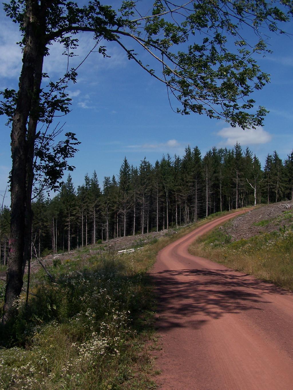
Red Dirt Road

MATTER OF VAN AKEN v. Town of Roxbury, 211 AD 2d 863.

As found on Google Scholar.

211 A.D.2d 863 (1995) 621 N.Y.S.2d 204 In the Matter of Millard Van Aken et al., Appellants, v. Town of Roxbury et al., Respondents

Appellate Division of the Supreme Court of the State of New York, Third Department.

January 5, 1995 Mikoll, Crew III, Yesawich Jr. and Peters, JJ., concur.

Cardona, P. J.

Petitioners are property owners with residences located in the Town of Roxbury, Delaware County, which extends beyond the roadway presently maintained by respondents as a Town road. On October 20, 1992, petitioners wrote to respondent Town of Roxbury requesting maintenance of the road segment at issue. On November 10, 1992, the Town Attorney responded by requesting evidence that the segment was a Town road. The attorney for petitioners wrote back indicating the reasons the particular segment was a Town highway. When no response was received, petitioner Millard Van Aken asked the Town Supervisor about the status of the request and was told that the Town Attorney was supposed to respond but had been delayed by other matters.

On March 4, 1993, the Town Attorney informed petitioners that if the segment was a Town road it had been abandoned. On July 1, 1993, petitioners commenced this CPLR article 78 proceeding seeking to compel the Town and respondent Town Superintendent of Highways to maintain the road segment pursuant to Highway Law § 140. In their answer, respondents asserted that the proceeding was barred by the four-month Statute of Limitations (see, CPLR 217 [1]). Supreme Court held that the Town was required to make a final binding determination on petitioners’ request before CPLR article 78 review was possible and the Town Attorney’s letter of March 4, 1993 did not constitute a binding determination. Unable to determine 864*864 if or when the Town had taken official action on petitioners’ request, Supreme Court dismissed the petition as either untimely or premature. By letter to the Town Board dated September 30, 1993, petitioners sought a formal vote on their request for maintenance. On October 11, 1993, the Town Board denied their request. Thereafter, petitioners moved for reconsideration, which Supreme Court denied.

Initially, we note that Supreme Court relied upon our decision in Treadway v Town Bd. (163 AD2d 637) in determining the Statute of Limitations issue. We treated the declaratory judgment action in Treadway as a mandamus to review for limitation purposes. However, the present proceeding is in the nature of mandamus to compel rather than mandamus to review. In mandamus to review, the court examines an administrative action involving the exercise of discretion for which no quasi-judicial hearing is required. On the other hand, in mandamus to compel an agency or officer’s performance of a ministerial act, the court examines whether the petitioner possesses a clear legal right to the relief sought and whether the agency or officer has a corresponding nondiscretionary duty to grant the relief requested (see, CPLR 7803 [1]; Matter of Scherbyn v Wayne-Finger Lakes Bd. of Coop. Educ. Servs., 77 N.Y.2d 753, 757; see also, Matter of Armstrong v Centerville Fire Co., 83 N.Y.2d 937, 939; Matter of Legal Aid Socy. v Scheinman, 53 N.Y.2d 12, 16).

In Treadway (supra), review was sought of an administrative action in the form of a declaration by the Town Board that the disputed road was not a public road. We held that the four-month Statute of Limitations began to run from that final binding determination. In this case, there is no question but that petitioners made a demand for maintenance to the Town on October 20, 1992. The March 4, 1993 letter from the Town Attorney[*] conveyed the Town’s refusal to perform its ministerial duty to maintain the road (see, Highway Law § 140). Accordingly, the four-month Statute of Limitations began to run at that time (see, CPLR 217 [1]; Matter of Waterside Assocs. v New York State Dept. of Envtl. Conservation, 72 N.Y.2d 1009, 1010; Matter of De Milio v Borghard, 55 N.Y.2d 216, 220; Matter of Pfingst v Levitt, 44 AD2d 157, 159, lv denied 34 N.Y.2d 518; see also, Siegel, NY Prac § 566, at 887 [2d ed]). Therefore, the petition filed on July 1, 1993 was 865*865 within the applicable period of limitations and the proceeding was timely commenced.

Having established that petitioners’ proceeding was timely commenced, we turn now to the merits of their petition. While it is clear that the Town has a legal duty to maintain Town roads (see, Highway Law § 140) and can be compelled to perform such a duty (see, People ex rel. Schau v McWilliams, 185 N.Y. 92, 100), the parties disagree on the fundamental question of whether the road segment at issue was abandoned by the Town and therefore no longer a Town highway. It is undisputed that no certificate of abandonment was ever filed by the Town, as provided for in Highway Law § 205. “Once a road becomes a highway, it remains such until the contrary is shown” (Matter of Shawangunk Holdings v Superintendent of Highways of Town of Shawangunk, 101 AD2d 905, 907; see, Matter of Flacke v Strack, 98 AD2d 881). A highway will be deemed abandoned if it is not traveled or used as a highway for six years (see, Highway Law § 205). The burden of proving such abandonment rests, in this case, with the Town (see, Matter of Shawangunk Holdings v Superintendent of Highways of Town of Shawangunk, supra, at 907).

Respondents have failed to meet their burden of proving that the road segment at issue was not traveled or used as a highway for six years. Although respondents argue that abandonment is shown because of a period of nonmaintenance in excess of 30 years, the law is clear that a highway does not cease to be a highway merely because the Town has failed to service it (see, Hewitt v Town of Scipio, 32 AD2d 734, affd 26 N.Y.2d 934). Nor is it relevant whether the Town intended an abandonment, as it is the substantive facts themselves which establish abandonment (see, Daetsch v Taber, 149 AD2d 864, 865). Petitioners have introduced uncontroverted cartographic and testimonial evidence to support their contention that the road has been and continues to be regularly used and traveled as a highway. We, therefore, find that no genuine issue of abandonment exists and that the contested road segment continues to be a Town road.

Ordered that the judgment and order are reversed, on the law, with costs, and petition granted.

Betty Brook Road

Holland v. SUPT. OF HIGHWAYS, 73 Misc. 2d 851

This case also from Google Scholar.

73 Misc.2d 851 (1973)

Eugene W. Holland, Plaintiff,
v.
Superintendent of Highways of the Town of Smithtown et al., Defendants.

Supreme Court, Special Term, Nassau County.

April 3, 1973 Donner, Fagelson & Hariton for plaintiff. H. Paul King for defendants.

BERTRAM HARNETT, J.

Eugene W. Holland owns property in Smithtown, New York, bordering to the east on a plot of land about 50 feet wide sometimes known as the “Old Smithtown to St. Johnsland Road”. In this declaratory judgment action brought against the Town of Smithtown and its Superintendent of Highways, Mr. Holland now seeks, by summary judgment motion, a declaration that he owns the westerly one half of the land by virtue of State and town abandonment of 852*852 it. Defendants move to dismiss pursuant to CPLR 3211 (subd. [a], par. 10).

Despite some minor disputation, the parties essentially agree that the subject land is not used as a public road for motor vehicular traffic. It is unpaved, blocked off on both ends, and substantially overgrown with trees and shrubbery. Pedestrians and bicyclers occasionally use it as a sort of pathway or shortcut. No material issue of fact appears to prevent a summary disposition. (Sachs v. Real Estate Capital Corp., 31 A D 2d 916; Law Research Serv. v. Honeywell, 31 A D 2d 900.)

Subdivision 1 of section 205 of the Highway Law provides in pertinent part: “Every highway that shall not have been traveled or used as a highway for six years, shall cease to be a highway * * * The town superintendent with the written consent of a majority of the town board shall file, and cause to be recorded in the town clerk’s office of the town a written description, signed by him, and by said town board of each highway and public right-of-way so abandoned, and the same shall thereupon be discontinued”.

The statute does not specify any procedures to be followed in town ascertainment of an abandoned highway, in contrast to the notice and hearing required for a “qualified abandonment” finding. (See Highway Law, § 205, subd. 2.) Any route once declared and used as a highway is presumed to continue as such until shown, by the party seeking a contrary declaration, to have been abandoned. (Hallenbeck v. State of New York, 59 Misc 2d 475, 480; Stupnicki v. Southern New York Fish & Game Assn., 41 Misc 2d 266, affd. 19 A D 2d 921.) The focal determination is essentially a factual one. And, nonuse of only a portion of a highway, while the rest continues to be utilized as a highway, does not result in abandonment, even of the unused portion. (Bovee v. State of New York, 28 A D 2d 1165.)

While at one time the Smithtown to St. Johnsland Road may have been heavily traveled, after its completion in 1917, the portion abutting Mr. Holland’s land has been in substantial disuse since a realignment of the Jericho Turnpike intersection in 1930. The evidence is overwhelming for much more than the past six years the land was not used as a highway. Petitioner and 16 residents in the surrounding neighborhood so attest in sworn statements and the photographs submitted clearly indicate lack of highway activity for many years. Indeed, the town itself uses the easterly half of the old road land as part of a park.

853*853While use as a highway upon appropriate circumstances may encompass less than contemporary expressway traffic of trailer trucks and high-speed automobiles, even the most active use posited by the town, that of pedestrian and bicycle passage, falls far short of being highway use. (Town of Leray v. New York Cent. R. R. Co., 226 N.Y. 109, 113.) Were this activity to create a public easement, the ownership rights of the adjoining fee owner would still remain unaffected. “It is the rule that where an easement only exists in the public that upon abandonment the fee is presumptively in the owners of the adjoining land.” (Stupnicki v. Southern New York Fish & Game Assn., 41 Misc 2d 266, 271, affd. 19 A D 2d 921, supra).

As Judge CARDOZO observed in Barnes v. Midland R. R. Term. Co. (218 N.Y. 91, 98): “If for six years the highway remains closed with the acquiescence of the public, there is an extinguishment of the public right”.

One peculiar wrinkle remains. After the State apparently realized that this portion of the “Old Smithtown to St. Johnsland Road” would be unused because of the mentioned realignment, the Commissioner of the Department of Works, Division of Highways, issued an official order dated July 19, 1932, substituting as part of the official State highway the realigned section for the abandoned section, stating that the unused portion was to be “TURNED OVER to the COUNTY OF SUFFOLK for future maintenance and repair”. The town asserts, in seeking dismissal, that this directive adversely affects Mr. Holland’s fee interest, and further requires the County of Suffolk to be joined as a necessary party.

Mr. Holland’s fee interest, clearly established by his surveyor’s title search of deeds going back over one hundred years, is not disturbed by the State’s order which relates solely to maintenance and care of the discontinued stretch of highway, not to the underlying ownership. Under the State highway system, created in 1908, the State does not own its roads unless prescribed condemnation procedures are first completed. (L. 1908, ch. 330; Highway Law, § 30.) Here, there is no indication of any prior State condemnation. When the Department of Works’ order was issued in 1932, the State’s interest was merely that of a public right of way, limited to its entitlement and obligation to maintain the roads. Accordingly, even if the Commissioner had conveyance power, all that could have been “turned over” to Suffolk County in 1932 was the State’s maintenance right. In this proceeding to determine ownership rights in the land, the county is not, therefore, a necessary or 854*854 indispensable party, particularly where, upon abandonment declaration, and resulting ownership and use vesting in the adjoining owner, he would then assume use, control and maintenance of the land.

Moreover, the purported deed from the county to the town dated July 28, 1930, transferring the 15 feet on each side of the subject parcel to the town only for use as a park or plaza, does not appear to affect the easterly side of the road, not owned at any time by the town. In any event, it could not convey a fee interest that the county did not have.

Finally, the lack of any formal application for a town certificate is not at this stage fatal. The abandonment exists, independent of the town certification, a purely ministerial act. (See People ex rel. De Groat v. Marlette, 94 App. Div. 592, 594.) There are no procedures set forth in the statute indicating who may obtain, and how, the “consent” to abandonment by the Town Board. (Highway Law, § 205, subd. 1.) No reason is suggested why a court, with the town and its Highway Department fully and fairly before it, may not declare the respective rights of the parties so as to resolve the controversy. Exhaustion of administrative remedies is not a prerequisite in an action for declaratory judgment. (Northern Operating Corp. v. Town of Ramapo, 31 A D 2d 822.) Moreover, the town, by fully appearing here and expressing its opposition on the merits in the many forms indicated, has demonstrated that a remand of Mr. Holland’s application to the town would be a futile and superfluous avenue, and has therefore rendered the dispute ripe for judicial determination.

Accordingly, defendants’ motion to dismiss is denied, the plaintiff’s motion for summary judgment is granted, and a declaratory judgment shall be issued declaring the road land abutting plaintiff’s property to be abandoned.

Settle judgment on notice.

A look at the various laws and a few cases relating to the abandonment of highways in NY State.

Article XIV (Conservation) of NY State Constitution

As amended by the voters on November 5, 2013.

Section 1: Forest preserve to be forever kept wild; authorized uses and exceptions.

The lands of the state, now owned or hereafter acquired, constituting the forest preserve as now fixed by law, shall be forever kept as wild forest lands. They shall not be leased, sold or exchanged, or be taken by any corporation, public or private, nor shall the timber thereon be sold, removed or destroyed.

Snowy Mountain

Exception 1:
Adirondack Northway.

Nothing herein contained shall prevent the state from constructing, completing and maintaining any highway heretofore specifically authorized by constitutional amendment, nor from constructing and maintaining to federal standards federal aid interstate highway route five hundred two from a point in the vicinity of the city of Glens Falls, thence northerly to the vicinity of the villages of Lake George and Warrensburg, the hamlets of South Horicon and Pottersville and thence northerly in a generally straight line on the west side of Schroon Lake to the vicinity of the hamlet of Schroon, then continuing northerly to the vicinity of Schroon Falls, Schroon River and North Hudson, and to the east of Makomis Mountain, east of the hamlet of New Russia, east of the village of Elizabethtown and continuing northerly in the vicinity of the hamlet of Towers Forge, and east of Poke-O-Moonshine Mountain and continuing northerly to the vicinity of the village of Keeseville and the city of Plattsburgh, all of the aforesaid taking not to exceed a total of three hundred acres of state forest preserve land, …

Exception 2:
State-owned Ski Resorts Bellayre and Gore Mountain.

… nor from constructing and maintaining not more than twenty-five miles of ski trails thirty to two hundred feet wide, together with appurtenances thereto, provided that no more than five miles of such trails shall be in excess of one hundred twenty feet wide, on the north, east and northwest slopes of Whiteface Mountain in Essex county, nor from constructing and maintaining not more than twenty-five miles of ski trails thirty to two hundred feet wide, together with appurtenances thereto, provided that no more than two miles of such trails shall be in excess of one hundred twenty feet wide, on the slopes of Belleayre Mountain in Ulster and Delaware counties and not more than forty miles of ski trails thirty to two hundred feet wide, together with appurtenances thereto, provided that no more than eight miles of such trails shall be in excess of one hundred twenty feet wide, on the slopes of Gore and Pete Gay mountains in Warren county, …

Exception 3:
Realignment of Certain State Highways in Adirondacks,
Namely Route 9, Route 73, Route 28, and Route 30.

… nor from relocating, reconstructing and maintaining a total of not more than fifty miles of existing state highways for the purpose of eliminating the hazards of dangerous curves and grades, provided a total of no more than four hundred acres of forest preserve land shall be used for such purpose and that no single relocated portion of any highway shall exceed one mile in length.

Exception 4:
Saranac Lake Town Dump Land Exchange.

Notwithstanding the foregoing provisions, the state may convey to the village of Saranac Lake ten acres of forest preserve land adjacent to the boundaries of such village for public use in providing for refuse disposal and in exchange therefore the village of Saranac Lake shall convey to the state thirty acres of certain true forest land owned by such village on Roaring Brook in the northern half of Lot 113, Township 11, Richards Survey.

Exception 5:
Piseco Airport, Part I, Land Exchange.

Notwithstanding the foregoing provisions, the state may convey to the town of Arietta twenty-eight acres of forest preserve land within such town for public use in providing for the extension of the runway and landing strip of the Piseco airport and in exchange therefor the town of Arietta shall convey to the state thirty acres of certain land owned by such town in the town of Arietta.

Exception 6:
Moose River Plains and International Paper Land Exchange.

Notwithstanding the foregoing provisions and subject to legislative approval of the tracts to be exchanged prior to the actual transfer of title, the state, in order to consolidate its land holdings for better management, may convey to International Paper Company approximately eight thousand five hundred acres of forest preserve land located in townships two and three of Totten and Crossfield Purchase and township nine of the Moose River Tract, Hamilton county, and in exchange therefore International Paper Company shall convey to the state for incorporation into the forest preserve approximately the same number of acres of land located within such townships and such County on condition that the legislature shall determine that the lands to be received by the state are at least equal in value to the lands to be conveyed by the state.

Exception 7:
Sagamore Insitute Land Exchange.

Notwithstanding the foregoing provisions and subject to legislative approval of the tracts to be exchanged prior to the actual transfer of title and the conditions herein set forth, the state, in order to facilitate the preservation of historic buildings listed on the national register of historic places by rejoining an historic grouping of buildings under unitary ownership and stewardship, may convey to Sagamore Institute, Inc., a not-for-profit educational organization, approximately ten acres of land and buildings thereon adjoining the real property of the Sagamore Institute, Inc. and located on Sagamore Road, near Racquette Lake Village, in the Town of Long Lake, county of Hamilton, and in exchange therefor; Sagamore Institute, Inc. shall convey to the state for incorporation into the forest preserve approximately two hundred acres of wild forest land located within the Adirondack Park on condition that the legislature shall determine that the lands to be received by the state are at least equal in value to the lands and buildings to be conveyed by the state and that the natural and historic character of the lands and buildings conveyed by the state will be secured by appropriate covenants and restrictions and that the lands and buildings conveyed by the state will reasonably be available for public visits according to agreement between Sagamore Institute, Inc. and the state.

Exception 8:
Piseco Airport, Part II Land Exchange.

Notwithstanding the foregoing provisions the state may convey to the town of Arietta fifty acres of forest preserve land within such town for public use in providing for the extension of the runway and landing strip of the Piseco airport and providing for the maintenance of a clear zone around such runway, and in exchange therefor, the town of Arietta shall convey to the state fifty-three acres of true forest land located in lot 2 township 2 Totten and Crossfield’s Purchase in the town of Lake Pleasant.

Exception 9:
Town of Keene Cemetery Land Exchange.

Notwithstanding the foregoing provisions and subject to legislative approval prior to actual transfer of title, the state may convey to the town of Keene, Essex county, for public use as a cemetery owned by such town, approximately twelve acres of forest preserve land within such town and, in exchange therefor, the town of Keene shall convey to the state for incorporation into the forest preserve approximately one hundred forty-four acres of land, together with an easement over land owned by such town including the riverbed adjacent to the land to be conveyed to the state that will restrict further development of such land, on condition that the legislature shall determine that the property to be received by the state is at least equal in value to the land to be conveyed by the state.

Exception 9:
Hamlet of Raquette Lake Drinking Wells, Land Exchange.

Notwithstanding the foregoing provisions and subject to legislative approval prior to actual transfer of title, because there is no viable alternative to using forest preserve lands for the siting of drinking water wells and necessary appurtenances and because such wells are necessary to meet drinking water quality standards, the state may convey to the town of Long Lake, Hamilton county, one acre of forest preserve land within such town for public use as the site of such drinking water wells and necessary appurtenances for the municipal water supply for the hamlet of Raquette Lake. In exchange therefor, the town of Long Lake shall convey to the state at least twelve acres of land located in Hamilton county for incorporation into the forest preserve that the legislature shall determine is at least equal in value to the land to be conveyed by the state. The Raquette Lake surface reservoir shall be abandoned as a drinking water supply source.

Exception 10:
Tupper Lake/National Grid “Tri-Lakes Reliability Project” Land Exchange.

Notwithstanding the foregoing provisions and subject to legislative approval prior to actual transfer of title, the state may convey to National Grid up to six acres adjoining State Route 56 in St. Lawrence County where it passes through Forest Preserve in Township 5, Lots 1, 2, 5 and 6 that is necessary and appropriate for National Grid to construct a new 46kV power line and in exchange therefore National Grid shall convey to the state for incorporation into the forest preserve at least 10 acres of forest land owned by National Grid in St. Lawrence county, on condition that the legislature shall determine that the property to be received by the state is at least equal in value to the land conveyed by the state.

Exception 11:
Ending the Township 40/Racquette Lake Property Dispute.

Notwithstanding the foregoing provisions, the legislature may authorize the settlement, according to terms determined by the legislature, of title disputes in township forty, Totten and Crossfield purchase in the town of Long Lake, Hamilton county, to resolve longstanding and competing claims of title between the state and private parties in said township, provided that prior to, and as a condition of such settlement, land purchased without the use of state‐appropriated funds, and suitable for incorporation in the forest preserve within the Adirondack park, shall be conveyed to the state on the condition that the legislature shall determine that the property to be conveyed to the state shall provide a net benefit to the forest preserve as compared to the township forty lands subject to such settlement.

Exception 12:
NYCO Minerals Land Exchange.

Notwithstanding the foregoing provisions, the state may authorize NYCO Minerals, Inc. to engage in mineral sampling operations, solely at its expense, to determine the quantity and quality of wollastonite on approximately 200 acres of forest preserve land contained in lot 8, Stowers survey, town of Lewis, Essex county provided that NYCO Minerals, Inc. shall provide the data and information derived from such drilling to the state for appraisal purposes. Subject to legislative approval of the tracts to be exchanged prior to the actual transfer of title, the state may subsequently convey said lot 8 to NYCO Minerals, Inc., and, in exchange therefor, NYCO Minerals, Inc. shall convey to the state for incorporation into the forest preserve not less than the same number of acres of land, on condition that the legislature shall determine that the lands to be received by the state are equal to or greater than the value of the land to be conveyed by the state and on condition that the assessed value of the land to be conveyed to the state shall total not less than one million dollars. When NYCO Minerals, Inc. terminates all mining operations on such lot 8 it shall remediate the site and convey title to such lot back to the state of New York for inclusion in the forest preserve. In the event that lot 8 is not conveyed to NYCO Minerals, Inc. pursuant to this paragraph, NYCO Minerals, Inc. nevertheless shall convey to the state for incorporation into the forest preserve not less than the same number of acres of land that is disturbed by any mineral sampling operations conducted on said lot 8 pursuant to this paragraph on condition that the legislature shall determine that the lands to be received by the state are equal to or greater than the value of the lands disturbed by the mineral sampling operations.

Ashokan Reservior

Section 2:
Reserviors.

The legislature may by general laws provide for the use of not exceeding three per centum of such lands for the construction and maintenance of reservoirs for municipal water supply, and for the canals of the state.

Such reservoirs shall be constructed, owned and controlled by the state, but such work shall not be undertaken until after the boundaries and high flow lines thereof shall have been accurately surveyed and fixed, and after public notice, hearing and determination that such lands are required for such public use.

The expense of any such improvements shall be apportioned on the public and private property and municipalities benefited to the extent of the benefits received. Any such reservoir shall always be operated by the state and the legislature shall provide for a charge upon the property and municipalities benefited for a reasonable return to the state upon the value of the rights and property of the state used and the services of the state rendered, which shall be fixed for terms of not exceeding ten years and be readjustable at the end of any term. Unsanitary conditions shall not be created or continued by any such public works.

Mallet Pond Dam

Section 3:
Forest and wild life conservation; use or disposition of certain lands authorized.

1. Forest and wild life conservation are hereby declared to be policies of the state. For the purpose of carrying out such policies the legislature may appropriate moneys for the acquisition by the state of land, outside of the Adirondack and Catskill parks as now fixed by law, for the practice of forest or wild life conservation. The prohibitions of section 1 of this article shall not apply to any lands heretofore or hereafter acquired or dedicated for such purposes within the forest preserve counties but outside of the Adirondack and Catskill parks as now fixed by law, except that such lands shall not be leased, sold or exchanged, or be taken by any corporation, public or private.

2. As to any other lands of the state, now owned or hereafter acquired, constituting the forest preserve referred to in section one of this article, but outside of the Adirondack and Catskill parks as now fixed by law, and consisting in any case of not more than one hundred contiguous acres entirely separated from any other portion of the forest preserve, the legislature may by appropriate legislation, notwithstanding the provisions of section one of this article, authorize:

(a) the dedication thereof for the practice of forest or wild life conservation; or

(b) the use thereof for public recreational or other state purposes or the sale, exchange or other disposition thereof; provided, however, that all moneys derived from the sale or other disposition of any of such lands shall be paid into a special fund of the treasury and be expended only for the acquisition of additional lands for such forest preserve within either such Adirondack or Catskill park.

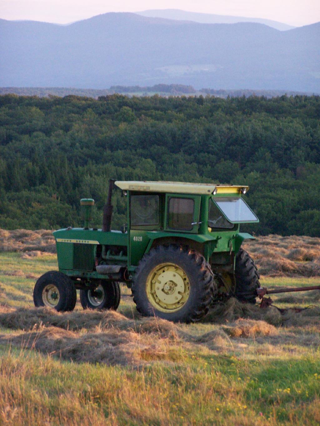
Farm Tractor

Section 4:
Protection of natural resources; development of agricultural lands

The policy of the state shall be to conserve and protect its natural resources and scenic beauty and encourage the development and improvement of its agricultural lands for the production of food and other agricultural products.

The legislature, in implementing this policy, shall include adequate provision for the abatement of air and water pollution and of excessive and unnecessary noise, the protection of agricultural lands, wetlands and shorelines, and the development and regulation of water resources.

The legislature shall further provide for the acquisition of lands and waters, including improvements thereon and any interest therein, outside the forest preserve counties, and the dedication of properties so acquired or now owned, which because of their natural beauty, wilderness character, or geological, ecological or historical significance, shall be preserved and administered for the use and enjoyment of the people.

Properties so dedicated shall constitute the state nature and historical preserve and they shall not be taken or otherwise disposed of except by law enacted by two successive regular sessions of the legislature.

Off Firetower

Section 5:
Violations of article; how restrained.

A violation of any of the provisions of this article may be restrained at the suit of the people or, with the consent of the supreme court in appellate division, on notice to the attorney-general at the suit of any citizen.

What is a Primitive Tent Site?

The Adirondack Park State Land Master Plan describes primative tent sites as follows:

25. Primitive Tent Site–a designated tent site of an undeveloped character providing space for not more than three tents, which may have an associated pit privy and fire ring, designed to accommodate a maximum of eight people on a temporary or transient basis, and located so as to accommodate the need for shelter in a manner least intrusive on the surrounding environment. (page)

The Adirondack State Land Master Plan uses the definition of a “primitive tent site” in a wilderness area to explain campsites in wild forest.

1. All structures and improvements permitted under the guidelines covering wilderness areas will be allowed in wild forest areas. […]

Here is the wilderness “primitive tent site” regulations per the APSLMP:

1. The structures and improvements listed below will be considered as conforming to wilderness standards and their maintenance,rehabilitation and construction permitted:

— primitive tent sites below 3,500feet in elevation that are out of sight andsound and generally one-quarter mile from any other primitive tent site or lean-to:

(i) where physical and biological conditions are favorable, individual unit management plans may permit th establishment, on a site-specific basis, of primitive tent sites between 3,500 and 4,000feet in elevation, and,

(ii) where severe terrain constraints prevent the attainment of the guideline for a separation distance of generally one-quarter mile between primitive tent sites, individual unit management plans may provide, on a site-specific basis, for lesser separation distances, provided such sites remain out of sight and sound from each other, be consistent with the carrying capacity of the affected area and are generally not less than500 feet from any other primitive tent site;

Also, in wild forest, so-called groups of primitive campsites are allowed:

Small groupings of primitive tent sites designed to accommodate a maximum of 20people per grouping under group camping conditions may be provided at carefully selected locations in wild forest areas, even though each individual site may be within sight or sound and less than approximately one-quarter mile from any other site within such grouping, subject to the following criteria:

— such groupings will only be established or maintained on a site specific basis in conformity with a duly adopted unit management plan for the wild forest area in question;

— such groupings will be widely dispersed (generally a mile apart) and located in a manner that will blend with the surrounding environment and have a minimum impact on the wild forestcharacter and natural resource quality of thearea;

— all new, reconstructed or relocated tent sites in such groupings will beset back a minimum of 100 feet from themean high water mark of lakes, ponds,rivers and major streams and will be located so as to be reasonably screened from the water body to avoid intruding on the natural character of the shoreline and the public enjoyment and use thereof.

Roadside Camping at Site 5

Despite threats from PROTECT! and Residents Committee to Protect the Adirondacks, the Adirondack State Land Master Plan has never been litigated in court, so there is no legal interpretations of the ASLMP outside what has been decided by the DEC and Adirondack Park Agency.

Many different wild forests have taken that definition to different meanings…

Camping at Campsite 57

Generally Open to All Campers…

At Ferris Lake Wild Forest, particularly on Piseco-Powley Road, it has been taken to mean roadside campsites, where vehicles can access, and people are free to bring in a pickup camper or recreational vehicle if they so choose. Indeed, the draft UMP and the Adirondack State Land Master Plan both mention roadside camping. The Ferris Lake UMP goes as far as to describe various sites, and how big of a vehicle can fit in individual campsites. The sites have fire rings and outhouses, which is consistent with that definition. A minority of sites also have picnic tables.

This is common in most wild forests with roadside campsites, including Black River Wild Forest (North Lake, Woodhull Lake), Debar Mountain (Mountain Pond, Jones Pond, etc.), Ferris Lake Wild Forest (Powley Road, G-Lake Road, Edick Road, Mountain Road, etc.), Moose River Plains, and Vanderwhacker Wild Forest (Moose Club Way, Northwoods Club Road, NY 28N, Cheney Pond, Blue Ridge Road), Wilcox Lake Wild Forest (NY 8, Pumpkin Hollow, Hope Falls, etc.).

Tent Site Use Only…

On the polar opposite would be Lake George Wild Forest, particularly along Darcy Clearing Road and Hogstown Road, where all of the campsites have been relocated and blocked off to prevent any vehicle use or non-tent use. The argument here is that primitive tent site must be taken literally in the dictionary sense, and that any use of vehicles, such as truck campers or recreational vehicles are inconsistent with the Adirondack Park State Land Master Plan.

Similar policies on restricting use of motor vehicles in roadside campsites exist in a minority of other wild forest campsites (like the lower portion of Harrietstown Road and Garnet Lake in Wilcox Lake Wild Forest), however the majority of forests allow some roadside campsites, with vehicle access.

Tent Camping at Foxx Lair

History Looms Large.

But let’s be honest, most wild forests allow unrestricted roadside campsites for a variety of vehicles, including pickup campers and recreational facilities. This has been going on for over 100 years, basically as long as their has been motor vehicles in the Adirondacks, and certainly as long as recreational vehicles and truck campers have existed. Most public lands, outside of NY State also do not have much in restrictions on roadside camping.

It’s tough to take away from people what they are already granted, and enjoy, especially if the rational is limited. People enjoy roadside camping in a variety of vehicles, and in many locations. For many people, they have been coming to the backcountry for decades, parking their truck or RV, and enjoying all of the solitude and pleasure that roadside camping.