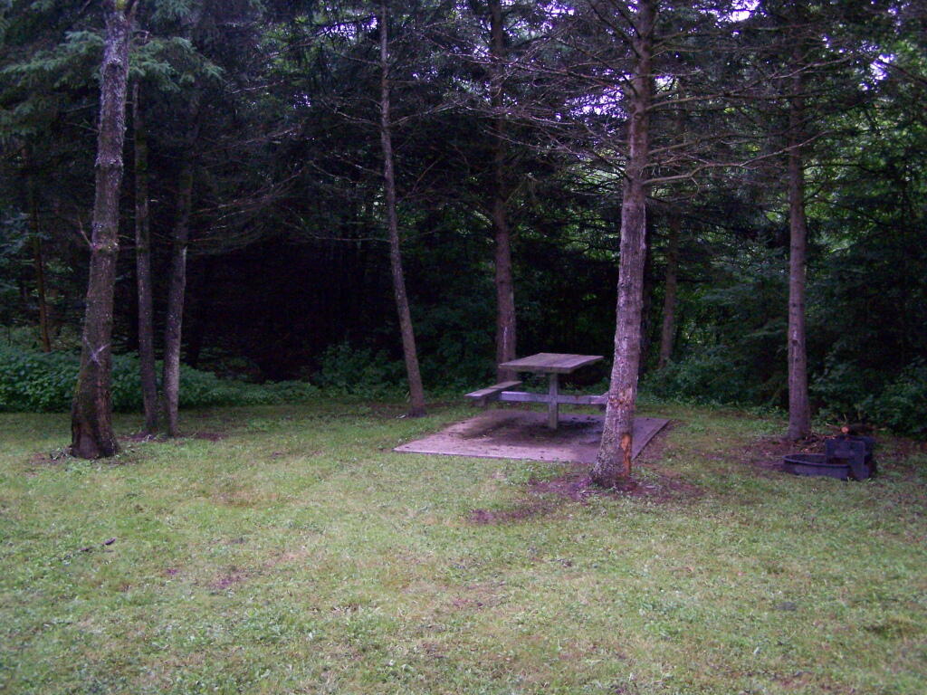
Campsite No 4
This is campsite No 4 at Mountain Pond. A nice campsite, big, roomy, and private, although the much smaller Campsites 5 is fairly close.
Taken on Saturday August 14, 2010 at Mountain Pond.
This is campsite No 4 at Mountain Pond. A nice campsite, big, roomy, and private, although the much smaller Campsites 5 is fairly close.
Taken on Saturday August 14, 2010 at Mountain Pond.
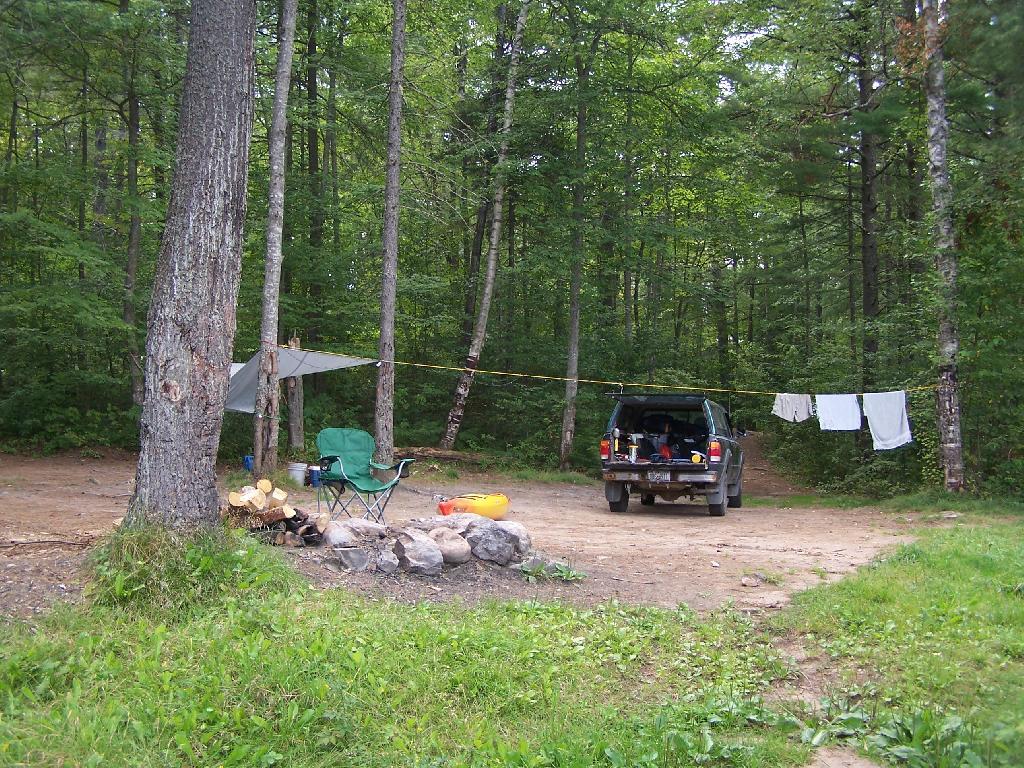
This campsite was surrounded by wildflowers and beauty.
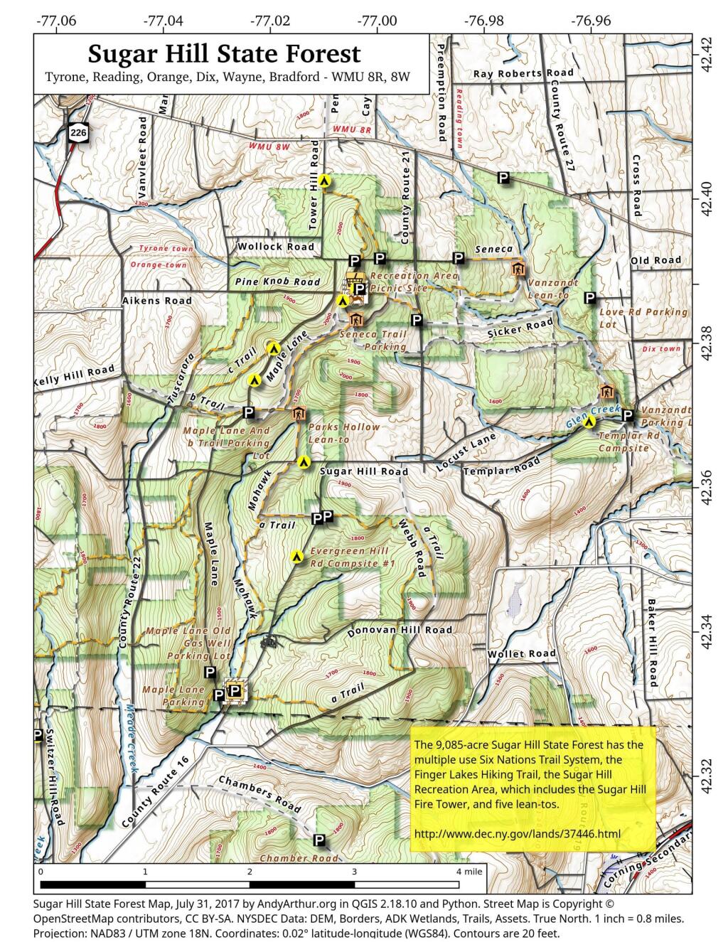
Taken on Wednesday July 22, 2020 at Spectulator.Explore this webpage for comprehensive maps and campsite listings within Sugar Hill State Forest, situated in the Finger Lakes region near Watkins Glen. Renowned for its equestrian trails and mountain biking possibilities, this forest also intersects with the Finger Lakes Trails.
Equipped with coordinates and interactive maps, this invaluable resource assists in pinpointing free camping sites within this area. Uncover more about the region to enhance your exploration, ensuring a memorable experience amid its natural beauty. From the allure of equestrian trails to the thrill of mountain biking routes and the Finger Lakes Trails, Sugar Hill State Forest offers a diverse range of outdoor activities for all to enjoy.
Free campsites are available for stays of up to 3 nights. Simply register on-site by signing the log book. For longer stays of 4 to 14 nights, contact the DEC Region 8 Bath Office during their operating hours (M-F, 8:30 AM – 4:30 PM) at (607) 622-8282 or region8@dec.ny.gov to request a free permit.
Here are the coordinates to the campsites.
| Name | Description | Notes | Latitude | Longitude |
| 1 Tower Area Campsite | #1 | 42.3868508079723 | -77.0033564547783 | |
| 2 Tower Area Campsite | #2 | 42.3866442287727 | -77.0033822152506 | |
| 3 Tower Area Campsite | #3 | 42.3864639920396 | -77.0033635495228 | |
| 4 Tower Area Campsite | #4 | 42.3862833428498 | -77.0033685808509 | |
| 6 Tower Area Campsite | #6 | 42.386387348997 | -77.0029946864047 | |
| 7 Tower Area Campsite | #7 | Water Spigot | 42.3862370801033 | -77.0029985287376 |
| 8 Tower Area Campsite | #8 | 42.3861734193137 | -77.003166784239 | |
| 9 Tower Area Campsite | #9 | 42.3865302803854 | -77.0027707543571 | |
| 10 Tower Area Campsite | #10 | 42.3861779212511 | -77.0028177471854 | |
| 11 Tower Area Campsite | #11 | 42.3864896808166 | -77.0025428626279 | |
| 12 Tower Area Campsite | #12 | 42.386122136377 | -77.0026163066674 | |
| 13 Tower Area Campsite | #13 | 42.3865438057378 | -77.0022831123144 | |
| 14 Tower Area Campsite | #14 | 42.386195258838 | -77.0023742768928 | |
| 15 Tower Area Campsite | #15 | 42.3860849947623 | -77.0021918714237 | |
| 16 Tower Area Campsite | #16 | 42.3860541128779 | -77.0019473250332 | |
| 17 Tower Area Campsite | #17 | 42.3860671182971 | -77.0017515936378 | |
| 18 Tower Area Campsite | #18 | Water Spigot | 42.386226464603 | -77.0016855292304 |
| 19 Tower Area Campsite | #19 | Water Spigot | 42.3865569715304 | -77.0017003446791 |
| 20 Tower Area Campsite | #20 | Water Spigot | 42.3866767087554 | -77.0017063052538 |
| 21 Tower Area Campsite | #21 | Water Spigot | 42.3869433342594 | -77.0017190894415 |
| 22 Tower Area Campsite | #22 | 42.3868316308635 | -77.0011615867452 | |
| 23 Tower Area Campsite | #23 | 42.3865865191587 | -77.001106379471 | |
| 24 Tower Area Campsite | #24 | 42.3863193084256 | -77.0012185947968 | |
| 25 Tower Area Campsite | #25 | 42.3861742601053 | -77.0012894260423 | |
| 26 Tower Area Campsite | #26 | 42.3860963967437 | -77.0015391367911 | |
| 27 Tower Hill Cmpsite | #27 | 42.3907655427657 | -76.9988721092714 | |
| 28 Tower Hill Rd Campsite | #28 | 42.3910797321534 | -76.9837920975243 | |
| 29 Cr 23 Campsite | #29 | 42.4023570878519 | -76.9758496629551 | |
| 30 Tower Hill Rd Campsite | #30 | 42.3902721886657 | -77.0028807356518 | |
| 31 Tower Hill Rd Campsite | #31 | 42.3904413584792 | -77.0036125118773 | |
| 32 Seneca North Campsite | #32 | 42.3847576397127 | -77.0052625526894 | |
| 33 Maple Lane Campsite | #33 | 42.3779066686613 | -77.0179033333715 | |
| 34 Maple Lane Campsite | #34 | 42.3734853366746 | -77.0214073314773 | |
| 35 Maple Lane Campsite | #35 | 42.3690875961503 | -77.0223501994882 | |
| 36 Sugar Hill Road Campsite | #36 | 42.3623013335723 | -77.0118293336207 | |
| 37 Spencer Pond Campsite | #37 | 42.4016911747852 | -77.0084235506782 | |
| 38 Evergreen Hill Road Campsite | #38 | 42.3547490565555 | -77.0073917279777 | |
| Cr 21 Campsite | 42.3843480264464 | -76.9922894964248 | ||
| Evergreen Hill Rd Campsite #1 | 42.3491716695934 | -77.0127316661659 | ||
| Lower Evergreen Camping | 42.3304466927625 | -77.0236097240433 | ||
| Randall Road Campsite | Log Landing | 42.3412383335045 | -77.0695449989935 | |
| Switzer Hill Road Campsite #2 | Log Landing | 42.3406636026594 | -77.0649210396798 | |
| Templar Rd Campsite | 42.3688377042101 | -76.9587191825894 |
Exploring the lesser-traveled back roads and backcountry of Schoharie County reveals a host of hidden camping gems, perfect for those seeking a tranquil woods experience. This guide assists in pinpointing these sites, most of which are accessible by vehicle, suitable for tents or smaller camper units. While some roads can be rugged and seasonally accessible, a pre-trip exploration is recommended to ensure a smooth and enjoyable extended stay amidst the natural surroundings.
|
Facility |
Name |
Asset |
Lat |
Lng |
Street |
City |
|
Burnt-Rossman Hills State Forest |
Betty Brook Campsite |
Roadside Campsite |
42.5282069949748 |
-74.5141411051093 |
267 Miller Rd |
Summit |
|
Burnt-Rossman Hills State Forest |
Cole Hollow Stream Campsite |
Tent Campsite |
42.5173809830791 |
-74.4783362503377 |
739 Cole Hollow Rd |
West Fulton |
|
Burnt-Rossman Hills State Forest |
Duck Pond Campsite |
Roadside Campsite |
42.5101650935711 |
-74.483569788123 |
116 Duck Pond Rd |
West Fulton |
|
Burnt-Rossman Hills State Forest |
Eminence Lean-To |
Lean-To |
42.5433037239374 |
-74.488594594497 |
1478 Burnt Hill Rd |
West Fulton |
|
Burnt-Rossman Hills State Forest |
Panther Creek Campsite |
Tent Campsite |
42.5707997358218 |
-74.5222079737636 |
822 Sawyer Hollow Rd |
Richmondville |
|
Burnt-Rossman Hills State Forest |
Westkill Camp Site |
Tent Campsite |
42.4891982222204 |
-74.5093675822639 |
1223 Westkill Rd |
Jefferson |
|
Clapper Hollow State Forest |
Clapper Hollow Lean-To |
Lean-To |
42.5282012275126 |
-74.6420043552481 |
460 Meade Rd |
Jefferson |
|
Dutch Settlement State Forest |
Lean-To |
Lean-To |
42.6294376035285 |
-74.2675434310789 |
334 Treadlemire Rd |
Berne |
|
Huntersfield State Forest |
Lean-To |
Lean-To |
42.3550413795618 |
-74.3460668476724 |
371 Huntersfield Rd |
Prattsville |
|
Keyserkill State Forest |
Keyserkill Campsite |
Tent Campsite |
42.4892248356724 |
-74.3594496582389 |
578 Keyserkill Rd |
Middleburgh |
|
Keyserkill State Forest |
Pond Campsite |
Tent Campsite |
42.5026457018464 |
-74.3614634029007 |
198 Coons Den Rd |
Middleburgh |
|
Lutheranville State Forest |
Sisson Rd Campsite |
Roadside Campsite |
42.6110826168082 |
-74.6399766310532 |
833 County Route 353 |
Middleburgh |
|
Mallet Pond State Forest |
Mallet Pond Campsite (Undesignated) |
Tent Campsite |
42.5878422010516 |
-74.5223274563456 |
634 Rossman Fly Rd |
Richmondville |
|
Mallet Pond State Forest |
Rossman Pond Campsite (Undesignated) |
Roadside Campsite |
42.5941596281094 |
-74.5290358970195 |
634 Rossman Fly Rd |
Richmondville |
|
Rensselaerville State Forest |
Campsite 2 |
Roadside Campsite |
42.4994499144647 |
-74.1948355550861 |
856 Cheese Hill Rd |
Preston Hollow |
|
Rensselaerville State Forest |
Campsite 4 |
Roadside Campsite |
42.501426797599 |
-74.2175233050623 |
833 County Route 353 |
Middleburgh |
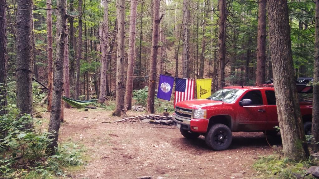
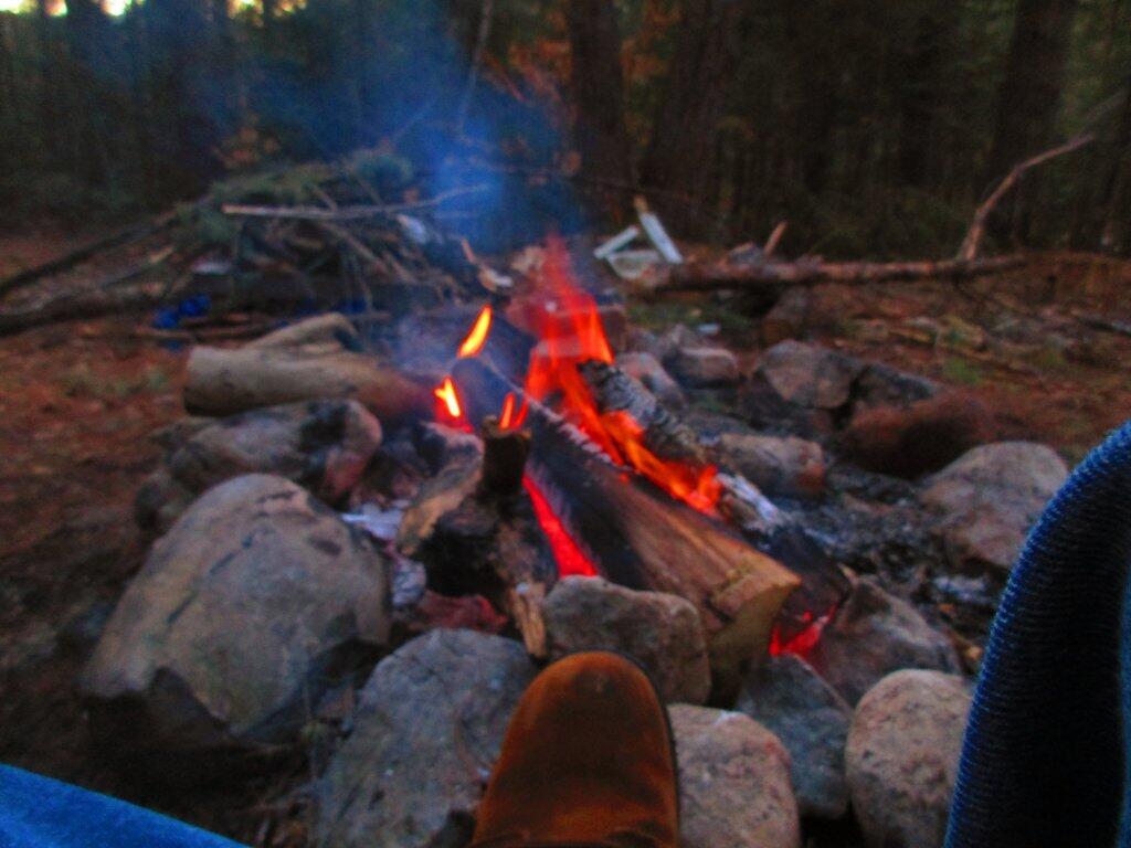
Despite there being a lot of people up along the East Branch this weekend, it was a cold weekend on both days. That said, it's not a bad place to social distance -- the nearest campsite was a mile away, and despite them shooting riflably most of the weekend -- I couldn't hear it from my campsite and I doubt they could have heard my shooting either.
Taken on Saturday April 18, 2020 at East Branch Sacandaga River.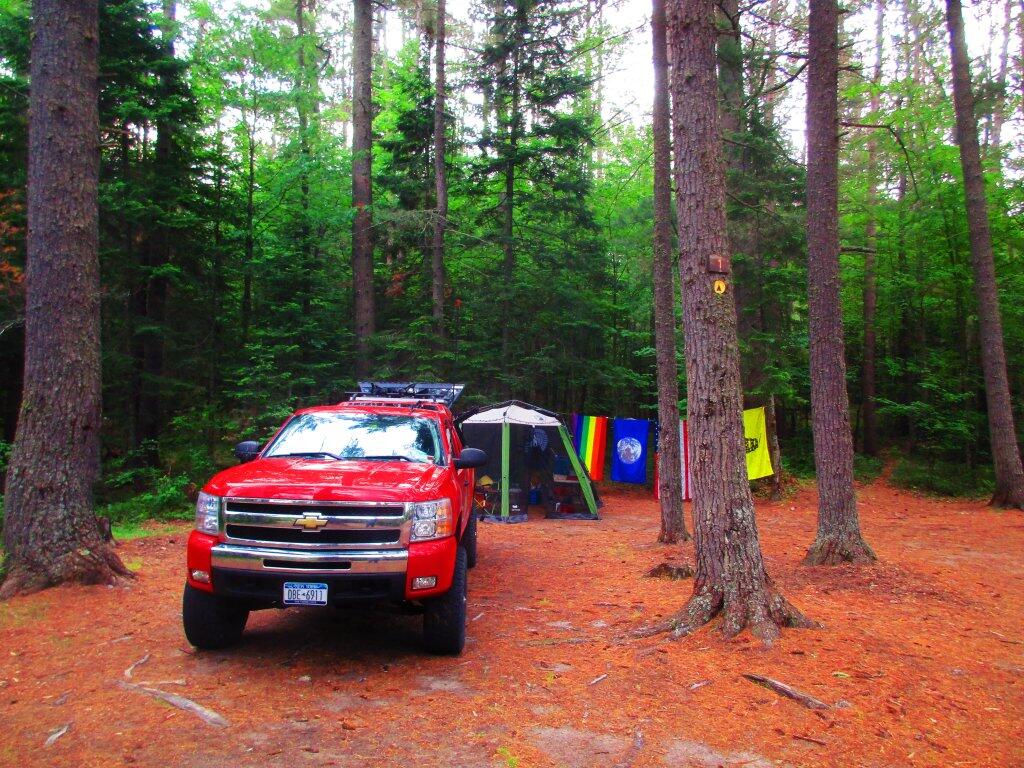
Campsite 1 isn't the greatest campsite ever -- it's kind of in the boat launch parking lot, but I made the best of it. Campsites 2 and 3 were already taken.
Taken on Saturday June 27, 2020 at Jones Pond.The following state forests in Chautauqua County have designated campsites …
| Campsite | State Forest | Latitude | Longitude |
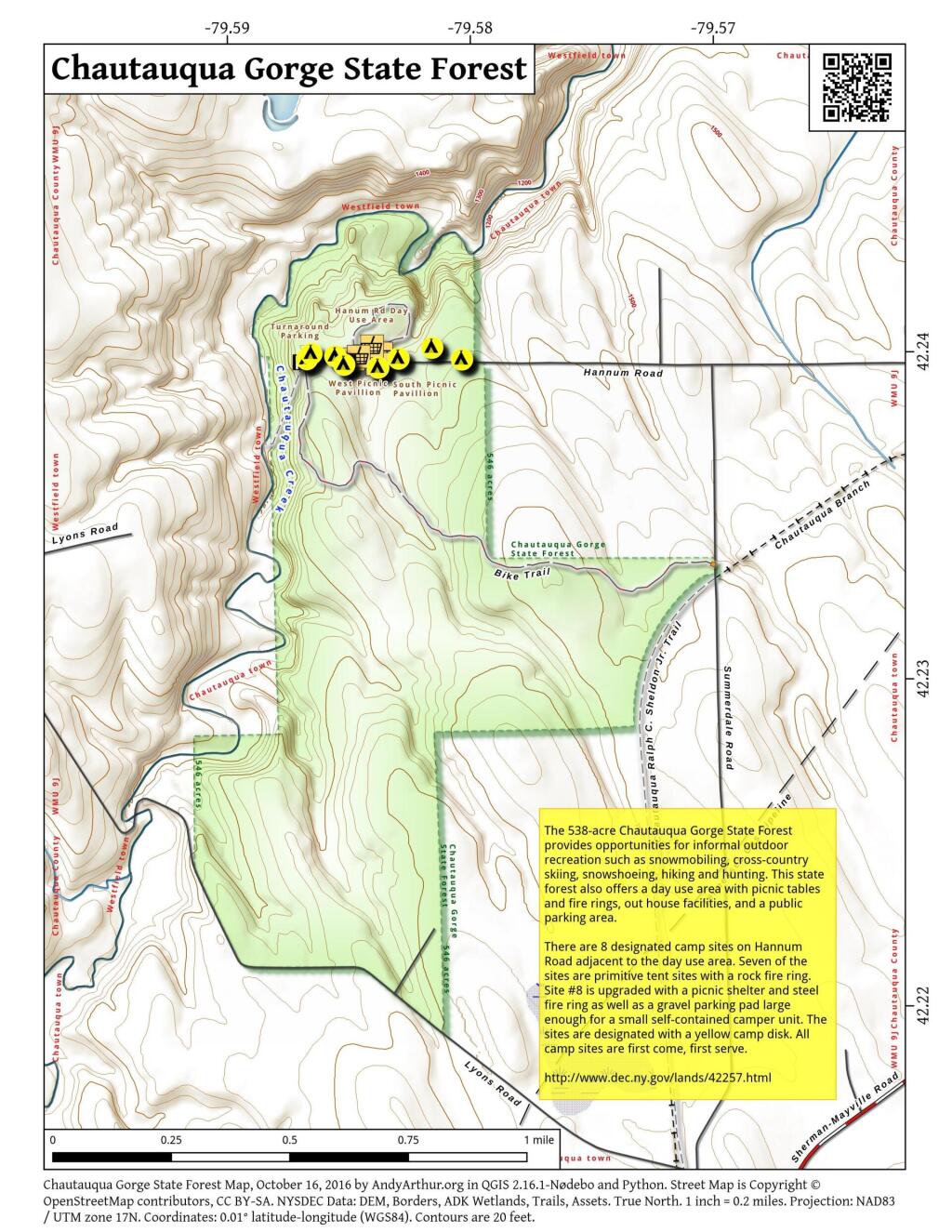
| Designated Camp Sites | Chautauqua Gorge State Forest | 42.24 | -79.586 |
| Designated Camp Sites | Chautauqua Gorge State Forest | 42.24 | -79.584 |
| Designated Camp Sites | Chautauqua Gorge State Forest | 42.24 | -79.586 |
| Designated Camp Sites | Chautauqua Gorge State Forest | 42.24 | -79.583 |
| Designated Camp Sites | Chautauqua Gorge State Forest | 42.24 | -79.581 |
| Designated Camp Sites | Chautauqua Gorge State Forest | 42.24 | -79.587 |
| Designated Camp Sites | Chautauqua Gorge State Forest | 42.24 | -79.582 |
| Designated Camp Sites | Chautauqua Gorge State Forest | 42.24 | -79.587 |
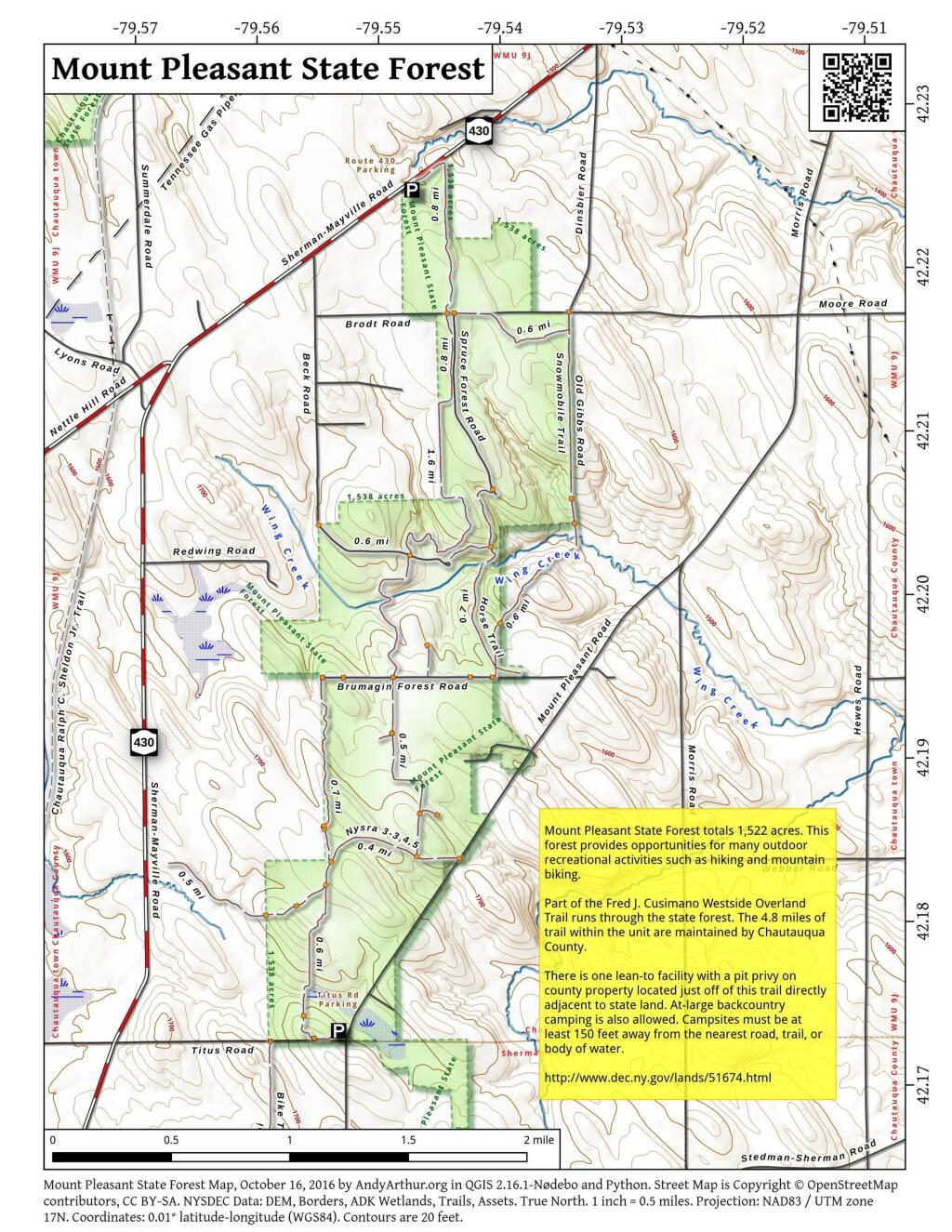
| Beck Forest Road | Mount Pleasant State Forest | 42.202 | -79.546 |
| Designated Camp Site | North Harmony State Forest | 42.087 | -79.529 |
| Designated Camp Site | North Harmony State Forest | 42.089 | -79.528 |
| Designated Camp Site | North Harmony State Forest | 42.089 | -79.53 |
| Designated Camp Site | North Harmony State Forest | 42.095 | -79.511 |
| Designated Camp Site | North Harmony State Forest | 42.089 | -79.529 |
| Designated Camp Site | North Harmony State Forest | 42.095 | -79.512 |
| Designated Camp Site | North Harmony State Forest | 42.098 | -79.507 |
| Designated Camp Site | North Harmony State Forest | 42.102 | -79.518 |
| Designated Camp Site | North Harmony State Forest | 42.088 | -79.529 |
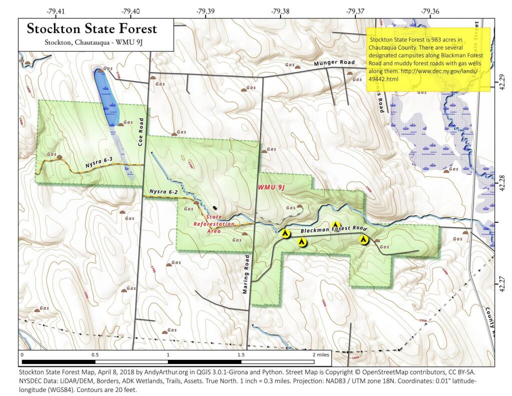
| Designated Camp Site | Stockton State Forest | 42.274 | -79.376 |
| Designated Camp Site | Stockton State Forest | 42.274 | -79.373 |
| Designated Camp Site | Stockton State Forest | 42.274 | -79.37 |