Search Results for: photo camp only at designated sites

I’m tuckered out 🛏

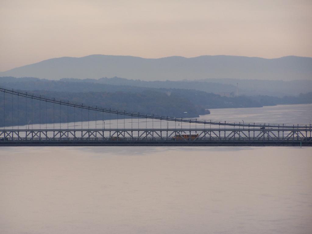
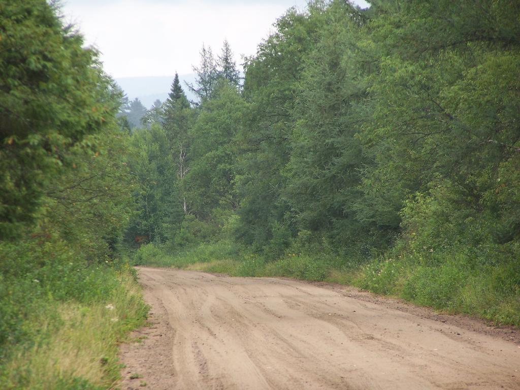
Good day but a busy one with all that driving down from County Bridge Campground in Blossburg Penna to Cumberland Maryland, riding bike for 23 miles of the Chesapeake and Ohio Trail along with part of the Great Allegheny Passage then finally heading down to Canaan Heights WV. What a day, and there was still some daylight to set up camp too though

Good evening from West Virginia! Mostly clear and 43 degrees in Canaan Heights, WV. 🌠 Breezy, ️16 mph breeze from the northwest 🌬 .

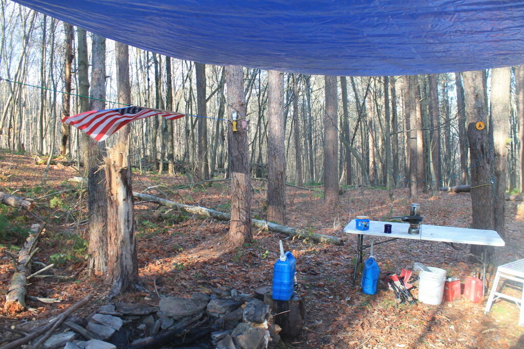
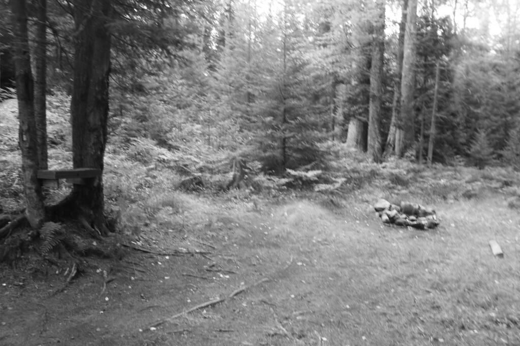
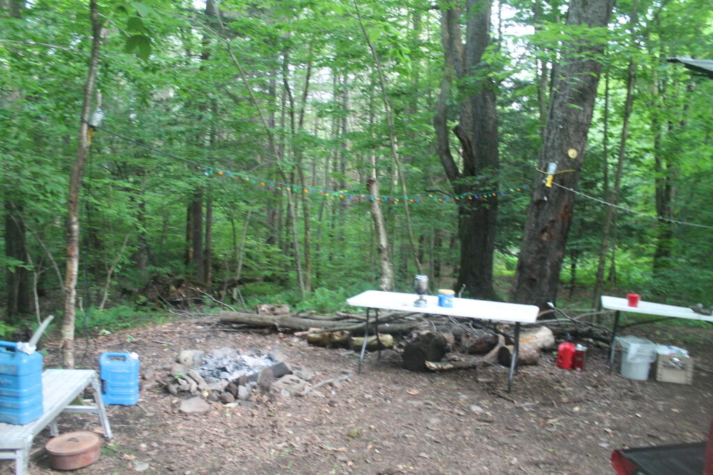
Got to camp around 6:30 pm in West Virginia, was a bit worried as the first few campsites I drove by where taken and I noticed a new sign on the way in that said camping at Designated Sites Only. ⛺ That said all of the old sites are still in service and have been improved a bit by the forest service and new sites added. It was a cold Sunday night, I had plenty of choices in the other eight or nine unoccupied sites. The nearest campsite to where I am id more than a third of a mile away.

Totally my fault, lol, 😂 I wanted to maximize my time riding bike 🚲 on the Chesapeake and Ohio Trail and the Great Allegheny Passage Trails before heading down to Keyser to get supplies and ultimately head to camp. Didn’t help though that Waze had the wrong address programmed into it for Tractor Supply. 🚜 I wanted to make sure I had a full propane tank for the next six nights as especially tonight I’m working the heater hard to stay warm – too late to find wood for camp, plus I’m dog 🐶 tired. Probably will retire to bed shortly in my truck though honestly I don’t want to sleep too soon as it’s going to be a long night and the sun rises late in West Virginia this time of year. 7:30 am tomorrow.

Tonight will be clear with a low of 27 degrees at 4 am. 🌉 Winds will die down as the night progreses. In 2022, we had partly cloudy skies in the evening, which became mostly clear by the early hours of the morning. It got down to 39 degrees. The record low of 20 occurred back in 1969.

Tonight will have a First Quarter 🌓 Moon with 61% illuminated. At 8 PM, the moon was in the south (181°) at an altitude of 25° from the horizon, some 226,951 miles away from where you are looking up from the earth. 🚀 At the state speed limit of 55 mph, you’ll make it there by April 11th. Buckle up for safety! 💺 The Hunter 🏹 Moon is on Saturday, October 28. The darkest hour is at 12:41 am, followed by dawn at 6:59 am, and sun starting to rise at 7:30 am in the east-southeast (104°) and last for 2 minutes and 59 seconds. Sunrise is one minute and 12 seconds later than yesterday. 🌄 The golden hour ends at 7:56 am with sun in the east-southeast (111°). Tonight will have 13 hours and 12 minutes of darkness, an increase of 2 minutes and 44 seconds over last night.

Tomorrow will be sunny ☀ with a high of 59 degrees at 3pm. Four degrees below normal, which is similar to a typical day around November 1st. Northwest wind 9 to 11 mph. A year ago, we had sunny skies in the morning with some clearing in the afternoon. The high last year was 63 degrees. The record high of 81 was set in 1947. 0.5 inches of snow fell back in 2002.❄

Looks like I picked an excellent week for vacation. ⛺ The director was jokingly giving me a hard time for once again canceling a vacation day and then taking another one off, but it was worth it looking at the forecast. I just kind of wished I had packed more then three or four t-shirts as they may be what I’m wearing with the warm weather. Almost bought a West Virginia t-shirt at Walmart earlier today.

It wasn’t perfect on Saturday though. Day one, the drive down to Pennsylvania was rainy the first part of the trip, ☔ maybe more misty and drizzle not difficult driving, lots of color along many parts of Interstate 88, Warren Anderson’s expressway. 🍂 Some places were past peak but others had excellent color.

Got Cider Doughnuts 🍩 🍏, apple cider and apples at Aunnoto’s in Oneonta. The doughnuts while not quite warm where still very fresh and exceptionally good, especially the first one I had fresh in the parking lot. Maybe it’s because I’m not used to all that sugar and fats in doughnuts but I felt like it had an out of this world taste. 😋 The cider was decent but more tart than I had imagined. Probably the breed of apples pressed. The apples I got where quite good I’ll be enjoying them throughout the trip.

Came much closer to runnung out of gas then I want to admit on the way down to o Binghamton ultimately getting gas in Harpursville. ⛽ Put in over 25 gallons of gas in a truck with a 26 gallons tank. 🤯 Hoping to get gas as close to the Pennsylvania to avoid higher prices with the high Pennsylvania gas tax but it turns out gas was more expensive in the Binghamton area then the Northern Tier of Pennsylvania. $4 a gallon gas, added $100 to the vacation bill. The good news is filling up there I avoided getting gas until I reach the Mason Dixon line, actually south of Cumberland for $3.35 a gallon. ☺ Vacation costs money 💵 and my vacation is quite frugal so I shouldn’t bitch about gas prices too much.

The County Bridge Campground is still only $10 a night through New Years Eve 💰💸 when the PA DNCR is doing away with self registration honor pay in favor of online reservations with the out of state fee, reservation fee and whatever the rustic campground fee works out to be. Not such a great deal then for one night but whatever it’s not like I stay there much. Still ten dollars a night is a steal these days with inflation, especially as that’s what it cost I believe back in 2010. Obviously subsidized by all those fracking leases, though the fracking money is drying up for the commonwealth now.

In four weeks on November 19 the sun will be setting in the west-southwest (244°) at 4:31 pm (Standard Time),🌄 which is one hour, 32 minutes and 59 seconds earlier then tonight. In 2022 on that day, we had mostly sunny and temperatures between 39 and 21 degrees. Typically, you have temperatures between 48 and 31 degrees. The record high of 71 degrees was set back in 1921.

Looking ahead, 7:15 AM Sunrise ⌛️ is in 7 weeks, Days are Getting Longer ☀️ is in 2 months and Christmas Eve 🎅 is in 9 weeks.

Mountains

The Catskill Wilderness Areas

Trees and Mountains

The text of today’s fodder is based on the Catskill Park State Lands Master Plan, as revised in 2008. Maps were rendered by myself, using Quantum GIS and DEC Lands and Forests data.

Big Indian Wilderness

(Formerly Big Indian – Beaverkill Range Wilderness Area)

This wilderness is located in the Towns of Hardenburgh, Denning and Shandaken in Ulster County. It lies generally west of Oliverea and the Frost Valley Road, south of Belleayre Ski Center, east of Seager and Hardenburgh and north of Willowemoc and Claryville. The area ranges in width from 1 to 5 miles, is about 19 miles long and contains approximately 33,500 acres of land. Elevations range from 1,500 feet in McKenley Hollow to 3,840 feet where the state boundary crosses Doubletop Mountain. The mountains in the northeastern portion of the area are quite rugged, while those to the south and west are more characteristic of high hills. Water from the area flows into three New York City water supply reservoirs and the Delaware River Basin. Nine mountains or ridges with elevations of over 3000 feet make up the area.

Peaks

Doubletop* 3,860′
Haynes 3,420′
Big Indian 3,700′
Spruce 3,380′
Fir 3,620′
Eagle 3,600′
Hemlock 3,240′
Balsam* 3,600′
Beaver Kill Range 3,377′

* Maximum elevations given are not necessarily located within the Wilderness Area.

The forest cover is predominantly hardwood mixtures in various associations. Spruce and fir, while present at some of the higher elevations, are less noticeable here than in other Catskill wilderness areas.

Interior facilities consisting of foot trails and lean-tos are generally considered adequate.

Area statistics:

Approximate Area 33,500 Acres
Roads (non conforming) 1.4 Miles
Foot Trails 29.4 Miles
Lean-tos 6
Designated Campsites 5
Parking Lots 5
Public Use (visitors/year) 4,500
Exterior Boundary Line 67 Miles
Minimum Elevation 1,500′
Maximum Elevation 3,840′

Non-conforming uses:

Motor vehicle use of Black Bear Road from the wilderness boundary to Fall Brook Lean-to.

A UMP for this area was completed in June of 1993.

Hunter – West Kill Wilderness

(Formerly West Kill – North Dome Wilderness, Ox Clove Wild Forest, and a portion of the former Hunter Mountain Wild Forest)

The unit generally lies within the following boundaries: New York State Route 42 on the west, the Shandakan Wild Forest and NYS Route 28 to the south, and NYS Route 214 on the east. The northern extent of the unit is County Route 6, and continues along a line 100′ parallel to, and south or east of, the edge of Spruceton trailhead parking area and the centerline of the Spruceton Truck Trail, to the junction of the Colonel’s Chair Trail. A corridor, 100 feet either side of the center line of the Spruceton Truck Trail, from the Colonel’s Chair Trail to the summit of Hunter Mountain, culminating in a circle 175′ in radius from the center of the chimney on the observer’s cabin shall be within the Rusk Mountain Wild Forest.

The unit contains approximately 27,000 acres of land, and inside it’s boundaries are found the named mountain peaks of Balsam, Sherrill, North Dome, West Kill, Sheridan, Hunter and Southwest Hunter. Hunter Mountain is the second highest peak in the Catskills at 4,040 feet, and portions of it’s summit, along with a fairly extensive area on the summits of West Kill, North Dome and Sherrill Mountains are within the Catskill High Peaks Bird Conservation Area, and are of special significance in that they provide habitat for high elevation spruce-fir inhabitants such as Bicknell’s Thrush and the Blackpoll Warbler, among others.

There are currently two lean-to’s on the unit, the Diamond Notch lean-to located just off the Diamond Notch Trail, and the Devil’s Acre Lean-to off of the Devil’s Path Trail. Waters from this unit drain into Schoharie and Esopus Creeks and then into the Schoharie and Ashokan Reservoirs, which are in the New York City water supply system.

Area statistics:

Approximate Area 27,000 Acres
Foot Trails 18 Miles
Lean-to’s 2
Parking Lots 5
Minimum Elevation 920′ Maximum Elevation 4,040′

Indian Head Wilderness

(Formerly Plateau Mountain – Indian Head Mountain Wilderness Area)

This wilderness is located in the Town of Hunter, Greene County and the Towns of Saugerties and Woodstock, Ulster County. It lies generally west of the east boundary of the Catskill Park, south of Platte Clove, east of Devil’s Tombstone Campground and north of Lake Hill and Shady. The area ranges from 1 ½ miles to 3 ½ miles in width, is eight miles long and contains approximately 16,800 acres.

Elevations range from 900 to 3840 feet and the four major mountains in the area are visible against the skyline from all directions. Echo Lake, the only natural lake in a Catskill wilderness, is located in the east-central portion of the area. Water from this eastern section flows into the Kingston and Saugerties water supply reservoirs, while drainage from the central and western section flows into two New York City water supply reservoirs. Six named mountain peaks over 3,000 feet in elevation dominate the area.

Peaks

Plateau 3,840′
Indian Head 3,573′
Sugarloaf 3,800′
Olderbark 3,440′
Twin 3,640′
Plattekill 3,100′

The forest cover varies from extensive oak stands on the eastern most slopes to mature spruce-fir on top of Plateau Mountain. An excellent mature stand of northern hardwood and hemlock occupies the slopes south of the Saw Kill.

Echo Lake, unique to the Catskill wilderness, is very popular for undeveloped camping. A small number of scattered primitive tent sites with fire rings have been established and public camping is limited to their capacities.

Public access is provided by several foot trails entering the area, including the old road from Meads to Overlook Mountain.

Area statistics:

Approximate Area 16,800 Acres
Roads 6.6 Miles
Foot Trails 24.1 Miles
Cross-country Ski Trails 5.6
Lean-tos 3
Designated Campsites 10
Parking Lots 1
Public Use (visitors/year) 8,000
Length of Boundary 33 Miles
Minimum Elevation 900′
Maximum Elevation 3,840′

A UMP for this area was completed in October of 1992.

Slide Mountain Wilderness

(Formerly Slide Mountain – Panther Mountain Wilderness Area)

This wilderness is located in the towns of Shandaken, Denning and Olive in Ulster County. It lies generally south of NYS Route 28, west of West Shokan, north of the Peekamoose Road (County Route 42) and east of the Frost Valley Road (County Route 47). It surrounds the Woodland Valley Campground and abuts the Sundown Wild Forest to its south. This area ranges from 1 to 10 miles in width, is about 13 miles long, and contains approximately 47,500 acres of land. The wilderness boundary is 118 miles long.

The terrain is rugged and steep with elevations ranging from 1,100 to 4,180 feet. All water draining from the area eventually reaches three New York City water supply reservoirs by way of the East and West Branches of the Neversink River, Rondout Creek and Esopus Creek. Twelve named mountain peaks with elevations over 3000 feet exist in the area. Of these, six may still be considered trail-less to the extent that they have no marked and maintained trails.

Peaks with Trails

Slide 4,180′
Peekamoose 3,843′
Cornell 3,860′
Wittenberg 3,780′
Table 3,847′
Panther 3,720′

Trail-less Peaks

Lone 3,721′
Rocky 3,508′
Friday 3,694′
Van Wyck 3,206′
Wildcat 3,340′
Balsam Cap 3,623′

The forest cover consists of nearly every possible mixture and association of hardwood and softwood trees native to the mountain region. While hardwoods predominate higher elevations are often covered with red spruce and balsam fir.

This area receives more public use than any other Catskill wilderness. Superb vistas are found on Slide, Wittenberg, Cornell, Giant Ledge and Panther Mountains. Access via foot trails is available from the north, south, east and west.

Area statistics:

Approximate Area 47,500 Acres
Foot Trails 35.3 Miles
Lean-tos 3
Parking Lots 10
Designated Campsites 29
Public Use (visitors/year) 23,000
Length of Boundary 118 Miles
Minimum Elevation 1,100′
Maximum Elevation 4,180′

A UMP for this area was completed in March of 1987 and revised in October of 1998.

Windham – Blackhead Range Wilderness

(Formerly Blackhead Range, and North Mountain Wild Forests, and portions of Windham High Peak, and Black Dome Valley Wild Forests)

The combination of these Wild Forest areas creates the Windham – Blackhead Range Wilderness Area, which lies within the Greene County towns of Cairo, Hunter, Jewett, Windham and Durham. The classification of these former Wild Forest areas was changed to Wilderness because their combined area comprises approximately 17,100 acres and contains rugged, high elevation land that clearly exhibits wilderness character. This newly classified area has seven named mountain peaks over 3,000 feet in elevation.

They are:

Peaks Black Dome 3,980′
Windham High Pk 3,520′
Blackhead 3,940′
Stoppel Point 3,420′
Thomas Cole 3,940′
Burnt Knob 3,180′
Acra Point 3,100′

The unit also contains six unnamed peaks over 3,000 feet, which range from 3,040 feet to 3,540 feet in elevation. Of the five highest peaks in the Catskills, three – Black Dome, Thomas Cole and Blackhead – are in this unit. This concentration of 13 peaks over 3,000 feet, within an area of approximately 28 square miles, with limited access, structures and improvements (30 miles of maintained foot trails and two lean-to’s) make the Windham – Blackhead Range Unit an area with excellent wilderness character.

A fairly extensive area of old growth forest can be found on this unit at the higher elevations, along the ridge stretching from an area west of Thomas Cole Mountain to Blackhead Mountain, and on Windham High Peak. The presence of this old growth forest, with its distinctive flora and fauna, add to the wilderness character of the unit. The unit also includes the headwaters of the Batavia Kill and, to the south over the Blackhead Range, the headwaters of the East Kill. Both of these rivers flow into Schoharie Creek, and are an integral part of the New York City Watershed system.

The western boundary of this unit shall be the east side of the Elm Ridge Trail, Black Dome Trail leaving it within the Elm Ridge Wild Forest, continuing north along the drainage to the Catskill Park boundary. The southern boundary of the unit shall be the Escarpment Trail approximately one half mile south of Stoppel Point to a point on the Escarpment Trail where it comes closest to the eastern Forest Preserve boundary. Both North Point and Stoppel Point will be within the Wilderness area. Lands to the south of the south edge of the Escarpment Trail in this area, will be in the Kaaterskill Wild Forest.

Because the Windham – Blackhead Range Wilderness surrounds the smaller Colgate Lake Wild Forest Unit, and because they are linked together by public use, the Unit Management Plans for the two units shall be contained in one document.

Area statistics:

Approximate Area 18,0000 Acres
Foot Trails 30 Miles
Lean-tos 2
Parking Lots 1
Minimum Elevation 980′
Maximum Elevation 3,980′

Site Map

🌲🌲 Our Public Lands 🌳🌲

Interactive maps with backcountry and roadside camping: New York, Pennsylvania, West Virginia & Vermont.
List of NYS DEC Lean-Tos with map coordinates. List of NYS DEC Firetowers with map coordinates and more information.
Google Spreadsheet with Roadside, Primitive and Pay Campsites

Explore the Finger Lakes Trail, Long Path, Northville-Placid Trail and Long Trail/Appalachian in Vermont.
Catskill Park Mountain Peaks, Hudson Valley & Long Island Peaks, Peaks Over 3000 ft Elevation, Highest Peaks in Adirondacks, Interactive Map of All Named Summits in NYS, Blaze Colors in Catskill Park, Trailhead Parking Coordinates and Addresses in the Catskills.

Browse USGS Topo Quads as PDF 🆕 by State Lands or County. You can Bulk Download New & Old USGS Topograpic Maps.

Links to various NY State Land Websites 🆕. Get latest GIS Data from state Web Services.

⛺🌲 Camp 🌲🏕

Moose River PlainsCampsite Listing, Maps and photos of state’s largest free camping area.
Piseco-Powley RoadCampsite Listing, Maps and photos of 15 mile dirt road with camping.
Catskill Park Primitive CampsitesAn overview of free camping locations in Catskill Park.
Burnt-Rossman Forest, Cattaraugus County, East Branch Sacandaga River, Finger Lakes National Forest, Madison County, Pennsylvania, Vermont and West Virigina.

Campsite Coordinates for Bog River Flow / Lows Lake, Hudson River SMA (Buttermilk Falls), Lake Lila, Oswegathie River, Nine-Corner Lake, Pharaoh Lake Wilderness, Saranac River Campsites, Stillwater Lake, Schoharie County, and Sugar Hill State Forest.

Overview of Camping Areas in the Catskills, Green Mountains, Southern Adirondacks, Central Adirondacks, Northern Adirondacks, Allegheny National Forest and Penna. DCNR Motorized Campsites and the Monongahela National Forest West Virginia.

Free Campsite Overview Maps: Adirondack – North Country, Catskills, Central NY, Finger Lakes, Western NY. Interactive Map.

Places I camped in 2023, 2022, 2021 and 2020.

🏞 🛹 Bicycle Trails and “Blackie” My Mountain Bike 🚲 🚶

Finally bought a mountain bike, after chewing over a mountain vs commuter bike. Really enjoying riding my bike to work and when it rains there is always a bike rack to safely take it back home. One way to get to adventures at Thacher Park is the Nature Bus.

Empire Trail – KMZ and Interactive Map. Parking along it.

More Trailways with KMZ files including the Albany County Rail Trail, Black Diamond Trail, Catharine Valley Trail, Catskill Scenic Trail, Fonda, Johnstown & Gloversville Rail Trail, Genesee Valley Trail, Link Trail.

🦌🌲 Hunt 🦃🐿

Wildlife Management Units (Deer)KMZ Map shows the WMU boundaries.

Summer 2019 Aerial Photographs of WMUs

KMZ Maps of Deer Harvest Density by Town: 2019, 2018, 2017, 2016. By WMU 2017, 2016, 2015.

KMZ Maps of Buck Harvest Density by Town: 2019, 2018, 2017, 2016. By WMU 2017, 2016

2016 -2019 Deer and Buck Harvest by TownKMZ Spreadsheet with FIPS codes for making your own calculations.

🎣🐡 Fish 🐟🐠

Parking and Access to Trout StreamsAn interactive, downloadable KMZ Map.
Lakes with DEC Contour MapsA KMZ Map links to Contour Maps for Fishing.

🌨🏔 Sled & Wheel 🚙❄

State Truck Trails Over A Half MileDirt roads to explore in the backcountry.
NYS Statewide Snowmobile Trail SystemState trails on public and private lands.

📉📊 Learn 💵📈

Interactive Maps of NY CensusExplore and download KML files.
Charts and Interactive DiagramsFrom population to pollution control.
Andy Arthur GitHubGit my R and Python scripts used to make maps and diagrams.
Use ArcPullR to Get Geospatial DataSuper easy way to connect to get GIS data in R from government servers.
GDAL Opens E00 FilesMost open source programs nowadays can open common geospatial formats.
NY Building FootprintsWhere to find on the internet for making maps.
WMS and ArcMap ServicesDownloadable CSV file listing services used on the blog.
2022 US Census Population EstimatesRed states, south continue to gain population.
2020 Cartogram of State Population

💳 🏛 Property Taxes 🏠💸

Properties in Albany Pine Bush Study Area, Excel Files: Various Tax Rolls, Find coordinates and political districts, Look Up State Tax Records and a Script for Processing RPTL 1520 PDFs. Match NY SWIS Codes to FIPS Codes and GEOID

🚗🚗 Big Red 🚗🚗

Big RedPhotos and Videos of my lifted truck with its camper shell. Big Red’s Dual Battery Setup for Camp Power, Video Tour and Diagram. Big Red is getting old. What is next? I’ve thought about going carless for a while to save money and reduce pollution. Or maybe going bigger? Or smaller? Five dollar gas sucks.

🔥🌲 Off-Grid Living 🏠🤠

I am seriously thinking about building an off-grid house. I have a first draft. I need to learn CAD! I have a road map towards buying land and building. I concede might have to live with long commute and give up traveling and camping. I need to be strong.

Why off grid? Well, I’m not into contemporary society. I want to own land, but not be called a landowner, and a cabin, not hooked to electrical grid, farm, raise pigs for food and burn my own trash. I’m saving for a better tomorrow, hoping to make the leap to another freer state. Having acreage is important. Cornfields aren’t bad neighbors. Maybe though my vision has grown smaller and more local. More on off-grid living.

I am 16 years into my career and have made some significant progress in my life. I love my job. But I do wonder on all the things I’m missing out but saving sure makes me high. Maybe it will be different when I own my own land — the end of goal of all this saving.

2020 into 2021 during the pandemic was a year of remote work. It was a struggle not having internet at home, worked a lot out of my truck. But I worked remotely from Horseshoe Lake which was super cool.

Generally I like the idea of owning land in a red state, particularly Idaho, Iowa, Pennsylvania, West Virginia, Wisconsin — and Midwest more generally. But I may settle for New York – it’s all about the f-ing money!

💻👨‍💻 Open Source 🗺️📍

I use open source software and public sources of data for the blog. Quantum GIS (QGIS), GDAL/ogr2ogr, PyQGIS, GeoPANDAS, R Studio and Leaflet for map making, Arduino and ESP32 microprocessors, Ubuntu Linux and XFCE Window Manager. I’ve recently gotten interested in machine learning.

I avoid using commercial software like Microsoft Windows and do not have home internet or television. If you don’t use commercial software and use your brain, fears of computer viruses are overblown. I deleted most of my social media accounts.

Creating Digital Surface Models using LiDAR Point Clouds.

📊🗺 R Statistical Programming 📜👨‍🏫

The R programming language and RStudio are powerful tools for statistical analysis, making maps and charts. Many of the blog posts and analysis I do are in R, ggplot not only makes great charts but also maps using tidycensus. Generally, R is better then Python for geospatial work.

Use IDW Interpolation to fill in missing Census data, Zonal Histograms for land cover, load WMS Aerial Photography in R, find mountain peaks, save Census shapefiles using tigris quickly, pull NY Election Night Results using Selenium. Fast reverse Geocoding in PostGIS. Working with PDFs in R. Fix a common error starting rselenium/wdman. Make data-filled calendars. R is wonderful and weird, learn it!

🐼🔢 Python and Pandas 💻🐍

Querying state property database, political enrollments, PL 94-171 Census files, calculating population statistics, what address is a district in, converting old districts to new districts, Shapefiles missing Projection information in QGIS.

Learn to code for free modern HTML, Javascript, Python and SQL at freeCodeCamp and web development at the Odin Project.

🐴 🐘 Politics 🦁 🐍

Crunched Election Results with Turnout for Albany County: November 2023, 2022, 2021, 2020, 2019 and Primaries June 2019, Pres/June 2020, June 2021, June 2022, Aug 2022, June 2023.

Albany County Races converted to the new 2023 EDs using Super EDs and Code: 2022, 2021, 2020, 2019 and Primaries June 2019, Pres/June 2020, June 2021, June 2022, Aug 2022.

Above Election Results as zipped Excel files.

Albany County Legislature Districts 2024 Maps

Maps Comparing 2017 and 2023 Albany County Election Districts and a Crosswalk Table Showing the Proposition of Voting Age Population in New and Old EDs

Maps of 2022 NYC Assembly Races, NYS Assembly Races, NY Senate Races, Governor’s Race in Erie County and Statewide. Partisan shift in governor race between 2010 and 2018.

A comparison of Democratic Performance 2022 Assembly Districts to those proposed in 2023 by the IRC. Here is latest 4/20/23 IRC Maps, showing ADP and how they change from existing Assembly districts. Most towns upstate, outside of cities, are quite red. Using LATFOR data with R to calculate Average Democratic Performance.

You can scrape employee salary data from SeeThroughNY using R. Other useful investigative resources.

I often think politics is for losers. I’m into the politics of statistical analysis and reading history books.

I believe strongly in the first amendment, second amendment, oppose gun restrictions and I support de-funding the police in favor of lower-cost technology and civilian employees. Maybe use red flag laws for voting to stop dangerous voters? And the media should stop promoting mass-shootings, even if it’s super profitable for all involved. They should tax the media when it promotes violence. I think some people are much too paranoid in politics. How elections are rigged under law to benefit incumbents. But vote, it’s the best option and inexpensive.

Yeah for the third parties! I voted for Larry Sharpe for Governor and Jo Jergenson for President but my views are complicated and often vote for Democrats, after voting Jill Stein Green Party in 2016.

Generally, I think Biden has been a good change over DJT and glad the Trump era is over and are glad prosecutors and grand jurors are holding him responsible by indicting him for many serious felonies. I don’t think Trump can win in 2024, as nothing has changed politically from 2020.

I think rural people should be left alone and not worship government workers or have parades for them. I am no fan of Donald Trump, his speeches are bad, I don’t like Trump’s embrace of radical environmentalists, but do admire the homemade roadside monuments to DJT.

I don’t toke. But whatever. There are too many transit authorities.

🌲🌳The Earth 🌎 🐸

Why I oppose wilderness areas and parks. It’s trendy to be green these days, but is eco-marketing good for the planet? I visited the Mount Storm Coal Plant and Corridor H.

I worry about a lot about overly-aggressive Climate Change Action, and Undermining Environment Laws for Climate Action. I think we should all admit we are Addicted to Fossil Fuels. These days, urban recycling has become a joke, when it’s still an option at all. It’s better to just buy less shit and avoid the alure of Costcos. I really don’t like how aging radicals have become industrial solar salespeople.

Big bucks are coming to state-designated disadvantaged communities under the CLCP. Which counties and political districts are in line for the the most pork? Interactive map.

I’m a big of farmers who are essentially Living Off the Earth and think Rednecks are Noble Savages. Dairy Farming are key to our rural landscape. I’d trust a farmer or a hunter in a pile of guts he’s butchered over any ivory-tower scientist.

🌎🔆 Industrial Solar 🌞 🏭

Hundreds of multi-acre industrial solar farms are being built in our state. How bad is solar for the environment? We should ask tough questions. Interactive of recently built solar farms, proposed facilities. List of proposed industrial solar facilities. See how the Greenville Solar Farm changed the landscape.

💳 💸Saving Money 💰 💷

I am not a fan of ESG Investing as it’s not well diversified. I prefer index-funds and other tax-advantaged ways of saving. Why I am concerned about saving enough for retirement, even though I’m in my late 30s. We as a nation should save more, consume less. I like the idea of carbon tax to replace capital gains taxes to discourage consumption.

🥦 🍎Mission Fifty & Being Healthier 🏠🧠

I am now officially in my 40s! I am building to a better life in my 50s, which means getting up early, walking a lot, saying no to cake and yes to more fruit. In many ways, the forties are an awesome time to be alive.

And eating healthy for less without losing sleep over arsenic. And I don’t think we should subsidize unhealthy habits. How I got started in eating healther. Meals are too focused on meat and carbs due to how we describe them, maybe I eat too many bananas in the office, what to eat while camping, worry more about salt then GMOs, eat more beans. Do spend extra for farmers market peaches, especially doughnut peaches and plums. Consider ethnic supermarkets. Thinking about how to make a healthier macaroni and cheese, spinach-mackeral-pasta salad, quick-cook biscuits and whole-wheat bread. That said, too many recipes are junk food crap. Okay in moderation is not okay. The fact that I’m thinner is not a sign I’m dying.

A few years back I decided to explore my mental illness with therapy, thinking about why I have so much anxiety and how many of my values are rational or just thinking too much rednecks’ burn barrels and how much of a throwaway society we live in. Do I want to change?

I’ve learned to care less about the world, and focus more on myself. Maybe I am happier as I am now, saving and investing a lot towards owning my own land, where I don’t have to deal with all the bullshit of modern life.

Mission Fifty: Getting to the point where I own my own land. 🚜
Healthy Eating 🍎 / Growing My Wealth 💰
Healthy Thoughts 💭 / Enjoying Life 😃

Questions, comments? Feel free to email me at andy@andyarthur.org.

You do your thing, I’ll do mine.

I use GNU open source software.
Plus I like buck goats,
because they’re real macho men
spraying their beards with goat urine.

Finally things have greened up and nights are long. Now if only the rain would stop.” – Andy Arthur

Return to the Top

Laugh a bit and learn how your data is used on this blog: Privacy Policy

This blog is © Copyright 1997-2023 Andy Arthur.org, please share using the Creative Commons Attribution 3.0 License.

Categories:

Weekend at Bear Springs Mountain, Delaware Wild Forest, Warren Highlands

Based on the forecast for the long weekend, I decided to head down to the Western Catskills rather then Moose River Plains. It certainly was a bit sunnier, drier, and less snowy then it looks like they got up at Moose Plains. I simply did not another Memorial Day Weekend at Moose Plains, sitting in rain and snow showers.

I ended up heading down to the Western Catskills. Didn’t leave home until after 10 AM, because I was putzing around. So be it. I also had to stop at Walmart to buy another blaze orange hat, for hiking, because I lost mine. I knew it would be hunting season down there, and figured better safe then sorry. The previous night, they didn’t have one at Glenmont Walmart, so had to visit the Decided to head out the Warren Anderson Expressway (I-88) down to NY 10, and take that all the way south to Walton.

Fire Tower

Driving down NY 10, as soon as I reached Summit, you could see a dusting of snow on the summits around. Stopped in Stamford, drove up to Mount Utsaythana. There was a dusting of snow there too, in parts it looked like a winter wonderland. Then it was down to Walton, following NY 10 and the East Branch of Delaware River. Drove through Delhi, a small rural college town. I had been through Delhi years ago, meandering around Stamford, but not in years. Then I went down to Walton, climbed an enormous hill in the truck, and was at the Bear Spring Mountain Wildlife Management Area (aka Public Hunting Grounds).

At Bear Spring Mountain WMA there is a state DEC campground known as Bear Spring Mountain Campground. It consists of two parts, a fully developed campground with hot showers that is open during the summer months near Launt Pond, and the Spring Brook area with stud pends and a pit privy, similar to Charles Baker State Forest. Both areas are a $18 a night in summer, but from October to the end of hunting season, the lower area is free, but the water is shut-off down there. The designated campsites there are crunched together, and there is no privacy, so I can’t imagine it’s much fun camping there, especially with the smell of horses on a hot summer’s afternoon.

By the time I got down there, it was fairly early, so decided to explore a bit. Drove up to Corbett, explored the Corbett Suspension Bridge, and an old chimney from the “acid factory”, which made an acid from tree bark for smokelesss gunpowder. Decided to head back and explore Bear Spring Mountain WMA a bit more, and drove up West Trout Brook Road, past several hunters. There are some limited views from end of East Trout Brook Road, namely at the summit Bear Spring Mountain. There are better views from NY 206, climbing up from Walton, but with few view points. Also explored Beers Brook Road, which had some limited but nice views into the valley below, and Russ Gray Pond.

Bridge Tower

Bear Spring WMA, being a federally-funded public hunting grounds, does not allow camping. The only camping there is those tiny, smashed together developed campgrounds known as the Bear Spring State Campground, operated by the DEC. I decided it was getting late, and I would camp there tonight, especially because it looked like one of campers had packed up, and the only other person around, was a female bow hunter, on far end of the campground. I wasn’t thrilled, as it meant I would have to keep the music down, but at least the campground was deep in the valley, protected from the wind.

It wasn’t a bad night though. The pit privies were kind of gross, but probably not worst then most of the outhouses in the woods. There was surprisingly a lot of wood in woods near the campground. The truck worked well with keeping the lights on, since switching the truck’s radio back to the starting battery and evenly discharging both batteries. The radio shuts off automatically when the starting battery is starting to get a bit low, and Big Red’s DIC says “Battery Low: Start Engine Low”. Previously, with the starting battery at full charge, hooked up to the discharged auxiliary battery, the alternator wouldn’t kick up to full charge, so the auxiliary battery would fail to get fully charged. Now, with the starting battery slightly discharged – but with enough charge to crank the engine, things kept working well all night long. There was a little bit of sleet in the evening, but nothing major.

Russ Grey Pond

The next morning, I got a slow start. It was drizzling, and I kind of slept in. I didn’t have a tarp set up, which didn’t help. I probably didn’t break camp until 10:30 AM..I was thinking of hiking the NYC DEP trail that overlooks the Pepacton Reservoir, but I ended up turning off onto Holiday Brook Road, and deciding to check out Huggins Lake. Hugging Lake was a nice hike back, following an old woods road back there. There is a campsite down by the lake. Apparently on the ridge above Huggins Lake, there is an old growth forest, but I never got back there.

Then it was off to Mary Smith Road. On Campground Road, one of the cut-over roads, I got to a cover bridge, which had a clearance of 6’6”, which is about an inch too low for my pickup truck with the cap and racks on. So I had to turn around, and back track for about 5 miles. That sucked. Stopped and grabed a few pictures. When I got on Mary Smith Road, and back in forest preserve, I was pleasantly surprised to find three roadside campsites on it. I ended up camping at the most used of the sites – as witnessed by vegetation – along the Finger Lakes Trail/Mary Smith Trail/Middle Mountain Trail. It was a pretty nice roadside campsite.

About as soon as I scoped out the campsite, I realized it would be a pretty night up there. Despite the mountains on both sides, the north wind was whipping along the col. But I liked the campsite, and there was plenty of trees to hang a tarp up. I starting setting up camp at 2:30 PM – which was kind of early – but I figured it was too late to hike Mary Smith Hill (which wasn’t true), but it did start to rain/sleet a bit. Got the tarp up, then the lights strung up and flag up. A heavy sleet squall pounded the col, for a while bad enough I hid out in the cab of the truck. Then I went out, built a fire, and spent sometime listening to a podcast and reading a book about the 1964 World Fair in New York.

The new 60-watt equivalent LED bulb I bought worked real well in the cold, which got down below freezing that night.. But with the bulb focused on the book, it was easy reading and plenty bright. In the cold, the 60-watt equivalent LED bulb was actually brighter then the 100-watt florescent bulb I had at camp, even after fully warming up, because the cold wind made it impossible for the florescent tube to get warm enough to fully atomize the mercury in the fixture.

At times the wind picked up, and it was pretty darn cold, to say the least. I end up putting the fire out cold before bed, to reduce the risk of the fire spreading, and because the tarp partially covered the fire pit, I was afraid it could fall into the fire, and possibly set the truck on fire or cause dripping plastic to fall on it. The fire was out cold, and I went to bed around 10:30 PM. No nightmares.

Mary Smith Hill Roadside Campsite 1

After bedding down, the wind started to whip around. It literally was howling, and the tarp was snapping up and down, making quite a bit of noise. Morning came, and it was beautiful blue skies, but very cold. That was when I first saw car actually pass by on Mary Smith Hill Road – despite being a through-road, and not a super remote road at that. Had another slow breakfast, and built a small fire to burn up some camp garbage. Usually I don’t start fires in the morning, but I was chilly, and knowing that it may be a while until I got out camping again, I wanted to have a fire.

Once I finally got going, I hiked up Mary Smith Hill to the overlook. It really was a lot less further then I expected, and ha+d some interesting views to the north. Nothing totally breathtaking, but still an interesting short hike of maybe 20 minutes each way. Then I drove over to Russell Brook Falls, making a wrong turn and ending up going through Livingston Manor and the world famous fly fishing town, Roscoe. My impression of Roscoe, was it was a very a long and pokey 30 MPH zone, but with more stores then one would expect in such a rural, small town. I probably should have stopped, but I was burning daylight.

Finally made it to Morton Hill Road, and passed a Game Warden in a unmarked green suburbanite-style Jeep. The only reason I know that, was I saw him outside of the car talking to somebody in full uniform. Morton Hill Road climbs a lot from Roscoe out to where it hits Russell Brook Road. There are three campsites along Russell Brook Road, although in all of them there is a boulder barrier between the campsite and fire pit. One might still be able to use them for a pickup with a camper on them, I guess.

Russell Brook Falls 2

I hiked back to Russell Brook Falls – a beautiful but relatively unknown set of falls – at least to non-regulars to that part of state. They are less then quarter mile from the Russell Brook Falls parking area. I stopped and grabbed some pictures. Then, it’s easy hike back to back to Trout Pond, following a gated road 9/10th of a mile from the parking area. There is a slight incline on the road, but nothing to make one break a sweat, even a fat out of shape dude like me, who spends too much time sipping cold buds in the woods. The road is a designated route for people with disabilities – somebody very strong with a wheel chair could theoretically get back there, or maybe with a CP-4 disabled with an ATV permit.

Back at Trout Pond, there is a campsite on the easterly end, and the gated road continues to the west end of lake. On the west end of the lake, there are two other campsites, spaced a ¼ mile apart, along with two lean-tos. All are designed for those with disabilities. There is also a trout spawning shelter on one of the creeks leading into lake. One of the lean-tos was well equipped – somebody left behind some nice pots and pans, all cleaned up, and a selection of perfectly good adult beverages and soda along the back wall of the lean-to. Talk about paying it forward to the next person who will use that lean-to – most certainly a hunter this time of year.

It’s small game hunting season, heard several small game bullets ring out, while hiking back there. No hunters nearby, as far as I could see, but I did wear plenty of blaze orange. I am sure next week, there will be a lot more hunters back there. Wish them luck. Hiked back to my truck and explored Campbell Mountain Road and Campbell Brook Road, looking for additional roadside campsites, preferably the kind you can back a pickup all the way back to. No such luck. Oh, well.

Trout Pond

Then I drove down NY 30, through the hamlet of Harvard, then East Branch. Took Old Route 17 to Hancock, then poked around the Poconos and the Warren Highlands in Pennsyltucky, before eventually ending up in Susquehanna and Great Bend. The area around Hancock is very mountainous and beautiful. The Warren Highlands were rough, mostly hunting and rural landscape country, with a relatively small amount of farming going on. Lots of open burning going on too – I love Pennsylvania..

I love that wild country, and everything Pennsylvania. Fueled up, picked up certain Pennsylvania products not legal in New York and/or cheaper then New York, then hopped on I-88/Warren Anderson Expressway, and made a bee-line back to Delmar, stopping only momentarily at the rest stop on I-88. That place was creepy as all hell after dark, and not well lit either. I seriously thought of just taking a piss in some farm

I made it back to Delmar around 7 PM. It was a good adventure. Burned through more gasoline, then I had planned, although on the trip back along I-88, I average 19.9 mpg in my Big Red Silverado pickup, so not complaining.

A long-weekend trip in early November to explore the the Western Catskills.

Abandoning Existing Roads in Essex Chain Tract Makes No Sense

There are some wilderness advocates in our state that are calling for abandoning of existing roads in the Essex Chain tract to create an expanded Hudson Gorge Wilderness-area. Their argument is that by closing off these roads to all uses except foot traffic, it’s an opportunity to create yet another wilderness area in the Adirondacks – as if there was a shortage of wilderness areas.

The Proposals.

Essex-Chain-MapoptHere is the vision of the towns, where they propose to keep most of the existing roads open for low-speed motor vehicle travel.

Essex-Chain-DEC-MapThe DEC in contrast is proposing to limit most of the existing dirt roads to hiking, mountain bikes, and snowmobiles, but also preserves access to the Hudson River, Cedar River, and Essex Tract within a 1/4 mile buffer. The buffer is designed so that people on the lakes can’t hear or see motor vehicles, which could compromise their experience.

council.map_This is the proposal that the wilderness advocates. Not much access to the lakes, and a banning of mountain bikes and snowmobiles from existing roads.

Why It’s Important to Protect Public Access.

Low-speed motor vehicle roads are an important to making the back-country accessible and widely available. The reality is relatively few people use our public wild spaces, with most people preferring to staying within the comfort of the cities and suburbs, with cable television, high speed internet, wash tubs, and flush toilets. It’s important to encourage public use of our lands, to create a constituency to protect these lands for future use.

Washed Out Section of Cheney Pond Road

Nobody is arguing for a widening or expansion of the Essex Chain tract roads. This would be constitutionally prohibited, and could detract from these wonderful lands. Nobody is arguing for blacktop pavement, flush toilets, water fountains, or developed campsites. In contrast, any use of these of these lands would be primitive, with facilities limited to dirt seasonal-use roads, outhouses, and designated campsites that have only natural-stone fireplaces. Even so-called roadside campsites, would have little more then a place to park a vehicle, a fire ring made of local stone and maybe an outhouse. Picnic tables are generally not allowed in wild forest areas.

Beaver Creek Campsite

Even with the existing dirt roads, the only people who would drive miles back into the woods would be people who don’t mind getting dirty, and want to go canoe, fish, hike, hunt, or camp in a wild setting. Fears of overuse are well overblown, because there are many other wild forest areas – with roads, campsites, trails, and minimal development – that get light use at best.

WINONA STATE FOREST UMP

Senior Forester Ed Sykes
NYS Department of Environmental Conservation, Region 6
7327 State Route 812
Lowville, NY 13367

July 15, 2013

Dear Mr. Sykes:

 RE: WINONA STATE FOREST UMP

The Draft Winona State Forest UMP appears to be incorrect as it relates to the Facilities Inventory, subsection “Designated Campsites” on page 24:

There are three designated campsites on Winona, and their locations are as follows:

 • Co. Rte. 90, 0.1 mile east of the intersection of Brown and Co Rt. 90;

• On Bargy Rd., 0.3 mile south of CCC Camp;

• On Tucker Rd., 0.4 mile east of the intersection of Bargy and Tucker Road

Based on my casual inspection of these locations, I was unable to locate these campsites. It is possible that these sites have not been mowed, reverted to woods, and/or do not have the required “Camp Here” disks pursuant to NYCRR 6 Part 190.

There is however, one relatively well-used campsite near GPS location N 43.69528 W 75.97681. This site is located roughly 300 feet south of the intersection of Bargy Road and Dog Leg Trail. It is indicated by a “Camp Here” disk, and is consists of a stone fire ring, and a hardened-with-gravel camping pad.

Many traveling New Yorkers enjoy having drive-to, “road-side campsites”, that provide minimal facilities  but allow one to camp there with a pickup truck with a camper top, or a small-tow along camper, such a pop-up or tear-drop camper. Likewise, people with families appreciate being able to pull into a campsite, set up a tent, without having to carry it back to the woods. In the western Tug Hill Plateau, this is the only location that offers this essentially primitive-style camping.

The DEC should designate five (5) roadside campsites along the various roads in Winona State Forest.

The Next Morning

 These campsites should follow the design of roadside campsites in the Adirondack Park, e.g.

all campsites should be at least a quarter mile apart (at least out of eye-shot/ear-shot each other),

  • be properly designated with “Camp Here” disks,
  • set back at least 150 ft from water, trails, and other facilities; and
  • consist of a gravel-hardened pull off with shading from the road, and a small stone-fire ring.
  • No other facilities should be a provided, except for outhouses, as decided based on usage.

Standard policies under NYCRR 6 Part 190, such as requiring a camping permit for stays longer then 3 nights, should apply.

DEC operations staff should be instructed to occasionally maintain the campsites, such as mowing and litter removal, similar to what is currently done along roadsides and in parking/assembly areas. DEC Forest Rangers and law enforcement should also occasionally patrol the area, especially on Friday evenings in May and June, to discourage littering and abuse by young adults during the end of school year.

Finally, the DEC Forester should GPS the location of such campsites. and provide such data to the centralized DEC Maintenance Management System (MMS) in Albany, and provide campsite locations on maps and informational kiosks.

Winona Forest CCC Camp

Many people choose roadside camping over state and private campgrounds, or primitive camping the backcountry on undesigned and undeveloped sites. Many like the privacy of roadside camping, the social nature of it, the ability to listen to music without disturbing others in the close-proximity conditions that exist in state campgrounds. By expanding roadside camping opportunities on this state land, it will expand the use of these lands in summer months.

Winona State Forest offers a lot to the visitor, including miles of hiking, mountain biking, and horse trails. The miles of roads provide scenic driving, and access to the interior forest for hunting and nature observation. The forest is a short drive to Salmon River Reservoir and Lakeview Marsh WMA which offer fishing, boating, and other opportunities. Expanding camping opportunities will enhance the public’s use of this area.

Thank you for reviewing these comments. I look forward to reviewing the revised draft Winona UMP.

Sincerely,

Andy Arthur

DEIS on 2013 Amendments to the Adirondack Park State Land Master Plan

July 15, 2013

James E. Connolly, Deputy Director, Planning
Adirondack Park Agency
Post Office Box 99
1133 State Route 86
Ray Brook, NY 12977

Dear Mr. Connolly:

 RE:  DEIS on 2013 Amendments to the Adirondack Park State Land Master Plan

 The Draft Supplemental Environmental Impact Statement fails to provide all ‘reasonable alternatives’ in its review of possibilities, by failing to include the option of classifying the lands of Essex Chain Tract, Indian River Tract, OK Slip Tract, and Open Space Conservancy (OSC) Tracts as ‘Wild Forest’ in their entirety.  A reasonable person could conclude that providing such a ‘Wild Forest’ classification, as part of the review, is required under the analysis mandated by ECL 8-0109 (“reasonable alternatives under SERQA”) and the Executive Law 816 (“state land plan for Adirondacks”).

While Alternative 4A (“New Land as Wild Forest with a Wilderness Corridor Along the Hudson River”) comes close to a pure ‘Wild Forest’ option, I would strongly recommend that the agency consider creating an Alternative 4C, with a ‘Wild Forest’ option, and ultimately adopt the Alternative 4C, pure ‘Wild Forest’ option, to preserve access to existing roadways, as felt necessary and proper by the Department of Environmental Conservation.

A pure ‘Wild Forest’ option would continue to allow use many of the existing roadways to provide access to the interior of these lands that exists today, under private ownership to existing camps and facilities. Nobody is proposing the construction of new roads or expanded motor vehicle access to this area, indeed such a provision would be violative of Article XIV of the state’s constitution, which states, “…nor shall the timber thereon be sold, removed or destroyed.”

East

The unique provisions of the state’s constitution will prevent excessive development and use of these lands. In Association for Protection of Adirondacks v MacDonald (253 N.Y. 234, affg 228 App Div 73, 1930), it was decided that most cutting of trees in the forest preserve by the DEC was prohibited. A state-owned bob sleigh run was prohibited from being built in state forest preserve.

 “The Adirondack Park was to be preserved, not destroyed. Therefore, all things necessary were permitted, such as measures to prevent forest fires, the repairs to roads and proper inspection, or the erection and maintenance of proper facilities for the use by the public which did not call for the removal of the timber to any material degree. The Forest Preserve is preserved for the public; its benefits are for the people of the State as a whole.” (emphasis added)

No new facilities on these lands may be constructed that require the cutting of timber, beyond a “material degree” as defined in MacDonald and subsequent decision in Balsam Anglers Club v. DEC (153 Misc. 2d 606, 1991), which continued to hold that DEC could not cut any material amount of timber, although a small amount of brush removed to conduct a hiking a trail would be permissive.

Further restrictions on public motor vehicle use in ‘Wild Forest’ lands under 1935 opinion of Attorney General John J. Bennett, Jr., who stated it would be unlawful to create new public roads within forest preserve, without amending the state constitution. Mr. Bennett’s opinion permitted the DEC to create new “truck trails” for administrative use and forest-fire prevention, however if such truck trails were to be built, the public would be banned from use of them.

Therefore, Adirondack Park Agency (APA) should not be concerned or fearful about an expansion of motorized transportation in this areas, but should continue to allow existing access roads where deemed necessary and proper by the Department of Environmental Conservation (DEC).

Sandy Plains

Moreover, the APA is not constrained, on their classification of these parcels. The controlling law is Executive Law 816, which simply requires the APA to create a plan, and for the DEC to follow it. The statue allows for the APA to amend their plan, at will, when acquiring new parcels or meet contemporary uses of land, as long as it is consistent with the state constitution’s prohibition on the removal of timber.

A ‘Wild Forest’ classification, with the protections provided under state constitution is what is needed for these lands. This would keep most of the existing interior roads open for low-speed, controlled motor vehicle travel, for access to the Hudson River, campsites, and the many ponds and trail heads up mountains. Let the DEC then decide which existing interior roads to convert to hiking trails, based on terrain and sensitive environmental areas.

Additionally, a ‘Wild Forest’ classification would keep existing interior roads open to snowmobiles in winter and ATV access in the summer and fall including hunting seasons. Again, exact routing of such corridors should be left to the DEC in their creation of the Unit Master Plan (UMP). Likewise, hiking trails should be designated in the UMP, and may be created either following existing routes, or new routes, under the authority granted by the court in Balsam Anglers Club.

To be clear, current precedence and practice allows roadside camping, with a small trailer or pickup truck with a camper top, is allowed in Wild Forest-area in designated areas. As such, I would call for an amendment to the APSLMP, as part of the plan to strike the road “tent” from the description of campsite, as designated under Wild Forest. All other provisions, including the ¼ mile separation should remain for campsites in Adirondack Park.

Units with existing, department-designed roadside campsites, and no prohibitions on small vehicular campers include the following Wild Forests: Aldrich Pond, Black River, Debar Mountain, Ferris Lake, Horsehoe Lake, Jessup River, Independence River, Moose River, Saranac Lake, Sargent Ponds, Taylor Pond, Vanderwhacker, and Wilcox Lake – all of largest wild forests. Roadside camping is popular activity on many back roads, and is not only allowed in many designated sites in New York State, but is common in National Forests in neighboring states, such as Pennsylvania and Vermont. The impact on existing ecosystems is minimal, as the land is already impacted by existing motor vehicle traffic traveling on these roads.

Finally, the Adirondack Park Agency should carefully review the resolution, “Resolution in Support of the Upper Hudson Recreational Hub Request for Maximum Access to Unclassified State Lands,” by the Adirondack Association of Village and Towns in making their classification decision for these lands. Setting out a dramatic vision for these lands, they would protect the existing wild forest character of these lands, while maximizing the public use of these lands, which were ultimately paid for with our taxpayer dollars.

Thank you for reviewing these comments. I look forward to reviewing the revised DEIS.

Sincerely,

Andy Arthur

Beaver Dam


 Resolution in Support of the Upper Hudson Recreational Hub

Request for Maximum Access to Unclassified State Lands


Resolution Date: 3 June 2013 at the Membership Meeting of the Adirondack Association of Towns and Villages

Moved By: Supervisor Farber, seconded by Supervisor Monroe  CARRIED

WHEREAS, Governor Cuomo has announced the State’s acquisition of 69,000 acres of the former Finch Pruyn and other Nature Conservancy Lands; and

WHEREAS, Governor Cuomo has stated that this agreement will make the Adirondack Park one of the most sought after destinations for paddlers, hikers, hunters, sportspeople, and snowmobilers, and that opening these lands to public use and enjoyment for the first time in 150 years will provide extraordinary new outdoor recreational opportunities, increase the number of visitors to the North Country and generate additional tourism revenue; and

WHEREAS, the five Towns in the Adirondack Park most affected by this acquisition wish to realize the maximum benefit of increased tourism revenue; and

WHEREAS, the five Towns consisting of Indian Lake, Long Lake, Minerva, Newcomb, and North Hudson wish to work together to achieve the maximum economic benefit to the region from the increased tourism and have now formed the Upper Hudson Recreation Hub; and

WHEREAS, these tracts of land have an extensive network of maintained roads formerly used as logging and access roads; and

WHEREAS, the Upper Hudson Recreation Hub is in agreement that the only path to realize the maximum economic benefit of this land acquisition is to provide the utmost access to the public to the ponds, lakes, rivers, streams, and trails and that access should be provided to all citizens including the elderly, handicapped, disabled and physically challenged; and

WHEREAS, the Upper Hudson Recreation Hub is also in agreement that all forms of recreational activities to include, but not be limited to, hiking, canoeing, camping, skiing, snowmobiling, mountain biking, horseback riding, dog sledding, and the use of ATV’s be permitted; and

WHEREAS, the Upper Hudson Recreation Hub is of the opinion that the “Gooley Historical Society” be permitted to preserve and maintain the Outer Gooley Farmhouse, a building of historical significance that would be a learning tool for current and future generations and the loss of this valuable asset would be truly disrespectful to our Adirondack Ancestors; and ..

WHEREAS, the Upper Hudson Recreation Hub agrees that the proposal to surplus the Boreas Pond Lodge and support buildings would be a complete waste of a valuable asset that could be used for many purposes such as training and education, as an information center, an outpost, or as lodging; and

NOW, THEREFORE BE IT RESOLVED, that the Adirondack Association of Towns and Villages wholeheartedly supports the position of the Upper Hudson Recreation Hub, in its honorable efforts to achieve the greatest economic benefit from this purchase by requesting that the State classify these lands in away that promotes the maximum access to the ponds, lakes, rivers, streams, and trails by all citizens, including the elderly, handicapped, disabled and physically challenged; and

BE IT FURTHER RESOLVED, the Adirondack Association of Towns and Villages strongly oppose any land use and classification that does not allow for all forms of recreational activities to include, but not be limited to, hiking, canoeing, camping, snowmobiling, skiing, mountain biking, horseback riding, dog sledding, and the use of ATV’s; and

BE IT FURTHER RESOLVED, that the Adirondack Association of Towns and Villages fully supports the continued maintenance and preservation of the Outer Gooley Farm House, a place of historical significance where early settlers tried to farm and run a sporting camp; where there was a discovery of hand dugout canoes; where Heavyweight boxer Gene Tunney trained; and where Senator Bobby Kennedy launched his raft into the Hudson River, and, if not preserved, would be the loss of an invaluable asset that could be used as a learning center for present and future generations; and

BE IT FURTHER RESOLVED, that the Adirondack Association of Towns and Villages fully supports the continued use of Boreas Pond Lodge and support buildings that could be used for many purposes such as training and education, as an information center, an outpost, or as lodging; and

BE IT FURTHER RESOLVED, that copies of this resolution be sent to Governor Andrew Cuomo, Commissioner Joe Martens, Senator Elizabeth O’C Little, Senator Hugh T. Farley, Assemblyman Daniel G. Stec, Assemblyman Marc W. Butler, Adirondack Park Agency Chairwoman Leilani Ulrich, DEC Region 5 Regional Director Robert Steggeman and DEC Region 5 Regional Natural Resource Supervisor Thomas Martin.