Search Results for: map upper south pond trail

Moose River Plains Campsites

Interactive Map of Lean-Tos and Campsites

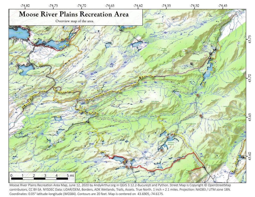
An overview map and list of campsites and their locations at the Moose River Recreation Area.

 Moose River Plains Recreation Area

Maps

Campsites

Milepoint Name Feature Notes Access Location
Cedar River Flow 1 Cedar River Flow Tent site on flow Boat 43.702924803151, -74.4871304116533
Cedar River Flow 2 Cedar River Flow Tent site on flow Boat 43.7104737708879, -74.4802343768254
Cedar River Flow 3 Cedar River Flow Tent site on flow Boat 43.7145237017622, -74.4679264444554
Cedar River Flow 5 Cedar River Flow Tent site on flow Boat 43.7111711590583, -74.4675178486588
Cedar River Flow 6 Cedar River Flow Tent site on flow Boat 43.7084767866376, -74.4717703157492
Beaver Lake Campsite Beaver Lake Site overlooks Beaver Lake Hike 43.6516613421651, -74.7407833400961
81 Icehouse Pond Accessible site at Icehouse Pond with privy Hike 43.6646602166505, -74.7029502913239
140A Indian Lake Campsite on Indian Lake, outhouse in bad condition Hike 43.6154753632731, -74.7499942080732
East of Muskrat Pond Indian Lake Trail Former roadside campsite, largely abandoned Hike 43.645116528704, -74.696221627206
46 Lost Ponds Trail Beyond the end of current Lost Ponds Road Hike 43.6868179572109, -74.6655581886723
47 Lost Ponds Trail Above Lost Ponds Hike 43.6859472953826, -74.6722052916864
Mitchell Pond 1 Mitchell Pond Tent site, bushwhack Hike 43.6729475881673, -74.7502538624373
Mitchell Pond 2 Mitchell Pond Tent site, bushwhack Hike 43.6716991892117, -74.7432124817486
64A Mitchell Pond (Accessible Campsite at End of Gravel Trail) Gravel path to site, wildrness privy Hike 43.6706136251028, -74.7387363015355
10 89 Beaver Lake Road Off Otter Brook Road, Sand Plains Vehicle 43.6583112347181, -74.7012491214803
11 90 Beaver Lake Road Off Otter Brook Road, Sand Plains Vehicle 43.6577446555162, -74.7038760912165
16 1 Cedar River – Limekiln Lake Road Driveway Along Tributary of Silver Run Vehicle 43.7033162602551, -74.5742148239156
16 3 Cedar River – Limekiln Lake Road Along Silver Run Vehicle 43.7027301523306, -74.5757742464803
16 4 Cedar River – Limekiln Lake Road Along Silver Run, driveway at Sharp S Turn Vehicle 43.7026421104662, -74.5769731929134
16 7 Cedar River – Limekiln Lake Road Along Silver Run Vehicle 43.7040070126376, -74.5809411044503
15 10 Cedar River – Limekiln Lake Road Old gravel pit, accessible Vehicle 43.7031498027862, -74.5893864145496
15 11 Cedar River – Limekiln Lake Road Across from 12 Vehicle 43.702458607149, -74.5926546451668
15 12 Cedar River – Limekiln Lake Road Across from 11 Vehicle 43.7028667147947, -74.5929833340894
15 13 Cedar River – Limekiln Lake Road Along Silver Run Vehicle 43.7010402113051, -74.5956355707995
15 14 Cedar River – Limekiln Lake Road Along Silver Run Vehicle 43.7010328498576, -74.597457469967
14 16 Cedar River – Limekiln Lake Road Access Road for 16/17/18 Group Vehicle 43.7025294616695, -74.5969885248639
14 17 Cedar River – Limekiln Lake Road Access Road for 16/17/18 Group Vehicle 43.7021028692463, -74.5966599329259
14 18 Cedar River – Limekiln Lake Road Access Road for 16/17/18 Group Vehicle 43.7023846304313, -74.5978818600647
14 19 Cedar River – Limekiln Lake Road Along Silver Run Vehicle 43.7003546491841, -74.5964872856253
14 21 Cedar River – Limekiln Lake Road Across road from Silver Run Vehicle 43.6957217888458, -74.6020563094081
13 22 Cedar River – Limekiln Lake Road Across road from Silver Run Vehicle 43.6935817523545, -74.6036764840587
13 27 Cedar River – Limekiln Lake Road Across road from Silver Run Vehicle 43.6926540634024, -74.6082201775478
13 30 Cedar River – Limekiln Lake Road Open Area in Woods Vehicle 43.6918525577623, -74.6118452191364
13 31 Cedar River – Limekiln Lake Road Near Marsh off Silver Run Vehicle 43.6881856235873, -74.6271629609656
12 34 Cedar River – Limekiln Lake Road Open Field Near Old Sly Pond Road Vehicle 43.6846954329325, -74.634678249126
12 35 Cedar River – Limekiln Lake Road Former Sly Pond Road Vehicle 43.6836690328942, -74.6318552827363
11 38 Cedar River – Limekiln Lake Road On Hill Overlooking Road, near start of Lost Ponds Area Vehicle 43.6836029270341, -74.6401393590772
11 39 Cedar River – Limekiln Lake Road Above CRLLR, start of Lost Ponds Area Vehicle 43.6841476346233, -74.6487511980121
11 40 Cedar River – Limekiln Lake Road Above CRLLR, start of Lost Ponds Area Vehicle 43.682942162164, -74.6537793571789
11 41 Cedar River – Limekiln Lake Road Above CRLLR, start of Lost Ponds Area Vehicle 43.681311345096, -74.6589116717693
10 42 Cedar River – Limekiln Lake Road Above CRLLR, start of Lost Ponds Area Vehicle 43.6799039050817, -74.6646031695507
10 43 Cedar River – Limekiln Lake Road Above CRLLR, start of Lost Ponds Area Vehicle 43.6793727911294, -74.6664156654099
10 44 Cedar River – Limekiln Lake Road West of Lost Ponds Road, Sand Plains Vehicle 43.678808787762, -74.6696555368193
10 50 Cedar River – Limekiln Lake Road West of Lost Ponds Road, Sand Plains Vehicle 43.677986610504, -74.6732025802129
10 51 Cedar River – Limekiln Lake Road Pull-Off, Small Site, Sand Plains Vehicle 43.6775108499728, -74.6750146421403
10 52 Cedar River – Limekiln Lake Road Old gravel pit, short loop below CRLLR Vehicle 43.6748840847288, -74.6815273754233
10 53 Cedar River – Limekiln Lake Road Access Road for 55/54/55 Group, Sand Plains Vehicle 43.6733317629897, -74.6820452615144
10 54 Cedar River – Limekiln Lake Road Access Road for 55/54/55 Group, Sand Plains Vehicle 43.673268538603, -74.6822820352903
9 55 Cedar River – Limekiln Lake Road Access Road for 55/54/55 Group, Sand Plains Vehicle 43.6733705968856, -74.6827076379887
9 56 Cedar River – Limekiln Lake Road Driveway, East of Former Dump, Sand Plains Vehicle 43.673126585883, -74.6891475571674
9 57 Cedar River – Limekiln Lake Road Has Trail to Moose River Vehicle 43.6736673106707, -74.6902687046523
8 64 Cedar River – Limekiln Lake Road Near Mitchell Pond Trail Vehicle 43.6757521870177, -74.707500815672
8 66 Cedar River – Limekiln Lake Road Near Pine Creek Vehicle 43.6784203854214, -74.7068492021325
7 67 Cedar River – Limekiln Lake Road Benedict Creek Road, Wooded Vehicle 43.6851041444828, -74.7031887110586
7 69 Cedar River – Limekiln Lake Road Remote site, perched over the road Vehicle 43.6834516958835, -74.7168906980223
6 70 Cedar River – Limekiln Lake Road Large loop off of CRLLR Vehicle 43.6839906014562, -74.7249870178447
6 71 Cedar River – Limekiln Lake Road Very sandy site near Mitchells Pond Upper Loop Vehicle 43.6833776353921, -74.7321947941391
5 72 Cedar River – Limekiln Lake Road At end of Bear Pond Loop Road (Accessable) Vehicle 43.6828956047277, -74.7359084701559
4 73 Cedar River – Limekiln Lake Road Very sandy site near Mitchells Pond Upper Loop Vehicle 43.6835777053685, -74.7387188889593
4 74 Cedar River – Limekiln Lake Road On a hill overlooking road and marshy area Vehicle 43.6839187521201, -74.742285779317
4 76 Cedar River – Limekiln Lake Road Very sandy site near Mitchells Pond Upper Loop Vehicle 43.6864452702399, -74.7471689344191
4 77 Cedar River – Limekiln Lake Road Near Red River, Bear Pond Loop, Sand Plains Vehicle 43.6897961458669, -74.7484803840413
10 58 Helldiver Pond Road Near Helldiver Pond Vehicle 43.6735979105991, -74.6920316000423
10 59 Helldiver Pond Road Near Helldiver Pond Vehicle 43.6723766419894, -74.6929318681131
10 60 Helldiver Pond Road Near Helldiver Pond Vehicle 43.6713193532923, -74.692758456613
10 61 Helldiver Pond Road Accessible site at end of Helldiver Pond Road Vehicle 43.6705019900204, -74.6921751440693
15 West of Brooktrout Trail Indian Lake Road Past Brooktrout Trail, on a hill over road Vehicle 43.6254538914434, -74.7337300739322
10 48 Lost Pond Road Sand Plains, Marshes Aroubnd Vehicle 43.6814268347573, -74.6667101324338
11 49 Lost Pond Road Sand Plains, Marshes Aroubnd Vehicle 43.6819456385478, -74.6670131106595
10 80 Otter Brook Road Has Trail to Moose River Vehicle 43.6620917920003, -74.7112181918076
11 98 Otter Brook Road Above Moose River on Hill Vehicle 43.6588725644731, -74.6966603409996
11 101 Otter Brook Road Sand Plains Vehicle 43.6564420559443, -74.6938956128147
11 103 Otter Brook Road Sand Plains Vehicle 43.657108724794, -74.6873446316172
12 104 Otter Brook Road Wooded Site Vehicle 43.6560617426567, -74.6832992891923
12 106 Otter Brook Road Wooded Site Vehicle 43.6565121581975, -74.6789913497265
13 110 Otter Brook Road Wooded Site Vehicle 43.6566072628101, -74.6733859460379
13 111 Otter Brook Road Near Otter Brook Bridge Vehicle 43.6539235327721, -74.6747718892435
23 1 Wakely Dam Camping Area Accessible site Vehicle (before gate) 43.7266767212397, -74.474100266424
23 2 Wakely Dam Camping Area Field Camping Vehicle (before gate) 43.7266515010084, -74.4733110730078
23 3 Wakely Dam Camping Area Field Camping Vehicle (before gate) 43.7259595122959, -74.473899965642
23 4 Wakely Dam Camping Area On Driveway to Lake Vehicle (before gate) 43.7260676922081, -74.4742326471903
23 5 Wakely Dam Camping Area On Driveway to Lake Vehicle (before gate) 43.7255637908987, -74.4741751228291
23 6 Wakely Dam Camping Area On Driveway to Lake Vehicle (before gate) 43.7252231337487, -74.4745830371916
23 9 Wakely Dam Camping Area Across bridge Vehicle (before gate) 43.726275356142, -74.4717840349063
23 10 Wakely Dam Camping Area Across bridge Vehicle (before gate) 43.7266308152758, -74.4712600272389
10 82 Otter Brook Road On Moose River Vehicle (driveway) 43.6603083771227, -74.7010353925305
11 84 Otter Brook Road On Moose River Vehicle (driveway) 43.6619962517853, -74.6957783254417
6 120 Natural Rock Dam Road Sand Plains near Red River Vehicle (Opens July) 43.6848543033273, -74.7664253595203
6 122 Natural Rock Dam Road Wooded Site Vehicle (Opens July) 43.684367353989, -74.7717171949716
6 123 Natural Rock Dam Road Wooded Site Vehicle (Opens July) 43.6804228755091, -74.7782951743141
6 124 Natural Rock Dam Road Wooded Site Vehicle (Opens July) 43.6792030487765, -74.7847972548314
7 125 Natural Rock Dam Road Wooded Site Vehicle (Opens July) 43.6783559964111, -74.7880327043169
7 126 Natural Rock Dam Road Wooded Site Vehicle (Opens July) 43.6748535298235, -74.790591643043
7 127 Natural Rock Dam Road Wooded Site Vehicle (Opens July) 43.6739776362472, -74.7910844137006
7 128 Natural Rock Dam Road Wooded Site Vehicle (Opens July) 43.6751413481917, -74.7924842843025
8 129 Natural Rock Dam Road Wooded Site Vehicle (Opens July) 43.6703784784539, -74.7926312803463
8 130 Natural Rock Dam Road Wooded Site Vehicle (Opens July) 43.6666270858056, -74.8019151989726
8 131 Natural Rock Dam Road Wooded Site Vehicle (Opens July) 43.6643581634434, -74.8054154753831
8 132 Natural Rock Dam Road Wooded Site Vehicle (Opens July) 43.6652083016168, -74.8036826184027
5 119A Natural Rock Dam Road Sand Plains near Red River Vehicle (Opens July) 43.6844716021433, -74.7646961785253
6 123A Natural Rock Dam Road Wooded Site Vehicle (Opens July) 43.6802422604152, -74.782965042166
6 124A Natural Rock Dam Road Wooded Site Vehicle (Opens July) 43.6785899888224, -74.7864319884685
6 125A Natural Rock Dam Road Wooded Site Vehicle (Opens July) 43.6776017274889, -74.7902229325712
7 126A Natural Rock Dam Road Wooded Site Vehicle (Opens July) 43.6756110574941, -74.7901645681643
8 129A Natural Rock Dam Road Wooded Site Vehicle (Opens July) 43.6689370211979, -74.7948887917477
8 129AA Natural Rock Dam Road Wooded Site Vehicle (Opens July) 43.6674497436753, -74.7980604042935
8 130A Natural Rock Dam Road Wooded Site Vehicle (Opens July) 43.6661052974262, -74.8016557609016
8 130AA Natural Rock Dam Road Wooded Site Vehicle (Opens July) 43.6669094078356, -74.8007390664074

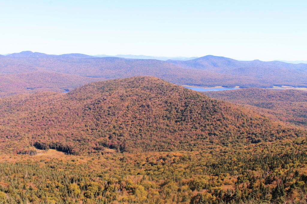
Payne Mountain with Cedar River Flow Beyond It

The Final Day at Moose River Plains

I thought my Moose River Trip was a pretty good one, even if I ran into some minor issues along the way.

It was a pretty foggy start to my morning when I first woke up with the fog picking up right before eight AM then burning off a little while after the sun rose. While Friday and Saturday nights were fairly chilly the same could not be said about last night. Yesterday was pretty nice paddling along the Cedar River Flow then up on Cedar River to Carry Lean-To, which as the name suggests is close to the end of the navigable waters on the river. Maybe you can “carry” and get to another section of deep enough water but I have my doubts. The leaves along the flow were quite colorful, although the mountains surrounding the flow where already past peak and starting to turn quite brown and gray, with only some deep reds from the maples and greens from the evergreens remaining. It seems ironic that Moose River Plains is already looking like late fall, with the weather still in the 80s. Cool weather, some with a frost in early September made the leaves fall on many of the trees, despite the big warm up of this weekend.

While I don’t know how truly warm it got up here on Sunday — September 24th I should note — my phone said it was 87 degrees by mid afternoon, and the water in the Cedar River wasn’t super cold. I went swimming every day I was up here. The weather this weekend was warmer then it was when I camped up here over the Independence Day Weeekend. So be it.

I got lost in the muck and vegetation looking for the Cedar River, which if your inexperienced paddling or been a while since the last time on the Cedar River Flow can be quite difficult to find. Fortunately I saw a passing kayaker and he gave me verbal advice on how to find the river. I had a topographic map on my phone but it’s only of limited use, because topographic maps are old, and do not reflect the lower lake level since the DEC put in the modern dam in 1969.

There was a dreaded beaver dam on the Cedar River, only a short distance from the entrance from the flow. I am really quite surprised a beaver dam survived the boats crossing the area and the trappers seeking beaver pelts. I guess beaver pelts haven’t been fetching the price they once did, and with less human pressures, beavers are able to build an dam up whatever they want these days.

Coming back over the Beaver Dam the second time, I managed to flip my kayak getting back into it. My smartphone stayed plenty dry in it’s protective bag, but my camera and tackle box got soaked. Well, only briefly, but my camera is drying out and I assume in a day or two it will be fine to power back up again. So for the last day of my trip, I am limited to smartphone pictures.

I haven’t paddled the Cedar River Flow in a while because I have been spending more time up in the western end of Moose River Plains, and it’s a big haul back there. At 15 MPH speed limit, it takes almost an hour. From Wakely Dam to Carry Lean-to, it’s an hour and a half paddle, assuming you find the entrance to the river with ease and don’t stop for an hour for lunch, personal business on the smartphone, and of course updating social media. I know, hah. But there is good AT&T GSM access from the upper end of Cedar River Flow, especially near Campsite 6. That’s not as common in much of the Moose River Recreation Area.

Driving to the Cedar River Flow from the camping area in the western part of the Moose River Plains near Helldiver is an hour long proposition, which is why I haven’t spent much time there lately. I’ve also been spending more time exploring things around Inlet, in part because I like being able to check my phone to see if any family or work things come on up. I also get a bit tired of all those bumpy miles of 15 MPH road, especially now that I know Cedar River – Limekiln Lake Road like the back of my hand.

I cooked up some beef, cheese and chilies, and had some more burritos with Corona beer. After a few beers, with the hot sun all day, the five hours of paddling, I watched the fire for a bit then I retired for the night. I was probably in bed by nine. Which seems silly, as it was it was a pleasant evening with billions of stars above and temperatures in the 60s, but I felt like I needed toothpicks to keep my eyes open. I’ve also been trying to get more sleep these days.

In the past few years, I’ve camped up at Moose River Plains but it’s been at least two years since I camped in the plains formal — the area where the campsites are sand, the canopies are open and the surrounding area is quite swampy. The reason for not camping up here is quite simple — the bugs can be quite horrific during the spring and early summer — while the surrounding wooded sites tend to be bug free or have much fewer mosquitoes. It can be like night or day, especially in black fly season.

That said the “plains” campsites just are a special place to camp at with the big starry skies above in the remote country. I really enjoyed campsite 80, and should try to make sure to camp up here more often.

Broke camp before ten, walked down to the Moose River. Cooked up biscuits in the camp oven, took down the flags, put away the gear, hung out the wet stuff to dry, worked on the blog post, and once the fog burnt off it was a beautiful but rapidly warming morning as the leaves continued to fall.

First tried my hand at fishing the Moose River from the path behind my campsite, then I drove to the bridge over the Moose River and fished under there. Caught nothing. Hiked back from the Squaw Lake parking area first to Muskrat Pond and then to Indian Lake, that is the one in the southwestern most part of Moose River Plains. Nice hike, although at this point some of the colors are already done. Other places, less color. It varies a lot with elevation. But regardless the weather on this extended weekend has been amazing.

I tell you there aren’t many 80 degree days during the last week of September in the Adirondacks. It was nice sitting down by the lake with a fishing pole, even if I only caught a few bullheads. No mosquitoes which was nice too. And I almost slipped and fell in the lake which honestly today wouldn’t have been the worse thing. They’ve removed most of the signs and tables from the old campsites along the closed portion of Indian Lake Road, even if it’s in better condition than the open portion. The open portion of Indian Lake Road has been beat to shit by trucks and cars due to it being so wet and rainy this summer. Good colors along the road though. Definitely a beautiful day, not too humid with a lot of fair weather clouds.

Apparently I don’t have cell service up at Indian Lake or Muskrat Pond with my GSM phone like my old CDMA model. That’s fine but I do like to check in with the world from time to time. Oh well, by the time you read this I will be back in cellphone range.

I was looking at the map and thinking I have never hiked back to the Indian River. IΒ didn’t have time today but I should add that to my list for next summer. Also hiking back to Cellar Pond by Cellar Monument now that the DEC has a big sign announcing the trail and they’ve blocked off the old dirt track used by hunters to drive down that way. I always go to the same places at Moose River Plains, I should explore new places.

After visiting Muskrat Pond, Indian Lake, and Squaw Lake I made it back to my truck closer to four PM then three. And I was at the Inlet gate around five, when I stopped and put the front and back ropes back on the kayak, and headed back via Old Forge.I didn’t feel like driving all the way back through Moose River Plains to Indian Lake, and heck, I haven’t been back via NY 28 in a long time.

Driving back through Inlet and Old Forge was really quiet. It was nice to be on the nice smooth black top, after driving over Indian Lake Road, the little used and little maintained section between the Falls Pond and Squaw Lake Trailhead was particularly rough. The sound of windshield washer fluid hitting the kayak on NY 28 made me pull over, but it was just that noise, the kayak was riding fine. But in general it seemed like all of the roads at Moose River Plains were rougher then usual after such a wet summer, with some heavy rains eroding away the roads and vehicles giving the road a good pounding in spots.Β Β I thought there was a McDonalds in Old Forge where I could get a milk shake, but I couldn’t find it.

NY 28 except for the small towns is really a good road, if not boring. The DOT has straightened and improved much of the road except through the small towns. Without summer vacationer traffic and being a weekday, there was very little traffic. I always like that section of NY 28 when it meets up with NY 12 south of Alder Creek, and becomes a four lane, but I think people always seem to speed on it and there are always cops watching for speeders. But the scenery is nice along this section of the road, looking down at the Mohawk Valley and the rough farm country, and swamp land of the greater Remsen area. I always find the rocky, rough farms cut into the mountains to be much more interesting to look at then the lush, more heavily capitalized and better maintained farms of the lush alluvial valleys you see in some parts of the state. The Tug Hill, in it’s upper elevations is a rough country, with lots of snow, and very hardy people. A big black F-350 Harvey Davidson edition passed by with Agriculture plates, and I had to think, “he must do some good shit, “no pun intended”.

Drove down to Poland and Middleville via NY 28. I like this part of NY 28 even if the villages are pokey, just because it’s pretty along the East Canada Creek. I should try my hand trout fishing there one spring — I just got to find a good place to camp up that way — it’s a bit of a trip for a day trip from Albany in my opinion. Middleville is quite the quaint little town, reminding me of what America used to be like.

Then it was down to NY 169 to Little Falls from Herkimer. I like this section of road, even though it’s hilly, because it’s quite beautiful. I like seeing the farms and valleys, and a landscape that works but isn’t that perfect, and still somewhat rough. Drove through Little Falls, a nice little but struggling city that has much potential. Yeah, I was there last weekemd at Moss Island, then onwards toward the Thruway. Stopped at Fink Basin Road to tighten the kayak on the roof of my truck.

Right before getting on the Thruway, I decided to shun pike some more, and take NY 5S from the Little Falls exit to Canjahoharie. I don’t like having to drive through Fort Plain and then Canjahoharie before getting onto he Thruway, but so be it. I do like that section of NY 5S high above the valley though. Some farms in the valleys haven’t cut silage yet due to the high temperatures (more growing seasons, more yields) and lack of frost.

When I got to Fort Plain I almost stopped at the Red Dragon Chinese place. I like Chinese and they tend to be inexpensive. People always think small town Chinese places are bad, but actually some can be pretty good, especially if families are trying to make a living in a place with few other options. I liked the Chinese I got in Canastota when I was working there, but then again, I got awful tasting Chinese food in North Syracuse. I don’t know, I passed as it was getting dark and I wanted to get home.

When I got on the Thruway at Canjahoharie it was getting pretty dark. My eyes were watering up and I ended up stopping at the rest area outside of Amsterdam. Took a piss and washed my hands good — nice bathrooms — then went into my truck and cleaned off my contacts and reinstered them. That made the rest of the drive easier.

Got home around 8 PM and things unpacked, well mostly so, before the heat started to get to me. Then I took a shower, and finished up this blog post. And here we are now.

My current smartphone isn’t as good at picking up distant radio channels and I didn’t play with it much so I missed hearing the news during my extended weekend trip at Moose River Plains. I doubt I missed much, most of the things in the news don’t effect me much. I’m sure my political Facebook friends will post plenty of memes to fill me in on what I’ve been missing.

2017 NYSDEC Lean-To Listing

Location Region Facility Name Notes
40.8977396062,
-72.6606151038
1 David A. Sarnoff Pine Barrens Preserve Interior Lean- To
42.039846675,
-74.593646931
3 Balsam Lake Mountain Wild Forest Balsam Lake Mountain Lean-To
42.0821851976,
-74.5866114487
3 Balsam Lake Mountain Wild Forest Dry Brook Ridge Lean-To
42.0669125899,
-74.6546347244
3 Balsam Lake Mountain Wild Forest Kelly Hollow Lean-To
42.0673682324,
-74.5869876883
3 Balsam Lake Mountain Wild Forest Mill Brook Lean-To
42.0490509759,
-74.644686588
3 Balsam Lake Mountain Wild Forest Mill Brook Ridge Lean-To
42.1150311581,
-74.4907498238
3 Belleayre Mtn Ski Center East Ski Lean-To
42.1177186512,
-74.5031992126
3 Belleayre Mtn Ski Center West Ski Lean-To
42.009105151,
-74.4838519037
3 Big Indian Wildernes Area Biscuit Brook Lean-To
41.9980754336,
-74.5603918334
3 Big Indian Wildernes Area Fall Brook Lean-To
42.0753394054,
-74.4858565042
3 Big Indian Wildernes Area Mckinly Hollow Lean-To
42.0920121203,
-74.50571316
3 Big Indian Wildernes Area Rider Hollow Lean-To
42.0502743293,
-74.5106001667
3 Big Indian Wildernes Area Shandaken Brook Lean-To
42.0697505965,
-74.2874492999
3 Phoenicia – Mt. Tobias Wild Forest Tremper Mountain Lean-To 1
42.0719347774,
-74.280350018
3 Phoenicia – Mt. Tobias Wild Forest Tremper Mountain Lean-To 2
42.1388242073,
-74.4544191301
3 Shandaken Wild Forest Rochester Hollow Lean-To
42.1027865494,
-74.3948255307
3 Slide Mountain Wilderness Fox Hollow Lean-To
41.9591817103,
-74.4068771821
3 Slide Mountain Wilderness Table Mountain Lean-To
42.0273156785,
-74.3356447251
3 Slide Mountain Wilderness Terrace Mountain Lean-To
41.9400595492,
-74.6320548238
3 Willowemoc Wild Forest Long Pond Lean-To
42.1584913515,
-75.3620266032
4 Arctic China State Forest A-40 Lean-To
42.1528069973,
-75.3102096425
4 Barbour Brook State Forest A-41 Lean To
42.2276166115,
-75.3902198332
4 Beals Pond State Forest
42.3354251044,
-73.4841812463
4 Beebe Hill State Forest Beebe Hill Lean-To
42.543303724,
-74.4885945942
4 Burnt-Rossman Hills State Forest Eminence Lean-To
42.5282012278,
-74.6420043552
4 Clapper Hollow State Forest Clapper Hollow Lean-To
42.0491041533,
-74.9281738602
4 Delaware Wild Forest Cat Hollow Lean-To
42.0118726464,
-74.9483763817
4 Delaware Wild Forest Mud Pond Trail Lean-To
42.0058597072,
-74.8682131934
4 Delaware Wild Forest Pelnor Hollow Lean-To
42.0124988931,
-74.9472696156
4 Delaware Wild Forest Trout Pond Trail Lean-To Built For ADA
42.6294376039,
-74.2675434311
4 Dutch Settlement State Forest Lean-To
42.2197534864,
-74.4391024687
4 Halcott Mountain Wild Forest Halcott Lean-To
42.313988005,
-73.4414954693
4 Harvey Mountain State Forest Harvey Mountain Lean-To
42.1660752671,
-74.2304343401
4 Hunter-West Kill Wilderness Devil’s Acre Lean-To Good Condition
42.1692897833,
-74.2576582937
4 Hunter-West Kill Wilderness Diamond Notch Lean-To
42.3550413796,
-74.3460668476
4 Huntersfield State Forest Lean-To
42.1196391066,
-74.0873843029
4 Indian Head Wilderness Devils Kitchen Lean-To
42.0985881282,
-74.0915994051
4 Indian Head Wilderness Echo Lake Lean-To
42.1357750354,
-74.1634997793
4 Indian Head Wilderness Mink Hollow Lean-To
42.1894936316,
-74.239507302
4 Rusk Mountain Wild Forest John Robb Lean-To
42.2789596573,
-74.1033902943
4 Windham Blackhead Range Wilderness Batavia Kill Lean-To
42.3062546068,
-74.1744107284
4 Windham Blackhead Range Wilderness Elm Ridge Lean-To
43.8755968409,
-74.366426237
5 Blue Mountain Wild Forest O’neill Flow Lean-To
43.8873444776,
-74.3788006261
5 Blue Mountain Wild Forest Tirrel Pond North Lean-To
43.829937473,
-74.4366163022
5 Blue Ridge Wilderness Cascade Pond Lean-To Fair
43.8186736685,
-74.4205248717
5 Blue Ridge Wilderness Stephens Pond Lean-To Good
43.8201917816,
-74.4686803224
5 Blue Ridge Wilderness Wilson Pond Lean-To Fair
44.5989256982,
-74.2285921246
5 Debar Mtn. Wild Forest Debar Mountian Lean-To Debar Mtn Leanto
44.4918501724,
-74.2523227309
5 Debar Mtn. Wild Forest Grass Pond Lean-To
44.5192586399,
-74.2710522386
5 Debar Mtn. Wild Forest Sheep Meadow Lean-To #1
44.5193465505,
-74.2711670085
5 Debar Mtn. Wild Forest Sheep Meadow Lean-To #2
44.108205472,
-73.7738312581
5 Dix Mountain Wilderness Bouquet Lean-To
44.0601596209,
-73.8078167801
5 Dix Mountain Wilderness Lilian Brook Lean-To
44.044126198,
-73.8058583966
5 Dix Mountain Wilderness Slide Brook Lean-To
44.1759172265,
-73.7215350426
5 Giant Mountain Wilderness Giant Mtn. Lean-To
43.8863219437,
-73.5641701351
5 Hammond Pond Wild Forest Eagle Lake Lean-To
43.9655912049,
-73.6440374623
5 Hammond Pond Wild Forest Moose Mt Pond Lean-To
44.1447454969,
-73.9547665307
5 High Peaks Wilderness Avalanche
44.1809734501,
-73.8284043214
5 High Peaks Wilderness Bear Brook Lean-To
44.121015479,
-73.9821264349
5 High Peaks Wilderness Beaver Point #1
44.1207874446,
-73.9817139904
5 High Peaks Wilderness Beaver Point #2
44.1825279757,
-74.1805220238
5 High Peaks Wilderness Blueberry Lean-To
44.1449655863,
-73.8833895452
5 High Peaks Wilderness Bushnell Falls #1 Lean-To
44.1444007481,
-73.8834828976
5 High Peaks Wilderness Bushnell Falls #2 Lean-To
44.1129718174,
-73.9928913122
5 High Peaks Wilderness Calamity #1 Lean-To
44.1448580137,
-74.2751710479
5 High Peaks Wilderness Calkin’s Brook Lean-To
44.1058294131,
-74.3120366857
5 High Peaks Wilderness Calkin’s Creek Lean-To
43.9980126927,
-74.3927845611
5 High Peaks Wilderness Catlin Bay #1 Lean-To
43.9972143811,
-74.3959393656
5 High Peaks Wilderness Catlin Bay #2 Lean-To
44.1425166432,
-74.1303582429
5 High Peaks Wilderness Cold River #2 Lean-To
44.091459278,
-74.2576417508
5 High Peaks Wilderness Cold River #3 Lean-To
44.0913902533,
-74.2557348025
5 High Peaks Wilderness Cold River #4 Lean-To
44.1427273763,
-74.1298402107
5 High Peaks Wilderness Cold River Lean-To #1 Lean-To
44.1778467491,
-73.833854921
5 High Peaks Wilderness Deer Brook Lean-To
44.141626874,
-74.1069373468
5 High Peaks Wilderness Duck Hole #1 Lean-To
44.1416768647,
-74.1065435467
5 High Peaks Wilderness Duck Hole #2 Lean-To
44.1142099053,
-73.9556152329
5 High Peaks Wilderness Feldspar Lean-To
44.1186643668,
-73.9840090128
5 High Peaks Wilderness Flowed Lands #2 Lean-To
44.1077341951,
-73.9912056361
5 High Peaks Wilderness Griffin Lean-To
44.1773165403,
-74.3218077012
5 High Peaks Wilderness Hemlock Hill Lean-To
44.1041784421,
-74.0669132937
5 High Peaks Wilderness Henderson Lake Lean-To
44.1117549601,
-74.0592189223
5 High Peaks Wilderness Henderson Lean-To
44.1178828905,
-73.9873641274
5 High Peaks Wilderness Herbert Brook Lean-To
44.0026552882,
-74.3864802633
5 High Peaks Wilderness Hidden Cove Lean-To
44.0760291647,
-74.3235341651
5 High Peaks Wilderness Island House Lean-To
44.1494011459,
-73.9557902347
5 High Peaks Wilderness Kagel Lean-To
44.0288002362,
-74.367307986
5 High Peaks Wilderness Kelly Point #1 Lean-To
44.0287025672,
-74.3671303487
5 High Peaks Wilderness Kelly Point #2 Lean-To
44.1706807759,
-73.9050776091
5 High Peaks Wilderness Klondike Lean-To
44.1130126221,
-73.9888393806
5 High Peaks Wilderness Livingston Point Lean-To
44.1469386475,
-73.9552287453
5 High Peaks Wilderness Marcy Brook Lean-To
44.1579156535,
-73.953395811
5 High Peaks Wilderness Marcy Dam #1 Lean-To
44.1573119259,
-73.9533863686
5 High Peaks Wilderness Marcy Dam #2 Lean-To
44.1573817221,
-73.9512823564
5 High Peaks Wilderness Marcy Dam #3 Lean-To
44.158399029,
-73.9510719571
5 High Peaks Wilderness Marcy Dam #4 Lean-To
44.1586913289,
-73.9524288871
5 High Peaks Wilderness Marcy Dam #5 Lean-To
44.1828433824,
-74.0736410238
5 High Peaks Wilderness Moose Pond Lean-To
44.079589789,
-74.2389368367
5 High Peaks Wilderness Moose Pond Stream Lean-To
44.0795538786,
-74.2391509433
5 High Peaks Wilderness Moose Pond Stream Lean-To #2
44.1992083493,
-73.9059885406
5 High Peaks Wilderness Mr. Van Lean-To
44.0158171441,
-74.1523218843
5 High Peaks Wilderness Newcomb Lake Lean-To #1
44.0205306743,
-74.1522782707
5 High Peaks Wilderness Newcomb Lake Lean-To #2
44.1733720177,
-74.1571389816
5 High Peaks Wilderness Number Four #1 Lean-To
44.1733860424,
-74.1561240274
5 High Peaks Wilderness Number Four #2 Lean-To
44.1110695692,
-73.9924324205
5 High Peaks Wilderness Opalescent Lean-To
44.1466502842,
-73.8622440861
5 High Peaks Wilderness Ore Bed Brook Lean-To
44.1202212816,
-74.1874471739
5 High Peaks Wilderness Ouluska Pass Brook Lean-To
44.0996351514,
-73.9133647612
5 High Peaks Wilderness Panther Gorge Lean-To
44.0654422644,
-74.3285192442
5 High Peaks Wilderness Plumley Point #1 Lean-To
44.0655989161,
-74.3276122455
5 High Peaks Wilderness Plumley Point #2 Lean-To
44.1472355081,
-74.318105399
5 High Peaks Wilderness Raquette Falls #1 Lean-To
44.1568302695,
-74.3133083456
5 High Peaks Wilderness Raquette Falls #2 Lean-To
44.1710800022,
-73.9974911766
5 High Peaks Wilderness Rocky Falls Lean-To
44.0414093849,
-74.3501490964
5 High Peaks Wilderness Rodney Point #1 Lean-To
44.0429767454,
-74.3493346475
5 High Peaks Wilderness Rodney Point #2 Lean-To
44.099413657,
-74.1052871721
5 High Peaks Wilderness Santanoni Lean-To
44.159177638,
-74.013876769
5 High Peaks Wilderness Scott Clearing Lean-To
44.1062441377,
-74.2091536428
5 High Peaks Wilderness Seward Lean-To
44.1247329647,
-73.9010796778
5 High Peaks Wilderness Slant Rock Lean-To
44.1988046777,
-74.3183103111
5 High Peaks Wilderness Stony Creek Lean-To
44.1093110139,
-73.961729679
5 High Peaks Wilderness Uphill Lean-To
44.1191510722,
-73.9841831313
5 High Peaks Wilderness Walker Brook Lean-To
44.1221483174,
-74.0532242803
5 High Peaks Wilderness Wallface Lean-To
44.1784419747,
-74.1736369919
5 High Peaks Wilderness Ward Brook Lean-To
44.161824666,
-73.8555947195
5 High Peaks Wilderness Wm. G. Howard Lean-To
44.1538919753,
-73.8510077515
5 High Peaks Wilderness Wolf Jaw Lean-To
44.2530195934,
-73.7180348153
5 Hurricane Mountain Primitive Area Gulf Brook Lean-To Fair
44.2607301476,
-73.7100106669
5 Hurricane Mountain Primitive Area Lost Pond/Biesemeyer Lean-To Fair
43.5996600139,
-73.5330643346
5 Lake George Wild Forest Black Mountain Ponds Lean-To Lean-To With Privy And Fire Ring Black Mtn Pond Trail
43.6193129088,
-73.5841121844
5 Lake George Wild Forest Fifth Peak Lean-To Lean-To W/ Privy And Fire Ring Tongue Mtn Range Trail
43.5760391953,
-73.5361031163
5 Lake George Wild Forest Fishbrook Pond North Lean-To Leanto With Privy, Picnic Table And Fire Ring Fishbrook Pd-Lk Grg Shore Trl
43.5738720148,
-73.5384766731
5 Lake George Wild Forest Fishbrook Pond South Lean-To Leanto With Privy, Picnic Table And Fire Ring Fishbrook Pd E Shore Trl
43.6473357817,
-73.5745337831
5 Lake George Wild Forest Five Mile Mountain Lean-To Lean-To W/ Privy And Fire Ring Tongue Mtn Range Trail
43.5778037953,
-73.5168397538
5 Lake George Wild Forest Greenland Pond Lean-To Leanto With Privy, Picnic Table And Fire Ring Greenland Pd Shelter Spur
43.5958213341,
-73.5179510245
5 Lake George Wild Forest Lapland Pond Lean-To Campsite With Lean-To 13-27 Lapland Pond Lean-To Conector
43.5871682823,
-73.5277594231
5 Lake George Wild Forest Millman Pond Lean-To Campsite With Lean-To 5-10 Old Farm To Millman Pond Trl
44.3214560457,
-74.0307860439
5 Mckenzie Mtn. Wilderness Placid Lean-To
44.3442169075,
-73.9286469378
5 Mckenzie Mtn. Wilderness White Face Brook Lean-To
43.7790246336,
-74.7044289121
5 Moose River Plains Wild Forest 8th Lake Island Lean-To
43.7801152974,
-74.7044390115
5 Moose River Plains Wild Forest 8th Lake North Shore
43.7897826664,
-74.6985922707
5 Moose River Plains Wild Forest 8thlake East Shore Lean-To
43.8316711731,
-74.6617561796
5 Moose River Plains Wild Forest Beaver Bay Lean-To 1
43.8316049364,
-74.6615109228
5 Moose River Plains Wild Forest Beaver Bay Lean-To 2
43.8314336654,
-74.6609019165
5 Moose River Plains Wild Forest Beaver Bay Lean-To 3
43.7478050188,
-74.7441985068
5 Moose River Plains Wild Forest Seventh Lake Lean-To 1
43.7507665118,
-74.7346427944
5 Moose River Plains Wild Forest Seventh Lake Lean-To 2
43.7563901134,
-74.7178174969
5 Moose River Plains Wild Forest Seventh Lake Lean-To 3
43.8145480145,
-73.5808194792
5 Pharaoh Lake Wilderness Berrymill Pond Lean-To Digitized From National Geographic Map
43.8384100119,
-73.5916749102
5 Pharaoh Lake Wilderness Clear Pond Lean-To Digitized From National Geographic Map
43.8412911595,
-73.6316882519
5 Pharaoh Lake Wilderness Crab Pond Lean-To Digitized From National Geographic Map
43.8223693677,
-73.5906397879
5 Pharaoh Lake Wilderness Grizzle Ocean Lean-To Digitized From National Geographic Map
43.8492027141,
-73.6180024108
5 Pharaoh Lake Wilderness Lillypad Pond Lean-To Digitized From National Geographic Map
43.8500028762,
-73.5895397847
5 Pharaoh Lake Wilderness Little Rock Pond Lean-To Digitized From National Geographic Map
43.8405296779,
-73.6501782303
5 Pharaoh Lake Wilderness Oxshoe Pond Lean-To Digitized From National Geographic Map
43.7945783128,
-73.6458567831
5 Pharaoh Lake Wilderness Pharaoh Lake #1 Lean-To Digitized From National Geographic Map
43.7966550547,
-73.6403349616
5 Pharaoh Lake Wilderness Pharaoh Lake #2 Lean-To Digitized From National Geographic Map
43.8049450672,
-73.6240085371
5 Pharaoh Lake Wilderness Pharaoh Lake #3 Lean-To Digitized From National Geographic Map
43.8049450672,
-73.6240085371
5 Pharaoh Lake Wilderness Pharaoh Lake #3 Lean-To Digitized From National Geographic Map
43.8121074537,
-73.6282851829
5 Pharaoh Lake Wilderness Pharaoh Lake #4 Lean-To Digitized From National Geographic Map
43.8021964679,
-73.6391689125
5 Pharaoh Lake Wilderness Pharaoh Lake #5 Lean-To Digitized From National Geographic Map
43.8505590671,
-73.5922949091
5 Pharaoh Lake Wilderness Rock Pond Lean-To Digitized From National Geographic Map
43.8581713271,
-73.626483712
5 Pharaoh Lake Wilderness Tubmill Marsh Lean-To Digitized From National Geographic Map
44.3961331068,
-74.3704212658
5 Saint Regis Canoe Area Fish Pond Site 2 Lean-To Saint Regis Mountain
44.3913013571,
-74.3658071555
5 Saint Regis Canoe Area Fish Pond Site 5 Lean-To New Lean-To Built Sept. 2010,Relocated Further From Water
44.3808655111,
-74.3200340382
5 Saint Regis Canoe Area St. Regis Pond Site 3 Lean-To Lean-To Too Close To Water, Need To Move Back When Major Work Is Needed
44.3250945507,
-74.3498966646
5 Saranac Lakes Wild Forest Follensby Clear Lean-To
44.2866574735,
-74.1626018103
5 Saranac Lakes Wild Forest Kiwasa Lake Site 3 Lean-To
44.3322955804,
-73.9566258523
5 Saranac Lakes Wild Forest Lake Placid Site 2 Lean-To Lake Placid
44.3325954268,
-73.9566801194
5 Saranac Lakes Wild Forest Lake Placid Site 3 Lean-To Lake Placid
44.2253525405,
-74.3803783852
5 Saranac Lakes Wild Forest Raquette Lean-To Built In 2013 Relocated From Trombley Landing Site
44.3092299998,
-74.1801499997
5 Saranac Lakes Wild Forest Saranac Islands Site 2 Lean-To
44.2890999998,
-74.2172199999
5 Saranac Lakes Wild Forest Saranac Islands Site 45 Lean-To
44.2666999994,
-74.2447999995
5 Saranac Lakes Wild Forest Saranac Islands Site 63 Lean-To
44.2729500004,
-74.27398
5 Saranac Lakes Wild Forest Saranac Islands Site 81 Lean-To
44.2878799998,
-74.2885399997
5 Saranac Lakes Wild Forest Saranac Islands Site 87 Lean-To
44.2287716477,
-74.3755334312
5 Saranac Lakes Wild Forest Trombley Landing Lean-To
44.3028866826,
-74.3026336593
5 Saranac Lakes Wild Forest Upper Saranac Lake Lean-To
43.8161997506,
-74.6446678086
5 Sargent Ponds Wild Forest Big Island Lean-To 1
43.8170896757,
-74.6432509546
5 Sargent Ponds Wild Forest Big Island Lean-To 2
43.8171339137,
-74.6437800321
5 Sargent Ponds Wild Forest Big Island Lean-To 3
43.8707715776,
-74.6285067054
5 Sargent Ponds Wild Forest Boucher Point Lean-To #1
43.8710064606,
-74.6281079204
5 Sargent Ponds Wild Forest Boucher Point Lean-To #2
43.8707202965,
-74.629171869
5 Sargent Ponds Wild Forest Boucher Point Lean-To #3
44.1027442039,
-74.321862706
5 Sargent Ponds Wild Forest Deep Hole Lean-To
43.9262175397,
-74.4753958672
5 Sargent Ponds Wild Forest Deerland Carry # 2 Lean-To Fair Condition
43.9257807189,
-74.4758457554
5 Sargent Ponds Wild Forest Deerland Carry #1 Lean-To Fair Condition
43.9028470717,
-74.5480629364
5 Sargent Ponds Wild Forest Forked Lake Lean-To
44.0814068183,
-74.3358291461
5 Sargent Ponds Wild Forest Long Lake Nw Lean-To #1
44.0825043385,
-74.3339145725
5 Sargent Ponds Wild Forest Long Lake Nw Lean-To #2
43.8593314968,
-74.5626945075
5 Sargent Ponds Wild Forest Lower Sargents Pond Lean-To Fair Condition
43.8794136061,
-74.6060523536
5 Sargent Ponds Wild Forest Outlet Bay Lean-To Hit By Tree, 2011
43.9066458928,
-74.5025901551
5 Sargent Ponds Wild Forest Pinebrook Lean-To Fair Condition
43.8368984989,
-74.5352656022
5 Sargent Ponds Wild Forest Utowana Lake Lean-To
44.3317122951,
-73.8997103538
5 Sentinel Range Wilderness Copperas Pond Lean-To
43.2171873383,
-74.3641178087
5 Shaker Mountain Wild Forest Chase Lake Lean-To
43.1885867657,
-74.4310218123
5 Shaker Mountain Wild Forest Holmes Lake Lean-To
43.6161332228,
-74.1506253912
5 Siamese Ponds Wilderness E. Sacandaga River Lean-To
43.7007731961,
-74.1581732825
5 Siamese Ponds Wilderness Hour Pond Lean-To
43.7278247362,
-74.2012685562
5 Siamese Ponds Wilderness John Pond Lean-To
43.6775543215,
-74.1916025718
5 Siamese Ponds Wilderness Puffer Pond #1 Lean-To
43.6765395437,
-74.1997399401
5 Siamese Ponds Wilderness Puffer Pond #2 Lean-To
43.3974135952,
-74.45529759
5 Silver Lake Wilderness Hamilton Lake Stream #1 Lean-To
43.3426710732,
-74.4562907856
5 Silver Lake Wilderness Mud Lake Lean-To
43.2919354568,
-74.4237351677
5 Silver Lake Wilderness Silver Lake Lean-To
44.4897002134,
-73.8614267379
5 Taylor Pond Wild Forest North Shore Taylor Pond Lean-To Managed By Operations
44.4776887718,
-73.881283087
5 Taylor Pond Wild Forest Northwest Shore Taylor Pond Lean-To Managed By Operations
44.3997973549,
-73.5145569962
5 Taylor Pond Wild Forest Poke-O-Moonshine Summit Lean-To
44.4828880086,
-73.8537772441
5 Taylor Pond Wild Forest South East Taylor Pond Lean-To Managed By Operations
43.9326741166,
-73.9690844017
5 Vanderwhacker Mountain Wild Forest Cheney Pond Lean-To
43.8387348153,
-73.9856219154
5 Vanderwhacker Mountain Wild Forest Stony Pond Lean-To
43.6259693968,
-74.5492715037
5 West Canada Lake Wilderness Beaver Pond (AKA Cedar Lakes Lean-To #2)
43.6787448835,
-74.4954982188
5 West Canada Lake Wilderness Carry Lean-To
43.628125665,
-74.5404732399
5 West Canada Lake Wilderness Cedar Lakes #1 Lean-To
43.6084635843,
-74.559724172
5 West Canada Lake Wilderness Cedar Lakes #3 Lean-To
43.6524139144,
-74.4903803529
5 West Canada Lake Wilderness Colvin Brook Lean-To
43.5968984709,
-74.5316653645
5 West Canada Lake Wilderness Pillsbury Lake Lean-To
43.5807608964,
-74.576533363
5 West Canada Lake Wilderness Sampson Lake Lean-To
43.5872448097,
-74.6215788384
5 West Canada Lake Wilderness South Lake Lean-To
43.5272841126,
-74.6099246975
5 West Canada Lake Wilderness Spruce Lake #1 Lean-To
43.5346306298,
-74.6080858031
5 West Canada Lake Wilderness Spruce Lake #2 Lean-To
43.5371297279,
-74.608209628
5 West Canada Lake Wilderness Spruce Lake #3 Lean-To
43.4527175892,
-74.5822815394
5 West Canada Lake Wilderness T Lake Lean-To
43.586987614,
-74.613997971
5 West Canada Lake Wilderness West Canada Creek Lean-To
43.5931622288,
-74.6268866843
5 West Canada Lake Wilderness West Lake #1 Lean-To
43.5970642572,
-74.6231056496
5 West Canada Lake Wilderness West Lake #2 Lean-To
43.5102617091,
-74.0492883971
5 Wilcox Lake Wild Forest Lizard Pond Lean-To Digitized From National Geographic Map
43.3363734227,
-74.2173211966
5 Wilcox Lake Wild Forest Murphy Lake Lean-To Digitized From National Geographic Map
43.396075559,
-74.1532214824
5 Wilcox Lake Wild Forest Wilcox Lake #1 Lean-To Digitized From National Geographic Map
43.39859675,
-74.1554639493
5 Wilcox Lake Wild Forest Wilcox Lake #2 Lean-To Digitized From National Geographic Map
44.0021452737,
-74.7756817712
5 William C. Whitney Wilderness Lake Lila # 7 Lean-To
44.4244015852,
-73.8486868866
5 Wilmington Wild Forest Cooper Kill Lean-To Too Close To Water, Need To Replocate, Do Not Repair
44.1070894301,
-75.0674448544
6 Aldrich Pond Wild Forest Streeter Lake Lean-To Wood
43.7434886212,
-74.8776068003
6 Alger Island Campground Campsite # 01
43.7443528827,
-74.8771318496
6 Alger Island Campground Campsite # 02
43.7456011181,
-74.8768832894
6 Alger Island Campground Campsite # 03
43.7466942129,
-74.8745145576
6 Alger Island Campground Campsite # 04
43.746535972,
-74.8735980503
6 Alger Island Campground Campsite # 05
43.7467703384,
-74.8722666576
6 Alger Island Campground Campsite # 06
43.7465482669,
-74.8718037808
6 Alger Island Campground Campsite # 07
43.7458848539,
-74.8729191925
6 Alger Island Campground Campsite # 08
43.7454701717,
-74.8727721949
6 Alger Island Campground Campsite # 09
43.7450840439,
-74.8725955649
6 Alger Island Campground Campsite # 10
43.744783668,
-74.8724088972
6 Alger Island Campground Campsite # 11
43.7441622435,
-74.8727256743
6 Alger Island Campground Campsite # 12
43.7440135576,
-74.8739878218
6 Alger Island Campground Campsite # 13
43.7431429387,
-74.875172598
6 Alger Island Campground Campsite # 14
43.7428736074,
-74.8760835968
6 Alger Island Campground Campsite # 15
43.6000735406,
-75.0530032053
6 Black River Wild Forest Bear Lake Lean-To
43.5245079024,
-75.0409215605
6 Black River Wild Forest Chub Pond #1 Lean-To Rehabbed In 2008
43.5298225654,
-75.0424937056
6 Black River Wild Forest Chub Pond #2 Lean-To Built By Lean-To Permit 1963, Taken Care Of By Plumley Family
43.5537469236,
-75.059377614
6 Black River Wild Forest Gull Lake Lean-To
43.5341150034,
-74.9280935302
6 Black River Wild Forest Lean-To
43.6299248982,
-75.0362877527
6 Black River Wild Forest Remsen Falls Lean-To Rehabbed In 2008
43.5589136946,
-75.0030576033
6 Black River Wild Forest Sand Lake Falls Lean-To Rehabbed In 2008
43.5998849075,
-75.0203817469
6 Black River Wild Forest Woodhull Lake Lean-To Rehabbed In 2008, Double Sized Lean-To
43.6520754244,
-75.0592470923
6 Black River Wildforest Nelson Lake Trail Lean-To
43.3445446485,
-75.6722203255
6 Cobb Brook State Forest Leanto
44.1990987752,
-74.8148790735
6 Cranberry Lake Wild Forest Bear Mountain Lean-To
44.2105729246,
-74.7181527787
6 Cranberry Lake Wild Forest Burntbridge Pond Lean-To
44.1533999108,
-74.8840290725
6 Cranberry Lake Wild Forest Ranger School Lean-To Campsite 41 Aka Inlet Flow Lean-To
44.0529214425,
-74.9471939334
6 Five Ponds Wilderness Big Shallow Lean-To Cs 30
44.0528916324,
-75.0090580588
6 Five Ponds Wilderness Cage Lake Lean-To
44.0931113064,
-74.8498397365
6 Five Ponds Wilderness Cowhorn Pond Lean-To
44.1123581654,
-74.8914922468
6 Five Ponds Wilderness Janacks Landing Lean-To With Full Sized Privy
44.0474525004,
-74.9526919257
6 Five Ponds Wilderness Little Shallow Lean-To Cs 30
44.1198328093,
-74.8454890242
6 Five Ponds Wilderness Olmstead Pond Lean-To With Full Sized Privy
44.0689970407,
-74.9112845696
6 Five Ponds Wilderness Oswegatchie River Site 13 Lean-To Cs 13 Lt
44.0688665373,
-74.9093532798
6 Five Ponds Wilderness Oswegatchie River Site 15 Lean-To Cs 15 Lt
44.0746275016,
-74.9613775006
6 Five Ponds Wilderness Oswegatchie River Site 34 Lean-To Cs 34 Lt
44.0843538607,
-74.9687312803
6 Five Ponds Wilderness Oswegatchie River Site 38 Lean-To Cs 38 Lt
44.0154640897,
-75.0054753701
6 Five Ponds Wilderness Sand Lake Lean-To Cs 30
43.9284894776,
-74.9448704212
6 Five Ponds Wilderness Trout Pond Lean-To
43.9284894776,
-74.9448704212
6 Five Ponds Wilderness Trout Pond Lean-To
44.0299676783,
-74.9801386129
6 Five Ponds Wilderness Wolf Lake Lean-To Cs 30
43.7029255425,
-75.0960024266
6 Haderondah Middle Branch Lake Lean-To
43.6859486954,
-75.0986138399
6 Haderondah Middle Settlement Lake Lean-To
44.1511613292,
-74.5657606156
6 Horseshoe Lake Wild Forest Black Bay Lean-To Checked 11/2015
44.196860294,
-74.5121752893
6 Horseshoe Lake Wild Forest Eagle Landing Lean-To Tupper Lake Site #5
43.8235350455,
-75.1693122081
6 Independence River Wild Forest Panther Pond Lean-To
43.7083935125,
-75.14645298
6 Independence River Wild Forest Pine Lake Lean-To
43.8089062032,
-75.474955964
6 Lowville Demonstration Area Lowville Forestry Demonstration Area
43.8558345419,
-74.804220953
6 Pigeon Lake Wilderness Andes Creek Lean-To
43.8575116443,
-74.8252446695
6 Pigeon Lake Wilderness Gull Lake Lean-To
43.8764050748,
-74.7655286668
6 Pigeon Lake Wilderness Lower Sister Lake Lean-To
43.8421644493,
-74.8055993839
6 Pigeon Lake Wilderness Russian Lake Lean-To
43.8139160683,
-74.7983685471
6 Pigeon Lake Wilderness Area Queer Lake Lean-To Campsite With Lean-To
43.8348742486,
-75.8607286637
6 Tug Hill State Forest Electric Loop Lean-Too Wooden Lean-Too Built In 1982, By Steve Wood Troop 7
44.3578220602,
-75.3160008277
6 Wolf Lake State Forest Beaver Flow Lean-To Beaver Flow Leanto
44.3242717044,
-75.3337383742
6 Wolf Lake State Forest Huckleberry Lake Lean-To Huckleberry Lake Leanto
44.3322757137,
-75.3211717792
6 Wolf Lake State Forest Moon Pond Lean-To Moon Lake Leanto
44.3322757137,
-75.3211717792
6 Wolf Lake State Forest Moon Pond Lean-To Moon Lake Leanto
44.3322757137,
-75.3211717792
6 Wolf Lake State Forest Moon Pond Lean-To Moon Lake Leanto
44.3322757137,
-75.3211717792
6 Wolf Lake State Forest Moon Pond Lean-To Moon Lake Leanto
44.3363136709,
-75.313863327
6 Wolf Lake State Forest Wolf Lake Lean-To Wolf Lake Leanto
42.746653083,
-75.3797255193
7 Charles E. Baker State Forest Trail 17 Lean-To Primitive Campsite With Fire Pit
42.7627233838,
-75.379619514
7 Charles E. Baker State Forest Woodland Pond Lean-To Primitive Campsite With Hore Tie Rail And Fire Pit
42.3270424066,
-76.4900608723
7 Danby State Forest Chestnut Lean-To
42.3176423354,
-76.4225442513
7 Danby State Forest Tamarack Lean-To
42.8201846305,
-75.8591052772
7 Deruyter State Forest Deruyter Lean-To
42.4228873052,
-75.7674346807
7 Genegantslet State Forest Top Ten Lean-To 20′ X 20′ Log Cabin
42.4728525684,
-76.1787322193
7 Kennedy State Forest Foxfire Lean-To
42.4458019158,
-75.7015069607
7 Ludlow Creek State Forest Ludlow Creek Lean-To 8′ X 10′ Constructed 2002
42.723126977,
-75.8709545002
7 Mariposa State Forest Mariposa Finger Lakes Lean-To
42.7672022335,
-76.0112561891
7 Morgan Hill State Forest Morgan Hill Lean-To
42.6423073773,
-75.7437663179
7 Perkins Pond State Forest Flt Lean-To Lean-To
42.3905962266,
-76.2718006242
7 Robinson Hollow State Forest Kimme Lean-To
42.3276442724,
-76.3290355678
7 Shindagin Hollow State Forest Shindagin Lean-T0 Scheduled For Replacement In 2004
42.5122011517,
-76.1208238604
7 Tuller Hill State Forest Woodchuck Hollow Lean-To Rebuilt In 2002 From Local State Forest Red Pine, Built By Volunteers From Suny Cortland
42.6060629372,
-75.4671141039
7 Whaupaunaucau State Leanto
42.3132130609,
-77.5663734584
8 Burt Hill State Forest On Finger Lake Trail Lean-To
42.625051213,
-77.3586638233
8 High Tor Wma High Tor North Lean-To Campsite With Stone Firepit And Privy Updated By Emily Bonk Forest Tech
42.6146971076,
-77.3661109424
8 High Tor Wma High Tor South Lean-To Campsite With Firepit And Privy Updated By Emily Bonk Forest Tech
42.0965007548,
-77.1964378403
8 Mccarthy Hill State Forest Mccarthy Hill Leanto Built By Fltc 2012
42.2891155929,
-77.1188809327
8 South Bradford State Forest Moss Hill Lean-To
42.3730816642,
-76.9554800047
8 Sugar Hill State Forest Buck Settlement Lean-To Built 2006 By Fltc
42.369515888,
-77.0127591279
8 Sugar Hill State Forest Parks Hollow Lean-To
42.3690917205,
-77.0130036276
8 Sugar Hill State Forest Parks Hollow Lean-To Log Built 2011
42.3822533326,
-77.0026799995
8 Sugar Hill State Forest The Twin Lean-To’s 2 Lean-To At This Location
42.3898077706,
-76.9725898373
8 Sugar Hill State Forest Vanzandt Lean-To
42.3340314562,
-78.532889311
9 Boyce Hill State Forest Flt Lean To Log Lean To Built In 2012 By Flt Club
42.53472215,
-73.9623319605
Cabins
42.3492343019,
-77.8075299409
Flt

Lean-To Side

This lists out the 331 lean-tos with coordinates in the DEC's April 2017 release of Points of Interest Shapefile, that can be obtained from here: http://gis.ny.gov/gisdata/inventories/member.cfm?OrganizationID=529

July 3, 2016 Afternoon

Good afternoon! Sunny and 72 degrees  on the Skyline Trail in Eagle Bay. There is a west-southwest breeze at 13 mph. The dew point is 52 degrees. Certainly not a blazing hot Independence Day Weekend in the Adirondacks but still quite pleasant. 

This afternoon will be mostly sunny, with a high near 76. Six degrees below normal. West wind around 10 mph. The record high of 102 was set in 1911.Tonight the sun will set at 8:43 pm with dusk around 9:17 pm, which is 15 seconds earlier than yesterday. Today will have 15 hours and 13 minutes of daylight, a decrease of 52 seconds over yesterday.

Tonight will be mostly clear, with a low around 50. 11 degrees below normal. Northwest wind around 5 mph becoming calm. The record low of 44 occurred back in 1971.

On this day in 1886, the New York Tribune becomes the first newspaper to use a linotype machine, eliminating typesetting by hand. The times have certainly change. 

Summer is an endangered species. Be warned that there  are only 10 weeks until September 11th when the sun will be setting at 7:17 pm with dusk at 7:45 pm. The average high temperature is 74 degrees, with a record high of 98 in 1931.

Last night was definily a pretty nice evening, although a bit cool at times. Finally my boots dried out and the sun came back out. Spent some time exploring the Red River Plains, hiked a bit along the upper  Mitchell’s Pond trail, then around sunset drove down to the Moose River to watch the sunset there. 

I got the new red white and blue star globe lights I bought last week, strung high over the campsite. Flag was prominently hung so both I and passers-by could enjoy old glory bathed in light. Lit off one of those sparkler fountains. I had a bit of trouble lighting it but once it got going it was nice.  Combined with a nice campfire, it was a very nice evening, although I definitely needed by blaze orange hoodie to stay warm. The low was 45 degrees last night and even at 11, it was already 50.The bugs haven’t been too bad up here, except a little bit in the evening. As beautiful as the sand plains are, they can be buggy as a lot of them are quite swampy. 

Griddle worked pretty good for making pancakes this morning. Fresh maple syrup and sausage topped it off. Walking around the plains, it looks like the blueberries are not out yet. A nice morning for sure. Did some plinking with the 22 this morning, and now I’m hiking on the Skyline Trail after checking out Moss,  Bub and Sis Lakes. Nice hike but the Skyline Trail is kind of short on good views. Later I plan to swing by Limekiln Lake for a paddle, a swim, and maybe a quick hot shower. 

Tomorrow I pack up and will probably stop by Cedar River Flow or Wakely Pond and toss a line while  I’m there. Then it’s back home. And in less than three weeks, it’s off to the Finger Lakes National Forest and playing a beach bum at the Finger Lakes State Park and other gorge parks. 

New Theme for the Blog. Central Vermont/Green Mountains This Extended Weekend. Lift Kits vs Other Toys. Getting off the Grid.

Good Morning! Happy Wednesday.Β Yes, folks it’s Wednesday. I think this is the first note I’ve done in a few months, but so be it. It really isn’t that hard to do notes, especially now that I’ve switched WordPress, and everything is pretty much standardized and easy to use. It’s a long one, jotted down over the past week,w with lots of things to talk about.

Working on a New WordPress Theme for the Blog. When I brought the blog over to WordPress, my intent was not to create another generic looking WordPress blog, although in many ways that’s how it ended up. I also messed up some of the code, and didn’t build a proper client theme, instead relying on an adapted theme.

The result was a kind of bland mess. The good news is I am now learning how to build a proper client theme on top of an existing, much nicer WordPress theme — that doesn’t look so much like a generic WordPress theme. One of the reasons I avoided for so long going with WordPress, as I didn’t want to end up with a very generic theme. But somehow it all ended up that way. I think the new theme I am going to — based on the popular Pinboard theme is much nicer.

Hopefully it will be up by the start of September, if all goes well. New maps up are on the blog today.

Sitting in the river until it get really dark

Heading Up to the Northern Half of Green Mountains this Weekend.Β Probably leave Friday after work, first camp in the Southern Green Mountains near Somerset Reservior, then head North on Vermont 100. Β There looks to be a lot of neat places to see in the northern Green Mountains, Β and some spectular scenery.

Plan to stay for a long weekend, by also taking off Monday and Tuesday, which promise to be pretty nice weather. As I don’t really know the area, a lot of the trip will be about seeing what is up there, and going from there to figure out what to do. I will bring the kayak and camera, and certainly are keeping my mind open to taking a nice hike somewheres. They are talking about a continuation of the recent low-humidity, temperate climate weather over the weekend, especially as we head into Monday and Tuesday. Supposed to be some good meteor showers.

I’ve decided to do more of these long weekends, rather then take any full weeks off this summer. I guess you could say the July 4th week was technically a week off, although actually July 4th and July 5th were holidays at the office, so they didn’t really count.

I might take a week-long trip in October to Western NY and Pennsylvania during peak foliage season. That said, I also want to do an extended weekend trip to Moose River Plains and also Lake Kushaqua/Jones Pond and recently re-opened Loon Mountain firetower.

Going to Put Off Getting the Lift-Kit Installed Until at Least March.Β Originally the plan was to have a lift-kit installed on my truck in October. But after giving it more thought, and carefully reviewing the options, I’ve decided the best option is to wait another six months or so. For one, I want to wear down the stock tires more, so I’m not wasting them as much, and also so I’m a bit closer to end of the factory warranty — the lift kit isn’t covered by the truck’s factory warranty, and while it wouldn’t invalidate the whole warranty, certainly any damage (as unlikely as it is) it could cause wouldn’t be warrantied.

But the other part of the rational is partly money-wise, and because I’m not totally sold on the lift-kit idea. I’ve thought about getting Β a snowmobile instead this winter, and have been looking at Want Ad Digest. That said, the more I look at it, the more I am not in a rush to get a snowmobile. As much fun as it would be to get deep in the back country in winter — assuming there are groomed trails back there — I worry about break downs and the alike. Not to mention, snowmobiles use a lot of gas, and really aren’t much more efficient then automobiles, because the snow drags them down.

The money-wise issue comes in that things are more expensive then I first estimated a year ago. I think I am going to go with 35s and a 6″ lift kit from a good brand like BDS. Any bigger then that isn’t cost-effective, and non-pratical. That will get me up high enough. The final increase in the height of the truck will be something like 8 inches, because the 35s are 4 inches larger in diameter then factory 31s, and a six-inch lift is half foot higher.

31626460002_large

I also think I will go for full-leaf replacements in the back rather then add-a-leafs, to ensure the weight of the camper shell and equipment in the back won’t cause the nose to be pointing in the air, etc. Going to have it re-geared to save fuel, add some more power, not kill the engine or tranny. And there are some other things like the narrower brake lines that are recommended, among other parts, I would probably spring for when it comes to lift-kit. Plus all that labor cost, which will easily be a grand on it’s own.

I want to ride up higher. I am a tall guy. It also will give me a chance to “freshen” up the look of my truck, which after 2 1/2 years will be getting kind of boring and old. I want something I can get 10 years or more out of without getting totally bored with. After I do the lift kit, there are other projects for future years, such as getting the rocker panels Line-X’d, and replacing the bumpers with those awesome Ranch bumpers, that can actually be used for parallel parking without being damaged.

Or maybe I’ll find other toys to spend my money on. It’s good having some extra disposable money kicking around, as I’m sure future jobs won’t nearly pay as much.

Been Reading and Watching More Videos About Getting Off the Grid. Being somebody who camps most weekends from April to November in the back of my pickup truck, and relies heavily on my inverter and the deep cycle battery to keep things lighted up all evening long. I cook my own food in the woods, clean dishes using bottled water, burn my garbage, and dig a whole in Β woods when I need to go to the bathroom. Heck, with my laptop and the wireless card, I can be up in woods and surfing the web, doing work, and even fielding calls over my cellphone.

I have a pretty decent working understanding of electricity, and how all the off-the-grid thing too. I grew up in the country, are comfortable in woods, and know how to build a good fire in woodstove. I am fascinated to learn more about some of the relatively inexpensive and simplistic living arrangement many-off-the-griders live with, without all costs and hassles of an on-grid house.

My grandfather had one of those absorption-cooler refigerators/freezers in his RV at his campsite in Warrensburg. They’re neat, as one needs more then just a cooler when you live somewhere permanently, rather then wondering the wilderness in your pickup truck. They burn like 5-10 gallons of propane a month. But there also is these high-efficiency refrigerators that are electric and have a lot of insulation, so they don’t strain batteries in a PV/micro-hydro/wind system as much.

But a bigger issue for me is the ability to take showers and get cleaned up properly wherever I live. For that purpose, there are amazingly small tankless-water heaters that use a small amount of propane, but can get water very hot quickly. If you think small, you don’t really need that much flow, compared to a full-scale modern house with a massive-tanked water heater. Hot showers, and hot water for dishes is a necessity to keep clean. If I can get away with it from the code inspectors, I’d be fine with composting toilets or even just a plain old outhouse. That’s a luxury in woods.

Woodstoves, radiant flooring, and other familiar technology is self-explanatory. Having good insulation is a must in this part of the country. I don’t want to have trash pickup — I’m happy enough burning what can be burnt, and taking the glass and metals for proper recycling in the normal industrial fashion.

I like small houses. Smaller is better. I would rather spend my money on land, that could not only be used for recreation like riding quads, shooting guns, and hunting, but also for money by grazing livestock and timber. I am not a greeny, I don’t got a problem with using styrofoam plates for dinner and disposing them in an open fire. I just hate the whole upper-middle class, fancy house living style in the suburbs.

All this reading library books gots me thinking …

But for now I’m fine. As a transition though, I think I would next like to live in a small, handsome, downtown, one that is walkable to a bar and a store, but also provides ample-off-street parking. I think it would be a lot of fun to have an apartment on the second or third floor, above a shop, and be able to sit out and look at my window and watch the traffic go by.

Anywhere I live, I want to be near a National Forest or State Forest that allows free, primitive camping, in a remote-roadside fashion. Not to mention scenic vistas, places to hunt, fish, hike, and spend time outdoors. But I really want to get out of New York, at least eventually. I think it would be fun to own an AR-15, and eventually get a concealed carry permit from a must-issue state, without any pesky questions about whatever stupid things I did decades ago back in college — that hurt nothing but folks egos. To say nothing of not being in a state that’s totally anti-rural and not into the philosophical nature thing.

Far off I guess. Things aren’t that bad right now.

Owls Head Mountain Firetower (Long Lake)

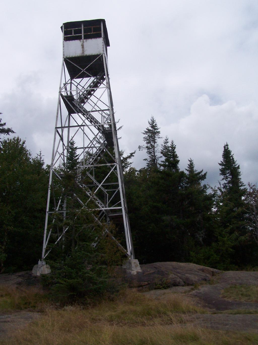
There are at least three different mountains in the Adirondacks known as Owls’ Head due to their small rounded peaks, with broad cols for shoulders. This one is the one near Long Lake, that has a 30 foot LS 45 Aermotor Firetower on top of it.

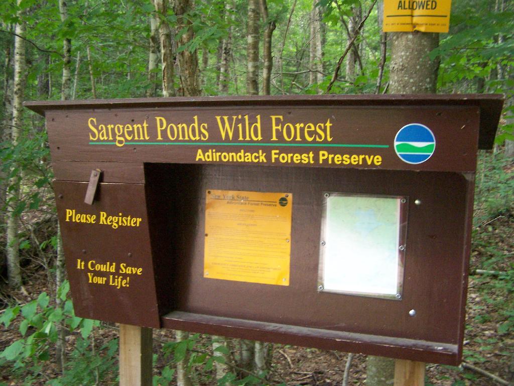
Sargent Ponds Wild Forest Kiosk. This is where you sign in, so they can have an idea on trail use, and make it easier to find you if your lost or injured.

Sargent Ponds Wild Forest Kiosk

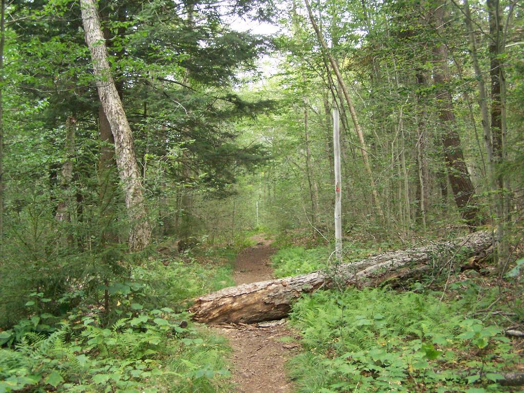
1/2 Mile In. The trail crosses this downed tree.

1/2 Mile In

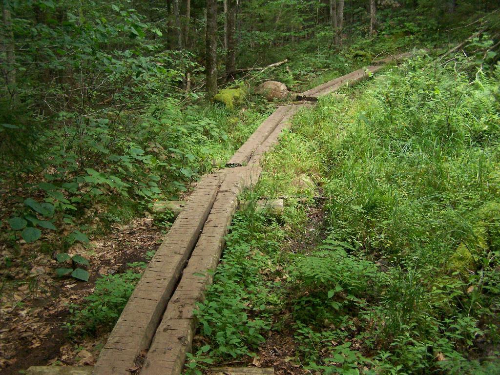
Boardwalks. Parts of the trail cross marshy areas on board walks, like these constructed on the first 3/4 mile of the trail.

Boardwalks

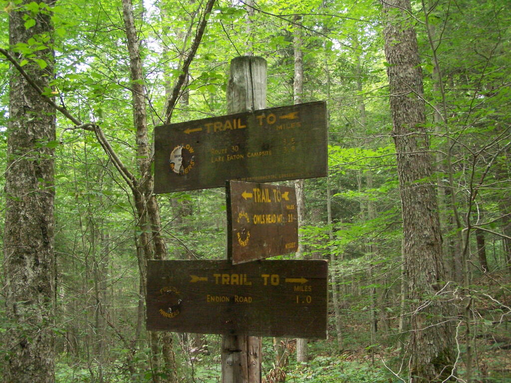
T Intersection. Make a left at one mile, to go up Owls Head. The other direction takes you to the Lake Eaton State Campground.

T Intersection

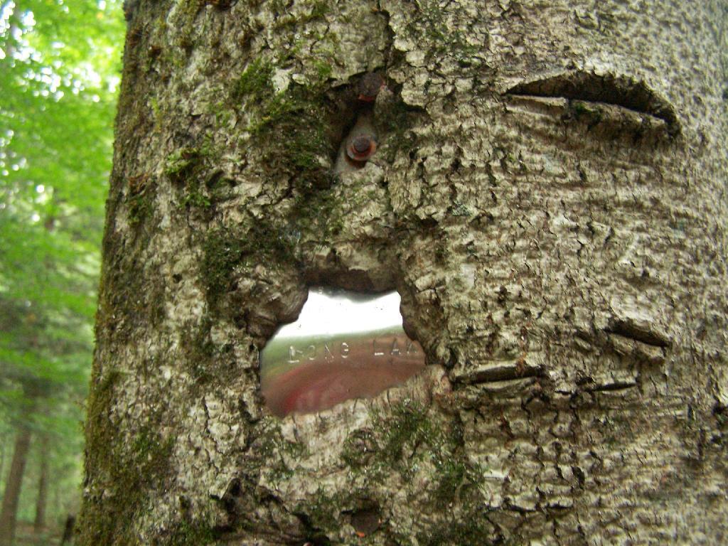
Grown Over Steel Trail Marker. It looks like in 1982, the state experimented with these imprinted steel trail markers along the trail, long since largely grown into the barks of the tree.

Grown Over Steel Trail Marker

Views as You Ascend. This is looking backwards, towards the Sargent Ponds Wilderness, Lake Eaton, and the timber lands between here and Tupper Lake.

Views as You Ascend

Observers Cabin Ruins. The cabin the fire warden lived in years ago, is not located on top of Owl’s Head, but below it on the shoulder. It’s a 1/4 mile hike to the top, and you accent about 200 more feet, up the pointly little head. The cabin was probably located here, so the warden could meet visitors, and escort them to the top.

Observers Cabin Ruins

Well Worn Trail. Part of the trail is well worn, and is on open rock face. The good news however is with the lush tree cover, you don’t have to worry about acrophobia up here.

Well Worn Trail

Reaching the Tower. You can’t see the fire tower until your almost on top of it, due to the heavy trees that surround the summit of the mountain, except for the bald portion where the tower is located, open to views to the south and east.

North Creek Falls

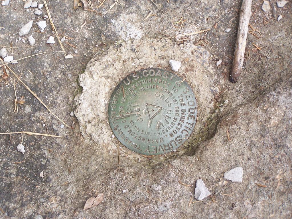
Survey Marker. It says it was placed in 1942 by USGS. It’s right below the fire tower proper.

Survey Marker

Fire Tower. The fire tower is a 30 foot LS 45 Aermotor tower, pretty typical for NY State. It’s one of the short little towers, like also seen on Rondaxe Mountain in Eagle Bay.

Fire Tower

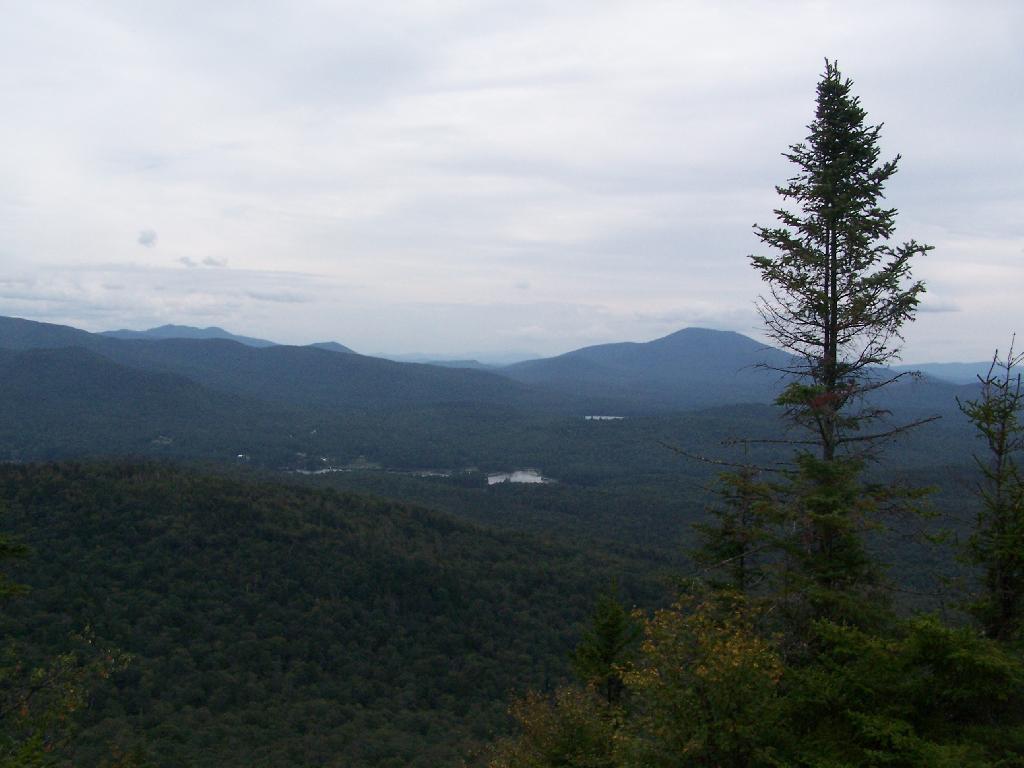
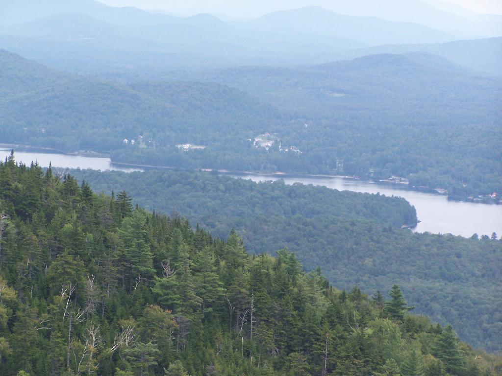
Forked Lake. This is looking south from the summit towards Forked Lake Campground and possibly Racquette Lake. The mountain in the distance is Wakely Mountain, one of the other fire towers originally used to pin-point fires in the Adirondacks (it takes two towers to locate a fire through triangulation).

Forked Lake

Long Lake. This is another picture of Long Lake, a little bit farther north, with the shoulder/col of Owls Head visible in the foreground.

Long Lake

North. In the distance is Saranac Lake and Lake Placid, with Whiteface just beyond it. Not the clearest or nicest of days, but still visable. In the foreground is the col/shoulder of Owls Head.

North

Blue Mountain. Blue Mountain is another fire tower / mountain that is visible from Owls Head. Located about 10 miles away, in the foreground are Minnow Pond and Mud Pond.

Blue Mountain

Sargent Ponds Area & Timberland. This portion north of NY 28 Corridor and Fulton Chain of Lakes is relatively flat, wild, and many portions privately owned as timberland.

Sargent Ponds Area & Timberland

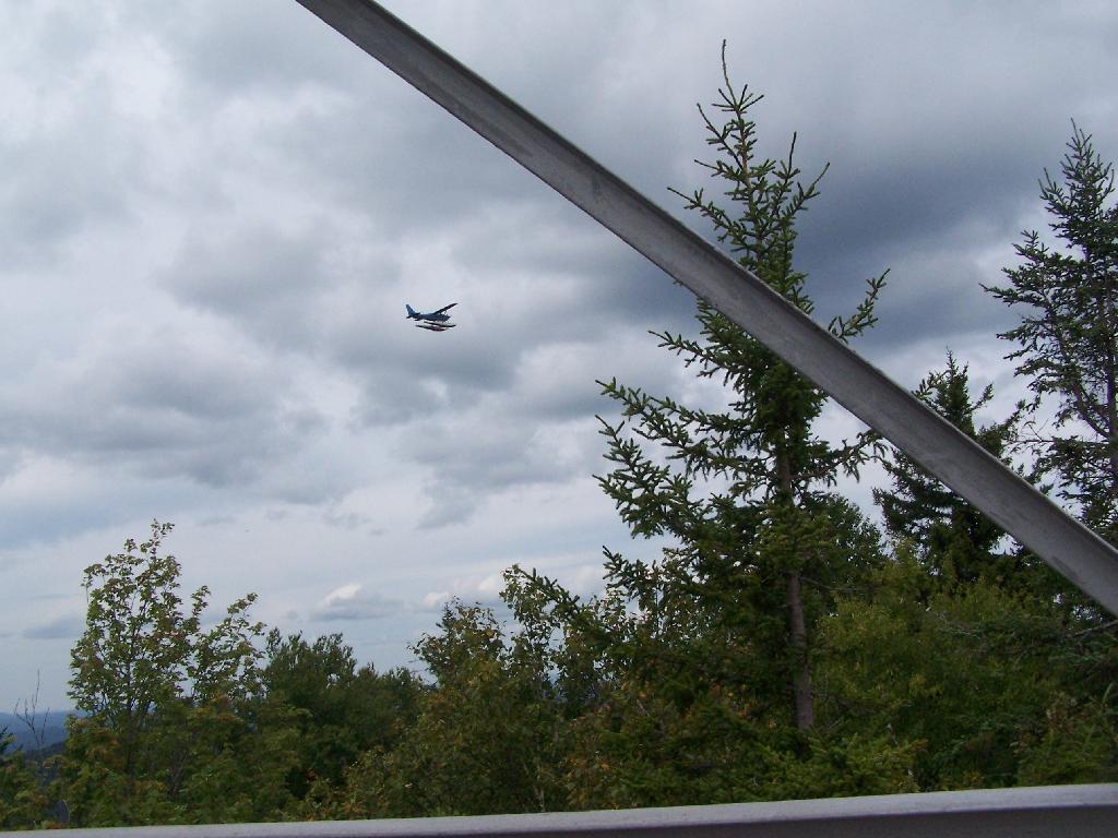
Float Plane. Owls Head is not the quietest mountain out there. Throughout the day, tourist float planes for hire, fly on and off Long Lake, just to north of mountain. They fly quiet low, as they are making the decent back to Long Lake.

Float Plane

Long Lake Village. While hazy today, you can see village of Long Lake quite well from the tower. It’s always crazy there, and I try to avoid towns whenever I’m in the Adirondacks.

Long Lake Village

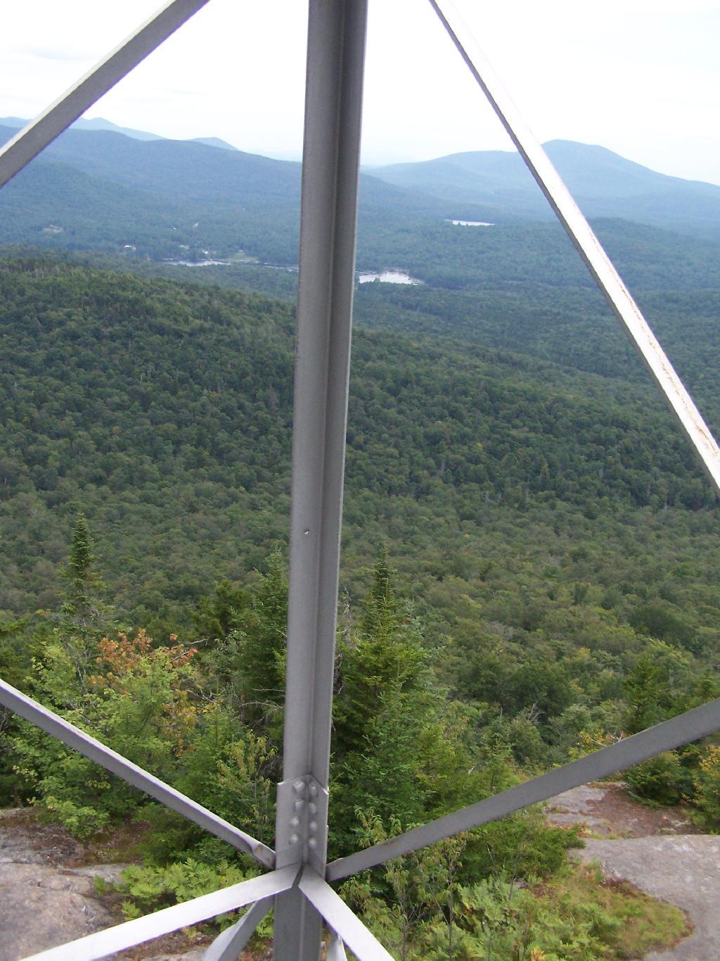
Fire Tower Corner. I always like pictures of the angles and construction of the fire tower. While common after climbing so many, fire towers have a lot of character in their structural steel.

Fire Tower Corner

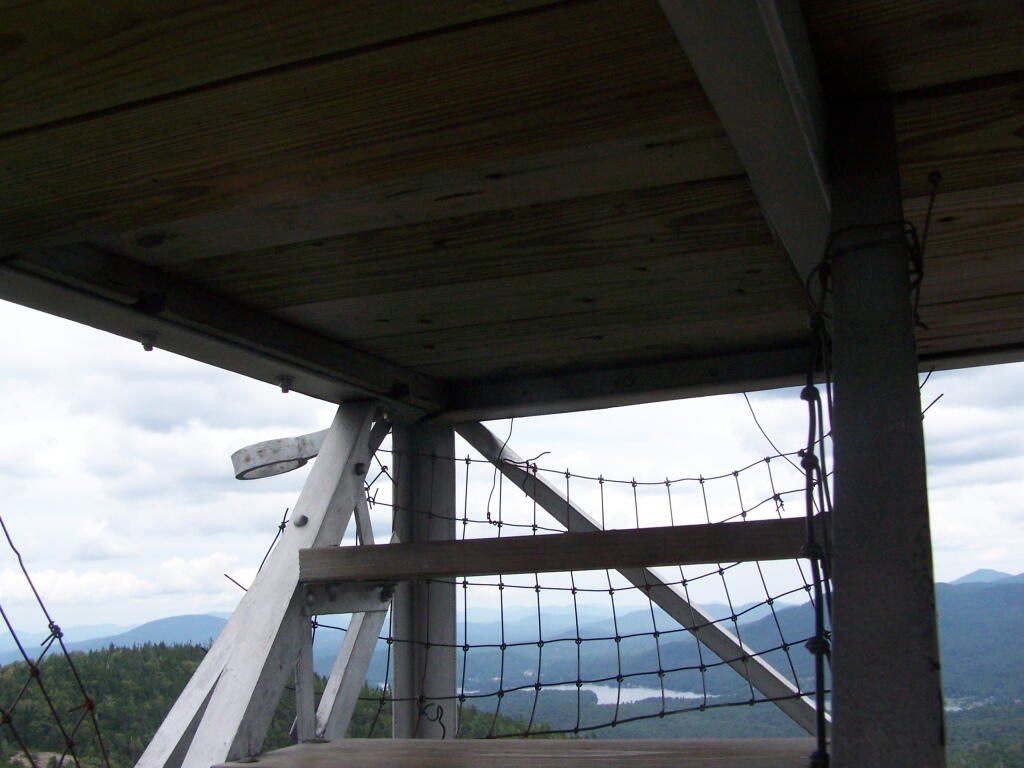
Tower Cabin Closed. It’s unfortunate but the tower’s cabin on this tower is closed, as it’s used for communications equipment.

Tower Cabin Closed

Sitting on Mountain. Just sitting back and looking south from the open rock face a top Owls Head.

Sitting on Mountain

Old Telephone Poll. Descending the trail off Owls Head, I saw several of the old telephone poles, heading up to the former Ranger’s cabin. Some have been cut down, and used to control run-off on the trail, but others still remain.

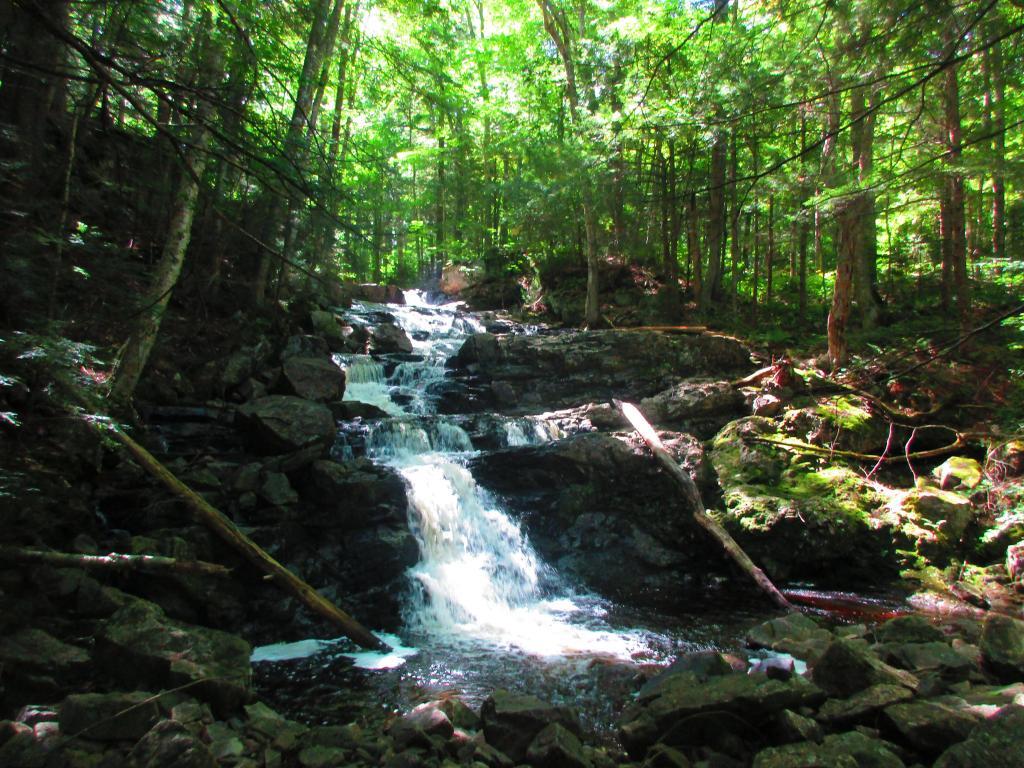
Dexter Lake

Here is a map of the hike.


View Owls Head in a larger map

Wakely Mountain Firetower

On the afternoon of Thursday July 22nd I hiked up to the Wakley Mountain Firetower. The weather wasn’t perfect, but it was still quite popular, passing several hikers and families visting this tower. The views are pretty good, but probably not as good as Pillsbury Mountain or Snowy Mountain to the south. The nice thing is it’s a 5 minute drive from Cedar River Flow and pretty close from Moose River Plans too, and provides a great overview of the Plains.

Camp Fire

You can print the above map, by clicking it, to be taken to a high resolution (500 DPI) that will print nicely on a laser or inkjet printer.

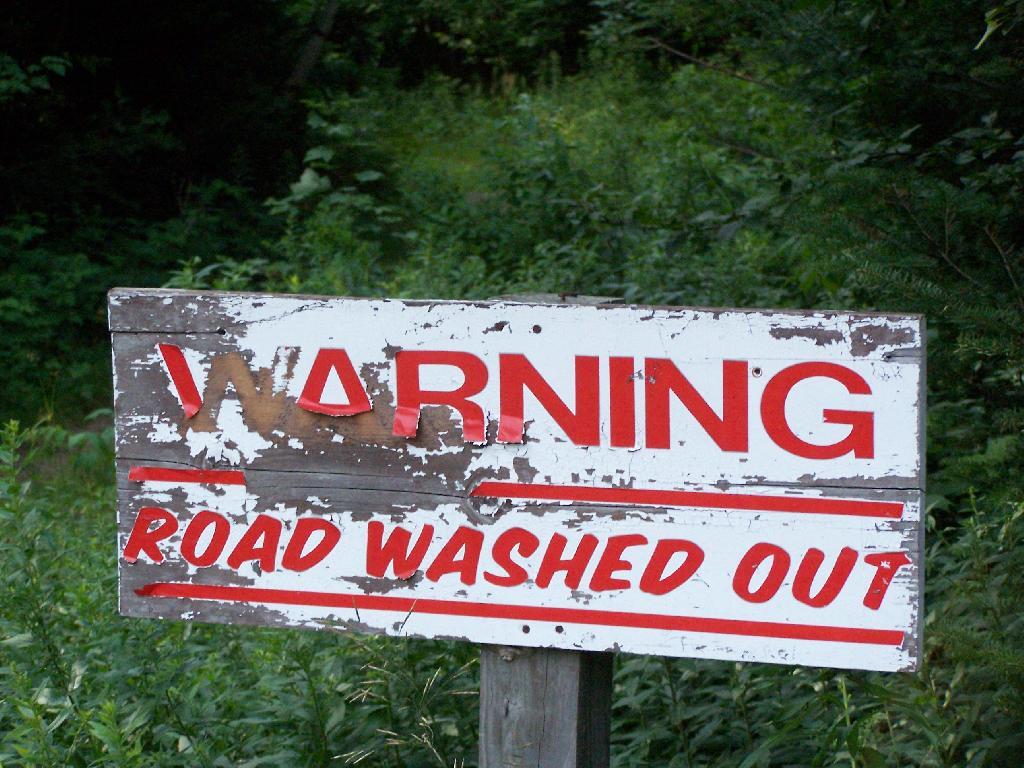
When you first start up the mountain, you pass a “Warning! Road Washed Out” sign. This sign is at the parking area for Wakely Mountain, to warn drivers that they won’t get very far on Wakely Mountain Road, since the DEC has basically abandoned it.

Warning! Road Washed Out

Washed Out Road to Wakely Mountain. I honestly don’t expect the DEC to fix this road, but instead will make people walk the entire 3 miles up the mountain, because that keeps the eco-facists happy.

Washed Out Road to Wakely Mountain

Washout on Wakely Road

The End of Wakely Road. That said, you’d be hard press to get a vehicle this far, due to the wash out at the earlier marsh.

The End of Wakely Road

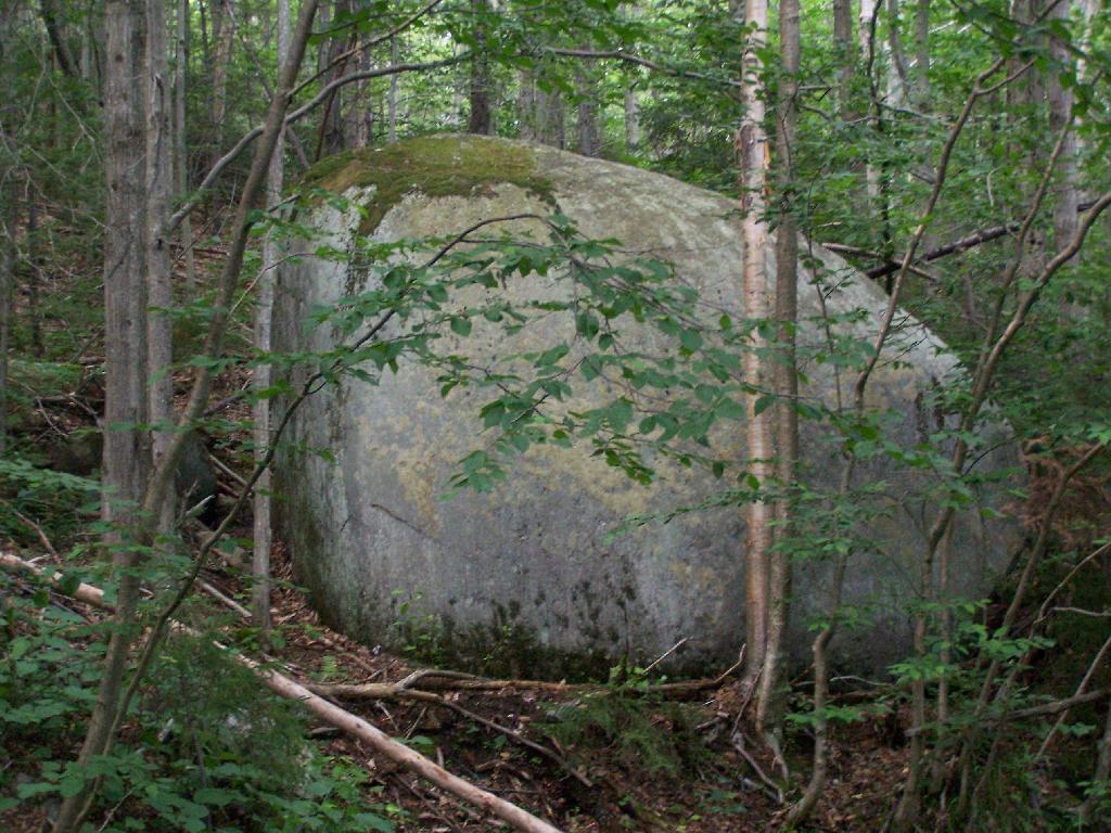
As you climb, you pass this big boulder On side of Wakely.

Big Boulder On Side of Wakely

The first two miles of the trail are pretty flat, a small incline that increases above 400 feet in elevation over two miles.

Flatter Two Miles of Wakely Trail

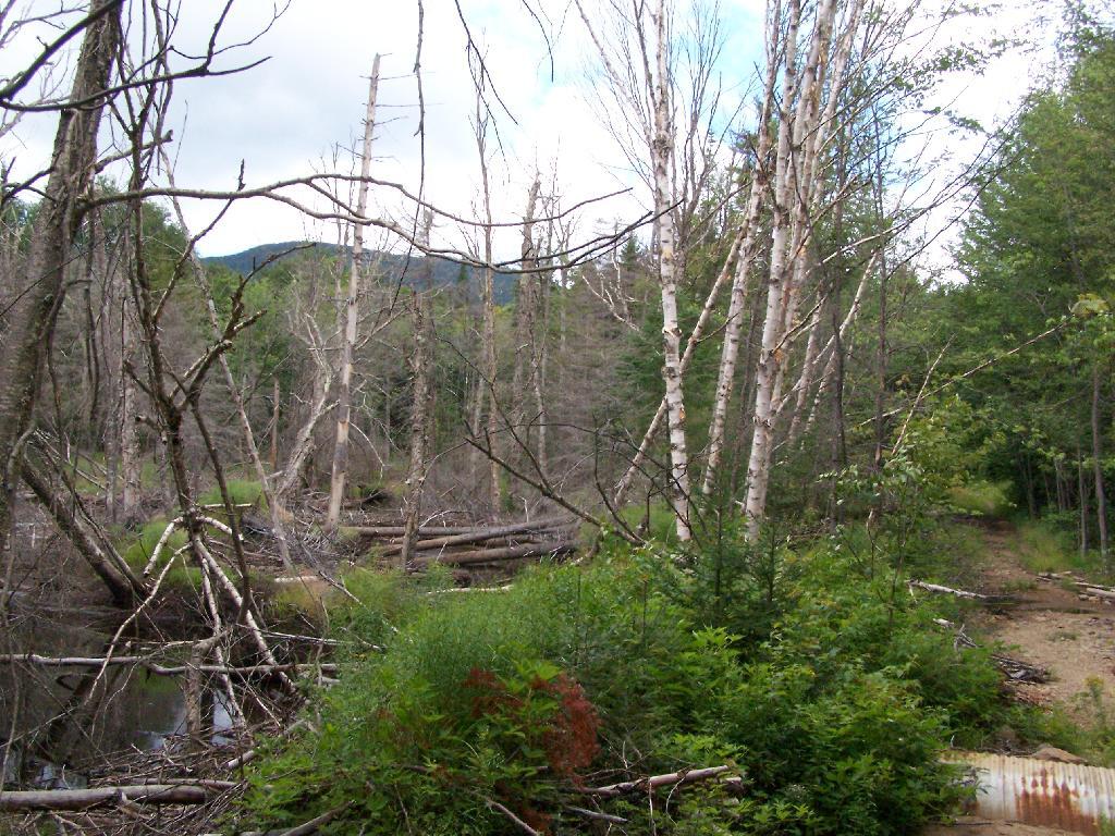
Marsh Along Wakely Mountain Trail. That’s Payne Mountain, not Wakely Mountain in the background.

Marsh Along Wakely Mountain Trail

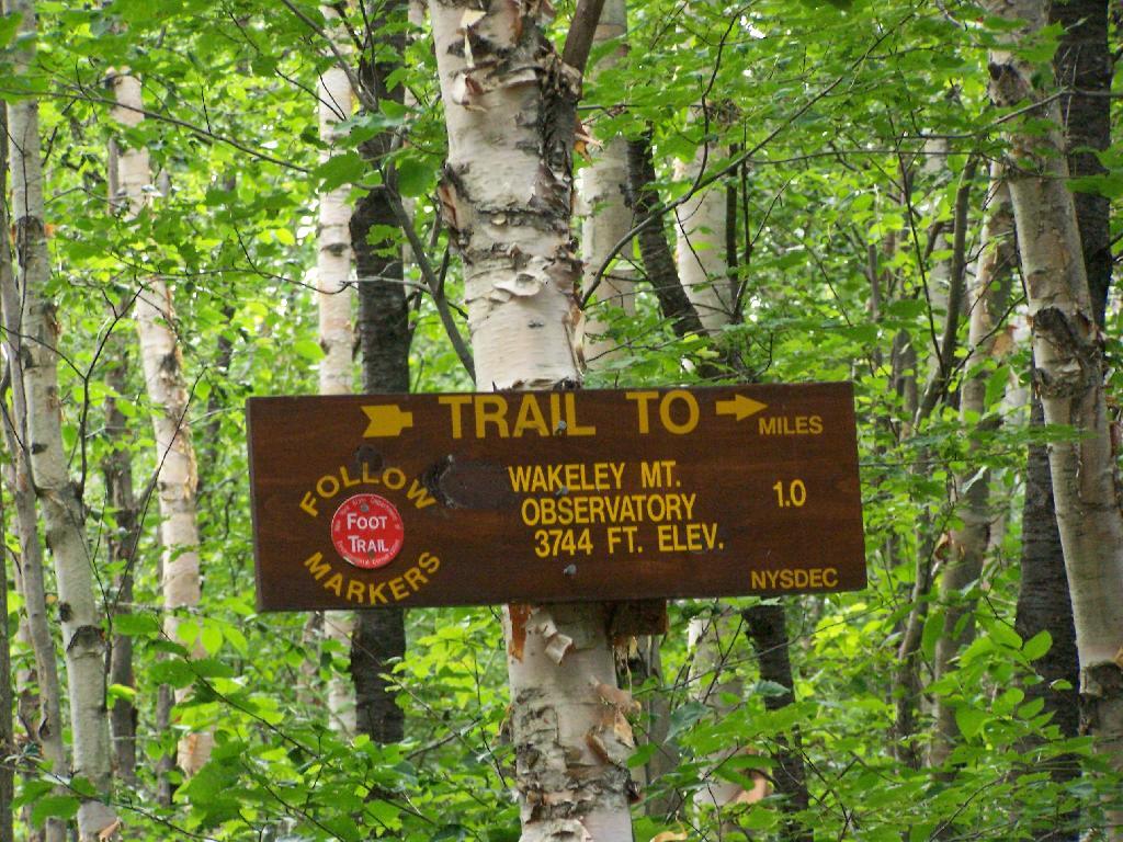
The Final Mile. You might think the previous two miles of the Wakely Mountain trail where easy, rising maybe 300 feet, until you hit the last mile, as indicated by this sign. It’s another 1200 feet on up for that last mile.

The Final Mile

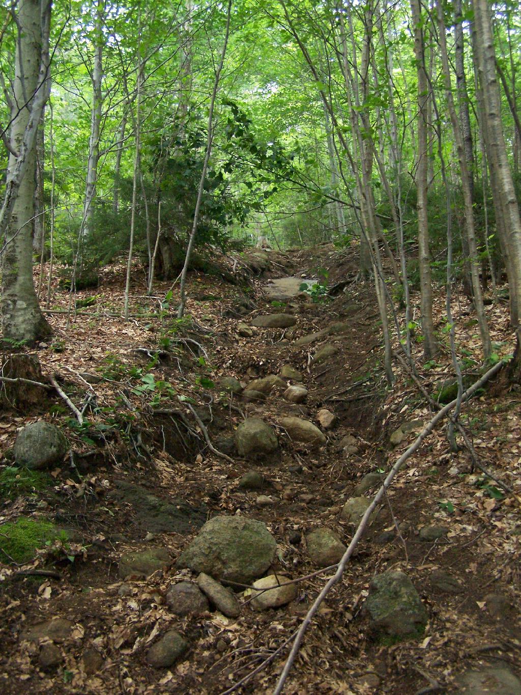
The trail up Wakely Mountain is badly eroded due to heavy use and neglect by the DEC.

Badly Eroded Wakley Mountain Trail

The last mile up Wakely Mountain is a long one, especially if you start late in the afternoon as I did. You are treated with some limited views while climbing Wakely Mountain, but all and all, there isn’t a lot to see except steep trail (but no open rock face!).

Broken Views Climbing Wakely

Once you almost reach the top of the mountain, you come to the Wakely Mountain Helipad. This is used by emergency responders, providing quick access to the top of mountain, to either access the tower for observation, or to help those injured on top of the mountain.

Next to helipad is a trash pile. I was wondering how this trash ended up top of the mountain, but after thinking about it a bit, it probably was trash from the ranger’s cabin, that was dumped here some time in the past, and was dug up in the re-construction of the helipad.

Trash Pile Next to Helipad

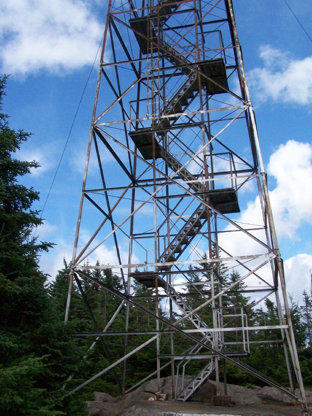
Eventually you reach the fire tower, about a 500 feet from the Helipad. The Wakely Fire Tower is an interesting Aeromotor LS 25 tower, that originally lacked a staircase, but was added in the form of an internal ladder, for the convience of hikers and the fire warden alike. Prior to the 1919 addition of the “stairs tower within the fire tower”, you had to climb a ladder on the side of the tower, to get all 60 feet to the top of the tower.

Wakely Fire Tower Stairs Inside Tower

Here is the original ladder you had to climb. They removed the lower flights to discourage people from trying to use the ladder, although the stairs themselves also lack any safety fencing, so it’s a bit scary if your not used to climbing towers.

Tower within a Tower

A close up over the tower within the tower.

Wakely Fire Tower Stairs Inside Tower

The firetower presents one with spectular views of the upper Moose River Plains, from the marshy end of Cedar River Flow to the Lost Ponds area, to around Wakely Dam and Wakely Pond.

Plains from Firetower

To the east is the Blue Ridge Wilderness and Blue Mountain.

Blue Ridge and Blue Mountain

Looking down towards Indian Lake from the Fire Tower. There are many beautiful peaks to the south east.

Towards Indian Lake

You can also see the High Peaks from Wakley Mountain.

High Peaks from Wakley Mountain

And the Fulton Chain of Lakes.

Fulton Chain of Lakes

Cellar Mountain somewhat blocks the views to the west, as you look down to the plains, towards the ridges that follow along the NY 28 Corridor.

Cellar Mountain

The tower’s foundation sadly is in bad shape and needs work. The cabin of the tower is also only accessible via ladder, if your crazy enough to do that. It lacks safety fences on the various landings. Hopefully the state will find the funds and resources to restore this beautiful and popular tower, even though it’s likely to be expensive due to the need to use to Helicopter in supplies and possibly ironworkers to restore it.

Cracked Firetower Foundation

A Google Map of the hike…


View Wakely Mountain Firetower in a larger map