Search Results for: map mud pond 3

Crane Pond Road in My Pickup

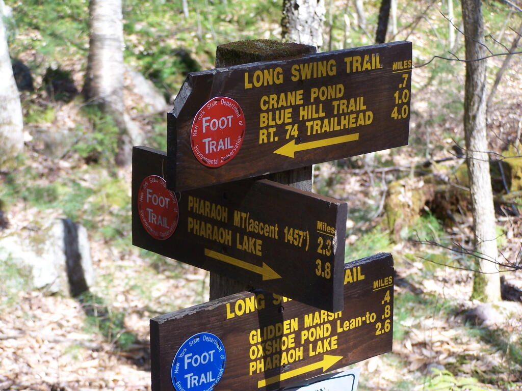
Crane Pond Road is a 2 mile historical truck trail in the Pharaoh Lake bureaucratically-defined “Wilderness”. This truck trail provides access Alder Pond and Crane Pond, along with access to hiking trails to Goose Pond, Glidden Marsh, Oxshoe Pond, Crab Pond, and Pharaoh Mountain.

In the Wilderness?

This truck trail is popular and is frequently used hunters, fishermen, backpackers, and hikers visiting the vast lands of Pharoah Lake “Wilderness”. The wilderness distinction, is rather dubious as these lands are not historical wilderness but only designated as such on paper by the Department of Environmental Conservation and the Adirondack Porn Agency. There is few old growth forests or undeveloped land remaining in our state, and the wilderness designation is frequently abused by environmental extremists.

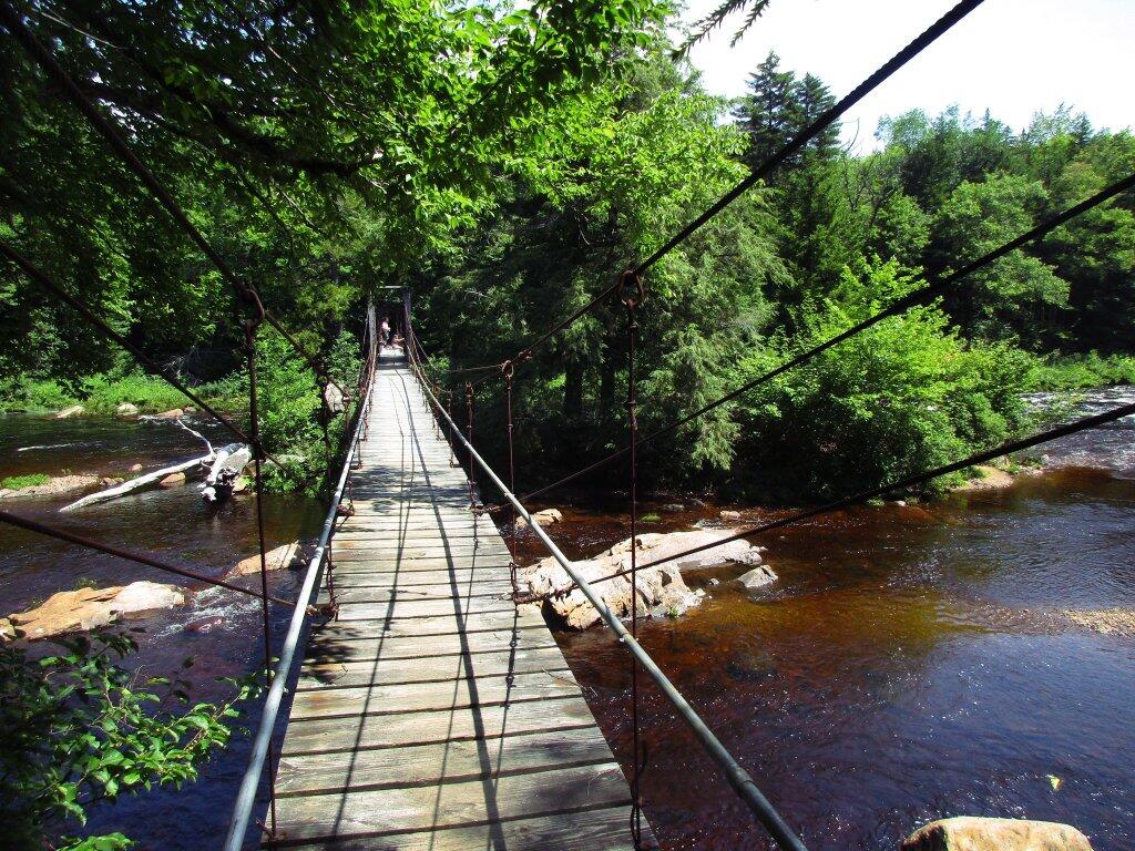
The entire Pharaoh Lake “Wilderness” is traversed by old logging roads, has old foundations, and other ruins of a once privately owned, farmed or logged land. Many of the hiking trails follow old logging roads. The state has developed foot bridges, hiking trails, and many lean-tos throughout the property, so man made structures are not uncommon to find in this so-called “Wilderness”.

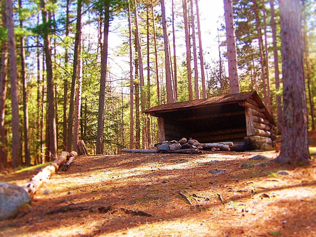
Oxbow Pond LeanTo

A Rough Truck Trail.

The entire Crane Pond Road is a rough truck trail. It’s has gotten minimal maintenance by the state of New York, ever since those with an certain extremist ideological agenda attempted to get this truck trail closed off.

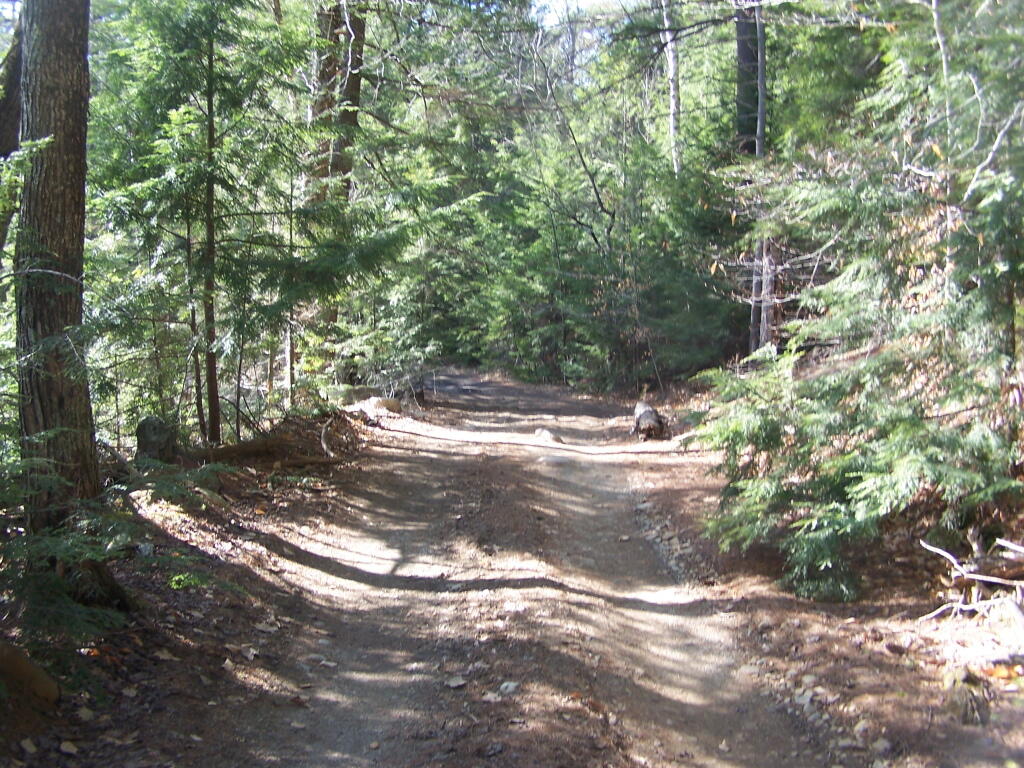
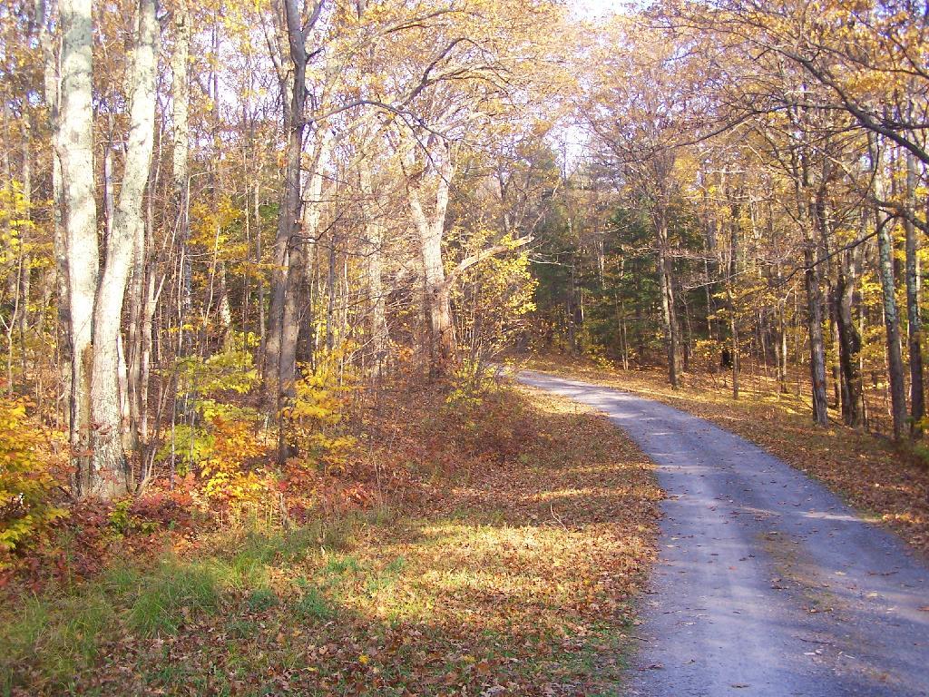
 Relatively Smooth Section of Crane Pond Road

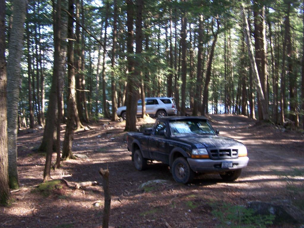
Some portions of the truck trail are deeply rutted, and at least this time of year, very muddy. A few places are washed out, and you have to travel past washed outs, or carefully climb over them. I bottomed out my Ford Ranger a couple of times and could feel the front-drive train pulling the back wheels along as they started to slip.

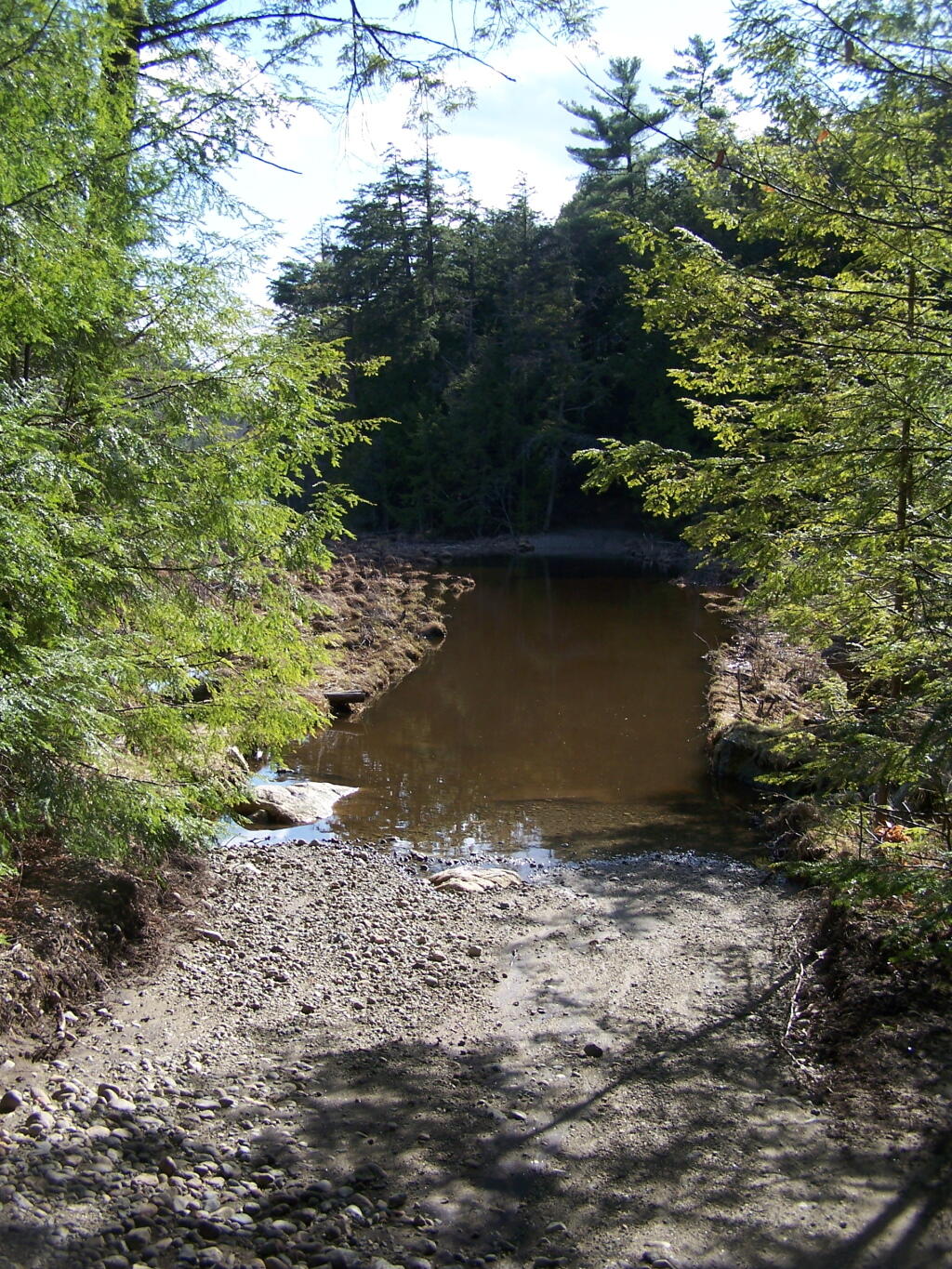
 Where Crane Pond Road Crosses Alder Pond

Towards the end of the truck trail, the truck trail actually crosses an inlet to Alder Pond. I didn’t try driving through this section during the high water of spring, but apparently at least one person with an old Chevy K1500 4×4 made it to the end without problems.

Lazy spring days

I drove to the pull-off right before the spot where the truck trail crosses Alder Pond. In low water, I wouldn’t mind driving through the inlet to the parking area at the end of Crane Mountain Road, but I wasn’t going to get my pickup stuck or flooded.

 My Truck Parked at Alder Pond

A Good Thing to Still Be Open.

All and all, I am happy that citizens fought to keep this existing truck trail open, against an extremist ideological agenda of some environmentalists. It shortens the hike up Pharaoh Mountain by 4 miles, and provides easy access to many important areas.

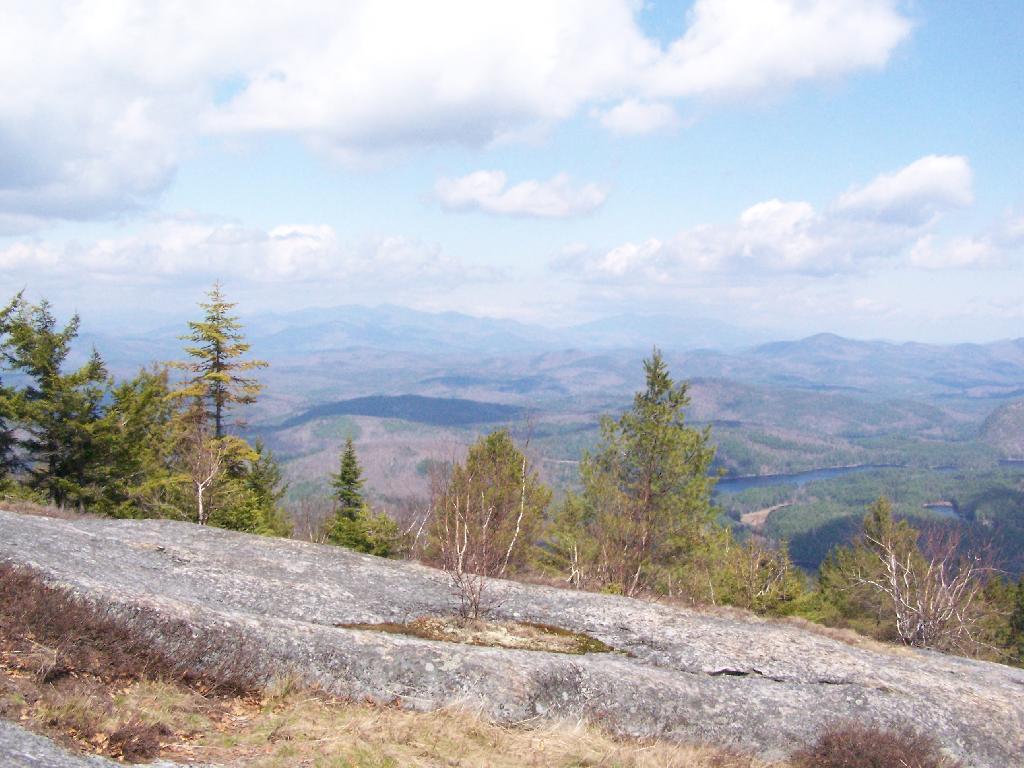
 Granite Rock Face

This would have been different issue if was proposed by the NYS DEC to build a new road through the Pharoah Lake “Wilderness”. If the DEC had shown up with bulldozers, and chainsaws, to cut a new road one could have made an argument against building a new road.

 Intersection

Yet, Paraoh Lake “Wilderness” is not that — it’s a land that has long been minimally developed with forest access roads, trails, lean-tos, with Crane Pond Road long being minimally maintained to provide access to this important public land. It’s not a Strip Mall or Housing division, and most of the area is very wild, even if it’s somewhat developed to provide for the public access and enjoyment.

New York State Should Maintain &
Keep Crane Pond Road
OPEN to Public Motor Vehicles !

Below is a list of lean-tos, campsites, parking areas, and other assets along the Northville – Placid Trail πŸ•οΈ

Link to anΒ  Interactive Map of the Northville Placid Trail.

Type Name Description Coordinates
Hand Launch Ceder River Flow Boat Ramp Hand Carry Launch, Ramp 43.725826369700904, -74.47289916126694
Lean-To Beaver Pond (Aka Cedar Lakes Lean-To #2) Β  43.625969396804386, -74.54927150370021
Lean-To Carry Lean-To Β  43.67874488347091, -74.49549821879448
Lean-To Catlin Bay #1 Lean-To Β  43.99801269269887, -74.39278456108421
Lean-To Cedar Lakes #1 Lean-To Β  43.628125665037935, -74.54047323992656
Lean-To Cold River #2 Lean-To Β  44.14251664317184, -74.13035824291548
Lean-To Cold River #3 Lean-To Β  44.091459278051204, -74.25764175084498
Lean-To Cold River #4 Lean-To Β  44.09139025333258, -74.25573480252505
Lean-To Cold River Lean-To #1 Lean-To Β  44.14272737628489, -74.12984021065587
Lean-To Duck Hole #1 Lean-To Β  44.14162687400988, -74.10693734676616
Lean-To Duck Hole #2 Lean-To Β  44.14167686466829, -74.10654354672256
Lean-To Hamilton Lake Stream #1 Lean-To Β  43.39741359517532, -74.45529759002217
Lean-To Hidden Cove Lean-To Β  44.00265528819394, -74.38648026325164
Lean-To Kelly Point #1 Lean-To Β  44.02880023617087, -74.36730798599064
Lean-To Kelly Point #2 Lean-To Β  44.02870256717196, -74.36713034867948
Lean-To Moose Pond Lean-To Β  44.182843382402666, -74.07364102375995
Lean-To Mud Lake Lean-To Β  43.342671073157994, -74.45629078563864
Lean-To O’neill Flow Lean-To Β  43.875596840936154, -74.36642623697053
Lean-To Ouluska Pass Brook Lean-To Β  44.120221281603584, -74.18744717390932
Lean-To Plumley Point #2 Lean-To Β  44.06559891610762, -74.32761224546002
Lean-To Rodney Point #1 Lean-To Β  44.04140938489936, -74.35014909639557
Lean-To Rodney Point #2 Lean-To Β  44.042976745412616, -74.34933464753136
Lean-To Seward Lean-To Β  44.106244137686204, -74.2091536427719
Lean-To Silver Lake Lean-To Β  43.29193545679836, -74.4237351676776
Lean-To South Lake Lean-To Β  43.58724480971, -74.62157883837274
Lean-To Spruce Lake #1 Lean-To Β  43.52728411257782, -74.6099246975027
Lean-To Spruce Lake #2 Lean-To Β  43.53463062983387, -74.60808580306896
Lean-To Spruce Lake #3 Lean-To Β  43.53712972792447, -74.60820962802477
Lean-To Stephens Pond Lean-To Β  43.818673668554965, -74.42052487172707
Lean-To Tirrel Pond North Lean-To Β  43.887344477557306, -74.37880062606054
Lean-To West Canada Creek Lean-To Β  43.58698761405157, -74.61399797100106
Lean-To West Lake #1 Lean-To Β  43.59316222884976, -74.62688668431306
Lean-To West Stony Creek Lean-To Β  43.22474428954461, -74.26933345717664
Paved Parking Lot Lake Durant Northville Placid Trail Parking Lot Paved, 12 Vehicle Capacity 43.84219550506574, -74.3862742856788
Paved Parking Lot Northville Lake Placid Trail Parking Lot Paved, Good Condition 43.84213270187873, -74.38656792328511
Primitive Tent Site Canary Pond Campsite Β  43.30513256312245, -74.4472062440692
Primitive Tent Site Cedar Lake Dam 1 Β  43.62894580965635, -74.53639939387939
Primitive Tent Site Cedar Lake Dam Tentsite Β  43.62937624507422, -74.53679785644344
Primitive Tent Site Cedar River Flow Tentsite Β  43.70292480315104, -74.48713041165333
Primitive Tent Site Fall Stream Tentsites Β  43.49661052800474, -74.53713112743992
Primitive Tent Site Jessup River Tentsites Β  43.51246207852797, -74.57229710138834
Primitive Tent Site Kelly Point Tentsites Β  44.02910364406153, -74.36670207204214
Primitive Tent Site Moose Pond Tentsites Β  44.18274441156179, -74.07408240028583
Primitive Tent Site Moose River Plains Campsite 01 Live 43.72667672123972, -74.47410026642402
Primitive Tent Site Moose River Plains Campsite 02 Live 43.72665150100841, -74.47331107300782
Primitive Tent Site Moose River Plains Campsite 03 Live 43.725959512295866, -74.47389996564202
Primitive Tent Site Moose River Plains Campsite 04 Live 43.726067692208126, -74.47423264719026
Primitive Tent Site Moose River Plains Campsite 05 Live 43.725563790898704, -74.47417512282912
Primitive Tent Site Moose River Plains Campsite 06 Live 43.72522313374867, -74.47458303719159
Primitive Tent Site Mud Lake Tentsites Β  43.59647433847274, -74.61354076182431
Primitive Tent Site O’neill Flow Tentsite Β  43.87567135918534, -74.3666467203306
Primitive Tent Site Rock Lake Campsite Β  43.265591839994535, -74.41543516012669
Primitive Tent Site Salmon River Tentsites Β  43.907925071619914, -74.38530801916977
Primitive Tent Site Shattuck Clearing Tentsites Β  44.08679657756681, -74.26368397541134
Primitive Tent Site Silver Lake Tent Site Β  43.29112770008321, -74.4240469986026
Primitive Tent Site Spruce Lake Tentsite Β  43.53695545329776, -74.60818912022354
Primitive Tent Site Tirrell Pond North Tentsites Β  43.88594343639596, -74.37834897628142
Primitive Tent Site Trailside Campsite Β  43.2716741112023, -74.43107546264162
Primitive Tent Site Wanika Falls Tentsites Β  44.19944690357389, -74.05663862305364
Primitive Tent Site West Lake Former Caretaker Clearing Tentsites Β  43.59389874347195, -74.62560220247346
Primitive Tent Site Whitehouse Campsite Β  43.373430193527696, -74.43578942968477
Primitive Tent Site Whitehouse Campsite Β  43.37406302094423, -74.43516794694158
Primitive Tent Site Woods Lake Campsite #2 Fire Pit, Water Front Campsite 43.25071034607129, -74.31177480398298
Primitive Tent Site Woods Lake Campsite #3 Fire Ring, Water Front Tentsite, Scenic View 43.250888826581715, -74.31104030228295
Primitive Tent Site Woods Lake Campsite #4 Fire Place, Water Front Campsite, Nice View 43.251811433787196, -74.3092782205918
Unpaved Parking Lot Benson Road Parking Area 8 Vehicle Capacity 43.24745928673895, -74.31187044250609
Unpaved Parking Lot Chubb River Bridge Β  44.2628824981147, -74.01364844250504
Unpaved Parking Lot Moose River Recrieation Area Northville-Placid And Cedar River Trails 43.726457025366315, -74.47386984656715
Unpaved Parking Lot Norhtville Placid Parking-Haskells Rd Β  43.45841038153893, -74.52201705350714
Unpaved Parking Lot Northville Placid Trail Parking Area 6 Car Interior Parking Area 43.21330828950083, -74.2083824784703
Unpaved Parking Lot Northville Placid Trail Route 28n Parking Lot Β  43.97584466308438, -74.39296138679799
Unpaved Parking Lot Tarbell Road Shoulder Parking Lot Β  43.984346733793245, -74.39813014848872
Unpaved Parking Lot Wakely Dam Β  43.72640808237045, -74.47425964611213
Unpaved Parking Lot Wakely Mountain Trailhead Parking Lot 1250 Sq Feet 43.732197733217824, -74.47253968128065
Unpaved Parking Lot Wakely Pond Accessible Fishing Dock Β  43.737643556916666, -74.46542853470272
Unpaved Parking Lot Wakely Pond Accessible Launch Β  43.738042554833534, -74.46399313053813

 Whitehouse Suspension Bridge

After a cloudy start the sun is out β›… πŸ‘‰ β˜€

Starting to finally get nice out this morning. Going to be a beautiful day.

Good morning! Happy Sunday from Vacationland 2023. Partly sunny and 60 degrees at the Finger Lakes National Forest. There is a north-northwest breeze at 8 mph. πŸƒ. The dew point is 57 degrees. Much cooler than before the front came through.

Woke up pretty early this morning, thinking that it would be a nice morning πŸŒ… and I could get up, use the bucket shitter 🚽 and they have coffee β˜•. I even thought πŸ’­ about taking a ride over to Searsburg Road and watching the sun rise. They promised it would be a beautiful day, and it probably will be but it didn’t clear out by nine o’clock last night as promised by the weathermen. ☁️ I looked to the sky this morning and all I saw was clouds. Maybe I should have pooped πŸ’© and gone back to bed but instead it was apple banana pancakes πŸ₯ž using the remainder of the pancake mix I bought last winter mixed with whole oatmeal, fried apples and mashed bananas. Through
In chia seeds 🌱 for an extra health punch πŸ‘Š.

Going forward I won’t buy any more pancake mix but instead use that whole grain oatmeal with water and bananas. πŸ₯ž I like the hardy more fiber rich oatmeal over the bleached flour, sugar and chemicals of Aunt Jamina’s pancake mix. Less garbage and cost too by using just simple oatmeal and bananas. Really don’t need to waste money πŸ’΅ on packaging to burn. Likewise I’m using real silverware and dishes now while camping as paper plates, and plastic silverware have gotten so expensive with inflation plus who wants to burn all that toxic plastic trash? πŸ—‘

Today will be sunny 🌞, with a high of 71 degrees at 3pm. 13 degrees below normal, which is similar to a typical day around September 24th. Maximum dew point of 57 at 8am. Northwest wind around 9 mph. A year ago, we had cloudy skies. The high last year was 82 degrees. The record high of 100 was set in 1933. Cool but getting sunny for sure.

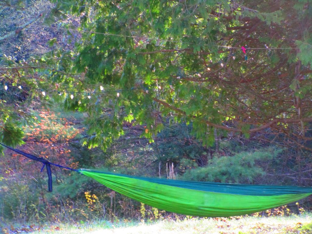
Today I have a busy agenda planned. πŸ“œ But it’s going to be a great one. I plan to get a fairly early start, bike most of the Cayuta Valley Rail Trail. 🚲 Then swim at the Watkins Glen Pool, get ice cream at Glen Dairy Bar 🍦, ride along Rock Cabin Road, watch the sunset πŸŒ‡ on Seneca Lake. Then back to camp for some hammock time before bed. Greased my chain πŸ”— up well on my bike this morning, cleaned off the mud, and set up the GoPro mount on my bike πŸ“Έ so I can do some video today riding for the blog and YouTube and other social media. πŸ“Ή

Despite a fairly soggy day yesterday, 🌧️ I’ve been feeling great without the alcohol and calories 🀰 of years past, choosing healthier nutrient dense meals 🍴 and whole fruits and vegetables πŸ«‘up here at camp. β›Ί A healthy diet I believe really does improve ones mental health. ☺ While I’m not one to blame the chemicals in processed foods – most of them are relative safe, πŸ§ͺβš—οΈ most of them mask crap ingredients that are rich in low quality fats and sugars while providing not much vitamins, fiber or protein. Plus being skinner I feel great though I certainly have been stuffing myself this weekend πŸ‘ but with higher quality whole foods.

Solar noon 🌞 is at 1:14 pm with sun having an altitude of 66Β° from the due south horizon (-4.7Β° vs. 6/21). A six foot person will cast a 2.7 foot shadow today compared to 2.2 feet on the first day of summer. The golden hour πŸ… starts at 7:51 pm with the sun in the west-northwest (290Β°). πŸ“Έ The sunset is in the west-northwest (297Β°) with the sun dropping below the horizon at 8:31 pm after setting for 3 minutes and 14 seconds with dusk around 9:02 pm, which is one minute and 5 seconds earlier than yesterday. πŸŒ‡ At dusk you’ll see the Full 🌝 Moon in the southeast (146Β°) at an altitude of 11Β° from the horizon, 228,672 miles away. πŸš€ The best time to look at the stars is after 9:43 pm. At sunset, look for mostly clear skies πŸŒ„ and temperatures around 64 degrees. The dew point will be 53 degrees. There will be a northwest breeze at 5 mph. Today will have 14 hours and 35 minutes of daytime, a decrease of 2 minutes and 6 seconds over yesterday.

Yesterday became a wet day, though later then expected. Rochester got the rain early, we got it later in the Finger Lakes. 🌧️ Breakfast was eggs with tomatoes, onions and peppers with a side of old breakfast sausage I bought last winter. Rode Blackie 🚡 to the top of Hector Backbone though I admit I dismounted and pushed the bicycle part of the way. I had lower gears βš™ to drop it down to but I wasn’t feeling motivated. At the top by Blueberry Hill Campground 🫐 it started to rain – it was already one o’clock before that happened. More of a passing shower, waited waited it out under a tree. 🌳 Rode around the campground, the fee is now up to $15 a night though I can’t imagine camping so packed in with others. I like my fires πŸ”₯ and music 🎢, I would be a nuisance if I had to camp around others. 🀫

Tried to get good cell service up there πŸ“Ά without much luck. A few bars but it was slow, possibly due to the weather. β›ˆ Rode down the backbone to Potomac Road, much more fun going down then over to Potomac Ponds which I started back, started slinging mud 🐽 and decided to turn back when the trail got too muddy. I rode down old Chicken Co-op Road as my GPS calls it πŸ—Ί and the sky just opened up. β›ˆοΈ I wanted to see my favorite old campsite and see how the mud wallow was holding up after all the stone I dumped in it last year. Still quite muddy. Glad I got the site I like on Potomac instead. I headed back to camp, I didn’t mind being soaked as it was still quite warm. πŸ§… Fried up another delicious πŸ˜‹ Vadella onion on the griddle – sliced it into rings, put it on a cast iron skillet and added a little MSG to really make it pop. Dessert was red kidney beans with some maple syrup 🍁 and a beer 🍻. Had two beers yesterday between lunch and dinner which is my limit though the first day I had one and maybe none today.

As the front came through the rain picked up and the temperature dropped. 🌑️ I read for a while πŸ“– and listened to a podcast πŸ“» from Focus on Albany with Cynthia Pooler interviewing Leon Van Dyke. Interesting history about how the Democratic 🐴 machine worked and the $5 votes πŸ—³ and the fear people had about ever speaking up about the machine. Found out John Wolcott is returning home Monday for hospice care, πŸ§‘β€βš•οΈ but he’s still pretty much in his final hours, hope to visit him at least one more time when I get back from vacation. Had some great interviews with John Wolcott and Leon Van Dyke over the years though I wish we had started years earlier 🎀 before John lost much of his memory and became so frail after getting bit by a tick and collapsing one day in his bathtub πŸ›. Tick born illnesses are no joke. 🐜

After a while with the wind and the rain β˜” I started to get chilled through at camp and decided I needed to take off my wet clothes. πŸ‘š I got jeans and a hoodie on, bedded down in my truck with the remainder of the Boggleheads investing book πŸ“™ which I finally finished off before putting on a different podcast about the history of Mad Magazine before nodding off. 🀑 Got some shut eye πŸ‘οΈ for a few hours before dinner time.

Dinner was more salmon 🐠 with delicious pearl onions, mini red potato πŸ₯” , sweet corn and fried slices of tomato πŸ… – the second half of the big juicy one I got at the farm stand. I still have a full tomato left, it’s like heaven. Eating good. Rode up to Searsburg Road 🚲 hoping to catch the sunset but it was still gray last night but I do have good reception πŸ“Ά there. Maybe tonight though I think I’ll watch the sunset tonight from Seneca Lake πŸŒ‡. Decided I wanted to get some more miles in before bed πŸ› after a fairly lazy day 😴 so around dusk started over to Foster Pond on the bicycle but turned back as drizzle started. πŸ”™ Had a small campfire πŸ”₯ at warm myself and retired to bed around ten πŸ”Ÿ. Early by vacation standards when it’s not really dark out until around nine.

Tonight will have increasing clouds ☁, with a low of 56 degrees at 5am. Six degrees below normal, which is similar to a typical night around September 6th. Maximum dew point of 54 at 6pm. Northwest wind around 6 mph becoming southwest in the evening. In 2022, we had mostly clear skies in the evening, which became partly cloudy by the early hours of the morning. It got down to 60 degrees. The record low of 49 occurred back in 2021.

One month πŸ“… from now will the Average High Falls To 79 ️Degrees ⛱️️️ when the sun will be setting at 7:47 pm with dusk at 8:14 pm. As they say, all good things must come to an end, autumn leaves must fall. But first, summer vacation! πŸ–

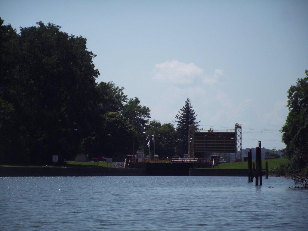
Mud Lock In Cayuga Lake

Empire Trail, Erie Canalway, Champlain Valley Trail Parking Areas

Name Address Latitude Longitude
Mohawk Hudson Bike Hike Trail (Albany to Peebles Island State Park) – 10.8 miles
Riverfront Garage 2 Columbia St, Albany, NY 12207 42.65149 -73.74890
Corning Preserve Parking Area Quay St, Albany, NY 12207 42.65346 -73.74496
Corning Preserve Boat Launch Parking Water St, Albany, NY 12207 42.65612 -73.74286
Mohawk Hudson Bike Hike Trail 330 Broadway, Watervliet, NY 12189 42.70950 -73.70495
Peebles Island State Park 1 Delaware Ave North, Cohoes, NY 12047 42.78469 -73.68042
Waterford Parking Lot Front St, Waterford, NY 12188 42.78592 -73.67788
Hudson Shores Park 23rd Street, Watervliet, NY 12189 42.73216 -73.69710
Green Island Trail Parking 260 Cannon St, Green Island, NY 12183 42.75824 -73.68804
Champlain Canalway Trail (Peebles Island State Park to Halfmoon) – 5.6 miles
Waterford Harbor Visitor Center 1 Tugboat Alley, Waterford, NY 12188 42.78741 -73.67902
Park at the Point 61 South St, Waterford, NY 12188 42.78823 -73.68159
Town of Halfmoon Trailhead Parking Brookwood Rd, Waterford, NY 12188 42.83700 -73.67586
Town of Halfmoon Trailhead Upper Newtown Rd, Mechanicville, NY 12118 42.86098 -73.68230
Lighthouse Park Halfmoon 597 Hudson River Rd, Waterford, NY 12188 42.83821 -73.67215
CCT Parking Schoolhouse Ln @ Bells Ln, Waterford, NY 12188 42.81920 -73.67628
On-Road Section (Halfmoon to Schuylerville) – 18.7 miles
Zim Smith East Trailhead 1044 Elizabeth St Exd, Mechanicville, NY 12118 42.90909 -73.70276
Champlain Canalway Trail (Schuylerville to Fort Miller) – 6.7 miles
Old Schuylerville Junction Lock County Rt 42, Schuylerville, NY 12871 43.11263 -73.57849
Hudson Crossing Park Co Rd 42, Schuylerville, NY 12871 43.11456 -73.57742
Schuylerville Visitor Center 30 Ferry St, Schuylerville, NY 12871 43.10001 -73.57954
Fort Hardy Park Reds Rd, Schuylerville, NY 12871 43.10025 -73.57857
Champlain Canalway Trail (Fort Edward to Fort Ann) – 11.9 miles
Fort Edward Adult Exercise Park 39 Mc Intyre St, Fort Edward, NY 12828 43.27362 -73.57990
Feeder Canal Trail Parking Towpath Ln, Fort Edward, NY 12828 43.28390 -73.56889
Champlain Canalway Trail Parking Baldwin Corners Rd, Fort Ann, NY 12827 43.39027 -73.48666
Champlain Canal Lock C-9 2450 NY-149, Fort Ann, NY 12827 43.35247 -73.49676
Champlain Canalway Trail New Swamp Rd, Hudson Falls, NY 12839 43.33236 -73.51177
Feeder Canal Trail Parking 2425 Burgoyne Ave, Hudson Falls, NY 12839 43.29780 -73.56977
Champlain Canalway Trail (Fort Ann to Comstock) – 5.1 miles
Fort Ann Canal Park Ann St, Fort Ann, NY 12827 43.41416 -73.48546
Champlain On-Road Bicycle Route (Whitehall to Ticonderoga) – 25.5 miles
TR41-Whitehall NEW Skenesborough Dr, Whitehall, NY 12887 43.55176 -73.40285
Champlain On-Road Bicycle Route (Ticonderoga to Westport) – 26.8 miles
Bicentennial Park McCormick St, Ticonderoga, NY 12883 43.84908 -73.42144
Westport Trailhead Main St (Route 9N), Westport, NY 12993 44.18174 -73.43264
Champlain On-Road Bicycle Route (Westport to Keeseville) – 30.8 miles
Keeseville Trailhead Front St, Keeseville, NY12944 44.50545 -73.48007
Champlain On-Road Bicycle Route (Keeseville to Plattsburgh) – 14.1 miles
Terry Gordon Bike Path Nevada Oval, Plattsburgh, NY 12901 44.67275 -73.44310
Champlain On-Road Bicycle Route (Plattsburgh to Rouses Point) – 25.8 miles
Plattsburgh Public Parking Green St, Plattsburgh, NY 12901 44.69910 -73.44864
Terry Gordon Bike Path Hamilton & Jay St, Plattsburgh, NY 12901 44.69380 -73.44494
Rouses Point Trailhead 39 Lake St, Rouses Point, NY 12979 44.99658 -73.36542
Shoreline Trail – 8 miles
Fishing and Kayaking South St, Buffalo, NY 14204 42.86554 -78.86801
Buffalo Harbor State Park Boat Launch 1111 Fuhrmann Boulevard, Buffalo, NY 14203 42.84629 -78.86315
Tifft Nature Preserve 1200 Fuhrmann Boulevard, Buffalo, NY 14203 42.84627 -78.85944
Buffalo Harbor State Park 1111 Fuhrmann Boulevard, Buffalo, NY 14203 42.84517 -78.86158
Shoreline Trail (Buffalo) – 8 miles
Lasalle Park DAR Drive, Buffalo, NY 14202 42.89368 -78.89556
Erie Canalway Trail (Tonawanda to Amherst) – 9.4 miles
Tonawanda EST Gateway 72 E Niagara St, Tonawanda, NY 14150 43.02244 -78.87073
Shoreline Trail (Buffalo to Tonawanda) – 9.4 miles
Riverwalk Parking 200 Niagara St, Tonawanda, NY 14150 43.01935 -78.88756
Niawanda Park 200 Niagara St, Tonawanda, NY 14150 43.01781 -78.88921
Riverwalk Parking 200 Niagara St, Tonawanda, NY 14150 43.01549 -78.89387
Niawanda Park Shoreline Trail, Tonawanda, NY 14150 43.01300 -78.90021
Niawanda Park 600 Niagara St, Tonawanda, NY 14150 43.01111 -78.90557
Niawanda Park 600 Niagara St, Tonawanda, NY 14150 43.00952 -78.91018
Niawanda Park 600 Niagara St, Tonawanda, NY 14150 43.00837 -78.91334
Niawanda Park 600 Niagara St, Tonawanda, NY 14150 43.00715 -78.91629
Isle View County Park 796 Niagara St, Tonawanda, NY 14150 43.00175 -78.92581
Aqua Lane Park 128 Aqua Ln, Tonawanda, NY 14150 42.96398 -78.92198
Black Rock Harbor Road Fort Ontario, Buffalo, NY 14207 42.94669 -78.90924
Black Rock Canal Park Aqua Ln, Buffalo, NY 14207 42.94531 -78.90952
Ontario Boat Launch Dog Park Fort Ontario, Buffalo, NY 14207 42.94442 -78.90943
Shoreline Trail – 9.4 miles
Towpath Park Hertel Ave, Buffalo, NY 14207 42.93993 -78.90773
Erie Canalway Trail (Tonawanda to Amherst) – 10 miles
Buffalo Niagara Heritage Village 3755 Tonawanda Creek Rd, Amherst, NY 14228 43.08452 -78.72916
Nature View Park Entrance 1087 Tonawanda Creek Rd, Buffalo, NY 14228 43.06125 -78.80003
Creekside Drive Picnic Area Creekside Dr, Tonawanda, NY 14150 43.02968 -78.82829
Creekside Drive Picnic Area Creekside Dr, Tonawanda, NY 14150 43.02484 -78.83238
Amherst Veterans Canal Park Tonawanda Creek Rd, Amherst, NY 14228 43.06492 -78.80158
Erie Canalway Trail (Amherst to Lockport) – 7.2 miles
Lockport Canal Bike Trail 151-217 State Rd, Lockport, NY 14094 43.16407 -78.70088
East Canal Road Parking E Canal Rd, Lockport, NY 14094 43.13259 -78.72467
Erie Canalway Trail Parking 5557-5599 Feigle Rd, Lockport, NY 14094 43.11317 -78.73737
Erie Canalway Trail (Lockport to Middleport) – 12 miles
Erie Canalway Trail Day Rd & N Canal Rd, Lockport, NY 14094 43.19173 -78.64967
Erie Canalway Trail Parking 7839 LA-57, Lockport, NY 14094 43.18668 -78.66616
Erie Canalway Trail Parking Peet St, Middleport, NY 14105 43.21479 -78.50538
Erie Canalway Trail Parking Hartland Rd, Gasport, NY 14067 43.19985 -78.57615
Lockport Gateway Parking Canal St, Lockport, NY 14094 43.17069 -78.69381
Erie Canalway Trail (Middleport to Albion) – 18.8 miles
Erie Canalway Trail Parking Bates Rd, Medina, NY 14103 43.23052 -78.37135
Erie Canalway Trail Parking Horan Rd, Medina, NY 14103 43.22577 -78.38031
Erie Canalway Trail Parking North Gravel Rd, Medina, NY 14103 43.22573 -78.39221
Middleport Trailhead Front St, Middleport, NY 14105 43.21348 -78.47537
Erie Canalway Trail Parking N Main St, Albion, NY 14411 43.24927 -78.19254
Erie Canalway Trail (Albion to Brockport) – 11.4 miles
Sans Souci Canal Park 4159 County Line Rd, Brockport, NY 14420 43.22226 -77.99676
Erie Canalway Trail Parking 1 Holley Falls Park Rd, Holley, NY 14470 43.22795 -78.02189
Erie Canalway Trail Parking Densmore Rd, Albion, NY 14411 43.25000 -78.13532
Brockport Trailhead Redman Rd (Rt 31), Brockport, NY 14420 43.21436 -77.96716
Erie Canalway Trail Parking N Main St, Brockport, NY 14420 43.21703 -77.93834
Erie Canalway Trail (Brockport to Rochester) – 19.2 miles
Erie Canalway Trail N Union St (Rt 259), Spencerport, NY 14559 43.19388 -77.80052
Erie Canalway Trail Access Lee Rd, Rochester, NY 14606 43.17123 -77.68022
Greece Canal Park 343 Elmgrove Rd, Rochester, NY 14626 43.19127 -77.73625
Greece Canal Park 343 Elmgrove Rd, Rochester, NY 14626 43.19877 -77.73751
Henpeck Park 2901 Ridgeway Ave, Rochester, NY 14626 43.18833 -77.73134
Genesee Valley Park 149 Elmwood Ave, Rochester, NY 14611 43.12358 -77.64017
Erie Canalway Trail (Rochester to Fairport) – 14.7 miles
Erie Canalway Trail Parking Marsh Rd, Pittsford, NY 14534 43.07433 -77.49283
Great Embankment Park Marsh Rd, Pittsford, NY 14534 43.07355 -77.49023
Lock 32 Canal Park 2759 Clover St, Pittsford, NY 14534 43.09300 -77.54798
Meridian Centre Park 2025 Meridian Centre Blvd, Rochester, NY 14618 43.10523 -77.59538
Erie Canalway Trail Parking S Clinton St, Rochester, NY 14618 43.10621 -77.59950
Erie Canalway Trail Parking 3 Schoen Pl, Pittsford, NY 14534 43.09200 -77.51250
Genesee Valley Park Hawthorne Dr, Rochester, NY 14620 43.11628 -77.63802
Lock 33 Canal Park Trailhead 1159-1175 Edgewood Ave, Rochester, NY 14618 43.09616 -77.56898
Perinton Community Park 99 O’Connor Rd, Fairport, NY 14450 43.10078 -77.45640
Genesee Valley Park Gateway Moore Rd, Rochester, NY 14620 43.11977 -77.63706
Erie Canalway Trail (Fairport to Palmyra) – 10.2 miles
Erie Canalway Trail Parking Wayneport Rd, Macedon, NY 14502 43.07609 -77.36101
Erie Canalway Trail Parking Cobb’s Ln, Fairport, NY 14450 43.09620 -77.43081
Macedon Bridge Parking O’Neil Rd, Macedon, NY 14502 43.07035 -77.28931
Erie Canalway Trail (Palmyra to Newark) – 10.2 miles
Pal-Mac Park 555 W Main St, Palmyra, NY 14522 43.06407 -77.24792
Erie Canalway Trail (Palmyra to Newark) – 9.6 miles
Harder Canal Park West Shore Rd, Newark, NY 14513 43.05272 -77.12667
On-Street Parking Van Buren St, Newark, NY 14513 43.04786 -77.09380
Swift Landing County Park Hogback Hill Rd, Palmyra, NY 14522 43.06683 -77.18848
Palmyra Marina Division St, Palmyra, NY 14522 43.06573 -77.22933
Erie Canalway Trail (Newark to Savannah) – 20.4 miles
Galen Boat Launch Water St, Clyde, NY 14433 43.08016 -76.87079
Abbey Park Trailhead 177 Water St, Lyons, NY 14489 43.06384 -77.00222
Erie Canalway Trail Parking Old Lyons Rd, Newark, NY 14513 43.06357 -77.02061
Lock 28B Canal Park 106 N Clinton St, Newark, NY 14513 43.04724 -77.08449
Empire State Bicycle Route (Savannah to Port Byron) – 10.2 miles
Old Erie Canal Heritage Park 1575 Rooker Dr, Port Byron, NY 13140 43.03579 -76.63501
Erie Canalway Trail (Port Byron to Camillus) – 20.2 miles
Nancy Brown Wildlife Sanctuary Warners Rd, Camillus, NY 13031 43.06302 -76.26889
Lock 51 Parking Route 31, Jordan, NY 13080 43.06668 -76.49592
Erie Canalway Trail Parking Route 31 (Erie Dr), Weedsport, NY 13166 43.04336 -76.57577
Nine Mile Creek Aqueduct Thompson Rd, Camillus, NY 13031 43.05869 -76.28733
Erie Canal Park 5750 Devoe Rd, Camillus, NY 13031 43.05262 -76.30320
Warners Park Newport Rd, Warners, NY 13164 43.07605 -76.32720
Schasel Park Trailhead 20-28 Utica St, Port Byron, NY 13140 43.03748 -76.61930
Empire State Trail (Camillus to Syracuse) – 9.2 miles
Inner Harbor Creekwalk W Kirkpatrick St, Syracuse, NY 13204 43.05922 -76.16602
Gere Lock Parking Horan Rd, Syracuse, NY 13209 43.06878 -76.23436
Loop the Lake Trail 280 Restoration Way, Syracuse, NY 13209 43.06680 -76.19696
Creekwalk Parking Bear St W, Syracuse, NY 13204 43.06129 -76.16960
State Fairgrounds Trailhead Gate 2 State Fair Blvd, Syracuse, NY 13209 43.07324 -76.21563
Reed Webster Park Warners Rd, Camillus, NY 13031 43.06405 -76.26878
Erie Canalway Trail (DeWitt to Chittenango) – 10.6 miles
Cedar Bay Park Lyndon Rd, Fayetteville, NY 13066 43.04328 -76.03750
Old Erie Canal State Park – Minoa Green Lakes Rd, Fayetteville, NY 13066 43.05389 -76.00029
Old Erie Canal State Park N Burdick St, East Syracuse, NY 13057 43.04350 -76.02227
Old Erie Canal State Park Kirkville Rd N, Kirkville, NY 13082 43.07030 -75.94932
Old Erie Canal State Park – Poolsbrook Andrus Rd, Kirkville, NY 13082 43.07335 -75.92142
DeWitt – Old Erie Canal State Park Butternut Dr, East Syracuse, NY 13057 43.04440 -76.05074
Erie Canalway Trail (Chittenango to Erie Canal Lock 21) – 19.6 miles
Old Erie Canal State Park Beebe Bridge Rd, Canastota, NY 13032 43.07399 -75.78531
Old Erie Canal State Park N Court St, Canastota, NY 13032 43.08891 -75.71069
Old Erie Canal State Park – Chittenango Lakeport Rd, Chittenango, NY 13037 43.06041 -75.87072
Erie Canalway Trail (Erie Canal Lock 21 to Rome) – 9.3 miles
Empire State Heritage Park NY-46, Rome, NY 13440 43.22640 -75.50188
Erie Canalway Trail (Rome to Utica) – 16.5 miles
Erie Canalway Trail Mohawk St, Marcy, NY 13403 43.13433 -75.27838
Lock 20 Trailhead 5842 NY-291, Marcy, NY 13403 43.14433 -75.29771
Oriskany Flats Wildlife Management Area Oriskany Rd (Rt 32), Oriskany, NY 13424 43.16634 -75.32525
Erie Canalway Trail Parking NY-69, Oriskany, NY 13424 43.16014 -75.33278
Erie Canalway Trail Parking Rome Oriskany Road, Rome, NY 13440 43.19383 -75.43258
Bellmay Harbor Park 139 E Whitesboro St #111, Rome, NY 13440 43.20229 -75.44865
Erie Canalway Trial Parking E Whitesboro St, Rome, NY 13440 43.20200 -75.45406
Gyziec Field Parking S James St & Muck Rd, Rome, NY 13440 43.20253 -75.46768
NYSCC-Utica 39-99 Harbor Lock Rd E, Utica, NY 13502 43.11242 -75.21740
Erie Canalway Trail (Frankfort to Little Falls) – 10.8 miles
Mohawk Boat Launch 102 E Main St, Mohawk, NY 13407 43.01485 -74.99466
Ilion Marina 190 Central Ave, Ilion, NY 13357 43.02058 -75.03039
German Flatts Town Park 575 NY-5S, Mohawk, NY 13407 43.01797 -74.95521
Erie Canalway Trail Parking W Shore St, Little Falls, NY 13365 43.03757 -74.86073
Erie Canal Lock E-18 State Route 5S, Mohawk, NY 13407 43.01600 -74.91772
Erie Canalway Trail (Little Falls to Canajoharie) – 18.7 miles
Erie Canalway Trail Parking Bridge St @ S Saint Johnsville Rd, Fort Plain, NY 13339 42.99223 -74.68075
Canajoharie Trailhead Old Fort Plain Rd, Canajoharie, NY 13317 42.90505 -74.58544
Herkimer Home SHS 200 NY-169, Little Falls, NY 13365 43.02756 -74.81748
Erie Canalway Trail (Canajoharie to Amsterdam) – 22.9 miles
Canalway Bike Parking Lot Bridge St, Amsterdam, NY 12010 42.93480 -74.19961
Auriesville Pilgrimage Lunch Area Queen Anne Road, Amsterdam, NY 12010 42.95260 -74.23838
Schoharie Crossing State Historic Site 129 Schoharie St, Fort Hunter, NY 12069 42.93994 -74.28280
Erie Canalway Trail (Amsterdam to Schenectady) – 16.9 miles
Erie Canalway Trail Parking Rice Rd, Schenectady, NY 12306 42.81765 -73.98462
Lock 8 Park 106 Rice Rd, Schenectady, NY 12306 42.82872 -73.99157
Rotterdam Kiwanis Park Route 5S, Rotterdam, NY 12306 42.84652 -74.01414
Erie Canalway Trail Parking Route 5S (River Rd), Pattersonville, NY 12137 42.89111 -74.08159
Mohawk River Gateway 1 Bridge St, Amsterdam, NY 12010 42.93520 -74.19560
Erie Canalway Trail (Schenectady to Niskayuna) – 10.9 miles
Lions Park 3439 Rosendale Rd, Niskayuna, NY 12309 42.77743 -73.82407
Lock 7 Park Lock 7 Rd, Schenectady, NY 12309 42.80253 -73.84749
Jeff Blatnick Park River Rd, Schenectady, NY 12309 42.81600 -73.86341
Erie Canalway Trail (Niskayuna to Green Island) – 10.5 miles
MHBHT Parking 27 Alexander St, Cohoes, NY 12047 42.76083 -73.70414
Erie Canalway Trail (Niskayuna to Cohoes) – 10.5 miles
MHBHT Parking Loudon Rd, Cohoes, NY 12047 42.79801 -73.73423
Colonie Mohawk River Park 71 Schermerhorn Rd, Cohoes, NY 12047 42.79498 -73.74503
Mohawk Riverside Landing Park 4071 River Rd, Schenectady, NY 12309 42.77184 -73.81475
Manhattan Greenway Trail (The Battery to Inwood Hill) – 13 miles
Riverside Park (limited parking) Henry Hudson Pkway Northbound @ W 96th St, Manhattan, NY 10025 40.79789 -73.97613
NYC On-Road Section (Inwood Hill to Van Cortlandt Park) – 3 miles
Manhattan Greenway Trail On-Street Parking 348 Dyckman St, New York, NY 10034 40.86824 -73.93033
Bronx and Westchester South County Trail (Van Cortlandt Park to Elmsford) – 13.6 miles
HF Redmond Park Redmond Park, Yonkers, NY 10701 40.93827 -73.86921
South County Trail Parking 132 Tuckahoe Rd, Yonkers, NY 10701 40.95519 -73.86624
South County Trail Parking Farragut Ave, Hastings-On-Hudson, NY 10706 40.98298 -73.86601
Great Hunger Memorial (VE Macy Park) Saw Mill River Parkway, Elmsford, NY 10523 41.02507 -73.84579
Tibbets Brook Park 355 Midland Ave, Yonkers, NY 10704 40.92976 -73.87722
Van Cortlandt Park Van Cortlandt Park S, The Bronx, NY 10463 40.88900 -73.89336
Tibbets Brook Park 355 Midland Ave, Yonkers, NY 10704 40.93049 -73.87427
South County Trail Parking Grey Oaks Ave, Yonkers, NY 10710 40.97597 -73.86766
On-Street Parking Broadway @ W 242nd St, Bronx, NY 10471 40.88919 -73.89824
Westchester North County Trail (Elmsford to New Castle) – 9.8 miles
South County Trail Parking Old Saw Mill River Rd (Route 303), Elmsford, NY 10523 41.08039 -73.82943
Tarrytown Lakes Park 209 Neperan Rd, Tarrytown, NY 10591 41.07811 -73.84834
Park and Ride Lot Old Saw Mill River Rd (Route 303), Elmsford, NY 10523 41.08239 -73.83067
North County Trail Parking Bedford Rd (Route 117), Pleasantville, NY 10570 41.12339 -73.81113
Walter Law Memorial Park Library Rd, Briarcliff Manor, NY 10510 41.14573 -73.82451
North County Trail Parking Route 100/N State Rd, Ossining, NY 10562 41.17522 -73.81163
Westchester Landing (Gov. Mario M. Cuomo Bridge) 333 S Broadway, Tarrytown, NY 10591 41.06540 -73.86343
Rockland Landing (Gov. Mario M. Cuomo Bridge) 267 S Broadway, Nyack, NY 10960 41.08169 -73.92205
Westchester North County Trail & Putnam Trailway (New Castle to Mahopac) – 16.1 miles
Mahopac Park and Ride Bucks Hollow Rd, Mohopac, NY 10541 41.37285 -73.73082
Putnam Trailway Parking Mt Hope Rd, Mahopac, NY 10541 41.37291 -73.72876
North County Trail Parking Station Rd (Route 133), Chappaqua, NY 10514 41.18680 -73.80079
Millwood Municipal Parking Route 133/Station Rd, Chappaqua, NY 10514 41.18968 -73.79717
North County Trail Parking Route 118 (Saw Mill River Rd), Yorktown Heights, NY 10598 41.23136 -73.77910
Yorktown Municipal Parking Kear St, Yorktown Heights, NY 10598 41.27055 -73.77999
Yorktown Heights Parking 363 Underhill Ave, Yorktown Heights, NY 10598 41.26911 -73.78163
Junior Lake Park 1939 Edgewater St, Yorktown Heights, NY 10598 41.27637 -73.77495
North County Trail Parking Route 118-Tomahawk St, Baldwin Place, NY 10505 41.34469 -73.75518
Bucks Hollow Rd Parking Bucks Hollow Rd (Off Route 6), Mahopac, NY 10541 41.36744 -73.73981
Putnam Trailway (Mahopac to Brewster) – 8 miles
Putnam Trailway Parking Mud Pond Rd, Mohapac, NY 10541 41.37876 -73.72301
Putnam Trailway Parking Willow Rd, Carmel Hamlet, NY 10512 41.41461 -73.68627
Putnam Trailway Parking 30 Tilly Foster Rd, Brewster, NY 10509 41.41327 -73.63908
Carmel Hamlet Parking 1808 US-6 (Stoneleigh Ave), Carmel Hamlet, NY 10512 41.41868 -73.67240
Maybrook Trailway (Brewster to Pawling) – 9.3 miles
Maybrook Trailway Parking – Lake Tonetta 146 Pumphouse Rd, Brewster, NY 10509 41.41778 -73.61374
Maybrook Trailway (Pawling to Hopewell Junction) – 14.8 miles
Maybrook Trailway Parking South Green Haven Rd, Poughquag, NY 12570 41.57587 -73.70843
Maybrook Trailway Parking 237 NY-292, Pawling, NY 12531 41.52423 -73.64727
Dutchess Rail Trail (Hopewell Junction to Poughkeepsie) – 13.6 miles
Dutchess Rail Trail Parking Diddell Rd, Wappingers Falls, NY 12590 41.62286 -73.85113
Dutchess Rail Trail Parking Van Wyck Lane, Wappingers Falls, NY 12590 41.60340 -73.83655
Dutchess Rail Trail Parking Railroad Ave, Hopewell Junction, NY 12533 41.58550 -73.80697
Victor Waryas Park 75 N Water St, Poughkeepsie, NY 12601 41.70748 -73.94009
Waryas Park 75 N Water St, Poughkeepsie, NY 12601 41.70700 -73.93943
Morgan Lake Park 51 Creek Rd, Poughkeepsie, NY 12601 41.71728 -73.90699
Overocker Rd Parking Area Overocker Rd, Arlington, NY 12603 41.69363 -73.88423
Old Manchester Rd Trail Parking Old Manchester Rd, Poughkeepsie, NY 12603 41.68336 -73.86533
LaGrange Trail Parking Old Machester Rd, Poughkeepsie, NY 12603 41.68297 -73.86347
Dutchess Rail Trail Parking 258 Titusville Rd, Poughkeepsie, NY 12603 41.65609 -73.85640
Dutchess Rail Trail Parking Lake Walton Rd, Hopewell Junction, NY 12533 41.60174 -73.83602
Walkway Over the Hudson 61 Parker Ave, Poughkeepsie, NY 12601 41.71244 -73.92491
Love Rd Parking Area 35-99 Love Rd, Arlington, NY 12603 41.69878 -73.88619
Hudson Valley Rail Trail (Lloyd to New Paltz) – 10.5 miles
Hudson Valley Rail Trail Haviland Rd Lot, Highland, NY 12528 41.71032 -73.95717
Hudson Valley Rail Trail Commercial Ave, Highland, NY 12528 41.71906 -73.96886
Hudson Valley Rail Trail New Paltz Rd, Highland, NY 12528 41.73418 -73.97483
Tony Williams Park S Riverside Rd, Highland, NY 12528 41.73595 -74.00204
HRVT South St Parking 565-557 NY-299, Highland, NY 12528 41.73749 -74.03449
Walkway Over the Hudson 87 Haviland Rd, Highland, NY 12528 41.71027 -73.95510
Sojourner Truth Park 55 Plains Rd, New Paltz, NY 12561 41.74322 -74.09299
Wallkill Valley Rail Trail (New Paltz to South Kingston) – 13.2 miles
DEC Wallkill Boat Launch 395 Springtown Rd, New Paltz, NY 12561 41.80199 -74.08566
WVRT Binnewater Parking 720 Binnewater Rd, Rosendale, NY 12472 41.84813 -74.08809
Ulster County Municipal Parking North Chestnut St, New Paltz, NY 12561 41.75464 -74.08436
Wallkill Valley Rail Trail Rt 32 and Rockwell Ln, Kingston, NY 12401 41.91026 -74.02140
WVRT Parking Coffey Rd, New Paltz, NY 12561 41.78143 -74.09244
Municipal Parking Lot Huguenot St, New Paltz, NY 12561 41.75075 -74.08973
Kingston Section (South Kingston – East Kingston) – 6.7 miles
City of Kingston Public Parking Dock St, Kingston, NY 12401 41.91696 -73.98465
West Strand Park Parking E Strand St, Kingston, NY 12401 41.91834 -73.98221
Rondout Landing Street Parking Rondout Lndg, Kingston, NY 12401 41.91917 -73.98089
Kingston Pt Rail Trail Parking East Chestnut St, Kingston, NY 12401 41.92687 -73.99380
Kingston Point Beach Delaware Ave Parking Lot, Kingston, NY 12401 41.92991 -73.96511
Hudson Valley On-Road Section (East Kingston to Tivoli) – 11.9 miles
Poets Walk Park 776 River Rd, Red Hook, NY 12571 41.98197 -73.91851
Tivoli Community Lot Broadway, Tivoli, NY 12583 42.05881 -73.91215
Tivoli Bays Wildlife Management Area Off Kidd Lane, Tivoli, NY 12583 42.03886 -73.91442
Hudson Brickyard Trail John St, Kingston, NY 12401 41.95186 -73.96395
Tivoli Bays Wildlife Management Area Kidd Lane, Tivoli, NY 12583 42.04595 -73.90676
Kingston-Rhinecliff Bridge Toll Plaza State Route 199 (NY-199), Kingston, NYΒ  12402 41.98025 -73.96296
Kingston-Rhinecliff Bridge East Approach Parking State Route 199 (NY-199), Kingston, NY 12402 41.97267 -73.92535
Hudson Valley On-Road Section (Tivoli to Olana) – 16.1 miles
Clermont State Historic Site 1 Clermont Ave, Germantown, NY 12526 42.08409 -73.91881
Germantown Municipal Parking 189 Main St, Germantown, NY 12526 42.13217 -73.88266
Hudson Valley On-Road Section (Olana to Hudson) – 6.7 miles
Hudson Trailhead N 2nd St & Dock St, Hudson, NY 12534 42.25761 -73.78941
Hudson Skywalk Trailhead Routes 9G and 23, Hudson, NY 12534 42.21932 -73.83254
Albany-Hudson Electric Trail (Hudson to Kinderhook) – 10.5 miles
Stottville Park Trailhead Atlantic Ave, Stottville, NY 12172 42.28591 -73.73847
Stuyvesant Falls Trailhead CR 25A (Hudson Ave), Stuyvesant, NY 12174 42.35813 -73.73331
Stuyvesant Falls Park Lindenwald Ave, Stuyvesant, NY 12174 42.35723 -73.73241
Albany-Hudson Electric Trail (Kinderhook to Nassau) – 11.1 miles
Kinderhook Village Playground Park Rothermel Ave, Kinderhook, NY 12106 42.39639 -73.70419
Kinderhook / Valatie Trailhead Routes 9 & 9H, Valatie, NY 12184 42.40878 -73.69047
Niverville Trailhead Rt 203 and Main St (CR 28), Niverville, NY 12130 42.43335 -73.65889
Albany-Hudson Electric Trail (Nassau to East Greenbush) – 10.5 miles
Village of Nassau Trailhead John Street, Nassau, NY 12123 42.51454 -73.61221
Nassau Lake Trailhead County Route 7, Nassau, NY 12123 42.53585 -73.60887
North Chatham Trailhead Depot Street, North Chatham, NY 12132 42.47592 -73.63326
On-Road Section (East Greenbush to Albany) – 3.5 miles
Riverfront Park Trailhead Broadway, Rensselaer, NY 12144 42.64291 -73.74536
Clinton Street Trailhead Clinton St. and Columbia Turnpike (Rt 20), East Greenbush, NY 12061 42.61908 -73.73343
East Greenbush Trailhead Southern Avenue (at the intersection with Hudson Ave West), Rensselaer, NY 12144 42.61742 -73.73073

State Truck Trails and Forest Preserve Roads Over A Half Mile

Looking for state land to wheel on? This list shows all of the conservation department-maintained DEC truck trails and public access roads that are more then a 1/2 mile long. This roads are varied, but most of them are dirt roads that take you through the back country. Town maintained roads through state forests are generally not shown on in this listing.

State Land Road Miles
Albert J. Woodford Memorial State Forest Truck Trail 0.7
Albert J. Woodford Memorial State Forest Janis Road 1.1
Aldrich Pond Wild Forest Powell Road 0.5
Aldrich Pond Wild Forest Mullins Flow Road 0.6
Aldrich Pond Wild Forest Little River Road 0.7
Aldrich Pond Wild Forest Silver Dawn Road 0.7
Aldrich Pond Wild Forest Jackworks Trail 1.1
Aldrich Pond Wild Forest South Creek Lake Road 1.6
Aldrich Pond Wild Forest Tyler Road 3.7
Aldrich Pond Wild Forest Streeter Lake Road 4.8
Allen Lake State Forest George Forest Road 1.5
Ambler State Forest Truck Trail 1.8
Ampersand Primitive Area Ampersand Park Road 3.2
Andersen Hill State Forest Big Pine Public Forest Acess Road 1.5
Arctic China State Forest China Public Forest Access Road 1.1
Arctic China State Forest Shears Public Forest Access Road 2
Arctic China State Forest Dunbar Public Forest Access Road 2.1
Armlin Hill State Forest Truck Trail 1.1
Arnold Lake State Forest Public Forest Access Road 0.9
Arnold Lake State Forest Hartwick Forest Access Road 1
Ashland Pinnacle State Forest Ashland Pinnacle Access Road #2 0.5
Ashland Pinnacle State Forest Haul Road #1/Long Path Hiking Trail 1.4
Avon Regional Office Goodlake Year Entrance Road 0.7
Baker School House State Forest Baker School House Public Forest Acess Road 1.8
Bald Mountain State Forest Howe Forest Road 2.4
Balsam Creek State Forest Briar Hill Road 1.5
Barbour Brook State Forest Barbour Brook Public Forest Access Road 2
Basswood State Forest Burlington Public Forest Access Road 0.5
Basswood State Forest Basswood Pond Public Forest Access Road 1
Basswood State Forest Dr. Crouch Truck Trail 1.3
Bates State Forest Pucker Street 1
Bates State Forest Bates Forest Road 2.6
Battle Hill State Forest Unnamed 1.3
Bear Pond Primitive Area Bear Pond Road 0.8
Bear Swamp State Forest Karsch Haul Road 0.5
Bear Swamp State Forest Joe Chamberlin Public Forest Access Road 1.6
Bear Swamp State Forest Roseboom Public Facility Truck Trail 1.8
Bear Swamp State Forest Snowmobile Trail 8.3
Bearpen Mountain State Forest Ski Run Road 2.1
Beartown State Forest Town Road 0.7
Beartown State Forest Cotton Road 0.8
Beartown State Forest Steam Mill Road 0.8
Beartown State Forest Aspen Hollow Road 2.4
Beaver Creek State Forest Public Forest Access Road 2, Madison 11 0.5
Beaver Creek State Forest Truck Trail -2-12 0.7
Beaver Creek State Forest Public Forest Access Road 1, Madison 11 1.3
Beaver Creek State Forest Truck Trail -1-12 3.6
Beaver Dam State Forest Sears Public Forest Acess Road 1.4
Beaver Meadow State Forest Weir Dam Truck Trail 0.5
Beebe Hill State Forest Barrett Pond Road 1.4
Beebe Hill State Forest Loop Road 2.3
Big Brook State Forest County Line Road Spur 0.6
Big Brook State Forest Walasek Mulcoy Road 0.8
Big Brook State Forest Hanifin Road 0.9
Big Brook State Forest County Line Road 1.4
Birdseye Hollow State Forest Sanford Lake Access Road 0.5
Black Creek State Forest Stanley Road 1.1
Black River Wild Forest Remsen Falls Trail 0.5
Black River Wild Forest Woods Lake Road 0.5
Black River Wild Forest Gull Lake Road 0.6
Black River Wild Forest Flansburg Road 0.7
Black River Wild Forest Party Road 0.7
Black River Wild Forest Black Creek Road 0.8
Black River Wild Forest Cohen Road 1.7
Black River Wild Forest Flansberg Road 2.6
Black River Wild Forest Black Creek Lake Road 3
Black River Wild Forest Haskell Road 3
Black River Wild Forest Mill Creek Road 3.4
Black River Wild Forest Nicks Lake Campground Roads 3.5
Black River Wild Forest Wolf Lake Landing Road 4.8
Black River Wild Forest West Creek Road 6.3
Blenheim Hill State Forest Ward Allen Road 1.1
Blenheim Hill State Forest Quarry Road 1.2
Blue Mountain Wild Forest Deer Pond Road 1.1
Blue Mountain Wild Forest Chain Lakes Road North 1.3
Blue Mountain Wild Forest Polaris Road 1.3
Bombay State Forest Cross Haul Road 0.7
Bombay State Forest Railroad Bed Public Forest Acess Road 1.2
Bombay State Forest Pike Brook Haul Road 3.1
Bonaparte’s Cave State Forest Corbine Road 0.8
Bonaparte’s Cave State Forest Mud Pond Road 0.8
Boutwell Hill State Forest Arab Hill Forest Road, Cha 1 Section 0.8
Boutwell Hill State Forest Arab Hill Forest Road, Cha 7 Section 2.1
Boyce Hill State Forest Jackson Forest Road 0.6
Brasher State Forest Route 53 Haul Road 0.5
Brasher State Forest Beaver Pond Trail 0.6
Brasher State Forest Kennehan Haul Road 0.8
Brasher State Forest Bush Road 1.1
Brasher State Forest Buckley Haul Road 1.2
Brasher State Forest Cc Dam Public Forest Access Road 1.2
Brasher State Forest Mccarthy Public Forest Access Road 1.6
Brasher State Forest Liberty Public Forest Access Road 1.7
Brasher State Forest Hastings Falls Haul Road 2.1
Brasher State Forest Wilson Public Forest Access Road 2.1
Brasher State Forest Camp / Larue Public Forest Access Road 2.2
Brasher State Forest Pascal Haul Road 2.4
Brasher State Forest Bush Public Forest Access Road 2.9
Brasher State Forest Railroad Bed Public Forest Access Road 3.6
Brokenstraw State Forest Brokenstraw Forest Road 1.7
Bryant Hill State Forest Hawk Forest Road 1.4
Buck Hill State Forest Hertz Road 0.7
Buck Hill State Forest Truck Trail 1.5
Buck Hill State Forest Buck Hill Road 3.1
Bucks Brook State Forest Access Trail 0.6
Buckton State Forest Buckton Haul Road 0.8
Bucktooth State Forest Baily Hollow Forest Road 0.6
Bucktooth State Forest Manley Hill Forest Road 1
Bully Hill State Forest Dixon Forest Road 1
Bully Hill State Forest Connection Forest Road 1.6
Bully Hill State Forest Stearns Forest Road 2.1
Burnt-Rossman Hills State Forest Koenig Road 0.5
Burnt-Rossman Hills State Forest Betty Brook Haul Road 0.6
Burnt-Rossman Hills State Forest Eminence Dead End Truck Trail 0.7
Burnt-Rossman Hills State Forest Duck Pond Road 1.2
Burnt-Rossman Hills State Forest Monkey Run Truck Trail East 1.3
Burnt-Rossman Hills State Forest Yankee Street Truck Trail 1.3
Burnt-Rossman Hills State Forest Betty Brook Road 1.4
Burnt-Rossman Hills State Forest Betty Brook Truck Trail 1.5
Burnt-Rossman Hills State Forest Duck Pond Truck Trail 1.5
Burnt-Rossman Hills State Forest Morey Road Truck Trail 1.7
Burnt-Rossman Hills State Forest Eminence Road Truck Trail 2.6
Burnt-Rossman Hills State Forest Burnt Hill Road 2.9
Bush Hill State Forest Fox Cross Forest Road 2
California Hill State Forest Wayawanda Road 0.7
Canacadea State Forest Macduff Road 2.3
Canadaway Creek Wma Dibble Hill Forest Road 2
Canaseraga State Forest Ringelberg Truck Trail 0.5
Canaseraga State Forest Right Fork Truck Trail 1
Canaseraga State Forest Stanley Road 1.1
Canaseraga State Forest Left Fork Truck Trail 1.4
Caroga Lake Campground Campground Road 2
Catherineville State Forest Santamont Access Trail 1.1
Catherineville State Forest Circle Public Forest Access Road 1.8
Charles E. Baker State Forest Truck Trail 5 0.6
Charles E. Baker State Forest Truck Trail 2 0.9
Charles E. Baker State Forest Truck Trail 6 0.9
Charles E. Baker State Forest Truck Trail 4 1.4
Charles E. Baker State Forest Truck Trail 12 1.5
Charles E. Baker State Forest Truck Trail 8 1.9
Charles E. Baker State Forest Truck Trail 7 2.1
Charles E. Baker State Forest Truck Trail 1 3
Charles E. Baker State Forest Truck Trail 13 3.2
Chazy Highlands State Forest Spring Road 0.6
Cherry Valley State Forest Kniskern Public Access Road 1.2
Cherry Valley State Forest Mosse Public Forest Access Road 1.9
Cinnamon Lake State Forest Hornby Road Haul Road 0.7
Clapper Hollow State Forest Clapper Hollow Truck Trail 1
Clark Hill State Forest Abandoned Town Road 0.8
Clark Hill State Forest Truck Trail 0.9
Clark Hill State Forest Access Road North Of Buck Hill Road 0.9
Clark Hill State Forest Class A Truck Trail 1.2
Clark Hill State Forest Haul Road 1.3
Cliffside State Forest Railroad Haul Road 1.3
Cobb Brook State Forest Unnamed Truck Trail 0.6
Cold Creek State Forest Headwaters Forest Road 1.4
Cold Spring Brook State Forest Cold Spring Brook Public Forest Access Road 1.9
Cole Hill State Forest Cr 2 Access Road 0.8
Coyle Hill State Forest Warner Spur Forest Road 0.5
Coyle Hill State Forest Slawson Forest Road 0.8
Coyle Hill State Forest Warner Forest Road 1.8
Cranberry Lake Campground Campground Road 2.5
Cranberry Lake Wild Forest Grass River Railroad 6.1
Cuyler Hill State Forest Jipson Hill Public Forest Acess Road 1.3
Cuyler Hill State Forest Cuyler Hill Public Forest Acess Road 5.1
David A. Sarnoff Preserve Field Access Road 0.8
Debar Mountain Wild Forest Debar Game Refuge Road 0.5
Debar Mountain Wild Forest Debar Meadow Road 0.6
Debar Mountain Wild Forest Vanderwalker Road 0.9
Debar Mountain Wild Forest 4 Mile Road Riffle Season Access Corridor 1.1
Debar Mountain Wild Forest Ny Centrail Railroad Bed 2.2
Deer River State Forest Ccc Road 0.6
Deer River State Forest Hogsback Road 0.6
Deer River State Forest Willow Road 0.6
Deer River State Forest Glaze Road 0.7
Deer River State Forest Avery Lot Road 0.9
Deer River State Forest Esseltine Hill Road 0.9
Deer River State Forest Ricky’s Number Trail 1
Deer River State Forest Horse Barn Road 1.2
Deer River State Forest Laramie Road 1.3
Deer River State Forest Beanville Road 1.4
Deer River State Forest Spruce Road 1.6
Deer River State Forest Loope Road 2
Deer River State Forest Firewood Road 2.6
Degrasse State Forest Burns Flats Road 0.5
Degrasse State Forest Loop Road 1.2
Deruyter State Forest Tromp Road 1.5
Dobbins Memorial State Forest Snowmobile Trail 3.5
Dog Hollow State Forest Brewer Public Forest Acess Road 0.9
Downerville State Forest River Public Forest Access Road 1
Dry Run State Forest Wildcat Hollow 0.8
Dunkin’s Reserve State Forest Access Road 3.5
Dutch Settlement State Forest Haul Road #1 0.6
Dutton Ridge State Forest Dutton Ridge Access Road 1.5
Earlville State Forest Mad 2 Forest Access Road 1.5
East Osceola State Forest Malloy Brook Road 1.1
East Otto State Forest Kriedeman Forest Road 1.7
Edgewood Oak Brush Plains Preserve Edgewood Oak Brush Plains Preserve 0.5
Edgewood Oak Brush Plains Preserve Unpaved Forest Road 0.5
Edgewood Oak Brush Plains Preserve Old Commack Road 1.6
English Hill State Forest Ricketts Forest Road 0.9
Exeter State Forest Exeter Public Forest Access Road 1.3
Fairfield State Forest Jenksville Hill Public Forest Acess Road 2
Fall Brook State Forest Gossner Road 0.6
Fall Brook State Forest Haul Road To B-45 Wetland 0.9
Fall Brook State Forest Access Road From Co. Rt 67A 1
Fall Brook State Forest Forest Access Roaad 1.2
Ferris Lake Wild Forest Meco Lake Trail 0.9
Ferris Lake Wild Forest Sheriff Lake Trail 0.9
Ferris Lake Wild Forest Mud Lake Road 5.5
Fish Creek State Forest Forward Road 0.5
Fish Creek State Forest Trestle Road 0.6
Fish Creek Wma State Highway 184 Access Road 0.9
Five Rivers Education Center Goose Lane 0.5
Flat Rock State Forest Pedobo Road 0.8
Flat Rock State Forest Karsch Haul Road 0.9
Flat Rock State Forest Ampersand Park Road 1.9
Florence Hill State Forest Florence Hill Road 1.9
Fort Jackson State Forest Sheldon Public Forest Access Road 0.5
Frank E. Jadwin Memorial State Forest Keesler Road 0.6
Frank E. Jadwin Memorial State Forest Old Croghan Road 0.7
Frank E. Jadwin Memorial State Forest Henry Road 0.8
Frank E. Jadwin Memorial State Forest Nelson Road 0.8
Frank E. Jadwin Memorial State Forest Wahalula Road 0.8
Frank E. Jadwin Memorial State Forest Q- Road 1.5
Frank E. Jadwin Memorial State Forest Patchin Road 1.7
Frank E. Jadwin Memorial State Forest Blanchard Creek Road 2.7
Frank E. Jadwin Memorial State Forest Wisner Road 2.7
Frank E. Jadwin Memorial State Forest Judy Cole Road 2.8
Frank E. Jadwin Memorial State Forest Loop Road 3.2
Fulton Chain Wild Forest Cary Lake Road 1.8
Furnace Creek State Forest Miller Road East 0.7
Furnace Creek State Forest Powerline Row 0.7
Furnace Creek State Forest Sheehan Road 1.2
Furnace Creek State Forest B-29 Road 1.4
Gates Hill State Forest Coons Den Truck Trail 0.6
Gates Hill State Forest Eviann Road 1.2
Genegantslet State Forest South Loomis Road 0.7
Gillies Hill State Forest Abbey Forest Road 0.9
Gillies Hill State Forest Pettit Forest Road 1.4
Golden Hill State Forest Firelane Forest Road 1.6
Goundry Hill State Forest Guiren Road 1
Goundry Hill State Forest Corbett Hollow Access Road 1.1
Grant Powell State Forest Huck Berry Road 2.1
Grass River Wild Forest Spruce Mountain Road 0.8
Grass River Wild Forest Hollywood Road 2.5
Grass River Wild Forest Railroad Grade Road 2.9
Greenwood Creek State Forest Grass Pond Public Forest Access Road 0.9
Grigg’s Gulf State Forest Grigg’s Gulf Public Forest Acess Road 1.5
Gulf Unique Area Gulf R.O.W. Road 0.5
Gulf Unique Area Old Skid Road 1.1
Hall Island State Forest Unnamed Public Forest Acess Road 0.7
Hammond Hill State Forest Redman Run Public Forest Acess Road 1.1
Hammond Hill State Forest Cannan Public Forest Acess Road 1.3
Hammond Pond Wild Forest Paynes Way 0.7
Harris Hill State Forest Sprague Forest Road 0.8
Harvey Mountain State Forest Harvey Mt Access Road 0.9
Harvey Mountain State Forest East Hill Access Road 2.4
Hatch Creek State Forest Hodge Forest Road 0.6
Hatch Creek State Forest North Forest Road 0.8
Hatch Creek State Forest South Forest Road 0.9
Hemlock-Canadice State Forest South Hemlock Access Road 0.7
Henderson Shores Unique Area Radar Road 0.8
Hewitt State Forest Hewitt Rd 1.1
Hickok Brook Multiple Use Area Spur Road 0.7
Hickok Brook Multiple Use Area Main Road 1.1
High Flats State Forest Chapel Hill Access Trail 0.5
High Flats State Forest Crowley Access Trail 0.5
High Flats State Forest Close Pond Access Trail 0.7
High Flats State Forest Donovan Public Forest Access Road 1.1
High Knob State Forest Shale Pit Road 1.9
High Peaks Wilderness Northville-Placid Trail-Northern Terminus 1.1
Hill Higher State Forest Hill Higher Forest Road 1.1
Hinckley State Forest Elm Flats Road 0.5
Hinckley State Forest Roberts Road 0.5
Hinckley State Forest Lanning Road 0.8
Hinckley State Forest Access Road 1.6
Hinckley State Forest Black Creek Road 2
Hogsback State Forest Forest Access Road 3
Honey Hill State Forest Edwards Public Forest Access Road 1.4
Hooker Mountain State Forest Norton Public Forest Access Road 0.8
Horseshoe Lake Wild Forest Cut Off Road 0.6
Horseshoe Lake Wild Forest Lower Dam Road 0.7
Horseshoe Lake Wild Forest Otter Brook Trail 0.9
Horseshoe Lake Wild Forest Grass River Railroad 1.7
Horseshoe Lake Wild Forest Otter Brook Road 2.2
Hoxie Gorge State Forest Russel Hill Public Forest Acess Road 2.5
Huntersfield State Forest Huntersfield Access Road #2 0.7
Huntersfield State Forest Huntersfield Access Road #1 1.9
Hunts Pond State Forest Truck Trail 1.7
Independence River State Forest Assembly Road 1
Independence River Wild Forest Blue Jog Road 0.5
Independence River Wild Forest Sunday Lake Road 0.5
Independence River Wild Forest Evies Pond Road 0.7
Independence River Wild Forest Burnt Creek Road 0.7
Independence River Wild Forest Elbow Rd 0.7
Independence River Wild Forest Shortcut Road 0.8
Independence River Wild Forest Fish Pond Road 1
Independence River Wild Forest Halfmoon Lake Rd 1
Independence River Wild Forest Little Otter Creek Road 1
Independence River Wild Forest Long Pond Spur 1
Independence River Wild Forest East Loop Road 1.1
Independence River Wild Forest Copper Lake Road 1.2
Independence River Wild Forest Necessary Dam Road 1.2
Independence River Wild Forest Pitcher Pond Road 1.3
Independence River Wild Forest Hinchings Pond Road 1.8
Independence River Wild Forest Basket Factory Road 2.1
Independence River Wild Forest Catspaw Lake Road 2.4
Independence River Wild Forest Confusion Flats Road 2.6
Independence River Wild Forest Big Otter Lake Road 3.1
Independence River Wild Forest Stony Lake Road 3.1
Independence River Wild Forest Florence Pond Road 3.1
Independence River Wild Forest Steam Mill Road 3.5
Independence River Wild Forest Smith Road 3.7
Indian Pipe State Forest Dunes Road 0.7
Indian River Wma Red Lake Road 2
Jackson Hill State Forest Forest Access Road 2.1
Jersey Hill State Forest Scholes Forest Road 1.6
Jessup River Wild Forest Lake Colby Camp Road 0.7
Karr Valley Creek State Forest Frungillo Forest Road 0.8
Karr Valley Creek State Forest Norton Forest Road 1.3
Karr Valley Creek State Forest Davison Forest Road 1.4
Keeney Swamp State Forest Fitch Hill Spur Forest Road 0.7
Keeney Swamp State Forest C3D 0.8
Keeney Swamp State Forest Fitch Hill Forest Road 1.2
Keeney Swamp State Forest Gordon Forest Road 1.4
Kennedy State Forest Courtney Hill Public Forest Acess Road 0.7
Kennedy State Forest Cotton-Hanlon Public Forest Acess Road 1
Kennedy State Forest Kennedy Public Forest Acess Road 2.5
Kenneth Wilson Campground Campground Road 9.7
Ketchumville State Forest Ketchumville Public Forest Acess Road 1
Keyserkill State Forest Guinea Road Truck Trail 1
Keyserkill State Forest Keyserkill Truck Trail #1 1.3
Klipnocky State Forest Emery Forest Road 1.2
Klipnocky State Forest Marble Forest Road 1.6
Klondike State Forest Klondike Public Forest Acess Road 1.7
Lafayetteville Multiple Use Area Wilbur Flats Road 0.9
Lake Durant Campground Scott Public Forest Acess Road 0.9
Lake George Wild Forest Jabe Pond Road 1
Lake George Wild Forest Dacy Clearing Road 1.6
Lake George Wild Forest Lily Pond Road 2.1
Lake George Wild Forest Gay Pond Road 4
Lake Harris Campground Campground Road 0.9
Lakeview Marsh Wma Skinner Road 0.7
Leonard Hill State Forest Leonard Hill Access Road #1 0.7
Leonard Hill State Forest Leonard Hill Access Road #3 1.2
Leonard Hill State Forest Leonard Hill Access Road #2 1.6
Lesser Wilderness State Forest Gomer Hill Road 0.5
Lesser Wilderness State Forest Toole Road 0.6
Lesser Wilderness State Forest Alguire Road 0.7
Lesser Wilderness State Forest Smith Road 0.8
Lesser Wilderness State Forest Nob Road 0.9
Lesser Wilderness State Forest Seelman Road 1.3
Lesser Wilderness State Forest Mcgoldrick Road 3
Lesser Wilderness State Forest #9 Road 4.7
Limekiln Lake Campground Lime Kiln Lake Campground Trails 3.9
Linda Gronlund Memorial At Barcelona Neck Trustee Road West 1
Linda Gronlund Memorial At Barcelona Neck Trustee Road East 1.7
Lonesome Bay State Forest Alamogin Public Forest Access Road 2.2
Long Pond State Forest Access Road 0.5
Long Pond State Forest Truck Trail 0.7
Long Pond State Forest Long Pond Snowmobile Trail 0.8
Lookout State Forest Ball Road 0.6
Lost Nation State Forest Brookdale Road / Jenkins Corners Rd / Red Barn Rd 2.5
Lost Valley State Forest Lost Valley Haul Road 1.2
Lowville Demonstration Area Dadville Road 0.6
Ludlow Creek State Forest Trail Road 1.3
Lutheranville State Forest Access Road #1 0.5
Lutheranville State Forest Access Road #2 1.2
Lyon Brook State Forest Lyon Brook Truck Trail 1.2
Mad River State Forest Thompson Corners Florence Road 0.5
Mad River State Forest Bartlett Road 0.6
Mad River State Forest Rehm Road 0.6
Mad River State Forest Phalen Road South 1.9
Mad River State Forest Mcspirit Road 2.1
Madawaska Flow – Quebec Brook Primitive Area Benz Pond Road 2.2
Mallet Pond State Forest Cemetery Road Truck Trail 2
Maxon Creek State Forest Pease Hill Public Forest Acess Road 1
Mccarthy Hill State Forest Main Access Road 0.5
Mccarty Hill State Forest Ccc Forest Road 1.5
Mccarty Hill State Forest Mccarty Hill East Forest Road 2
Mcdonough State Forest Ccc Trail 1
Mcdonough State Forest Truck Trail 4 1.1
Mcdonough State Forest Finger Lakes Trail 1.8
Mcdonough State Forest Truck Trail 3 2
Melondy Hill State Forest Public Forest Access Road 2.5
Montrose Point State Forest Through Trail 0.6
Moose River Plains Wild Forest Loop Road 1.2
Moose River Plains Wild Forest Indian Lake Road 3.4
Moose River Plains Wild Forest Otter Brook Road 3.4
Moose River Plains Wild Forest Rock Dam Road 4.2
Moose River Plains Wild Forest Lime Kiln Lake – Cedar River Road 16.9
Morgan Hill State Forest Herlihy Haul Road 0.6
Morgan Hill State Forest Keith Gutchess Haul Road 0.7
Morrow Mountain State Forest Mollie Road 2.8
Mount Hunger State Forest Whalen Road 0.6
Mount Pisgah State Forest Mt Pisgah Access Road #1 1.3
Mount Pleasant State Forest Beck Forest Road 0.6
Mount Pleasant State Forest Brumagin Forest Road 0.7
Mount Pleasant State Forest Spruce Forest Road 0.8
Mount Tom State Forest Notch Lane Access Road 1.4
Mount Tom State Forest Shaker Hollow Access Trail 1.4
Muller Hill State Forest Davenport Road 1.4
Muller Hill State Forest Bliss Road 1.5
New Forge State Forest New Forge Access Road #2 0.5
New Forge State Forest New Forge Access Road #3 0.6
New Forge State Forest New Forge Access Road 1.5
Newfield State Forest Irish Hill Haul Road 0.8
Nicks Lake Campground Nicks Lake Campground Roads 0.6
Nimham Mountain Multiple Use Area Coles Mills Road 0.7
Nimham Mountain Multiple Use Area Tower Road 0.7
Nine Mile Creek State Forest North Nine Mile Town Road 0.5
Nine Mile Creek State Forest Phearsdorf Forest Road 0.5
Nine Mile Creek State Forest North Nine Mile Forest Road 2.2
North Harmony State Forest Snake Forest Road 0.9
North South Lake Campground South Lake Road 1.3
North South Lake Campground North Lake Campground Road 1.8
Northhampton Beach Campground Campground Road 5.5
Oakley Corners State Forest Oakley Corners North Public Forest Acess Road 1.6
Ohissa State Forest Cramers Corner Road 0.8
Onjebonge State Forest Lime Quarry Road 1.3
Onjebonge State Forest Alice Coffey Road 2.5
Orebed Creek State Forest Ritz Road 1.3
Ossian State Forest Back Road To Rattlesnake 0.7
Ossian State Forest Scoville Access Road 1
Ossian State Forest Linzy Road Truck Trail 1.8
Otselic State Forest Truck Trail 3.1
Otsquago State Forest Wagner Hill Road 0.8
Otter Creek State Forest Eatonville Road 0.6
Otter Creek State Forest Mikes Road 1.2
Otter Creek State Forest Otter Creek Road 1.5
Palmer’s Pond State Forest Geitner Forest Road 0.7
Palmer’s Pond State Forest Palmer’s Pond Forest Road 1.5
Palmer’s Pond State Forest 6 2.4
Partridge Run Wma Boys Camp Road Ext 2
Patria State Forest Pleasant Valley Road 0.6
Patria State Forest Barkman Road Access 0.6
Patria State Forest Hardscrabble Road Access 0.8
Peck Hill State Forest Swamp Road 0.5
Peck Hill State Forest West Boundary Trail 0.6
Peck Hill State Forest Beaver Vly 0.7
Peck Hill State Forest Dam Road 0.7
Penn Mountain State Forest Star Hill Road 1
Penn Mountain State Forest West Gate Road 2.6
Penn Mountain State Forest South Gate Road 3.6
Penn Mountain State Forest East Gate Road 3.8
Perch River Wma Perch Lake Road 0.5
Perch River Wma Buckminster Road 0.9
Perch River Wma Cook Road 1.4
Perch River Wma Allen Road 2.1
Perch River Wma State Route 12 2.6
Perch River Wma Vaadi Road 3
Perch River Wma Dog Hill Road 4
Pharsalia Woods State Forest Nine Mile Truck Trail Snowmobile Trail 1.6
Piermont Marsh Tidal Wetland Piermont Pier Access Road 0.9
Pine Hill State Forest Bundy Hollow Public Forest Access Road 1
Pittstown State Forest State Fire Lane 2.2
Plainfield State Forest Hughes Public Forest Access Road 1.3
Plattekill State Forest Mountain Brook Road 1
Plumbottom State Forest Reddy Forest Road 3
Point Peninsula Wma Pine Woods Road 1.5
Point Peninsula Wma Beach Road 2.1
Point Peninsula Wma Shore Road 8
Point Rock State Forest Egger Brrok Raod 1.3
Popple Pond State Forest Smith Road 0.7
Popple Pond State Forest Haul Road Shared By Oneida 6 And County Forest 1.6
Popple Pond State Forest Truck Trail 3
Potato Hill State Forest Blackman Hill Rd 1.1
Potato Hill State Forest Level Green Rd 1.2
Pulpit Rock State Forest Watson Road 0.6
Punkeyville State Forest Irish Settlement Road 0.7
Punkeyville State Forest River Road 0.9
R Milton Hick Memorial State Forest Lafleuer Road 1.2
Relay State Forest Relay Public Forest Access Road 1.2
Rensselaerville State Forest Kenyon Road Access 2.4
Ridge Conservation Area And Maintenance Center Mid-Island Access Road 0.5
Rock City State Forest Salamanca Forest Road 0.8
Rock City State Forest Eckert Forest Road 0.9
Rock City State Forest Little Rock City Forest Road 2
Rock Creek State Forest Admin Access Road 1.3
Rockwood State Forest Spring Road 0.5
Rockwood State Forest B Road 0.6
Rocky Point Pine Barrens State Forest Accessible 0.5
Rocky Point Pine Barrens State Forest Firestone Road 1.7
Rural Grove State Forest Rural Grove Access Road (Shibley Road) 3.1
Rush Creek State Forest C2-C 1.2
Rush Creek State Forest Russell Forest Road 3
Sacandaga Campground Sacandaga Campground 1.4
Salmon River State Forest Harpers Ferry Public Forest Acess Road 0.9
Sand Flats State Forest Bucks Corners Road 0.9
Sand Flats State Forest Obrian Road 0.9
Sand Flats State Forest Water Hole Road 1
Sand Flats State Forest Y Road 1.5
Sand Flats State Forest Powell Road 1.7
Sand Flats State Forest Fall Brook Road 2.2
Saranac Lakes Wild Forest Horseshoe Pond Trail 0.5
Saranac Lakes Wild Forest Little Clear Pond Road 0.5
Saranac Lakes Wild Forest Connery Pond Road 0.6
Saranac Lakes Wild Forest Little Green Pond Road 0.6
Saranac Lakes Wild Forest Rollins Pond Access Road 0.8
Saranac Lakes Wild Forest Medow Pond Truck Trail 0.9
Saranac Lakes Wild Forest Bartlett Carry Road 1.2
Saranac Lakes Wild Forest Floodwood Mountain Road 1.2
Saranac Lakes Wild Forest Rat Pond Road 1.5
Saranac Lakes Wild Forest Sunday Pond Road 1.6
Scott Patent State Forest Scott Patent Access Road 1.4
Shawangunk Ridge State Forest Woods Road 1
Shindagin Hollow State Forest Ekroos Public Forest Acess Road 1.4
Skyline Drive State Forest Skyline Drive Public Forest Acess Road 2.2
Slader Creek State Forest Oberdorf Forest Road 2.1
Sonyea State Forest Shaker Access Road 1.9
South Bradford State Forest Ccc Road 1.6
South Hill State Forest South Hill Truck Trail 0.5
South Hill State Forest Public Forest Access Road Extension 0.9
South Hill State Forest South Hill Public Forest Access Road 0.9
South Hill State Forest Kotary Road Extension 1
South Hill State Forest Powerline Road 1
South Mountain State Forest Ashland Pinnacle Access Road #2 0.5
South Mountain State Forest South Mountain Access Road 0.9
South Mountain State Forest Bluebird Road 1.1
South Valley State Forest Phillips Brook Fr First Section 0.7
South Valley State Forest Phillips Brook Forest Road 1.2
St. Regis River State Forest Old Railroad Bed 1.6
Stammer Creek State Forest Sugar Bush Haul Road 1.1
Steam Mill State Forest Zion Public Forest Access Road #2 0.5
Steam Mill State Forest Glass House Hill Road 1
Steam Mill State Forest Assembly Road 1.1
Steam Mill State Forest Steammill Rd 1.4
Steam Mill State Forest Carroll Hill Public Forest Access Road #2 1.9
Steam Mill State Forest Zion Public Forest Access Road #1 2
Steam Mill State Forest Carroll Hill Public Forest Access Road #3 2.5
Stewart State Forest Great Swamp Road 0.5
Stewart State Forest Drakes Ln 0.6
Stewart State Forest Orlando Dr 0.6
Stewart State Forest Ridge Road South 0.6
Stewart State Forest Scofield Lane 0.7
Stewart State Forest Armstrong Lane Trail 0.9
Stewart State Forest Giles Road 0.9
Stewart State Forest Pittman Robertson Pond Road 0.9
Stewart State Forest Weed Road 1.2
Stewart State Forest Beaver Pond Road 1.3
Stewart State Forest Barron Road 1.8
Stewart State Forest Barron Road South 208 1.8
Stewart State Forest Ridge Road 2.8
Stewart State Forest Maple Ave 3.1
Stewart State Forest New Road 3.4
Stockton State Forest Blackman Forest Road 1.4
Stone Store State Forest Fawn Ridge Road 2.7
Sugar Hill State Forest Firetower Access Road 0.5
Sugar Hill State Forest Old Westerfield Road 0.5
Sugar Hill State Forest A Trail 1
Sugar Hill State Forest Pine Knob Road 1
Sugar Hill State Forest Maple Lane 2.1
Summer Hill State Forest Snowmobile Trail 5
Sundown Wild Forest South Mountain Extension 1
Swancott Hill State Forest Tower Road 2.3
Swancott Mill State Forest Swancott Mill Road 0.9
Taconic Hereford Multiple Use Area Pirate Crrek 0.5
Taconic Hereford Multiple Use Area Whatchamacallit 0.5
Taconic Hereford Multiple Use Area Camp 0.6
Taconic Hereford Multiple Use Area Mercury 0.6
Taconic Hereford Multiple Use Area Border Trail 0.8
Taconic Hereford Multiple Use Area Mustang 0.8
Taconic Hereford Multiple Use Area Outer Gut 0.8
Taconic Hereford Multiple Use Area Brockway Road 0.9
Taconic Hereford Multiple Use Area Green Acres 1.2
Taconic Hereford Multiple Use Area Tsp Road 1.2
Taconic Hereford Multiple Use Area Pond Gut Road 1.3
Taconic Hereford Multiple Use Area Timbuktu 1.3
Taconic Hereford Multiple Use Area Fong’s Way 1.4
Taconic Hereford Multiple Use Area Getaway 1.9
Taconic Hereford Multiple Use Area Upper Snowmobile Trail 1.9
Taconic Ridge State Forest Rounds Mountain Rd. 0.8
Taconic Ridge State Forest Robinson’s Hollow Road 0.9
Taconic Ridge State Forest Green Hollow Access Road 1.1
Taylor Creek State Forest T Road Public Forest Access Road 1
Taylor Valley State Forest Seacord Hill Spur Public Forest Acess Road 0.9
Taylor Valley State Forest Seacord Hill Public Forest Acess Road 2.1
Taylor Valley State Forest Mount Roderick Public Forest Acess Road 4.3
Terry Mountain State Forest Lynch Mt Road Trail 1
Terry Mountain State Forest Red Road 1.7
Terry Mountain State Forest Mud Pond Road Trail 2
Terry Mountain State Forest Tower Road 2
Texas Hill State Forest M8 Access Trail 0.6
Texas Hill State Forest Texas Hill Truck Trail 0.7
Texas School House State Forest New Lisbon Public Forest Access Road 1.2
Three Springs State Forest Three Springs Access Road 1.6
Tied Lake Primitive Area Tied Lake Road 1.2
Titusville Mountain State Forest Lee Road 2
Tomannex State Forest Tomannex Public Forest Access Road 1
Tomannex State Forest Haul Road #1 4.7
Toothaker Creek State Forest Garrison Access Trail 1.1
Tri-County State Forest Flanagan Road 0.5
Trout Lake State Forest Cedar Lake Public Forest Access Road 0.5
Tug Hill State Forest Home Run Road 0.6
Tug Hill State Forest Babbit Road 0.8
Tug Hill State Forest Gruntley Road 1.3
Tug Hill State Forest Mile Strip Road 2.5
Tug Hill State Forest Denning (West) Road 2.8
Tug Hill State Forest Willams Road 2.9
Tug Hill State Forest Horace Forward Road 3.3
Tug Hill Wma Alphabet Lane Road 0.8
Tug Hill Wma Runing George Road 1.3
Tug Hill Wma Beech Street Road 1.7
Tug Hill Wma Running George Road 3.8
Tuller Hill State Forest Snyder Hill Public Forest Acess Road 1.6
Tuller Hill State Forest Pipeline Public Forest Acess Road 1.6
Tuller Hill State Forest Vinnedge Public Forest Acess Road 1.7
Turkey Hill State Forest Turkey Hill Public Forest Acess Road 1.3
Turkey Ridge State Forest Turkey Road 0.7
Turnpike State Forest Turnpike Forest Road 2.2
Turnpike State Forest Stewart Forest Road 3.1
Upper And Lower Lakes Wma Canton Access Road 0.5
Upper And Lower Lakes Wma Logging Access Road 0.5
Upper And Lower Lakes Wma Corning Access Road 1
Upper And Lower Lakes Wma Middle Access Road 1.2
Vandermark State Forest Allen Forest Road 1.1
Vandermark State Forest Bird Forest Road 1.5
Vanderwhacker Mountain Wild Forest Cheney Pond Road 0.5
Vanderwhacker Mountain Wild Forest Thilo Road 1.7
Vanderwhacker Mountain Wild Forest Vanderwhacker Road 2.6
Watson’s East Triangle Wild Forest Wolf Creek Road West 0.5
Watson’s East Triangle Wild Forest Deep Cuts Road 0.6
Watson’s East Triangle Wild Forest Tunnel Road 0.7
Watson’s East Triangle Wild Forest Number 1 Road 2.1
Watson’s East Triangle Wild Forest Bear Pond Road 8.4
Webster Hill State Forest Webster Hill Forest Access Road 0.8
West Canada Lake Wilderness Northville-Placid Trail 2.2
West Parishville State Forest Scotch Pine Access Trail 0.5
West Parishville State Forest Red Pine Access Trail 0.7
West Parishville State Forest Kidney Killer Access Trail 0.9
Whalen Memorial State Forest Whalen Forest Road 1.6
Whaupaunaucau State Forest Haul Road #4 0.5
Whaupaunaucau State Forest Alguire Road 1
Whaupaunaucau State Forest C8 – B15 Road 1.3
Whippoorwill Corners State Forest Loop Access Road 1.3
Whiskey Flats State Forest Capell Access Road 0.5
Whiskey Flats State Forest Sochia Pond Public Forest Access Road 0.5
Whiskey Flats State Forest Sandy Public Forest Access Road 0.7
White Pond Multiple Use Area Farmers Mills Road 0.9
White Pond Multiple Use Area White Pond Road 1
Wilcox Lake Wild Forest Dorr Road 0.5
Wilcox Lake Wild Forest Lizard Pond Road 0.6
Wilcox Lake Wild Forest Mud Pond Road 0.7
Wilcox Lake Wild Forest Fish Ponds Road 0.8
Wilcox Lake Wild Forest Harrisburg Lake Road 1.5
Wilcox Lake Wild Forest Pumpkin Hollow Road 1.5
Wilcox Lake Wild Forest Oregon Road 1.7
Wilcox Lake Wild Forest West Stony Creek Road 5.4
Wiley Brook State Forest Finger Lakes Trail 0.7
William C. Whitney Wilderness Lake Lila Road 5.8
Wilson Hill Wma Sand Road 0.6
Wilson Hill Wma Northern Access Road 1.9
Winona State Forest Blood Road 0.7
Winona State Forest Hessel Road 0.9
Winona State Forest Remington 1.1
Winona State Forest Hawley Road 1.5
Winona State Forest Tucker Road 2.6
Winona State Forest Bargy (Main) Road 3.2
Wolf Lake State Forest Orbegezo Row 1.4
Woodland Valley Campground Woodland Valley Road 0.5
Woodland Valley Campground Camping Trail Road 0.8
Yatesville Falls State Forest Yatesville Falls Access Road 1.2

Along Pheasant Truck Trail

Looking for state land to wheel on? This list shows all of the conservation department-maintained DEC truck trails and public access roads that are more then a 1/2 mile long. This roads are varied, but most of them are dirt roads that take you through the back country. Town maintained roads through state forests are generally not shown on in this listing.

East Branch of Sacandaga River and NY 8

Interactive Map

Here is an interactive map of the campsites and trails along the East Branch of Sacandaga River.

Printable Map

Here are several helpful printable maps.

 Fox Lair Campsites

 Kibby Pond Trail

 East Branch Gorge Trail

List and Coordinates for Campsites and Trailheads

Here is a list of campsites, trailheads and other destinations along NY 8 and East Branch Sacandaga River. You can also get this as a Google Sheets.

NameDetailsLatitudeLongitude
11th Mountain Parking LotLarge > 20 Cars43.5903782-74.0900314
11th Mountain Trailhead CampsiteNear large parking area for 11th Mountain43.5901834-74.0910822
Boulder Rock CampsiteCave-Like Site Against Large Erratic43.5384607-74.1215703
Cod Pond Parking LotMedium 5 – 20 Cars, across from campsite 7 and 843.5301580-74.1455890
Cod Pond Trail CampsiteAt end of Cod Pond trail on pond43.5176969-74.1437559
County Line Brook Trail CampsiteAlong County Line Trail43.5242772-74.1892664
County Line CampsiteEnd of County Line Trail43.5022688-74.1828085
E. Branch Gorge CampsiteEnd of East Branch George, near Waterfalls43.5803187-74.1209517
E. Branch Gorge Trail Parking AreaSmall < 5 Cars43.5690250-74.1132232
Eagle Pond CampsiteNear Eagle Pond43.5401509-74.1167243
East Sacandaga River Parking Picnic AreaDOT Maintained Roadside Parking And Picnic Area43.4783862-74.2010766
Forks Mountain Trail – Bushwhack to Auger Falls43.4685687-74.2457562
Georgia Creek Parking LotMedium 5 – 20 Cars43.4915171-74.1892866
Girrad Sugarbush Trailhead43.4764458-74.2043731
Griffin Connector Parking Lot At Route 8Medium 5 – 20 Cars43.4703209-74.2248680
Kibby Pond Campsite #3Far End of Lake43.5766649-74.0781098
Kibby Pond Trail #2End of Trail43.5725581-74.0821443
Kibby Pond Trail Parking LotSmall <5 Cars43.5789951-74.1033601
Little Joe Pond CampsiteAt Little Joe Pond43.5055662-74.1423052
Little Joe Pond Picnic Site43.5039558-74.1422817
Mud Ponds CampsiteAt Mud Point43.5650797-74.1739273
NY 8 Campsite 1Old Routing of 8, Near Kibby Pond Area43.5771279-74.1054574
NY 8 Campsite 2Overlooks Cliff43.5650960-74.1160232
NY 8 Campsite 3Long dirt road to open area43.5616391-74.1169664
NY 8 Campsite 4Dirt road to campsite above Kibby Brook43.5612062-74.1138524
NY 8 Campsite 5Old home site, sits on ledge above NY 843.5542527-74.1234025
NY 8 Campsite 71/4 mile north of Cod Pond Parking43.5328656-74.1440210
NY 8 Campsite 8Near Cod Pond Parking43.5316564-74.1459341
NY 8 Campsite 9 (Seasonal Use)Route 8 Near Little Joe Trail Pulloff With Fire Ring (Campsite Removed During Winter)43.5149220-74.1583197
NY 8 Campsite 10Gravel Pit 1/4 mile south of Girrad Sugarbush Trailhead43.4761691-74.2072253
Oregon Trail Primitive CampsiteBeyond Stewart Creek Snomwobile Bridge43.5194607-74.1339532
Parking LotMedium 5 – 20 Cars43.5355769-74.1414217
Shanty Brook Trail CampsiteAlong Shanty Brook Trail43.5460737-74.1459537
Shanty Falls Parking LotSmall <543.5376556-74.1409559
Square Falls43.5814233-74.1218099
Stewart Creek Bridge43.5204188-74.1356239
Stewart Creek Flume43.5204188-74.1356239
Stewart Creek Lower Falls43.5225332-74.1365675
Teachout Road Bridge Over Griffin Falls43.4733545-74.2236654
Teachout Road Parking at Griffin Falls43.4737995-74.2238438

Catskill Trailhead Parking Coordinates πŸ…ΏοΈ πŸ” πŸ‘£

Below is a listing of DEC parking areas in the Catskill Park with coordinates and addresses, nearby trails and the roads they are located on.

Trailhead Parking Lot Sign

TrailRoadNameNotesStreetCityStZIPLatitudeLongitude
Ashokan High PointWatson Hollow RoadKanape Valley Parking Lot 826 Watson Hollow RdWest ShokanNY1249441.9357923141228-74.3281141901214
Beaverkill RoadBeaverkill RoadBeaverkill Road Parking Lot 2795 Beaverkill RdLivingston ManorNY1275842.0117166110155-74.6223767934834
Beaverkill RoadTurnwood RoadBeaverkill Road Parking Lot 2952 Beaverkill RdLivingston ManorNY1275842.0233290355646-74.5995306115641
Becker Hollow TrailLane RoadBecker Hollow Parking Lot6 Vehicle Capacity3940 Route 214Elka ParkNY1242742.1816084527769-74.1969812784753
Bengle Hill TrailPeekamoose RoadEastern Upper Field Parking Lot 359 Peekamoose RdGrahamsvilleNY1274041.9166423616552-74.4377863112221
Bengle Hill TrailPeekamoose RoadLower Field Parking Lot 194 Peekamoose RdGrahamsvilleNY1274041.9101942400042-74.452852499381
Bengle Hill TrailPeekamoose RoadMiddle Field Parking Lot 304 Peekamoose RdGrahamsvilleNY1274041.9158997405029-74.443422031256
Bengle Hill TrailPeekamoose RoadNorth Middle Field Parking Lot 304 Peekamoose RdGrahamsvilleNY1274041.9164180048779-74.4416441135141
Bengle Hill TrailPeekamoose RoadTrailer Feild Parking Lot 359 Peekamoose RdGrahamsvilleNY1274041.9162603251141-74.4346555497984
Bengle Hill TrailPeekamoose RoadWestern Upper Field 359 Peekamoose RdGrahamsvilleNY1274041.9169982073948-74.4396463051141
Big Pond – Alder LakeBarkaboom RoadBarkaboom Road Parking LotLocated On Barkaboom Road, 6 Cars288 Barkaboom RdAndesNY1373142.0426860004001-74.7267519998891
Big Pond – Alder LakeCross Mountain RoadAlder Lake Parking Lot 2 Cross Mountain RdLivingston ManorNY1275842.0497953211373-74.6827571604492
Black Dome TrailBig Hollow RoadBig Hollow Road Parking Lot7 Vehicle Capacity947 Route 56MaplecrestNY1245442.2889033425096-74.1151262941519
Campbell Mountain TrailCat Hollow RoadRoute 206 Parking Lot5 Vehicle Capacity1611 County Road 7RoscoeNY1277642.051659649187-74.9147231839428
Cic – Esopus TrailState Route 28Parking Area For Esopus Creek Fishing AccessParking Area For Esopus Creek Fishing Access – Cic5067 Route 28Mount TremperNY1245742.0254799892217-74.2717292519349
Cic Hill TrailWittenberg RoadWittenberg Road Parking Lot 1298 Wittenberg RdMount TremperNY1245742.0279684988885-74.2620571929729
Colgate Lake Trail To Dutcher NotchColgate RoadColgate Lake Lower Parking Lot50 Vehicle Capacity525 Colgate RdEast JewettNY1242442.2384696568264-74.1233979344461
Colgate Lake Trail To Dutcher NotchColgate RoadColgate Lake Parking Lot2 Vehicle Capacity524 Colgate RdEast JewettNY1242442.2385040003097-74.1206960003026
Colgate Lake Trail To Dutcher NotchColgate RoadColgate Lake Trail Parking Lot8 Vehicle Capacity653 Colgate RdEast JewettNY1242442.2384599994304-74.1163269993959
Condon Hollow Rd.Condon Hollow RoadCondon Hollow Road Parking Lot3 Vehicle Capacity139 Condon Hollow RdWest KillNY1249242.2161010059593-74.4163349850283
Condon Hollow Rd.Elk Creek RoadElk Creek Road Parking Lot5 Vehicle Capacity734 Elk Creek RdFleischmannsNY1243042.1996047835286-74.4451315908425
Condon Hollow Rd.South Beech Ridge RoadBeech Road Parking Lot4 Vehicle Capacity291 S Beech Ridge RdWest KillNY1249242.2139020709257-74.4012095700882
Condon Hollow Rd.State Highway 42Rte 42 Parking Lot3 Vehicle Capacity1088 Route 42ShandakenNY1248042.1851525975488-74.4149115068685
Denman Mountain Snowmobile TrailGlade Hill RoadDenman Parking Lot 327 Glade Hill RdGrahamsvilleNY1274041.8853341886314-74.5320280123605
Denman Mountain Snowmobile TrailMoore Hill RoadHogs Roack Plot Parking Lot 578 Alpha RdGrahamsvilleNY1274041.9003387815796-74.5274487605523
Devil’s PathBroadstreet Hollow RoadBroadstreer Hollow Parking Lot2 Vehicle Capacity619 Broadstreet Hollow RdShandakenNY1248042.1394450770105-74.3308357356817
Devil’s PathSpruceton RoadSpruceton Road Parking Lot5 Vehicle Capacity1518 Spruceton RdWest KillNY1249242.1920191641918-74.3238474073796
Devil’s PathPrediger RoadPrediger Road 75 Prediger RdElka ParkNY1242742.1338909995054-74.1042720006852
Diamond Notch TrailDiamond Notch RoadSouth Diamond Notch Parking Lot2 Vehicle Capacity508 Diamond Notch RdWest KillNY1249242.147861770123-74.2646596008456
Diamond Notch TrailSpruceton RoadDiamond Notch Parking Lot8 Vehicle Capacity2778 Spruceton RdWest KillNY1249242.1823740001994-74.2695430002389
Dry Brook Ridge TrailMill Brook RoadDry Brook Ridge Parking Lot 12 Balsam Mountain Camp RdMargaretvilleNY1245542.0715022570921-74.5738756337513
Dry Brook Ridge TrailSouth Side SpurNorth End Of Dry Brook Ridge Parking Lot 301 Southside SpurMargaretvilleNY1245542.1446292458628-74.649333317932
Elm Ridge TrailPeck RoadPeck Road Parking Lot10 Vehicle Capacity189 Peck RdMaplecrestNY1245442.2965789997488-74.1693680002929
Fluggertown Road Long Pond TrailFluggertown RoadFlugertown Road Parking Lot 191 Flugertown RdLivingston ManorNY1275841.9347657909639-74.649696950272
Flynn TrailMongaup RoadMongaup Road Parking Lot 1 Beech Mountain RdLivingston ManorNY1275841.9467974587868-74.7052771774711
Giant Ledge-Panther Mountian-Fox Hollow TrailFox Hollow RoadFox Hollow Road Parking Lot 67 Mountain DrShandakenNY1248042.1008382907335-74.3904559601097
Giant Ledge-Panther Mountian-Fox Hollow TrailPeck Hollow RoadPeck Hollow Road Parking Lot 254 Peck Hollow RdShandakenNY1248042.1357649784827-74.3712920364471
Giant Ledge-Panther Mountian-Fox Hollow TrailPeck Hollow RoadEsopus Creek Fishing Access (Upper)Gravel7019 Route 28PheoniciaNY1246442.1065553340012-74.3519924442835
Giggle Hollow TrailNY 23 – BelleayrBelleayre Day Use Parking Lot 33 Friendship Manor RdPine HillNY1246542.1256810090987-74.4731178408634
Harding Road Spur TrailWhites RoadWhites Road Parking Lot4 Vehicle Capacity274 White RdPalenvilleNY1246342.1823951680298-74.0261906353256
Harding Road TrailHarding RoadHarding Road Parking Lot5 Vehicle Capacity3525 Route 23APalenvilleNY1246342.1762358120255-74.0304949714876
Huckleberry North TrailHill RoadHill Road Parking Lot4 Vehicle Capacity1209 Hill RdMargaretvilleNY1245542.1166129796449-74.6486105632054
Huckleberry North TrailHuckleberry Brook Spur RoadHuckleberry Brook Road Parking Lot6 Vehicle Capacity1613 Huckleberry Brook RdMargaretvilleNY1245542.1130238724914-74.6515523618233
Huckleberry South TrailHuckleberry Brook Spur RoadHuckleberry Road Parking Lot5 Vehicle Capacity1073 Huckleberry Brook RdMargaretvilleNY1245542.1152546105706-74.6636037740616
Huckleberry South TrailHull RoadPloutz Road4 Vehicle Capacity1634 Ploutz RdMargaretvilleNY1245542.0938719675255-74.6204457323272
Huggins Lake TrailBerry Brook RoadHuggins Lake Road Parking Lot4 Vehicle Capacity2414 Holiday And Berry Brook RdRoscoeNY1277642.0157959909969-74.8436914198853
Jockey Hill Bicycle TrailWood RoadWood Road Parking Lot 334 Woods RdKingstonNY1240141.9777439980953-74.0501113306995
Kaaterskill Falls TrailState Highway 23aMolly Smith Parking LotDot Facility, 20 Vehicles4729 Route 23AElka ParkNY1242742.1898508772368-74.074111945438
Kaaterskill Rail TrailLaurel House RdLaurel House Rd 103 Laurel House RdTannersvilleNY1248542.1956250050266-74.063093393786
Kelly Hollow Long Loop TrailMill Brook RoadEast Kelly Hollow Parking Lot 5163 Mill Brook RdMargaretvilleNY1245542.078800277463-74.6497556922038
Kelly Hollow Long Loop TrailMill Brook RoadWest Kelly Hollow Parking Lot 5163 Mill Brook RdMargaretvilleNY1245542.0795848697519-74.6545040693769
Long PathSteenburg RoadSteenburgh Road 2425 Platte Clove RdElka ParkNY1242742.1337889994516-74.0819709994867
Long PathRoute 23Route 23 Parking Lot20 Vehicle Capacity3 Cross RdWindhamNY1249642.312706999584-74.1904309994766
Long Pond South LoopWillowemock RoadWild Meadow Road Parking Lot 136 Round Pond RdClaryvilleNY1272541.9435338737706-74.5864488816452
Lost Clove TrailLost Clove RoadLost Clove Parking Lot 343 Lost Clove RdBig IndianNY1241042.1054379266455-74.4700849794812
Mary Smith TrailHolliday Brook RoadHoliday And Berry Brook Road Parking Lot5 Vehicle Capacity3851 Holiday And Berry Brook RdRoscoeNY1277642.0386999995498-74.8473909994493
Mckinley Hollow TrailMc Kinley Hollow RoadMckinly Hollow Parking Lot 200 McKinley Hollow RdBig IndianNY1241042.0704132895809-74.4740296153462
Mckinley Hollow TrailRider Hollow RoadRider Hollow Parking Lot 12 Warren Todd Subdivision DrArkvilleNY1240642.1018368545182-74.5170339246663
Mckinley Hollow TrailBurnham Hollow RoadBurnham Hollow Parking Lot 17 Sagmore TrlBig IndianNY1241042.05564157218-74.4669789486585
Middle Mountain TrailMary Smith Hill RoadMary Smith Hill Road Parking Lot3 Vehicle Capacity865 Mary Smith Hill RdAndesNY1373142.0401290003224-74.8089319993063
Mink Hollow TrailMink Hollow RoadLake Hill 599 Mink Hollow RdBearsvilleNY1244842.1051314008054-74.1735651990356
Mount Pleasant-Romer MountainState Highway 28Sawmill Lot50×50 Parking Area – Trailless6331 Route 28PhoeniciaNY1246442.1008585056075-74.3445327399439
Mud Pond TrailCounty Road 179aOld Rte 17 Fishing Access6 Vehicle Capacity6175 State Route 17 WRoscoeNY1277641.9497668355721-74.9281906252666
Mud Pond TrailHorton Brook RoadLittle Fuller Brook Parking Lot6 Vehicle Capacity845 Horton Brook RdRoscoeNY1277642.0159481159029-74.9790550095988
Onteora Lake Parking AccessState Highway 28Onteora Lake Trailhead Upper Lot 881 Route 28KingstonNY1240141.9807660434687-74.0853059041223
Onteora Lake Yellow TralNY 23Onteora Lake Parking 960 Route 28KingstonNY1240141.9840941553893-74.0827910535657
Overlook Spur Trail ExtensionMacdaniiel RoadMeads Meadow Parking Area 452 MacDaniel RdBearsvilleNY1240942.0756312690235-74.1276188121255
Overlook TrailMeads Mountain RoadOverlook Mountain Trailhead 334 Meads Mountain RdWoodstockNY1249842.0710794980857-74.1224765106456
Peekamoose-Table TrailPeekamoose RoadPeekamoose Road Parking Lot 415 Peekamoose RdGrahamsvilleNY1274041.9233895882109-74.4128616227944
Peekamoose-Table TrailPeekamoose RoadPeekamose Mountian Trail Head Parking Lot 415 Peekamoose RdGrahamsvilleNY1274041.9149365156904-74.4289858455429
Pelnor Hollow TrailBeaver Kill RoadWaneta Lake Parking Lot 732 Beaverkill RdLivingston ManorNY1275841.9676202925977-74.8292314401778
Phoenicia East Branch TrailDenning RoadDenning Road Parking Lot 3381 Denning RdClaryvilleNY1272541.9690314347788-74.4486958819482
Phoenicia East Branch TrailOliverea-Slide Mountain RoadOliverea Road North Parking Lot 1453 Oliverea RdBig IndianNY1241042.0265659167754-74.4038665935078
Phoenicia East Branch TrailOliverea-Slide Mountain RoadOliverea Road South Parking Lot 19 Shandaken Rod Gun ClbBig IndianNY1241042.0078280894865-74.4268762683237
Phoenicia TrailPlank RoadTremper Mountain Parking AreaGravel Lot5636 Route 28PhoeniciaNY1246442.0705625579484-74.3024012416267
Pine Hill West Branch TrailWest Branch RoadBiscuit Brook Parking Lot 1886 Frost Valley RdClaryvilleNY1272541.990833872737-74.4845571593918
PowerlineBeech Ridge Road 1Vinegar Hill Parking Area 1060 N Beech Ridge RdPrattsvilleNY1246842.2449000123037-74.4075985539776
Red Hill Fire Tower TrailRed Hill RoadRed Hill Fire Tower Parking Lot 129 Coons RdClaryvilleNY1272541.9302938486155-74.5073498606472
Roaring Kill TrailDale LaneRoaring Kill6 Vehicle Capacity155 Roaring Kill RdElka ParkNY1242742.1511360000949-74.1310779997324
Rochester HollowShaft RoadShaft 6 Parking20 Vehicle Capacity73 Shaft RdShandakenNY1248042.166173156258-74.4083342114093
Rochester HollowSpisak WayRochester Hollow Parking Lot 51 Matyas RdBig IndianNY1241042.1179698674129-74.4517651458059
Seager Big Indian TrailDry Brook RoadSeager Parking Lot 5672 Dry Brook RdArkvilleNY1240642.0578836653667-74.5396998623234
Spencer RoadTrails End RoadTrails End Parking Lot 197 Trails End RdKerhonksonNY1244641.8835868385135-74.3594081701432
Spruceton TrailSpruceton RoadSpruceton Trail Parking Lot20 Vehicle Capacity2628 Spruceton RdWest KillNY1249242.1846329998217-74.2719879999707
Touch-Me-Not-TrailBarkaboom RoadBig Pond Parking LotLocated Off Barkaboom Road, 6 Cars366 Barkaboom RdAndesNY1373142.0433679998314-74.7277000006876
Touch-Me-Not-TrailBeech Hill RoadBeech Hill Road Parking Lot3 Vehicle Capacity2054 Beech Hill RdAndesNY1373142.0506230001697-74.7789470006467
Touch-Me-Not-TrailDeerlick Brook RoadDeerlick Road Parking Lot3 Vehicle Capacity1553 Deerlick Brook RdAndesNY1373142.0814567992576-74.7365160981546
Touch-Me-Not-TrailBarkaboom RoadForest Preserve Access ParkingEast Of Barkaboom Road 3 Cars1954 Barkaboom RdAndesNY1373142.0655363440977-74.7284401046935
Trout Pond Access RouteRussell Brook RoadRussell Brook Road Parking Lot10 Vehicle Capacity4348 Russell Brook RdRoscoeNY1277641.9943949997582-74.941432999876
Trout Pond TrailCampbell Brook RoadCampbell Brook Road Parking Lot 4747 Campbell Brook RdDownsvilleNY1375542.0306374772623-74.9384473452279
Trout Pond TrailCampbell Mountain RoadCampbell Mountain Road Parking Lot5 Vehicle Capacity3693 Campbell Mountain RdDownsvilleNY1375542.0433291750688-74.9358959381363
Vernooy Kill Falls Snowmobile TrailDymond RoadDymond Road Parking Lot 498 Yeagerville RdNapanochNY1245841.8792625226568-74.4012606035291
Vernooy Kill Falls Snowmobile TrailUpper Cherrytown RoadUpper Cherry Town Road Trail Head Parking Lot 559 Upper Cherrytown RdKerhonksonNY1244641.8643822024537-74.3454535201223
Willow TrailAbbey RoadMount Toblas Parking Lot 439 Abbey RdMount TremperNY1245742.0537752508176-74.2306894602594
Willow TrailJessup RoadWillow Trailhead Parking6 Vehicle Capacity218 Jessop RdWillowNY1249542.078213053797-74.2442314353898