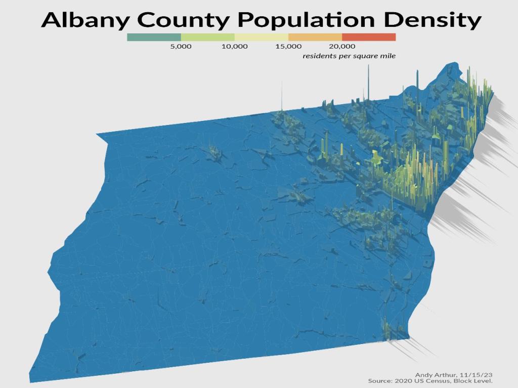
Search Results for: map albany county
Highest Elevation in Albany County
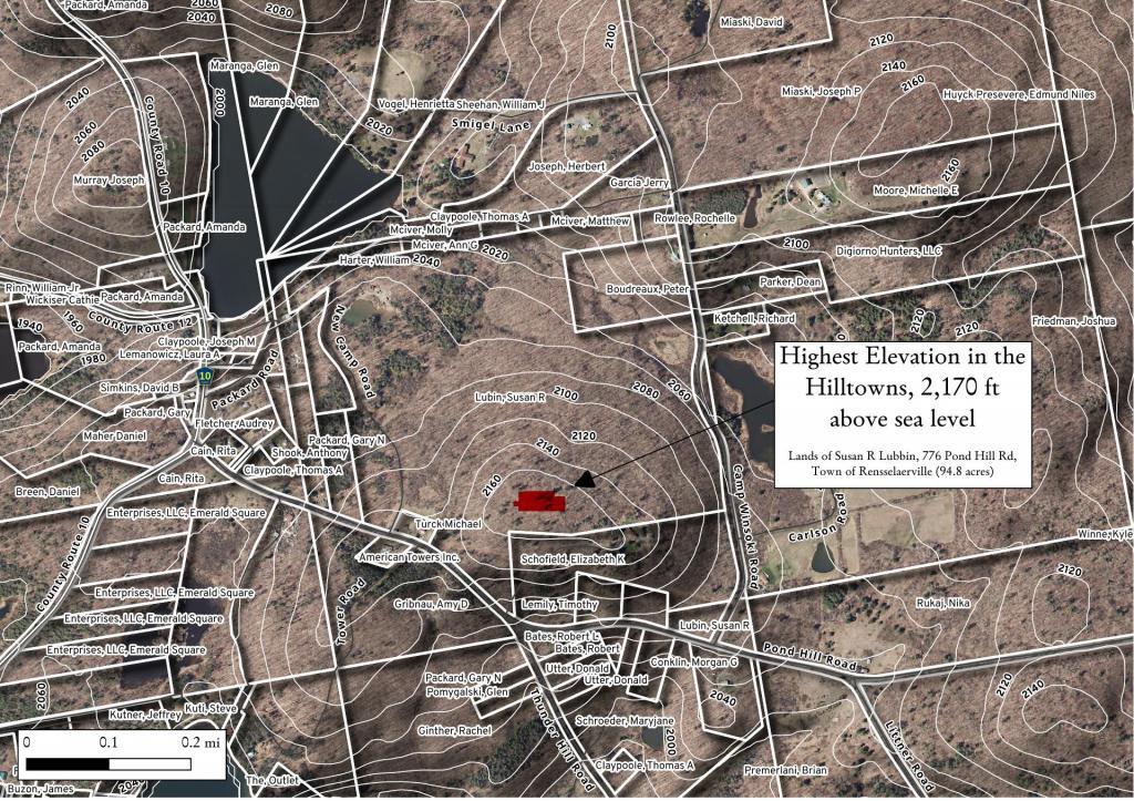
There was a discussion on Facebook about the highest point in Albany County. I thought this would be an easy and fun GIS question. Looking at 10 m digital elevation model, the answer would be 42.52806632, -74.19845216 -- the lands of Susan R Lubbin, 776 Pond Hill Rd, Town of Rensselaerville (94.8 acres). Officially, Henry Hill at 2,162 foot elevation is the highest point in county, however at least from digital elevation model, Henry Hill is 2,164 ft and the lands of Ms. Lubbins is 2,170 ft.
2020 Albany County Presidential Election
An interactive map of the 2020 Presidential Election in Albany County.
Data Source: Albany County Board of Elections. https://www.albanycounty.com/departments/board-of-elections
Houses Heated Primarily with Wood in Southern Albany County
2020 Presidential Election In Albany County Cartogram
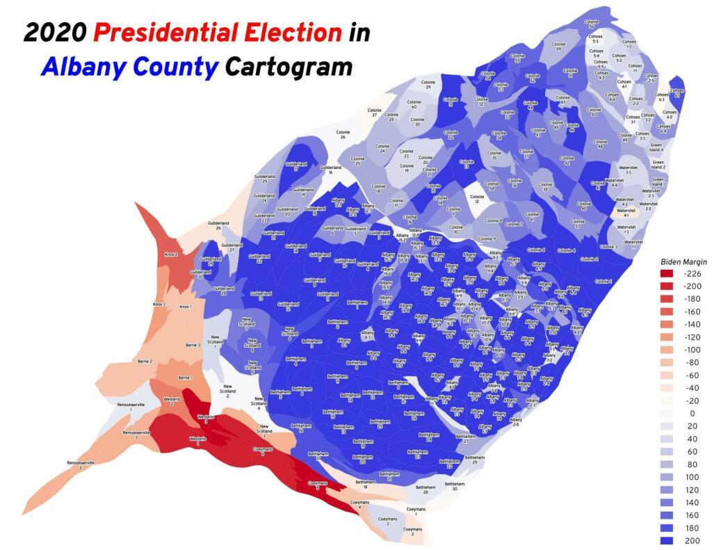
When you look at the map of the election districts that are red, you might think Albany County is redder then it really is. But truth be told, that redness is misleading as the red districts are rural and large in area but have close to the same population as many city election districts.
National Land Cover Albany County – 2016 and 2019
Small land use changes over the past three years can be seen on this map, especially if you Zoom in.
Albany County Fire Districts
Here is a map of various fire protection districts in Albany County.