Red House Lake is an artificial lake located within Allegany State Park in Red House, New York. Fish species present in the lakes are brown trout, rainbow trout, and brook trout. There is a state owned beach launch located 6 miles south of Salamanca. No motors are allowed on the lake.
The Chadakoin River is a 7.8-mile-long stream that is a tributary of the Conewango Creek. The Chadakoin lies entirely in Chautauqua County in Western New York in the United States. The stream drains an area of 192 square miles, covering much of Chautauqua County.
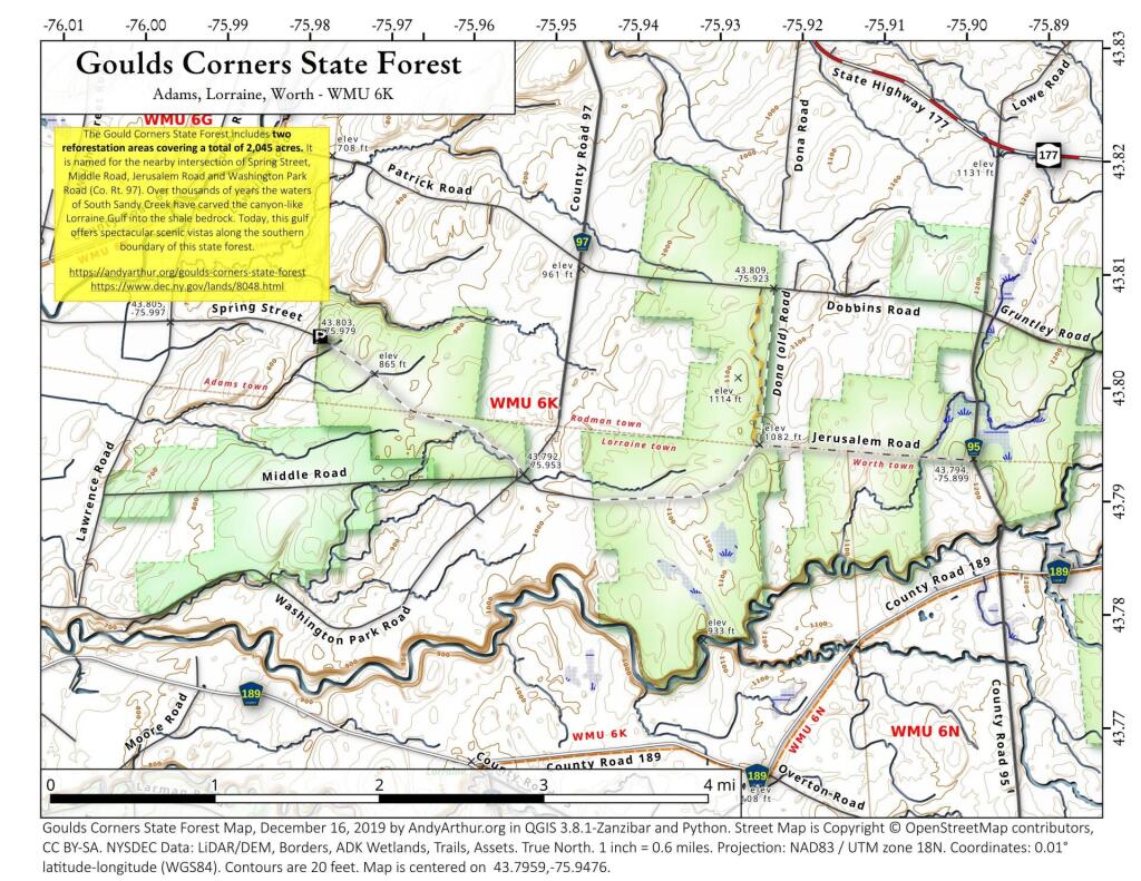
The Gould Corners State Forest includes two reforestation areas covering a total of 2,045 acres. It is named for the nearby intersection of Spring Street, Middle Road, Jerusalem Road and Washington Park Road (Co. Rt. 97). Over thousands of years the waters of South Sandy Creek have carved the canyon-like Lorraine Gulf into the shale bedrock. Today, this gulf offers spectacular scenic vistas along the southern boundary of this state forest.
https://andyarthur.org/goulds-corner-state-forest
https://www.dec.ny.gov/lands/8048.html
Eventually the western portion of the Susquehanna Beltway and US 15 north of Williamsport will be designated Interstate 99, as all of US 15 through Corning, NY has been twinned and made-grade seperated to Interstate standards, but there are still significant gaps of at-grade four-lane road around Jersey Shore and the interchange between section of US 220 south of Lock Haven and Interstate 80 is not yet started. Notice that tight "U"-turn flyover that makes the connection to US 15 due to the location of the river, the Lycomming Creek and other topological constraints to the interchange.
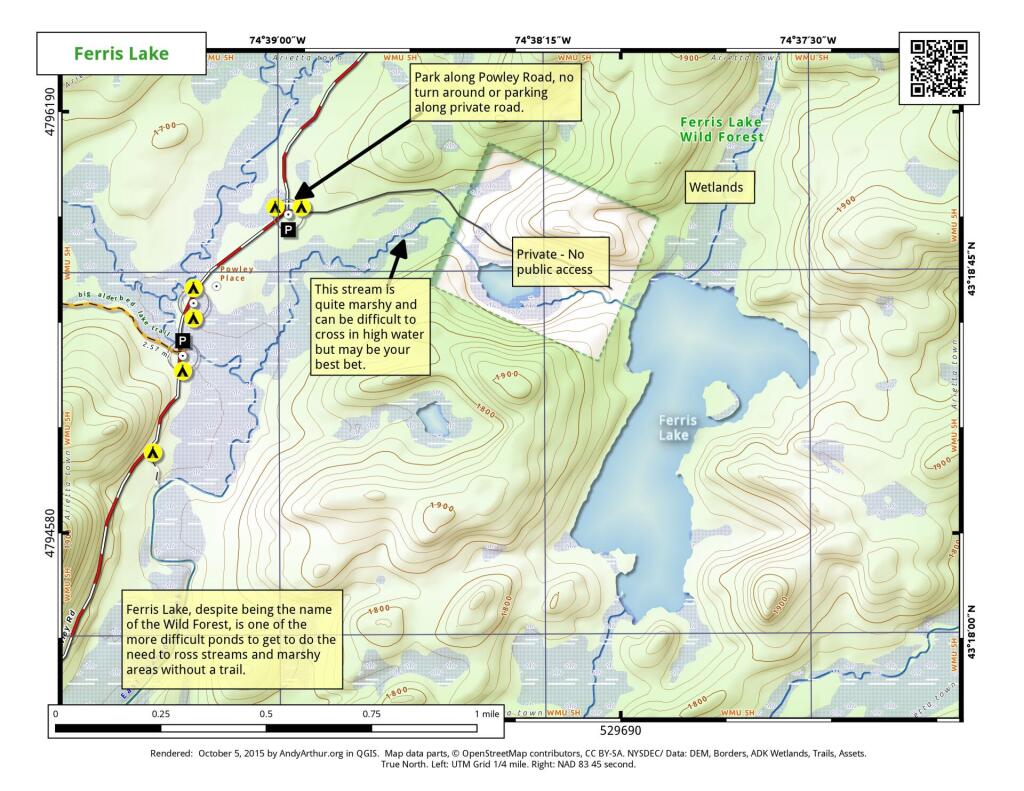
Ferris Lake, despite being the name sake of this region, is actually one of the more challenging lakes to get back to. Not due to the terrain as much as the lake is surrounded by small streams and wetlands, and the best access to the lake is posted via the old road. The DEC has said they will eventually build a trail out to this lake in the Unit Management Plan, which has yet to be approved.
Clouds and rain to start out our autumn on Saturday.
This is a somewhat unusual interchange due to the constraints of the land, and because very little traffic goes from Interstate 86 East to Interstate 390 North, so the loop ramp despite being tight is only lightly used. A false color image.

