Here is a Leaflet/KML/Google Maps overview of Lean-tos and Primitive Campsites in an interactive map for NYS DEC Lands and Finger Lakes National Forest Lean-To data and many of campsites come from the NYS DEC, while additional data has been heads-up digitized based on my own exploration.
Helpful Hints: In the upper right corner, use the layer button to switch to US Forest Service Maps for more detail on forest service lands, or use the US Topographic Map DRGs to get traditional topographic maps from the USGS.
Updated on 3/14/2021 Incorporated additional data found on DEC ARC Map Server at gisservices.dec.ny.gov, adding 81 additional NY State campsites not found on this map.
Updated on 1/31/2021 Fixed overlaps between NYS DEC data and heads up-digitized campsites by myself. Also, re-created all the points in Speculator Tree Farm/Perkins Clearing by geo-referencing and plotting the official map to add campsites to correct locations.
Note: This was not available for a number of years due to the limitations of Google Maps, however since switching to Leaflet, it has made it possible to load in a larger number of points.
Here are the primitive campsites dataset broken into KML files 🏕 that are less then 1,000 points per file that are more friendly with Google Earth and similar services:
Catskills, Central NY, Western NY - generally campsites South of the Mohawk River / Erie / Barge Canal, extended east by an imaginary line to the Vermont - Massachusetts border.
Southern Adirondacks and Tug Hill - generally campsites North of the Mohawk River / Erie / Barge Canal but South of NY 177 (Tug Hill) to NY 26 to Moose River Road to NY 28 to NY 28N to Blue Ridge Road to Johnson Pond Road to NY 74 to Ticonderoga. Includes Tug Hill, Black River WF, Moose River Plains, Wilcox Lake WF, Hammond Pond WF, Vanderwhacker, Cheney Pond, and Pharaoh Lake WF.
North Adirondacks and Tug Hill - generally campsites North of NY 177 (Tug Hill) to NY 26 to Moose River Road to NY 28 to NY 28N to Blue Ridge Road to Johnson Pond Road to NY 74 to Ticonderoga. Includes White Hill SF, Grass River, Pigeon Lake, Ha-De-Ron-Dah, Sargent Ponds, Blue Lake, High Peaks, Five Ponds, Watsons Triangle, St. Regis Canoe, McKenzie, Debar Mnt, Taylor Pond, Valcour Island, Deer River, Brasher Falls, Hammond Pond WF (North of NY 78)
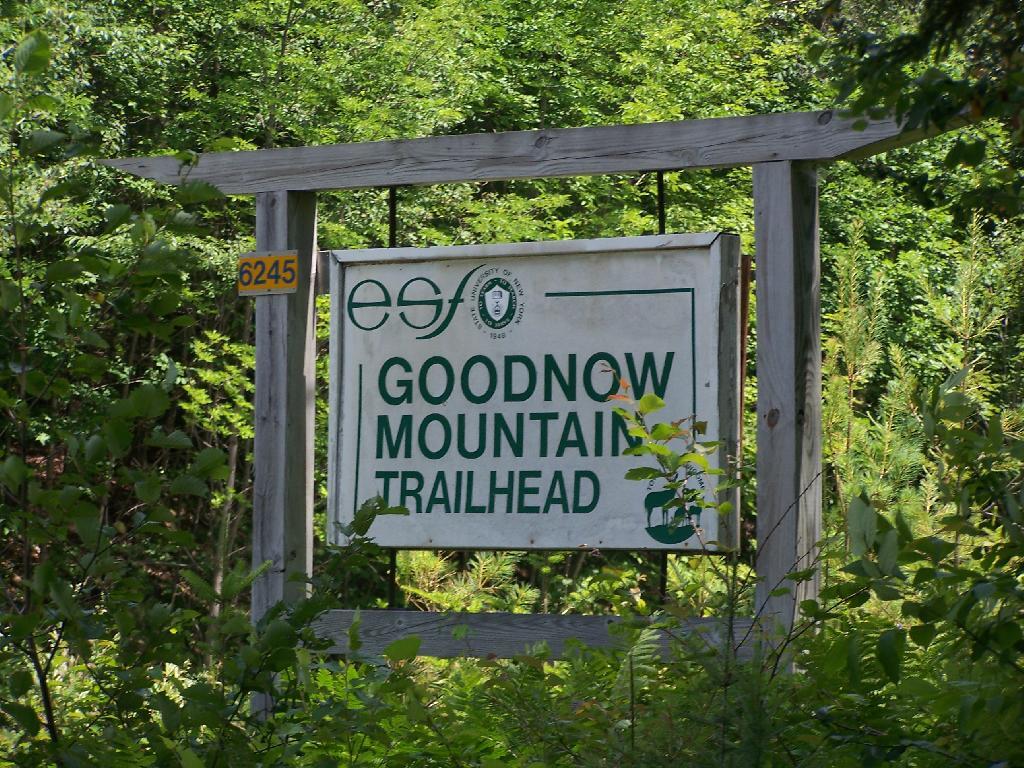
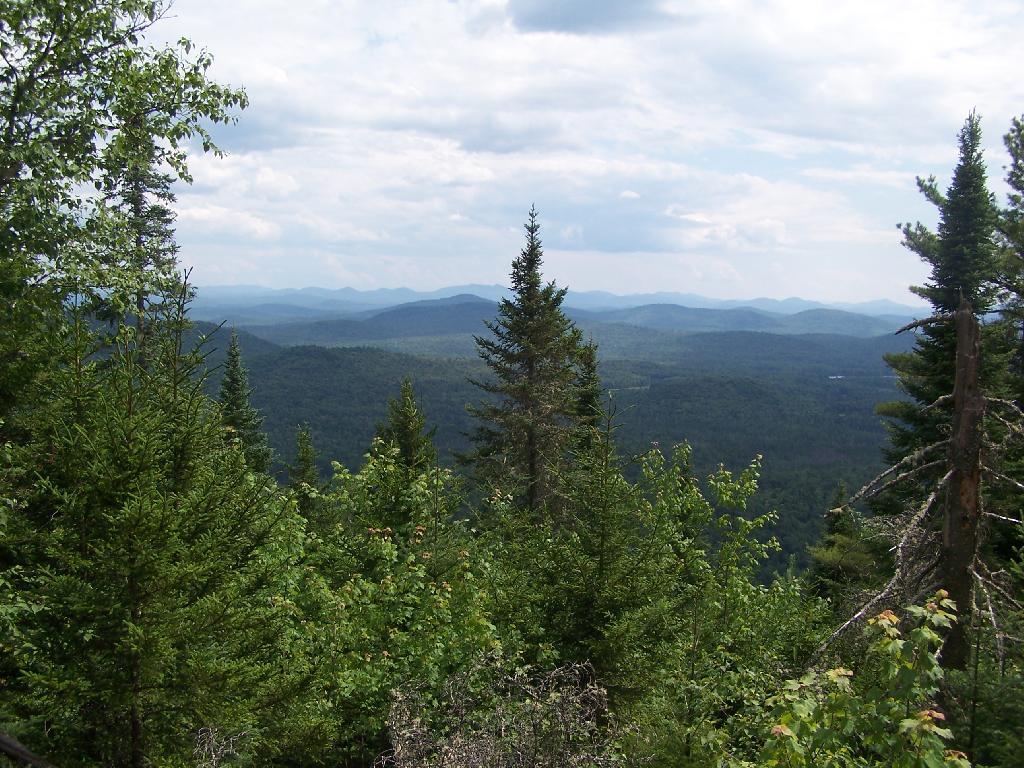
A couple of weeks ago I hiked up Goodnow Mountain, on a beautiful clear afternoon, that by the time I reached the mountain it started to cloud up and the humidity started to increase. I had previously in the morning attempted to hike up Giant Mountain in the High Peaks, and wanted to do something easier for the afternoon.
Goodnow Mountain is located at the SUNY ESF (Environmental Science-Forestry) College, just south of the Adirondack High Peaks on NY 28, just to the west of Newcomb. It’s a bit of a drive from the Adirondack Northway from the east or even a little ways from Long Lake to the west, but well worth it for the views.
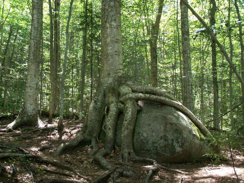
About a quarter mile up the trail you pass an interesting tree grown over a rock. This is not as uncommon as you might think in the Adirondacks where the soils are poor and the ground is rocky, and trees seek to put down more roots to pick up nuetrants.
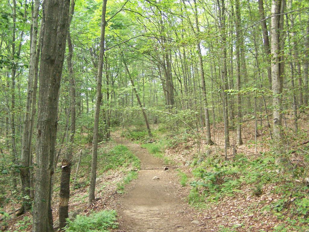
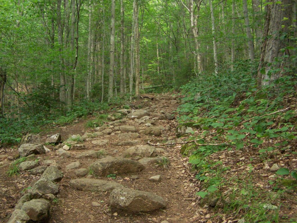
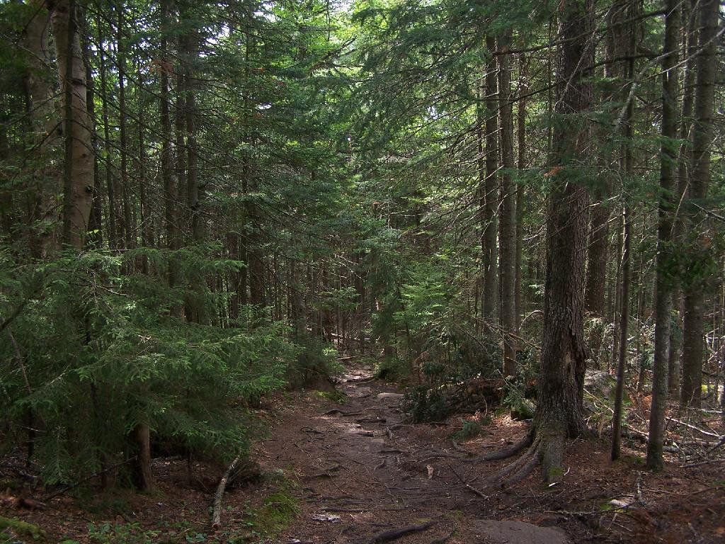
At about 1/2 mile you reach the old woods road that at one time, decades ago, provide vehicular access to the tower for forest rangers. Part of the trail is flat, but then it keeps steeper and erosion is noticable on the old road bed, no longer passable by anything then ATV in an emergency.
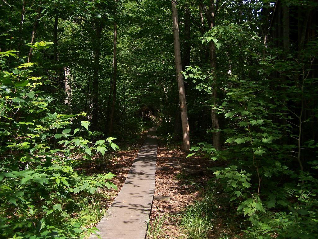
Further up the mountain, the trail follows a series of boardwalks that keeps most of the trail out of the mud and the muck.
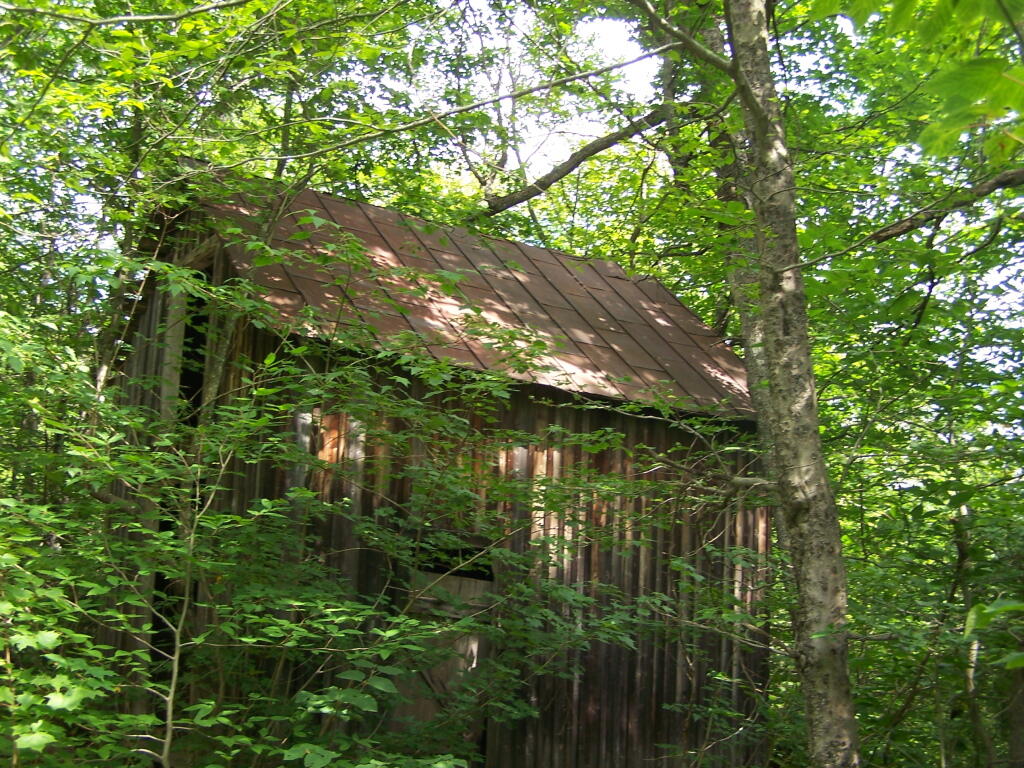
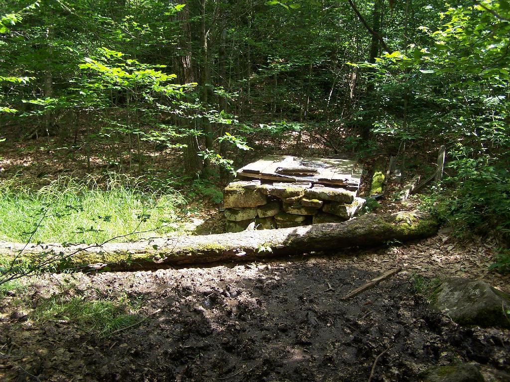
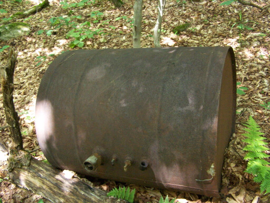
Then you reach an old abandoned barn, a well, and some interesting old debris like what appears to be a tank from a hot water heater storage unit.
You ascend a ledge, with some limited views to the south.
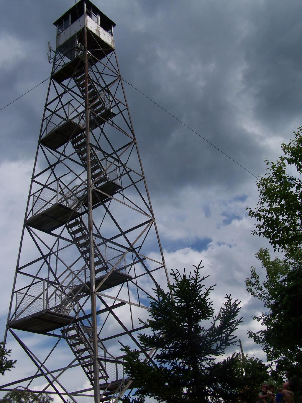
Then their is a thick planation of White Pines along the trail as you make one relatively short ascent to the firetower.
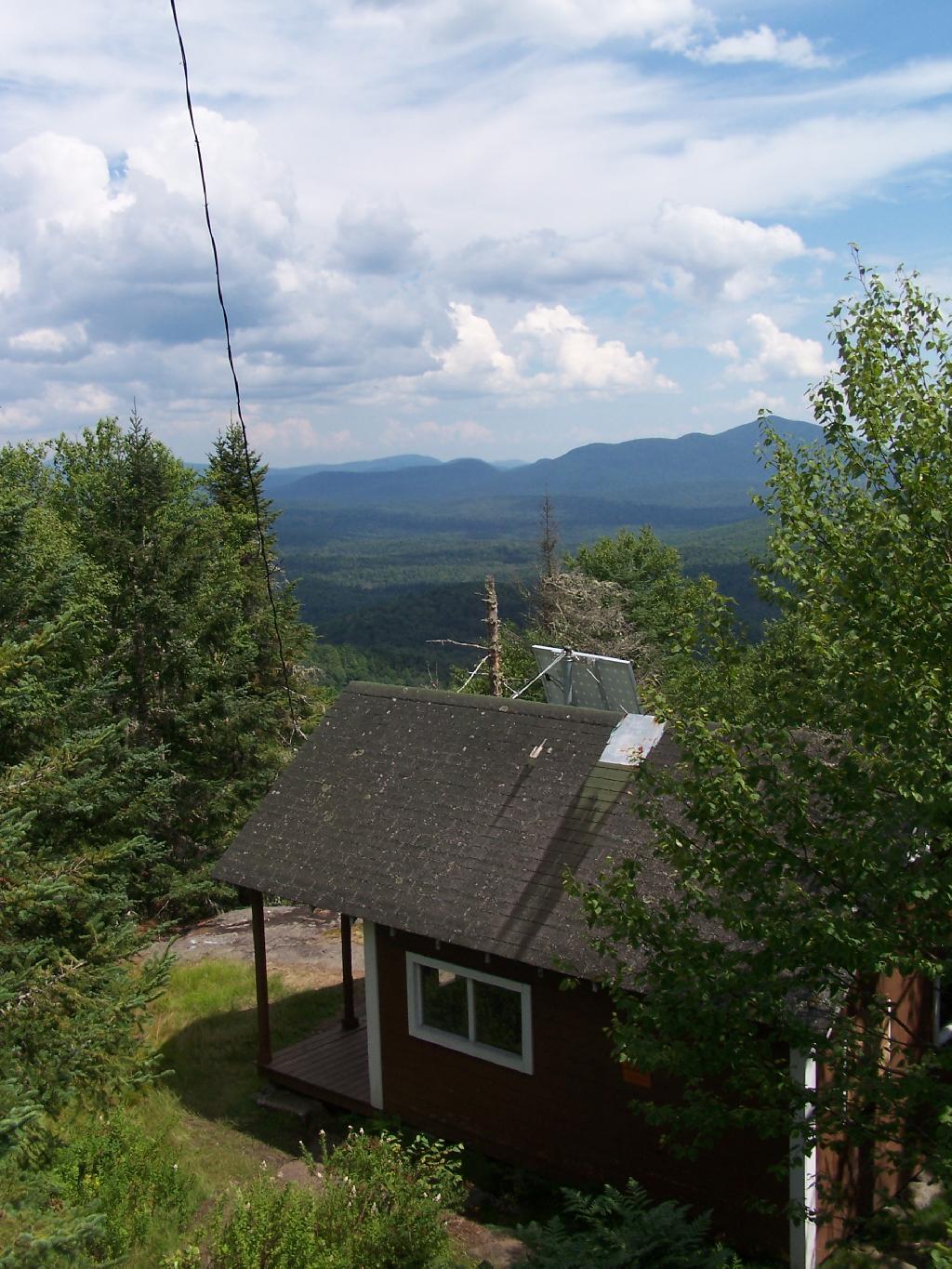
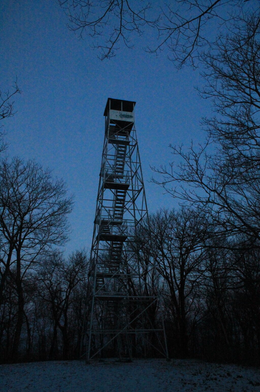
Eventually at the last possible moment, you break through the White Pines to see the Goodnow Firetower, and almost instantly want to start climbing it for the views, unless your suffering from heat exhaustion, then you might want to look for the relatively limited shaded but open sections on the mountain.
SUNY ESF has restored to the Ranger’s cabin, and the porch is a farely popular place to sit, enjoy the view, beat the heat for a few moments.
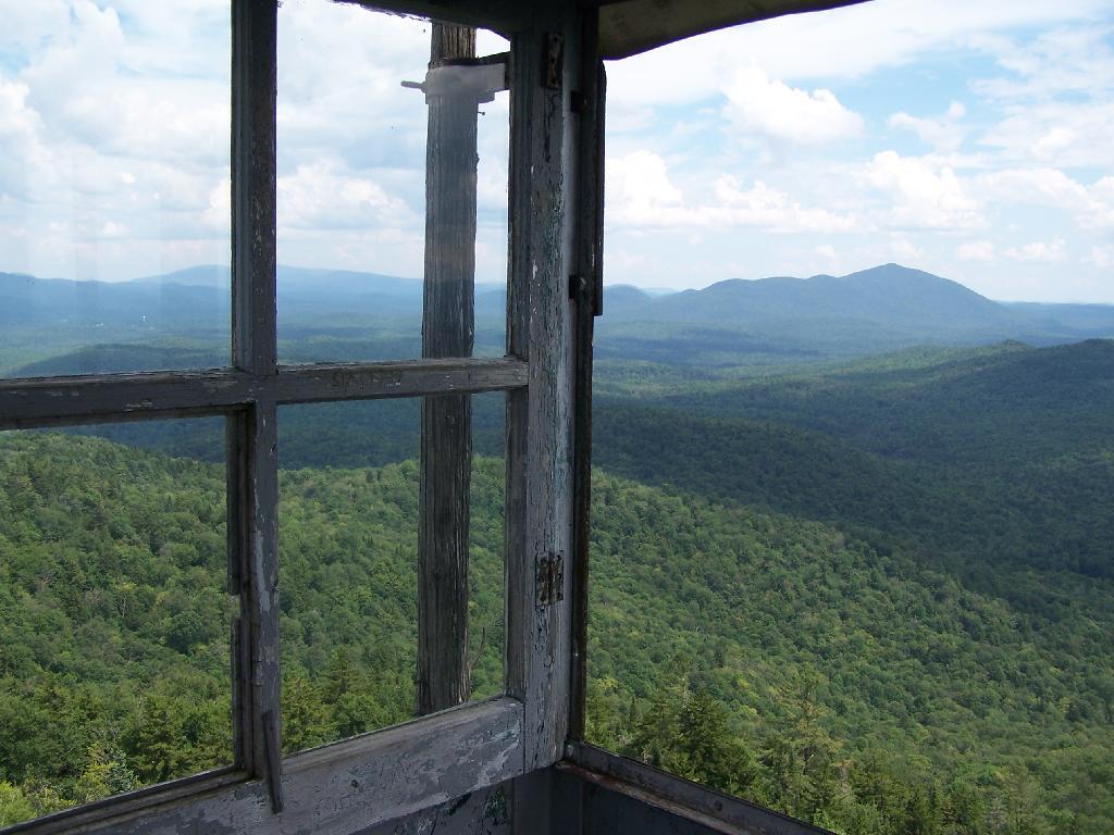
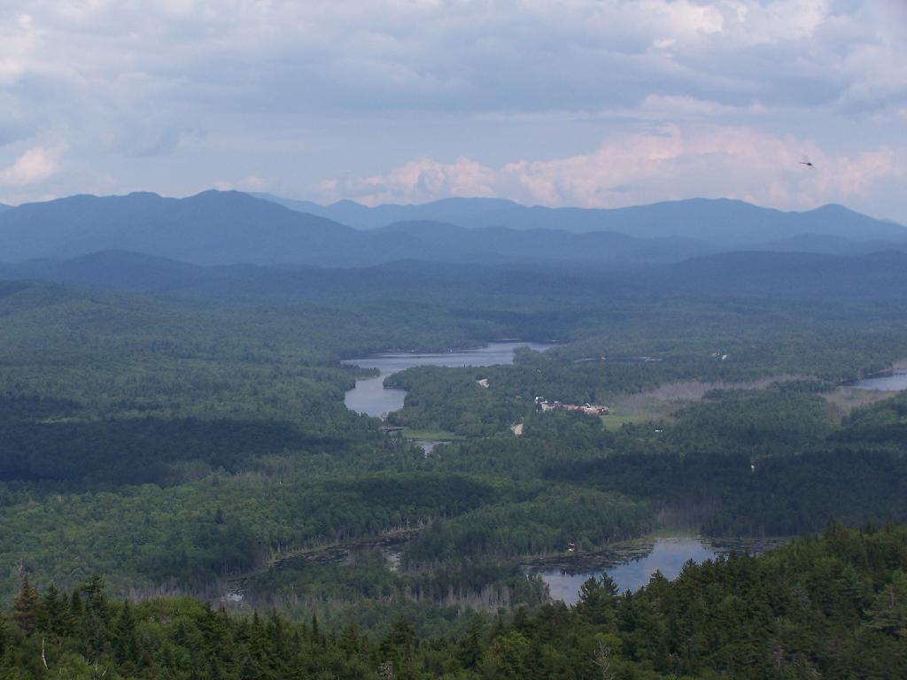
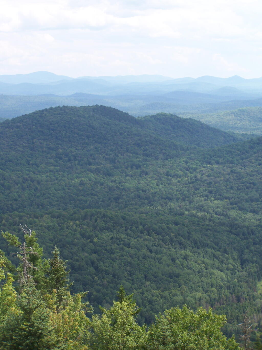
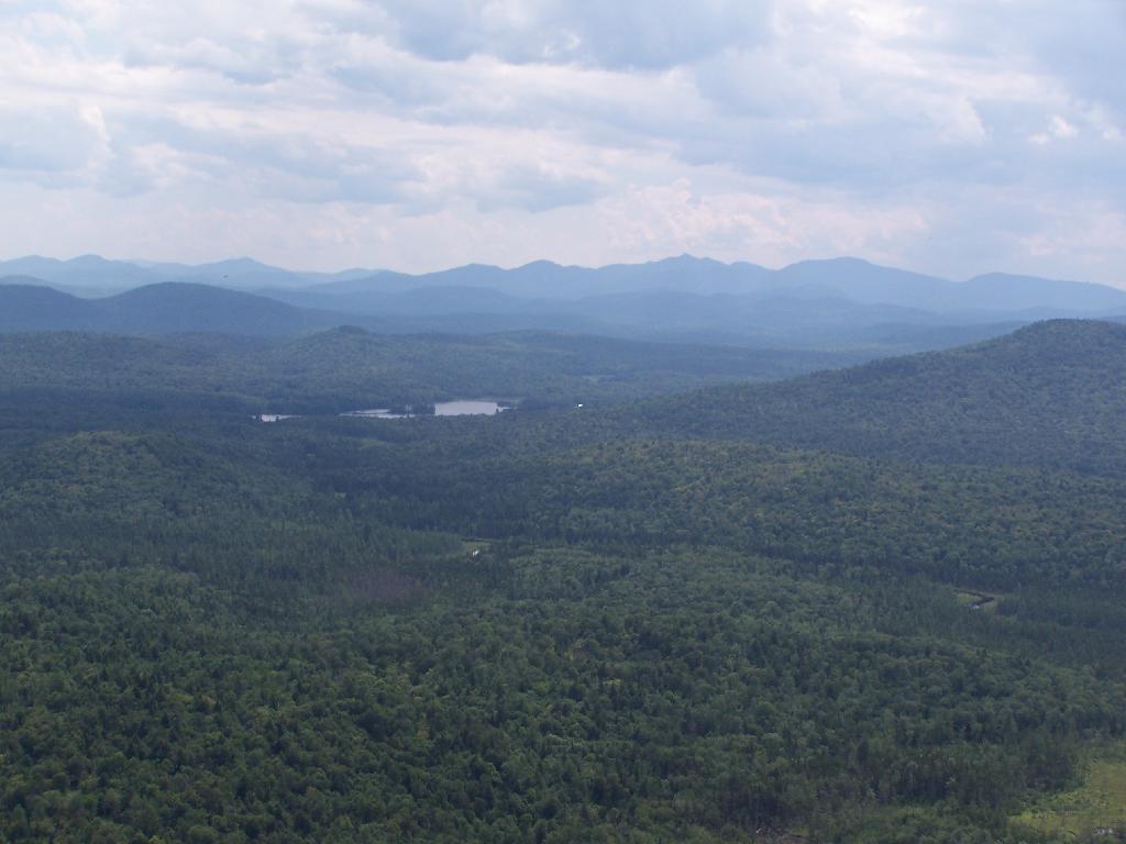
There are many interesting views from the firetower. Here are the High Peaks looking North, the Vanderwhacker Wild Forest to the east, Kempshall Mountain / Long Lake to the west, and Blue Mountain / Blue Ridge to the South.
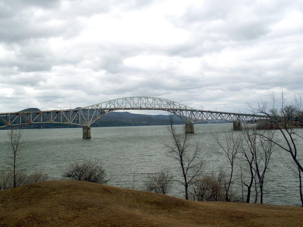
It was almost two years ago when they blew up the old Lake Champlain Bridge…
— Andy
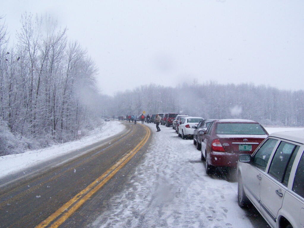
Yesterday, I drove up to Chimney Point, in Vermont outside of Addison to witness the sad but historic passing of the Champlain Bridge. The massive 80-year old span was imploded into the frozen lake, after two piers where discovered badly damaged, and was determined to be likely to fail catastrophically without a controlled demolition.
It is sad to see such a historic landmark go. Nobody really wanted to see such a landmark go up into a pile of rubble. As I stood there on Chimney Point, I stood next to many farmers and other local residents who had been alongside of and over the Champlain Bridge thousands of times. It’s such a big landmark, that stands out over the landscape, with it’s arches reaching 130 feet above the flat landscape around. Pictures simply don’t do justice. Many had grown up seeing it’s majestic spans and beautiful archways, and just assumed it would always be there. Some of the oldest residents might even remember back 80-years ago to 1929, when the bridge was under construction.
It was truly a community event. I swear every person from the very rural Addison County, VT and surrounding areas had to have been there. I don’t think I’ve ever seen so many pickup trucks with dairy-farming related bumper stickers, men and children with muck boots on, Carharts and seed-hats. It was such an amazing group of people, with such a complicated mix of emotions about the demolition of the bridge. People where sad to see it go, but also hopeful for the new bridge. Some where cynical that something ever as great could be built again.
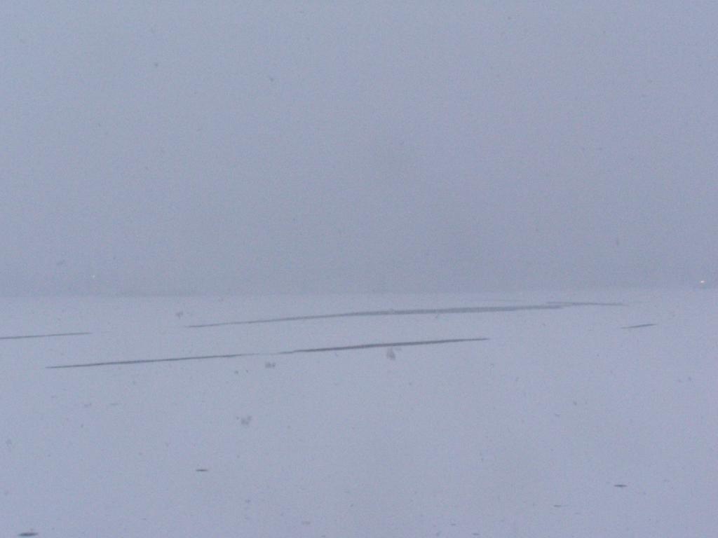
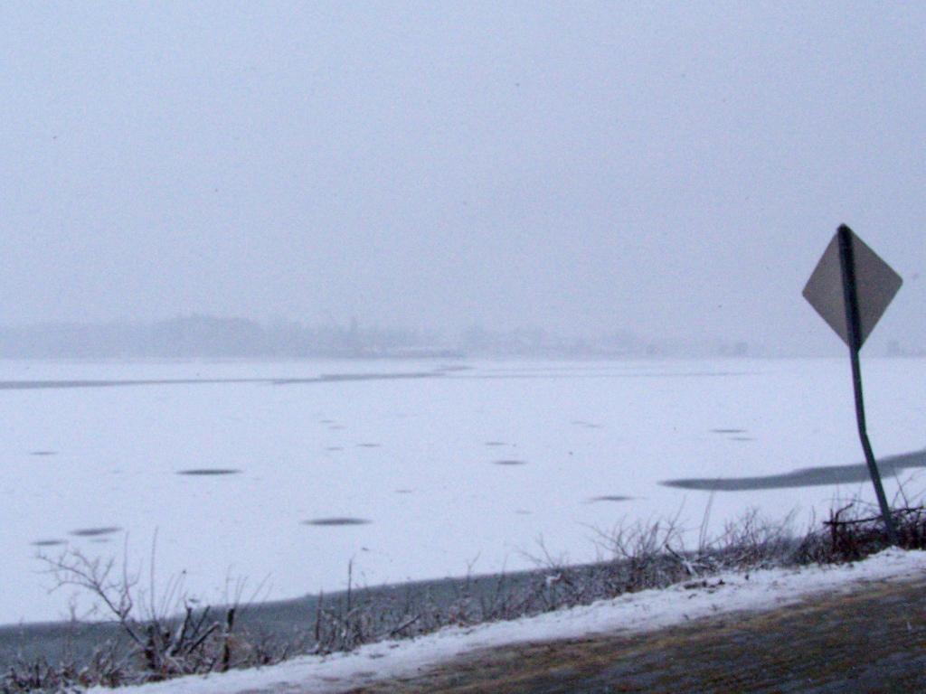
The wintry weather made the span almost invisible from the site about 3,000 feet away from the bridge where I was looking at. Chimney Point had probably the best viewpoint of the Champlain Bridge on a sunny day, your back would be to the sun, and with a back drop of the Adirondack Mountains. You could see the bridge fade in and out like a ghost as the snow squalls blew out and blew in. What you could see was so massive, so beautiful. Yet eerie, because all that was left was the lightest silhouette of the old bridge. The silhouette was so light, that it was hidden from the camera.
Then there was the loud bang, right at ten in the morning — a thunderous roar lasting less then a second or two, that shook the ground and sent ice soaring a foot into the air on Lake Champlain, even as far away as we where. The energy wave forced upon the lake and the surrounding landscape shook the parked cars so hard that it set off car alarms. It was not like listening to a firecracker going off, but more like a wave of energy coming at you. In the wintry blizzard-like weather, you barely saw the bridge fall, but it was still the most remarkable feeling at you felt the thousands of tons of steel and concrete hit the waters of Lake Champlain.
Vermont 127 and Vermont 17 where one way during the day to allow for parking, so leaving everyone had to drive by the fallen bridge. The once majestic bridge was little more then just a pile of rubble sticking up from the frozen lake in a wintry fury of the snow. I looked like something out of a war photograph, although it was much bigger and much more realistic. It was a bit scary that we as a society could convert such a massive and beautiful structure to just a pile of rubble.
On the 400th Anniversary of Samuel de Champlain’s discovery of Lake Champlain and the fertile plains that surround it, it’s sad to see such a man-made landmark go. Yet, it’s also a reminder of how man made landmarks come and go, and only natural wonders like the mountains and the lake remain. While people since 1929 have looked out across the lake at Chimney Point at the engineering marvel of Champlain Bridge, much of the rest of the landscape remains unchanged since the day Samuel de Champlain first made his voyage in 1609.
A new bridge will replace the first Lake Champlain bridge, and service the automobile, truck, pedestrian, and bicycle needs of the 21st century, but it will be little more then an impermanent landmark that must someday fall and be destroyed like the first Lake Champlain Bridge. Nobody can foresee the demolition of the new bridge, in some future century, but it will ultimately be gone just like the first bridge is now gone.
(this picture taken just north of the bridge was taken in March 2006).
Blue – Bridge
Yellow – My View
Green – Where I Parked
I’m a big of farmers who are essentially Living Off the Earth and think Rednecks are Noble Savages. Dairy Farming are key to our rural landscape. I’d trust a farmer or a hunter in a pile of guts he’s butchered over any ivory-tower scientist.
Discover a wealth of information on this page about fire towers situated on state lands, accessible through invigorating hikes that lead to panoramic vistas. Interactive maps guide your exploration, offering insights into the locations and trails leading to these towering viewpoints. Additionally, find convenient links to other pages that delve deeper into fire towers across the entirety of New York State. Embark on a journey that combines outdoor adventure with breathtaking scenery, as you navigate the trails and pathways leading to these historic landmarks that have stood as guardians of the landscape. This resource opens doors to captivating experiences that allow you to savor the beauty of nature from elevated perspectives while providing avenues for further exploration of New York’s fire tower heritage.
Here is a list of Fire Towers on NYS DEC lands. You can get this also on Google Sheets. Does not include the Dickinson Hill Fire Tower in Grafton, which is part of the Grafton Lakes State Park. You might also be interested in nearby camping opportunities.
Check out the DEC's website to find out an excellent overview map of Debar Mountain Wild Forest, updated April 2017.
"Trails on the unit offer opportunities for hiking, cross country skiing, snowshoeing, horse back riding, mountain biking and snowmobiling. Popular destinations within the unit include Debar Mountain, Azure Mountain and Debar Meadows. Other popular pastimes are hunting, fishing, canoeing and boating. Access to the unit's water resources is available at Meacham Lake Campground and Buck Pond Campground, as well as on the St. Regis River, Osgood Pond, Jones Pond, Deer River Flow, Mountain Pond, and Lake Kushaqua. Vehicle access to the unit is provided primarily via NYS Routes 3, 30 and 458. Important local roads for access include county route 26 (Old Route 99), Red Tavern Road, Kushaqua-Mud Pond Road, Gabriels-Onchiota Road, Blue Mountain Road, and Oregon Plains Road."

 Bicycle Trails and “Blackie” My Mountain Bike


 R Statistical Programming


 Python and Pandas


 Politics

 The Earth


 Saving Money


 Mission Fifty & Being Healthier


 / Enjoying Life

