Kings Road Dunes
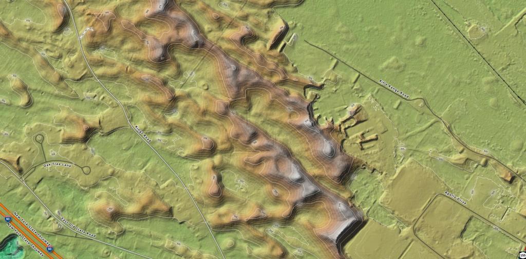
I have been interested in the height of various dunes and had the LiDAR data loaded up, so I made hillshade - contour map of the dunes off Kings Road.
I have been interested in the height of various dunes and had the LiDAR data loaded up, so I made hillshade - contour map of the dunes off Kings Road.

With the proposed development at Crossgates Maul, I was interested in looking at the terrain of the area. There is definitely part of a dune remaining in the portion that Crossgates plans to donate to the Commission, and along the backside of Gipp Road. Interesting.
]
One of the reasons that developers cite for developing the Albany Pine Bush Preserve, is to increase the local tax base for the municipalities. This map shows that many properties -- including developed ones -- throughout the Albany Pine Bush Study Area -- are tax exempt.
Data Source: 2019 Final Tax Rolls, as posted by the Town Assessors in Albany, Colonie, Guilderland. Limited by the Albany Pine Bush Study Area, the area the Albany Pine Bush Commission is limited by law.
This interactive map shows the various soils found in the Albany Pine Bush Study Area.
A few weeks ago I was experimenting with r.param.scale which allows one to discover the various components of landscape using the feature parameter. I was interested in making a map of the Albany Pine Bush to discover "pits", as way to discover potential vernal wetlands.
Data Source: LiDAR Digital Elevation Models. http://gis.ny.gov/elevation/lidar-coverage.htm Processed with r.param.scale then converted over to a vector using r.to.vect and some other processing tools in QGIS.