A look at tree clearing in the Albany Pine Bush. A lot of the large recent cuts are actually part of restoration efforts for the Pine Bush, although some is development. An interesting exploration from the National Land Cover Dataset.
One of the great things about the Albany Pine Bush is it's kind of a wilderness in a great urban area. This aerial of the northwest branch of Rensselaer Lake captures a mix of restoration efforts, timbering and wildlife only 5 miles from the Capitol of New York State.
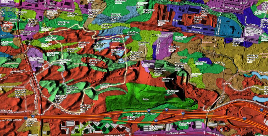
Lately I've been experimenting with soil mapping data, and made this map of the Pine Bush East Barrens in Albany.
Use this interactive mapper to explore development of the Albany Pine Bush over the past 70 years.
A new feature I've added to my mapping software is ability to pull historical topographic maps directly from USGS and create blog posts. Today, we are looking at the 62.5k USGS topographic maps from Albany and Schenectady that look at the Albany Pine Bush. Drag the opacity slider to adjust the transparency. You can also change the base layers in the upper right hand corner.