Search Results for: Map
NYS DOT Traffic Counts – Albany Pine Bush Area
Here are traffic counts form the NYS Department of Transportation. Click for a pop-up with traffic counts and other details.
Albany Pine Bush Trails Today vs. Historical Sand Roads
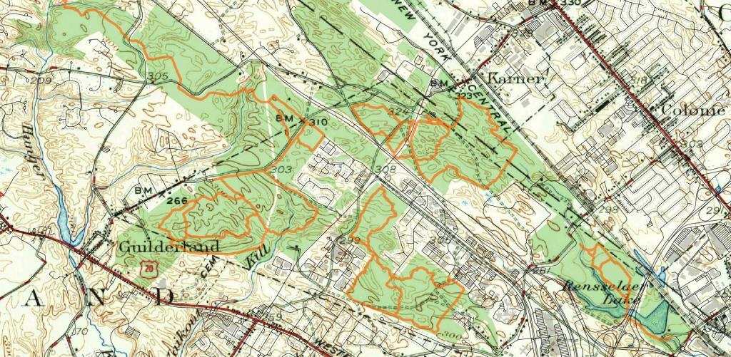
Many of the current Albany Pine Bush Preserve trails (shown in orange) follow historical sand roads in the Pine Bush as seen on this 1947 topographic map.
Karner East 10 Foot Elevation
This map shows highly detailed contours for the East Barrens of the Albany Pine Bush.
Data Source: NYS GIS Program Office. NYS LIDAR Coverage. http://gis.ny.gov/elevation/lidar-coverage.htm
Rensslear Lake 1952
LEFT - 1952
RIGHT - 2020
Get the original on MapWarper, https://mapwarper.net/maps/44102
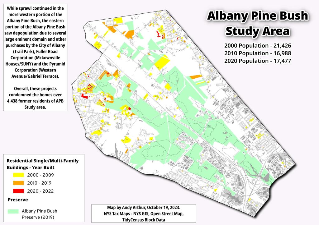
Rapp Road Historic District – Year of Construction
Eastern Albany Pine Bush Summits Over 325 Feet
This map shows the 300 or so points in the Albany Pine Bush Study Area, that are above 325 feet in elevation and are a prominence around the surrounding land. The landfill is the highest peak at 432 feet above sea level, while Overlook Dune near the Albany Pine Bush Discovery Center tops out at 374 feet above sea level. The highest dune can be seen from the Traux Trailhead on Kings Road, which tops out 390 feet above sea level.
Data Source: Albany County LIDAR Digital Elevation Models. Dune peaks obtained by using the GRASS plugin in QGIS with r.param.scale, method=feature, then r.reclass to remove anything but value=6 to create peaks, then r.tovect to convert to vector areas, then used zonal statistics to find the maximum value on the peak, then extracted the centroids of the polygons.