West River Road (Whitehouse) Campsites
This interactive map shows the West River Road Campsites at Whitehouse in the Silver Lake Wilderness outside of Wells, NY.
This interactive map shows the West River Road Campsites at Whitehouse in the Silver Lake Wilderness outside of Wells, NY.
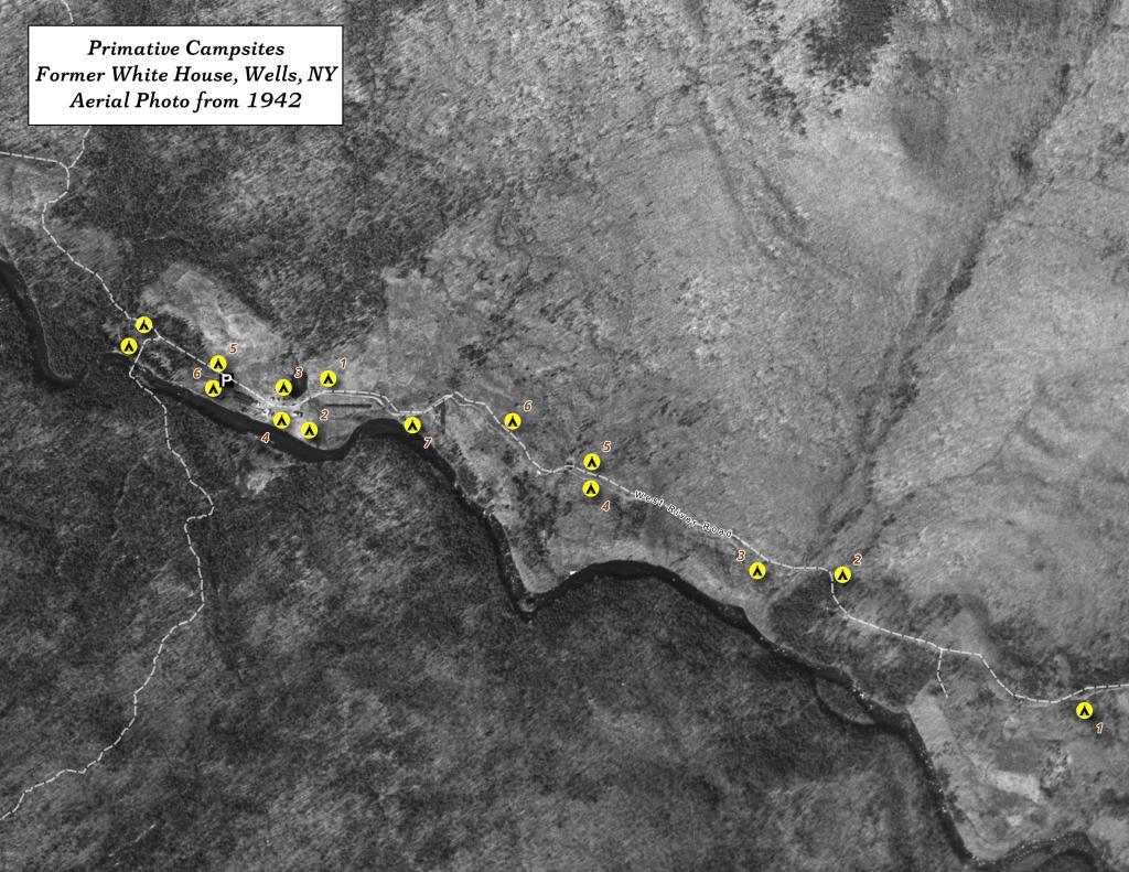
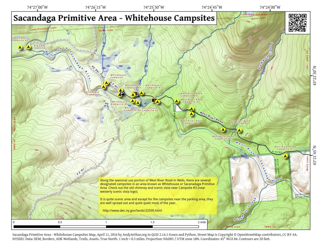
The DEC recently GPS'd the various designated campsites at Whitehouse area of the Sacanadaga Primitive Area along West River Road in Wells. This provides a pretty accurate map of the various campsite locations. West River Road isn't open to motor vehicles yet, but will open later in May once the frost is out of the ground and the dirt road isn't too soft.
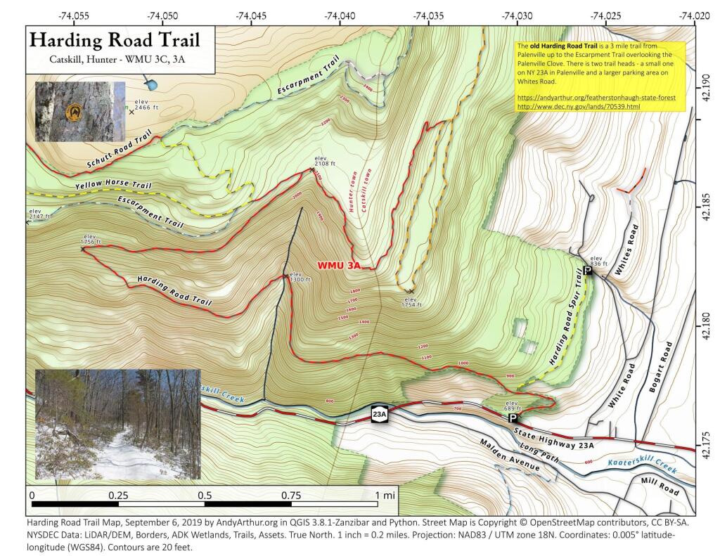
The Harding Road Trail is an old carriageway built to the former Kaaterskill Mountain House, long abandoned but still largely remaining 25-foot wide road cut into the side of South Mountain, running 2 miles from Palenville to the old carriageway looping around South Mountain. Additional parking is available along Whites Road.
Waits River is a village in the town of Topsham, Vermont. Located alongside a river of the same name, the village of Waits River is made up of a number of residential homes, several barns and sheds, and a white Methodist church.[1] Waits River Schoolhouse, an early 20th century building which is now a private residence, was added to the National Register of Historic Places in 1988.
Photographs of the village during the foliage season have been popular since at least the 1960s, and scenic images of the village have appeared in jigsaw puzzles, calendars and postcards. Postcards of this type have been published since at least 1914.