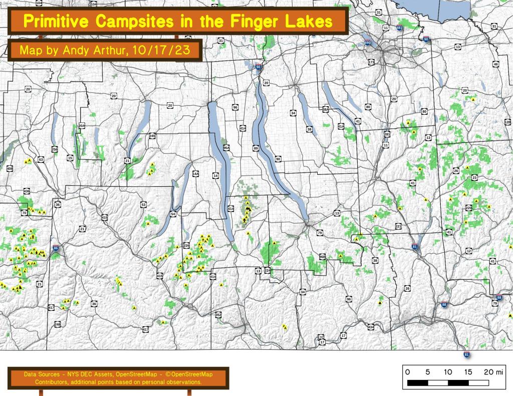
An overview of free primitive and roadside campsites located throughout the Finger Lakes region of New York State including Chemung County, Tioga County, Tompkins County, Steuben County, and Schuyler County. Major areas include the Sugar Hill State Forest and Recreation Area and the Finger Lakes National Forest. You can see more detailed locations by exploring this Interactive Google Map (KML) of the campsites across the state.
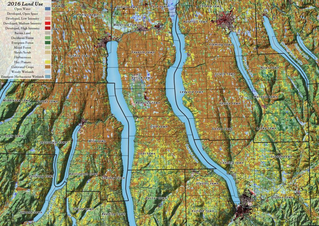
Yesterday, I downloaded the National Land Cover Data for 2016. I had some older data but I hadn't updated it in years, but soon realized I could make some very interesting maps and graphics with this data. The Finger Lakes are kind of interesting to look at in particular as you can see the Northern Finger Lakes have a lot of cultivated lands -- mostly corn and soybeans -- for feeding dairy cattle, while the more upland and rocky lands in the Southern Finger Lakes are either wooded or pasture.
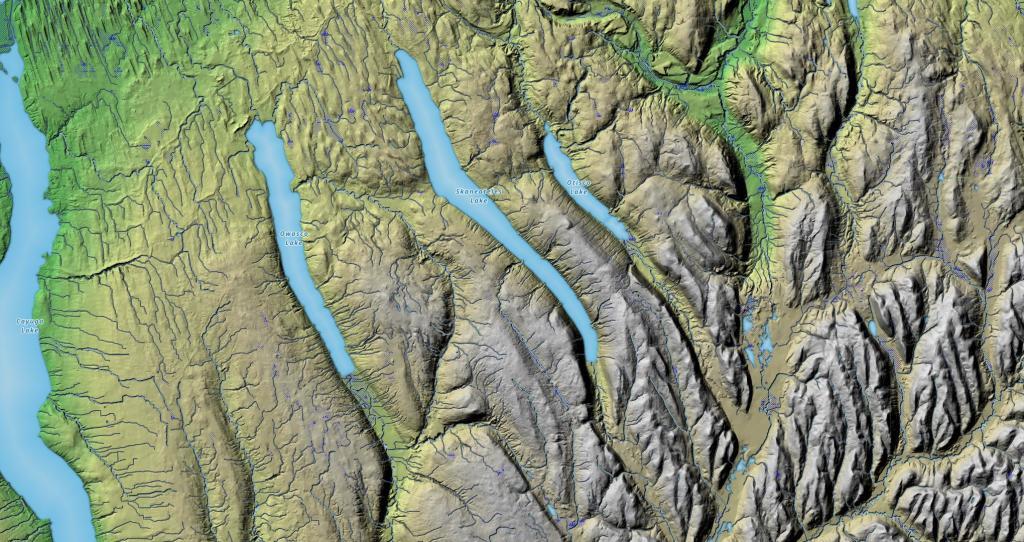
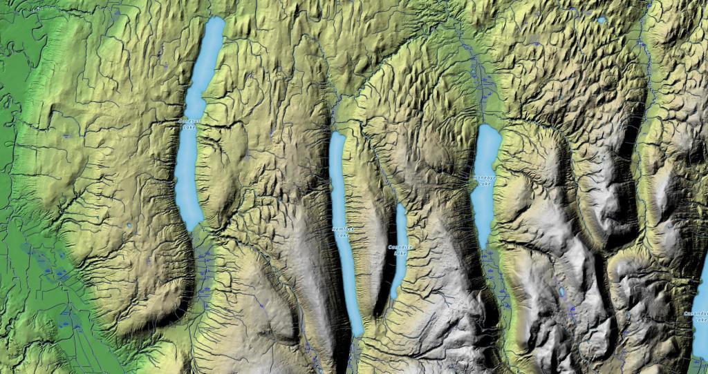
I've always been fascinated by the terrain as you drive from the hill and holler country of Southern Madison and Onondaga County, into the rolling country of the Finger Lakes, along US 20. This relief map of this region shows the change in the landscape, along with the dunes sculpted by the glaciers as you head out into the Finger Lakes.