Search Results for: "Map:" South Pond
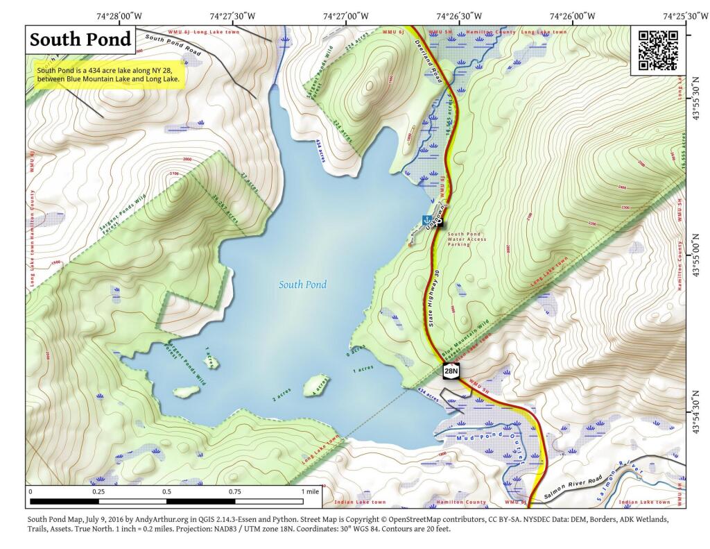
South Pond
Bear Swamp State Forest
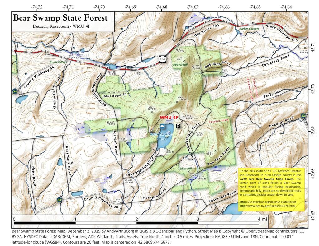
On the hills south of NY 165 between Decatur and Roseboom in rural Otsego county is the 1,749 acre Bear Swamp State Forest. The center point of state forest is Bear Swamp Pond which is popular fishing destination. Remote and hilly, there are no developed trails or campsites besides a path down to lake.
https://andyarthur.org/decatur-state-forest
http://www.dec.ny.gov/lands/102478.html
Stoney Creek Pond
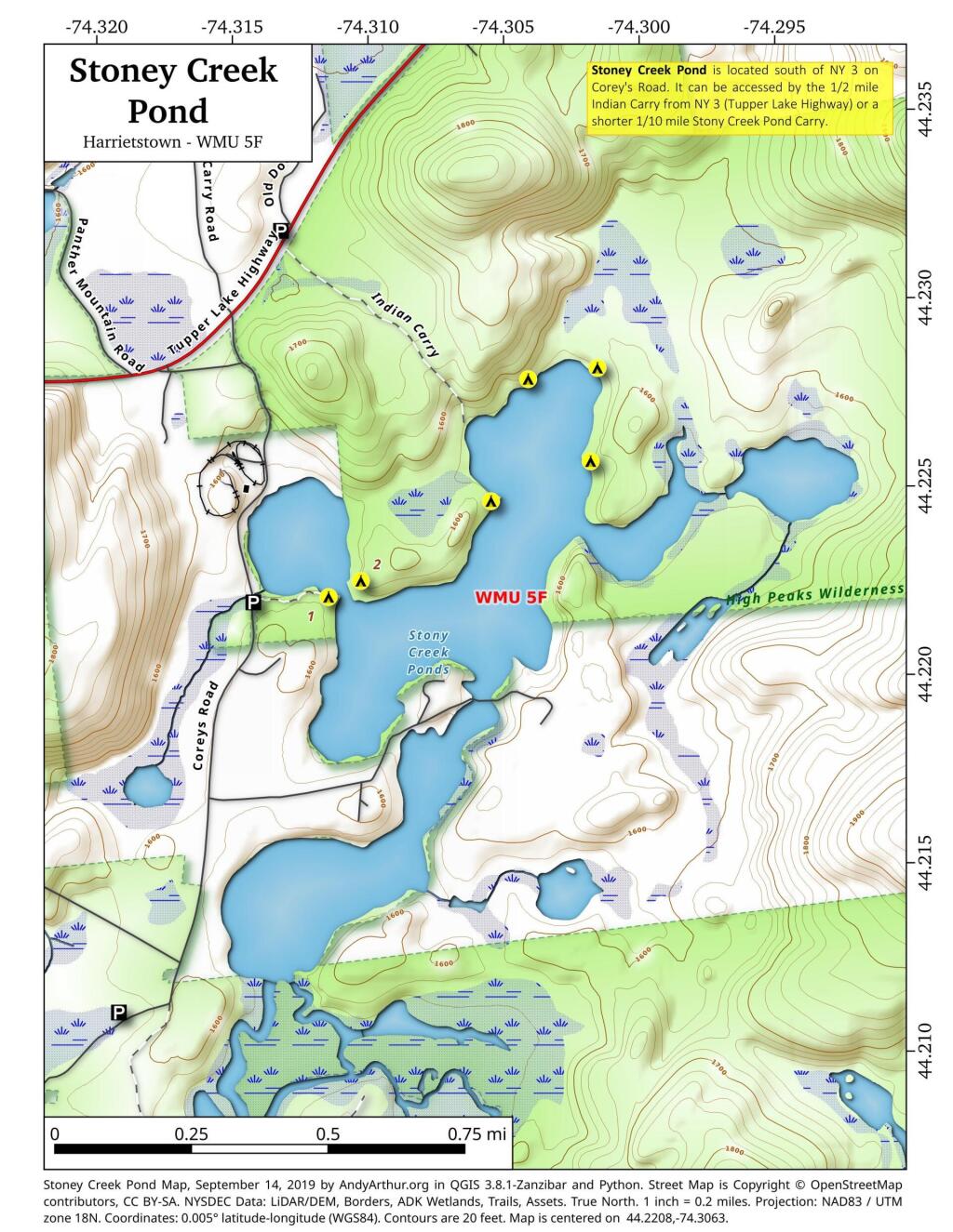
44.22080561052468,-74.30630484336764
Stoney Creek Pond is located south of NY 3 on Corey's Road. It can be accessed by the 1/2 mile Indian Carry from NY 3 (Tupper Lake Highway) or a shorter 1/10 mile Stony Creek Pond Carry.
Trace the Black River Canal !
If you want to do something fun, you can trace how the Alder Pond Dam diverts water from the upper Black River lakes (such as North Lake, Woodhull Lake, South Lake, Sand Lake) into the Black River Canal, the upper part which is still used for moving water to the Lansing Kill which dumps into the Mohawk River and Delta Reservoir in Westernville.
Reeds Pond
Located at the intersection of Farr Road and North Lake Road, this lake is near the Black River, about 10 miles south of South Lake.
Glidden Marsh To Pharaoh Lake Trail
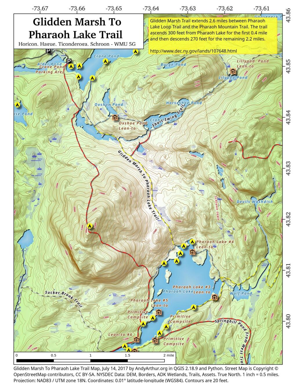
There are two ways to get between Crane Pond and Pharaoh Lake. One brings you over Pharoah Mountain, which has great views but it's a much bigger climb, especially on the southern side.
Pharaoh Mountain Trail (2,556 feet) extends 3.8 miles between the Pharaoh Lake Trail and Crane Pond Trail. The trails ascends 1,355 feet in 1.2 miles to the summit and then descends 1,405 feet in 2.6 miles to Crane Pond.
Glidden Marsh Trail extends 2.6 miles between Pharaoh Lake Loop Trail and the Pharaoh Mountain Trail. The trail ascends 300 feet from Pharaoh Lake for the first 0.4 mile and then descends 270 feet for the remaining 2.2 miles.