Lock 2 of the Oswego Canal
Broadway Bridge in Fulton.
Broadway Bridge in Fulton.
Lock 2 and Old Champlain Canal in Waterford.
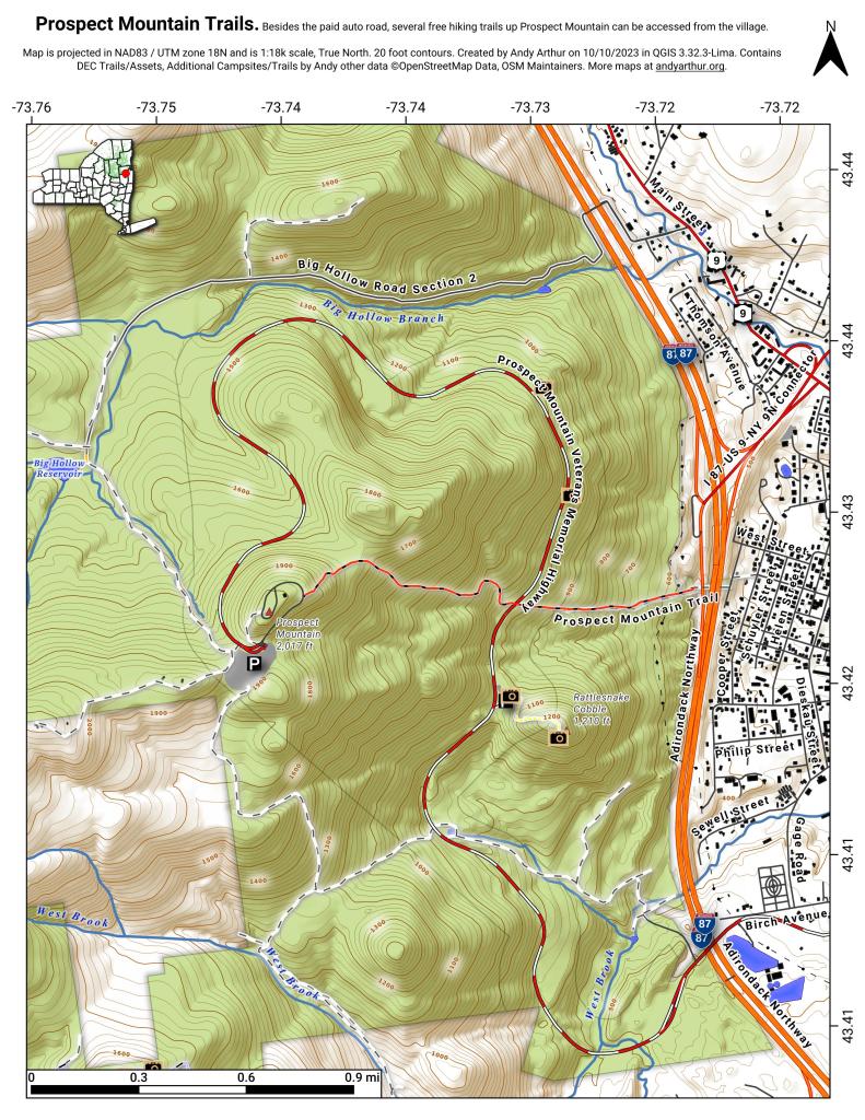
"The red DEC marked Prospect Mountain Trail is 1.5 miles long, leads steeply at times to the 2021 foot summit of Prospect Mountain. To reach the trail from Lake George Village, turn left on Montcalm Street to Smith Street. At Smith Street, turn south a half block to the sign indicating the start of the trail, where it crosses the Northway on a pedestrian bridge. The climb to the summit is difficult but rewarding."
Sprawl at work ... paraphrasing from the Times Union:
The Lowville Forestry Demonstration Area is located on 98 acres at the former NYS Lowville Tree Nursery. The nursery was in operation from approximately 1923 to 1971 and during that time, a total of 530 million seedlings were produced. A demonstration forest was created here by planting trees together in blocks based on species. Demonstration forests are used to show how different species of trees grow and look together. https://www.dec.ny.gov/lands/8075.html
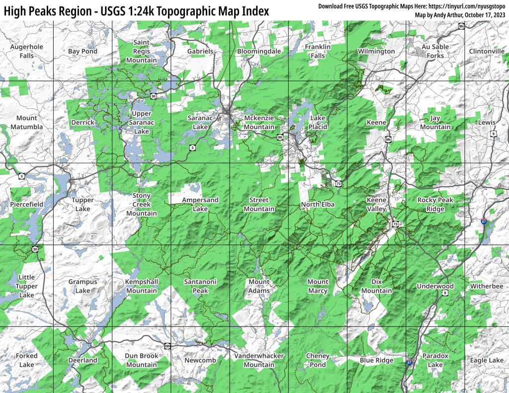
This map provides a handy, printable index of all USGS 1:24k Topographic Maps in the High Peaks region.
Download Free USGS Topographic Maps Here: https://tinyurl.com/nyusgstopo
Did you know that the highest elevation in Niagara County – at 699 feet above sea level – is Sanitary Landfill No. VI? The dumping ground (the site of Cecos International, Inc.) was first “built” in the late 1800s. It sits smack in-between the Town of Niagara and the City of Niagara Falls. Altogether, there are 12 landfills on the site – Sanitary Landfill No. VI was added in the 1980s.