Search Results for: "Map:" Hunt Pond
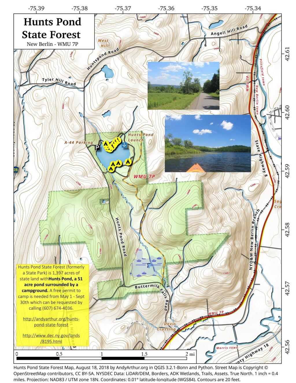
Hunts Pond State Forest
Huntley Pond
Free Primitive and Roadside Campsites in Central New York
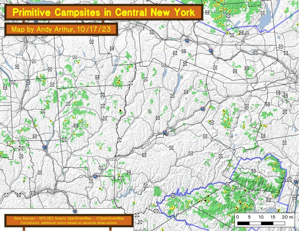
An overview of free primitive and roadside campsites located throughout the Central New York region of New York State including Broome County, Cortland County, Chenango County, Madison County, Otsego County and Schoharie County. Major areas include Burnt Rossman State Forest, Charles Baker State Forest, Stony Pond State Forest, Hunts Pond State Forest and Long Pond State Forest. You can see more detailed locations by exploring this Interactive Google Map (KML) of the campsites across the state.
Onteora Lake
"Located at one of the most popular gateways to the Catskill Forest Preserve, just three miles west of historic Kingston, the 3,000-acre Bluestone Wild Forest, has something for everyone. Its lake, ponds, trails, old quarries, hemlock and oak forests on gently rolling hills - and an occasional cliff- are ideal for hiking, mountain biking, fishing, hunting, trapping, snowshoeing and cross-country skiing. There is developed access to Onteora Lake off State Route 28, one of the few publicly accessible lakes in the Catskills." https://www.dec.ny.gov/lands/75323.html
Chub Lake
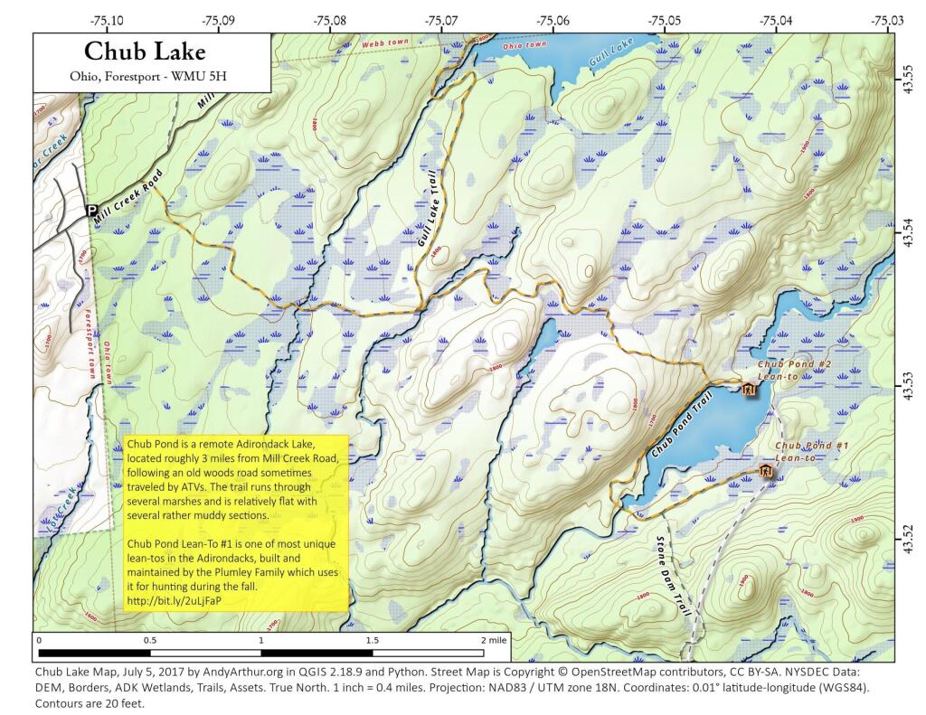
Chub Pond is a remote Adirondack Lake, located roughly 3 miles from Mill Creek Road, following an old woods road sometimes traveled by ATVs. The trail runs through several marshes and is relatively flat with several rather muddy sections. Chub Pond Lean-To #1 is one of most unique lean-tos in the Adirondacks, built and maintained by the Plumley Family in 1963 which uses it for hunting during the fall. http://www.protectadks.org/2014/09/a-forest-preserve-lean-to-on-chub-pond-in-the-black-river-wild-forest-area-has-been-extensively-modified-and-turned-into-a-private-camp/
Hays Brook Horse Trails
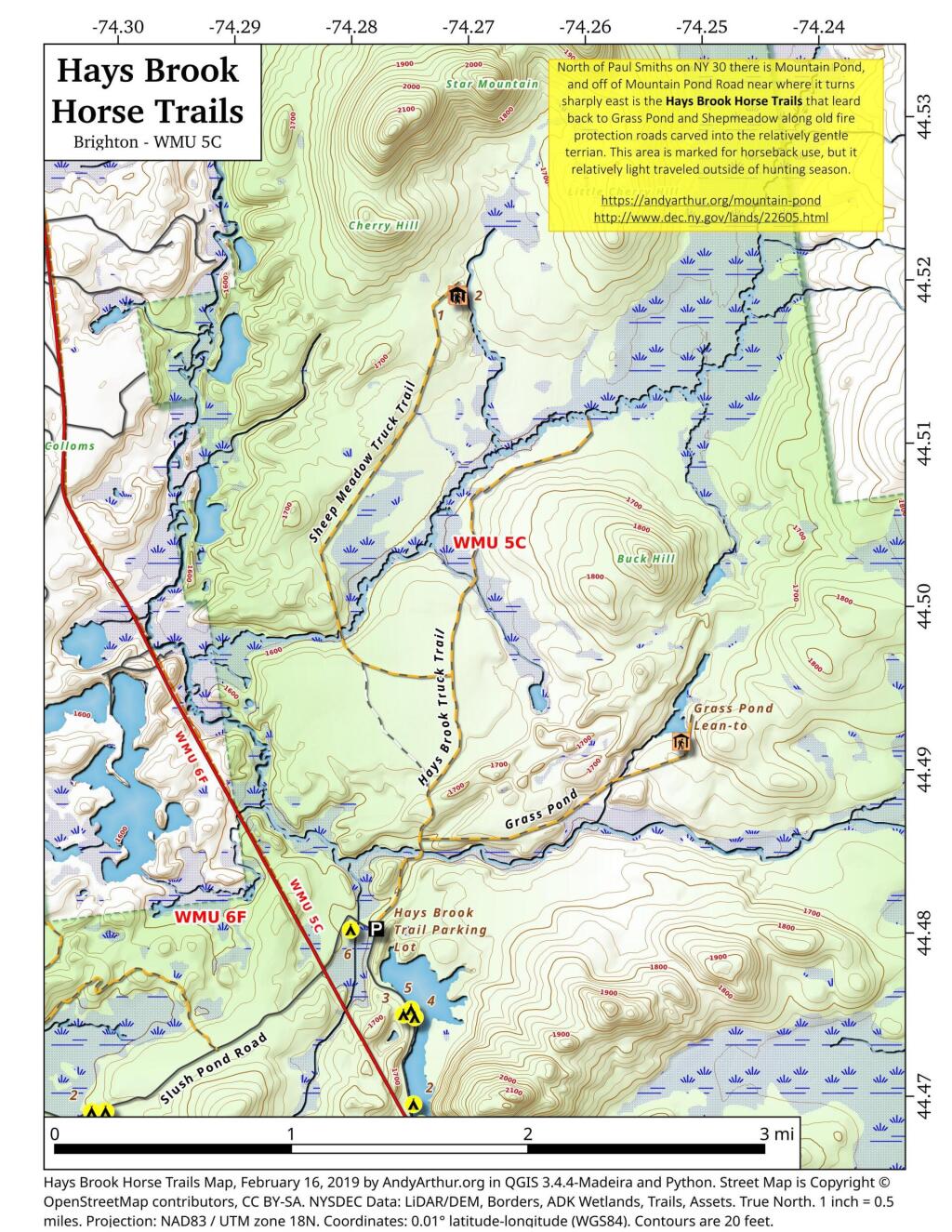
North of Mountain Pond in Paul Smiths is an old routing of NY 30 and several old fire protection roads that are used today for hiking, horseback riding, and accessing backcountry hunting locations. Known as the Hays Brook Horse Trails, there is a small parking area along Mountain Pond Road (Old Route 30), along with a falling apart wooden sign indicating the trail head.