Headwaters of the White River
Here are some of the camping opportunity along the Headwaters of the White River.
Here are some of the camping opportunity along the Headwaters of the White River.
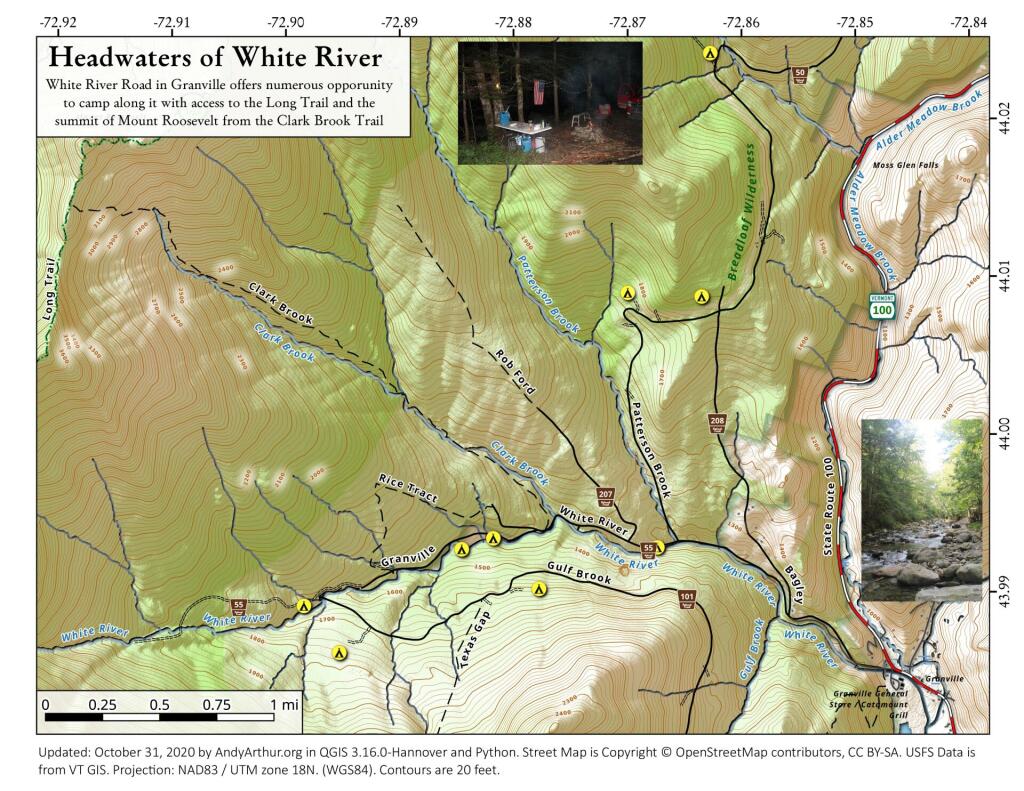
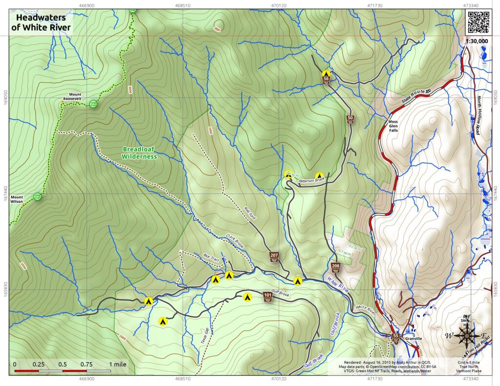
On the backside of Mount Grant and Bread Loaf Mountain is the headwaters of the White River in Granville, Vermont. Forest Route 55 provides access to the back country, and there is a deep hollow with informal campsites along it to explore.
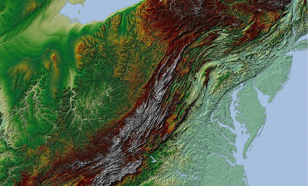
The Allegheny Front stands as the prominent escarpment facing southeast or east within the Allegheny Mountains, spanning southern Pennsylvania, western Maryland, and eastern West Virginia in the USA. Serving as a demarcation, the Allegheny Front acts as the dividing line between the Ridge-and-Valley Appalachians to the east and the Appalachian Plateau (often referred to as the Allegheny Plateau) to the west. This geological feature is intimately linked with the Eastern Continental Divide of the Appalachian Mountains. In this region, the Eastern Continental Divide separates the watersheds of the Ohio/Mississippi river system, which flow towards the Gulf of Mexico, from those of rivers that eventually empty into Chesapeake Bay and further into the Atlantic Ocean.
Nonetheless, it's important to note that the Allegheny Front and the Divide don't always perfectly align. For instance, the North Branch of the Potomac River originates significantly west of the Allegheny Front, near the Fairfax Stone located at the southwestern tip of Maryland. It's merely around 10 miles (16 km) away and situated across the physical divide from the headwaters of the Youghiogheny River, which flows westward into the Monongahela and Ohio rivers.