Glacier Lake
Glacier Lake at Clark Reservation was the site of a large waterfall formed by melting glacial ice at the end of the last Ice Age; the plunge basin at the base of the old falls is now a small lake.
Glacier Lake at Clark Reservation was the site of a large waterfall formed by melting glacial ice at the end of the last Ice Age; the plunge basin at the base of the old falls is now a small lake.
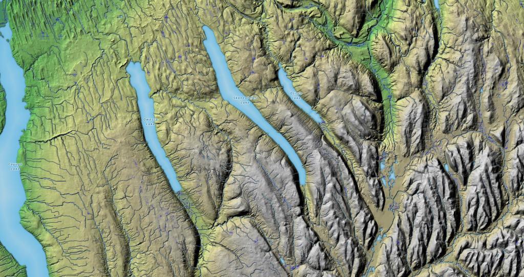
I've always been fascinated by the terrain as you drive from the hill and holler country of Southern Madison and Onondaga County, into the rolling country of the Finger Lakes, along US 20. This relief map of this region shows the change in the landscape, along with the dunes sculpted by the glaciers as you head out into the Finger Lakes.
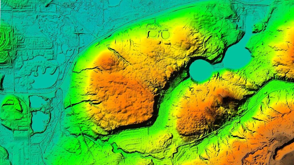
LiDAR not only shows elevation of the landscape in detail, it shows things like earthworks from road beds and stone wells. Green Lakes State Park is a geological wonder -- looking at it's elevation profile and how it was cut with glaciers is pretty interesting.