Empire State Plaza take area, Albany, NY
This is a stitch of ten sheets of a Sanborn fire insurance map showing the area demolished for the Empire State Plaza in 1962 in Albany, NY Uploaded by Dave Hochfelder to Map Warper, showing his beautiful work as an overlay here. Get the original warped map here: https://mapwarper.net/maps/31269
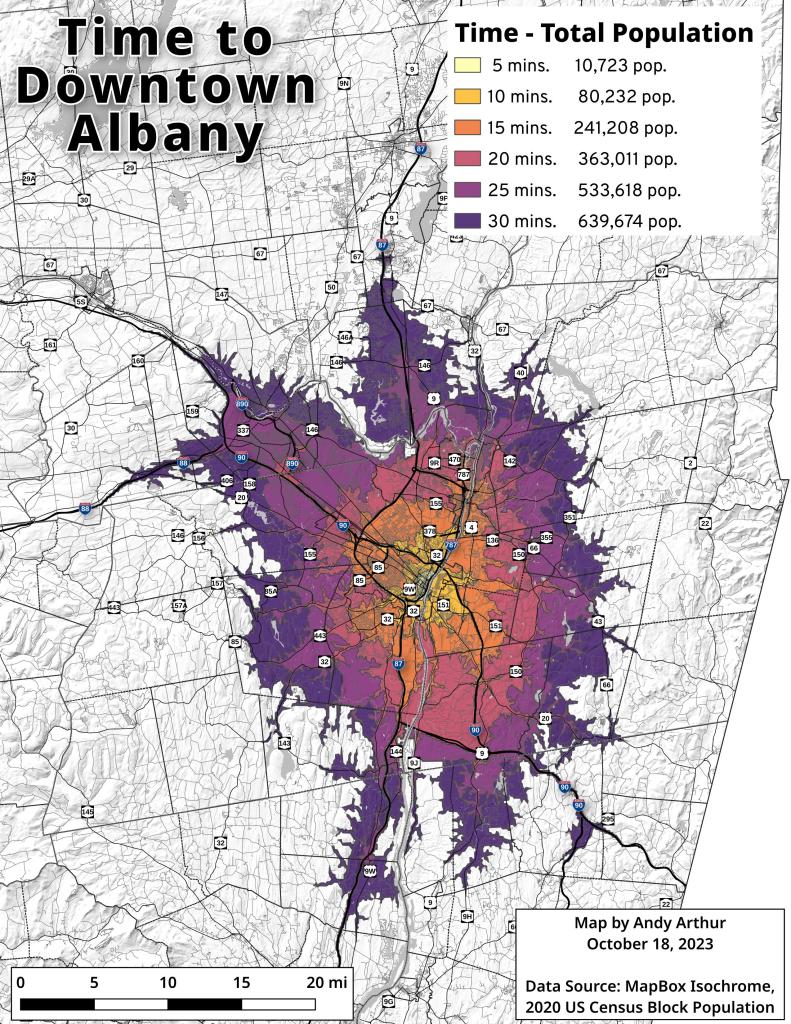
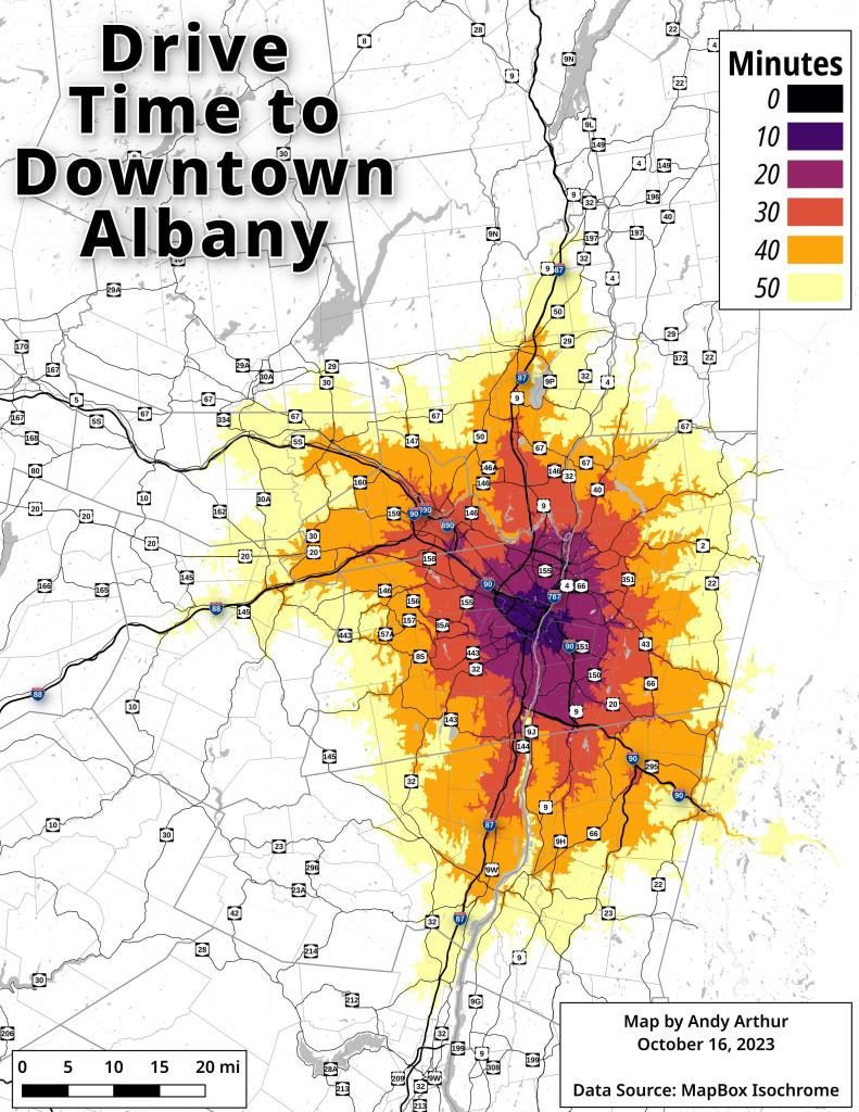
I was asked how many people live within 30 minutes of Downtown Albany. A few lines of tidycensus, and we're off to the races or at least our daily commute !
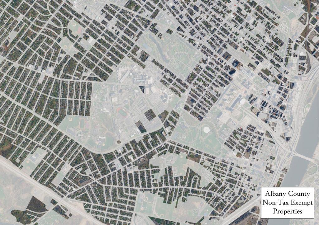
Data Source: Albany County Tax Rolls. Tax exempt properties are defined as properties that have a town tax value of zero-dollars assigned in the tax rolls. Non-tax exempt properties are shown as a darker color.
A look at traffic counts from recent DOT traffic studies. Zoom, pan, and click for details.
Data Source: NYS Department of Transportation. https://gis.dot.ny.gov/hostingny/rest/services/Roadways/Traffic_Monitoring/MapServer


