Search Results for: "Map:" Black Lake
Alma Pond
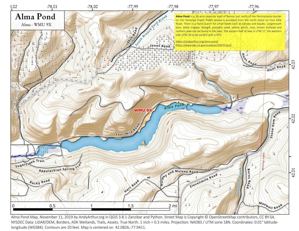
Alma Pond is a 36-acre reservior east of Bolivar just north of the Pennsylvania border on the Honeoye Creek. Public access is provided from the north shore on Four Mile Road. There is a hand launch for small boats such as canoes and kayaks. Largemouth bass, black crappie, bluegill, pumpkin seed, yellow perch, carp, brown bulhead and nothern pike can be found in this lake. The eastern half of lake is UTM 17, the western side UTM 18 so be careful with a GPS.
Illion
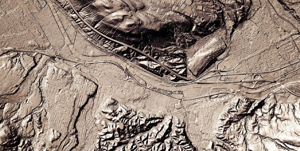
I always find driving the part of the Thruway around Illion to be the most fascinating. It's an interesting mix of geologies as you rise from the end of the Mohawk Valley into the Onieda Lake plains - the mucky farm country with many a swamp and arces of fertile black dirt.
North Lake Reservior
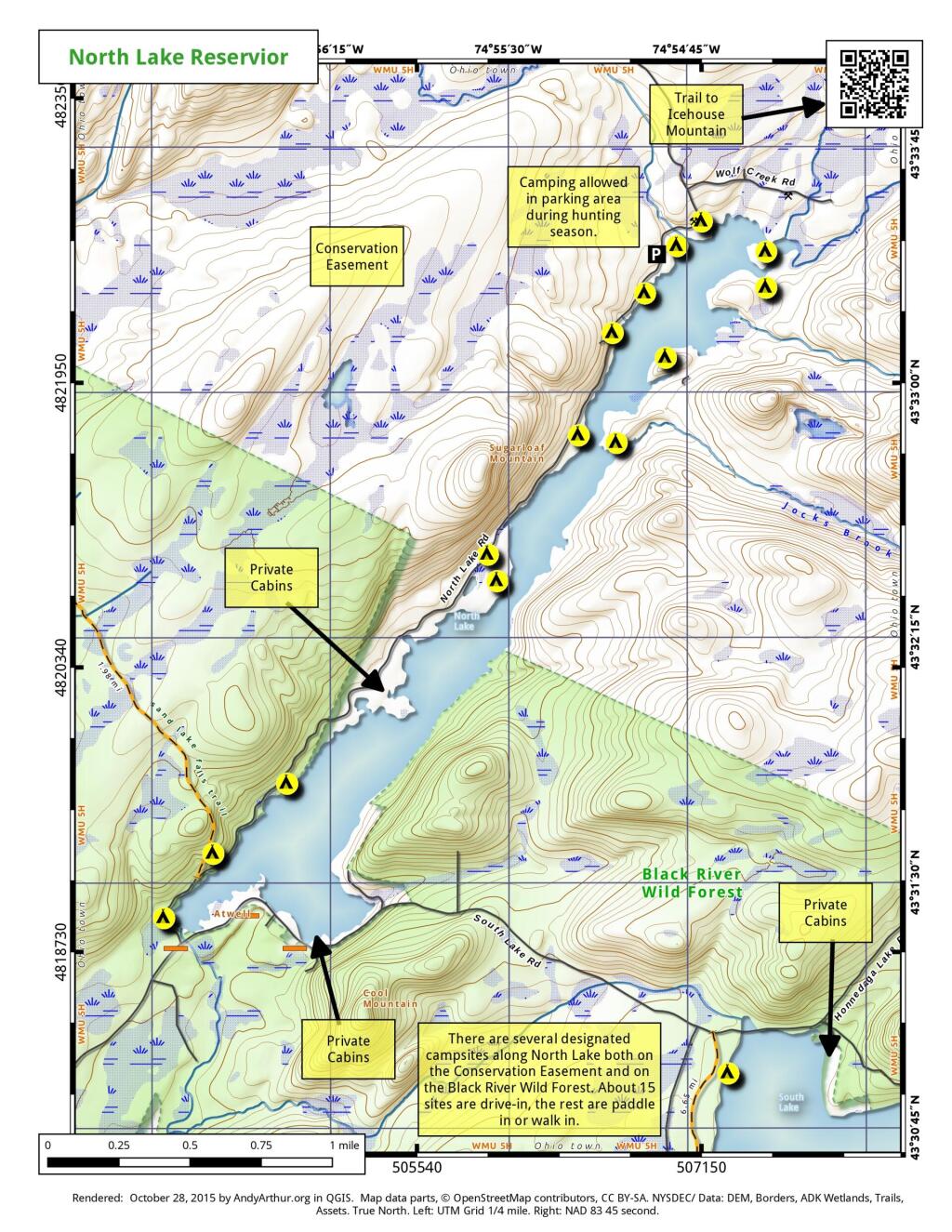
There are several designated campsites along North Lake both on the Conservation Easement and on the Black River Wild Forest. About 15 sites are drive-in, the rest are paddle-in or walk-in.
Cranberry Lake
Green on white campsites are fee campsites which you must pay for and reserve. Yellow on black campsites are free on a first come first serve basis.
Forked Lake
Forked Lake is home to both a developed reservation and fee campground (green and white) and a handful of primative free campsites (yellow and black) along the lake. There also is a couple of lean tos along the lake.
Chub Lake
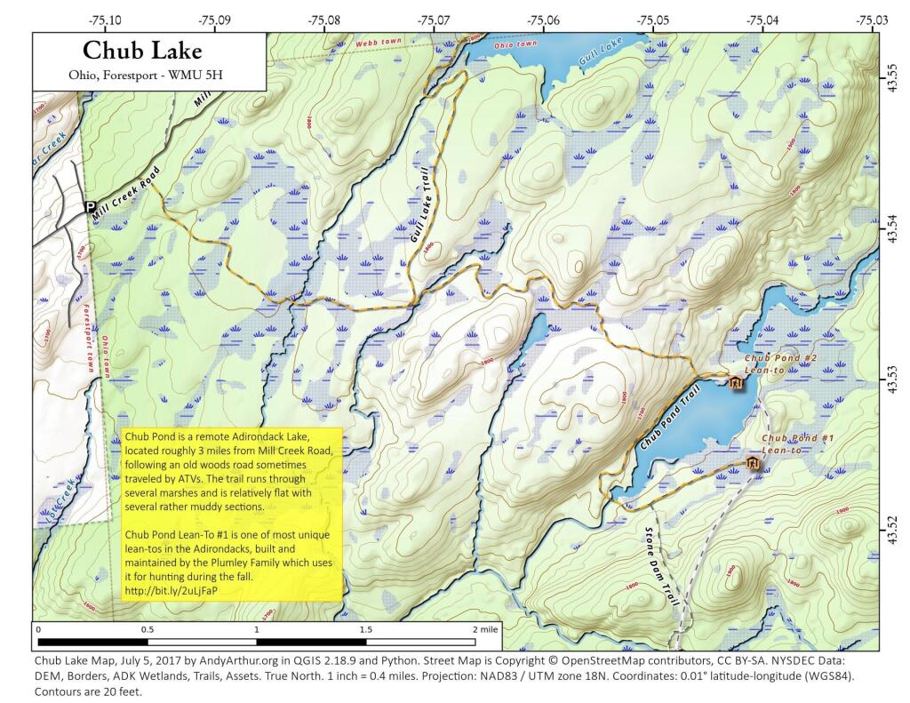
Chub Pond is a remote Adirondack Lake, located roughly 3 miles from Mill Creek Road, following an old woods road sometimes traveled by ATVs. The trail runs through several marshes and is relatively flat with several rather muddy sections. Chub Pond Lean-To #1 is one of most unique lean-tos in the Adirondacks, built and maintained by the Plumley Family in 1963 which uses it for hunting during the fall. http://www.protectadks.org/2014/09/a-forest-preserve-lean-to-on-chub-pond-in-the-black-river-wild-forest-area-has-been-extensively-modified-and-turned-into-a-private-camp/