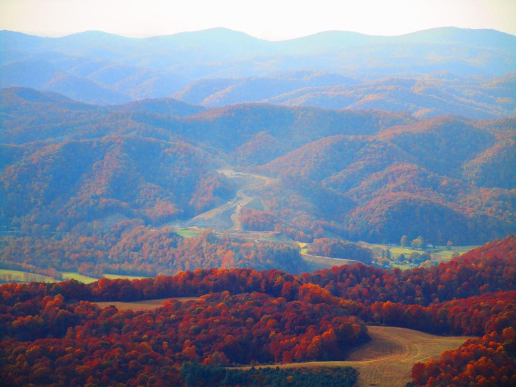
Photo: Blasting Coridoor H Through the Mountains
Download a High Resolution JPEG Image of the Blasting Coridoor H Through the Mountains or an Adobe Acrobat Printable PDF of the Blasting Coridoor H Through the Mountains.
Blasting Coridoor H Through the Mountains ...
As seen from the Olson Firetower, they are blasting Corridor H through the mountains from Kearns to Parsons.
The new superhighway, when fully built out from I-66 in Stratsburg, VA will take hours off the drive to I-78 in Weston WV, unlocking both the wilderness areas and natural areas of the northern part of state to thousands from Washington DC and Pittsburgh Penna, but it's not without controversy.
For one, it's expensive to blast through mountains and build many bridges hundreds of feet above the valleys below, and only comes at the troughs of federal largess. And it's not even built up to full interstate standards, with many at-grade intersections due to enormous cost of the highway, one of most expensive per mile currently under active construction nationwide.
Second, several sections are very controversial, such as whether to build the road north or south of Thomas. The southerly route is much shorter, but it would cross the North Fork of Blackwater Canyon, significant wetlands and the Coketon Historic-area, once an African American village -- and risks spilling millions of gallons of acid mine discharge into the river. But the northerly route is miles longer, steeper and much more expensive to build. Likewise, VA DOT has opposed the extension through Virginia, despite being on WV Maps. State DOTs ultimately have final say if interstate highways are constructed, if they don't request funding, people will continue to have to get off onto a narrow, steep, twisty road at the state line.
Plus, the existing portions of the expressway are bringing record numbers each year of tourists to northern WV, on narrow, twisty local roads with limited parking, and parks and wilderness areas not prepared to deal with that kind of traffic especially during peak summer and autumn seasons.
Taken on Thursday October 26, 2023 at Monongahela National Forest.
More about Monongahela National Forest...
Spanning the Appalachian Mountains of West Virginia, Monongahela National Forest sprawls across 900,000 acres of diverse landscapes. Its lush forests, rolling hills, and rugged mountains create a haven for outdoor enthusiasts. With abundant trails, including those in the designated Cranberry Wilderness, hiking, camping, fishing, and wildlife watching are popular pursuits. The forest offers primitive and roadside camping, allowing visitors to immerse themselves in nature. While embracing its wilderness charm, it's important to note that limited cell service adds to the authentic back-to-nature experience. From the Allegheny Plateau to mountainous terrains, Monongahela National Forest beckons adventurers to explore its untouched beauty and embrace the outdoor splendor of the Appalachian region.
https://www.fs.usda.gov/mnf
https://en.wikipedia.org/wiki/Monongahela_National_Forest
Maps and Interactives
Whites Run
Spruce Mountain
Canaan Valley National Wildlife Refuge
Canaan Valley
Canaan Heights
Blackwater River Tributory at Canaan Valley
Olson Fire Tower
Monongahela National Forest 1:24k Topographic Map Index
Forest Road 13 Informal Camping Opporunities
Blackwater Canyon Trail
... photos, maps and other content from from Monongahela National Forest.
