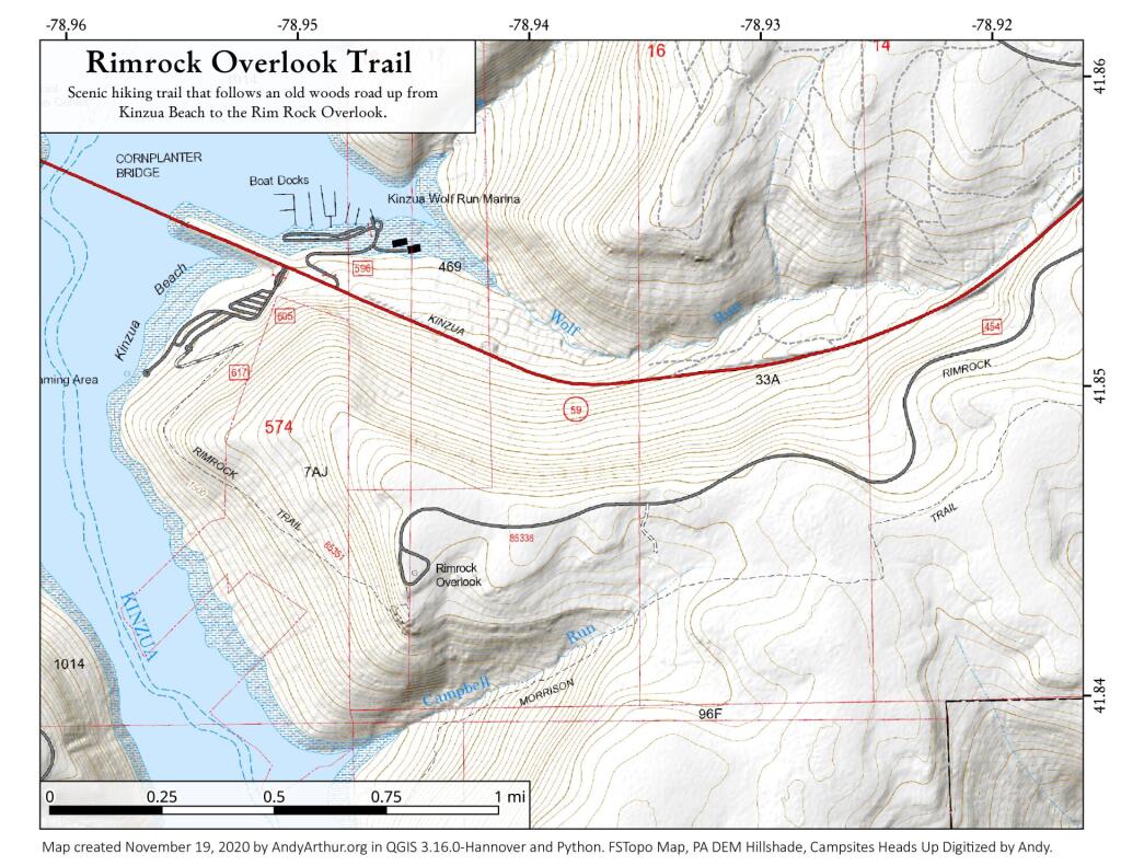
Map: Rimrock Overlook Trail
Download a High Resolution JPEG Image of the Rimrock Overlook Trail or an Adobe Acrobat Printable PDF of the Rimrock Overlook Trail.
About Map: Rimrock Overlook Trail ....
An alternative to going to the top of Rim Rock is to go for a nice stroll up the mountain via an old woods road from Kinzua Beach to the summit.

Bookmark my free Interactive GPS Map for your phone:
https://andyarthur.org/ny
... shows your location as a blue dot in relationship to campsites, trails, state land. This online map requires cell service, won't work in remote country, so also bring a paper map.
Free Download of New & Historical USGS 1:24k Topograpic Maps
Interactive maps with backcountry and roadside camping: New York, Pennsylvania, West Virginia & Vermont. List of NYS DEC Lean-Tos and Firetowers.
Google Spreadsheet with Roadside, Primitive and Pay Campsites
More about Rim Rock...
Rimrock Overlook offers a scenic view of Kinzua Bay, which extends southwest from the main body of the Allegheny Reservoir. The overlook is a 200 foot elevation drop from the parking area (via steps). Facilities include: vault toilets, paved & gravel paths to picnic area with tables and grills. The access road (2.5 miles) from State Route 59 is designated as a cross country ski trail during winter activity season 12/15 - 4/1.
http://www.fs.usda.gov/recarea/allegheny/recreation/recarea/?recid=6091&actid=64
... photos, maps and other content from from Rim Rock.
