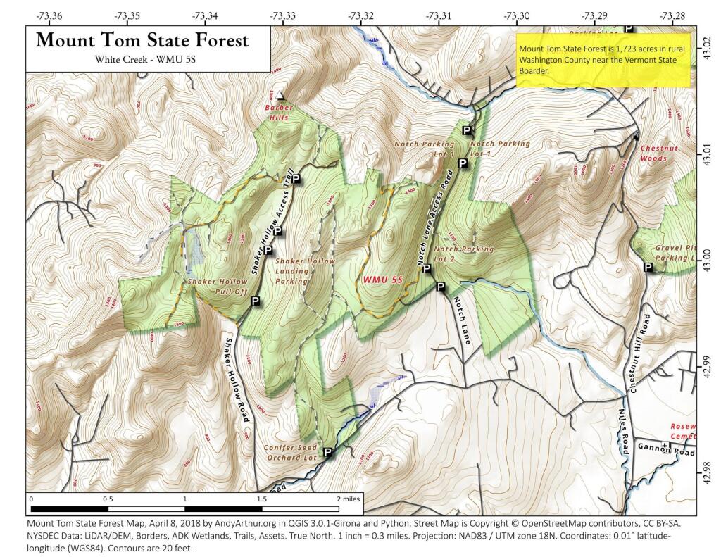
Map: Mount Tom State Forest
Download a High Resolution JPEG Image of the Mount Tom State Forest or an Adobe Acrobat Printable PDF of the Mount Tom State Forest.

Bookmark my free Interactive GPS Map for your phone:
https://andyarthur.org/ny
... shows your location as a blue dot in relationship to campsites, trails, state land. This online map requires cell service, won't work in remote country, so also bring a paper map.
Free Download of New & Historical USGS 1:24k Topograpic Maps
Interactive maps with backcountry and roadside camping: New York, Pennsylvania, West Virginia & Vermont. List of NYS DEC Lean-Tos and Firetowers.
Google Spreadsheet with Roadside, Primitive and Pay Campsites
More about Mount Tom State Forest...
Mount Tom State Forest is the largest state forest located in Washington County, with over 1,700 acres. The property is filled with ample wildlife. Additionally, it is one of the few State Forests that can be driven through from one side to the other.
https://www.dec.ny.gov/lands/107197.html
Maps and Interactives
Mount Tom
Mount Tom State Forest
... photos, maps and other content from from Mount Tom State Forest.

2 Comments
Hi. Thanks for posting the map of Mount Tom State Forest trails near Hoosick, NY. I’m planning a bikepacking trip for next week and planning on primitive camping there. I understand there are no formal primitive sites. Are you aware of any places that might be well suited for primitive camping? My current plan is to go up Shaker Hollow Road and look in that flattish area to the west of the road.
Thanks,
Glenn
I don’t I’ve never been up that way before. Thanks.