
Parking Area Overlooking Reservior
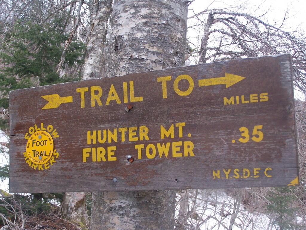
The yellow trail, about 2 1/2 miles from the parking area at the bottom of Becker Hollow is a short cut up to the firetower, bypassing the overlook.
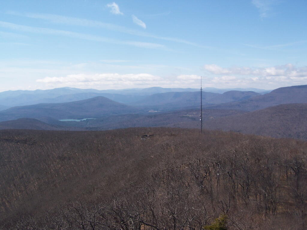
Taken on Sunday April 12, 2009 at Hunter Mountain.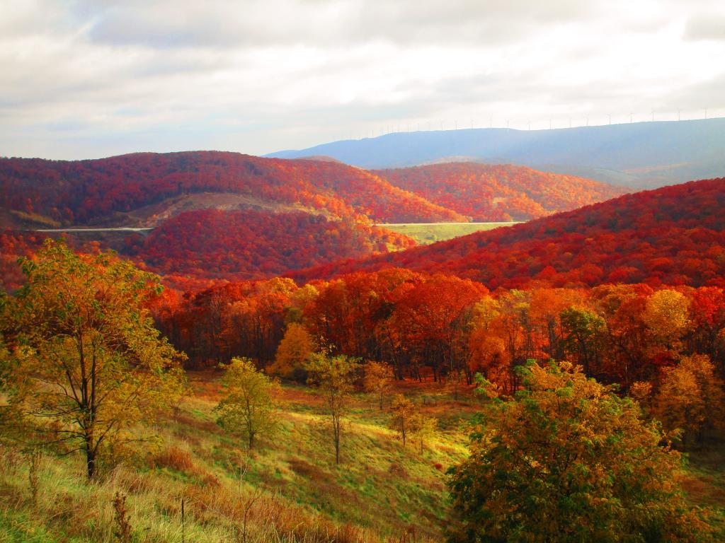
Heading down the Allegheny Front from Mount Storm, Corridor H has a parking area that offers fantastic views of the Fore Knobs, New Creek Mountain and the area around Scheer.
Taken on Saturday October 28, 2023 at Mount Storm.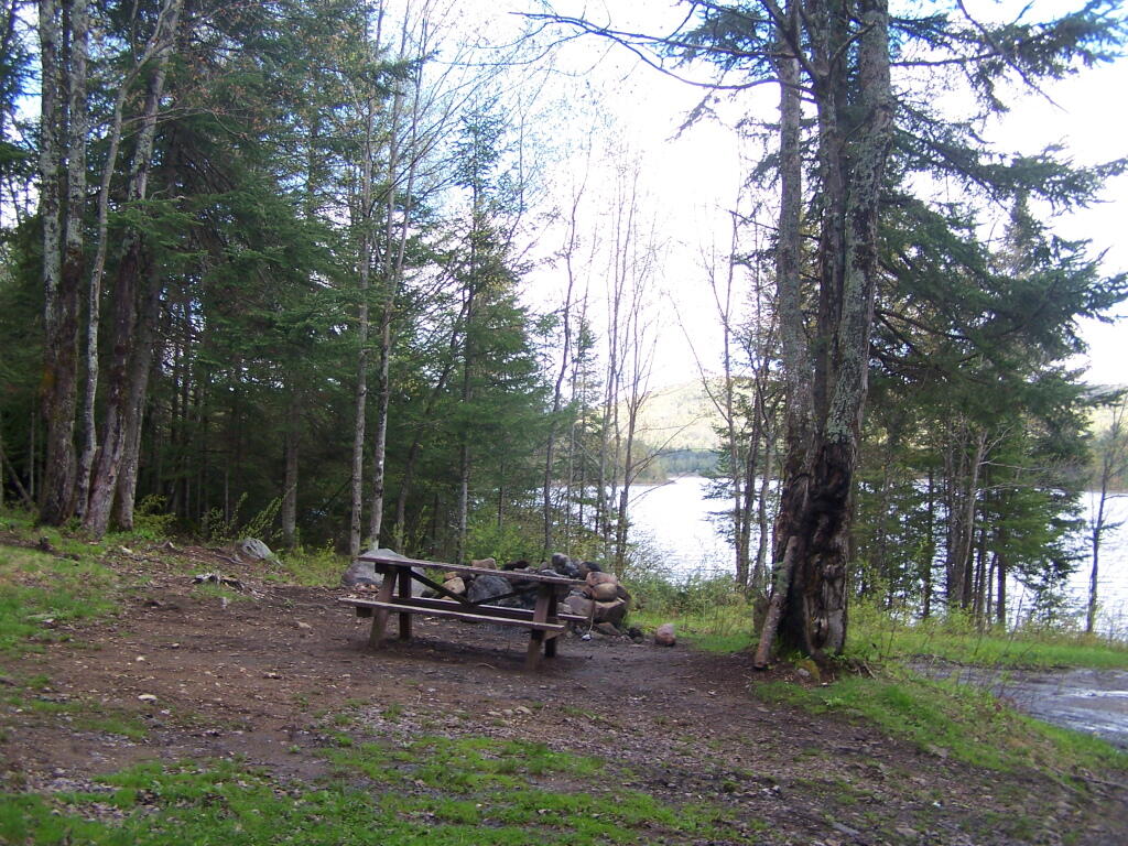
There was a single road campsite, overlooking the parking lot and Cheney Pond. There is a lean-to and two other campsites on the other side of the lake, only accessible by boat.
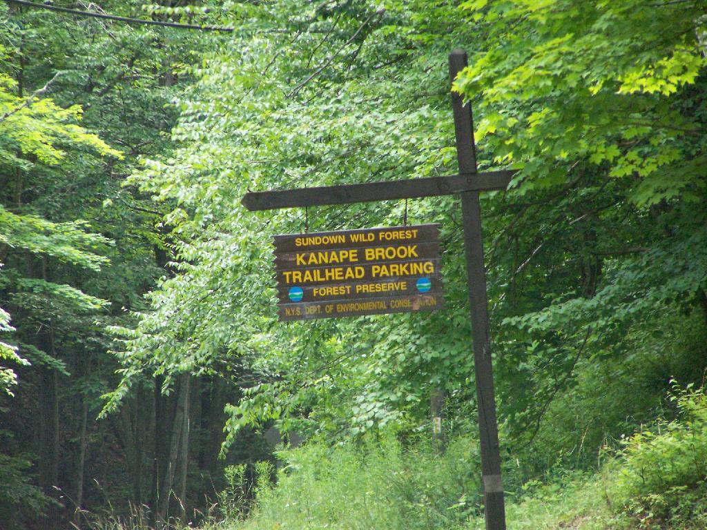
Taken on Saturday May 21, 2011 at Lester Flow and Cheney Pond.Below is a listing of DEC parking areas in the Catskill Park with coordinates and addresses, nearby trails and the roads they are located on.
| Trail | Road | Name | Notes | Street | City | St | ZIP | Latitude | Longitude |
| Ashokan High Point | Watson Hollow Road | Kanape Valley Parking Lot | 826 Watson Hollow Rd | West Shokan | NY | 12494 | 41.9357923141228 | -74.3281141901214 | |
| Beaverkill Road | Beaverkill Road | Beaverkill Road Parking Lot | 2795 Beaverkill Rd | Livingston Manor | NY | 12758 | 42.0117166110155 | -74.6223767934834 | |
| Beaverkill Road | Turnwood Road | Beaverkill Road Parking Lot | 2952 Beaverkill Rd | Livingston Manor | NY | 12758 | 42.0233290355646 | -74.5995306115641 | |
| Becker Hollow Trail | Lane Road | Becker Hollow Parking Lot | 6 Vehicle Capacity | 3940 Route 214 | Elka Park | NY | 12427 | 42.1816084527769 | -74.1969812784753 |
| Bengle Hill Trail | Peekamoose Road | Eastern Upper Field Parking Lot | 359 Peekamoose Rd | Grahamsville | NY | 12740 | 41.9166423616552 | -74.4377863112221 | |
| Bengle Hill Trail | Peekamoose Road | Lower Field Parking Lot | 194 Peekamoose Rd | Grahamsville | NY | 12740 | 41.9101942400042 | -74.452852499381 | |
| Bengle Hill Trail | Peekamoose Road | Middle Field Parking Lot | 304 Peekamoose Rd | Grahamsville | NY | 12740 | 41.9158997405029 | -74.443422031256 | |
| Bengle Hill Trail | Peekamoose Road | North Middle Field Parking Lot | 304 Peekamoose Rd | Grahamsville | NY | 12740 | 41.9164180048779 | -74.4416441135141 | |
| Bengle Hill Trail | Peekamoose Road | Trailer Feild Parking Lot | 359 Peekamoose Rd | Grahamsville | NY | 12740 | 41.9162603251141 | -74.4346555497984 | |
| Bengle Hill Trail | Peekamoose Road | Western Upper Field | 359 Peekamoose Rd | Grahamsville | NY | 12740 | 41.9169982073948 | -74.4396463051141 | |
| Big Pond – Alder Lake | Barkaboom Road | Barkaboom Road Parking Lot | Located On Barkaboom Road, 6 Cars | 288 Barkaboom Rd | Andes | NY | 13731 | 42.0426860004001 | -74.7267519998891 |
| Big Pond – Alder Lake | Cross Mountain Road | Alder Lake Parking Lot | 2 Cross Mountain Rd | Livingston Manor | NY | 12758 | 42.0497953211373 | -74.6827571604492 | |
| Black Dome Trail | Big Hollow Road | Big Hollow Road Parking Lot | 7 Vehicle Capacity | 947 Route 56 | Maplecrest | NY | 12454 | 42.2889033425096 | -74.1151262941519 |
| Campbell Mountain Trail | Cat Hollow Road | Route 206 Parking Lot | 5 Vehicle Capacity | 1611 County Road 7 | Roscoe | NY | 12776 | 42.051659649187 | -74.9147231839428 |
| Cic – Esopus Trail | State Route 28 | Parking Area For Esopus Creek Fishing Access | Parking Area For Esopus Creek Fishing Access – Cic | 5067 Route 28 | Mount Tremper | NY | 12457 | 42.0254799892217 | -74.2717292519349 |
| Cic Hill Trail | Wittenberg Road | Wittenberg Road Parking Lot | 1298 Wittenberg Rd | Mount Tremper | NY | 12457 | 42.0279684988885 | -74.2620571929729 | |
| Colgate Lake Trail To Dutcher Notch | Colgate Road | Colgate Lake Lower Parking Lot | 50 Vehicle Capacity | 525 Colgate Rd | East Jewett | NY | 12424 | 42.2384696568264 | -74.1233979344461 |
| Colgate Lake Trail To Dutcher Notch | Colgate Road | Colgate Lake Parking Lot | 2 Vehicle Capacity | 524 Colgate Rd | East Jewett | NY | 12424 | 42.2385040003097 | -74.1206960003026 |
| Colgate Lake Trail To Dutcher Notch | Colgate Road | Colgate Lake Trail Parking Lot | 8 Vehicle Capacity | 653 Colgate Rd | East Jewett | NY | 12424 | 42.2384599994304 | -74.1163269993959 |
| Condon Hollow Rd. | Condon Hollow Road | Condon Hollow Road Parking Lot | 3 Vehicle Capacity | 139 Condon Hollow Rd | West Kill | NY | 12492 | 42.2161010059593 | -74.4163349850283 |
| Condon Hollow Rd. | Elk Creek Road | Elk Creek Road Parking Lot | 5 Vehicle Capacity | 734 Elk Creek Rd | Fleischmanns | NY | 12430 | 42.1996047835286 | -74.4451315908425 |
| Condon Hollow Rd. | South Beech Ridge Road | Beech Road Parking Lot | 4 Vehicle Capacity | 291 S Beech Ridge Rd | West Kill | NY | 12492 | 42.2139020709257 | -74.4012095700882 |
| Condon Hollow Rd. | State Highway 42 | Rte 42 Parking Lot | 3 Vehicle Capacity | 1088 Route 42 | Shandaken | NY | 12480 | 42.1851525975488 | -74.4149115068685 |
| Denman Mountain Snowmobile Trail | Glade Hill Road | Denman Parking Lot | 327 Glade Hill Rd | Grahamsville | NY | 12740 | 41.8853341886314 | -74.5320280123605 | |
| Denman Mountain Snowmobile Trail | Moore Hill Road | Hogs Roack Plot Parking Lot | 578 Alpha Rd | Grahamsville | NY | 12740 | 41.9003387815796 | -74.5274487605523 | |
| Devil’s Path | Broadstreet Hollow Road | Broadstreer Hollow Parking Lot | 2 Vehicle Capacity | 619 Broadstreet Hollow Rd | Shandaken | NY | 12480 | 42.1394450770105 | -74.3308357356817 |
| Devil’s Path | Spruceton Road | Spruceton Road Parking Lot | 5 Vehicle Capacity | 1518 Spruceton Rd | West Kill | NY | 12492 | 42.1920191641918 | -74.3238474073796 |
| Devil’s Path | Prediger Road | Prediger Road | 75 Prediger Rd | Elka Park | NY | 12427 | 42.1338909995054 | -74.1042720006852 | |
| Diamond Notch Trail | Diamond Notch Road | South Diamond Notch Parking Lot | 2 Vehicle Capacity | 508 Diamond Notch Rd | West Kill | NY | 12492 | 42.147861770123 | -74.2646596008456 |
| Diamond Notch Trail | Spruceton Road | Diamond Notch Parking Lot | 8 Vehicle Capacity | 2778 Spruceton Rd | West Kill | NY | 12492 | 42.1823740001994 | -74.2695430002389 |
| Dry Brook Ridge Trail | Mill Brook Road | Dry Brook Ridge Parking Lot | 12 Balsam Mountain Camp Rd | Margaretville | NY | 12455 | 42.0715022570921 | -74.5738756337513 | |
| Dry Brook Ridge Trail | South Side Spur | North End Of Dry Brook Ridge Parking Lot | 301 Southside Spur | Margaretville | NY | 12455 | 42.1446292458628 | -74.649333317932 | |
| Elm Ridge Trail | Peck Road | Peck Road Parking Lot | 10 Vehicle Capacity | 189 Peck Rd | Maplecrest | NY | 12454 | 42.2965789997488 | -74.1693680002929 |
| Fluggertown Road Long Pond Trail | Fluggertown Road | Flugertown Road Parking Lot | 191 Flugertown Rd | Livingston Manor | NY | 12758 | 41.9347657909639 | -74.649696950272 | |
| Flynn Trail | Mongaup Road | Mongaup Road Parking Lot | 1 Beech Mountain Rd | Livingston Manor | NY | 12758 | 41.9467974587868 | -74.7052771774711 | |
| Giant Ledge-Panther Mountian-Fox Hollow Trail | Fox Hollow Road | Fox Hollow Road Parking Lot | 67 Mountain Dr | Shandaken | NY | 12480 | 42.1008382907335 | -74.3904559601097 | |
| Giant Ledge-Panther Mountian-Fox Hollow Trail | Peck Hollow Road | Peck Hollow Road Parking Lot | 254 Peck Hollow Rd | Shandaken | NY | 12480 | 42.1357649784827 | -74.3712920364471 | |
| Giant Ledge-Panther Mountian-Fox Hollow Trail | Peck Hollow Road | Esopus Creek Fishing Access (Upper) | Gravel | 7019 Route 28 | Pheonicia | NY | 12464 | 42.1065553340012 | -74.3519924442835 |
| Giggle Hollow Trail | NY 23 – Belleayr | Belleayre Day Use Parking Lot | 33 Friendship Manor Rd | Pine Hill | NY | 12465 | 42.1256810090987 | -74.4731178408634 | |
| Harding Road Spur Trail | Whites Road | Whites Road Parking Lot | 4 Vehicle Capacity | 274 White Rd | Palenville | NY | 12463 | 42.1823951680298 | -74.0261906353256 |
| Harding Road Trail | Harding Road | Harding Road Parking Lot | 5 Vehicle Capacity | 3525 Route 23A | Palenville | NY | 12463 | 42.1762358120255 | -74.0304949714876 |
| Huckleberry North Trail | Hill Road | Hill Road Parking Lot | 4 Vehicle Capacity | 1209 Hill Rd | Margaretville | NY | 12455 | 42.1166129796449 | -74.6486105632054 |
| Huckleberry North Trail | Huckleberry Brook Spur Road | Huckleberry Brook Road Parking Lot | 6 Vehicle Capacity | 1613 Huckleberry Brook Rd | Margaretville | NY | 12455 | 42.1130238724914 | -74.6515523618233 |
| Huckleberry South Trail | Huckleberry Brook Spur Road | Huckleberry Road Parking Lot | 5 Vehicle Capacity | 1073 Huckleberry Brook Rd | Margaretville | NY | 12455 | 42.1152546105706 | -74.6636037740616 |
| Huckleberry South Trail | Hull Road | Ploutz Road | 4 Vehicle Capacity | 1634 Ploutz Rd | Margaretville | NY | 12455 | 42.0938719675255 | -74.6204457323272 |
| Huggins Lake Trail | Berry Brook Road | Huggins Lake Road Parking Lot | 4 Vehicle Capacity | 2414 Holiday And Berry Brook Rd | Roscoe | NY | 12776 | 42.0157959909969 | -74.8436914198853 |
| Jockey Hill Bicycle Trail | Wood Road | Wood Road Parking Lot | 334 Woods Rd | Kingston | NY | 12401 | 41.9777439980953 | -74.0501113306995 | |
| Kaaterskill Falls Trail | State Highway 23a | Molly Smith Parking Lot | Dot Facility, 20 Vehicles | 4729 Route 23A | Elka Park | NY | 12427 | 42.1898508772368 | -74.074111945438 |
| Kaaterskill Rail Trail | Laurel House Rd | Laurel House Rd | 103 Laurel House Rd | Tannersville | NY | 12485 | 42.1956250050266 | -74.063093393786 | |
| Kelly Hollow Long Loop Trail | Mill Brook Road | East Kelly Hollow Parking Lot | 5163 Mill Brook Rd | Margaretville | NY | 12455 | 42.078800277463 | -74.6497556922038 | |
| Kelly Hollow Long Loop Trail | Mill Brook Road | West Kelly Hollow Parking Lot | 5163 Mill Brook Rd | Margaretville | NY | 12455 | 42.0795848697519 | -74.6545040693769 | |
| Long Path | Steenburg Road | Steenburgh Road | 2425 Platte Clove Rd | Elka Park | NY | 12427 | 42.1337889994516 | -74.0819709994867 | |
| Long Path | Route 23 | Route 23 Parking Lot | 20 Vehicle Capacity | 3 Cross Rd | Windham | NY | 12496 | 42.312706999584 | -74.1904309994766 |
| Long Pond South Loop | Willowemock Road | Wild Meadow Road Parking Lot | 136 Round Pond Rd | Claryville | NY | 12725 | 41.9435338737706 | -74.5864488816452 | |
| Lost Clove Trail | Lost Clove Road | Lost Clove Parking Lot | 343 Lost Clove Rd | Big Indian | NY | 12410 | 42.1054379266455 | -74.4700849794812 | |
| Mary Smith Trail | Holliday Brook Road | Holiday And Berry Brook Road Parking Lot | 5 Vehicle Capacity | 3851 Holiday And Berry Brook Rd | Roscoe | NY | 12776 | 42.0386999995498 | -74.8473909994493 |
| Mckinley Hollow Trail | Mc Kinley Hollow Road | Mckinly Hollow Parking Lot | 200 McKinley Hollow Rd | Big Indian | NY | 12410 | 42.0704132895809 | -74.4740296153462 | |
| Mckinley Hollow Trail | Rider Hollow Road | Rider Hollow Parking Lot | 12 Warren Todd Subdivision Dr | Arkville | NY | 12406 | 42.1018368545182 | -74.5170339246663 | |
| Mckinley Hollow Trail | Burnham Hollow Road | Burnham Hollow Parking Lot | 17 Sagmore Trl | Big Indian | NY | 12410 | 42.05564157218 | -74.4669789486585 | |
| Middle Mountain Trail | Mary Smith Hill Road | Mary Smith Hill Road Parking Lot | 3 Vehicle Capacity | 865 Mary Smith Hill Rd | Andes | NY | 13731 | 42.0401290003224 | -74.8089319993063 |
| Mink Hollow Trail | Mink Hollow Road | Lake Hill | 599 Mink Hollow Rd | Bearsville | NY | 12448 | 42.1051314008054 | -74.1735651990356 | |
| Mount Pleasant-Romer Mountain | State Highway 28 | Sawmill Lot | 50×50 Parking Area – Trailless | 6331 Route 28 | Phoenicia | NY | 12464 | 42.1008585056075 | -74.3445327399439 |
| Mud Pond Trail | County Road 179a | Old Rte 17 Fishing Access | 6 Vehicle Capacity | 6175 State Route 17 W | Roscoe | NY | 12776 | 41.9497668355721 | -74.9281906252666 |
| Mud Pond Trail | Horton Brook Road | Little Fuller Brook Parking Lot | 6 Vehicle Capacity | 845 Horton Brook Rd | Roscoe | NY | 12776 | 42.0159481159029 | -74.9790550095988 |
| Onteora Lake Parking Access | State Highway 28 | Onteora Lake Trailhead Upper Lot | 881 Route 28 | Kingston | NY | 12401 | 41.9807660434687 | -74.0853059041223 | |
| Onteora Lake Yellow Tral | NY 23 | Onteora Lake Parking | 960 Route 28 | Kingston | NY | 12401 | 41.9840941553893 | -74.0827910535657 | |
| Overlook Spur Trail Extension | Macdaniiel Road | Meads Meadow Parking Area | 452 MacDaniel Rd | Bearsville | NY | 12409 | 42.0756312690235 | -74.1276188121255 | |
| Overlook Trail | Meads Mountain Road | Overlook Mountain Trailhead | 334 Meads Mountain Rd | Woodstock | NY | 12498 | 42.0710794980857 | -74.1224765106456 | |
| Peekamoose-Table Trail | Peekamoose Road | Peekamoose Road Parking Lot | 415 Peekamoose Rd | Grahamsville | NY | 12740 | 41.9233895882109 | -74.4128616227944 | |
| Peekamoose-Table Trail | Peekamoose Road | Peekamose Mountian Trail Head Parking Lot | 415 Peekamoose Rd | Grahamsville | NY | 12740 | 41.9149365156904 | -74.4289858455429 | |
| Pelnor Hollow Trail | Beaver Kill Road | Waneta Lake Parking Lot | 732 Beaverkill Rd | Livingston Manor | NY | 12758 | 41.9676202925977 | -74.8292314401778 | |
| Phoenicia East Branch Trail | Denning Road | Denning Road Parking Lot | 3381 Denning Rd | Claryville | NY | 12725 | 41.9690314347788 | -74.4486958819482 | |
| Phoenicia East Branch Trail | Oliverea-Slide Mountain Road | Oliverea Road North Parking Lot | 1453 Oliverea Rd | Big Indian | NY | 12410 | 42.0265659167754 | -74.4038665935078 | |
| Phoenicia East Branch Trail | Oliverea-Slide Mountain Road | Oliverea Road South Parking Lot | 19 Shandaken Rod Gun Clb | Big Indian | NY | 12410 | 42.0078280894865 | -74.4268762683237 | |
| Phoenicia Trail | Plank Road | Tremper Mountain Parking Area | Gravel Lot | 5636 Route 28 | Phoenicia | NY | 12464 | 42.0705625579484 | -74.3024012416267 |
| Pine Hill West Branch Trail | West Branch Road | Biscuit Brook Parking Lot | 1886 Frost Valley Rd | Claryville | NY | 12725 | 41.990833872737 | -74.4845571593918 | |
| Powerline | Beech Ridge Road 1 | Vinegar Hill Parking Area | 1060 N Beech Ridge Rd | Prattsville | NY | 12468 | 42.2449000123037 | -74.4075985539776 | |
| Red Hill Fire Tower Trail | Red Hill Road | Red Hill Fire Tower Parking Lot | 129 Coons Rd | Claryville | NY | 12725 | 41.9302938486155 | -74.5073498606472 | |
| Roaring Kill Trail | Dale Lane | Roaring Kill | 6 Vehicle Capacity | 155 Roaring Kill Rd | Elka Park | NY | 12427 | 42.1511360000949 | -74.1310779997324 |
| Rochester Hollow | Shaft Road | Shaft 6 Parking | 20 Vehicle Capacity | 73 Shaft Rd | Shandaken | NY | 12480 | 42.166173156258 | -74.4083342114093 |
| Rochester Hollow | Spisak Way | Rochester Hollow Parking Lot | 51 Matyas Rd | Big Indian | NY | 12410 | 42.1179698674129 | -74.4517651458059 | |
| Seager Big Indian Trail | Dry Brook Road | Seager Parking Lot | 5672 Dry Brook Rd | Arkville | NY | 12406 | 42.0578836653667 | -74.5396998623234 | |
| Spencer Road | Trails End Road | Trails End Parking Lot | 197 Trails End Rd | Kerhonkson | NY | 12446 | 41.8835868385135 | -74.3594081701432 | |
| Spruceton Trail | Spruceton Road | Spruceton Trail Parking Lot | 20 Vehicle Capacity | 2628 Spruceton Rd | West Kill | NY | 12492 | 42.1846329998217 | -74.2719879999707 |
| Touch-Me-Not-Trail | Barkaboom Road | Big Pond Parking Lot | Located Off Barkaboom Road, 6 Cars | 366 Barkaboom Rd | Andes | NY | 13731 | 42.0433679998314 | -74.7277000006876 |
| Touch-Me-Not-Trail | Beech Hill Road | Beech Hill Road Parking Lot | 3 Vehicle Capacity | 2054 Beech Hill Rd | Andes | NY | 13731 | 42.0506230001697 | -74.7789470006467 |
| Touch-Me-Not-Trail | Deerlick Brook Road | Deerlick Road Parking Lot | 3 Vehicle Capacity | 1553 Deerlick Brook Rd | Andes | NY | 13731 | 42.0814567992576 | -74.7365160981546 |
| Touch-Me-Not-Trail | Barkaboom Road | Forest Preserve Access Parking | East Of Barkaboom Road 3 Cars | 1954 Barkaboom Rd | Andes | NY | 13731 | 42.0655363440977 | -74.7284401046935 |
| Trout Pond Access Route | Russell Brook Road | Russell Brook Road Parking Lot | 10 Vehicle Capacity | 4348 Russell Brook Rd | Roscoe | NY | 12776 | 41.9943949997582 | -74.941432999876 |
| Trout Pond Trail | Campbell Brook Road | Campbell Brook Road Parking Lot | 4747 Campbell Brook Rd | Downsville | NY | 13755 | 42.0306374772623 | -74.9384473452279 | |
| Trout Pond Trail | Campbell Mountain Road | Campbell Mountain Road Parking Lot | 5 Vehicle Capacity | 3693 Campbell Mountain Rd | Downsville | NY | 13755 | 42.0433291750688 | -74.9358959381363 |
| Vernooy Kill Falls Snowmobile Trail | Dymond Road | Dymond Road Parking Lot | 498 Yeagerville Rd | Napanoch | NY | 12458 | 41.8792625226568 | -74.4012606035291 | |
| Vernooy Kill Falls Snowmobile Trail | Upper Cherrytown Road | Upper Cherry Town Road Trail Head Parking Lot | 559 Upper Cherrytown Rd | Kerhonkson | NY | 12446 | 41.8643822024537 | -74.3454535201223 | |
| Willow Trail | Abbey Road | Mount Toblas Parking Lot | 439 Abbey Rd | Mount Tremper | NY | 12457 | 42.0537752508176 | -74.2306894602594 | |
| Willow Trail | Jessup Road | Willow Trailhead Parking | 6 Vehicle Capacity | 218 Jessop Rd | Willow | NY | 12495 | 42.078213053797 | -74.2442314353898 |
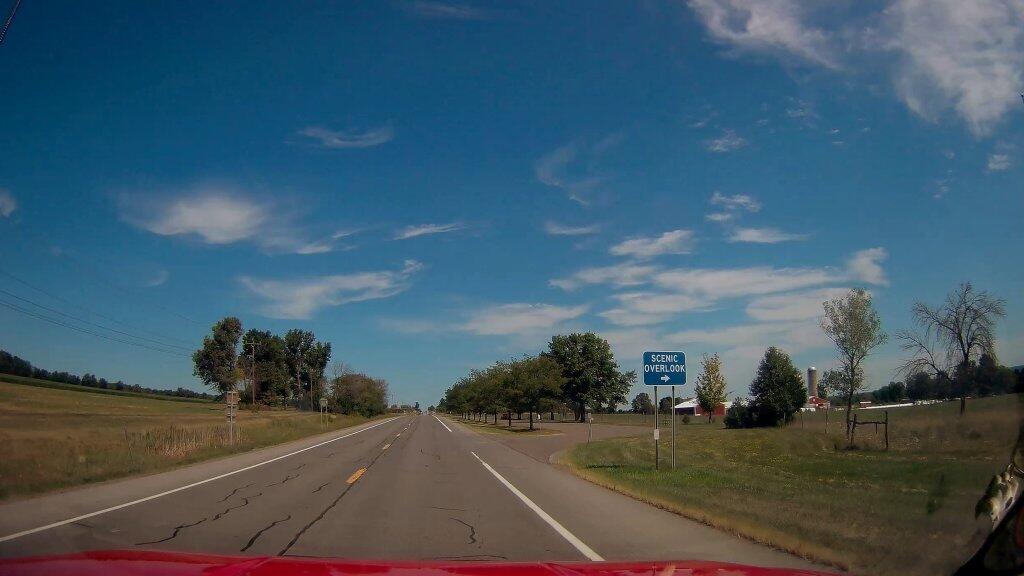
I have to say I was underwhelmed by the scenic view of the cow pasture from this parking area.
Taken on Friday August 14, 2020 at Lewis County.This past weekend’s Catskill Mountain hike was a return to Overlook Mountain, the first hike I took when I was working on my Hiking Merit Badge back in Boy Scouts. I also chose it because it was a quick hop down Route 9W or Thruway from Albany.
Not getting as early of a start as I would have liked, I arrived at the trail at around 8 AM. There was only one other car when I got there, it was packed by the time I leftbe aware if you plan hiking there. It was a nice clear morning on Sunday, and I made it up to the Catskill Mountain house around 9 AM, and to the fire tower around 9:30 AM. It was an easy hike up, following a well maintained authorized-vehicle only road, although somewhat more difficult psychologically, as you could see a quarter mile or more of the road, as it sloped uphill, sometimes at a 10-15% grade. It was not particularly warm at this hour, but I stopped frequently to snap pictures and stay hydrated.
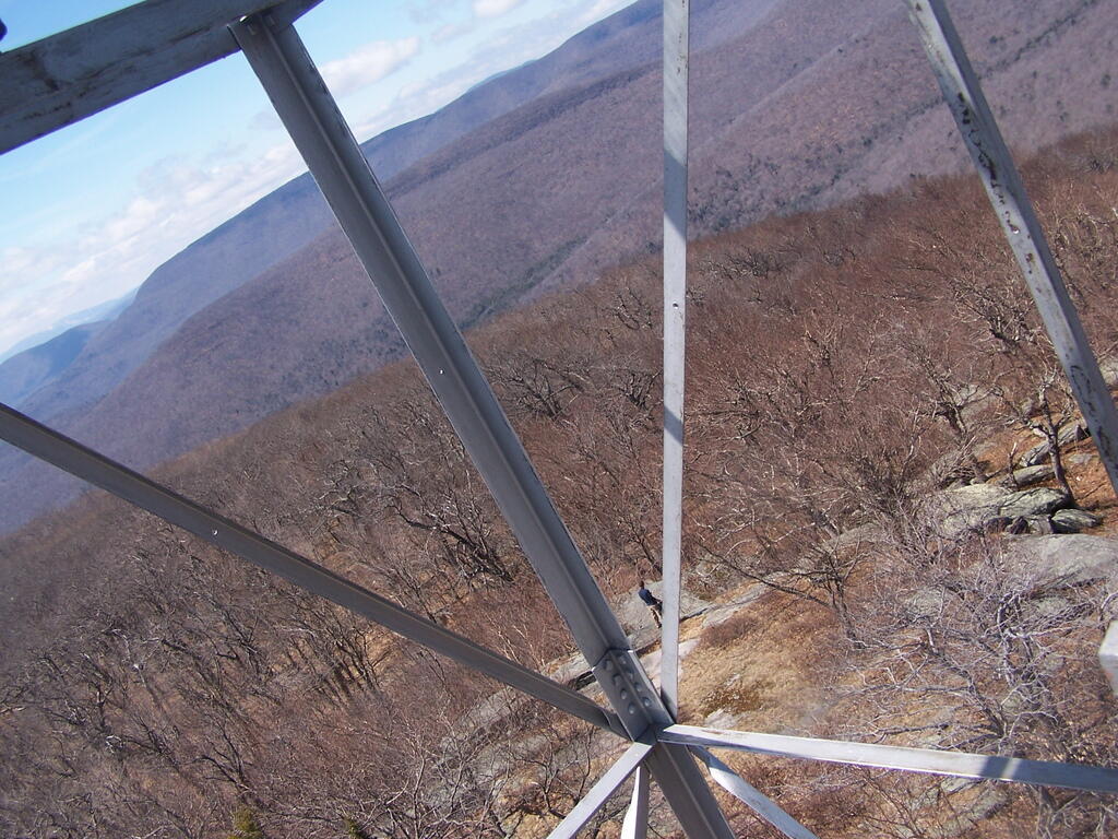
The ruins over the Overlook Mountain House (2.0 miles from parking area on Meads Mountain Road), was bigger then I last remember it. It was too bad it burned, although it’s kind of neat how the general public can inspect it and think how grand it must of been in the 1920s when it opened, and people drove up there in their Cadillacs of the era. I walked around and snapped some pictures. Then I went up to the fire tower, about 1/2 mile further. It was windy, and it appeared there was a gate closing it off, but I pushed it open and went right up. I didn’t go all the way to the top at first, because I have a little bit fear of heights remaining. I snapped several dozen of pictures.
There also is a trail with southerly view, allowing you to sit and look out over the Hudson River, Woodstock, mountains South of Overlook, and the Ashokian Reservoir. I can’t imagine how beautiful it must look in summer with everything nice and green. I took some notes, pictures, and just gazed at the landscape.
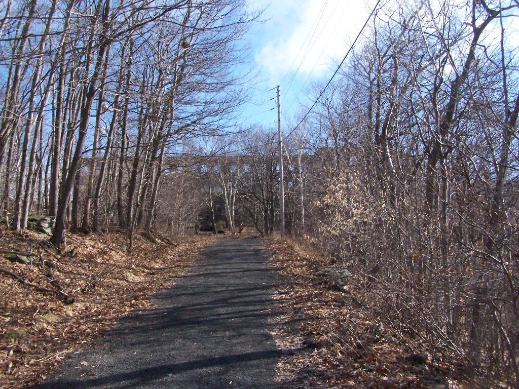
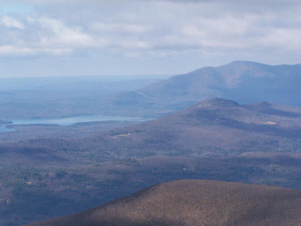
I then decided to head down the mountain. But it was early, around 11 AM, so I decided to go for a hike down to Echo Lake. It looked pretty from the fire tower. I had forgotten I had been down there, during the Boy Scout hike, until I reached the turn off for the Echo Lake trail. The trail from the fire tower to Echo Lake trail turn off, also known as the Overlook Mountain Blue trail, is a gentle descent, following a long abandoned old woods road, complete with extensive grading for travel by automobiles. It’s no longer passable by cars, but remains of the fairly extensive cut and fill can be seen. Some snow and ice where on the trail, and parts where muddy, but no part too bad. This section is 2.0 miles.
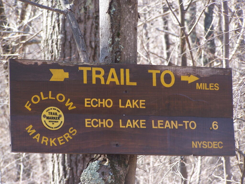
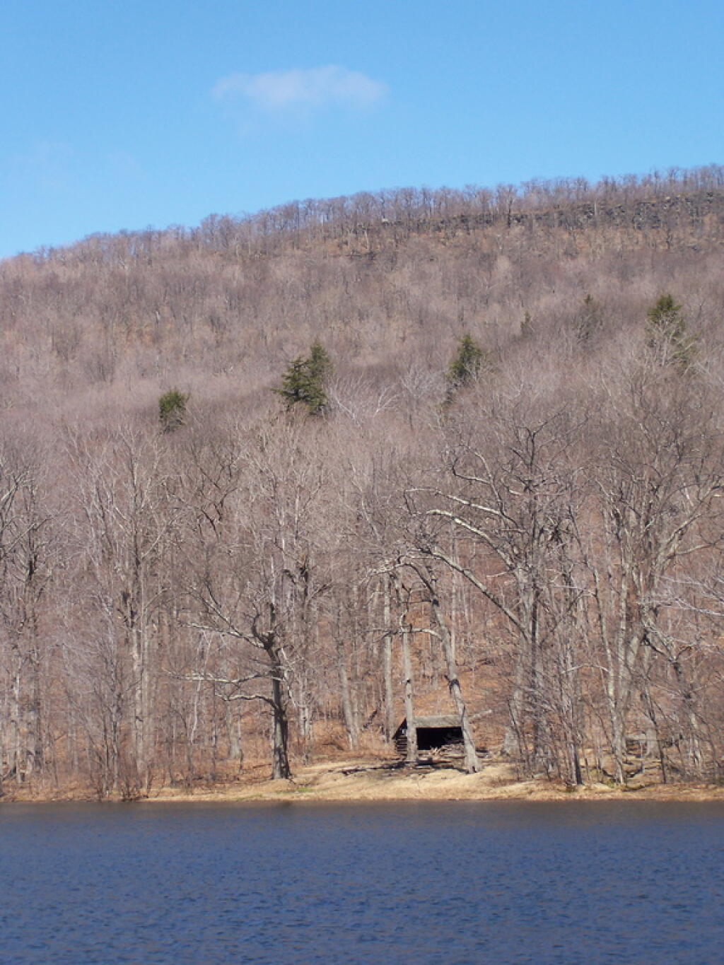
The yellow trail down to Echo Lake is somewhat steeper. You descend a lot of altitude in 0.6 miles. Echo Lake is relatively small, but pretty. There is a lean-to down there, along with an established camping area near the lake. The lean-to appeared to be well used and older. It arrived there around noon time. Spend about a half hour there.
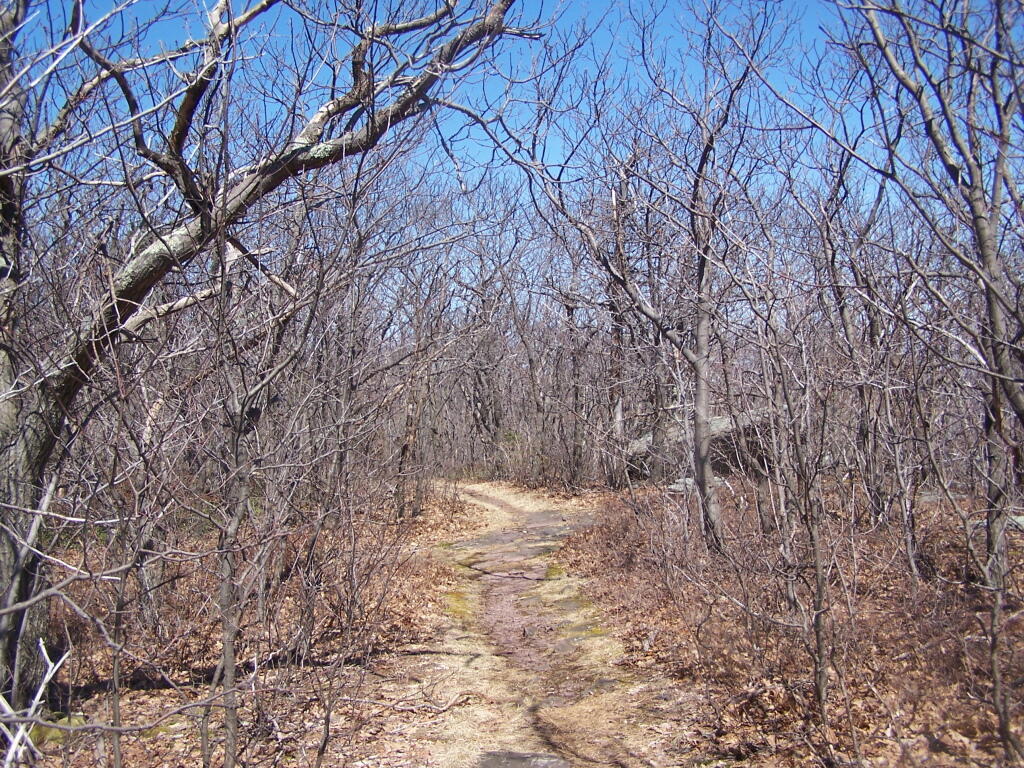
The trail from Echo Lake back up to the fire tower was not a bad hike. Passed several hikers, and made it back to the fire tower around 1:30 PM. It was amazing how much the light had changed in 3 hours. It went all the way up the tower this time, as the wind wasn’t blowing so hard, and also to the overlook. Around 2 PM, descended the trail and headed back to the truck. I arrived back around 2:45 PM. It was an easy hike down, although you had to keep holding yourself back.
See more photos from this hike in the Central Catskills Photos Series.
Hikers – Trail Head
House – Catskill Mountain House Ruins
Flag – Overlook Mountain Fire Tower
Tent – Echo Lake Lean-To