Shades of Brown

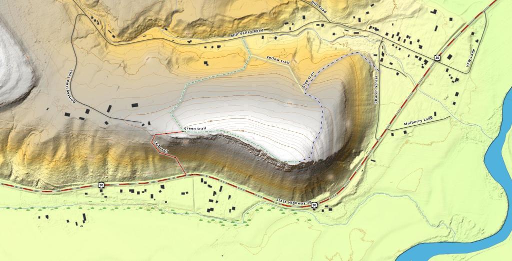
I've been fascinated by the Vromans Nose LiDAR and wanted a more detailed topographic layout with contours for elevation. So this is what I ended up producing.
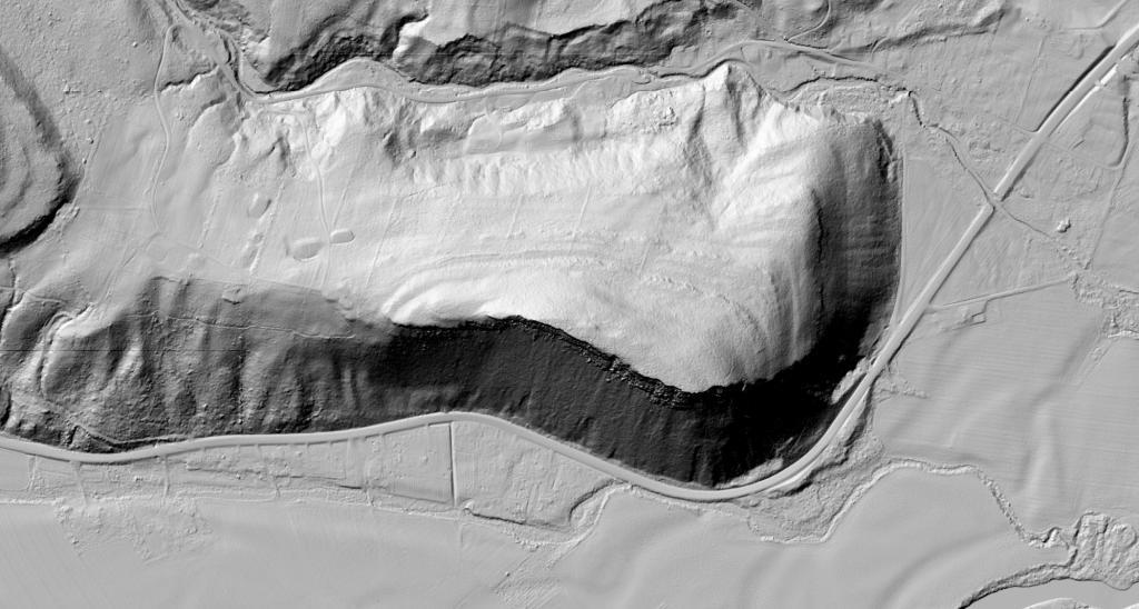
This LiDAR image of Vromans Nose does a great job of showing the cliff's edge and the stone walls that exist from the mountain's agricultural legacy on the backside.