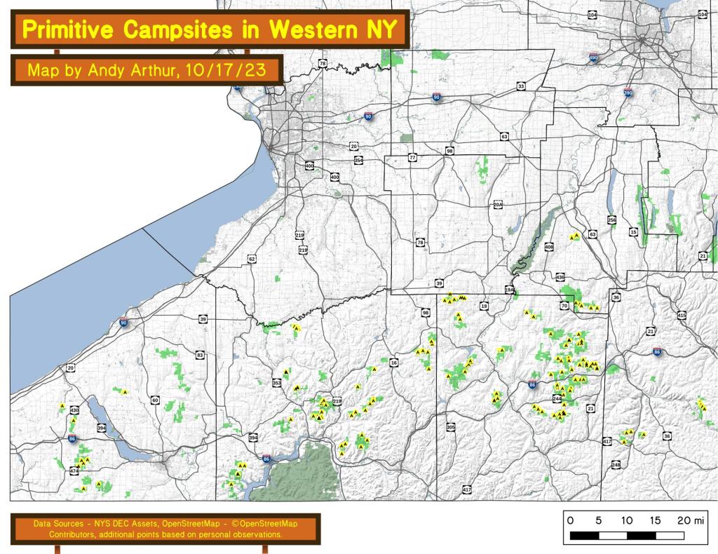
An overview of free primitive and roadside campsites located in Western New York, specifically the western portion of the Southern Tier -- Chautauqua County, Cattaragus County, and Allegany County. You can see more detailed locations by exploring this Interactive Google Map (KML) of the campsites across the state.
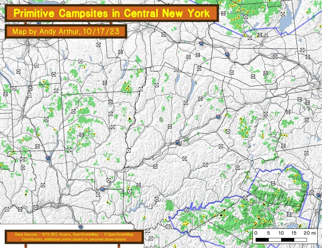
An overview of free primitive and roadside campsites located throughout the Central New York region of New York State including Broome County, Cortland County, Chenango County, Madison County, Otsego County and Schoharie County. Major areas include Burnt Rossman State Forest, Charles Baker State Forest, Stony Pond State Forest, Hunts Pond State Forest and Long Pond State Forest. You can see more detailed locations by exploring this Interactive Google Map (KML) of the campsites across the state.
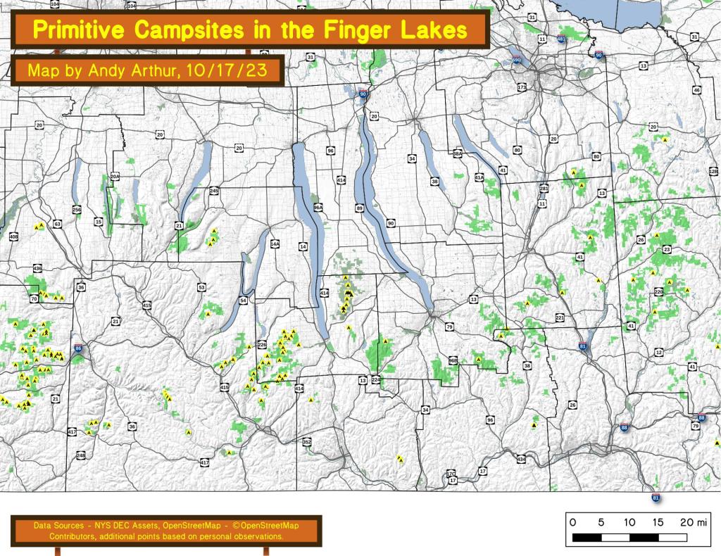
An overview of free primitive and roadside campsites located throughout the Finger Lakes region of New York State including Chemung County, Tioga County, Tompkins County, Steuben County, and Schuyler County. Major areas include the Sugar Hill State Forest and Recreation Area and the Finger Lakes National Forest. You can see more detailed locations by exploring this Interactive Google Map (KML) of the campsites across the state.
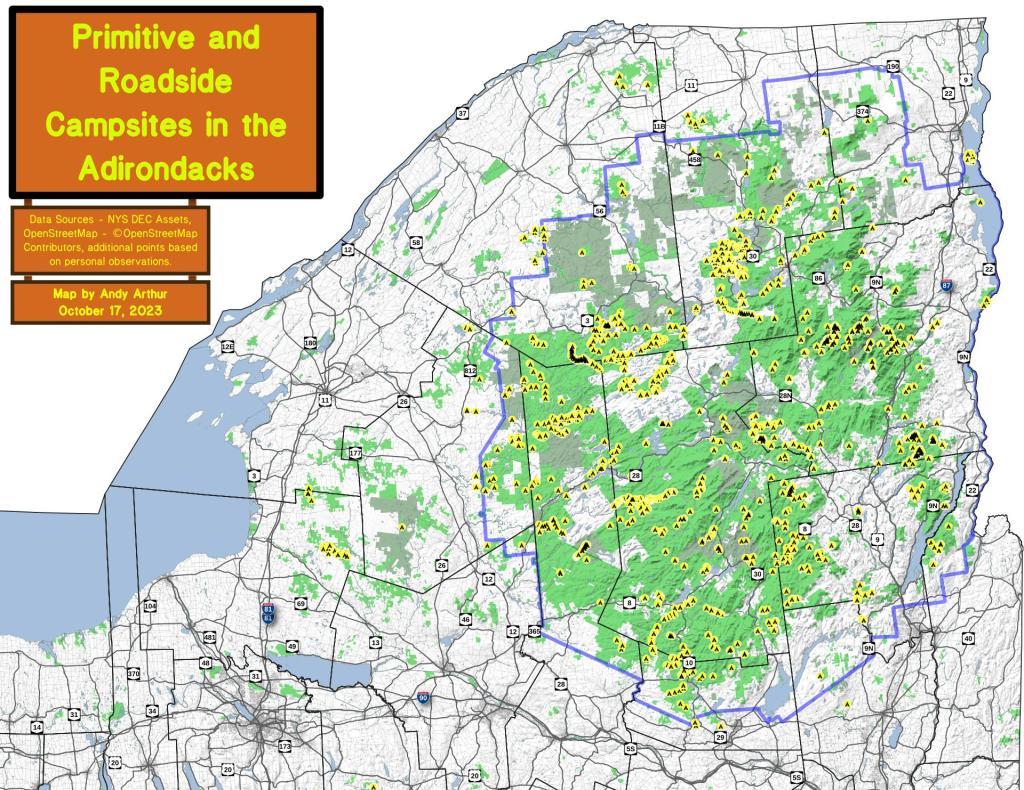
An overview of free primitive and roadside campsites located throughout the Adirondacks, North Country and Tug Hill -- including Saint Lawrence County, Franklin County, Clinton County, Essex County, Hamilton County, Lewis County and Jefferson County. You can see more detailed locations by exploring this Interactive Google Map (KML) of the campsites across the state.
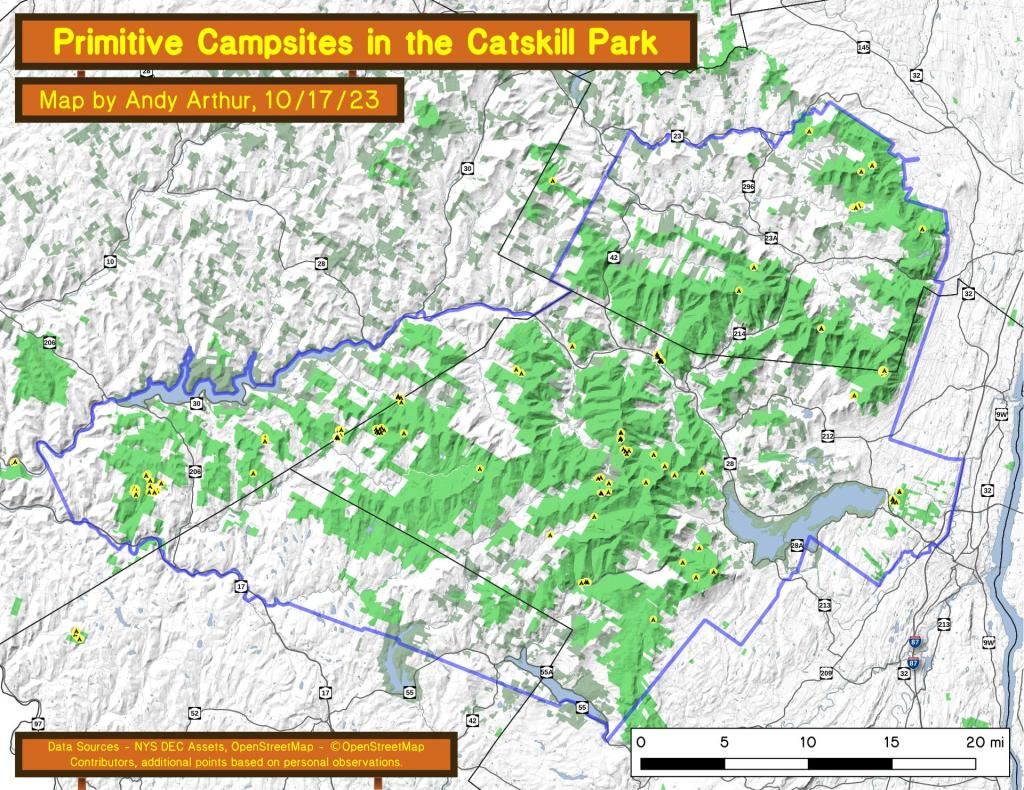
An overview of free primitive and roadside campsites located throughout the Catskills. You can see more detailed locations by exploring this Interactive Google Map (KML) of the campsites across the state.