Map: Ashland Flats Wildlife Management Area

Download a High Resolution JPEG Image of the Ashland Flats Wildlife Management Area or an Adobe Acrobat Printable PDF of the Ashland Flats Wildlife Management Area.

Bookmark my free Interactive GPS Map for your phone:
https://andyarthur.org/ny
... shows your location as a blue dot in relationship to campsites, trails, state land. This online map requires cell service, won't work in remote country, so also bring a paper map.
Free Download of New & Historical USGS 1:24k Topograpic Maps
Interactive maps with backcountry and roadside camping: New York, Pennsylvania, West Virginia & Vermont. List of NYS DEC Lean-Tos and Firetowers.
Google Spreadsheet with Roadside, Primitive and Pay Campsites
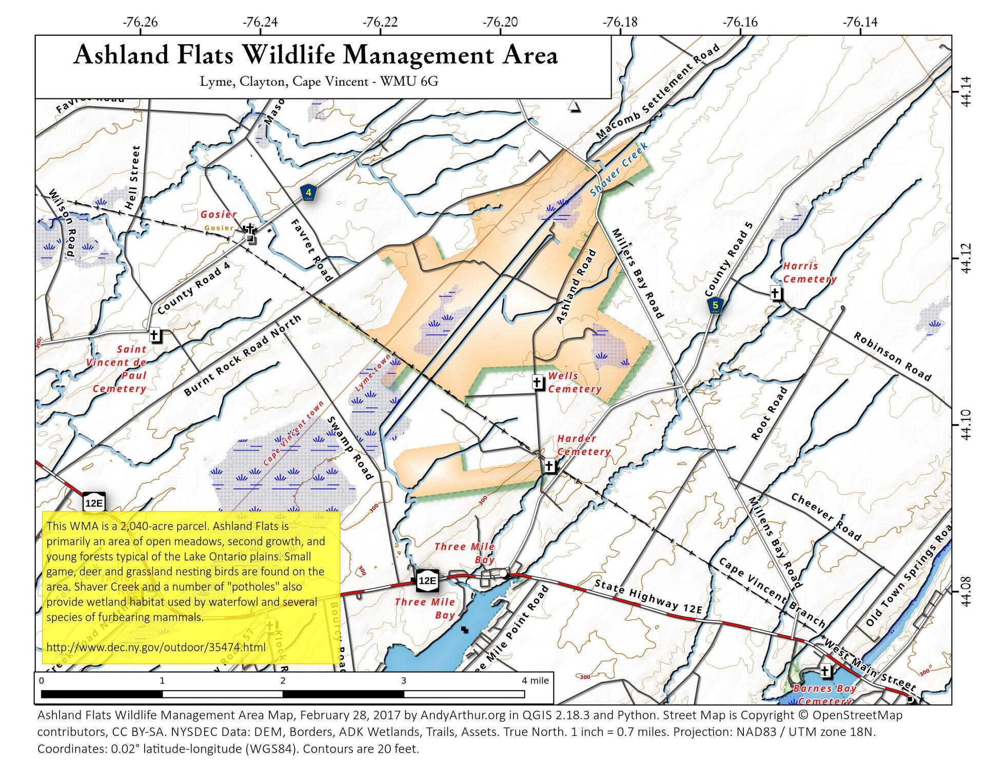
More about Ashland Flat WMA...
This 2040-acre WMA is located in northern Jefferson County two miles northeast of the village of Three Mile Bay, along the Depot and Ashland roads. Much of the land borders Burnt Rock Road and County Route 8. Ashland is primarily an area of open meadows, second growth and young forests typical of the Lake Ontario plains.
http://www.dec.ny.gov/outdoor/35474.html
... photos, maps and other content from from Jefferson County.