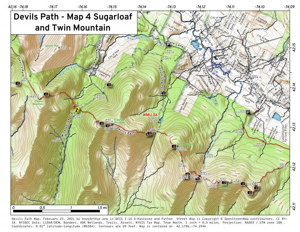
Devil’s Path
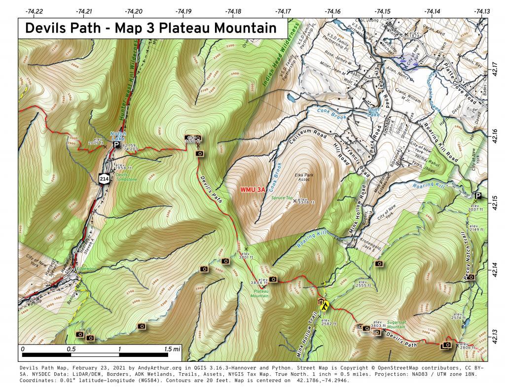
Devils Path – Map 3 Plateau Mountain
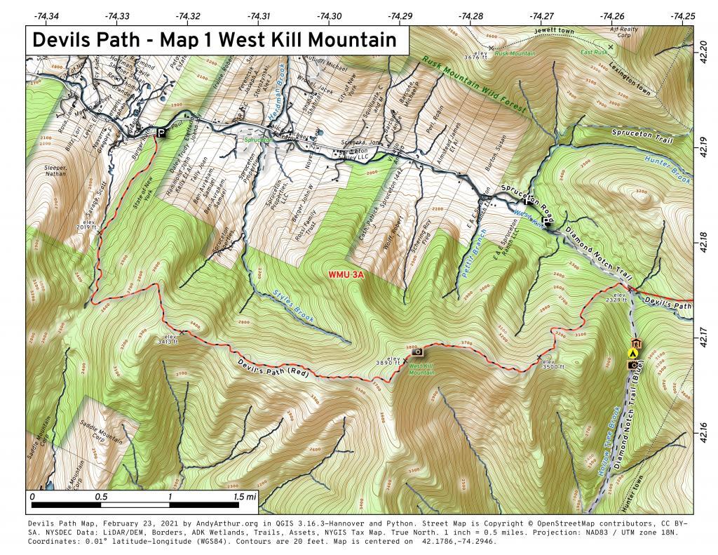
Devils Path – Map 1 West Kill Mountain
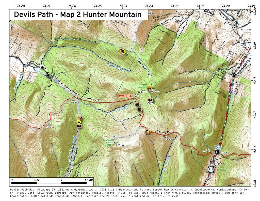
Devils Path – Map 2 Hunter Mountain
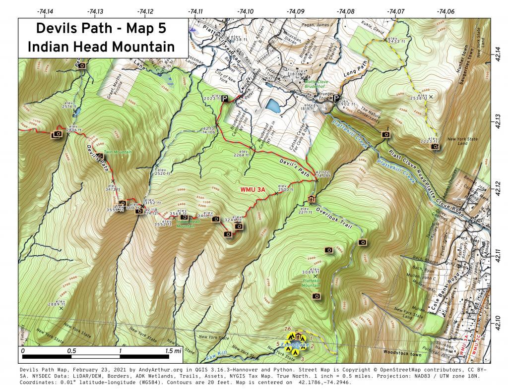
Devils Path – Map 5 Indian Head Mountain
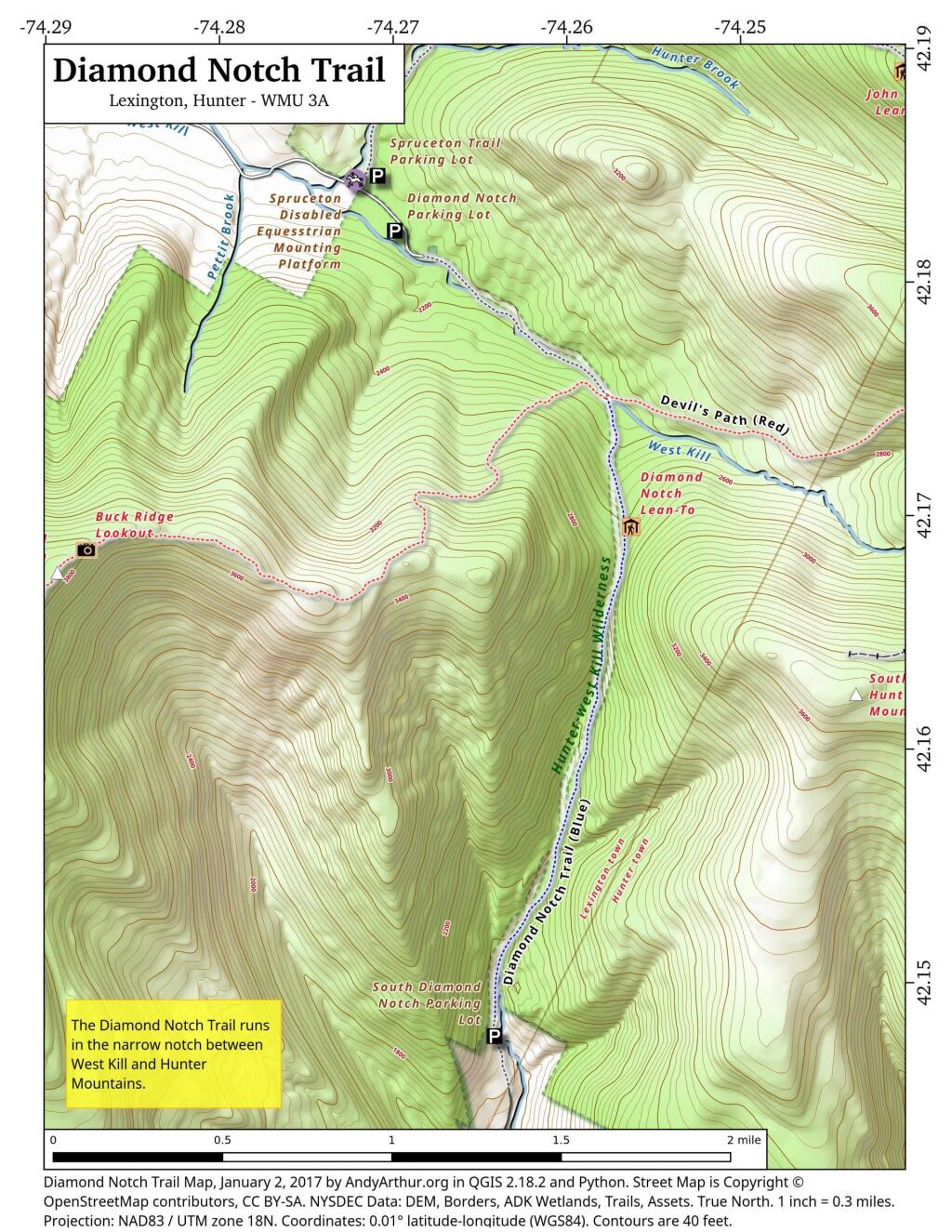
Diamond Notch Trail
Diamond Notch Trail – South Hunter Mountain
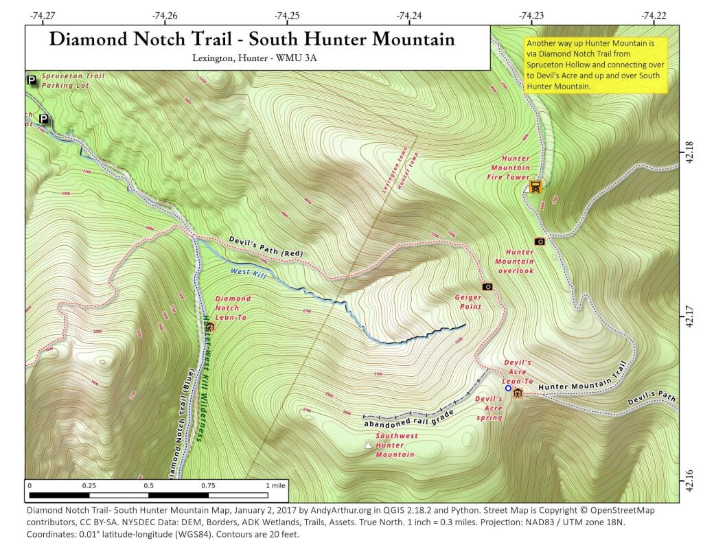
Another way up Hunter Mountain is via the Diamond Notch Trail to Devils Path to the South Hunter - Hunter Mountain connecting trail. I've never gone up this way, as it's pretty out of the way, but might be an interesting way to go up the mountain some day.