Map: Cuyler Hill State Forest
Download a High Resolution JPEG Image of the Cuyler Hill State Forest or an Adobe Acrobat Printable PDF of the Cuyler Hill State Forest.

Bookmark my free Interactive GPS Map for your phone:
https://andyarthur.org/ny
... shows your location as a blue dot in relationship to campsites, trails, state land. This online map requires cell service, won't work in remote country, so also bring a paper map.
Free Download of New & Historical USGS 1:24k Topograpic Maps
Interactive maps with backcountry and roadside camping: New York, Pennsylvania, West Virginia & Vermont. List of NYS DEC Lean-Tos and Firetowers.
Google Spreadsheet with Roadside, Primitive and Pay Campsites
More about Cuyler Hill State Forest...
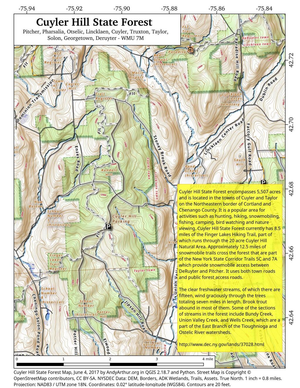
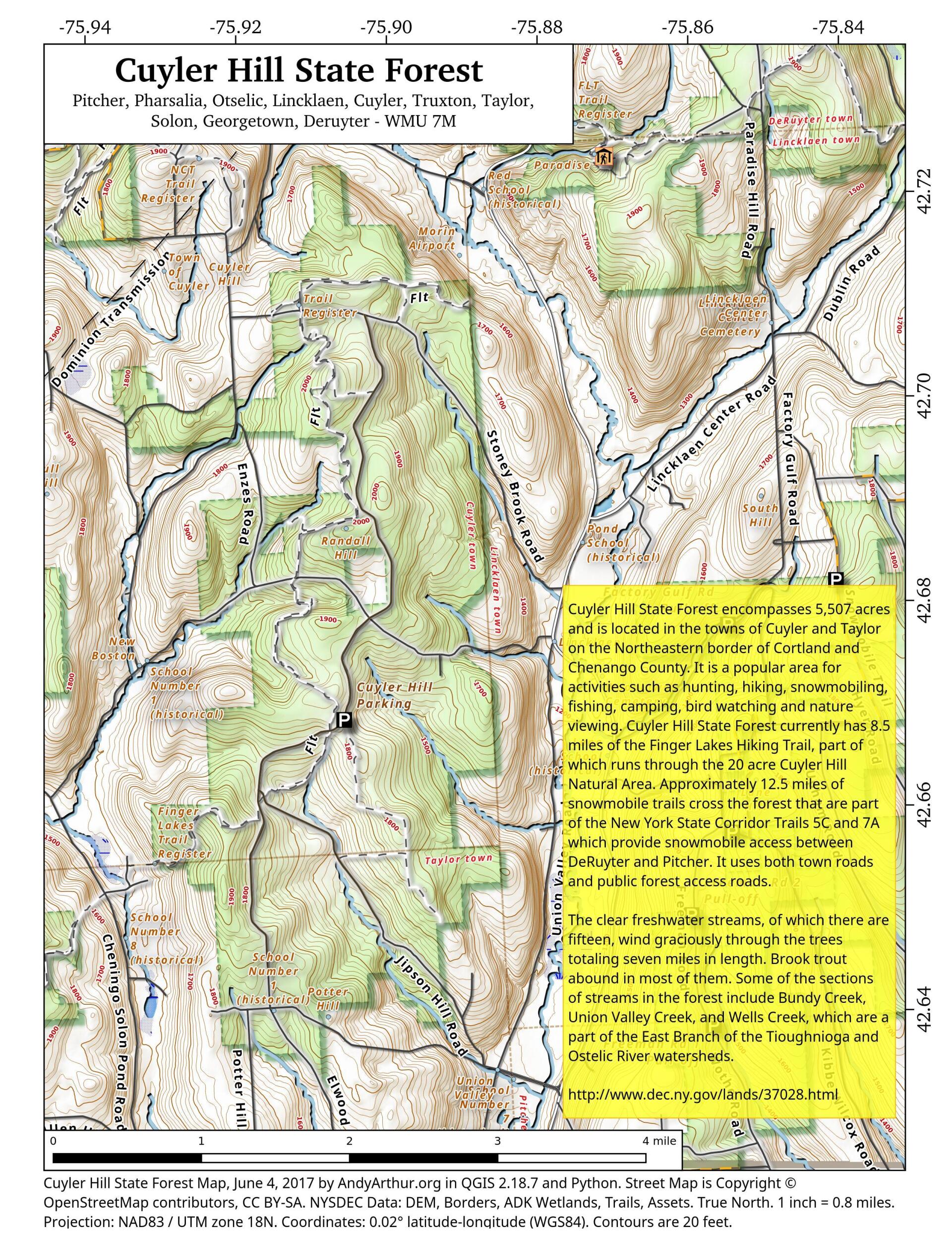
Cuyler Hill State Forest encompasses 5,507 acres and is located in the towns of Cuyler and Taylor on the Northeastern border of Cortland and Chenango County. It is a popular area for activities such as hunting, hiking, snowmobiling, fishing, camping, bird watching and nature viewing. Cuyler Hill State Forest currently has 8.5 miles of the Finger Lakes Hiking Trail, part of which runs through the 20 acre Cuyler Hill Natural Area. Approximately 12.5 miles of snowmobile trails cross the forest that are part of the New York State Corridor Trails 5C and 7A which provide snowmobile access between DeRuyter and Pitcher. It uses both town roads and public forest access roads.
The clear freshwater streams, of which there are fifteen, wind graciously through the trees totaling seven miles in length. Brook trout abound in most of them. Some of the sections of streams in the forest include Bundy Creek, Union Valley Creek, and Wells Creek, which are a part of the East Branch of the Tioughnioga and Ostelic River watersheds.
http://www.dec.ny.gov/lands/37028.html
... photos, maps and other content from from Cortland County.