Map: Bush Hill State Forest

Download a High Resolution JPEG Image of the Bush Hill State Forest or an Adobe Acrobat Printable PDF of the Bush Hill State Forest.

Bookmark my free Interactive GPS Map for your phone:
https://andyarthur.org/ny
... shows your location as a blue dot in relationship to campsites, trails, state land. This online map requires cell service, won't work in remote country, so also bring a paper map.
Free Download of New & Historical USGS 1:24k Topograpic Maps
Interactive maps with backcountry and roadside camping: New York, Pennsylvania, West Virginia & Vermont. List of NYS DEC Lean-Tos and Firetowers.
Google Spreadsheet with Roadside, Primitive and Pay Campsites
More about Bush Hill State Forest...
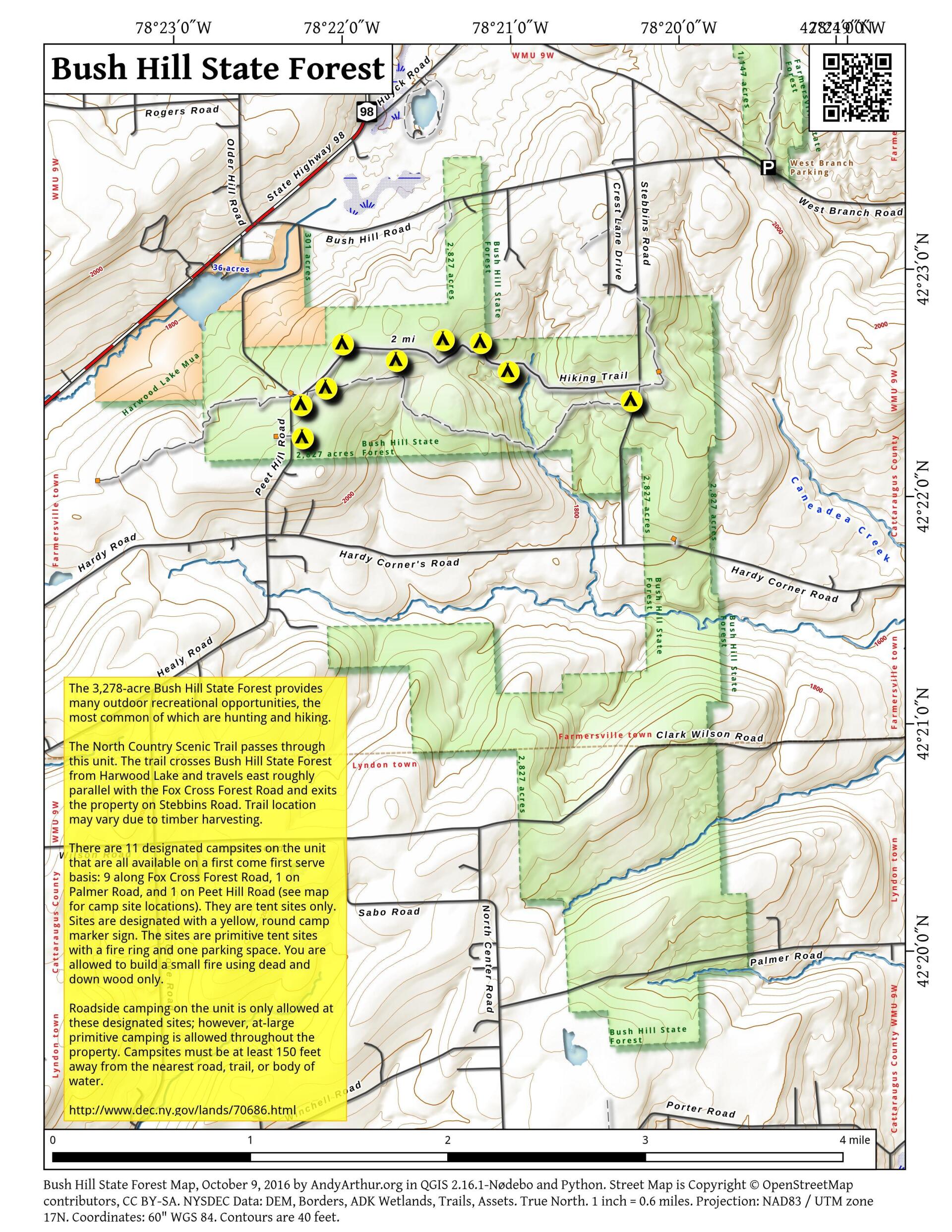
The 3,278-acre Bush Hill State Forest provides many outdoor recreational opportunities, the most common of which are hunting and hiking.
The North Country Scenic Trail crosses Bush Hill State Forest from Harwood Lake and travels east roughly parallel with the Fox Cross Forest Road and exits the property on Stebbins Road. Trail location may vary due to timber harvesting.
There are 11 designated campsites on the unit that are all available on a first come first serve basis: 9 along Fox Cross Forest Road, 1 on Palmer Road, and 1 on Peet Hill Road. They are tent sites only. Sites are designated with a yellow, round camp marker sign. The sites are primitive tent sites with a fire ring and one parking space. You are allowed to build a small fire using dead and down wood only.
http://www.dec.ny.gov/lands/70686.html
... photos, maps and other content from from Cattaraugus County.
1 Comment
The small lake north of Bush Hill rd is mine and this property runs up against the northernmost state land. All the huge cherry trees have been painted with a yellow spot and have yellow markers tied to the bark. Can you tell me what is going on here? Are they cutting my trees? These are the property line. This land was clear cut 15 years ago or so. How do I see what the plan is in the future?