Map: Bear Creek State Forest
Download a High Resolution JPEG Image of the Bear Creek State Forest or an Adobe Acrobat Printable PDF of the Bear Creek State Forest.

Bookmark my free Interactive GPS Map for your phone:
https://andyarthur.org/ny
... shows your location as a blue dot in relationship to campsites, trails, state land. This online map requires cell service, won't work in remote country, so also bring a paper map.
Free Download of New & Historical USGS 1:24k Topograpic Maps
Interactive maps with backcountry and roadside camping: New York, Pennsylvania, West Virginia & Vermont. List of NYS DEC Lean-Tos and Firetowers.
Google Spreadsheet with Roadside, Primitive and Pay Campsites
More about Bear Creek State Forest...
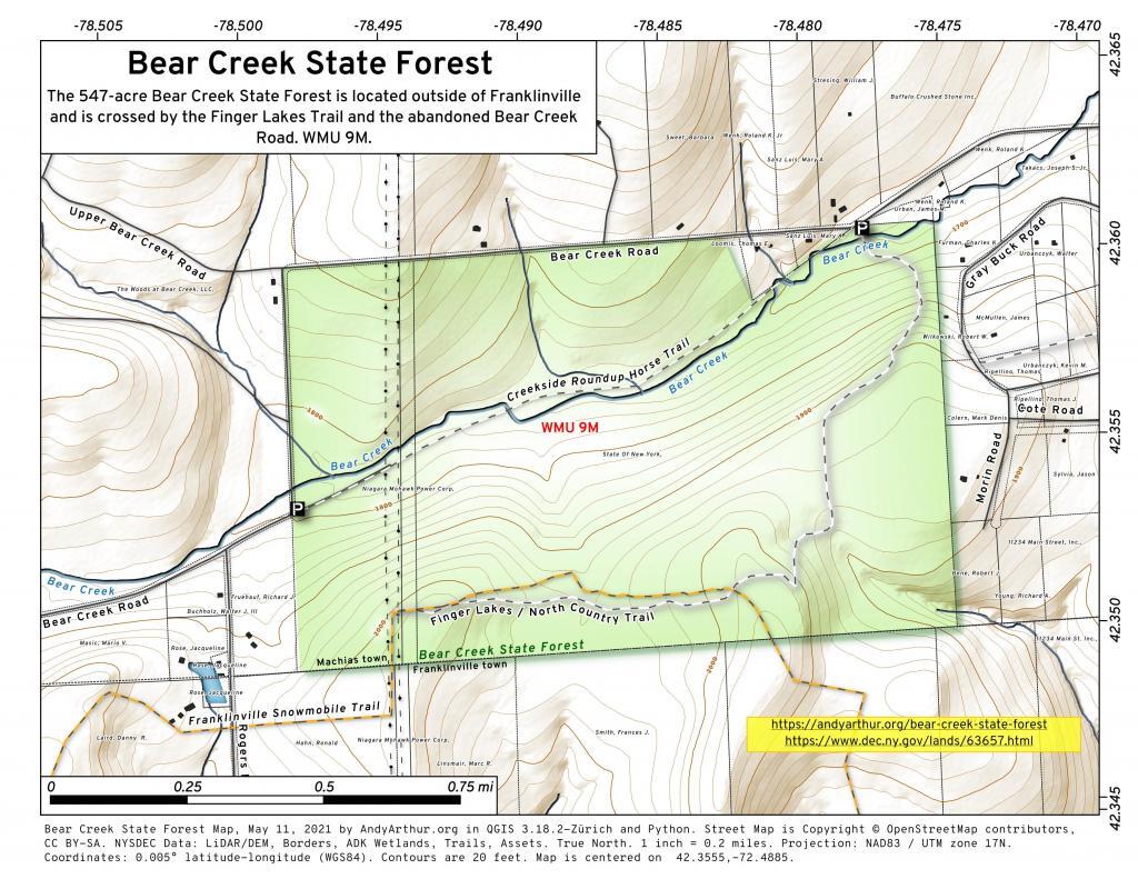
The 547-acre Bear Creek State Forest is a popular hunting, hiking, snowmobiling and horseback riding destination.
Because there were a number of stream crossings on Bear Creek Road that were difficult to maintain, that road was replaced by the Upper Bear Creek Road. The old road was abandoned and is now part of the state forest. Only the western end still exists as a haul road.
Hunting and trapping are permitted on the property in accordance with all game regulations, unless otherwise posted. Traps may not be set on public road right of ways. Body gripping traps set on land must be at least 100 feet from public trails.
There are no designated campsites; however, at-large primitive camping is allowed. Campsites must be at least 150 feet away from the nearest road, trail, or body of water. Camping for more than three nights or in groups of ten or more requires a permit from a Forest Ranger.
http://www.dec.ny.gov/lands/63657.html
... photos, maps and other content from from Cattaraugus County.