Map: Rush Creek State Forest
Download a High Resolution JPEG Image of the Rush Creek State Forest or an Adobe Acrobat Printable PDF of the Rush Creek State Forest.

Bookmark my free Interactive GPS Map for your phone:
https://andyarthur.org/ny
... shows your location as a blue dot in relationship to campsites, trails, state land. This online map requires cell service, won't work in remote country, so also bring a paper map.
Free Download of New & Historical USGS 1:24k Topograpic Maps
Interactive maps with backcountry and roadside camping: New York, Pennsylvania, West Virginia & Vermont. List of NYS DEC Lean-Tos and Firetowers.
Google Spreadsheet with Roadside, Primitive and Pay Campsites
More about Rush Creek State Forest...
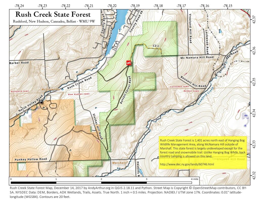
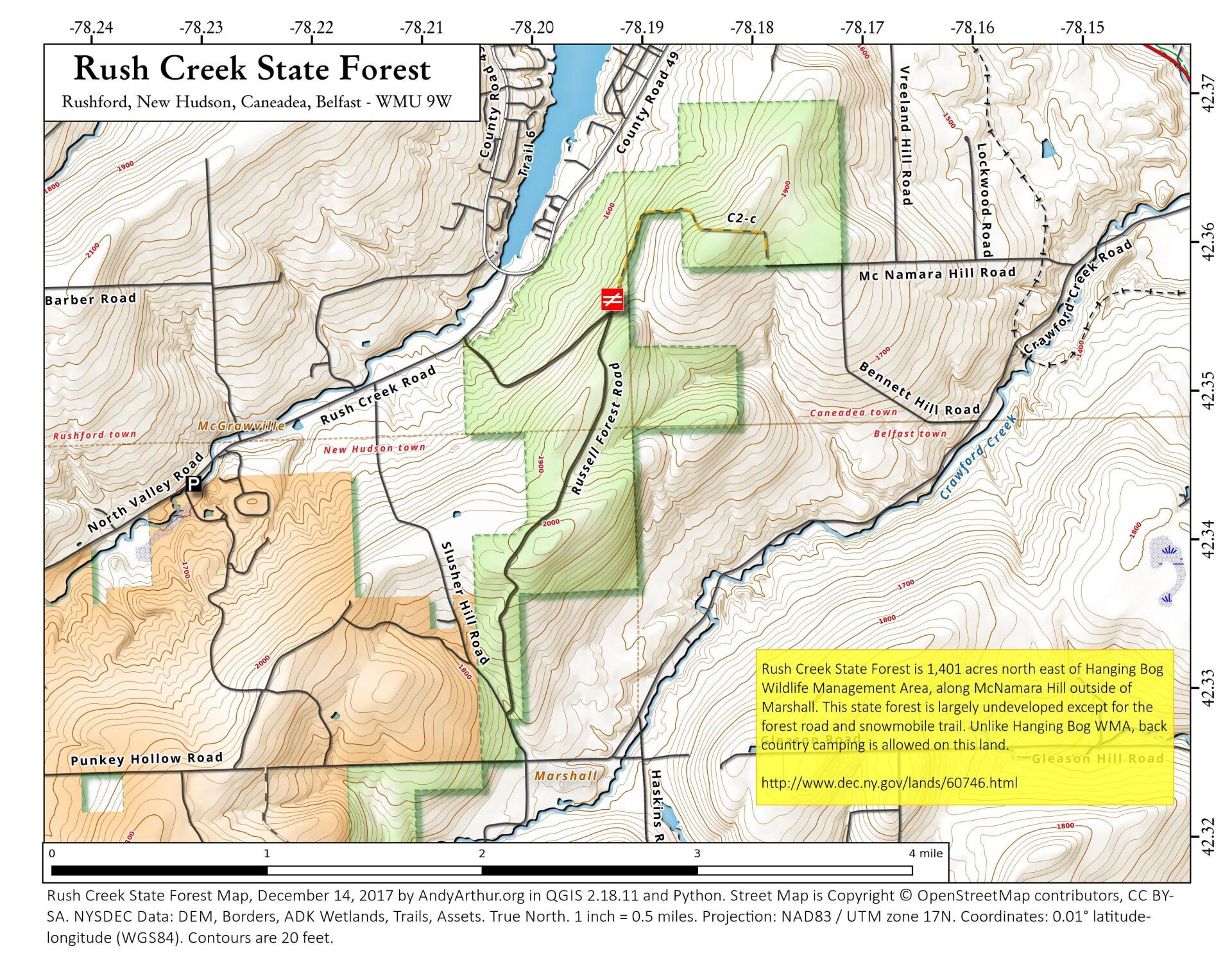
Rush Creek State Forest covers a total of 1,404 acres and borders the 4,475-acre Hanging Bog Wildlife Management Area. The forest cover types here are primarily native hardwood species, with a smaller number of planted conifers. There are no designated trails but hiking is allowed throughout the property. Dispersed camping is allowed throughout this property, no camping permit is required, unlike the Hanging Bog WMA which is located to the south-east of this properly and is shown in orange.
http://www.dec.ny.gov/lands/60746.html
... photos, maps and other content from from Allegany County.